By Amorin Mello
A curious series of correspondences from “Morgan”
… continued from Saint Croix Falls.

The Daily Union (Washington D.C.)
“Liberty, The Union, And The Constitution.”
July 31, 1845.
To the Editor of the Union:

Andrew Belcher Gray published the Map of the Mineral Lands Upon Lake Superior Ceded to the United States by the Treaty of 1842 With the Chippeway Indians in 1845.
~ Wisconsin Historical Society
SIR: In your paper of Tuesday evening, I have observed a communication from Copper Harbor, (Lake Superior,) so pregnant with errors or misrepresentations, that I am constrained, by a regard to truth and the public interests, to ask the use of your columns to correct some of them. I know not who your correspondent is; but, judging from the extraordinary zeal with which he labors to forestall public opinion of certain government agents on Lake Superior, whose conduct has recently become obnoxious to very grave suspicion, I think it no unwarrantable conclusion that he has either been most egregiously imposed upon, or that he is animated in his encomiums upon the officers alluded to, by motives much more special than in his admiring comments upon the handsome scenery and novel life upon the lake. He is evidently more than indifferently anxious to vindicate and extol General Stockton and his faithful deputy, Mr. Gray. Otherwise, what necessity would there be for asserting facts which do not exist? Your correspondent states that
“The only tenement on the island is a miserable log-cabin, in which General Stockton, for the want of better quarters, is compelled to keep his office. The room which he occupies, is only about eight feet square – just large enough to admit a narrow bed for himself, a table, and two or three chairs. In this salt-box of a room, he is compelled to transact all the business relating to the mineral lands embraced within this important agency. As many as a dozen men at a time are pressing forward to his ‘bee gum’ apartment, endeavoring to have their business transacted.
“The office of the surveyor of this mineral lands, in charge of Mr. Gray, at this agency, is still worse adapted to the transaction of public business. He is compelled to occupy the garret of the log-cabin,” &c.
Now, so far from this being true, “the miserable log cabin” of which your fastidious correspondent speaks, is an excellent hewed log house, well finished and ceiled, with three good-sized rooms below, and three above stairs, amply sufficient and convenient for all intended purposes. The construction of this house cost the government some fifteen hundred dollars, and was designed as the agency-house; whereas General Stockton has converted it into a sort of hotel – doubtless as a means of augmenting the perquisites of his station. Hence he has stinted himself, and the convenience of the government service, to his “bee-gum” and “salt-box” penetralia of “eight feet square.” So much for this misrepresentation.

Painting of Professor Douglass Houghton by Robert Thom. Houghton first explored the south shore of Lake Superior in 1840. Houghton died on Lake Superior during a storm on October 13, 1845. The City of Houghton on Chequamegon Bay was named in his honor, and is now known as the Houghton Falls State Natural Area.
Your correspondent expresses a like sympathy for the privations and long-suffering of Mr. Surveyor Gray. The apartment which Mr. Gray occupies above stairs, is an ample room, some fifteen or more feet square, and is quote comfortable – nay, quite luxurious quarters, when compared to those of the other surveyors, who are where Mr. Surveyor Gray should be, if he was faithfully discharging his duties – out in the woods and the weather, among the rocks and swamps, driving the compass and chain through almost impenetrable wilds. It may, perhaps, be a question with the government, as it certainly will be with the public, why Mr. Gray should be lolling at his ease in the agency-house on Porter’s island, while Dr. Houghton, the other surveyor, is traversing large tracts of the mineral lands, and sustaining all the hardships and perils which pertain to his employment? And it may become a further question, while I am on this head, why Mr. Gray, who was an unrelenting tool of the whig party, and neglected the public service, for which he was receiving a handsome salary, last year, to mingle in the orgies of federal-Clay-clubites, should not only be so sedulously retained in office, but be admitted to the privilege of almost total exemption from labor, which he is employed and paid to perform? It is a fact, that up to the 3d of July, Mr. Gray had surveyed only two miles, whereas Dr. Houghton had measured some five hundred miles of the mineral lands! And this is the gentleman against whose discomfort your correspondent so pathetically appeals, forsooth, because he is occupying at his ease an excellent apartment in a very comfortable house.
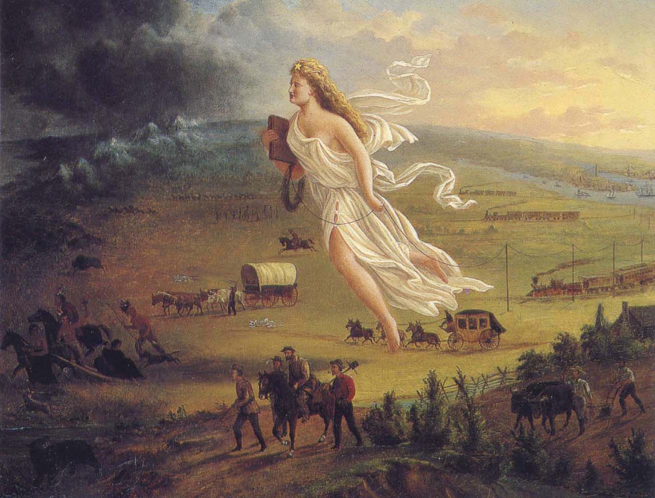
American Progress by John Gast, 1872
“This painting shows ‘Manifest Destiny’ (the belief that the United States should expand from the Atlantic to the Pacific Ocean. In 1872 artist John Gast painted a popular scene of people moving west that captured the view of Americans at the time. Called ‘Spirit of the Frontier’ and widely distributed as an engraving portrayed settlers moving west, guided and protected by Columbia (who represents America and is dressed in a Roman toga to represent classical republicanism) and aided by technology (railways, telegraph), driving Native Americans and bison into obscurity. It is also important to note that Columbia is bringing the ‘light’ as witnessed on the eastern side of the painting as she travels towards the ‘darkened’ west.”
~ Commons.Wikimedia.org
The design of this letter from Copper Harbor is perfectly apparent to me. It is the sequel to a movement which was made last June, viz: to white-wash and to shield from a just reprehension the present superintendent of the Lake Superior mineral lands. On the very day that General Stockton opened his office, a sort of soi-disant public meeting was gotten up there, in compliment to the General, in which the president of the New York and Lake Superior Mining Company was the prime mover. When it is known that General Stockton has certified to the Ordnance Department locations by this company of between one and three hundred square miles, upon which leases were granted, when not a single foot had been actually located, in flagrant violation of all the laws and regulations, some opinion may be formed of the secret of this most disinterested and valuable tribute to the official worth of this superintendent. What might have been the potency of this expression of public opinion (!) in protecting Gen. Stockton’s official conduct from censure and investigation up to the period of its dispensation, I will not now say. But, certain it is, that large and glaring spots which have begun to attract scrutiny and invoke exposure, have rendered his escutcheon needful of a new coat of white-washing; and hence this effort of your correspondent to forestall examination into his conduct, by pathetic epics of his patiently-endured privations iin the public service, and the ignorant or else sinister commendations of his conduct.
In animadverting upon the conduct of General Stockton and others, I do not mean to include Major Campbell, of whom everything that your correspondent has said is hereby confirmed.
POSTEA PLUS.
———

William Learned Marcy was the 20th United States Secretary of War during Polk’s presidency.
~ Wikipedia.org
We have omitted a large portion of the above communication, in which the writer proceeds to complain of the survey of the mineral lands, and arraigns the agents of the government for gross malversation in office. These charges are of a serious character, and they demand a full and rigid investigation. But, as it might lead to a protracted and angry war in the papers, in which crimination would be followed by recrimination; and as we are advised that the Secretary of War is determined to investigate the justice of these complaints and the truth of them – as he will receive any specifications in writing which may be submitted, and is determined to go to the bottom of the subject; and, with that view, will appoint a commission of two of the most respectable gentlemen he can obtain, who will go upon the lands, and probe everything for themselves, – we have thought it best to let matters take that turn. We have not the slightest doubt that the attention of the department is thoroughly exited to the importance of the duties which may devolve upon it, and that it will unquestionably discharge them. It is scarcely necessary, therefore, for the press to mingle at present in a discussion, which might occupy much space, lead to much excitement, and, after all, fail to lead to the best and wisest results.
– UNION.

The Daily Union (Washington D.C.)
“Liberty, The Union, And The Constitution.”
August 1, 1845.
THE COPPER REGION.

James Knox Polk:
11th President of the United States.
~ Wikipedia.org
We have been inconsiderately drawn into a subject of some importance to the United Sates. We have struck a vein, however, which promises to be rich in its resources. The reader will recollect a very long and interesting letter which we published on Tuesday evening, from one of our regular correspondents, who is now on a trip from New York to Lake Superior, in which he gave us a description of its peculiar and striking scenery, and made some remarks upon the copper lands in its vicinity, and upon the agents of the United States who have been charged with the care of the mineral lands belonging to the government. This letter drew forth a reply in our last evening’s paper; but we declined the publication of the whole communication, for the reasons which we then stated. The writer of that article charged the United States agent with many acts of mismanagement, and even malversation of office; and as we were aware that our government was about to appoint a commission to visit the country, and investigate the conduct of the agents, we deemed it most advisable to refer to another tribunal, (for the present, at least,) a full inquiry into these matters. In the mean time, a new scene was opened before us. We were scarcely aware of the existence of these mineral resources, – much less of their extent. But our curiosity is now being aroused. The public documents connected with them have been politely placed in our possession, and we shall prepare an article for the “Union” for the purpose of calling the attention of the country to this very interesting subject. The lead-mines belonging to the United States in Wisconsin, Illinois, Iowa, &c., have been longer known and are better understood than the copper region. They have been worked to a considerable extent, and their produce is so abundant, that they can not only supply our own market with lead, but afford a large export for the consumption of foreign nations. Perhaps no mines in the world are equal to those of the belt on both sides of the Mississippi.
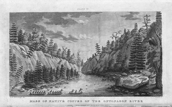
Engraving depicting the 1820 Cass/Schoolcraft expedition crossing the Ontonagon River to investigate the famous copper boulder.
~ Wisconsin Historical Society
The purchase of this rock from the Chippewa Indians was made in 1841. The treaty with these Indians, ceding this portion of the country to the United States, was not made until October, 1842, after the second expedition to that country for the purpose of removing this rock. The Indians say that they did [not] reserve this rock in the treaty of 1842, as they had already sold it to a citizen of the United States, and they conceived that they had no further control over it. They say that, by their treaty, they only sold their lands, and suppose that all moveable property of this kind, which had been previously the subject of individual negotiation, would be allowed to be removed by the individuals making the purchase of them, as readily as they would be allowed to remove their lodges or canoes.
J. ELDRED, for self and sons.“
~ Public Documents Printed by Order of the Senate of the United States: First Session of the Twenty-Eigth Congress, 1844.

The Ontonagon Copper Boulder at the Smithsonian Institution National Museum of Natural History. Photograph by Ian Shackleford, 2011; shared with a Creative Commons license.
~ Wikipedia.org
The copper region is probably more important than the lead-mines. It is supposed by some geologists to extend from Lake Superior to Texas, crossing the Mississippi diagonally at a lower point than the lead-mines, and forming a vein of from thirty to forty miles of average width. The ore is said to be unusually rich. In some places it is mixed with veins of silver, so abundant that the precious metal alone is sufficient to pay all the expenses of working the vein – the ore itself making a yield of 60 or 70 per cent. of copper. An immense boulder of this metal is now deposited in the public yard between the War and Navy Departments, and is well worthy the inspection of all curious observers who happen to visit Washington. It weighs more than 3,700 lbs., and is so rich in the metal that a plate of copper is smoothed off on its surface like the copper-plate of the engraver. It was transported to Washington from the banks of the Ontonagon river, about forty miles from the Eagle river. The two principal points where the richest ore has yet been developed, are on Eagle river, and near Copper Harbor, on Lake Superior. But the richest portion of the copper region, as far as it is explored, is reputed to be Isle Royale, in Lake Superior, much nearer the Canada side than our own; but the boundary line runs north of the island, so that it falls within the limits of the United States. Isle Royale is estimated to be about thirty miles in length, and five miles broad – singularly rich in copper, which is constantly cropping out on the surface. The department has decided that no patents should be granted, and no leases taken, on this singular island.
Two large companies have been formed for leasing and working the mines in the Lake Superior Copper Region – the one which operates in New York, and the other in Boston. So valuable have shares become in some cases, that a gentleman in Boston, who is said to own about eighty shares, has been offered more than $600 for a single share. The supervision of these mines is devolved on the Ordnance Bureau, (Col. Talcott,) attached, of course to the War Department. Some important regulations have been made about the leasing of the mines, but further legislation will be required from Congress. The Secretary of War grants the permits to applicants to go upon the lands; and upon presenting a certificate from the agent of the United States that the tract has not been previously occupied, a lease may be granted for three years, upon condition of paying 6 per cent. of the nett proceeds of the metal, after it is smelted from the ore. If the lease be renewed for another three years, the rent is extended to 10 per cent. The leaseholders were originally confined to the smelting of the ore in the neighborhood of the mines; but it was found that, owing to the want of fuel, and other appliances, it was best to transport the ore to New York or Boston. The secretary yielded at last to the application – the government still receiving its 6 per cent. of rent, in the metal itself, free of all expense of transportation.
On the 21st of March last, it was determined by the Secretary of War to grant no more permits which would authorize a selection of more than one square mile; and between that time and 18th ult., seven hundred and sixty such permits were issued. It was then determined to stop the further issue. The cause of this is expressed in the printed circular from the Secretary of War, which we have already published. It states that,
“should locations be made pursuant to the permits already issued from this department, to select lands in the Lake Superior mineral district, the quantity required to satisfy them would exceed one million one hundred thousand acres It is apprehended that the whole region open for lation may not contain this quantity of mineral lands. Explorations and surveys of these lands have been ordered, and it has been determined to suspend the further issue of permits until the results shall be made known. The applications for permits received at the department subsequent to the 17th instant, will be filed in the office; and if the disclosures of the examinations shall warrant the further issue of permits for the Lake Superior region, they will be considered in the order in which they have been or shall be received. It is not expected that the results of the examinations and surveys to ascertain the probable quantity of mineral lands in the region, and to make the locations pursuant to the permits already issued, can be completed for some time to come.”
This is to certify, that on the 1st day of September last, while attending the payment of the Chippewa Indians at Lapointe, Lake Superior, Okondókon, being the head chief of the band of that tribe, and who resided at the mouth of the Ontonagon River, state, in my presence, that he had sold to Julius Eldred, of Detroit, in the summer of 1841, the celebrated copper rock; and that he had received, at the time of the sale, a portion of the sum agreed upo, and that there remained due him one hundred and five dollars, which was to be paid him whenever Mr. Eldred removed the rock to the shore of the lake; which sum of one hundred and five dollars Mr. Eldred did pay to Okondókon a few days thereafter, at the Ontonagon agency, in pursuace of the agreement made between them in 1841.
I further certify, that, on the 10th day of September last, Julius Eldred paid to Messrs. Hammond & Co. seventeen hundred and sixty-five dollars, for the services which they rendered in removing the rock, as well as to obtain peaceable possession of the same.
The removal of this copper rock has been attended with very great risk as well as expense, and is one of the most extraordinary performances of the age, and one which, in my opinion, should entitle him to great praise as well as liberal compensation.
WALTER CUNNINGHAM.“
~ Public Documents Printed by Order of the Senate of the United States: First Session of the Twenty-Eigth Congress, 1844.
It seems that Walter Cunningham, the first superintendent of these lands, kept no record of the permits he granted, or of the selection of tracts to which he certified as not interfering with the claims of others; and, in consequence of the absence of this information, it appears that his successor (Stockton) has, in two or three instances, certified for others, tracts previously certified by Mr. Cunningham; and this has given rise, as may be supposed, to some complaint. The certificates of the latter have been dropping in for a week or two past, but we know that very few or more can be in existence.
Mr. Gray (the only one of the assistants assigned to the superintendent, who possessed any competent knowledge of the surveying or platting) has been busily engaged in preparing maps, and locating the leases, and claims to leases thereon, to save from the risk of granting certificates which will interfere; and another competent surveyor has recently been sent to that country, in order that the operations may be expedited as fast as possible. It is also understood that Dr. Houghton is carrying on surveys under the orders of the General Land Office, which will soon extend into Stockton’s district, and will probably throw much additional light upon the extent of this interesting region of country.
We are informed that, as regards Mr. Gray’s mingling in any way with politicians, (as was stated by our correspondent of last evening,) it can scarcely be true. “He is a young man, who has been constantly moving about, and acquired no right to give a vote in any location. Modest and retiring, he is the last man in the world to do anything of the kind charged upon him.”
It will be seen, from this very rapid sketch, on imperfect data, that the copper region of the United States abounds with interest; that, from the abundance and the richness of the ore, it is probably calculated to furnish copper enough for our own consumption, and for a large exportation to foreign countries. Of course, great interests are growing up in that wonderful region – much speculation, large companies, strong contests for the possession of the titles – the same mine sometimes shingled over with several claims – some violence and some fraud. And even the agents of the government have not escaped the suspicion of mismanagement and malversation. The executive is about to do its duty in these respects. It is contemplated to employ two highly respectable commissioners to inspect the lands, to receive and investigate all complaints, and make a report to the War Department. A more complete report also, of the mineral resources of the West, the quality and extent of the mines, and the best way of working them, will probably be obtained, under the auspices of the vigilant Secretary of War, to be submitted to the next Congress. The statistics will, no doubt, be found valuable; and, in fact, the whole subject is every day assuming a new and a more expanding interest.
Two additional articles were published by The Daily Union on August 2 and August 11 regarding the Copper Region. They include extensive quotes from United States government agents involved in surveying the Copper Region, but are not directly related to the correspondences of “Morgan” or his accuser “Postea Plus” and therefore are not reproduced here on Chequamegon History.
The Daily Union (Washington D.C.)
“Liberty, The Union, And The Constitution.”
August 26, 1845.
[From our regular correspondent.]
GALENA, ILL., August 14, 1845.
Not having time to say more at present about the country through which I passed in coming from the falls of St. Croix to this place, I beg leave to refer to a notice taken of a portion of a letter written by me to the “Union,” from Copper harbor, by some correspondent opposed to Gen. Stockton and Mr. Gray.
It seems that deserved praise bestowed upon these officers of a government has proved offensive to the said correspondent.
I deem his publication worth no other notice than to say, that he speaks falsely and malignantly of “Morgan,” when he attributes his praise of Stockton and Gray to “sinister motives.”
It is known that an attempt was made by members of a certain small band of speculators to locate a mineral lease on a town site at the falls, or Sault St. Marie, where no copper or other mineral has been found, for the purpose of making a speculation of it. And when told by Gen. Stockton that it was not put down in the mineral region, that it was beyond his jurisdiction, and that he could not consent to grant a location for it, they got made, spluttered about their influence at Washington, hinted at his removal, &c. Several other applications were made to him by the same and other parties, equally as absurd and ridiculous, which he had the firmness to deny. Hence, those foiled in using him to suit their own purposes, are most loud in his condemnation. They probably wish some pliant tool to occupy his place.
I am glad to see that a commission is to be appointed to visit Copper harbor, for the purpose of investigating the affairs of the mineral agency. I have no question it is the very thing Gen. Stockton and Mr. Gray themselves would solicit, in the event of charges being made against them, and without the least apprehension as to the result.
I could say more on this subject; but respectfully leave the whole matter in the hands of the government, where it belongs.
I learn from the worthy superintendent of the United States lead-mines at this place, that he thinks the amount of lead shipped from this district the present year will reach 60,000,000 of pounds, which, at 3 cents per pound, would amount to one million eight hundred thousand dollars. The quantity shipped last year was 43,000,000 of pounds.
Galena is growing, and, as a thriving business place, may be considered (of its size) one of the first in the western country; containing, as it does for a new place, an intelligent, active, and enterprising population.
“In the early 1800s Southwestern Wisconsin miners were too busy digging the ‘gray gold’ to build houses. Like badgers, they moved into abandoned mine shafts for shelter. As a result, Wisconsin was nicknamed ‘The Badger State.'”
Wisconsin Historical Society
Wisconsin is a flourishing Territory, and is going to make a splendid State, being rich in mineral, in farming land, and in fine timber, with a plenty of good water, health, &c. Emigrants are pouring into it from all parts of Europe.
Iowa has rejected her constitution, and elected a democratic governor.
I remain yours, very truly and respectfully,
MORGAN.
To be continued in The Upper Mississippi River…
Wisconsin Territory Delegation: Saint Croix Falls
April 28, 2016
By Amorin Mello
A curious series of correspondences from “Morgan”
… continued from La Pointe.
The Daily Union (Washington D.C.)
“Liberty, The Union, And The Constitution.”
August 27, 1845.
EDITOR’S CORRESPONDENCE.
—
(From our regular correspondent.)
FALLS, ST. CROIX, W. T., Aug. 7, 1845.
We left La Pointe on the afternoon of the day on which my last letter was dated. We had about 70 miles (English,) or 63 of French voyageur’s miles, to travel westward on the lake, before reaching the Brulé river, which we were to ascend for 75 miles, to make the portage to the St. Croix; the latter river being, from its source to the Mississippi river, including the Lake St. Croix at its mouth, about 300 miles long – thus making a journey before us of about 445 miles to reach the Mississippi. To La Pointe we had already coasted from Sault St. Marie, including the curves, bends, bays, &c , with the entire circuit of Keweena point, the distance of at least 500 miles. The two added together, give 945 miles of travel, in open boats by day, and under tents by night, with the exception of the three miles portage between the two rivers. We left the Sault on the 4th July, and reached this place within 50 miles of the Mississippi, making the whole time consumed one month and about three or four days, by the time we will have reached the “father of waters.”

Detail of the shoreline between La Pointe and the Bois Brulé River from Map of the Mineral Lands Upon Lake Superior Ceded to the United States by the Treaty of 1842 With the Chippeway Indians.
~ Wisconsin Historical Society
The distance, in a direct line, from the head of the bay opposite La Pointe, to the portage at the head of the Brulé, by land, is only 80 miles; while by the lake and river, it is about 145. The whole distance, in a direct line, by land, from La Pointe to the falls of St. Anthony, or to the mouth of the St. Peter’s, does not exceed, by the Indian trail alluded to, over 200 miles.
The first day we left La Pointe we were only enabled to reach Raspberry river, a small stream emptying into the lake 15 miles west of La Pointe, inside the group of islands.
We first encountered a prodigious thick fog, with a head wind. We had no sooner landed and raised our tent, than a thunder-storm, with a heavy rain, burst upon us. The voyageurs, as is their custom, had puled the bark canoes out of the water, and turned them over, placing provisions and other articles under them for shelter. The Indians, in travelling with their canoes, invariably pull them out of the water at night, turn them bottom upwards, and in bad weather, sleep under them; as our voyageurs (especially Jocko, our Indian voyageur) did on the night in question. In such cases, they turn water like the roof of a house. We had, late in the afternoon, doubled some frowning sandstone cliffs alluded to in my other letter, with the grottoes, caves, and excavations wrought out near the water’s edge, by the combined action of the waves and frost. Another high sandstone promontory still lay just ahead of us, which Ribedoux, our head man, said extended for six miles without affording a landing-place for a boat.
Next morning we found a severe gale blowing from the north-northeast, accompanied with rain. This compelled us to remain where we were till about 3 or 4 o’clock in the afternoon, when we set out. The wind had died away, but the sea was running very high, over which our canoes danced along at a great rate – riding them, however, like swans. The heaviest rolls would be mounted and slid over with as much ease as though the canoes were feathers, as they were propelled forward by the oars and paddles of our skillful voyageurs.
One canoe being small, only admitted of the use of paddles. The larger craft allowed a pair of oars to be used in front, while a paddle was employed in the stern. The usual plan of working canoes is to have only two persons to attend to one canoe. They are always steered with a paddle. One voyageur seats himself in the bow; while another does the same thing in the stern – the baggage, provisions, passengers, &c., being stored amidships, low in the hull. Thus arranged, the men apply their paddles with great skill, driving the canoe forward at a pretty rapid speed.
The Voyageurs by Charles Deas, 1846.
~ Commons.Wikimedia.org
The Indians display a deal of skill in the construction of their bark canoes. Their hulls have great symmetry of form; and, under careful handling, which the Indians perfectly understand and practise, they are very light and very strong.
The birch bark, from which they are principally made, is found of excellent quality on the shores and tributaries of Lake Superior, and is extensively used by the Indians for building their lodges, &c., as well as for canoes. In the latter application, the inside of the bark is exposed to the water and weather; while, in the former case, the outside of the bark is turned to the weather. Their lodges are of a hemispherical shape, with an opening at the top for the escape of smoke, with a door opening on one side of them, before which a blanket is usually suspended. The floor of the lodge, with the wealthier class, is usually covered with fine large richly-colored rush mats, on which the Indians recline or sit like Turks on them. The men, when at home, do little else than recline on the mats and smoke, while the squaws and half-grown children perform all the necessary manual labor. If an Indian brings in game or fish, he throws it down near his lodge, and troubles himself no more about it; or, if it be troublesome to carry, he leaves it in the woods, returns to the lodge, and sends his squaw for it.
The females among the Indians invariable exhibit the most modest and retiring deportment – equally as much so, I have thought, as is seen or met with among the most civilized whites. Neither males nor females, when you enter their villages or lodges, ever fix upon you that rude glare, or gaze, which white people often do upon the sudden appearance of a stranger. The usual salutation of the Chippewa, on meeting you, is “Bojour, bojour, bojour,” at the same time extending his hand to you in friendship. And if there are fifty men in company, they will all do the same thing. The exclamations they use is a corruption of the French salutation of “bon jour,” “good day;” or, in English parlance, “how d’ye do.”
The Indians are very fond of bathing and swimming, and they do not consider it the least indelicate for all sexes to bathe at the same time in the immediate vicinity of each other. I am told, on such occasions, the females wear dresses prepared for the purpose. The men also are partly clad.
“There are indications that Granville served as a teacher in a school unrelated to ABCFM on or near the Mackinaw Island from the fall of 1834 to the fall of 1835. His first connection with ABCFM dates from September 1835, and he was officially appointed by ABCFM as a missionary assistant some time in 1836. Granville took a leave between July 1837 and June 1838, then returned to La Pointe with his newly wed wife, Florantha nee Thompson. After one unsuccessful pregnancy, Florantha had two healthy daughters, in October 1842, and March 1844. Granville and Florantha retired from the mission in the summer of 1846.”
~ The Sproats at La Pointe: From pages of the Missionary Herald, Boston
I was told by Mr. Grote, who has resided at the Presbyterian mission at La Pointe for some 10 or 12 years, that the Indians, during long peace, and when little surrounds them of a nature to arouse or excite their energies, become, in general, very lethargic, and sink apparently (from ennui) into premature old age, few of them attaining to the years of advanced life. Among the chiefs I saw at La Pointe, was an old man of sixty. His hair was quite gray. He was introduced to me by a friend, at his own request. He wanted to know where I was from, and whether I had been sent to carry off the Indians. He was told that I had come on no such errand, but merely to visit and see the country, and that I was a “medicine man,” a “mushkiwinini:” this announcement put me on a very friendly footing with him. He bore a strong resemblance to Robert Dale Owen, the lecturer.
I was told by Mr. Grote that this old chief retained very strong predilections in favor of the British; that he frequently spoke of the good old times when they received fine presents and cheap goods from their great father, the King over the water; and that he annually paid a visit to the Hudson Bay Company’s trading-post at Fort William, or at the Sault, and received presents to some small amount. he nevertheless professed much friendship for the Americans.

“Mainland sea caves from the water.”
~ Apostle Islands National Lakeshore
We left Raspberry river between 3 and 4 p.m., and passed one among the most picturesque cliffs of sand-stone it was our lot to see during the voyage. It spread along the shore for 6 or 7 miles, varying in height from 50 to 100 feet. Its base was carved into holes and grottoes of every variety of form, into which the heavy rolls of the waves were pitching with a rumbling and heavy sound; while the white spray flew in foaming whiteness about the outward rocks. Making a beach near dark at the bottom of the bay, beyond the cliffs, we landed and camped. Early next morning we were again under way. In the afternoon we passed four Indian canoes loaded with Indians bound for La Pointe. They were from Fond-du-Lac.
Making Cranberry river, we found Capt. Stanard and his party of voyageurs, who had preceded us from La Pointe, and were bound for Fond-du-Lac, had stopped for dinner. We concluded to land at the same place for the same purpose.
We were told by Capt. S that he had, on his way, visited an encampment of Indians from Fond-du-Lac, who stated that the Chippewas at that place were laboring under a good deal of excitement. It seemed that two Indians of that place had been on a visit to the falls of St. Croix, where liquor was freely sold to the Indians; that one of the Indians and a white man quarrelled about a dog; that the latter mauled and beat the former most unmercifully, when the other Indian attempted to interfere, whom the white man attacked and commenced beating also. The last Indian thereupon stabbed the white man in the breast with a knife, the point of which struck a bone and glanced. The white man then drew a pistol, and fired it at the Indian, wounded him severely in the thigh. The Indians then left the falls, and returned to Fond-du-Lac highly incensed, and swearing vengeance against the whites; saying their relations numbered thirty warriors, who would aid them, if necessary, in seeing justice done. They also said that, some time ago, a Sioux Indian had killed a Chippewa, and that the whites did nothing with him for it. When the brother of the deceased Chippewa went over to St. Peter’s, and killed the Sioux, the whites had taken up two Chippewas, and had them in jail, which they thought very hard of. It was also said that sometimes, when the Chippewas left their homes to go to the payment, the Sioux followed them, with a view of annoying and harassing them in the rear.
Captain S. said that he had intended to visit the falls of the Brulé, to fish for trout; but that, owing to these reported difficulties, he should proceed directly to Fond-du-Lac. It seems that the whole foundation of the troubles on the St. Croix, with the Chippewas, has grown out of the circumstance of grog-shops having been opened at different places along that stream – say one at the falls, another at Wolf river, eighteen or twenty miles above, and a third at the Rising Sun, twenty-five miles above the falls – by low and villanous white men, or half-breeds engaged in their service. It seems that, some years since, the Chippewas made a treaty, ceding all their lands to the United States, south of a line running due south some fifty miles from the extreme west end of Lake Superior, and from that southern point due west to the mouth of Crow-wing river, on the Upper Mississippi, cutting nearly through the centre of Mille Lake in its course. There is a proviso in the treaty of cession, which authorizes the Indians to remain in the occupancy of the ceded territory till it is wanted by the government. I understood Mr. Hays (the Indian agent at La Pointe) to say that he had no power to stop the sale of ardent spirits to the Indians, by the white squatters in the ceded country. These drunken outrages, if not put a stop to on the St. Croix, will, ere long, lead to serious and disastrous consequences. The Indians and whites will soon become embroiled in a border “guerrilla” war, and the poor savages, in the end, be butchered and driven out of the country – all, too, growing out of the cupidity of a few rascally men, who aim to cheat and rob the Indians of their last blanket, by selling them the hellish poison of whiskey. What is the massacre of innocent whites, with the ruin and degradation of Indians, to them, provided they can turn a penny by dealing out rum!! Mr. Hays lives almost too remote from the St. Croix to prevent these outrages, even if he had the power. But it does seem to me, that the Indian agent at St. Peter’s, who resides within a day or two’s journey of these outrages, might do something to prevent them.
With due vigilance and firmness on his part, it would appear probable, at least, that Indian murders would not transpire within gun-shot of his agency at St. Peter’s.
The War Department should adopt immediate measures to break up the sale of whiskey to the Indians on the St. Croix, and other parts of that ceded territory, or very serious consequences will follow. One poor Indian from Fond-du-Lac, on a visit to one of the grogeries on the St. Croix, was made beastly drunk, who, in his helplessness, fell with his face on the fire; having his cheek, with one eye, awfully disfigured and burnt; leaving his whole visage an object of loathing and disgust for life.
As our course to the Mississippi lay along the St. Croix, directly through the whiskey district, the reports of present and prospective difficulties were not very pleasant. We nevertheless made up our minds to persevere, and meet whatever might happen.
Negwanebi (Quill)
Wazhashkokon (Muskrat’s Liver, aka Pítad in Dakota);
Noodin (Wind).
Towards sunset, we made the mouth of the Brulé, where we found about thirty Chippewa Indians with two or three chiefs encamped, who were on their way to La Pointe; from Leech Lake and Mille Lake. They belonged to the band denominated “pillageurs,” so nicknamed from their alleged propensity to steal small matters. We landed on the opposite side of the river to their camp, on a flat – the stream being about twice as wide as the Tiber in good water at Washington. We were soon joined by Captain Stanard, whose men pitched his tent near ours, and cooked supper by the same fire. We had scarcely kindled our camp fire, before the chiefs of the “pillageurs” manned their canoes, and came over, crying out, as they came up; “Bojour,” “bojour,” and giving us their hands, which we accepted. They looked poor and dirty, some of whom were nearly naked. They said they had nothing to eat, and were very hungry, and wished us to give them some flour, which we complied with. No sooner did the rest find out we were dispensing “farine,” as the French voyageurs term it, than the whole [posse?] kept coming over in instalments, till we had the whole camp upon our hands – women, children, and all.
We gave them all round about a pint of flour, from Captain S.’s and our own supply, and then gave them to understand we wished them to retire to their own side of the river; they all left us, except some old chiefs, who were privileged to remain, and appeared desirous of smoking their pipes before our fire, and talking over news with Jocko, our Indian voyageur, and one of Captain S.’s half-breeds.
In their camp opposite – out of joy, I suppose, over the flour we had given them – they commenced beating a drum, and singing in a most wild and monotonous manner, which they kept up till near ten p.m., when all became silent. We all fell fast asleep; and when I awoke next morning, calling the hands for an early start, all was quiet in the Indian camp. Captain Stanard prepared to depart at the same time, and before sunrise he was off to Fond-du-Lac, and we to the Mississippi. Whatever the “pillageurs” may have done elsewhere, we will do them the justice to say that they stole nothing from us; for next morning, on packing up, we missed nothing whatever. Many of them had pleasing and honest countenances, whatever else may be said about them.

Detail of the Bois Brulé River (aka “Wissakude [Wisakoda] or Burnt Wood”) and the portage over the Great Divide (a continential divide between the Lake Superior Basin and Missisippi River Basin) to the Saint Croix River from Hydrographical Basin of the Upper Mississippi River from Astronomical and Barometrical Observations Surveys and Information by Joseph Nicolas Nicollet, 1843.
~ David Rumsey Map Collection
At many places the rapids were so powerful, and the channel so crooked and narrow, that the voyageurs had to wade in the water frequently to their waist, and push the canoes forward with their hands. Sometimes their feet would slip from the spurs of trap-rock boulders, and they would go into holes of deep water, nearly to their arm-pits or chins.
We worked forward in this way over rapids, for about thirty miles; and having passed three portages, around which we had to walk and carry our baggage, with still the fourth and last severe one before us, we finally struck up a camp near the head of the third portage, where all were sufficiently fatigued to sleep most soundly. At this last portage rapid, there appeared in the bottom of the river a mass of trap crossing it, over which the water fell two or three feet nearly perpendicular.
We were off next morning early, after having examined the bottoms of our canoes, and patched and gummed the leaky places with birch bark and Canada balsam-tree rosin. The small canoe had to be patched and pitched two or three times, having been punched with holes by the rocks.
“In consideration of the cession aforesaid, the United States agree to make to the Chippewa nation, annually, for the term of twenty years, from the date of the ratification of this treaty, the following payments.
1. Nine thousand five hundred dollars, to be paid in money.
2. Nineteen thousand dollars, to be delivered in goods.
3. Three thousand dollars for establishing three blacksmiths shops, supporting the blacksmiths, and furnishing them with iron and steel.
4. One thousand dollars for farmers, and for supplying them and the Indians, with implements of labor, with grain or seed; and whatever else may be necessary to enable them to carry on their agricultural pursuits.
5. Two thousand dollars in provisions.
6. Five hundred dollars in tobacco.
The provisions and tobacco to be delivered at the same time with the goods, and the money to be paid; which time or times, as well as the place or places where they are to be delivered, shall be fixed upon under the direction of the President of the United States.
The blacksmiths shops to be placed at such points in the Chippewa country as shall be designated by the Superintendent of Indian Affairs, or under his direction.
If at the expiration of one or more years the Indians should prefer to receive goods, instead of the nine thousand dollars agreed to be paid to them in money, they shall be at liberty to do so. Or, should they conclude to appropriate a portion of that annuity to the establishment and support of a school or schools among them, this shall be granted them.”
“Whereas the whole country between Lake Superior and the Mississippi, has always been understood as belonging in common to the Chippewas, party to this treaty; and whereas the bands bordering on Lake Superior, have not been allowed to participate in the annuity payments of the treaty made with the Chippewas of the Mississippi, at St. Peters July 29th 1837, and whereas all the unceded lands belonging to the aforesaid Indians, are hereafter to be held in common, therefore, to remove all occasion for jealousy and discontent, it is agreed that all the annuity due by the said treaty, as also the annuity due by the present treaty, shall henceforth be equally divided among the Chippewas of the Mississippi and Lake Superior, party to this treaty, so that every person shall receive an equal share.”
Towards noon, we began to find the rapids less frequent and difficult, till we finally came into a beautiful low bottom, or meadow land, of elm trees, which lasted us for many miles; when, towards night, we again passed some severe rapids, and then entered a long lake of irregular width, formed by the expansion of the river at this point – in no case being more than from seventy-five to one hundred yards wide, with generally a swamp on one side, and considerable sloping pine hills or bluffs on the other. We found this river, and especially the lake part of it, to be very full of brook trout, some of which we caught, and found them not only beautiful in color, but most excellent to eat; they were continually jumping above the water. During this day and yesterday, we met several parties of half-breeds and Indians on their way to La Pointe. On inquiring of them about the fight at the falls, and the difficulties at St. Peter’s, they gave us the most favorable accounts of the quiet and peaceful disposition of the Indians, and said that we might travel just where we pleased, without the least danger whatever. At any rate, there was one guarantee of their good conduct for a few weeks to come – and that was the forthcoming payment at La Pointe, to which they go up with as much eagerness as the Jews of old did to the Passover. Any serious disturbance at the present time, or probably at any time, would jeopard the receipt of their annuity, and likely lead to their expulsion from the country. Besides, at the payment they have an opportunity of laying their numerous grievances before the father, who has to promise them to speak for them in the ear of the great father at Washington. So matters progress from one year to another, till many grievances of a minor or trivial nature are forgotten.
We camped on a sloping pine ridge, on the east side of the lake part of the river, about 7 p.m. We found all the nights on the Brulé cool and pleasant. The water throughout we found as cold as the best mountain spring-water.
We continued our ascent at an early hour next morning, and by noon found our little stream very much diminished in size and volume of water, dwindling first into a small creek, and afterwards into a mere meadow-brook, nearly choked up by the hanging and interlocked alder bushes, the limbs of which we had to push out of our way to enable us to pass. The little river on this swampy meadow-land also became very crooked. In going a mile, we very often had to traverse the meadow nearly a dozen times.

“Recreation of a voyageur carrying two 90 lb packs of fur across a portage to avoid rapids or move to another river.”
~ Saint Croix National Scenic Riverway
About half-past 2 p.m., however, we arrived at the portage, or the place where we were to take our canoes out, transport them, and afterwards their contents, on our backs, across hill-sides, and over the summit of one or two pine, sand, and pebble hills, about one hundred and fifty feet above the level of the swamp in which the St. Croix and Brulé head. The two rivers are said to have a common origin in one spring. But the swamp, in which they both head, is no doubt full of springs – some running one way and some running another. This swamp is wide, extending from one river to the other, nearly north and south. On the east side of this swamp, and parallel with it, are found the range of pine hills by the sides, and over the summits of which the portage path crosses. Still to the east of this short range of hills, is a small lake, which empties into the river Brulé at some distance below the portage, called by the voyageurs White-fish lake. Near the head of streams of the St. Croix river is Upper St. Croix lake, to which our portage path descended at the northeast corner, descending to it down the southern side of the hills spoken of, being three miles from the place of debarkation on the Brulé. The sources of these rivers are laid down in Mr. Nicollet’s map as being nine hundred feet above the Atlantic. They are also said to be two hundred and seventy-five feet above the level of the lake; but I am inclined to believe that they are higher than stated – especially so above the level of the lake, if the high land we crossed be included in the estimate. Most of the maps are in error about the geography of this part of the country, both with regard to the heading of the rivers; as well as to their size and course.
The course of the Brulé is from south-southeast to north-northwest from the portage to the lake, being comparatively a small river. The course of the St. Croix, from its head to the Mississippi is south-southwest, and is by no means so crooked low down as represented. It is so large, for fifty or seventy-five miles above the falls, as to compare very favorably with the Ohio; which, at some points, it much resembles. It, and its tributaries, have a deal of fine pine timber growing along its banks; a good deal of which has been cut, to supply the mills below. Mr. Nicollet’s map, which is generally very correct, lays down hills between the waters of the Brulé and St. Croix, where none exist. I believe he did not visit the portage in person, but relied on the information of voyageurs.
It was an agreeable reflection to know, when standing on the highest point of hills on the portage, that we could overlook the course of one river sweeping away to the north, on its vast journey to the Gulf of the St. Lawrence; while to the south were seen the waters of the St. Croix, just gathered into a pretty, quiet lake, from its conglomerate of springs near by about to speed its waters to the Mississippi, and down it to the Gulf of Mexico! and when once there, perchance, gathered in the Gulf stream, and be again wafted by it to the banks of Newfoundland, where it may again unite with the water of its kindred Brulé!
What a wonderful continent is this of ours! What cast rivers and lakes intersect it! To appreciate their lengths, magnitude, scenery, &c., they must be travelled over to be understood. In June, I was at the Falls of Niagara; in a few days I shall probably be at the Falls of St. Anthony – passing from one to the other by water, with the exception of three miles!
Having, on August the 2d, succeeded in getting everything over the portage, including canoes, luggage, &c.; and it being towards sundown; we concluded to camp, and get ready for an early start next morning. Sunday morning, the 3d of August, found us descending the beautiful upper lake St. Croix, bordered in the distance with rolling pine-hills.
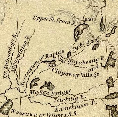
Detail of the upper Saint Croix River, Brule Bog portage, and “Chipeway Village” from Hydrographical Basin of the Upper Mississippi River From Astronomical and Barometrical Observations Surveys and Information by J.N. Nicollet, 1843. Also shown is the Grand Footpath (long dotted line) between Chequamegon Bay and Saint Anthony Falls.
~ David Rumsey Map Collection
We soon began to meet large parties of Indians in their canoes, bound to La Pointe, to be present at the payment. As Mr. Hays (the Indian agent at La Pointe) had told us that he expected the Rev. Mr. Ely, who had charge of a Presbyterian missionary station on the Percagaman, or Snake river, to be over at the payment, and thought it probable that we might meet him; and learning that some of the Indians we met were from Snake river, I asked them if they knew whether Mr. Ely had left. They told me he had, and that he was at his camp down the river, which we would soon reach.
We continued on, amidst fields of wild rice in full bloom, which covered the lake for acres upon acres on each side of the channel. This wild rice (rizania aquatica) is of great importance to the Indians, who gather large quantities of it when ripe, in autumn, for their winter food. Its soft stem and watery roots are immersed about 2 to 2½ feet under water, while the blades, head, and stalk reach about a foot to a foot and a half above water. In flowering, its heads present a singular appearance. Its pistils, or grain part of the flower, are clustered on a long, sharp-pointed spicular, terminating in a sharp cone at the very head of the stalk; while the pollen appears attached to the stalk below the head.
Why could not this rice be sown and cultivated in the lakes of western New York and in New England? Besides the value of the grain for poultry and various other purposes, its tops or blades would make the richest and sweetest fodder for cattle. I chewed the blades, and found them tender, and as sweet as the tender blades of green corn. The experiment might be worth the trial.

Reverend Edmund Franklin Ely.
~ Duluth Public Library
About the middle of the afternoon we reached the first rapids in descending the St. Croix, now contracted from a lake into a narrow river, strewed here and there with black boulders of trap. We here had the pleasure of finding Mr. Ely encamped on the west bank of the river, who had remained still all day, as it was Sunday. He had in company with him the Rev. Mr. Rosselle, a young clergyman from Ogdensburg, New York, to whom he introduced me. Mr. Rosselle informed me that he had been to the falls of St. Anthony, from whence he had gone on a steamboat “Still-water,” at the head of the lower Lake St. Croix, and from thence to the missionary station on the Pergacaman, or Snake river, where he concluded to accompany the Rev. Mr. Ely to La Pointe, and be present at the Indian payment. From La pointe he expected to make his way home by the Sault St. Marie, Mackinac, &c. Mr. Ely had some Indians along with him, who were evidently attached to the mission. He said the success of the mission had been interfered with, to some extend, by the dread in which the Chippewas held the Sioux in that part of the country; that in constant fear of their natural enemy, they disliked making permanent settlements and to improve them. After some other general conversation, we continued our journey over rapids, till near night, when we camped (as was often the case) on an old Indian camping-ground, and saw lying about us dog bones, on the meat of which the Indians had feasted. An innumerable swarm of horseflies surrounded our tent and camp-fire, which the voyageurs at first mistook for bumble bees, whose nest, they conceived, they had disturbed, and, for fear of being stung, they fled; but, on ascertaining they were merely noisy flies, they came back again.
We made an early start next morning, to resume our descent over rapids dashing over trap and granite boulders. We met a half-breed and his wife, who had a keg of whiskey in his canoe. They were going to La Pointe, where Mr. Hays suffers no liquor to land. The man offered to treat my voyageurs, one of whom was known to him. I consented that they might take one dram each, but no more. This being given them, we thanked him, and proceeded on our journey. About noon, we passed the last severe rapids, and the mouth of a large tributary from the east, called the Macagon, about 100 miles above the falls, and within 50 miles of Snake river.

Detail of the Saint Croix River with tributaries Snake River and Kettle River from Hydrographical Basin of the Upper Mississippi River From Astronomical and Barometrical Observations Surveys and Information by J.N. Nicollet, 1843. Also shown is the Grand Footpath (long dotted line) between Chequamegon Bay and Saint Anthony Falls.
~ David Rumsey Map Collection
The St. Croix, from this point down, became a larger, more beautiful, and more interesting stream. The bottoms, too, became wide and rich, but subject to inundation at very high water. The stratified red sandstone was seen to skirt the margins of the river, all along the rapids; while boulders of trap and granite were strewn over the centre of the channel. But, as we approached Kettle and Snake rivers, we began to notice the appearance of white sandstone on the shores of the river, which continued to appear till near the falls, and again rose in high cliffs below them, and continued to the Mississippi. At night, we camped on a high pine bluff on the right bank of the river, a large swamp being on the opposite side. Here we were nearly devoured by mosquitoes, and were glad to make our escape next morning without breakfast – intending to stop and cook at a place, if possible, less infested by them; which we did, on the pebbly beach of an island.
We had a showery forenoon, but continued our journey. We met with several long rapids, and, passing Kettle river, reached the mouth of Snake river, about 10 a.m. – where we found a body of Indians encamped, going to La Pointe. We exchanged some meal for some fish, and gave an old woman some sugar for a sick child. Then, wishing them a “bon voyage,” we put off. About 25 miles above the falls, we passed Sunrise river, with splendid and extensive bottom-land opposite to it on the left bank, lying high and dry above high-water mark.
The next place we made was Wolf river, about 18 or 20 miles above the falls. Here we found a rude village, on a rich piece of land, settled by half-breeds, Indians, and a Frenchman or two. They had lots of liquor, and offered to sell me some; but I declined to purchase, or to let my voyageurs buy any; and, though late in the afternoon, moved for some 8 or 10 miles further, and camped just within the first rapid or two, at the commencement of the falls. From the head of the rapids to the falls is 9 miles.

Detail of Saint Croix Falls with tributaries Sunrise River (“Memokage”) and Wolf Creek (“Attanwa”) from Hydrographical Basin of the Upper Mississippi River From Astronomical and Barometrical Observations Surveys and Information by J.N. Nicollet, 1843. Also shown is the Grand Footpath (long dotted line) between Chequamegon Bay and Saint Anthony Falls.
~ David Rumsey Map Collection
~ Fifty Years in the Northwest by William H. C. Folsom, 1888, page 87.
We reached the falls next morning to breakfast, where I made the acquaintance of Mr. Purinton, to whom I bore a letter of introduction, and found him a very clever and enterprising man. He has done more to develop this part of the country, and to enhance its value and settlement, than any other man in it. The falls afford a splendid water-power, fully equal to that yielded by the falls of the Merrimac at Lowell. Mr. Purinton is the proprietor, and has a saw-mill running with five saws, in separate frames. His logs come down the St. Croix.
There is a trap formation in place, crossing the river at the falls, obliquely from northwest to southeast. It is lost a short distance to the northwest of the river, but runs off in a range of 20 miles to the southeast of the falls. It differs a good deal from the trap-formation on Lake Superior. It is of a bluish and lighter color than the trap on the lake in the high perpendicular cliffs of this stone, which faces the river at, and for some little distance below the falls, may be seen strong indications of a columnar structure in its form; while in the trap on Lake Superior, the same rock is uniformly amorphous in its form.
Besides, the trap on Lake Superior appears uniformly to have had an upheaval through red sandstone; while that at the falls has been borne up through white sandstone, very distinct in its character from the red sandstone of the lake. It is probable, therefore, that there is no continuous connexion or homogeneousness of character between the trap-rock of the falls, and that on Lake Superior; and that they may have been raised at far different and distinct periods. Be this as it may, however, I found the trap at the falls of St. Croix to give very favorable indications of the existence of copper ore. Mr. Purinton gave me some very interesting specimens of the ore found in the vicinity of his mill.
While rambling about the falls, I discovered, also, one or two very fine mineral chalybeate springs.

Detail of the Saint Croix River from the Falls to the head of Saint Croix Lake (Stillwater, Minnesota) from Hydrographical Basin of the Upper Mississippi River From Astronomical and Barometrical Observations Surveys and Information by J.N. Nicollet, 1843. Also shown is the Grand Footpath (long dotted line) between Chequamegon Bay and Saint Anthony Falls (Minneapolis, Minnesota.
~ David Rumsey Map Collection
Having paid off my voyageurs at the falls, and sent them back in one of the canoes, I prepared to descend the river to the head of the lake, or to Stillwater, in the other; which I reached next day. There is a saw-mill at this place, and two others between it and the falls – all being turned by streams which enter the river on one side or the other. At Stillwater, a town not quite a year old, there is a tavern, two stores, a blacksmith-shop, one lawyer, one doctor, no preacher, no schoolmaster, no justice of the peace or mayor, one saw-mill, no school, a large cool spring, and a very pretty place for the town to grow on. We here met the steamboat Lynx, on which we took passage, after disposing of my canoe.
The land on the west side of Lake St. Croix is beautiful all the way to the Mississippi, and is fast settling up. This beautiful sheet of water is 22 miles long, and from one and a half to two miles wide.
I am, very respectfully and sincerely, yours,
MORGAN.
To be continued in Copper Harbor Redux…
Wisconsin Territory Delegation: La Pointe
April 23, 2016
By Amorin Mello
A curious series of correspondences from “Morgan”
… continued from The Copper Region.
The Daily Union (Washington D.C.)
“Liberty, The Union, And The Constitution.”
August 9, 1845.
La Pointe, Lake Superior
July 26, 1845
To the Editor of the Union:

View of La Pointe, circa 1843.
“American Fur Company with both Mission churches. Sketch purportedly by a Native American youth. Probably an overpainted photographic copy enlargement. Paper on a canvas stretcher.”
~ Wisconsin Historical Society
I have just time to state that, having spent five days at Copper Harbor, examining the copper mine, &c. at that place, and having got everything in readiness, we set off for this place, along the coast, in an open Mackinac boat, travelling by day, and camping out at night. We reached this post on yesterday, the 25th instant. We have now been under tents 21 nights. In coming up the shore of the lake, we on one occasion experienced a tremendous rain accompanied with thunder, which wetted our things to a considerable extent, and partly filled the boat with water.
On our way we spent a good part of a day at Eagle river, and examined the mine in the process of being worked at that place, but found it did not equal our expectations.
We also stopped at the Ontonagon, the mineral region bordering which, some fifteen miles from the lake, promises to be as good as any other portion of the mineral region, if not better.
I have not time at present to enter fully into the results of observations I have made, or to describe the incidents and adventures of the long journey I have performed along the lake shore for the distance of about 500 miles, from Sault Ste. Marie to La Pointe. There are many things I wish to say, and to describe, &c.; but as the schooner “Uncle Tom,” by which I write, is just about leaving, I have not time at present. I must reserve these things for a future opportunity.
I am, very respectfully,
Your obedient servant,
MORGAN.
P.S. – I set off in a day or two for the Mississippi and Falls of St. Anthony, via the Brulé and St. Croix rivers.
Yours, &c., M.
The Daily Union (Washington D.C.)
“Liberty, The Union, And The Constitution.”
August 25, 1845
EDITOR’S CORRESPONDENCE
—
[From our regular Northern correspondant.]
La Pointe, Lake Superior,
July 28, 1845.
Map of the Mineral Lands Upon Lake Superior Ceded to the United States by the Treaty of 1842 With the Chippeway Indians.
~ Wisconsin Historical Society
In what I said in my last letter of this date, in relation to the extent, value, and prospects of the copper-mines opened on Lake Superior, I had no wish to dampen the ardor, would the feelings or injure the interest of any one concerned. My only wish is to state facts. This, in all cases, I feel it my duty to do; although, in so doing, as in the present case, my individual interest suffers thereby. Could I have yielded to the impulses and influences prevailing in the copper region, I might have been greatly benefited in a pecuniary point of view by pursuing a different course ; but, knowing those whom I represented, as well as the public and the press for which I write, wanted the truth, the whole truth, and nothing but the truth, I could do nothing less than make the statement I did. Previous to visiting the country, I could, of course, know nothing of its real character. I had to judge, like others, from published reports of its mineral wealth, accompanied with specimens, &c., which appeared very flattering; but which, I am now convinced, have been rather overdrawn, and the mineral region set out larger and richer than it really is. The authors of the reports were, doubtlessly, actuated by pure motives. They, no doubt, had a wish, in laying down the boundaries of the mineral region, so to extend it as to leave out no knoll or range of trap-rock, or other formation, if any indicative of mineral deposites, which usually appear in connexion with them, occurred.
I consider, in conclusion, that the result thus far is this: that the mines opened may possibly, in their prosecution, lead to rich and permanent veins; and probably pay or yield something, in some cases, while exploring them. But, however rich the specimens of one raised, at present there is nothing in them, geologically speaking, that indicates, conclusively, that they have reached a vein, or that the mines will continue permanently as rich as they are at present. This would be my testimony, according to the best of “my knowledge and belief,” on the witness’s stand, under oath.
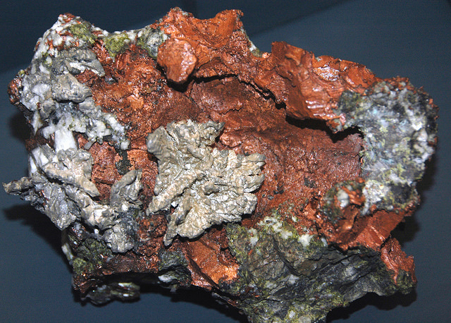
“The remarkable copper-silver ‘halfbreed’ specimen shown above comes from northern Michigan’s Portage Lake Volcanic Series, an extremely thick, Precambrian-aged, flood-basalt deposit that fills up an ancient continental rift valley.”
~ Creative Commons from James St. John
That the region, as before said, is rich in copper and silver ores, cannot be denied. And I think the indications that veins may or do exist somewhere in great richness, are sufficiently evident to justify continued explorations in search of them, by those who have the means and leisure to follow them up for several years. To find the veins, and most permanent deposites, must be the work of time; and as the season is short, on Lake Superior, for such operations, several years may be necessary before a proper and practical examination can be made of the country.
The general features of Lake Superior are very striking, and differ very much in appearance from what I have ever met with in any other part of the continent. The vastness and depth of such a body of pure fresh cold water so far within the continent, is an interesting characteristic. When we consider it is over 900 feet deep, with an area of over 30,000 square miles, and yet that, throughout its whole extent, it presents as pure and as fresh-tasted water as though it were taken from a mountain brook, the question naturally arises, Where can such a vast supply of pure water come from? It is true, it has great many streams flowing into it, but they are nearly all quite small, and would seem to be wholly inadequate to supply such a vast mass of water, and preserve it in such a state of purity. The water supplied by most of the rivers is far less pure than that in the lake itself. East of Keweena point, we found the water of the rivers discolored, being tinged by pine and other roots, clay, &c., often resembling the hue of New England rum. Such rivers, or all combined, would seem to be inadequate to supply such a vast quantity of pure clear water as fills this inland ocean!
~ United States Geological Survey
It is possible that this great lake is freely supplied with water from subterranean springs opening into it from below. The river St. Mary’s also seems inadequate, from its size, to discharge as much water as comes into the lake from the rivers which it receives. In this case, evaporation may be so great as to diminish the water that would otherwise pass out at it.
As relates to tides in the other lakes, we have nothing to say; but, as far as Lake Superior is concerned, we feel assured, from observation, as well as from the reports of others upon whom we can rely, that there are tides in it – variously estimated at from 8 to 12 inches; influenced, we imagine, by the point of observation, and the season of the year at which such tides are noticed.
The Voyageurs (1846) by Charles Deas.
~ Commons.Wikimedia.org
What strikes the voyageur with the most interest, in the way of scenery, is the wild, high, bold, and precipitous coast of the southern shore, for such much of the whole distance between Grand Sable and La Pointe, and, indeed, for some distance beyond La Pointe ; the picturesque appearance of which often seemed heightened to us, as on a clear morning, or late afternoon, or voyageurs would conduct our boat for miles near their bases. Above us, the cliffs would rise in towering heights, while the bald eagle would be soaring in grand circular flights above their summits; our voyageurs, at the same time, chanting in chorus many of their wildest boat songs, as we glided along on the smooth and silent bosom of the lake. I have heard songs among various nations, and in various parts of the world; but, whether it was the wild scenery resting in solemn grandeur before me, with the ocean-like waste of water around us, which lent wilderness to the song, I never listened to any which appeared to sing a verse in solo, and then repeat a chorus, in which the whole crew would join. This would often be continued for several miles at a time, as the boat glided forward over smooth water, or danced along over the gentle swells of a moderate sea; the voyageurs, at the same moment, keeping time with their oars.
Jean Baptiste, our pilot, had an excellent voice, full, loud, and strong. He generally led off, in singing; the others falling in at the choruses. All their songs were in French, sometimes sentimental or pathetic, sometimes comic, and occasionally extempore, made, as sung, from the occurrences of the preceding day, or suggested by passing scenes.
The Chippewa Indians are poor singers; yet they have songs (such as they are) among them; one of which is a monotonous air repeated at their moccasin games.
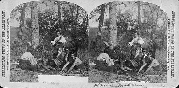
Stereographic view of a moccasin game, by J. H. Hamilton, 1880.
~ University of Minnesota Duluth
Next to the love of liquor, many of the Indians have a most unconquerable passion for gambling. While at La Pointe, I had an opportunity of seeing them play their celebrated moccasin game. They were to the number of two, or three aside, seated on the ground opposite to each other, which a blanket spread out between them, on which were placed four or five moccasins. The had two lead bullets, one of which was made rough, while the other remained smooth. Two f the gamesters were quite young men, with their faces painted with broad horizontal red and blue stripes, their eyelashes at the same time being dyed of a dark color. They played the game, won and lost, with as much sang froid as old and experienced gamblers. Those who sat opposite, especially one of them, was much older, but no means a match, at the time of my visit, for the young rascals, his antagonists. One takes the balls in his hands, keeps his eye directly on the countenance of the opposite party, at the same time tossing the balls in his hands, and singing, in a changing voice, words which sound somewhat like “He-he-hy-er-he-he-hy-er-haw-haw-haw-yer. He-he-hy-er,” &c. During which he keeps raising, shifting, and putting down the moccasins, till, finally, he raises his hands, having succeeded in concealing the balls under two of the moccasins, for which the other proceeds to search; and if he succeeds, on the first trial, in finding the rough ball, he wins. Then he takes the balls to hide, and commences singing himself. If he fails, he loses; and the first party repeats the song and the secretion of the balls. They hold in their hands small bundles of splinters of wood. When one loses, he gives to the winner so many sticks of wood. A certain number of them gained by any one of the party, wins the game. When I saw them, they had staked up their beads, belts, garters, knife-cases, &c. Their love of gaming is so strong, as to cause them to bet and lose everything they possess in the world – often stripping the last blanket from their naked backs, to stake on the game. It is said that some Indians acquire so much dexterity at this game, that others addicted to it refuse to play with them. In playing the game, they keep up a close watch on each other’s eyes, as being the best index to the movement of the hands. The song is repeated, no doubt, to diver the attention of the antagonists.
Among other peculiarities of Lake Superior, and one of its greatest recommendations, is the abundance and superiority of its fish, consisting of trout of large size, white fish, siskomit, ( a species of salmon,) and bass. The trout and siskomit are the finest and noblest fresh-water fish I ever saw. Almost every day we could catch trout by trailing a hook and line in the water behind out boat. In this way we caught one fine siskomit. Its meat, when fresh-cooked, we found about the color of salmon. The fish itself is about as heavy as a common-sized salmon, but less flat, being more round in form.

Detail of “The 12 Apostles” from Captain Jonathan Carver’s journal of his travels with maps and drawings, 1766.
~ Boston Public Library
If you will look at a map of Lake Superior, you will find, near its upper end, a labyrinth of islands, called by the early French voyageurs, of whom P. Charlevoix was one, (a Jesuit,) “the Madelaine islands.” They are sometimes called “the Twelve Apostles.” The largest island is now generally known as “the Madelaine island” – being the largest of the group. Just inside, and near its southern extremity, at the head of a large, regular bay, with a sandy beach, with an open and gently-rising scattered pine and spruce land in the rear of the beach, stands La Pointe – one of the most pleasant, beautiful, and desirable places for a residence on Lake Superior, and the very place where Fort Wilkins should have been placed, instead of its present location, which must be conceded, by every impartial person, to be among the very worst that could have been selected on the whole lake.
The garrison at Copper harbor, located, as it is, upon the rocky surface of trap conglomerate, affording a surface so scantily supplied with soil amidst masses of pebbly rock and trap fragments as to be wholly unfit for any sort of cultivation whatever, is altogether out of place. It is wholly inaccessible by land, and can only be reached by water in summer. It is at a spot where Indians usually never passed within forty miles of it, till since its occupation.
Detail of the Indian trail or “mail route” between La Pointe and St. Anthony Falls.
~ A new map of the State of Wisconsin, by Thomas, Cowperthwait & Co., 1850
The very next Congress should direct its prompt removal to La Pointe. Here, from the foot of the bay in front of the Madelaine island, there is an Indian trail, connecting La Pointe with St. Anthony’s Falls, and over which the mail is carried in winter by voyageurs on foot. La Pointe is the favorite resort of the Indians. Their lodges, in villages, bark canoes, &c. are found here the year round.
They delight to paddle and sail their canoes about the beautiful bays, harbors, &c. of these islands, employing their time in canoe building, hunting, fishing, &c. At every annual payment of their annuities, they flock to La Pointe in great numbers. Not only is that section of the great Chippewa nation sharing in the annuities brought together, but large parties of the same tribe, who receive no annuity, come at the same time from the British possessions to the north of Pigeon river. The Chippewas, called the “Pillageurs,” (so called from their thievish propensities,) inhabiting the country about Mille and Leech lakes, also attend – to meet relations, to traffic , and, perhaps, to steal a little. The great advantage of a government outpost is felt in the moral effect it exercises over the Indians. I know of no place where this influence would be more decidedly and beneficially exerted than at La Pointe. here should be daily unfurled the “stars and stripes,” and the sound of the evening gun be heard over the beautiful bays, and along the shores of the Twelve Apostles, which the Indians would learn to reverence with little less respect than they do the voice of the Manitou – the guardian spirit of the mines, embowelled in the dark trap hills of the lake.
Here, too, is an exceedingly healthy place, a good soil, and every convenience for raising the finest potatoes, turnips, and every kind of garden stuff.

1856 oil painting of Doctor Charles William Wulff Borup, a native of Copenhagen, Denmark. Borup married Elizabeth Beaulieu, a Lake Superior Chippewa daughter of Bazil Hudon Beaulieu and Ogimaagizzhigokwe. Borup and his brothers-in-law Charles Henry Oakes and Clement Hudon Beaulieu were co-signers of the 1842 Treaty with the Chippewa at La Pointe. Borup and Oakes became the first bankers of Minnesota.
Dr. Borup, the agent for the American Fur Company, (who have an extensive trading-post at this place,) has a superb garden. In walking through it with him, I saw very fine crops of the usual garden vegetables growing in it. His red currant bushes were literally bent down beneath their weight of ripe fruit. His cherry-trees had also borne well. Gooseberries also succeed well. The doctor also had some young apple-trees, that were in a thriving condition. Poultry, likewise, does well. Mrs. B. had her yard well stocked with turkeys, geese, ducks, and chickens. There was also a good garden at the mission-house of the American board.
However infinitely better is such a place for a United States garrison than Copper harbor, located, as it were, on a barren rock, where no Indians are seen, unless induced to go there by the whites – where there is nothing to protect – where intercourse is cut off in winter, and food can only reach it in summer – where there is no soil on which to raise a potato or a cabbage. I can only say that a greater blunder, in the location of a military post, was probably never committed. And if made (of which I am assured it was not) by a military man, he ought to be court-martialed and cashiered.
The mouth of the Ontonagon river is a far better spot for the fort than Copper harbor. It has a good soil, and a beautiful site for a fort. Furthermore, the country between it and Fort Winnebago, on the Wisconsin river, is favorable to the construction of a military road, which ought, at no distant day, to be opened. Another road should be cut from Fort Snelling, near the falls of St. Anthony, to La Pointe. In cutting these roads, it would seem to me as if the United States soldiers themselves might be usefully employed.
~ FortWiki.com
While at Copper harbor, I frequently visited Fort Wilkins, in command of Captain Cleary, whom I consider in every way an ornament and an honor to the service. In the brief space of time he has been at this post, and with the slender materials at command afforded by the country, he has nevertheless succeeded in making an “oasis” in a wilderness. He has erected one of the neatest, most comfortable, and best-planned garrisons it has been my lot to enter on the western frontier. He keeps all in excellent condition. His men look clean, healthy, and active. He drills them daily, and keeps them under most excellent discipline. He seems to take both pleasure and ride in the service. He says he never has any difficulty with is soldiers while he can exclude ardent spirits from them, as he succeeds in doing here, notwithstanding the great number of visitors to Copper harbor this summer.
To all travellers who are interested in objects of leading curiosity, the character of the Indians they fall in with cannot fail to arrest a share of attention.
The Chippewas are the only Indians now met with from the Sault Ste. Marie and Mackinac, extending from thence west along the southern shore of Lake Superior, to Fond du Lac, and from thence, in the same direction, to the Mississippi river. Within the United States they extend over the country south from the British boundary, to the country low down on the St. Croix and Chippewa rivers. The same tribe extends from our boundary northwest of the lake, entirely around its northern shore on British territory, till they reach the Sault Ste. Marie, opposite the American shore. It is said this tribe, spread over such a vast tract of country, is a branch of the powerful race of the Algonquins. They are sometimes called O-jib-was. They do not exist as a consolidated nation, or strictly as a confederation of bands. The entire nation on both sides of the line is divided into a great number of bands, with a chief at the head of each, which not uncommonly go by his name, such as “Old Martin’s band,” “Hole in the Day’s band,” &c.
The chief’s son, especially if he exhibits the right qualities, is expected to succeed his father at the head of the band; but very frequently the honor is reached by usurpation. The whole nation, which widely differ in circumstances, according to the part of the country they inhabit, nevertheless all speak the Chippewa language, and have extensive connexion by marriage, &c. The bands inhabiting the southern shore of Lake Superior are by far the best of any others. Though polygamy still prevails among them, and especially among their chiefs, it is nevertheless said to be becoming less common, especially where they are much influenced by Catholic and other missions. While at La Pointe, an Indian wedding was consummated, being conducted according to the ceremonies of the Catholic church, and performed by the missionary priest of that persuasion stationed at the Pointe.
There is one trait of character possessed by the Chippewas, (if we except, perhaps, the band of “pillageurs,” who have a kind of “Bedouin Arab” reputation among their countrymen,) which, I am sorry to say, the whites do not possess in an equal degree – that is, “very great honesty.”
White men can travel among them with the most perfect safety as to life and property. I will venture to say, that a man may carry baskets filled with gold and silver, and set them down in Indian villages, or leave them lying where he likes, or go to sleep by them, with Indians encamped all around him, and not one cent will be touched. Such a thing as a house being broken open and robbed at a Chippewa Indian trading-post was never heard of – within between two and three years’ intercourse with them – in time of peace. Dr. Borup said he would not be afraid, if concealed to look on, to leave his store door open all night; and the fact alone of its being left open, might be made known to the Indians at the Pointe. He would expect to see no Indian enter the store, nor would he expect to lose anything; such was his confidence in their honesty!!
Last winter, flour at the Pointe rose to $40 per barrel. The poor Indians were nearly famished for bread, but were unable to purchase it at such a price. They knew the American Fur Company had a considerable lot in store, guarded by nothing stronger than a padlock, yet they never offered the least violence towards the company’s agents or store! Would white people have acted as honestly? The poor Indians, by nature honest, have too often known the whites by the wrongs inflicted upon them, which God can forgive, but time can never blot out! They are very superstitious, but not as basely and insanely so, but a great deal, as the Mormons, Millerites, and other moon-stricken sects among the whites. They believe in one Great and Good Spirit, or a Being who can at will inflict good or evil on mankind; and there’s an end of it. They often denominate the mysterious spirit of evil import the Manitou, making him to dwell in the wild hills, islands, grottoes, and caves of Lake Superior.
From these huge birds the Indians obtained their first knowledge of fire, which they kindled with fire-sticks. These mythical birds were the most powerful of the animal deities of the Indians of the woodlands and of the plains. When the weather was stormy they flew about high in the heavens. When they flapped their great wings, one heard the crashes of thunder, when they opened and closed their eyes flashes of lightning were seen. Some carried lakes of water on their backs, these slopped over and caused downpours of rain. Their arrows, or thunderbolts, were the eggs which they dropped in their flight. These shattered the rocks and set fire to the forests and prairies.
A Chippewa Indian hunter, who was carried away to his nest by a Thunderer, saved his life by killing one of the young birds and flying back to earth in its feathered hide.
In the Smoky Mountains, a wild and rugged region in the southwestern part of Bayfield County, was the home of Winneboujou (Nenebozho), the fabled hero of the Ojibwa Indians. This all-powerful manitou was a blacksmith, and had his forge on the flat top of the highest mountain. Here he shaped the native copper of the Lake Superior region into useful implements for his Indian children. Much of his work at his forge was done at night, and the ringing blows of his great hammer could be heard throughout the Brule Valley and Lake Superior region. The fire of his forge reddened the sky. When he was not busy at his forge he was away hunting or seeking other adventures. Many stories of the exploits of this giant manitou have been told by the Chippewa and other Wisconsin Algonquian tribes.”
~ Legends of the Hills of Wisconsin by Dorothy Moulding Brown; The Wisconsin Archaeologist, Volume 18, Number 1, 1937, pages 20-21.
At times, it is said, a peculiar noise issues from the Porcupine mountains, and from the high hills on the main land, both east and west of La Pointe, some distance off. It is said to resemble the distant discharge of ordnance, or thunder. At one time, they said it was so loud and frequent, that they mistook it for signal guns fired from the brig Astor, which they thought might be in distress, and actually sent out a boat in search of her.
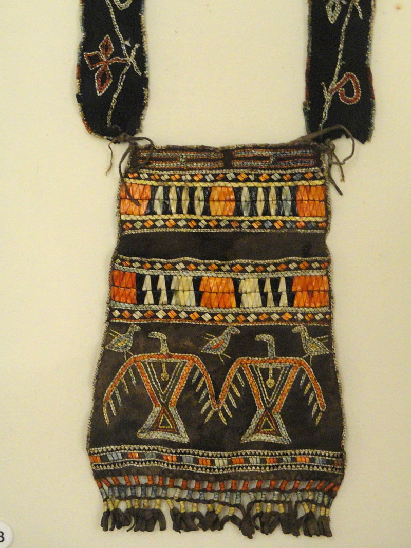
“Ojibwe shoulder pouch depicting two thunderbirds in quillwork, Peabody Museum, Harvard University.”
~ Commons.Wikimedia.org
These sounds the Indians believe to be the voice of the spirit “Manitou,” who guards the deposites of mineral wealth embowelled beneath the hills, and to whom any attempt made to dig them up, and carry them off, would be highly offensive, and followed by some kind of punishment. I have never yet heard of an Indian’s leading a white man to a locality of copper, or telling where he has found a piece when picked up!
Some have supposed that the noise in question arises from volcanic action; but, as no vibration is felt in the earth, and no other proof exists of such being the case, we are led to believe that the noise is produced by the lashing of the waves of the lake after a storm, as they are driven forward into the grottoes, caves, &c. of the tall sandstone cliffs, formed at their bases by the disintegrating effects of water and ice. Some distance east of La Pointe, about the Little Girl’s Point and Montreal river, as well as west of the same place, some fifteen or twenty miles, high red sandstone cliffs occur. At their bases, near the water’s edge, a great many curiously-shaped caves and grottoes appeared. In places, the sandstone had been so cut away, that only pillars remained standing at some ten or fifteen feet in the lake, from the top of which a high rude arch would extend to the main shore, and beneath which boats could easily pass. This was particularly the case near where the islands are parted with going west up the southern shore of the lake. Some caves, with small openings for mouths, run for a long distance back beneath the hills, expanding, likely, into large halls with high vaulted roofs, &c. After a storm, a heavy sea continues to roll into these grottoes and caverns, the waves lashing themselves against their sides and roofs – thus producing sounds resembling those heard at La Pointe, &c.
As the weather is generally calm after a storm, before the sea goes down, it is likely at such times these sounds are heard.
We had occasion to pass these places when a considerable sea would be on, close to the cliffs, and could hear the hollow heavy sounds of the waves as they broke into the caverns within the cliffs and hills. Every day, while we remained, parties of Indians continued to arrive, to be present at the payment.
We finally became prepared to leave for the Mississippi, having bought two bark canoes, and hired four new voyageurs – two for each canoe – one Indian, one half-breed, and two descendants of Canadian French; and, with a stock of provisions, we were ready to be off. From this place, I sent back three voyageurs to the Sault Ste. Marie, all that I hired to come as far as La Pointe. So, after paying our respects to Mr. Hays, our worthy Indian agent, and to Dr. Borup, (to both of whom I had borne letters of introduction,) and having many “bon voyages” heaped upon us by our friends and the friends of the voyageurs, we bade adieu to La Pointe.
You will not hear from me again till I reach the Falls of St. Croix.
I am yours, very truly, &c.
MORGAN.
To be continued in Saint Croix Falls…
Wisconsin Territory Delegation: The Copper Region
April 17, 2016
By Amorin Mello
A curious series of correspondences from “Morgan”
… continued from Copper Harbor.

The Daily Union (Washington D.C.)
“Liberty, The Union, And The Constitution.”
August 21, 1845.
EDITOR’S CORRESPONDENCE.
—
[From our Regular Correspondent.]
THE COPPER REGION.
La Pointe, Lake Superior
July 28, 1845.
Map of the Mineral Lands Upon Lake Superior Ceded to the United States by the Treaty of 1842 With the Chippeway Indians.
~ Wisconsin Historical Society
In my last brief letter from this place, I had not time to notice many things which I desired to describe. I have now examined the whole coast of the southern shore of Lake Superior, extending from the Sault Ste. Marie to La Pointe, including a visit to the Anse, and the doubling of Keweena point. During the trip, as stated previously, we had camped out twenty-one nights. I examined the mines worked by the Pittsburg company at Copper harbor, and those worked by the Boston company at Eagle river, as well as picked up all the information I could about other portions of the mineral district, both off and on shore. The object I had in view when visiting it, was to find out, as near as I could, the naked facts in relation to it. The distance of the lake-shore traversed by my part to La Pointe was about five hundred miles – consuming near four weeks’ time to traverse it. I have still before me a journey of three or four hundred miles before I reach the Mississippi river, by the way of the Brulé and St. Croix rivers. I know the public mind has been recently much excited in relation to the mineral region of country of Lake Superior, and that a great many stories are in circulation about it. I know, also, that what is said and published about it, will be read with more or less interest, especially by parties who have embarked in any of the speculations which have been got up about it. It is due to truth and candor, however, for me to declare it as my opinion, that the whole country has been overrated. That copper is found scattered over the country equal in extent to the trap-rock hills and conglomerate ledges, either in its native state, or in the form of a black oxide, as a green silicate, and, perhaps, in some other forms, cannot be denied;- but the difficulty, so far, seems to be that the copper ores are too much diffused, and that no veins such as geologist would term permanent have yet positively been discovered.

Detail of a Survey of Location No. 4 for the Pittsburgh & Boston Copper Harbor Mining Co. Image digitized by the Detroit Public Library Burton Historical Collection for The Cliff Mine Archeology Project Blog.
The richest copper ore yet found is that raised from a vein of black oxide, at Copper harbor, worked by the Pittsburg company, which yields about seventy per cent. of pure copper. But this conglomerate cementation of trap-rock, flint, pebbles, &c., and sand, brought together in a fused black mass, (as is supposed, by the overflowings of the trap, of which the hills are composed near this place,) is exceedingly hard and difficult to blast. An opinion seems to prevail among many respectable geologist, that metallic veins found in conglomerate are never thought to be very permanent. Doctor Pettit, however, informed me that he had traced the vein for near a mile through the conglomerate, and into the hill of trap, across a small lake in the rear of Fort Wilkins. The direction of the vein is from northwest to southeast through the conglomerate, while the course of the lake-shore and hills at this place varies little from north and south. Should the doctor succeed in opening a permanent vein in the hill of trap opposite, of which he is sanguine, it is probable this mine will turn out to be exceedingly valuable. As to these matters, however, time alone, with further explorations, must determine. The doctor assured me that he was at present paying his way, in merely sinking shafts over the vein preparatory to mining operations; which he considered a circumstance favorable to the mine, as this is not of common occurrence.
The mines at Copper harbor and Eagle river are the only two as yet sufficiently broached to enable one to form any tolerably accurate opinion as to their value or prospects.
~ Encyclopedia of the Earth
Other companies are about commencing operations, or talk of doing so – such as a New York, or rather Albany company, calling themselves “The New York and Lake Superior Mining Company,” under the direction of Mr. Larned, of Albany, in whose service Dr. Euhts has been employed as geologist. They have made locations at various points – at Dead river, Agate harbor, and at Montreal river. I believe they have commenced mining to some extent at Agate harbor.
One or two other Boston companies, besides that operating at Eagle river, have been formed with the design of operating at other points. Mr. Bernard, formerly of St. Louis, is at the head of one of them. Besides these, there is a kind of Detroit company, organized, it is said, for operating on the Ontonagon river. It has its head, I believe, in Detroit, and its tail almost everywhere. I have not heard of their success in digging, thus far; though they say they have found some valuable mines. Time must determine that. I wish it may be so.

Boston Mining Company stock issued by Joab Bernard in 1846.
~ Copper Country Reflections
From Copper harbor, I paid a visit to Eagle river – a small stream inaccessible to any craft larger than a moderate-sized Mackinac boat. There is only the open lake for a roadstead off its mouth, and no harbor nearer than Eagle harbor, some few miles to the east of it. In passing west from Copper harbor along the northern shore of Keweena point, the coast, almost from the extremity of Keweena point, to near Eagle river, is an iron-bound coast, presenting huge, longitudinal, black, irregular-shaped masses of trap-conglomerate, often rising up ten or fifteen feet high above water, at some distance from the main shore, leaving small sounds behind them, with bays, to which there are entrances through broken continuities of the advanced breakwater-like ledges. Copper harbor is thus formed by Porter’s island, on which the agency has been so injudiciously placed, and which is nothing but a conglomerate island of this character; with its sides next the lake raised by Nature, so as to afford a barrier against the waves that beat against it from without. The surface of the island over the conglomerate is made up of a mass of pebbles and fragmentary rock, mixed with a small portion of earth, wholly or quite incapable of cultivation. Fort Wilkins is located about two miles from the agency, on the main land, between which and the fort communication in winter is difficult, if not impossible. Of the inexcusable blunder made in putting this garrison on its present badly-selected site, I shall have occasion to speak hereafter.
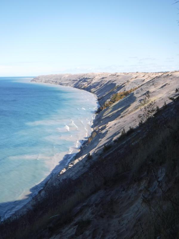
“Grand Sable Dunes”
~ National Park Service
In travelling up the coast from Sault Ste. Marie, the first 50 or 100 miles, the shore of Lake Superior exhibits, for much of the distance, a white sandy beach, with a growth of pines, silver fir, birch, &c., in the rear. This beach is strewed in places with much whitened and abraded drift-wood, thrown high on the banks by heavy waves in storms, and the action of ice in winter. This drift-wood is met with, at places, from one end of the lake to the other, which we found very convenient for firewood at our encampments. The sand on the southern shore terminates, in a measure, at Grand Sables, which are immense naked pure sand-hills, rising in an almost perpendicular form next to the lake, of from 200 to 300 feet high. Passing this section, we come to white sand-stone in the Pictured Rocks. Leaving these, we make the red sand-stone promontories and shore, at various points from this section, to the extreme end of the lake. It never afterwards wholly disappears. Between promontories of red stone are headlands, &c., standing out often in long, high irregular cliffs, with traverses of from 6, 7, to 8 miles from one to the other, while a kind of rounded bay stretches away inland, having often a sandy beach at its base, with pines growing in the forest in the rear. Into these bays, small rivers, nearly or quite shut in summer with sand, enter the lake.
The first trap-rock we met with, was near Dead river, and at some few points west of it. We then saw no more of it immediately on the coast, till we made the southern shore of Keweena point. All around the coast by the Anse, around Keweena bay, we found nothing but alternations of sand beaches and sand-stone cliffs and points. The inland, distant, and high hills about Huron river, no doubt, are mainly composed of trap-rock.

Detail from Map of the Mineral Lands Upon Lake Superior Ceded to the United States by the Treaty of 1842 With the Chippeway Indians.
~ Wisconsin Historical Society
Going west from Eagle river, we soon after lost both conglomerate and trap-rock, and found, in their stead, our old companions – red sand-stone shores, cliffs, and promontories, alternating with sandy or gravelly beaches.

Detail of the Ontonagon River, “Paul’s Cabin,” the Ontonagon Boulder, and the Porcupine Mountains from Map of the Mineral Lands Upon Lake Superior Ceded to the United States by the Treaty of 1842 With the Chippeway Indians.
~ Wisconsin Historical Society
The trap-rock east and west of the Portage river rises with, and follows, the range of high hills running, at most points irregularly, from northeast to southwest, parallel with the lake shore. It is said to appear in the Porcupine mountain, which runs parallel with Iron river, and at right angles to the lake shore. This mountain is so named by the Indians, who conceived its principal ridge bore a likeness to a porcupine; but, to my fancy, it bears a better resemblance to a huge hog, with its snout stuck down at the lake-shore, and its back and tail running into the interior. This river and mountain are found about twenty miles west of the Ontonagon river, which is said to be the largest stream that empties into the lake. The site for a farm, or the location of an agency, at its mouth, is very beautiful, and admirably suited for either purpose. The soil is good; the river safe for the entrance and secure anchorage of schooners, and navigable to large barges and keel-boats for twelve miles above its mouth. The trap range, believed to be as rich in copper ores as any part of Lake Superior, crosses this river near its forks, about fifteen miles above its mouth. The government have organized a mineral agency at its mouth, and appointed Major Campbell as agent to reside at it; than whom, a better selection could not have been made.
“Engraving depicting the Schoolcraft expedition crossing the Ontonagon River to investigate a copper boulder.”
~ Wisconsin Historical Society
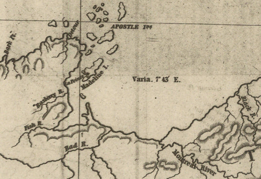
Detail of the Montreal River, La Pointe, and Chequamegon bay from from Map of the Mineral Lands Upon Lake Superior Ceded to the United States by the Treaty of 1842 With the Chippeway Indians.
~ Wisconsin Historical Society
The nearest approach the trap-rock hills make to the lake-shore, beyond the Porcupine mountain, is on the Montreal river, a short distance above the falls. Beyond Montreal river, to La Pointe, we found red-clay cliffs, based on red sand-stone, to occur. Indeed, this combination frequently occurred at various sections of the coast – beginning, first, some miles west of the Portage.
From Copper harbor to Agate harbor is called 7 miles; to Eagle river, 20 miles; to the Portage, 40 miles; to the Ontonagon, 80 miles; to La Pointe, from Copper harbor, 170 miles. From the latter place to the river Brulé is about 70 miles; up which we expect to ascend for 75 miles, make a portage of three miles to the St. Croix river, and descend that for 300 miles to the Mississippi river.
Painting of Professor Douglass Houghton by Robert Thom. Houghton first explored the south shore of Lake Superior in 1840, and died on Lake Superior during a storm on October 13, 1845. Chequamegon Bay’s City of Houghton was named in his honor, and is now known as Houghton Falls State Natural Area.
Going back to Eagle river, at the time of our visit, we found at the mine Mr. Henshaw, Mr. Williams, and Dr. Jackson of Boston, and Dr. Houghton of Michigan, who was passing from Copper harbor to meet his men at his principal camp on Portage river, which he expected to reach that night. The doctor is making a rapid and thorough survey of the country. This work he is conducting in a duplicate manner, under the authority of the United States government. It is both a topographical and geological survey. All his surveyors carry sacks, into which they put pieces of rock broken from every prominent mass they see, and carry into camp at night, for the doctor’s examination, from which he selects specimens for future use. The doctor, from possessing extraordinary strength of constitution, can undergo exposure and fatigue sufficient to break down some of the hardiest men that can be found in the West. He wears his beard as long as a Dunkard’s; has a coat and patched pants made of bed ticking; wears a flat-browned ash-colored, wool hat, and a piece of small hemp cord off a guard chain; and, with two half-breed Indians and a small dog as companions, embarks in a small bark, moving and travelling along the lake shore with great celerity.
Probably no company on Lake Superior has had a longer and harder struggle against adversity than the Phœnix. The original concern, the Lake Superior Copper Company, was among the first which operated at Lake Superior after the relinquishment of the Indian rights to this country in 1843. The trustees of this early organization were David Henshaw and Samuel Williams of Boston, and D. G. Jones and Col. Chas. H. Gratiot, of Detroit; Dr. Charles T. Jackson examined the veins on the property, and work was begun in the latter part of the year 1844. The company met with bad luck from the start, and, the capital stock having become exhausted, it has been reorganized several times in the course of its history.”
~ The Lake Superior Copper Properties: A Guide to Investors and Speculators in in Lake Superior Copper Shares Giving History, Products, Dividend Record and Future Outlook for Each Property, by Henry M. Pinkham, 1888, page 9.
We all sat down to dinner together, by invitation of Mr. Williams, and ate heartily of good, wholesome fare.
After dinner we paid a visit to the shafts at the mine, sunk to a considerable depth in two or three places. Only a few men were at work on one of the shafts; the others seemed to be employed on the saw-mill erecting near the mouth of the river. Others were at work in cutting timbers, &c.
They had also a crushing-mill in a state of forwardness, near the mine.
It is what has been said, and put forth about the value of this mineral deposite, which has done more to incite and feed the copper fever than all other things put together.
Professor Charles Thomas Jackson.
~ Contributions to the History of American Geology, plate 11, opposite page 290.
Dr. Jackson was up here last year, and has this year come up again in the service of the company. Without going very far to explore the country elsewhere, he has certainly been heard to make some very extravagant declarations about this mine,- such as that he “considered it worth a million of dollars;” that some of the ore raised was “worth $2,000 or $3,000 per ton!” So extravagant have been the talk and calculations about this mine, that shares (in its brief lease) have been sold, it is said, for $500 per share! – or more, perhaps!! No doubt, many members of the company are sincere, and actually believe the mine to be immensely valuable. Mr. Williams and General Wilson, both stockholders, strike a trade between themselves. One agrees or offers to give the other $36,000 for his interest, which the other consents to take. This transaction, under some mysterious arrangement, appears in the newspapers, and is widely copied.
Without wishing to give an opinion as to the value and permanency of this mine, (in which many persons have become, probably, seriously involved,) even were I as well qualified to do so as some others, I can only state what are the views of some scientific and practical gentlemen with whom I fell in while in the country, who were from the eastern cities, and carefully examined the famous Eagle river silver and copper mine. I do not allude to Dr. Houghton; for he declines to give an opinion to any one about any part of the country.
“The remarkable copper-silver ‘halfbreed’ specimen shown above comes from northern Michigan’s Portage Lake Volcanic Series, an extremely thick, Precambrian-aged, flood-basalt deposit that fills up an ancient continental rift valley.”
~ Shared with a Creative Commons license from James St. John
They say this mine is a deposite mine of native silver and copper in pure trap-rock, and no vein at all; that it presents the appearance of these metals being mingled broadcast in the mass of trap-rock; that, in sinking a shaft, the constant danger is, that while a few successive blasts may bring up very rich specimens of the metals, the succeeding blast or stroke of the pick-axe may bring up nothing but plain rock. In other words, that, in all such deposite mines, including deposition of diffused particles of native meteals, there is no certainly their PERMANENT character. How far this mine will extend through the trap, or how long it will hold out, is a matter of uncertainty. Indeed, time alone will show.
It is said metallic veins are most apt to be found in a permanent form where the mountain limestone and trap come in contact.
I have no prejudice against the country, or any parties whatever. I sincerely wish the whole mineral district, and the Eagle mine in particular, were as rich as it has been represented to be. I should like to see such vast mineral wealth as it has been held forth to be, added to the resources of the country.
Unless Dr. Pettit has succeeded in fixing the vein of black oxide in the side of the mountain or hill, it is believed by good judges that no permanent vein has yet been discovered, as far as has come to their knowledge, in the country!! That much of the conglomerate and trap-rock sections of the country, however, presents strong indications and widely diffused appearances of silver and copper ores, cannot be denied; and from the great number of active persons engaged in making explorations, it is possible, if not probable, that valuable veins may be discovered in some portions of the country.
To find such out, however, if they exist, unless by accident, must be the work of time and labor – perhaps of years – as the interior is exceedingly difficult, or rather almost impossible, to examine, on account of the impenetrable nature of the woods.
During our long and tedious journey, we were favored with a good deal of fine weather. We however experienced, first and last, five or six thunderstorms, and some tolerably severe gales.
Coasting for such a great length, and camping out at night, was not without some trials and odd incidents – mixed with some considerable hardships.
On the night before we reached La Pointe, we camped on a rough pebbly beach, some six or eight miles east of Montreal river, under the lea of some high clay cliffs. We kindled our fire on what appeared to be a clear bed of rather large and rounded stones, at the mouth of a gorge in the cliffs.

Topographic map of the gorge in the cliffs at Little Girl’s Point County Park.
~ United States Geological Survey
Next morning early, the fire was rekindled at the same spot, although some rain had falled in the night it being still cloudy, and heavy thunder rolling, indicating an approaching storm. I had placed some potatoes in the fire to roast, while some of the voyageurs were getting other things ready for breakfast; but before we could get anything done, the rain down upon us in torrents. We soon discovered that we had kindled our fire in the bed of a wet weather creek. The water rapidly rose, put out the fire, and washed away my potatoes.
We had then to kindle a new fire at a higher place, which was commenced at the end of a small crooked log. One of the voyageurs had set the frying-pan on the fire with an Indian pone or cake an inch thick, and large enough to cover the bottom it. The under side had begun to bake; another hand had mixed the coffee, and set the coffee-pot on to boil; while a third had been nursing a pot boiling with pork and potatoes, which, as we were detained by rain, the voyageurs thought best to prepare for two meals. One of the part, unfortunately, not observing the connexion between the crooked pole, and the fire at the end of it, jumped with his whole weight on it, which caused it suddenly to turn. In its movement, it turned the frying-pan completely over on the sand, with its contents, which became plastered to the dirt. The coffee-pot was also trounced bottom upwards, and emptied its contents on the sand. The pot of potatoes and pork, not to be outdone, turned over directly into the fire, and very nearly extinguished it. We had, in a measure, to commence operations anew, it being nearly 10 o’clock before we could get breakfast. When near the Madelaine islands, (on the largest of which La Pointe is situated,) the following night, our pilot, amidst the darkness of the evening, got bewildered for a time, when we thought best to land and camp; which, luckily for us, was at a spot within sight of La Pointe. Many trifling incidents of this character befell us in our long journey.
Lake Bands:
“Ki ji ua be she shi, 1st [Chief].
Ke kon o tum, 2nd [Chief].”
Pelican Lakes:
“Kee-che-waub-ish-ash, 1st chief, his x mark.
Nig-gig, 2d chief, his x mark.“
Lac Courte Oreilles Band:
At the mouth of the Montreal river, we fell in with a party of seventeen Indians, composed of old Martin and his band, on their way to La Pointe, to be present at the payment expected to take place about the 15th of August.
They had their faces gaudily painted with red and blue stripes, with the exception of one or two, who had theirs painted quite black, and were said to be in mourning on account of deceased friends. They had come from Pelican lake (or, as the French named it, Lac du Flambeau,) being near the headwaters of the Wisconsin river, and one hundred and fifty miles distant. They had with them their wives; children, dogs, and all, walked the whole way. They told our pilot, Jean Baptiste, himself three parts Indian, that they were hungry, and had no canoe with which to get on to La Pointe. We gave them some corn meal, and received some fish from them for a second supply. For the Indians, if they have anything they think you want, never offer generally to sell it to you, till they have first begged all they can; then they will produce their fish, &c., offering to trade; for which they expect an additional supply of the article you have been giving them. Baptiste distributed among them a few twists of tobacco, which seemed very acceptable. Old Martin presented Baptiste with a fine specimen of native copper which he had picked up somewhere on his way – probably on the headwaters of the Montreal river. He desired us to take one of his men with us to La Pointe, in order that he might carry a canoe back to the party, to enable them to reach La Pointe the next day, which we accordingly complied with. We dropped him, however, at his own request, on the point of land some miles south of La Pointe, where he said he had an Indian acquaintance, who hailed him from shore.
Having reached La Pointe, we were prepared to rest a few days, before commencing our voyage to the Mississippi river.
Of things hereabouts, and in general, I will discourse in my next.
In great haste I am,
Very respectfully,
Your obedient servant,
MORGAN.
To be continued in La Pointe…
Wisconsin Territory Delegation: Copper Harbor
April 11, 2016
By Amorin Mello
A curious series of correspondences from “Morgan”
… continued from Mackinac and Sault Ste Marie.
The Daily Union (Washington D.C.)
“Liberty, The Union, And The Constitution.”
July 22, 1845.
TERRITORY OF WISCONSIN.

“The Wisconsin Territorial Seal was designed in 1836 by John S. Horner, the first secretary of the territory, in consultation with Henry Dodge, the first territorial governor. It features an arm holding a pick and a pile of lead ore.”
~ Wisconsin Historical Society
Gen. Henry Dodge, having been re-appointed Governor of the Territory, from which he had been “so ingloriously ejected after the election of 1840, by his political opponents, his valuable services” have ceased as a member of Congress. It became necessary, of course, to elect another delegate. To choose a candidate for this office, a democratic convention was held at the capitol, in Madison, on the 25th June. Horatio N. Wells, of Milwaukie, was elected president; 18 ballots were taken before any one obtained a majority of the votes. Mr. Morgan L. Martin finally received 49, D. A. J. Upham 20, scattering 10. Mr. Martin accepts the nomination.
The Daily Union (Washington D.C.)
“Liberty, The Union, And The Constitution.”
July 29, 1845.
[From our regular correspondent.]
COPPER HARBOR, LAKE SUPERIOR,
JULY 15, 1845.
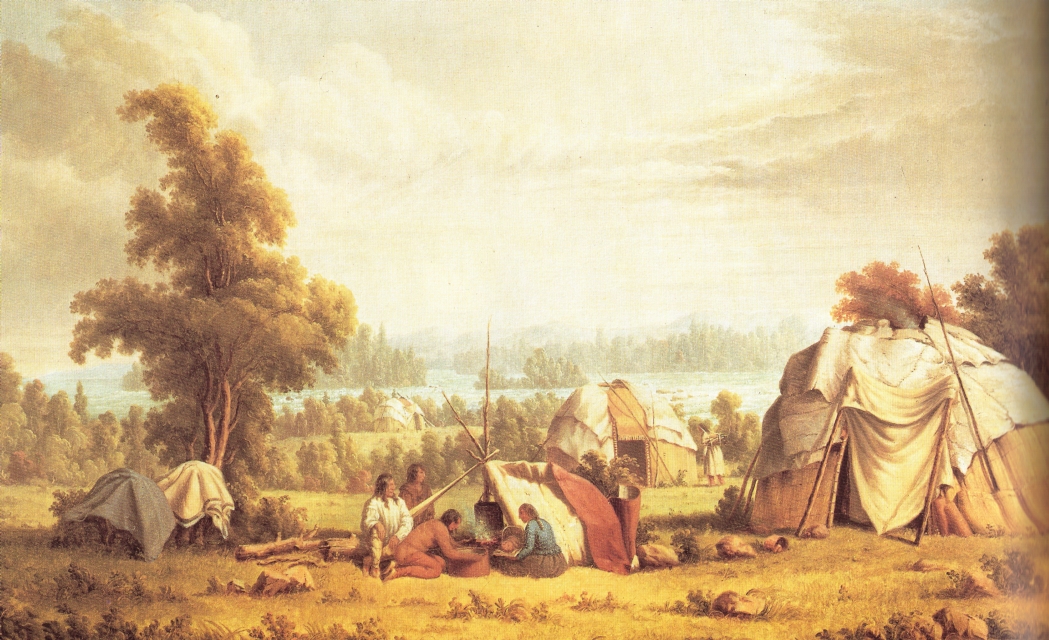
“Ojibwa village near Sault Ste Marie” by Paul Kane in 1845.
~ Wikipedia.org
Having chartered a Mackinac boat at the Sault St. Marie, and stored away our luggage, tents, provisions, with general camp equipage, &c., taking on board six able-bodied voyageurs, consisting of four descendants of Canadian French, and two half-breed Indians, (one of whom acted as our pilot,) we set off, on the 4th of July, at about 11, a.m., to coast it up the southern shore of Lake Superior, to Copper Harbor – a distance, by the way we were to travel, of over 280 miles.
The heat of the sun, combined with the attacks of musquitoes at night, annoyed us very much at first. I have seen what musquitoes are in many other parts of the world; but I never found them more abundant and troublesome than at some points on Lake Superior.
It took us eleven days’ voyaging to reach this place, travelling all day when the weather was favorable, and lying by when it became stormy, with strong head winds. At night we camped on shore, and generally rose every morning between three and four o’clock, being under way on the water as soon as it was light enough to see. In voyaging in this way, we had a better opportunity to view the country as we passed along, many portions of which were full of interest – such as the Grand Sable, the Pictured Rocks, &c. The former are immense cliffs, rising to the height of two hundred feet above the level of the lake, being composed of pure sand, and reaching about six miles in length along the lake shore, with its front aspects almost perpendicular. It is said, the sand of which they are formed maintains its perpendicularity by reason of the moisture which it derives from the vapor of the lake. The summits contain no vegetation, save here and there a solitary shrub or bush. The rest of this high, bold, and solemn mass stretches out, in silent and naked grandeur, beneath the horizon, forming a picture of desolate sublimity. We passed it late in the afternoon, during a bright and clear sky, when the sun had just begun to hide himself behind its huge masses.
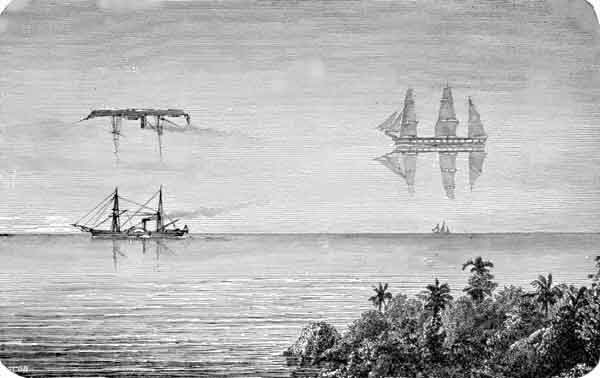
“Once a vessel was sailing over a northern ocean in the midst of the short, Arctic summer. The sun was hot, the air was still, and a group of sailors lying lazily upon the deck were almost asleep, when an exclamation of fear from one of them made them all spring to their feet. The one who had uttered the cry pointed into the air at a little distance, and there the awe-stricken sailors saw a large ship, with all sails set, gliding over what seemed to be a placid ocean, for beneath the ship was the reflection of it.”
~ Round-about Rambles in Lands of Fact and Fancy, by Frank Richard Stockton, 1910, page 277.
I have never travelled on a sheet of water where the effect of mirage is so frequently witnessed as on Lake Superior. For instance: early on Sunday morning, the 6th of July, soon after leaving our encampment, near White Fish Point, the morning being slightly foggy, we saw distinctly the Grand Sable, which must have been fifty miles in advance of us, with intervening points of land. I witnessed a similar instance of mirage when coming through Lake Huron. Early one morning, I distinctly saw Drummond’s island, which the officers of the boat assured me was eighty miles off!
I have never seen an atmosphere through which I could discern objects so far as on Lake Superior. Cliffs, headlands, islands, and hills, which often appeared as if within a mile or two of us, were found, on being approached, to be from five to ten miles off. Hence, in making what “voyageurs” called “traverses” – that is, a passage in a direct line from one headland to another, instead of curving with the shore of the lake – inexperienced voyageurs are very liable to be deceived, by supposing the distance to be short, when it is in reality very long. In making which, should a strong wind spring up from shore, a small boat would be liable to be blown out to sea, and the boat and people run the hazard of being lost. We had some brief but painful experience of this deception in apparent distance, by attempting one morning, after having camped at the mouth of the Dead river, to sail before what seemed to be a fair wind from Presqu’isle to Granite Point; but we had not made much over half the distance, when the wind suddenly changed to the west, and blew a gale on our beam, and we came very near being blown out into the open lake – which is just about equivalent to being blown into the Atlantic, for the storms are just as strong, and the waves roll equally as high. Finding we were going to leeward, we dropped sail, and took to our oars; and, although within half a mile of the point we wished to make, it took us hard oaring for about an hour to reach it.

“Pictured Rocks Splash © Lou Waldock”
~ National Park Service
I have never seen a sheet of water, where the wind can succeed in so suddenly throwing the water into turbulent waves, as on Lake Superior. This is owing to its freshness, making it so much lighter than salt water. One night, just as we had oared past a perpendicular red sandstone cliff a mile or two in length, where it would have been impossible for us to make a landing, and had reached a sand beach at the mouth of a small river, where we camped, the surface of the lake up to that time being as smooth as glass, we had no sooner pitched our tents, than a violent wind sprang up from the northeast, and blew a gale nearly all night, shifting from one point to another. In fifteen or twenty minutes after the commencement of the blow, the water of the lake seemed lashed into a fury of commotion, in which our boat could scarcely have survived.
The grandest scenery beheld in the whole route was that presented by the celebrated “Pictured Rocks.” They lie stretched out for nine miles in length, a little east of Grand island. They are considered very dangerous to pass by voyageurs, who generally select favorable spells of weather for the trip.
“Grand Sable Dunes”
~ National Park Service
On the morning of Tuesday, the 8th instant, soon after leaving our camp, the fog cleared up, sufficient to give us a glimpse of these stupendous sandstone cliffs. As the sun rose, the fog became dispersed, and its brilliant beams fell upon and illuminated every portion of them.
They rise in perpendicular walls from the water of the lake shore, to the height of from 200 to 300 feet. They are so precipitous, that they in some places appear to lean over the lake at top, to which small trees are seen leaning over the lake, hanging by their frail roots to the giddy crags above. At one point, a small creek tumbles over a portion of them in a cascade of 100 feet in height. They stretch for nine miles in length, and in all that distance there are only two places where boats can land – one cove being called the Chapel, and the second Miner’s river.
Photograph of “Chapel Rock” by David Kronk.
~ National Park Service
“Bridalveil Falls”
~ National Park Service
So deep is the water, that a boat can pass close along shore, almost touching the cliffs. Indeed, a seventy-four-gun ship can ride with perfect safety within ten feet of their base. Taken altogether, their solemn grandeur, and the awful sublimity of their gigantic forms and elevation, far surpass anything of the kind, probably, on the continent, if not in the world. Next to the Falls of Niagara, they are the greatest natural curiosity they eyes of man can behold. When steamboats are introduced on Lake Superior, they cannot fail to attract the attention of the tourist. They contain vast caves, one of which is only 30 feet wide at its mouth, but, on entering it, suddenly expands to 200 feet in width, beneath a lofty dome of 200 feet high. Different portions of the cliffs go by different names – such as the “Portailles,” the “Doric Rock,” the “Gros Cap,” the “Chapel,” &c. We went into a small bay at the base of the “Chapel,” which consists of an immense mass of rude sandstone, with trees growing on it, expanded in the form of an arch, its extremities resting on irregularly shaped columns, to the number of three or four under each end. Beneath the arch, a deep gorge enters the lake, crowded and choked with luxuriant vegetation. It appeared to me like the finest and most natural Druidical altar to be seen anywhere, not excepting even Stonehenge. Near the Chapel, a brisk little stream falls rapidly over the rocks into the water below. It is impossible to do justice to the splendid appearance of “the Pictured Rocks,” so called on account of the [???? ????? ???????] composed being mixed with iron ore, drippings from which they have stained the surface of the rocks with a variety of tints. The painter alone can convey any just image to the mind’s eye of these grand cliffs, and they will afford him a hundred views, every one of which will differ from the other. I will defy anybody to visit them, as we did, on a clear, bright day, when the lake is smooth, in an open boat, close by the side of them, without having his expectations of their natural grandeur far surpassed.
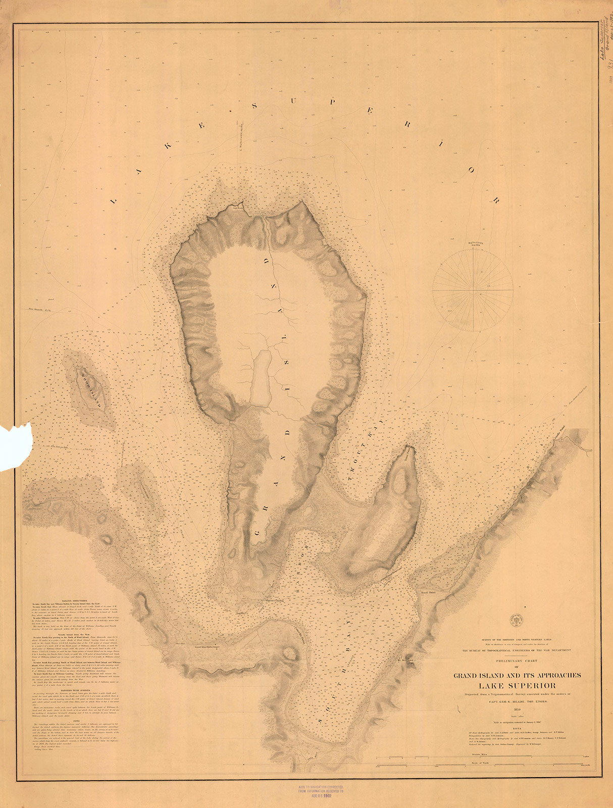
“Preliminary Chart of Grand Island and Its Approaches, Lake Superior, 1859″
~ Maritime History of the Great Lakes
Boats have sometimes been caught in the Chapel by sudden, high, and contrary winds, and compelled to remain there for three or four days, before being able to proceed. A few miles beyond the “Pictured Rocks,” we came to Grand Island, where, entering its harbor, we stopped at Mrs. Williams’s place, the only settlement on the island, which is very large. This is one of the most splendid and safe harbors on Lake Superior – perfectly land-locked on every side, and extensive enough to contain a large fleet of vessels, being easy of ingress or egress. From Grand Island we continued to persevere in our voyage, and finally reached Copper Harbor, via the Anse, in eleven days from the Sault Ste. Marie.
“The beginning of Methodism in the Upper Peninsula of Michigan west of Sault Ste. Marie is credited to the missionary trail blazers who came to Kewawenon, now known as Keweenaw Bay. The first, in 1832 with John Sunday a converted Canadian Indian. In 1833 Rev. John Clark continued the mission work started by Sunday. He was followed by Rev. Daniel Chandler in 1834 who remained here for two years. Rev. Clark was appointed Superintendent of Lake Superior Missions in 1834 and was instrumental in having a mission house and church school house erected during Rev. Chandler’s mission stay. Houses for the local natives were also erected along the lake shore in the vicinity of the present Whirl-I-Gig Road”
At the Anse we fell in with Mr. Ord, the United States Indian agent at the Sault Ste. Marie, who was on a visit to the Indians at that point, to take the census, and to hold a talk with their chiefs in council. We arrived at the Anse a few hours before the council began. The chiefs all sat around a hall on wooden benches, while Mr. Ord, with the interpreter, was seated at the head of the circle. Many of the Indians were fine-looking men. They had a great many petty grievances to relate to the agent, who listened to them with patient attention. The Chippewas about the Anse are said to be much better off than those who trade to La Pointe, at the upper end of the lake.
The Methodists have a missionary station and school on the east side of the bay of Keweewena, and near its head; around which there is an Indian village, consisting of 600 or 700 souls. The Catholics have also a missionary station on the opposite side of the bay, which is here only about a mile or two wide.

Reverend William Hadley Brockway: “The first Methodist minister licensed to preach in the State of Michigan.”
~ Geni.com
The government employs at this Indian post one blacksmith, (Mr. Brockaway,) one carpenter, (Mr. Johnson,) and one teacher, in the person of the Methodist minister. We left the Anse about half-past 4 o’clock, p.m., sailing before a fair wind, reaching the mouth of the Portage, or Sturgeon river, where we camped on a flat point of land severely infested by musquitoes, with the heat equal to any in intensity (which had prevailed during the day) that I ever experienced. At Fort Wilkins, Copper Harbor, on the same day, I have since learned the mercury rose to 100° in the shade. This would seem to be a tremendous degree of heat for such a high latitude, the fort standing on the parallel of 47° 30′.

Detail of “Keewaiwona Bay” with “Anse” and the “Old Indian Village” from Map of the Mineral Lands Upon Lake Superior Ceded to the United States by the Treaty of 1842 With the Chippeway Indians.
~ Wisconsin Historical Society
During the night, we could occasionally hear the plunges of sturgeon floundering in the water, which abound in this lake river. A thunder-storm, also, passed near, before day, which had the effect to cool the air. About half-past 1 o’clock, I was awakened by the loud talk and whooping of Indians, carried on between our Indian half-breed pilot, Jean Baptiste, and a lot of freshly-arrived Indian voyageurs, conducted in the Indian dialect. On looking out of our tent, I discovered a plain-dressed Yankee-looking man, standing in front of it. On hailing him, he proved to be the Rev. Mr. Brockaway, a Methodist minister, and superintendent of Indian missions in this part of the world. He had been on a visit to the missions at the upper end of the lake, and was returning to the Anse, which he was anxious to reach in time to attend to Sunday morning service, (the next day being Sunday,) and from whence he expected to proceed to the Sault Ste. Marie, where he is stationed in the capacity of chaplain to the garrison at that post. He said he had, on reaching our encampment, travelled that day from the Ontonagon river, 80 miles distance, in a bark canoe, accompanied by four Indian voyageurs. After the Indians had prepared some food, with tea, of which Mr. B. and themselves partook, they again set off for the Anse, about 15 miles from us, where they must have arrived at a very early hour. This despatch far exceeded the expedition of our movements, and displayed unusual activity on the part of the enterprising missionary of an extensive and practical church organization.
We rose at three a.m., and in half an hour were under way on the lake. In these latitudes it is light at three in the morning; twilight continuing till eight and nine in the afternoon.
The following night we camped near the mouth of Little Montreal river, in full view of the high mountains or large round hills of trap rocks running along the peninsula of Keweewena towards its extreme point, some of which rise to the elevation of eight hundred feet above the level of the lake.
The next day, after some detention, we reached Copper Harbor, and landed near the United States Mineral Agency on Porter’s island, where we found quite a village, consisting of white canvas tents of various sizes and forms, occupied by miners, geologists, speculators, voyageurs, visitors, &c.
The only tenement on the island is a miserable log-cabin, in which General Stockton, for the want of better quarters, is compelled to keep his office. The room which he occupies, is only about eight feet square – just large enough to admit a narrow bed for himself, a table, and two or three chairs. In this salt-box of a room, he is compelled to transact all the business relating to the mineral lands embraced within this important agency. As many as a dozen men at a time are pressing forward to his “bee gum” apartment, endeavoring to have their business transacted.
The office of the surveyor of this mineral lands, in charge of Mr. Gray, at this agency, is still worse adapted to the transaction of public business. He is compelled to occupy the garret of the log-cabin, with a hole cut through the logs in the gable to serve as a window. In this garret he is obliged to have all his draughting performed, subject to the constant interruption of parties wishing to see plans of the mineral lands. It would seem almost impossible, under such circumstances, for the officers to avoid making mistakes; yet, by dint of unwearied labor and attention to their official duties, they have conducted their affairs with an accuracy and despatch highly creditable to them.
The government has been fortunate in the selection of its agents in the mineral region of Lake Superior. To untiring industry, punctuality, and close attention to business, they unite, in a high degree, the bland, mild, and patient bearing of gentlemen.
Gen. Stockton’s labor are severe and perplexing. He is continually beset by crowds of applicants for locations, all anxiously pressing forward to secure leases for copper-mines – among whom are found some utterly reckless of all principles of justice and equity, who endeavor to bend the agent into a compliance with their unjust and unreasonable demands – such as wishing him to supersede prior locations for their benefit, or to grant locations evidently intended to cover town sites, beyond the bounds of his agency, where no mineral exists, which he has no authority to grant; and because he has, in every instance of the kind, resisted their unreasonable applications, he has not escaped making a few enemies among such persons, who are collecting together to abuse and misrepresent him. Considering the cramped quarters furnished him by the government, and the great rush of people upon him from all quarters, under the excitement of a copper fever raging at its height, and many anxious to obtain exclusive advantages, it is surprising how he has succeeded so well as he has done in giving such general satisfaction. His official duties are discharged with a promptitude, fidelity, firmness, and impartiality, which are creditable to the public service. He seems peculiarly fitted, both by habit and nature, for the discharge of the responsible duties involved in the administration of an agency established in a wild an uninhabited country, being traversed at present by bands of people in search of mineral treasures, as diversified in character, dispositions, &c., as the various sections of country from whence they come – many of whom are by no means scrupulous as to the means for promoting their own interest – who probably suppose they can play the same game in the copper mineral region that was practiced in the early leasing of the lead mineral districts of Illinois: that is, seize upon government lands, work and raise mineral ore, cheat the government, and sell rights, where they have never had a claim.
It is enough to say that, while such men as Gen. Stockton, Major Campbell, and Mr. Gray, remain in office on the southern shore of Lake Superior, all such desperadoes will be completely foiled and disappointed. The frauds committed on the government in the working of the lead-mines, cannot be repeated in the copper mineral region of the United States. When fraudulently-inclined adventurers find they cannot make the faithful officers of government stationed in this quarter swerve from the strict and impartial discharge of their duty, they will probably unite for the purpose of operating upon government to procure their removal, and endeavor to get men in their places more likely to act as plaint tools in promoting their selfish ends.
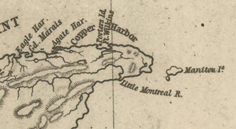
Detail of Porter’s Island, Fort Wilkins, Copper Harbor, Agate Harbor, Eagle Harbor, and Little Montreal River along the tip of the Keweenaw Peninsula from Map of the Mineral Lands Upon Lake Superior Ceded to the United States by the Treaty of 1842 With the Chippeway Indians.
~ Wisconsin Historical Society
The agency being on a narrow small island, half a mile from the mainland, makes it very inconvenient. The island does not afford sufficient timber for fire-wood, and in winter is isolated by ice, &c. It should by all means be removed to the main shore, and placed near Fort Wilkins, which is nearly two miles distant on the main land, or removed up to Eagle Harbor, which is a far preferable and more convenient site for the agency.
There is no question by the great range of trap-rock, running parallel with the southern shore of Lake Superior for a great distance, is [????????] with many valuable veins of copper ore; but to find them and develop them, must be the work of time. The impenetrable stunted forest seems to be little else than a thick, universal hedge, formed by the horizontal interlocked limbs of dwarf white cedars, intermingled with tamarack, birch, and maple. Persons who attempt to penetrate through them, without being protected by a mail of dressed buck-skin, have their clothes soon slit and torn from their bodies in shreds.
Painting of Professor Douglass Houghton by Robert Thom. Houghton first explored the south shore of Lake Superior in 1840, and died on Lake Superior during a storm on October 13, 1845. Chequamegon Bay’s City of Houghton was named in his honor, and is now known as Houghton Falls State Natural Area.
Dr. Houghton says, so considerable is the attraction of the trap-rock for the needle, that, on many places, when surveying over its ranges, he cannot rely upon it, and is compelled to run his lines by the sun and stellar observations.
So far as practicable mining operations have progressed in the country, the following seems to be the result:
At Eagle river several locations are being worked, superintended by Col. Gratiot, and on which from 70 to 80 men are employed.
At Agate Harbor another company have this season commenced operations under the direction of Mr. Larned, of New York, in whose service from 15 to 20 laborers find employment.
At Copper Harbor a company from Pittsburg are working a vein of black oxide of copper, under the superintendence of Dr. Pettit, who has from 30 to 40 hands employed under him. Besides these, there are other small parties at work in various directions. So that it would appear that mining in the United States copper mineral lands has fairly commenced.
Up to this time, the returns made to the agency by two of the above companies – the Eagle River, alias Boston Company, and the Pittsburg Company – amount to the following quantities of ore: The former have raised 500,000 lbs. of ore, worth not less than $125 per ton. The latter company have raised 6,670 lbs. of the black oxide copper ore, the value of which I do not exactly know.
Other companies are organizing for mining purposes, and will probably commence operations the present, or early in the next season.
The country still in the possession of the Chippewa Indians, embraced between the northwestern part of the lake and the British frontier, along Pigeon river, might be easily obtained from them by treaty. And, if poor in mineral wealth, it is a very rich soil and a good agricultural country; and by its acquisition we should at once extend and square out our possession and settlements to the British frontier, which should be protected by detached forts, extending along our lines, towards the Lake of the Woods. According to the present Indian boundary, it is made to pass along the water-line of the lake shore, from Pigeon river, around Fond du Lac; and when some distance east and south of the lake, strikes a straight line west from the Mississippi. The United States, by being cut off by this water-line from all landing sites for harbors or fortifications for one or two hundred miles of the western and northern shore of the lake, will be subject to great inconvenience.
The number of persons at present exploring or visiting the mineral region of Lake Superior, is supposed to amount to five hundred or more. The water of the lake, especially in deep places is remarkably fine and cool for drinking. The surface of the water in the upper part of the lake is said to be 900 feet above the level of the Atlantic. The shores of this great lake are, at many places, bold, high, grand, and solitary – the favorite resort of large eagles, several of which we saw – one, in particular, was a splendid specimen of the bald eagle. The lake abounds in white fish, trout, siskomit, and bass.

The Siscowet, or Fat Trout, is a subspecies of Lake Trout. Drawn by David Starr Jordan, and Barton Warren Evermann, 1911.
~ University of Washington
We caught fine trout almost every day during our voyage, by trailing a hook and line at the end of our boat. On the 13th inst., (the day before reaching Copper Harbor) we caught four fine large trout.
The scenery, climate, &c., of Lake Superior, strike the traveller as being peculiar, and something very different from what is met with in any part of the United States. Game is not abundant. With the exception of a porcupine, and a squirrel or two, we succeeded in killing nothing. Wild fowl, pigeon, and ducks are more plentiful. we killed many of the former, and two pheasants, during our trip. Our half-breed Indians skinned and dressed our porcupine for us, whose flesh we found quite palatable.
At one point I purchased the hind-quarters of a beaver, which some Indians had killed. The tail being considered a great delicacy, I sent it to Mr. Ord and party, who were then travelling in a separate boat, in company with us. We found the beaver meat, when dressed, most delicious food.
Our party, although sleeping in and exposed to showers for a day or two, all enjoyed excellent health. Many voyageurs are attacked with dysentery, but it is very slight, and easily overcome by the use of simple medicine.
I remain yours,
Very truly and respectfully,
MORGAN.
To be continued in The Copper Region…
By Amorin Mello
A curious series of correspondences from “Morgan”
… continued from To The Far West.
The Daily Union (Washington D.C.)
“Liberty, The Union, And The Constitution.”
July 7, 1845.
MADISON, (W.T.,) June 26, 1845.
To the Editor of the Union:
SIR: Our democratic territorial convention has this day nominated the Hon. Morgan L. Martin, of the county of Brown, as the candidate for the delegacy, to succeed Governor Dodge. Mr. Martin is one of our ablest and most reliable democrats, and there is but little doubt of his election by a triumphant majority. Mr. Martin has been fourteen years in the upper branch of our territorial legislature, and has been the presiding officer of that body at four sessions. The democrats of the Territory will go into the canvass in the best possible spirits, and with the fullest confidence of success; for they are well united, and have a candidate worthy of the cause and their most zealous support.

Henry Dodge
~ Wikipedia.org
More than twice the number of immigrants are arriving here daily, this season, than have ever come at any previous season. The administration of Governor Dodge is very popular with all parties, and so are the measures of the national administration, and particularly its course on those two great questions – the annexation of Texas, and the maintenance of our rights to Oregon.
The convention was very fully attended; and, although there was some division when it assembled, as to who the nominee should be, the members left here in the best possible spirits. In haste.
Yours, truly,
J. A. N.
The Daily Union (Washington D.C.)
“Liberty, The Union, And The Constitution.”
July 8, 1845.
[From our regular correspondent.]
MACKINAC, June 29, 1845.
This small town stands on a narrow slip of land sloping from the foot of elevated bluff hills in the rear, to the water. The second and highest elevation is about three-quarters of a mile in the rear of the town, and is three hundred feet above the level of the lake or straits, and nine hundred feet above the level of the ocean. The site of the town winds in a crescent form around a small harbor, indented in the southeastern part of the island.

Painting of Fort Mackinac by Seth Eastman in 1761.
~ United States Army Center of Military History
The old Fort Mackinac stood on an extreme northern point, putting out into the strait from the southern main land, some 10 or 15 miles to the southward of this place. It was first settled upon as a French missionary station, and a fort erected. When Carver visited it in 1756-’57, the fort was garrisoned by the English, who came into possession of it with the conquest of Canada, a few years before. It then contained 30 houses, and had one hundred men in garrison, besides a government-house, &c. In 1763, the various northwestern tribes of Indians who had long known the French as the first Europeans they had ever formed friendly intercourse with, became highly dissatisfied with the change from French to English rule. A powerful league was, therefore, formed between the Ottowas, Chippewas, the Hurons, Menomonees, &c.; and the celebrated Pontiac was their leader, who bore a deadly hostility to the English.
!["No authentic images of Pontiac [also known as Obwandiyag] are known to exist. This interpretation was painted by John Mix Stanley." ~ Wikipedia.org](https://chequamegonhistory.com/wp-content/uploads/2016/04/pontiac-chief-artist-impression-414px.jpg)
“No authentic images of Pontiac [also known as Obwandiyag] are known to exist. This interpretation was painted by John Mix Stanley.”
~ Wikipedia.org
After peace was made with Pontiac, the fort came again into the occupancy of the English, who transferred it to us, under the treaty of peace, at the close of the revolutionary war. When the late war broke out, the British took both old Fort Mackinac and the fort at this town, and held them up to the treaty of Ghent; and if war were to begin soon, they would inevitably fall into their hands again, owing to our neglect to fortify them in a proper manner. The old site we have abandoned, and erected a small and well-built fort on the hill, just in the rear of the town, on the island, which is about one hundred and fifty feet high above the level of the lake, or strait. About three-quarters of a mile behind the fort, there is a high hill – the highest on the island – with its steep face looking towards the fort and harbor, while its eastern and northern section extends over a narrow plateau, or level, which could be completely raked by guns stationed on the walls of a fort, which should, by all means, be erected near the brow of the hill. This high point of land overlooks and completely commands the fort our troops (two companies) at present occupy.
“Major Charles Gratiot visited Mackinac Island in 1817, using his trained engineer’s eye to carefully record the design of Fort Holmes in these detailed plans. The fort’s blockhouse, walls, and gun platforms are clearly visible on Gratiot’s drawings”
~ Mackinac State Historic Parks
The first news the people heard of the declaration of war in 1812 in Mackinac, was the appearance of a large body of English and Indians on the high hill, who commanded the surrender of the fort, then garrisoned by some fifty or sixty men which was complied with. The English entrenched this high ground, planted some batteries on its ramparts, and named it “Fort Holmes,” which it still bears.
This point is the main key to those important straits which connect two of the great lakes. It is now just in the state of ruins in which the British left it in 1814-’15; and why our government have not strongly fortified it, seems inexplicable. If this hill were strongly fortified, with armed outposts at some other points about the straits, the military defences of this place would be wholly impregnable – even stronger, if anything, than the rock of Gibraltar. The position is a most important one and government should lose no time in putting it in a complete state of defence.
The only communication by water, between the two great lakes of Michigan and Huron, is directly in view of the heights of this harbor.
From the hill of Fort Holmes, there is a most magnificent view. The great sheets of water in the straits, with the islands, distant main-land, &c., are all in full view. The approach of a steamer or vessel can be seen when from twelve to fifteen miles distant, in the eastern or western offing.
This post was first settled in 1764 – the year after the fall of old Mackinac. In 1796 it was conveyed by the English to St. Clair. It has long been a celebrated Indian trading-point, and is so yet; large numbers of whom constantly visit the place in the birch-bark canoes, encamping beneath bark wigwams (or shanties) on the stony beach along the shore.
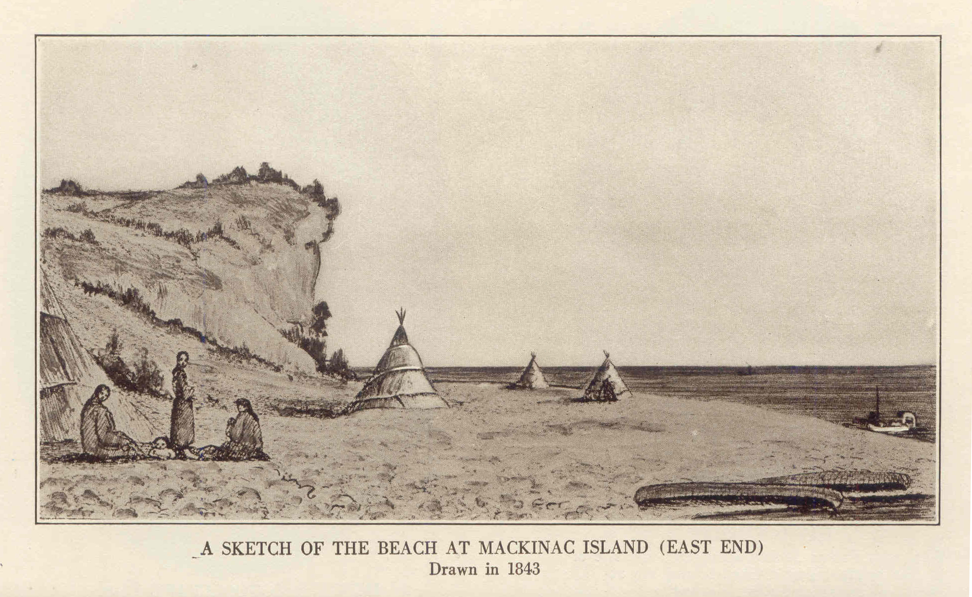
1843 Drawing of Mission Point Beach at Mackinac Island, Michigan
~ Historic Mackinac, Volume 1, facing-page 367.
This is also a great point for catching lake trout, or salmon-trout, white fish, &c., which are salted down in barrels, and shipped to market, selling for about seven dollars per barrel, on average. This business is in the hands of Indians, half-breed Indians, and French fishermen, who go out into the lakes in Mackinac boats, properly prepared with seines, hooks, &c.

Photograph of Arch Rock on Mackinac Island, by n8huckins, shared under Creative Commons.
~ Wikipedia.org
The island of Mackinac is about 9 miles in circumference, and contains several natural curiosities among which, is the Giant’s Arch, or Rock, about a mile northeast of the town. It is 100 feet high – the natural arch having a span of 45 feet wide.
Nearer the centre of the island is Henry’s cave, at which, it is said, this traveller once saved his life from the fury of drunken Indians, by secreting himself in it. It was then full of bones, which have since disappeared.
In the town of Mackinac, there are two small churches, the most ancient of which is a Catholic chapel, connected with a Catholic mission at the point. The other is a small Protestant church, originally built in connexion with an extensive mission-house founded by the Presbyterian Board of Foreign Missions. They have since changed the establishment to the shores of Lake Superior. The mission-house is now occupied by Mr. Herrick, lately from Detroit, who has converted it into a large and commodious tavern, at which we are staying. There is also another comfortable hotel in the place.
I know of no place on the continent that can make a more delightful summer residence than Mackinac. The heat of the summer is scarcely felt here at all. You can sleep under a blanket every night throughout the summer.
The drinking water is equal to, if not better than, any which ever gushed from the hill-sides of the Alleghany mountains. The fish are abundant and delicious. Large steamers running between Buffalo and Chicago pass twice daily, touching in each case.
The American Fur Company have an agent here. The United States government have an Indian sub-agent, also resident at this place.
I went to a small Catholic church to-day, where I heard a short sermon in French. The auditory consisted of French descendants, Indians, half-breeds, and some few Americans.
This island is called the county of Mackinac and Sate of Michigan. I believe, in addition to a State court, the United States district judge occasionally holds a court here.
We leave to-morrow, on the steamboat General Scott, expected up to-night from Green bay, for the Sault de Ste. Marie – the place of rendezvous for persons bound up Lake Superior, on which then is no craft at present, except two or three schooners sailing up the lake from the Sault to Copper Harbor, &c.
When I arrive at the Sault (pronounced Soo) Ste. Marie, I will write you again.
I remain yours, very respectfully.
MORGAN.
The Daily Union (Washington D.C.)
“Liberty, The Union, And The Constitution.”
July 16, 1845.
EDITOR’S CORRESPONDENCE.
—
[From our regular correspondent.]
SAULT STE. MARIE,
Near Lake Superior, July 2, 1845.
We left Mackinaw yesterday, the 1st July, about a quarter-past eight , a.m.; our course for forty miles to the “detour” lying through the open and upper part of Lake Huron, which exposed our little boat to a very heavy rolling sea- the result of the previous day or two’s severe blow on the lakes. Many of the passengers, as usual on such occasions, became severely sea-sick. At half-past 12, p.m., we rounded into St. Mary’s river, where we had smoother water.

“A painting by Paul Kane depicts an encampment on the shores of Lake Huron in about 1845.”
~ The Granger Collection, New York
The river at first appeared very wide, with a low and sandy beach on each side, and a flat swampy country running back into the interior. As we progressed, however, the stream grew more narrow, and again expanded into two smart lakes – the first called Great George, and the latter Little George’s lake. Leaving these lakes, the river fifteen or twenty miles below the Sault again contracted, and turned about among high hills a little distance off, while its margin was skirted with low, falt, gravelly ground, covered with white cedar and other rather dwarfed forest trees. These highlands showed steep hills or knobs of old red sandstone.
It was not long after passing the hills, before we hove in sight of the white and frothy rapids, at the foot of which stands the small village of the Sault, at the principal pier of which we landed – it being 60 miles from the lake.
The town exhibits a collection of wooden log-houses, roofed and weather-boarded with birch bark, gathered along the river at the foot of the falls, here and there showing small framed painted houses, one of which is an hotel, at present overflowing with people bound for the mineral lands of Lake Superior.
The Sault contains, besides the houses noticed, a small United States garrison; the slender wooden stockade defences of which, with officers’ quarters, are almost in a state of dilapidation. There is also a small missionary station and school-house belonging to the Methodists, and a U. S. Indian agency.
A painting of an Ojibwa village near Sault Ste Marie; also by Paul Kane in 1845.
~ Wikipedia.org
There is a collector of the port on each side of the river, which is here about a mile wide, between us and Canada. I imagine there is very little business to do by either functionary. The American Fur Company have a station at the Sault. The Hudson Bay Company have a factory, or station, on the opposite side of the river. I paid a visit to the latter yesterday, having a note of introduction to a Mr. Blenden, their agent, whom I found busy in packing up for a voyage up the Canada side of Lake Superior. He is bound on a tour among the posts towards Hudson’s Bay to the north. Mr. B. received me very politely. He informed me that he intended to carry his children with him, whom he expected to send in the care of friends across to Hudson’s Bay, where they would embark on one of the company’s ships for London, and be from thence conveyed to Edinburgh, to be placed at school. He told me Sir George Simpson, the governor of the company, had passed up the lake not long since, accompanied by his boats, &c. he was bound for the valley of the Red river of the North, where he expected to meet a kind of convention of the authorities of the company’s territories in that quarter – among whom would be the representatives of Selkirk’s colony, the population of which is about 5,000. They produce more grain, &c., than they can find means of having conveyed to market: hence there is some emigration from their colony to the valley of the Mississippi, within the States.
Mr. B. states that the Hudson Bay Company employ about seven ships in their trade – two or three of which, every summer, visit Hudson’s Bay; three double Cape Horn, and ascent the Columbia river; and one or two others are employed at other points. He states that their charter gives them ample territorial jurisdiction over all the lands, mines, &c., on the high lands to the north and west of Lake Superior, but not over the lands immediately along the shore. He states that a geologist, Dr. Logan, is engaged in surveying the country of Upper Canada, and is now employed between Lake Ontario and Lake Huron, or the inlet of the latter lake, called Lake Georgina Bay. He is expected up this summer, to examine the northern shore of Lake Superior, which is supposed to be as rich in copper ore, at certain points, as the southern shore.
The two fur companies (American and Hudson Bay) are on the best possible understanding; which has a very favorable influence on the northwestern tribe of Indians.
In 1830, they mutually agreed to exclude all intoxicating drinks, in their traffic and intercourse, from them. The Indians, in consequence of this wise and humane compact, are everywhere, within their bounds more inoffensive and peaceable. It is just as safe, if not more so, to travel among them, than among the whites. They have a considerable number of birch-bark lodges at the Sault, employing their time in catching fish at the foot of the falls, in their gill-nets. They belong almost exclusively to the Chippewa tribe. The Sault is the greatest place for catching fish I ever saw. They can take ten times as many white fish, salmon-trout, brook-trout, bass, &c., as can be disposed of. The Indians push their canoes up into the foam of the falls, cast forward their nets, and draw it as the current carries the boat down again. Our staple article of food at the Sault is fresh fish.
The falls here, or rapids, have only a descent of about 18 to 21 feet in a mile; while the ground is very favorable to the construction of a ship-canal – the length of which need only be a mile. On the Canada side, the length of the rapids is only about three-quarters of a mile long. It is very likely, if our government refuses to construct a canal on our side, that the English may, ere long, make one on their side; which will be only three-quarters of a mile long.

“Hudson Bay Fort, Sault Ste. Marie. By J.S. Hallam.”
~ Sault Ste. Marie Public Library
The fort at this place, in time of war, should be erected on a considerable hill, about three-quarters of a mile in the rear of the Sault, called Coal-pit hill; which commands a fine view of the falls, river, &c.
There are several schooners (say three or four) on Lake Superior, plying between the head of the falls and Lapointe, Copper Harbor, &c. They have been drawn around the falls on rollers. There is some talk of having a steamer carried around by the same means. A fine new vessel is on the stocks at the head of the falls, which is about half done. It will be launched about the 1st of August. She is building by Newbury & Co.; to be rigged as a fore-and-aft schooner.
At the Sault, a Catholic station was founded from one to two centuries ago, being fixed upon as a missionary station. next to Quebec and Montreal, it is said to be the oldest point settled upon by Europeans in Canada. It has always been an important point for the Indian trade. Here goods are carried round the falls, and sent up Lake Superior to be distributed to various Indian trading-posts, far in the northwestern region of the continent.
The early Catholic Jesuits, or priests, who first explored the far distant, cold, and deary regions bordering the shores and streams of the upper lakes, must have been animated with a deal of perseverance, and influenced by the dictates (to them) of an all-powerful religion. They at every prominent point throughout this vast country erected the cross among the savage tribes, and impressed their minds with the solemn and imposing ceremonies of the religion they professed. Their success among the savage tribes of North America has never been surpassed, if equalled, by more modern and persevering denominations. They acquired an influence over the Indians, which nearly a century of British and American domination has not been sufficeint to efface. Even at this day, the frail wooden cross seen standing in the humble grave-yards of the Indians, sufficiently attests the remaining influence of the Catholic religion. French and Indian have also intermarried more than the Anglo-Saxon and Indian. The latter also more commonly speak French. Indians never, in early times, fought Frenchmen. Our earliest accounts of the vast interior western and northwester regions of this continent were derived from Catholic priests, such as Father Hennespin, &c.
The first Englishmen who explored the upper lakes after the fall of Canada, were Henry and Carver, between the years 1766 and 1775-’76. Their works contain many interesting details relative to the country.
In alluding, in a former letter, to our loss of Hunters’ island by the treaty of Washington, I underrated its size. It is greater in area than the vaunted Isle Royale; being about 50 miles long, instead of 40, and about 40 wide.
A gross error prevails with regard to Isle Royale. It is supposed by some that we acquired it by the Lake Washington treaty, when it has always been ours, since the treaty of peace after the revolution. We have, therefore, given away important territory on Pigeon river, without receiving any equivalent, that I know of.
We have been wind-bound at the Sault for two or three days, by reason of a strong northwester, blowing directly down the river. It has been blowing about a half a gale on the upper lakes for nearly two months past; and, from all indications, the gale may last all summer. The weather in this latitude 46 degrees 30 minutes) is very cold. We have to wear thick woollens and sleep under blankets – it being difficult, on the 2d day of July, 1845, to keep warm at that! The soil produces fine Irish potatoes – better than I have tasted anywhere else – some oats, barley, turnips, rye, and wheat, &c. The soil is miserably bad, back in the interior. The population depends chiefly upon fishing, for a support; which, to all appearance, is a never-failing resource.
From this point, I expect to coast the southern lake shore in an open boat, with five or six “voyageurs;” or send them on, and go up to Copper Harbor in the schooner Swallow.
I shall pass to where mail facilities cease, and where the reduction of postage affords no benefit; and it may be some days before you can get another letter from me.
During the late war, the Americans, under command of Major Holmes, burnt down the Hudson Bay Company’s fur agency, or factor, on the opposite site of the river.
Almost the only tribe of Indians visiting or living about the Sault, belong to the Chippewa tribe – which, on the average, are good-locking Indians, and apparently comfortably clad, &c. Many of the half-breeds are really beautiful; and, in regularity of features, figure, and size of hands and feet, would do credit to more civilized life. They seem to me to be more industrious than more southern tribes of Indians among whom I have travelled, and far more inoffensive and civil to the whites. Some of the men are exceedingly tall and fine-looking fellows. I saw yesterday the son of a chief from the Canada side, who stood between six and seven feet high, and was as straight as an arrow. He could not speak a syllable of English. I saw him examining, with much attention, the new schooner building at the head of the falls.

The USS Michigan was launched in 1843, and later renamed as the USS Wolverine in 1905.
~ Wikipedia.org
The names of Indians are often very curious, and, in a measure, put at defiance the power of the English language to express them. I saw a tall man of the Chippewas at Mackinac, as he stood gazing at the United States steamship Michigan. Mr. Biddle, an old resident trader of the place, who spoke Chippewa, was standing near him. he wished to know of Mr. Biddle what sort of a vessel she was; who explained to him that she belong to “his great father, the President, who, if necessary, would use it against his enemies.” This Indian’s name, translated into English, was nothing less than “A Corpse,” or “A Dead Man” – an unusual name, I should think, even for an Indian!
The Indians always keep an abundant supply of dogs, which, about the Sault, seem uniformly to be a cross of the common cur with the wolf, and seem of little use, except to keep up an eternal barking at night about their bark lodges. This is a remarkably fine climate for the Newfoundland dog, some fine specimens of which I have seen in the possession of the whites about the Sault. At Mackinac, and other places in the northwest, the half-breeds especially make draught animals of dogs, in drawing water on trucks, and in performing other labor.
The dogs used by the Indians about Hudson’s Bay are said to be larger and more savage, and used to a greater extent as animals of labor.
The Chippewas, it is said, make no scruple of eating dogs, which they often esteem as a delicacy. This, however, I cannot vouch for.
Yours, very respectfully,
MORGAN.
To be continued in Copper Harbor…
Wisconsin Territory Delegation: To The Far West
April 4, 2016
By Amorin Mello
The Daily Union was a newspaper in Washington, D.C., now archived online at the Library of Congress, that published a curious series of correspondences with the pen name “Morgan” during 1845. In this series, “Morgan” included a remarkable and vicarious description of his experiences on Lake Superior and at La Pointe. Based on the circumstances and narrative, the identity of “Morgan” is assumed to be Morgan Lewis Martin.

Portrait of Morgan L. Martin Painted by Samuel Marsden Brookes (1816-1892) and Thomas H. Stevenson. Oil on canvas, 1856.
(Wisconsin Historical Museum object #1942.37.) WHI 2786
—
“From the time of his arrival in Green Bay in 1827, Morgan Lewis Martin (1805-1887) was an important figure in Wisconsin. Martin was an organizer of the Wisconsin Democratic Party, a member of the territorial and state legislatures, a delegate to Congress, and a Civil War paymaster. He played a key role in the early development of Milwaukee and for almost fifty years promoted various Fox and Wisconsin River improvement projects. Brookes and Stevenson, a Milwaukee-based partnership, executed this portrait of Martin during a two-month visit to Green Bay in the summer of 1856.”
According to the Biographical Directory of the United States Government:
MARTIN, Morgan Lewis, (cousin of James Duane Doty), a Delegate from the Territory of Wisconsin; born in Martinsburg, Lewis County, N.Y., March 31, 1805; attended the common schools and was graduated from Hamilton College, Clinton, N.Y., in 1824; studied law; was admitted to the bar and commenced practice in Detroit, Mich.; moved to Green Bay, Wis., in 1827 (then a part of Michigan Territory); member of the Michigan Territorial legislature 1831-1835; member of the Wisconsin Territorial legislature 1838-1844 and served as president in 1842 and 1843; elected as a Democrat to the Twenty-ninth Congress (March 4, 1845-March 3, 1847); president of the second State constitutional convention in 1847 and 1848; again elected to the State assembly in 1855; member of the State senate in 1858 and 1859; served in the Union Army as paymaster with the rank of major 1861-1865; Indian agent 1866-1869; unsuccessful candidate for election in 1866 to the Fortieth Congress; resumed the practice of his profession; elected judge of Brown County in 1875, in which capacity he served until his death at Green Bay, Brown County, Wis., December 10, 1887; interment in Woodlawn Cemetery.
Shortly before Morgan Lewis Martin was elected to the 29th Congress, the Territory of Wisconsin passed the following Joint Resolution:
JOINT RESOLUTION relative to Mail Routes.
Resolved by the Council and House of Representatives of the Territory of Wisconsin:
That our Delegate in Congress be requested to procure the establishment of a mail route from Janesville to Racine on the United States road between those places; also one from Racine to Prairie Village in Millwaukee county; and also one from Wheatland to Racine both in the county of Racine; also one from Mineral Point in Iowa county by way of Shullsburg and New Diggings to White Oak Springs in Iowa county, also one from Madison in Dane county via Sun Prairie, Columbus, and Beaver. 113 dam to Waupun in Fond du Lac county; also one from the falls of St. Croix [to] La Point on Lake Superior; also one from Prairieville in Milwaukee county by the way of Lisbon to Limestone in Washington county; also one from Potosi by way of Hurricane and Cassville to Patch Grove in Grant county; also one from Fond du Lac, Fond du Lac county, by the way of Ceresco and Green Lake to Fort Winnebago in Portage cou nty; also one from Madison to Prairie du Chien in Crawford county -by the most direct route; also, one from Plattville in Grant county by Jamestown to Fairplay, and from Fairplay by Hazel Green to White Oak Springs in Iowa county; also, one from Millwaukee by Lisbon, Warren, Oconomewoc, Watertown and Sun Prairie to Madison ; and also, one. from Milwaukee by Hustis Rapids to Fort Winnebago; also, one from Milwaukee via Whitewater and McFadden, on Sugar River to Mineral Point.
APPROVED, February 15, 1845.
The Daily Union (Washington D.C.)
“Liberty, The Union, And The Constitution.”
June 19, 1845.
EDITOR’S CORRESPONDENCE
—
[From our regular correspondent.]
NEW YORK, June 16, 1845.
We have had two arrivals from China, bringing dates as late as the 13th of March; but the papers received are said to contain little news of interest. Trade was represented as dull, except for gray cotton cloth and yarn.

Photographic copy of an 1845 daguerreotype featuring 78 year-old Andrew Jackson (seventh President of the United States) shortly before his death. ~ Commons.WikiMedia.org
The announcement of General Jackson’s death reached this city yesterday afternoon, and produced the deepest feelings of regret among thousands of people. The flags on the shipping in port, and at all the places of public resort, were immediately hoisted at half-mast, as the news spread by extra newspapers over the city like an electric shock. No doubt, arrangements will be speedily made to commemorate his death, and to express the sorrow of the people for the fall of so great a patriot, by every kind of suitable demonstration.
It is seldom in the annals of history that such men as Gen. Jackson rise up and stand out so prominently from the mass of mankind. Whatever else may be thought of him, his devoted love of country, his integrity of purpose, his Christian purity and benevolence can never be questioned by any one.
I have no general news of importance to note. Trade and stocks are dull; without material change in either since my last. Indeed, we have no change to expect till the arrival of the news by the Boston and Liverpool steamer, which is now daily looked for.
I must make my letter brief to-day, as I am about getting ready for a trip to the “far West,” and when you hear from me again, it will be en route towards sunset.
Yours, very truly and respectfully,
MORGAN.
The Daily Union (Washington D.C.)
“Liberty, The Union, And The Constitution.”
June 24, 1845.
EDITOR’S CORRESPONDENCE
—
[From our regular correspondent.]
BUFFALO, N. Y., June 19, 1845.

“Niagara, Hudson River steamboat built 1845.” Painting by James Bard.
I left New York at 7, a.m. yesterday morning, on board the splendid new steamboat called “Niagara,” on her first trip to Albany as a day-boat. She is 275 feet long on her keel, and 285 long on her main deck. Her large engine has a stroke of 11 feet; the main cylinder is 72 inches in diameter. She is fitted up like a palace. She ran the distance from New York to West Point, about 55 or 60 miles, in six minutes less than three hours. No boat runs as well when perfectly new, as when the portions of machinery subject to much friction have been worn smooth. The “Niagara” put us down in Albany a little before 5, p.m. Here we had to wait till 8, p.m., before a train left carrying us west towards Buffalo. We travelled all night, and reached the latter place, 584 or 585 miles, in 36 hours from New York; or, subtracting delays, in the remarkable short space of 30 hours, running time!
I slept as well as I could in the cars; and am here, at half-past 10, p.m., after a fatiguing thirty-six hours’ travel, sitting down trying to indite something for the “Union;” but, from a heavy feeling in my eye-lids, I fear I may make a drowsy affair of it.

“Map of the rail roads, from Rome to Albany and Troy, by one of the engineers who assisted in constructing, prepared from actual survey.” By Levi William, 1845. Digitized by the Library of Congress.
I found the western part of New York, and especially the country west of Utica, much better than I anticipated. The country looked new, for one of the old thirteen. As populous as the State is, western New York contains still much virgin soil to come into cultivation.
The staple productions appear to be wheat, rye, oats, potatoes, barley, &c. The first article is the greatest of all. The valley of the Mohawk is an interesting section of New York; but I think the country lying on the Genesee valley, and bordering the lakes of Cayuga, Seneca, and Canadaigua, c., by far the most interesting – and that portion especially about Seneca Falls, Waterloo, &c. The crops looked remarkably well in color, &c.; but seemed generally rather backward for the season. Wheat has headed very well, but does not appear very high, or to stand very thick on the ground, except in places, as the English farmers express it, I think “the heads of grain may be large and full,” if nothing happens; but “the straw will be light.”
After leaving Albany, the first place we stopped at of any note was Utica – 93 miles west of that town. It contains about 12,000 inhabitants, and is quite a well-built and pretty place. It is in Oneida county, much of which has been settled by industrious Welsh farmers. The county cast a majority of about 700 votes for the democratic electoral ticket last November.
As it was 3 o’clock at night when we reached Utica, we walked out to look at the place by moonlight, and were much pleased with its appearance.
From Utica we pushed on from village to village, bearing a variety of ancient Indian, Greek, and Roman names, till we were set down at this point.
As the country is familiar to many, and has been often described, I may have, in my next, to say something more about it. At present, I must close, or fall asleep over the paper.
Yours, very respectfully,
MORGAN.
P.S. I visit Niagara Falls to-morrow, and expect to return the same day, in time to take a boat (the St. Louis) at seven in the evening for Detroit, Michigan.
The Daily Union (Washington D.C.)
“Liberty, The Union, And The Constitution.”
July 1, 1845.
[From our regular correspondent.]
DETROIT, MICHIGAN, June 24, 1845.
On the next day after I wrote to you from Buffalo, I visited the falls of Niagara, over a railroad of 22 miles in length, running parallel with Niagara river. We passed Black Rock, a small scattered village, which the British captured, and, whose fort they destroyed in 1813. Schlosser was the next point of greatest notoriety, opposite the lower end of Navy island. It now contains only two houses- an old wooden warehouse and pier, (from which the Caroline was cut out,) with one small farm-house, standing, it is said, on the site of the old French fort, erected there prior to the conquest of Canada by the English. Schlosser is within two and a half miles of the falls.
I have not time to describe what has been so often and so well done; the character, appearances, points of view, &c., of these stupendous and wonderful cascades. They forcibly impress upon the mind of the beholder a sense of natural awe and sublimity, probably nowhere else, over this whole earth, to be equalled.
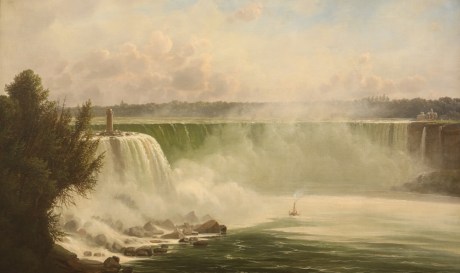
“Niagara Falls Terrapin Point” by Ferdinand Reichardt, 1856.
~ Buffalo History Museum
I crossed the river just below the falls, to the Canada side, and visited the battle-ground of Lundy’s Lane. A village has since sprung up at this place, called Drummondsville, named in honor of the British general who commanded the English troops on that occasion. Most of the battle-ground is now covered by orchards and fields.
I went with Anderson, the guide, (who says he was in the battle as a British soldier,) into an old grave-yard situated near where the British artillery stood, which Col. Miller took at the point of the bayonet. In this grave-yard, Anderson pointed out two graves which he says contains the remains of eighteen American officers. Why cannot American patriotism place some memorial over the graves of these brave men? The only memorial I saw of this kind, on our side, was a painted wooden board, with a simple epitaph, inscribing the name of Captain Hull, of the United States army, stating he had bravely fallen in this battle. Another board of a similar description, erected by the bounty of a corporal and a few privates, over the remains of an English officer, with a tomb-stone placed over Col. Cecil Bishop, of the English forces, who died of wounds received at Black Rock, are all the memorials seen at this burial-ground of Lundy’s Lane, who fell in that action.
~ Niagara Historical Society No. 22 Some Graves on Lundy’s Lane By Ernest Green, page 13.
Col. Gordon, buried in the same ground, lies without a stone. He belonged to the Royal Scotch Highlanders. This battle cost the contending parties over 800 aside, in killed and wounded.
Having seen all worthy of note about the falls, I returned to Buffalo, and sailed at 7 p.m. the same day, on board the St. Louis, for Detroit.
We had on board a large number of emigrants and cabin passengers. The tide of emigration setting west by the lake route is prodigious. Wisconsin, Illinois, Iowa, and Indiana, seem to be the great points of attraction just now.
Having touched at Fair Port and Cleveland, we reached this place on the 22d, early in the morning; having passed Fort Malden some twenty miles below.
Detroit is a handsome and well-laid-off town, and growing continually in population and commercial importance. It is situated on the west bank of the Detroit river, which never overflows or has any material rise or fall. Its water, as well as that of the lakes, affords the most delicious drinking water.
This town is connected in its history with many important scenes. Being early settled by the French, it became involved in the English and French Canadian war; and even before it became a part of the United States, it had changed its flag five times. it was once captured by the Indians, and was burnt down in 1803. In 1805, by the ignominious and disgraceful surrender of Gen. Hull, it fell into the hands of the English. This even took place in the southern part of this town, the spot still being pointed out by old settlers who witnessed the transaction. In 1813, Detroit was retaken by the Americans, when a government was reorganized, and Gen. Lewis Cass appointed its governor.
About fifty miles below this, the river Raisin empties into the lake, at a point called Monroe. It was on this river the bloody massacre of the brave Kentuckians by Indians was perpetrated by the non-interference of the English, under whose protection they had placed themselves as prisoners of war.
At Monroe, a most fiendish and cold-blooded crime was recently committed. it seems, a Mr. Hall, cashier of a bank at Monroe, was decoyed into the woods at night, by a man by the name of Wells, of this place, who was extremely intimate with Hall; when he shot him – once in the back of the head, and once in the back of his body. The deed, it is believed, was committed with the diabolical design of obtaining the keys of the bank from Hall, and robbing it. Young Hall has both balls in him, but still survives; and, strange to say, walked out a day or two since. Wells is in prison, and, like other persons guilty of such horrid crimes, professes “insanity.”

“Hydrographical basin of the upper Mississippi River from astronomical and barometrical observations, surveys, and information,” by Joseph Nicolas Nicollet, et al; published by order of the United States Senate, 1843.
Having a copy of M. Nicollet’s map of the upper basin of the Mississippi with me, I have been led to trace our boundary between this country and England, west from the northwestern shore of Lake Superior, beginning at the mouth of Pigeon river, by the late treaty of Washington; and find we have been most severely cheated in the new line, running from the point indicated to the Lake of the Woods. Soon after parting from Lake Superior, ascending Pigeon river, we come to Hunter’s island, about the size of a large county in one of the States. At the northwest point of this island, Pigeon river divides into two streams – one making an extensive turn to the north, while the other makes a bend to the south, uniting again at the foot of the island. Now, by the old line of boundary, the navigation of the entire river belonged to us, with Hunter’s and other islands. These, with the channel north of the island, which is the deepest, have, by the treaty of Washington, by some unaccountable means, been transferred to the English! Formerly, they yielded up the Pigeon river to our traders, &c., and moved their fort from the mouth of the river some forty miles up the lake, to Thunder Bay, where they built Fort William. They have now again come down (as they have a right to do) to Pigeon river, and interrupt the transit of our traders and people up and down its navigable channels and principal portages. Besides Hunter’s island, we have yielded Isle La Croix, still higher up the river. Hunter’s island is about forty miles long by thirty miles wide, with the deep channel on its northern side. Isle La Croix is about ten miles by fifteen miles in diameter. The line from La Croix west, is made to follow the southern chain of lakes, on the most southern part of Pigeon river, till it reaches the river above them. It then passes to the Lake of the Woods, and from thence to the 49th degree of north latitude, and so on west. What pretext there was for changing our boundary northwest of Lake Superior up Pigeon river, where there never was a boundary in dispute, and where the Pigeon river and Hunter’s island had for years been laid down in British maps as our property, is more than I can tell. Those who negotiated the treaty on our side, must have been grossly ignorant of geography, or they must have been woefully overreached by the British minister.

Thomas Douglas, 5th Earl of Selkirk, was a Scottish peer from the Royal Society of London, and established the Red River Colony along Hudson Bay (1811). This is neither the same person nor place as Alexander Selkirk’s colony on Más-a-Tierra Island, Chile, which inspired Daniel Defoe’s novel, Robinson Crusoe (1719).
The boundary line, stretching across from Lake Superior, along the Pigeon river, to the Lake of the Woods, Red river, &c., is the weakest and most exposed section of the United States. On the Red river of the North, and north of the Pigeon river, is a large body of hardy half-breed Indians, mixed with the Scotch and Germans, who have descended from Alexander Selkirk’s colony, founded near Hudson’s Bay. These people have about six thousand men capable of performing military duty. They come down to the head-waters of the St. Peter’s and Mississippi rivers every season, for the purpose of hunting buffalo, accompanied with their wagons and teams, which, when they have loaded with buffalo meat, they return to their own country. it is said, these men, with the warriors of the Indian tribes stretching west and north of the United States boundary line, number some twenty thousand fighting men, all of whom are under the control of the Hudson Bay (English) Company. In time of war these forces might be organized and brought to bear with destructive effect upon our new upper settlements in Wisconsin and Iowa, and other portions of our northwestern territory. To guard this weak point on our northwestern frontier, our forts are wrongly placed. The forts Snelling, Winnebago, and Wilkins, are too far in the interior.
Government ought, as early as practicable, to adopt measures to build a strong fort at the junction of Pigeon river with Lake Superior, and then to erect detached forts along our entire line of frontier, up Pigeon river to the Lake of the Woods, and from thence along to the Red river, west. These forts would serve to protect our northwestern settlements, and to keep the British and half-breed Indians, with Selkirk’s descendants, in check.
Let any man carefully examine a map of the country we have described, and he will see the propriety of our suggestion.
I leave here in a day or two for Mackinaw, from whence I will write again.
I am very respectfully and truly, yours,
MORGAN.
The Daily Union (Washington D.C.)
“Liberty, The Union, And The Constitution.”
July 5, 1845.
[From our regular correspondent.]
ON BOARD THE STEAMBOAT WISCONSIN,
Bound from Detroit to Mackinac,
June 27, 1845.
After spending some three or four days in Detroit, where I met with the friendly hospitality of a number of friends and acquaintances, I prepared to leave for Mackinac, at the head of Lake Huron.

“Bank of Michigan Building, SW corner of Jefferson and Griswold, built 1836”
~ History of Detroit and Michigan, by Silas Farmer, 1890.
While I was in Detroit, the United States circuit court was in session, Judges McLean and Wilkins presiding. This tribunal now occupies a very neat stone building, formerly erected and owned by the Bank of Michigan. This bank, in winding up its affairs, fell into debt some forty thousand dollars on their interest account, which, after meeting other liabilities, they were unable to discharge. The government, therefore, purchased this house from them at $40,000, and converted it to its present use.
A Presbyterian convention was also in session for a part of the time during my visit.
The large steamboats plying between Buffalo and the upper lakes, all touch at Detroit, to the number of two a day. Many of these are large and splendid structures of their kind. At this season of the year, they run very full of passengers, and, when bound west, carry out a great many emigrants, who are hunting homes in Wisconsin, Iowa, and Illinois. The principal tide is drifting towards Wisconsin at the present, generally landing at Milwaukie, and pushing out into the interior. The boats running on the upper lakes, are at present united in a combination to regular prices. From Buffalo to Chicago, they charge as follows: for cabin passage, 12 dollars; for deck passage, 6 dollars. Cabin to Detroit, 6 dollars; deck, 3 dollars. From Detroit to Mackinac: cabin, 7 dollars; for deck, 4 dollars. Meals for deck passengers charged 25 cents each, extra.
We found the Wisconsin pretty well crowded with passengers when we went on board. Among the deck people were several farmers’ families from Sussex, in England, bound out to Wisconsin, intending to land at Milwaukie, and proceed from thence some little distance into the interior.
On the 26th instant, the United States steam-ship Michigan, and the United States garrison near Detroit, fired minute-guns during the day, in obedience to general orders, and in respect to the memory of Gen. Jackson.
The single ten-inch gun fired from the bow of the Michigan made a loud report, which reverberated along the Canadian shore, as well as along the streets of Detroit.
“Map of the Great Western Railway of Canada, and Connections.” Circa 1879.
~ TrainWeb.org
Should the projected railroad to extend from Lake Ontario to Windsor, opposite Detroit, and that now in progress from the latter place to St. Joseph, on Lake Michigan, be completed, it will have a tendency to make this city a great thoroughfare for travellers, &c., going west.
Leaving Detroit about 9 a.m., we continued up the river till we came to Lake St. Clair. In our progress through it, we could see, by the aid of the glass, the bay formed on its eastern or Canadian side by the entrance of the river Thames, some distance up which, the celebrated battle was fought, which resulted in the death of Tecumseh. Gen. Cass, who now resides in Detroit, dispensing kindness and hospitality to his friends, was in that action, with Gen. Harrison.
From Lake St. Clair, we entered St. Clair river, which is a beautiful stream, forming the southern outlet to Lake Huron. It has cut itself a beautiful canal, on a large scale, through a level country, like Detroit river, leaving gravelly banks, of moderate elevation, on either side. The banks of this river, and especially on the American side, are pretty thickly settled. For some distance in the interior, on the Canada side, the Indians still remain in considerable numbers. At one point, we passed a village of theirs, on the river. At various points, we saw considerable parties of them, either engaged in fishing or travelling, or encamped.
In the afternoon we passed a village on the American side, called Palmer, where a Michigan volunteer company were out on parade, whose band of music greeted us with some lively airs. Near the head of the river, we passed a missionary school and station on the English side; and near the foot of Lake Huron, Fort Gratiot.
For a mile after the St. Clair leaves Lake Huron, the current has a force of six or seven miles per hour. Sail-vessels find it very difficult to stem it; and can only do so, when bound up, by the aid of stiff southerly winds. This river and rapids area serious obstacle to the passage of sail-vessels from the lower to the upper lakes. They are said often to remain wind-bound for a week or more in this river, and at the foot of the rapids. By aid of a tow-path along the shore, on the American side, a mile long, the length of the strongest current, I should think vessels might be pulled up by horse-power into the lake at any time.
“A painting by Paul Kane depicts an encampment on the shores of Lake Huron in about 1845.”
~ The Granger Collection, New York
Late in the afternoon of yesterday, we entered Lake Huron, a huge inland sea. On our right was a vast sheet of water, meeting the horizon, shutting out all sight of land in that direction. We still, however, kept in sight of the western, or American shore; although, at the distance at which we sailed from it, we could see only a small settlement now and then.
The wind, with some clouds and rain, sprung up from the NNE., and threatened a stormy night; but, as the sun went down, the wind fell, the clouds dispersed, and we had a clear, cool, and beautiful starlight night. With conversation, and listening to some music on a piano in the saloon, the evening passed off pleasantly.
The sun this morning rose bright and clear, from the pure bosom of the lake, bringing us a fine and pleasant day.
There is no better tasted, or purer drinking-water found in the world, than that found in these lakes – and especially in the upper lakes. They are, in fact, nothing more than pure fresh-water ocean springs. Your coolest wells in Washington, the Croton in New York, or Schuylkill of Philadelphia, bear scarcely any comparison to this lake water. There is one advantage to mariners navigating these inland seas – under no circumstances are they likely to suffer from a scarcity of drinking-water.
About half-past 2 to 3 p.m., we landed at Mackinac; which I found to be one of the most picturesque and beautiful places I have seen since leaving New York.
As I shall have another opportunity of writing to you from this place, I will say no more at present; but remain your very obedient and humble servant,
MORGAN.
To be continued in Mackinac and Sault Ste Marie…
Land Office Frauds
March 25, 2016
By Amorin Mello
New York Times
December 9, 1858
—~~~0~~~—
Land Office Frauds.
—~~~0~~~—
AGRICULTURAL CAPABILITIES HEREABOUT – LOCAL AMUSEMENTS AND EXCITEMENTS – SETTLEMENTS OF SUPERIOR CITY – A CONTROVERSY, AND SECRETARY M’CLELLAND’S ADJUDICATION OF IT – SECRETARY THOMPSON’S REVERSAL OF THAT JUDGEMENT – ITS CONSEQUENCES – LAND-STEALING RAMPANT – INSTRUCTIONS FOR THE ENTRY OF SUPERIOR CITY – THE LAND OFFICE REPEALS THE LAW OF THE LAND – A CASE FOR INVESTIGATION.
Correspondence of the New-York Times.
SUPERIOR CITY, Wis., Thursday, Nov. 25.

I am booked here for another winter, but fortunately with no fear of starvation this time. We have been most successful the last Summer in our Agricultural labors. The clay soils about here has proved marvelously fruitful, and where we expected little or nothing it has turned out huge potatoes that almost dissolve under the steaming process, and open as white as the inside of a cocoa-nut ; mammoth turnips, as good as turnips can be ; cabbages of enormous size ; and cauliflowers, that queen of vegetables, weighing as much as a child a year old. There is no reason to fear for the future of this country, now that we can show such vegetable products, and talk of our gardens as well as of our mines, forests, furs, and fisheries.
We are not without our excitements here, too ; though we have no model artists, or theatrical exhibitions, to treat our friends with. But our little city is now in a state of commotion produced by causes which often agitate frontier life, and sometimes reach the great center with their echo or reverberation. The Land Office is the great point of interest to frontier men, and the land law is the only jurisprudence save Lynch law, in which we are particularly interested. And as we have no means of reaching the great Federal legislature, through our Local Presses, we are always glad of an opportunity to be heard through the Atlantic organs, which are heard all over the country, and strike a note which the wind takes up and carries not only to San Francisco, but up here to the mouth of the St. Louis River, the hereafter great local point of Pacific and Atlantic intercommunication.

The Eye of the Northwest, pg. 8: James Stinson; Benjamin Thompson; W. W. Corcoran; U. S. Senator Robert J Walker; George W Cass; and Horace S Walbridge.
Five or six years ago a few American pioneers – stalwart backwoodsmen, undertook to select a town site out here, and did select one in good faith, and with clubs and muskets in had fought off from their premises a gang of Indians who were claiming to preëmpt it as “American citizens.” The Indians, however, were backup up by a Canadian white man by the name of STINSON, and some of the great speculators who were engaged in another town enterprise alongside here, and this “Indian war” was protracted in the local and general Land Offices some two or three years, when Mr. M’CLELLAND, then Secretary of the Interior, made a final adjudication of all the legal questions involved in the controversy, and sent it back to the Land Office to ascertain and apply the facts to the law as settled, on great deliberation by himself and Mr. CUSHING.
More Proprietors of Superior from The Eye of the North-west
, pg. 9: [names are illegible]
Meanwhile the original settlers and occupants maintained their adverse possession against the Indians and all the world, and expended a good deal of money in erecting buildings and a pier, and in cutting out streets and in laying out their town, and in carrying on their litigation, which was by no means inexpensive. M’CLELLAND’s determination of the law in their favor encouraged them to go on and incur additional expenses ; and they parted with diverse interests in the town site, some by assignment to persons who advanced money, and some by sale on quit-claim to persons who covenanted to make improvements. They made application to the proper office to enter the site, and nobody objected but the Indians – and the Indians were nowhere. So things stood when the case went back to the General Land Office, and to Mr. Secretary THOMPSON. The worthy Secretary, for some cause altogether unaccountable, adopted the extraordinary (and under the decision of the Supreme Court illegal) course of reversing the final judgement of his predecessor in this very case, (an exercise of power entirely unheard of in a case of mere private right,) and of rejecting the claim of the original occupants and settlers, though it was not contested by somebody who had a better right.
You may well imagine that this decision excited no little astonishment here. All the land stealers looked upon Superior City as vacant ground. They thought the men who selected and settled the town site were outlawed, and had no interests. Some supposed that the Land Office would put the ground up at auction. A chap by the name of SWEETZER came on here fresh from the General Land Office, and undertook to lay Sioux scrip on the whole site. Another – one JOHN GRANT – made application to preëmpt a portion of the site – and, what is the most remarkable feature about this business, GRANT was permitted to enter it as a preëmptor, though it was notoriously a selected town site, and in the adverse possession of town claimants half a year before GRANT ever saw it. This outrage created a great excitement for a small place. The Register, Mr. DANIEL SHAW, excuses himself by saying that he was almost expressly ordered by HENDRICKS to issue the certificate to GRANT, but this we do not believe in these parts. SHAW is clever, and covers his tracks, but nobody here supposes that the Commissioner ever countenanced such a gross violation of a public statute, without a motive. And what motive could the Commissioner have?
But, besides these movements, one of the Indians – ROY by name, who was defeated as one of the claimants by preëmeption – is now seeking to locate his Chippewa scrip on the town-site, and it is supposed that the same influences which urged him as an American citizen will support his claim as an Indian. A white man by the name of KINGSBURY, encouraged by the disregard of law exhibited by the local office, has made a claim on another part of the town-site. This purports to have originated in the fourth year of a litigation between the town claimants and the illegal preëmptors, and is supposed to be stimulated and encouraged by the Register.![Vincent Roy, Jr., portrait from "Short biographical sketch of Vincent Roy, [Jr.,]" in Life and Labors of Rt. Rev. Frederic Baraga, by Chrysostom Verwyst, 1900, pages 472-476.](https://chequamegonhistory.com/wp-content/uploads/2016/03/vincent-roy-jr.jpg)
Subsequently to his original rejection of the town-site claim, Mr. Secretary THOMPSON issued instructions to permit the entry, and the County Judge made application on the 18th instant, under the law of the United States, May 23, 1844. On this being known, some of the persons heretofore claiming under the original settlers and occupants (who had selected the town and paid all the expenses of the settlement) came together and formed an organization as a city, under a recent law of Wisconsin, the object of which they declare to be secure to themselves a title from the United States to the lots they specially occupy, and to sell the balance to defray their expenses in entering and alloting the land! The men whose rights vested under the absolute decision of Secretary MCCLELLAND, and who did all that they could do to enter the land, and paid the money for it more than two years ago, – the men whose “respective INTERESTS” the statute of 1844 recognizes and was designed to protect, – these men are all ruled off the course, and the men claiming under them have conspired to divide the land and its proceeds among themselves.
Of course these iniquitous and illegal proceedings are all within the reach of the Courts – but they are the legitimate consequence of Mr. JACOB THOMPSON’s repeal of so much of the Preëmption Law of 1841 as excludes from preëmption those portions of the public lands that have been “selected as the site of a city or town.” Mr. THOMPSON has overruled all his predecessors, all the Attorney-General, all the local offices, all the lexicographers, and the English language generally, by deciding solemnly that “selection” does not mean “selection,” but means something else – or more particularly nothing at all. Because, says he, if adverse “selection” excluded a preëmptor, then a preëmptor might be excluded by a false allegation of selection. Was there ever such an argal since Dogberry’s time? The Secretary has discovered an equally efficient “dispensing power” with that of King JAMES of blessed memory, and one which his brethren in the Cabinet may use very efficiently, if Congress does not look into the subject and fix some limits to it. For now, not only the Secretary, but the Commissioner, and the Register and Receiver, all think that they are at liberty to treat the repeal by the Secretary as an effective nullification of the law of the land.
If Congress would amuse their leisure a little by looking at these land office operations on the verge of civilization, they would strike a placer of corruption. Let them open the books and call for the documents, and see what Dr. T. RUSH SPENSER, late Register of the Willow River District, says of his predecessor and successor, Mr. JOHN O. HENNING, and then ascertain by what influences HENNING has been reappointed, and SPENSER transferred to Superior. Let them find out what Receiver DEAN said of Register SHAW, and what Register SHAW said of Receiver DEAN, and why DEAN was dismissed and why SHAW was retained. It will be rare fun for somebody. The country ought to know something about the Land Offices, and such an investigation as this would enlighten the country very materially. I hope it will be made, and that the country will learn how it is that more land has been entered in this district by Indians, foreigners, and minors than by qualified preëmptors, and all for the benefit of a few favored speculators.
Marangoin River Iron Property
March 21, 2016
By Amorin Mello

MARANGOIN RIVER
IRON PROPERTY
EMBRACING
FIVE HUNDRED AND SIXTY ACRES,
IN SECTIONS 16 AND 20,
TOWN 44, NORTH RANGE 5 WEST,
ASHLAND COUNTY, WISCONSIN.
———–
CLEVELAND, OHIO:
FAIRBANKS, BENEDICT & CO., PRINTERS, HERALD OFFICE.
1865.
—–

Detail of Township 44 North, Range 5 West, from Charles Whittlesey’s 1860 Geological Map of the Penokie Range.
The Penokie Iron Belt rises from low ground into an elevated mountain ridge, near the Fourth Principal Meridian, and extends westerly as far as Range 4 W., T. 44 North, where it drops off into the Valley of Bladder Lake. The iron stratum probably extends in the same general direction, beneath the surface ; but I have been unable to find any out-crop of the ore until after crossing the Marangoin Fork in T. 44, N. R. 5 W. Over this interesting space of about nine (9) miles the country is lower, and covered with the drift materials to a great depth. On the west bank of the Marangoin, in Section 16, T. 44, R. 5, a bold cliff is seen, as a prominent land mark over the country, rising to a level with the Iron Range at Bladder Lake. Here the Penokie system re-appears, embracing a band of magnetic ore, in all respects like that on the main waters of Bad River in Ranges 2 and 3 West. This outburst, or uplift of the strata rises to a height of 200 or 250 feet above the river, and 900 to 1000 feet above Lake Superior It is composed of the same quartz rocks, lying in the same order – the iron near the summit, – has a mural face or bluff to the South, and descends in a distance of about a mile and a-half beneath the level of Aitkin’s Lake on the West, as is represented in the accompanying map.
~ Geological Report on That Portion of Wisconsin Bordering on the South Shore of Lake Superior. Surveyed in the Year 1849, Under the Direction of David Dale Owen, United States Geologist, by Charles Whittlesey, Head of Sub-Corps, page 432.
Beyond this Lake, which discharges into the Nemakagon – a branch of the St. Croix River, the rocks are again generally covered with the drift deposits as far as Lake Long, in Town 44, North Range 7 West. I have not seen iron to the South-west of Lake Aitkin.
The general strike of the uplift through Sections 20, 21 and 16 is North 60° East, and the Dip North West 30° to 50°; but at the west end there is some dislocation, and the strata are flatter. Like the formation at Penokie Gap, there is a series of quartz rocks several hundred feet in thickness tilted more or less to the North. Beneath the ferruginous portion, which is near the middle, there is the same fine-grained, thin-bedded, laminated quartz, approaching to novaculte 50 to 100 feet thick. Below this a bed of coarser sub-crystalline, thicker bedded gray quartz, standing prominent in cliffs, covered with tripe de roche.
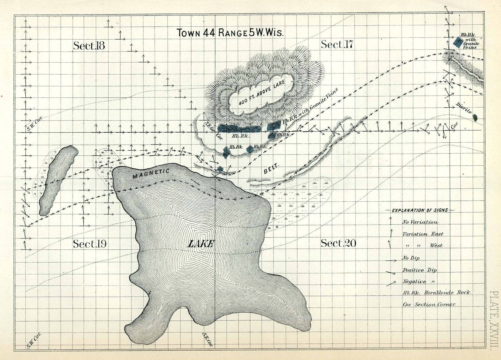
Detail of Aitkins Lake in Section 20, reproduced from the Geology of Wisconsin: Volume III.
Overlying the iron stratum, is a heavy quartz bed, of a darker color, and more jointed, resembling horne blende rock, 300 to 400 feet thick. The iron portion is in thin layers, which deserve the name of slate. It is full of joints, and the pieces come out in regular forms, with straight edges, not rounded by exposure. It dips conformably with the other beds, to the North, and of course descends with them to great depths, ensuring an inexhaustible supply of ore. On Sections 16, where it is steeper than on Section 20, the breadth of the out-crop is less. Its thickness varies from twenty (20) to sixty (60) feet, although in places there are layers of ore, alternating with quartz beds, over a breadth of 100 feet. Most of the way across the South-west quarter of Section 16 – the out-crop is at or near the edge of the bluff, receding from it towards the East. The height of the bluff is about 100 feet, which gives an excellent opportunity to quarry and throw down the ore, and the atde of a mine.
No analysis of this ore has been made; but it resembles the magnetite of the Penokie Range so closely, as to leave no reasonable doubt of their identity.

Detail of the Marengo/Marangoin River in Section 16, reproduced from the Geology of Wisconsin: Volume III.
Four specimens of that ore have been analyzed by three different chemists, the average of which resulted in giving fifty-nine 88/100 (59.88) per cent. of metallic iron. Three of these specimens were selected by myself for the government collections, with the intention of representing an average of the ores. One of the four was selected by a company to represent the best quality of ore, and yielded sixty-eight (68) per cent., the others fifty-six to fifty-eight. A pure magnetic oxide yields 72.40, which is the richest known ore of iron. No injurious chemical ingredient, such as phosphorus, arsenic, or sulphur, has been as yet discovered in the Penokie ores. The only foreign substance is silex, or quartz, a material entirely harmless, and i easily melted with a proper flux. It is from fine grained magnetic ore that the choicest iron is made. This ore is not always as rich, or as easily wrought as the specular and hematite varieties, but invariably produces better iron. It is also very desirable as a mixture with those ores for the purpose f producing a higher grade of metal. Magnetic iron ore is calculated for Bloomeries or common forges, where wrought iron is produced direct from the ore with charcoal, by one process. On this location there is a fall in the Marangoin Fork which I estimate to be equal to a twenty foot overshot wheel. The river is rapid above, and is the most prominent branch of the Bad River. Its sources are in numerous lakes, swamps and springs, which give it great uniformity in the supply of water. The Northern slope of the mountain is heavily covered with hard wood timber for making charcoal, principally sugar-tree. There is an abundance of timber land and water power in the vicinity not yet entered. A horse trail has been cut from the East side of Section 16 to Sibley’s, which is reported to be on easy ground and a trifle over eleven (11) miles in length. From Sibley’s there is a road to Ashland at the head of Chequamegon Bay, a distance of twelve (12) miles due North. At the head of this Bay is a spacious harbor, safe in all weather. The Berlin & Bayfield Railroad will probably pass within ten miles of this property on the East, and the West the Bayfield Branch of the Hudson & Superior Railroad within twelve miles.
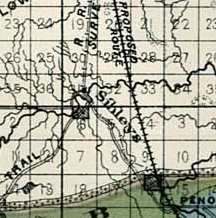
Detail of Thaddeus Pembroke Sibley‘s saw-mill on the Marengo River from Charles Whittlesey’s 1860 Geological Map of the Penokie Range.
The country on and North of the Iron Range is, for farming purposes, the best part of Lake Superior. Its climate is less severe, and the snow in winter less deep than at the Ontonagon and Portage Lake. Messrs. Sibley & Lehy have for many years raised cattle and farm crops successfully. Hay, oats, potatoes, barley and all kinds of vegetables grow better here than in many farming regions farther South. There is little doubt but wheat and rye can be raised when they are needed. The settlers and the Indians make large quantities of sugar from the sugar-maple, which is abundant and rich in sap. Thus a large part of the forage and the food required about iron works can be produced on the spot. There is no healthier region to be found in the United States. In Europe, a northern climate is considered favorable to the iron business, on account of the increased health and vigor of the laborers, as compared to warmer latitudes. When the railways now designed to connect the Mississippi and the Wisconsin Rivers with Lake Superior, shall have been built, or such portions as shall connect the Iron Range with navigation, charcoal furnaces may be erected at numerous points along the route, where there is timber and water power.
The Penokie Range is now held principally by three organized companies. In case there should be a failure, or a great delay, on the part of the Land Grant Railroad Company in prosecuting that work, on that part of the line from Lake Superior to the iron region, a road will probably by built by the parties interested. No business improves a new country, for the capital employed, so rapidly as the manufacture of iron. The rapid increase of the Town and County of Marquette, in Michigan, where in ten years, from 1855 to 1864 inclusive, the shipments of ore increased from 1,447 to 225,119 tons, is conclusive evidence of this fact. The iron business requires and introduces an intelligent class of mechanics and laborers, because skill and intelligence are necessary to carry it on successfully. For such iron as this pure magnetic ore will produce, there must always be a steady demand, at high prices. The competition for high grade charcoal iron is, and must always be, limited. Thus nature seems to have designed the region watered by the tributaries of the Bad River as an iron manufacturing country.
CHARLES WHITTLESEY.
Cleveland, Jan’y 1, 1865.
Abandoned mine shaft on the Marangoin River Iron Property.
Opinike (or Potatoe) River Property
March 20, 2016
By Amorin Mello

“Map Showing the Succession of Layers Along Potato River” by R. D. Irving, 1873. Reproduced from the Geology of Wisconsin: Volume III.

OPINIKE
(OR POTATOE)
RIVER PROPERTY,
TOWN 46, NORTH RANGE 1, WEST, SECTIONS 16 & 17,
480 ACRES,
ASHLAND COUNTY, WISCONSIN.
————–

Detail of the Opinike River Property and the Ironton trail in Township 45 North, Range 1 West, from Charles Whittlesey’s 1860 Geological Map of the Penokie Range.
The “Charter Oak” Mining Company occupied these premises in 1845-6 under permits from the government. The reports of the agents of the Company at that time state that copper bearing veins were found in the trap rocks next above the lower Falls. In geological characters and position, the rocks are the same here as at the Upper Falls of the Montreal, herein described. Next below the sandstone is the same black slate; below this the conglomerate, then alternating bands of sandstone and trap, and beneath them the main body of brown and amygdaloid trap. Like the Montreal River beds, they are here tilted up at a high angle to the North-west, their line of outcrop bearing North-east. They are, however, reduced in thickness materially, the conglomerate being about 600 feet, and the bands f sandstone are fewer in number. over the conglomerates, and over the trap, there are several falls and chutes in the river, amounting to 125 or 130 feet in a mile.
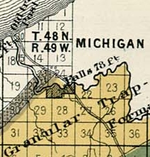
Detail of the Upper Falls (Saxon Falls) on the Montreal River and the Old Flambeau Trail in Township 47 North, Range 1 East from Charles Whittlesey’s 1860 Geological Map of the Penokie Range.
Here, as at the Montreal, the best trap is above the chutes, where it is well exposed in the channel of the river. For one mile above the Lower Falls the trap is of a favorable character ; but above this is not visible until the old Ironton trail is reached. The thickness of the productive trap is not as great as it is at the Montreal River. I judge that this tract covers the entire breadth of the soft brown amygdaloid trap. So far as I can form an opinion from the eternal character of the rocks, they promise as well as any part of this range. No part of the ground has been tested by recent explorations for veins, but there is abundant encouragement for a thorough trial. It must be remembered that it is only in the streams that the rocks composting the best part of this copper range are visible. From the Montreal to the Opinike River, neither the conglomerate nor the trap rises above the level of the country. From the Opinike to the forks of Bad River on Section 17, Town 45, Range 2, West, a distance South-easterly of about nine (9) miles, the productive belt of trap does not show itself above the drift materials, which over the country. The process of exploration is therefore much more tedious than it would be if the uplift was elevated into a high mountain ridge, with rocky cliffs exposed to view.
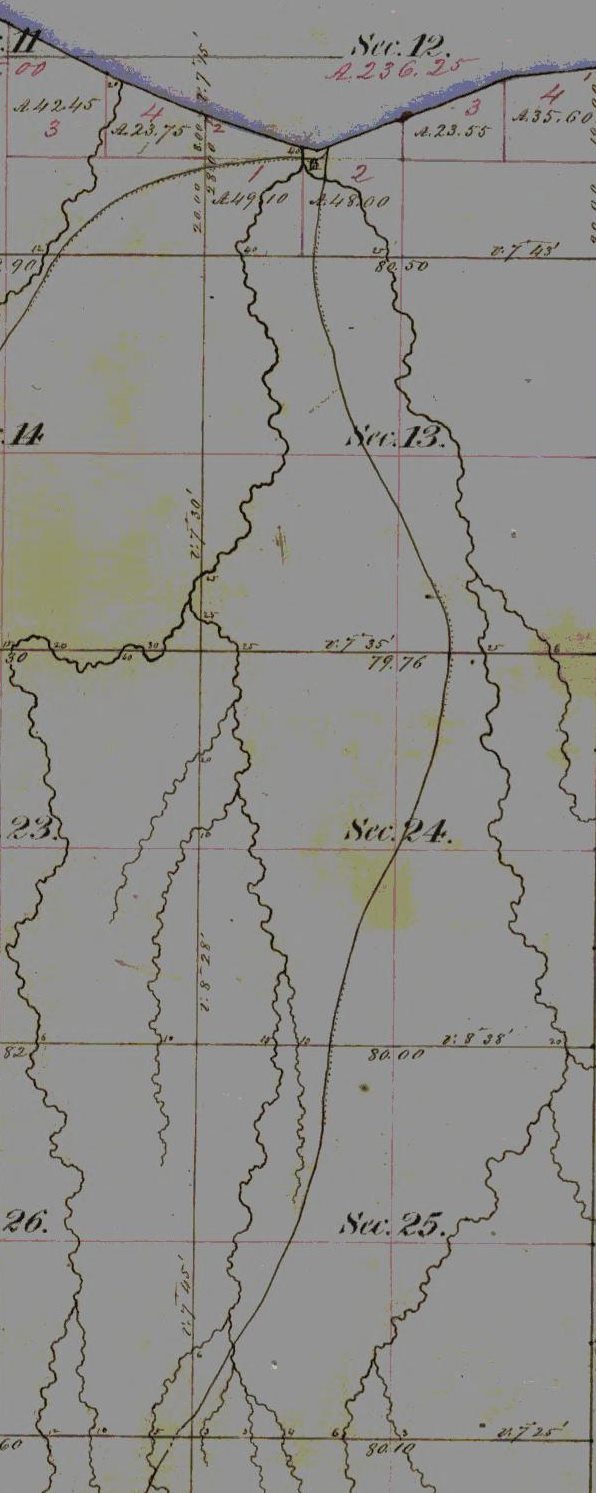
Ironton is the proper landing for works at the Opinike Falls, as well as for the Montreal River, and the distance is about nine miles. About two miles up the river, the Ironton trail to the Iron Range, crosses the River Opinike. It is highly probable the Ashland Copper Mining Company, which is now at work at the forks of Bad River, will seek an outlet this way. Although there is not a natural harbor at Ironton Landing, there is an angle in the cast which gives shelter to all but Northern winds, and the deep water approaches near the shore. Piers that were sunk there in 1857, have not yet been moved from their foundations by storms or by floating ice. This is the natural outlet for that part of the Iron Range which is East of the Penokie Gap. Although the country is somewhat mountainous, there are no serious obstacles to prevent highways, plank-roads or railroads from being built. Whatever mines may be developed on either the Copper or the Iron Range East of the Bad River, will find this the most convenient route to reach the lake. The water-power of the Opinike is at the upper chutes twenty-eight (28) feet and the lower seventy-five (75) feet – the latter being over the conglomerate rock and the former over trap. It is about three-fourths of a mile between them, and in the distance the river is rapid over a rocky bed. There is sufficient timber on the tract for all mining purposes, and a portion of the soil is equal to any in the country.

Detail of Ervin “Nigigoons” Leihy’s saw mill.
From the falls of the Opinike to Lehy’s saw-mill, at the falls of Bad River, is about nine (9) miles, in a North-westerly direction. Batteaux can reach Lehy’s mill from the lake during the ordinary stage of water. There is an Indian trail from Lehy’s to the falls, over a level country, somewhat more feasible for a road than the route to Ironton, but for the purposes of a mine the Ironton landing is much preferable. The flow of water in the Opinike is not equal to that of the Montreal, but the total fall is greater. Should workable mineral be found here – as appearances lead me confidently to anticipate – the location has advantages of position and water-power such as to place it next the Montreal River property for economical mining.
CHAS. WHITTLESEY,
Geologist and Mining Engineer.
Cleveland, Jan’y 1st, 1865.
