By Amorin Mello
A curious series of correspondences from “Morgan”
… continued from Saint Croix Falls.

The Daily Union (Washington D.C.)
“Liberty, The Union, And The Constitution.”
July 31, 1845.
To the Editor of the Union:

Andrew Belcher Gray published the Map of the Mineral Lands Upon Lake Superior Ceded to the United States by the Treaty of 1842 With the Chippeway Indians in 1845.
~ Wisconsin Historical Society
SIR: In your paper of Tuesday evening, I have observed a communication from Copper Harbor, (Lake Superior,) so pregnant with errors or misrepresentations, that I am constrained, by a regard to truth and the public interests, to ask the use of your columns to correct some of them. I know not who your correspondent is; but, judging from the extraordinary zeal with which he labors to forestall public opinion of certain government agents on Lake Superior, whose conduct has recently become obnoxious to very grave suspicion, I think it no unwarrantable conclusion that he has either been most egregiously imposed upon, or that he is animated in his encomiums upon the officers alluded to, by motives much more special than in his admiring comments upon the handsome scenery and novel life upon the lake. He is evidently more than indifferently anxious to vindicate and extol General Stockton and his faithful deputy, Mr. Gray. Otherwise, what necessity would there be for asserting facts which do not exist? Your correspondent states that
“The only tenement on the island is a miserable log-cabin, in which General Stockton, for the want of better quarters, is compelled to keep his office. The room which he occupies, is only about eight feet square – just large enough to admit a narrow bed for himself, a table, and two or three chairs. In this salt-box of a room, he is compelled to transact all the business relating to the mineral lands embraced within this important agency. As many as a dozen men at a time are pressing forward to his ‘bee gum’ apartment, endeavoring to have their business transacted.
“The office of the surveyor of this mineral lands, in charge of Mr. Gray, at this agency, is still worse adapted to the transaction of public business. He is compelled to occupy the garret of the log-cabin,” &c.
Now, so far from this being true, “the miserable log cabin” of which your fastidious correspondent speaks, is an excellent hewed log house, well finished and ceiled, with three good-sized rooms below, and three above stairs, amply sufficient and convenient for all intended purposes. The construction of this house cost the government some fifteen hundred dollars, and was designed as the agency-house; whereas General Stockton has converted it into a sort of hotel – doubtless as a means of augmenting the perquisites of his station. Hence he has stinted himself, and the convenience of the government service, to his “bee-gum” and “salt-box” penetralia of “eight feet square.” So much for this misrepresentation.

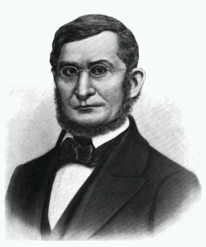
Painting of Professor Douglass Houghton by Robert Thom. Houghton first explored the south shore of Lake Superior in 1840. Houghton died on Lake Superior during a storm on October 13, 1845. The City of Houghton on Chequamegon Bay was named in his honor, and is now known as the Houghton Falls State Natural Area.
Your correspondent expresses a like sympathy for the privations and long-suffering of Mr. Surveyor Gray. The apartment which Mr. Gray occupies above stairs, is an ample room, some fifteen or more feet square, and is quote comfortable – nay, quite luxurious quarters, when compared to those of the other surveyors, who are where Mr. Surveyor Gray should be, if he was faithfully discharging his duties – out in the woods and the weather, among the rocks and swamps, driving the compass and chain through almost impenetrable wilds. It may, perhaps, be a question with the government, as it certainly will be with the public, why Mr. Gray should be lolling at his ease in the agency-house on Porter’s island, while Dr. Houghton, the other surveyor, is traversing large tracts of the mineral lands, and sustaining all the hardships and perils which pertain to his employment? And it may become a further question, while I am on this head, why Mr. Gray, who was an unrelenting tool of the whig party, and neglected the public service, for which he was receiving a handsome salary, last year, to mingle in the orgies of federal-Clay-clubites, should not only be so sedulously retained in office, but be admitted to the privilege of almost total exemption from labor, which he is employed and paid to perform? It is a fact, that up to the 3d of July, Mr. Gray had surveyed only two miles, whereas Dr. Houghton had measured some five hundred miles of the mineral lands! And this is the gentleman against whose discomfort your correspondent so pathetically appeals, forsooth, because he is occupying at his ease an excellent apartment in a very comfortable house.
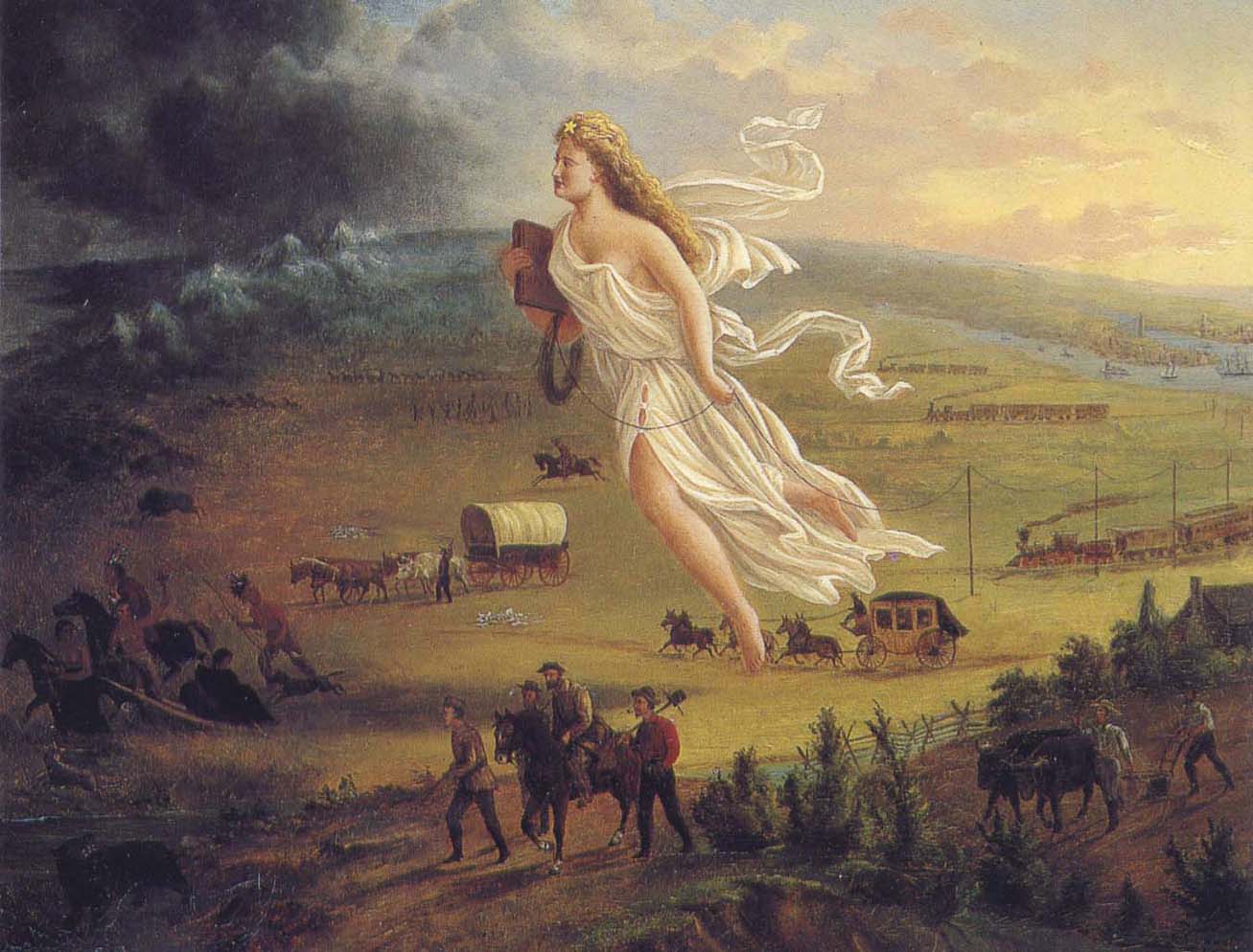
American Progress by John Gast, 1872
“This painting shows ‘Manifest Destiny’ (the belief that the United States should expand from the Atlantic to the Pacific Ocean. In 1872 artist John Gast painted a popular scene of people moving west that captured the view of Americans at the time. Called ‘Spirit of the Frontier’ and widely distributed as an engraving portrayed settlers moving west, guided and protected by Columbia (who represents America and is dressed in a Roman toga to represent classical republicanism) and aided by technology (railways, telegraph), driving Native Americans and bison into obscurity. It is also important to note that Columbia is bringing the ‘light’ as witnessed on the eastern side of the painting as she travels towards the ‘darkened’ west.”
~ Commons.Wikimedia.org
The design of this letter from Copper Harbor is perfectly apparent to me. It is the sequel to a movement which was made last June, viz: to white-wash and to shield from a just reprehension the present superintendent of the Lake Superior mineral lands. On the very day that General Stockton opened his office, a sort of soi-disant public meeting was gotten up there, in compliment to the General, in which the president of the New York and Lake Superior Mining Company was the prime mover. When it is known that General Stockton has certified to the Ordnance Department locations by this company of between one and three hundred square miles, upon which leases were granted, when not a single foot had been actually located, in flagrant violation of all the laws and regulations, some opinion may be formed of the secret of this most disinterested and valuable tribute to the official worth of this superintendent. What might have been the potency of this expression of public opinion (!) in protecting Gen. Stockton’s official conduct from censure and investigation up to the period of its dispensation, I will not now say. But, certain it is, that large and glaring spots which have begun to attract scrutiny and invoke exposure, have rendered his escutcheon needful of a new coat of white-washing; and hence this effort of your correspondent to forestall examination into his conduct, by pathetic epics of his patiently-endured privations iin the public service, and the ignorant or else sinister commendations of his conduct.
In animadverting upon the conduct of General Stockton and others, I do not mean to include Major Campbell, of whom everything that your correspondent has said is hereby confirmed.
POSTEA PLUS.
———

William Learned Marcy was the 20th United States Secretary of War during Polk’s presidency.
~ Wikipedia.org
We have omitted a large portion of the above communication, in which the writer proceeds to complain of the survey of the mineral lands, and arraigns the agents of the government for gross malversation in office. These charges are of a serious character, and they demand a full and rigid investigation. But, as it might lead to a protracted and angry war in the papers, in which crimination would be followed by recrimination; and as we are advised that the Secretary of War is determined to investigate the justice of these complaints and the truth of them – as he will receive any specifications in writing which may be submitted, and is determined to go to the bottom of the subject; and, with that view, will appoint a commission of two of the most respectable gentlemen he can obtain, who will go upon the lands, and probe everything for themselves, – we have thought it best to let matters take that turn. We have not the slightest doubt that the attention of the department is thoroughly exited to the importance of the duties which may devolve upon it, and that it will unquestionably discharge them. It is scarcely necessary, therefore, for the press to mingle at present in a discussion, which might occupy much space, lead to much excitement, and, after all, fail to lead to the best and wisest results.
– UNION.

The Daily Union (Washington D.C.)
“Liberty, The Union, And The Constitution.”
August 1, 1845.
THE COPPER REGION.

James Knox Polk:
11th President of the United States.
~ Wikipedia.org
We have been inconsiderately drawn into a subject of some importance to the United Sates. We have struck a vein, however, which promises to be rich in its resources. The reader will recollect a very long and interesting letter which we published on Tuesday evening, from one of our regular correspondents, who is now on a trip from New York to Lake Superior, in which he gave us a description of its peculiar and striking scenery, and made some remarks upon the copper lands in its vicinity, and upon the agents of the United States who have been charged with the care of the mineral lands belonging to the government. This letter drew forth a reply in our last evening’s paper; but we declined the publication of the whole communication, for the reasons which we then stated. The writer of that article charged the United States agent with many acts of mismanagement, and even malversation of office; and as we were aware that our government was about to appoint a commission to visit the country, and investigate the conduct of the agents, we deemed it most advisable to refer to another tribunal, (for the present, at least,) a full inquiry into these matters. In the mean time, a new scene was opened before us. We were scarcely aware of the existence of these mineral resources, – much less of their extent. But our curiosity is now being aroused. The public documents connected with them have been politely placed in our possession, and we shall prepare an article for the “Union” for the purpose of calling the attention of the country to this very interesting subject. The lead-mines belonging to the United States in Wisconsin, Illinois, Iowa, &c., have been longer known and are better understood than the copper region. They have been worked to a considerable extent, and their produce is so abundant, that they can not only supply our own market with lead, but afford a large export for the consumption of foreign nations. Perhaps no mines in the world are equal to those of the belt on both sides of the Mississippi.
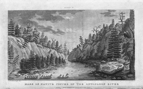
Engraving depicting the 1820 Cass/Schoolcraft expedition crossing the Ontonagon River to investigate the famous copper boulder.
~ Wisconsin Historical Society
The purchase of this rock from the Chippewa Indians was made in 1841. The treaty with these Indians, ceding this portion of the country to the United States, was not made until October, 1842, after the second expedition to that country for the purpose of removing this rock. The Indians say that they did [not] reserve this rock in the treaty of 1842, as they had already sold it to a citizen of the United States, and they conceived that they had no further control over it. They say that, by their treaty, they only sold their lands, and suppose that all moveable property of this kind, which had been previously the subject of individual negotiation, would be allowed to be removed by the individuals making the purchase of them, as readily as they would be allowed to remove their lodges or canoes.
J. ELDRED, for self and sons.“
~ Public Documents Printed by Order of the Senate of the United States: First Session of the Twenty-Eigth Congress, 1844.

The Ontonagon Copper Boulder at the Smithsonian Institution National Museum of Natural History. Photograph by Ian Shackleford, 2011; shared with a Creative Commons license.
~ Wikipedia.org
The copper region is probably more important than the lead-mines. It is supposed by some geologists to extend from Lake Superior to Texas, crossing the Mississippi diagonally at a lower point than the lead-mines, and forming a vein of from thirty to forty miles of average width. The ore is said to be unusually rich. In some places it is mixed with veins of silver, so abundant that the precious metal alone is sufficient to pay all the expenses of working the vein – the ore itself making a yield of 60 or 70 per cent. of copper. An immense boulder of this metal is now deposited in the public yard between the War and Navy Departments, and is well worthy the inspection of all curious observers who happen to visit Washington. It weighs more than 3,700 lbs., and is so rich in the metal that a plate of copper is smoothed off on its surface like the copper-plate of the engraver. It was transported to Washington from the banks of the Ontonagon river, about forty miles from the Eagle river. The two principal points where the richest ore has yet been developed, are on Eagle river, and near Copper Harbor, on Lake Superior. But the richest portion of the copper region, as far as it is explored, is reputed to be Isle Royale, in Lake Superior, much nearer the Canada side than our own; but the boundary line runs north of the island, so that it falls within the limits of the United States. Isle Royale is estimated to be about thirty miles in length, and five miles broad – singularly rich in copper, which is constantly cropping out on the surface. The department has decided that no patents should be granted, and no leases taken, on this singular island.
Two large companies have been formed for leasing and working the mines in the Lake Superior Copper Region – the one which operates in New York, and the other in Boston. So valuable have shares become in some cases, that a gentleman in Boston, who is said to own about eighty shares, has been offered more than $600 for a single share. The supervision of these mines is devolved on the Ordnance Bureau, (Col. Talcott,) attached, of course to the War Department. Some important regulations have been made about the leasing of the mines, but further legislation will be required from Congress. The Secretary of War grants the permits to applicants to go upon the lands; and upon presenting a certificate from the agent of the United States that the tract has not been previously occupied, a lease may be granted for three years, upon condition of paying 6 per cent. of the nett proceeds of the metal, after it is smelted from the ore. If the lease be renewed for another three years, the rent is extended to 10 per cent. The leaseholders were originally confined to the smelting of the ore in the neighborhood of the mines; but it was found that, owing to the want of fuel, and other appliances, it was best to transport the ore to New York or Boston. The secretary yielded at last to the application – the government still receiving its 6 per cent. of rent, in the metal itself, free of all expense of transportation.
On the 21st of March last, it was determined by the Secretary of War to grant no more permits which would authorize a selection of more than one square mile; and between that time and 18th ult., seven hundred and sixty such permits were issued. It was then determined to stop the further issue. The cause of this is expressed in the printed circular from the Secretary of War, which we have already published. It states that,
“should locations be made pursuant to the permits already issued from this department, to select lands in the Lake Superior mineral district, the quantity required to satisfy them would exceed one million one hundred thousand acres It is apprehended that the whole region open for lation may not contain this quantity of mineral lands. Explorations and surveys of these lands have been ordered, and it has been determined to suspend the further issue of permits until the results shall be made known. The applications for permits received at the department subsequent to the 17th instant, will be filed in the office; and if the disclosures of the examinations shall warrant the further issue of permits for the Lake Superior region, they will be considered in the order in which they have been or shall be received. It is not expected that the results of the examinations and surveys to ascertain the probable quantity of mineral lands in the region, and to make the locations pursuant to the permits already issued, can be completed for some time to come.”
This is to certify, that on the 1st day of September last, while attending the payment of the Chippewa Indians at Lapointe, Lake Superior, Okondókon, being the head chief of the band of that tribe, and who resided at the mouth of the Ontonagon River, state, in my presence, that he had sold to Julius Eldred, of Detroit, in the summer of 1841, the celebrated copper rock; and that he had received, at the time of the sale, a portion of the sum agreed upo, and that there remained due him one hundred and five dollars, which was to be paid him whenever Mr. Eldred removed the rock to the shore of the lake; which sum of one hundred and five dollars Mr. Eldred did pay to Okondókon a few days thereafter, at the Ontonagon agency, in pursuace of the agreement made between them in 1841.
I further certify, that, on the 10th day of September last, Julius Eldred paid to Messrs. Hammond & Co. seventeen hundred and sixty-five dollars, for the services which they rendered in removing the rock, as well as to obtain peaceable possession of the same.
The removal of this copper rock has been attended with very great risk as well as expense, and is one of the most extraordinary performances of the age, and one which, in my opinion, should entitle him to great praise as well as liberal compensation.
WALTER CUNNINGHAM.“
~ Public Documents Printed by Order of the Senate of the United States: First Session of the Twenty-Eigth Congress, 1844.
It seems that Walter Cunningham, the first superintendent of these lands, kept no record of the permits he granted, or of the selection of tracts to which he certified as not interfering with the claims of others; and, in consequence of the absence of this information, it appears that his successor (Stockton) has, in two or three instances, certified for others, tracts previously certified by Mr. Cunningham; and this has given rise, as may be supposed, to some complaint. The certificates of the latter have been dropping in for a week or two past, but we know that very few or more can be in existence.
Mr. Gray (the only one of the assistants assigned to the superintendent, who possessed any competent knowledge of the surveying or platting) has been busily engaged in preparing maps, and locating the leases, and claims to leases thereon, to save from the risk of granting certificates which will interfere; and another competent surveyor has recently been sent to that country, in order that the operations may be expedited as fast as possible. It is also understood that Dr. Houghton is carrying on surveys under the orders of the General Land Office, which will soon extend into Stockton’s district, and will probably throw much additional light upon the extent of this interesting region of country.
We are informed that, as regards Mr. Gray’s mingling in any way with politicians, (as was stated by our correspondent of last evening,) it can scarcely be true. “He is a young man, who has been constantly moving about, and acquired no right to give a vote in any location. Modest and retiring, he is the last man in the world to do anything of the kind charged upon him.”
It will be seen, from this very rapid sketch, on imperfect data, that the copper region of the United States abounds with interest; that, from the abundance and the richness of the ore, it is probably calculated to furnish copper enough for our own consumption, and for a large exportation to foreign countries. Of course, great interests are growing up in that wonderful region – much speculation, large companies, strong contests for the possession of the titles – the same mine sometimes shingled over with several claims – some violence and some fraud. And even the agents of the government have not escaped the suspicion of mismanagement and malversation. The executive is about to do its duty in these respects. It is contemplated to employ two highly respectable commissioners to inspect the lands, to receive and investigate all complaints, and make a report to the War Department. A more complete report also, of the mineral resources of the West, the quality and extent of the mines, and the best way of working them, will probably be obtained, under the auspices of the vigilant Secretary of War, to be submitted to the next Congress. The statistics will, no doubt, be found valuable; and, in fact, the whole subject is every day assuming a new and a more expanding interest.
Two additional articles were published by The Daily Union on August 2 and August 11 regarding the Copper Region. They include extensive quotes from United States government agents involved in surveying the Copper Region, but are not directly related to the correspondences of “Morgan” or his accuser “Postea Plus” and therefore are not reproduced here on Chequamegon History.
The Daily Union (Washington D.C.)
“Liberty, The Union, And The Constitution.”
August 26, 1845.
[From our regular correspondent.]
GALENA, ILL., August 14, 1845.
Not having time to say more at present about the country through which I passed in coming from the falls of St. Croix to this place, I beg leave to refer to a notice taken of a portion of a letter written by me to the “Union,” from Copper harbor, by some correspondent opposed to Gen. Stockton and Mr. Gray.
It seems that deserved praise bestowed upon these officers of a government has proved offensive to the said correspondent.
I deem his publication worth no other notice than to say, that he speaks falsely and malignantly of “Morgan,” when he attributes his praise of Stockton and Gray to “sinister motives.”
It is known that an attempt was made by members of a certain small band of speculators to locate a mineral lease on a town site at the falls, or Sault St. Marie, where no copper or other mineral has been found, for the purpose of making a speculation of it. And when told by Gen. Stockton that it was not put down in the mineral region, that it was beyond his jurisdiction, and that he could not consent to grant a location for it, they got made, spluttered about their influence at Washington, hinted at his removal, &c. Several other applications were made to him by the same and other parties, equally as absurd and ridiculous, which he had the firmness to deny. Hence, those foiled in using him to suit their own purposes, are most loud in his condemnation. They probably wish some pliant tool to occupy his place.
I am glad to see that a commission is to be appointed to visit Copper harbor, for the purpose of investigating the affairs of the mineral agency. I have no question it is the very thing Gen. Stockton and Mr. Gray themselves would solicit, in the event of charges being made against them, and without the least apprehension as to the result.
I could say more on this subject; but respectfully leave the whole matter in the hands of the government, where it belongs.
I learn from the worthy superintendent of the United States lead-mines at this place, that he thinks the amount of lead shipped from this district the present year will reach 60,000,000 of pounds, which, at 3 cents per pound, would amount to one million eight hundred thousand dollars. The quantity shipped last year was 43,000,000 of pounds.
Galena is growing, and, as a thriving business place, may be considered (of its size) one of the first in the western country; containing, as it does for a new place, an intelligent, active, and enterprising population.
“In the early 1800s Southwestern Wisconsin miners were too busy digging the ‘gray gold’ to build houses. Like badgers, they moved into abandoned mine shafts for shelter. As a result, Wisconsin was nicknamed ‘The Badger State.'”
Wisconsin Historical Society
Wisconsin is a flourishing Territory, and is going to make a splendid State, being rich in mineral, in farming land, and in fine timber, with a plenty of good water, health, &c. Emigrants are pouring into it from all parts of Europe.
Iowa has rejected her constitution, and elected a democratic governor.
I remain yours, very truly and respectfully,
MORGAN.
To be continued in The Upper Mississippi River…
Wisconsin Territory Delegation: The Copper Region
April 17, 2016
By Amorin Mello
A curious series of correspondences from “Morgan”
… continued from Copper Harbor.

The Daily Union (Washington D.C.)
“Liberty, The Union, And The Constitution.”
August 21, 1845.
EDITOR’S CORRESPONDENCE.
—
[From our Regular Correspondent.]
THE COPPER REGION.
La Pointe, Lake Superior
July 28, 1845.
Map of the Mineral Lands Upon Lake Superior Ceded to the United States by the Treaty of 1842 With the Chippeway Indians.
~ Wisconsin Historical Society
In my last brief letter from this place, I had not time to notice many things which I desired to describe. I have now examined the whole coast of the southern shore of Lake Superior, extending from the Sault Ste. Marie to La Pointe, including a visit to the Anse, and the doubling of Keweena point. During the trip, as stated previously, we had camped out twenty-one nights. I examined the mines worked by the Pittsburg company at Copper harbor, and those worked by the Boston company at Eagle river, as well as picked up all the information I could about other portions of the mineral district, both off and on shore. The object I had in view when visiting it, was to find out, as near as I could, the naked facts in relation to it. The distance of the lake-shore traversed by my part to La Pointe was about five hundred miles – consuming near four weeks’ time to traverse it. I have still before me a journey of three or four hundred miles before I reach the Mississippi river, by the way of the Brulé and St. Croix rivers. I know the public mind has been recently much excited in relation to the mineral region of country of Lake Superior, and that a great many stories are in circulation about it. I know, also, that what is said and published about it, will be read with more or less interest, especially by parties who have embarked in any of the speculations which have been got up about it. It is due to truth and candor, however, for me to declare it as my opinion, that the whole country has been overrated. That copper is found scattered over the country equal in extent to the trap-rock hills and conglomerate ledges, either in its native state, or in the form of a black oxide, as a green silicate, and, perhaps, in some other forms, cannot be denied;- but the difficulty, so far, seems to be that the copper ores are too much diffused, and that no veins such as geologist would term permanent have yet positively been discovered.

Detail of a Survey of Location No. 4 for the Pittsburgh & Boston Copper Harbor Mining Co. Image digitized by the Detroit Public Library Burton Historical Collection for The Cliff Mine Archeology Project Blog.
The richest copper ore yet found is that raised from a vein of black oxide, at Copper harbor, worked by the Pittsburg company, which yields about seventy per cent. of pure copper. But this conglomerate cementation of trap-rock, flint, pebbles, &c., and sand, brought together in a fused black mass, (as is supposed, by the overflowings of the trap, of which the hills are composed near this place,) is exceedingly hard and difficult to blast. An opinion seems to prevail among many respectable geologist, that metallic veins found in conglomerate are never thought to be very permanent. Doctor Pettit, however, informed me that he had traced the vein for near a mile through the conglomerate, and into the hill of trap, across a small lake in the rear of Fort Wilkins. The direction of the vein is from northwest to southeast through the conglomerate, while the course of the lake-shore and hills at this place varies little from north and south. Should the doctor succeed in opening a permanent vein in the hill of trap opposite, of which he is sanguine, it is probable this mine will turn out to be exceedingly valuable. As to these matters, however, time alone, with further explorations, must determine. The doctor assured me that he was at present paying his way, in merely sinking shafts over the vein preparatory to mining operations; which he considered a circumstance favorable to the mine, as this is not of common occurrence.
The mines at Copper harbor and Eagle river are the only two as yet sufficiently broached to enable one to form any tolerably accurate opinion as to their value or prospects.
~ Encyclopedia of the Earth
Other companies are about commencing operations, or talk of doing so – such as a New York, or rather Albany company, calling themselves “The New York and Lake Superior Mining Company,” under the direction of Mr. Larned, of Albany, in whose service Dr. Euhts has been employed as geologist. They have made locations at various points – at Dead river, Agate harbor, and at Montreal river. I believe they have commenced mining to some extent at Agate harbor.
One or two other Boston companies, besides that operating at Eagle river, have been formed with the design of operating at other points. Mr. Bernard, formerly of St. Louis, is at the head of one of them. Besides these, there is a kind of Detroit company, organized, it is said, for operating on the Ontonagon river. It has its head, I believe, in Detroit, and its tail almost everywhere. I have not heard of their success in digging, thus far; though they say they have found some valuable mines. Time must determine that. I wish it may be so.

Boston Mining Company stock issued by Joab Bernard in 1846.
~ Copper Country Reflections
From Copper harbor, I paid a visit to Eagle river – a small stream inaccessible to any craft larger than a moderate-sized Mackinac boat. There is only the open lake for a roadstead off its mouth, and no harbor nearer than Eagle harbor, some few miles to the east of it. In passing west from Copper harbor along the northern shore of Keweena point, the coast, almost from the extremity of Keweena point, to near Eagle river, is an iron-bound coast, presenting huge, longitudinal, black, irregular-shaped masses of trap-conglomerate, often rising up ten or fifteen feet high above water, at some distance from the main shore, leaving small sounds behind them, with bays, to which there are entrances through broken continuities of the advanced breakwater-like ledges. Copper harbor is thus formed by Porter’s island, on which the agency has been so injudiciously placed, and which is nothing but a conglomerate island of this character; with its sides next the lake raised by Nature, so as to afford a barrier against the waves that beat against it from without. The surface of the island over the conglomerate is made up of a mass of pebbles and fragmentary rock, mixed with a small portion of earth, wholly or quite incapable of cultivation. Fort Wilkins is located about two miles from the agency, on the main land, between which and the fort communication in winter is difficult, if not impossible. Of the inexcusable blunder made in putting this garrison on its present badly-selected site, I shall have occasion to speak hereafter.
“Grand Sable Dunes”
~ National Park Service
In travelling up the coast from Sault Ste. Marie, the first 50 or 100 miles, the shore of Lake Superior exhibits, for much of the distance, a white sandy beach, with a growth of pines, silver fir, birch, &c., in the rear. This beach is strewed in places with much whitened and abraded drift-wood, thrown high on the banks by heavy waves in storms, and the action of ice in winter. This drift-wood is met with, at places, from one end of the lake to the other, which we found very convenient for firewood at our encampments. The sand on the southern shore terminates, in a measure, at Grand Sables, which are immense naked pure sand-hills, rising in an almost perpendicular form next to the lake, of from 200 to 300 feet high. Passing this section, we come to white sand-stone in the Pictured Rocks. Leaving these, we make the red sand-stone promontories and shore, at various points from this section, to the extreme end of the lake. It never afterwards wholly disappears. Between promontories of red stone are headlands, &c., standing out often in long, high irregular cliffs, with traverses of from 6, 7, to 8 miles from one to the other, while a kind of rounded bay stretches away inland, having often a sandy beach at its base, with pines growing in the forest in the rear. Into these bays, small rivers, nearly or quite shut in summer with sand, enter the lake.
The first trap-rock we met with, was near Dead river, and at some few points west of it. We then saw no more of it immediately on the coast, till we made the southern shore of Keweena point. All around the coast by the Anse, around Keweena bay, we found nothing but alternations of sand beaches and sand-stone cliffs and points. The inland, distant, and high hills about Huron river, no doubt, are mainly composed of trap-rock.

Detail from Map of the Mineral Lands Upon Lake Superior Ceded to the United States by the Treaty of 1842 With the Chippeway Indians.
~ Wisconsin Historical Society
Going west from Eagle river, we soon after lost both conglomerate and trap-rock, and found, in their stead, our old companions – red sand-stone shores, cliffs, and promontories, alternating with sandy or gravelly beaches.

Detail of the Ontonagon River, “Paul’s Cabin,” the Ontonagon Boulder, and the Porcupine Mountains from Map of the Mineral Lands Upon Lake Superior Ceded to the United States by the Treaty of 1842 With the Chippeway Indians.
~ Wisconsin Historical Society
The trap-rock east and west of the Portage river rises with, and follows, the range of high hills running, at most points irregularly, from northeast to southwest, parallel with the lake shore. It is said to appear in the Porcupine mountain, which runs parallel with Iron river, and at right angles to the lake shore. This mountain is so named by the Indians, who conceived its principal ridge bore a likeness to a porcupine; but, to my fancy, it bears a better resemblance to a huge hog, with its snout stuck down at the lake-shore, and its back and tail running into the interior. This river and mountain are found about twenty miles west of the Ontonagon river, which is said to be the largest stream that empties into the lake. The site for a farm, or the location of an agency, at its mouth, is very beautiful, and admirably suited for either purpose. The soil is good; the river safe for the entrance and secure anchorage of schooners, and navigable to large barges and keel-boats for twelve miles above its mouth. The trap range, believed to be as rich in copper ores as any part of Lake Superior, crosses this river near its forks, about fifteen miles above its mouth. The government have organized a mineral agency at its mouth, and appointed Major Campbell as agent to reside at it; than whom, a better selection could not have been made.
“Engraving depicting the Schoolcraft expedition crossing the Ontonagon River to investigate a copper boulder.”
~ Wisconsin Historical Society
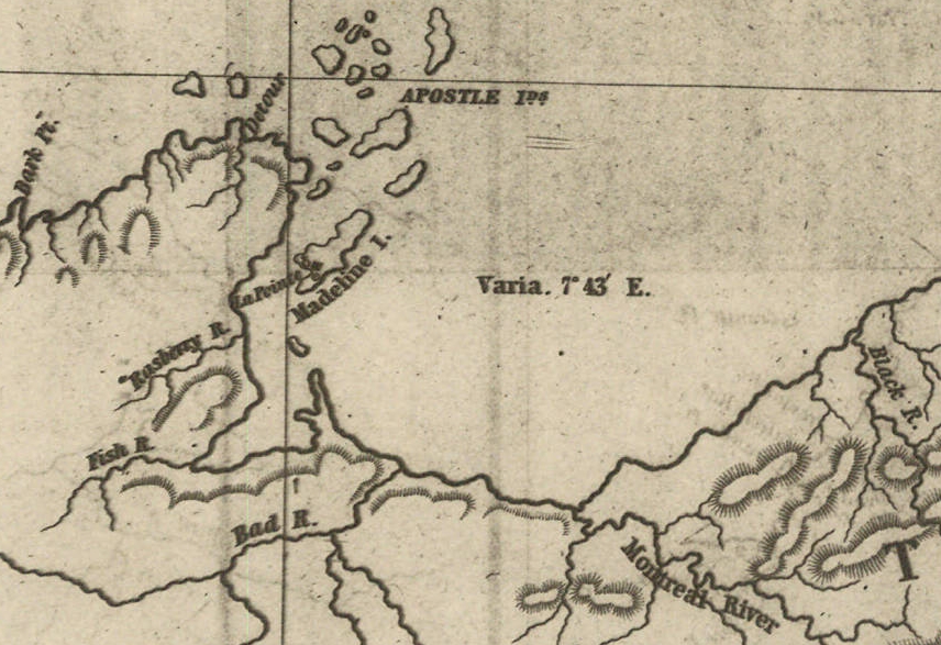
Detail of the Montreal River, La Pointe, and Chequamegon bay from from Map of the Mineral Lands Upon Lake Superior Ceded to the United States by the Treaty of 1842 With the Chippeway Indians.
~ Wisconsin Historical Society
The nearest approach the trap-rock hills make to the lake-shore, beyond the Porcupine mountain, is on the Montreal river, a short distance above the falls. Beyond Montreal river, to La Pointe, we found red-clay cliffs, based on red sand-stone, to occur. Indeed, this combination frequently occurred at various sections of the coast – beginning, first, some miles west of the Portage.
From Copper harbor to Agate harbor is called 7 miles; to Eagle river, 20 miles; to the Portage, 40 miles; to the Ontonagon, 80 miles; to La Pointe, from Copper harbor, 170 miles. From the latter place to the river Brulé is about 70 miles; up which we expect to ascend for 75 miles, make a portage of three miles to the St. Croix river, and descend that for 300 miles to the Mississippi river.
Painting of Professor Douglass Houghton by Robert Thom. Houghton first explored the south shore of Lake Superior in 1840, and died on Lake Superior during a storm on October 13, 1845. Chequamegon Bay’s City of Houghton was named in his honor, and is now known as Houghton Falls State Natural Area.
Going back to Eagle river, at the time of our visit, we found at the mine Mr. Henshaw, Mr. Williams, and Dr. Jackson of Boston, and Dr. Houghton of Michigan, who was passing from Copper harbor to meet his men at his principal camp on Portage river, which he expected to reach that night. The doctor is making a rapid and thorough survey of the country. This work he is conducting in a duplicate manner, under the authority of the United States government. It is both a topographical and geological survey. All his surveyors carry sacks, into which they put pieces of rock broken from every prominent mass they see, and carry into camp at night, for the doctor’s examination, from which he selects specimens for future use. The doctor, from possessing extraordinary strength of constitution, can undergo exposure and fatigue sufficient to break down some of the hardiest men that can be found in the West. He wears his beard as long as a Dunkard’s; has a coat and patched pants made of bed ticking; wears a flat-browned ash-colored, wool hat, and a piece of small hemp cord off a guard chain; and, with two half-breed Indians and a small dog as companions, embarks in a small bark, moving and travelling along the lake shore with great celerity.
Probably no company on Lake Superior has had a longer and harder struggle against adversity than the Phœnix. The original concern, the Lake Superior Copper Company, was among the first which operated at Lake Superior after the relinquishment of the Indian rights to this country in 1843. The trustees of this early organization were David Henshaw and Samuel Williams of Boston, and D. G. Jones and Col. Chas. H. Gratiot, of Detroit; Dr. Charles T. Jackson examined the veins on the property, and work was begun in the latter part of the year 1844. The company met with bad luck from the start, and, the capital stock having become exhausted, it has been reorganized several times in the course of its history.”
~ The Lake Superior Copper Properties: A Guide to Investors and Speculators in in Lake Superior Copper Shares Giving History, Products, Dividend Record and Future Outlook for Each Property, by Henry M. Pinkham, 1888, page 9.
We all sat down to dinner together, by invitation of Mr. Williams, and ate heartily of good, wholesome fare.
After dinner we paid a visit to the shafts at the mine, sunk to a considerable depth in two or three places. Only a few men were at work on one of the shafts; the others seemed to be employed on the saw-mill erecting near the mouth of the river. Others were at work in cutting timbers, &c.
They had also a crushing-mill in a state of forwardness, near the mine.
It is what has been said, and put forth about the value of this mineral deposite, which has done more to incite and feed the copper fever than all other things put together.
Professor Charles Thomas Jackson.
~ Contributions to the History of American Geology, plate 11, opposite page 290.
Dr. Jackson was up here last year, and has this year come up again in the service of the company. Without going very far to explore the country elsewhere, he has certainly been heard to make some very extravagant declarations about this mine,- such as that he “considered it worth a million of dollars;” that some of the ore raised was “worth $2,000 or $3,000 per ton!” So extravagant have been the talk and calculations about this mine, that shares (in its brief lease) have been sold, it is said, for $500 per share! – or more, perhaps!! No doubt, many members of the company are sincere, and actually believe the mine to be immensely valuable. Mr. Williams and General Wilson, both stockholders, strike a trade between themselves. One agrees or offers to give the other $36,000 for his interest, which the other consents to take. This transaction, under some mysterious arrangement, appears in the newspapers, and is widely copied.
Without wishing to give an opinion as to the value and permanency of this mine, (in which many persons have become, probably, seriously involved,) even were I as well qualified to do so as some others, I can only state what are the views of some scientific and practical gentlemen with whom I fell in while in the country, who were from the eastern cities, and carefully examined the famous Eagle river silver and copper mine. I do not allude to Dr. Houghton; for he declines to give an opinion to any one about any part of the country.
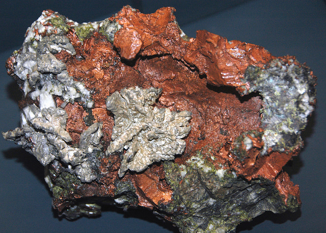
“The remarkable copper-silver ‘halfbreed’ specimen shown above comes from northern Michigan’s Portage Lake Volcanic Series, an extremely thick, Precambrian-aged, flood-basalt deposit that fills up an ancient continental rift valley.”
~ Shared with a Creative Commons license from James St. John
They say this mine is a deposite mine of native silver and copper in pure trap-rock, and no vein at all; that it presents the appearance of these metals being mingled broadcast in the mass of trap-rock; that, in sinking a shaft, the constant danger is, that while a few successive blasts may bring up very rich specimens of the metals, the succeeding blast or stroke of the pick-axe may bring up nothing but plain rock. In other words, that, in all such deposite mines, including deposition of diffused particles of native meteals, there is no certainly their PERMANENT character. How far this mine will extend through the trap, or how long it will hold out, is a matter of uncertainty. Indeed, time alone will show.
It is said metallic veins are most apt to be found in a permanent form where the mountain limestone and trap come in contact.
I have no prejudice against the country, or any parties whatever. I sincerely wish the whole mineral district, and the Eagle mine in particular, were as rich as it has been represented to be. I should like to see such vast mineral wealth as it has been held forth to be, added to the resources of the country.
Unless Dr. Pettit has succeeded in fixing the vein of black oxide in the side of the mountain or hill, it is believed by good judges that no permanent vein has yet been discovered, as far as has come to their knowledge, in the country!! That much of the conglomerate and trap-rock sections of the country, however, presents strong indications and widely diffused appearances of silver and copper ores, cannot be denied; and from the great number of active persons engaged in making explorations, it is possible, if not probable, that valuable veins may be discovered in some portions of the country.
To find such out, however, if they exist, unless by accident, must be the work of time and labor – perhaps of years – as the interior is exceedingly difficult, or rather almost impossible, to examine, on account of the impenetrable nature of the woods.
During our long and tedious journey, we were favored with a good deal of fine weather. We however experienced, first and last, five or six thunderstorms, and some tolerably severe gales.
Coasting for such a great length, and camping out at night, was not without some trials and odd incidents – mixed with some considerable hardships.
On the night before we reached La Pointe, we camped on a rough pebbly beach, some six or eight miles east of Montreal river, under the lea of some high clay cliffs. We kindled our fire on what appeared to be a clear bed of rather large and rounded stones, at the mouth of a gorge in the cliffs.

Topographic map of the gorge in the cliffs at Little Girl’s Point County Park.
~ United States Geological Survey
Next morning early, the fire was rekindled at the same spot, although some rain had falled in the night it being still cloudy, and heavy thunder rolling, indicating an approaching storm. I had placed some potatoes in the fire to roast, while some of the voyageurs were getting other things ready for breakfast; but before we could get anything done, the rain down upon us in torrents. We soon discovered that we had kindled our fire in the bed of a wet weather creek. The water rapidly rose, put out the fire, and washed away my potatoes.
We had then to kindle a new fire at a higher place, which was commenced at the end of a small crooked log. One of the voyageurs had set the frying-pan on the fire with an Indian pone or cake an inch thick, and large enough to cover the bottom it. The under side had begun to bake; another hand had mixed the coffee, and set the coffee-pot on to boil; while a third had been nursing a pot boiling with pork and potatoes, which, as we were detained by rain, the voyageurs thought best to prepare for two meals. One of the part, unfortunately, not observing the connexion between the crooked pole, and the fire at the end of it, jumped with his whole weight on it, which caused it suddenly to turn. In its movement, it turned the frying-pan completely over on the sand, with its contents, which became plastered to the dirt. The coffee-pot was also trounced bottom upwards, and emptied its contents on the sand. The pot of potatoes and pork, not to be outdone, turned over directly into the fire, and very nearly extinguished it. We had, in a measure, to commence operations anew, it being nearly 10 o’clock before we could get breakfast. When near the Madelaine islands, (on the largest of which La Pointe is situated,) the following night, our pilot, amidst the darkness of the evening, got bewildered for a time, when we thought best to land and camp; which, luckily for us, was at a spot within sight of La Pointe. Many trifling incidents of this character befell us in our long journey.
Lake Bands:
“Ki ji ua be she shi, 1st [Chief].
Ke kon o tum, 2nd [Chief].”
Pelican Lakes:
“Kee-che-waub-ish-ash, 1st chief, his x mark.
Nig-gig, 2d chief, his x mark.“
Lac Courte Oreilles Band:
At the mouth of the Montreal river, we fell in with a party of seventeen Indians, composed of old Martin and his band, on their way to La Pointe, to be present at the payment expected to take place about the 15th of August.
They had their faces gaudily painted with red and blue stripes, with the exception of one or two, who had theirs painted quite black, and were said to be in mourning on account of deceased friends. They had come from Pelican lake (or, as the French named it, Lac du Flambeau,) being near the headwaters of the Wisconsin river, and one hundred and fifty miles distant. They had with them their wives; children, dogs, and all, walked the whole way. They told our pilot, Jean Baptiste, himself three parts Indian, that they were hungry, and had no canoe with which to get on to La Pointe. We gave them some corn meal, and received some fish from them for a second supply. For the Indians, if they have anything they think you want, never offer generally to sell it to you, till they have first begged all they can; then they will produce their fish, &c., offering to trade; for which they expect an additional supply of the article you have been giving them. Baptiste distributed among them a few twists of tobacco, which seemed very acceptable. Old Martin presented Baptiste with a fine specimen of native copper which he had picked up somewhere on his way – probably on the headwaters of the Montreal river. He desired us to take one of his men with us to La Pointe, in order that he might carry a canoe back to the party, to enable them to reach La Pointe the next day, which we accordingly complied with. We dropped him, however, at his own request, on the point of land some miles south of La Pointe, where he said he had an Indian acquaintance, who hailed him from shore.
Having reached La Pointe, we were prepared to rest a few days, before commencing our voyage to the Mississippi river.
Of things hereabouts, and in general, I will discourse in my next.
In great haste I am,
Very respectfully,
Your obedient servant,
MORGAN.
To be continued in La Pointe…
Wisconsin Territory Delegation: Copper Harbor
April 11, 2016
By Amorin Mello
A curious series of correspondences from “Morgan”
… continued from Mackinac and Sault Ste Marie.
The Daily Union (Washington D.C.)
“Liberty, The Union, And The Constitution.”
July 22, 1845.
TERRITORY OF WISCONSIN.

“The Wisconsin Territorial Seal was designed in 1836 by John S. Horner, the first secretary of the territory, in consultation with Henry Dodge, the first territorial governor. It features an arm holding a pick and a pile of lead ore.”
~ Wisconsin Historical Society
Gen. Henry Dodge, having been re-appointed Governor of the Territory, from which he had been “so ingloriously ejected after the election of 1840, by his political opponents, his valuable services” have ceased as a member of Congress. It became necessary, of course, to elect another delegate. To choose a candidate for this office, a democratic convention was held at the capitol, in Madison, on the 25th June. Horatio N. Wells, of Milwaukie, was elected president; 18 ballots were taken before any one obtained a majority of the votes. Mr. Morgan L. Martin finally received 49, D. A. J. Upham 20, scattering 10. Mr. Martin accepts the nomination.
The Daily Union (Washington D.C.)
“Liberty, The Union, And The Constitution.”
July 29, 1845.
[From our regular correspondent.]
COPPER HARBOR, LAKE SUPERIOR,
JULY 15, 1845.
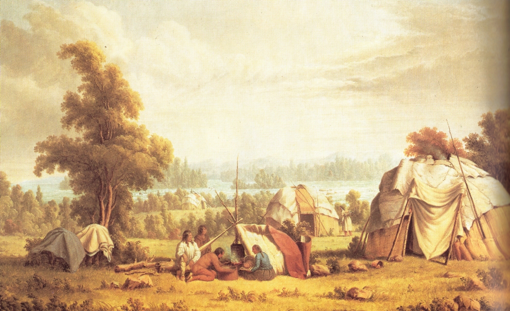
“Ojibwa village near Sault Ste Marie” by Paul Kane in 1845.
~ Wikipedia.org
Having chartered a Mackinac boat at the Sault St. Marie, and stored away our luggage, tents, provisions, with general camp equipage, &c., taking on board six able-bodied voyageurs, consisting of four descendants of Canadian French, and two half-breed Indians, (one of whom acted as our pilot,) we set off, on the 4th of July, at about 11, a.m., to coast it up the southern shore of Lake Superior, to Copper Harbor – a distance, by the way we were to travel, of over 280 miles.
The heat of the sun, combined with the attacks of musquitoes at night, annoyed us very much at first. I have seen what musquitoes are in many other parts of the world; but I never found them more abundant and troublesome than at some points on Lake Superior.
It took us eleven days’ voyaging to reach this place, travelling all day when the weather was favorable, and lying by when it became stormy, with strong head winds. At night we camped on shore, and generally rose every morning between three and four o’clock, being under way on the water as soon as it was light enough to see. In voyaging in this way, we had a better opportunity to view the country as we passed along, many portions of which were full of interest – such as the Grand Sable, the Pictured Rocks, &c. The former are immense cliffs, rising to the height of two hundred feet above the level of the lake, being composed of pure sand, and reaching about six miles in length along the lake shore, with its front aspects almost perpendicular. It is said, the sand of which they are formed maintains its perpendicularity by reason of the moisture which it derives from the vapor of the lake. The summits contain no vegetation, save here and there a solitary shrub or bush. The rest of this high, bold, and solemn mass stretches out, in silent and naked grandeur, beneath the horizon, forming a picture of desolate sublimity. We passed it late in the afternoon, during a bright and clear sky, when the sun had just begun to hide himself behind its huge masses.
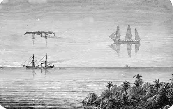
“Once a vessel was sailing over a northern ocean in the midst of the short, Arctic summer. The sun was hot, the air was still, and a group of sailors lying lazily upon the deck were almost asleep, when an exclamation of fear from one of them made them all spring to their feet. The one who had uttered the cry pointed into the air at a little distance, and there the awe-stricken sailors saw a large ship, with all sails set, gliding over what seemed to be a placid ocean, for beneath the ship was the reflection of it.”
~ Round-about Rambles in Lands of Fact and Fancy, by Frank Richard Stockton, 1910, page 277.
I have never travelled on a sheet of water where the effect of mirage is so frequently witnessed as on Lake Superior. For instance: early on Sunday morning, the 6th of July, soon after leaving our encampment, near White Fish Point, the morning being slightly foggy, we saw distinctly the Grand Sable, which must have been fifty miles in advance of us, with intervening points of land. I witnessed a similar instance of mirage when coming through Lake Huron. Early one morning, I distinctly saw Drummond’s island, which the officers of the boat assured me was eighty miles off!
I have never seen an atmosphere through which I could discern objects so far as on Lake Superior. Cliffs, headlands, islands, and hills, which often appeared as if within a mile or two of us, were found, on being approached, to be from five to ten miles off. Hence, in making what “voyageurs” called “traverses” – that is, a passage in a direct line from one headland to another, instead of curving with the shore of the lake – inexperienced voyageurs are very liable to be deceived, by supposing the distance to be short, when it is in reality very long. In making which, should a strong wind spring up from shore, a small boat would be liable to be blown out to sea, and the boat and people run the hazard of being lost. We had some brief but painful experience of this deception in apparent distance, by attempting one morning, after having camped at the mouth of the Dead river, to sail before what seemed to be a fair wind from Presqu’isle to Granite Point; but we had not made much over half the distance, when the wind suddenly changed to the west, and blew a gale on our beam, and we came very near being blown out into the open lake – which is just about equivalent to being blown into the Atlantic, for the storms are just as strong, and the waves roll equally as high. Finding we were going to leeward, we dropped sail, and took to our oars; and, although within half a mile of the point we wished to make, it took us hard oaring for about an hour to reach it.

“Pictured Rocks Splash © Lou Waldock”
~ National Park Service
I have never seen a sheet of water, where the wind can succeed in so suddenly throwing the water into turbulent waves, as on Lake Superior. This is owing to its freshness, making it so much lighter than salt water. One night, just as we had oared past a perpendicular red sandstone cliff a mile or two in length, where it would have been impossible for us to make a landing, and had reached a sand beach at the mouth of a small river, where we camped, the surface of the lake up to that time being as smooth as glass, we had no sooner pitched our tents, than a violent wind sprang up from the northeast, and blew a gale nearly all night, shifting from one point to another. In fifteen or twenty minutes after the commencement of the blow, the water of the lake seemed lashed into a fury of commotion, in which our boat could scarcely have survived.
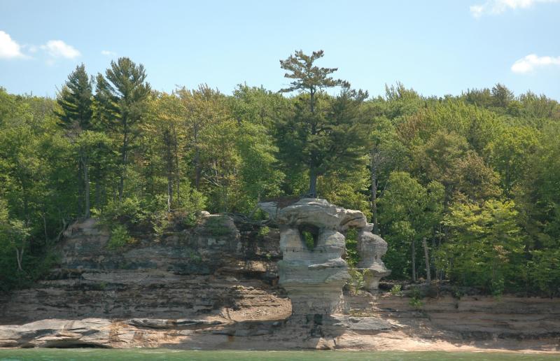
The grandest scenery beheld in the whole route was that presented by the celebrated “Pictured Rocks.” They lie stretched out for nine miles in length, a little east of Grand island. They are considered very dangerous to pass by voyageurs, who generally select favorable spells of weather for the trip.
“Grand Sable Dunes”
~ National Park Service
On the morning of Tuesday, the 8th instant, soon after leaving our camp, the fog cleared up, sufficient to give us a glimpse of these stupendous sandstone cliffs. As the sun rose, the fog became dispersed, and its brilliant beams fell upon and illuminated every portion of them.
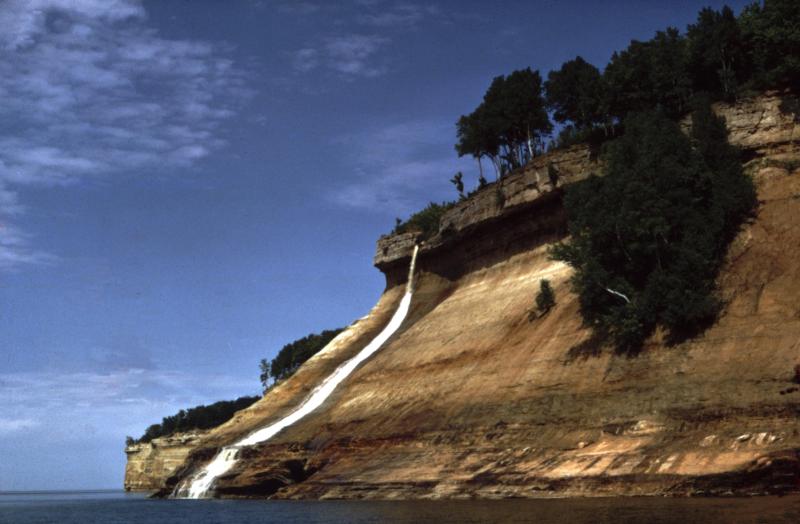
They rise in perpendicular walls from the water of the lake shore, to the height of from 200 to 300 feet. They are so precipitous, that they in some places appear to lean over the lake at top, to which small trees are seen leaning over the lake, hanging by their frail roots to the giddy crags above. At one point, a small creek tumbles over a portion of them in a cascade of 100 feet in height. They stretch for nine miles in length, and in all that distance there are only two places where boats can land – one cove being called the Chapel, and the second Miner’s river.
Photograph of “Chapel Rock” by David Kronk.
~ National Park Service
“Bridalveil Falls”
~ National Park Service
So deep is the water, that a boat can pass close along shore, almost touching the cliffs. Indeed, a seventy-four-gun ship can ride with perfect safety within ten feet of their base. Taken altogether, their solemn grandeur, and the awful sublimity of their gigantic forms and elevation, far surpass anything of the kind, probably, on the continent, if not in the world. Next to the Falls of Niagara, they are the greatest natural curiosity they eyes of man can behold. When steamboats are introduced on Lake Superior, they cannot fail to attract the attention of the tourist. They contain vast caves, one of which is only 30 feet wide at its mouth, but, on entering it, suddenly expands to 200 feet in width, beneath a lofty dome of 200 feet high. Different portions of the cliffs go by different names – such as the “Portailles,” the “Doric Rock,” the “Gros Cap,” the “Chapel,” &c. We went into a small bay at the base of the “Chapel,” which consists of an immense mass of rude sandstone, with trees growing on it, expanded in the form of an arch, its extremities resting on irregularly shaped columns, to the number of three or four under each end. Beneath the arch, a deep gorge enters the lake, crowded and choked with luxuriant vegetation. It appeared to me like the finest and most natural Druidical altar to be seen anywhere, not excepting even Stonehenge. Near the Chapel, a brisk little stream falls rapidly over the rocks into the water below. It is impossible to do justice to the splendid appearance of “the Pictured Rocks,” so called on account of the [???? ????? ???????] composed being mixed with iron ore, drippings from which they have stained the surface of the rocks with a variety of tints. The painter alone can convey any just image to the mind’s eye of these grand cliffs, and they will afford him a hundred views, every one of which will differ from the other. I will defy anybody to visit them, as we did, on a clear, bright day, when the lake is smooth, in an open boat, close by the side of them, without having his expectations of their natural grandeur far surpassed.
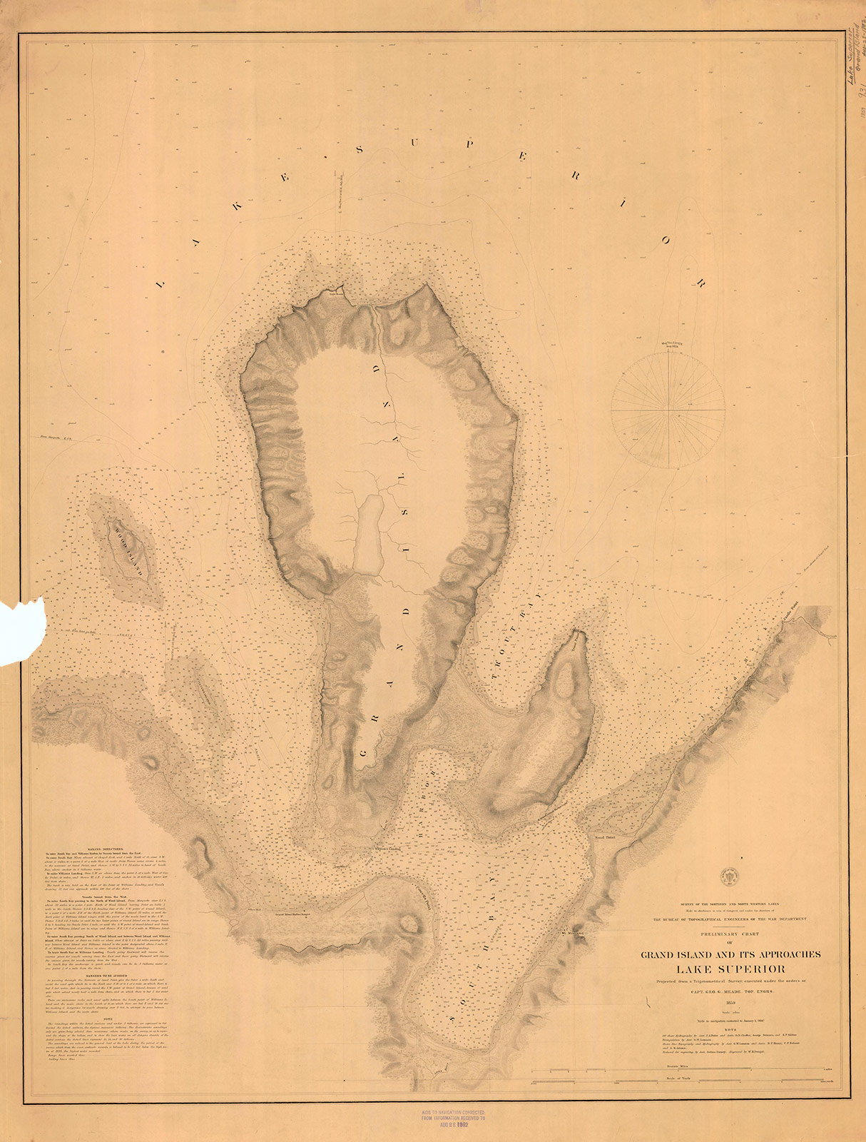
“Preliminary Chart of Grand Island and Its Approaches, Lake Superior, 1859″
~ Maritime History of the Great Lakes
Boats have sometimes been caught in the Chapel by sudden, high, and contrary winds, and compelled to remain there for three or four days, before being able to proceed. A few miles beyond the “Pictured Rocks,” we came to Grand Island, where, entering its harbor, we stopped at Mrs. Williams’s place, the only settlement on the island, which is very large. This is one of the most splendid and safe harbors on Lake Superior – perfectly land-locked on every side, and extensive enough to contain a large fleet of vessels, being easy of ingress or egress. From Grand Island we continued to persevere in our voyage, and finally reached Copper Harbor, via the Anse, in eleven days from the Sault Ste. Marie.
“The beginning of Methodism in the Upper Peninsula of Michigan west of Sault Ste. Marie is credited to the missionary trail blazers who came to Kewawenon, now known as Keweenaw Bay. The first, in 1832 with John Sunday a converted Canadian Indian. In 1833 Rev. John Clark continued the mission work started by Sunday. He was followed by Rev. Daniel Chandler in 1834 who remained here for two years. Rev. Clark was appointed Superintendent of Lake Superior Missions in 1834 and was instrumental in having a mission house and church school house erected during Rev. Chandler’s mission stay. Houses for the local natives were also erected along the lake shore in the vicinity of the present Whirl-I-Gig Road”
At the Anse we fell in with Mr. Ord, the United States Indian agent at the Sault Ste. Marie, who was on a visit to the Indians at that point, to take the census, and to hold a talk with their chiefs in council. We arrived at the Anse a few hours before the council began. The chiefs all sat around a hall on wooden benches, while Mr. Ord, with the interpreter, was seated at the head of the circle. Many of the Indians were fine-looking men. They had a great many petty grievances to relate to the agent, who listened to them with patient attention. The Chippewas about the Anse are said to be much better off than those who trade to La Pointe, at the upper end of the lake.
The Methodists have a missionary station and school on the east side of the bay of Keweewena, and near its head; around which there is an Indian village, consisting of 600 or 700 souls. The Catholics have also a missionary station on the opposite side of the bay, which is here only about a mile or two wide.

Reverend William Hadley Brockway: “The first Methodist minister licensed to preach in the State of Michigan.”
~ Geni.com
The government employs at this Indian post one blacksmith, (Mr. Brockaway,) one carpenter, (Mr. Johnson,) and one teacher, in the person of the Methodist minister. We left the Anse about half-past 4 o’clock, p.m., sailing before a fair wind, reaching the mouth of the Portage, or Sturgeon river, where we camped on a flat point of land severely infested by musquitoes, with the heat equal to any in intensity (which had prevailed during the day) that I ever experienced. At Fort Wilkins, Copper Harbor, on the same day, I have since learned the mercury rose to 100° in the shade. This would seem to be a tremendous degree of heat for such a high latitude, the fort standing on the parallel of 47° 30′.

Detail of “Keewaiwona Bay” with “Anse” and the “Old Indian Village” from Map of the Mineral Lands Upon Lake Superior Ceded to the United States by the Treaty of 1842 With the Chippeway Indians.
~ Wisconsin Historical Society
During the night, we could occasionally hear the plunges of sturgeon floundering in the water, which abound in this lake river. A thunder-storm, also, passed near, before day, which had the effect to cool the air. About half-past 1 o’clock, I was awakened by the loud talk and whooping of Indians, carried on between our Indian half-breed pilot, Jean Baptiste, and a lot of freshly-arrived Indian voyageurs, conducted in the Indian dialect. On looking out of our tent, I discovered a plain-dressed Yankee-looking man, standing in front of it. On hailing him, he proved to be the Rev. Mr. Brockaway, a Methodist minister, and superintendent of Indian missions in this part of the world. He had been on a visit to the missions at the upper end of the lake, and was returning to the Anse, which he was anxious to reach in time to attend to Sunday morning service, (the next day being Sunday,) and from whence he expected to proceed to the Sault Ste. Marie, where he is stationed in the capacity of chaplain to the garrison at that post. He said he had, on reaching our encampment, travelled that day from the Ontonagon river, 80 miles distance, in a bark canoe, accompanied by four Indian voyageurs. After the Indians had prepared some food, with tea, of which Mr. B. and themselves partook, they again set off for the Anse, about 15 miles from us, where they must have arrived at a very early hour. This despatch far exceeded the expedition of our movements, and displayed unusual activity on the part of the enterprising missionary of an extensive and practical church organization.
We rose at three a.m., and in half an hour were under way on the lake. In these latitudes it is light at three in the morning; twilight continuing till eight and nine in the afternoon.
The following night we camped near the mouth of Little Montreal river, in full view of the high mountains or large round hills of trap rocks running along the peninsula of Keweewena towards its extreme point, some of which rise to the elevation of eight hundred feet above the level of the lake.
The next day, after some detention, we reached Copper Harbor, and landed near the United States Mineral Agency on Porter’s island, where we found quite a village, consisting of white canvas tents of various sizes and forms, occupied by miners, geologists, speculators, voyageurs, visitors, &c.
The only tenement on the island is a miserable log-cabin, in which General Stockton, for the want of better quarters, is compelled to keep his office. The room which he occupies, is only about eight feet square – just large enough to admit a narrow bed for himself, a table, and two or three chairs. In this salt-box of a room, he is compelled to transact all the business relating to the mineral lands embraced within this important agency. As many as a dozen men at a time are pressing forward to his “bee gum” apartment, endeavoring to have their business transacted.
The office of the surveyor of this mineral lands, in charge of Mr. Gray, at this agency, is still worse adapted to the transaction of public business. He is compelled to occupy the garret of the log-cabin, with a hole cut through the logs in the gable to serve as a window. In this garret he is obliged to have all his draughting performed, subject to the constant interruption of parties wishing to see plans of the mineral lands. It would seem almost impossible, under such circumstances, for the officers to avoid making mistakes; yet, by dint of unwearied labor and attention to their official duties, they have conducted their affairs with an accuracy and despatch highly creditable to them.
The government has been fortunate in the selection of its agents in the mineral region of Lake Superior. To untiring industry, punctuality, and close attention to business, they unite, in a high degree, the bland, mild, and patient bearing of gentlemen.
Gen. Stockton’s labor are severe and perplexing. He is continually beset by crowds of applicants for locations, all anxiously pressing forward to secure leases for copper-mines – among whom are found some utterly reckless of all principles of justice and equity, who endeavor to bend the agent into a compliance with their unjust and unreasonable demands – such as wishing him to supersede prior locations for their benefit, or to grant locations evidently intended to cover town sites, beyond the bounds of his agency, where no mineral exists, which he has no authority to grant; and because he has, in every instance of the kind, resisted their unreasonable applications, he has not escaped making a few enemies among such persons, who are collecting together to abuse and misrepresent him. Considering the cramped quarters furnished him by the government, and the great rush of people upon him from all quarters, under the excitement of a copper fever raging at its height, and many anxious to obtain exclusive advantages, it is surprising how he has succeeded so well as he has done in giving such general satisfaction. His official duties are discharged with a promptitude, fidelity, firmness, and impartiality, which are creditable to the public service. He seems peculiarly fitted, both by habit and nature, for the discharge of the responsible duties involved in the administration of an agency established in a wild an uninhabited country, being traversed at present by bands of people in search of mineral treasures, as diversified in character, dispositions, &c., as the various sections of country from whence they come – many of whom are by no means scrupulous as to the means for promoting their own interest – who probably suppose they can play the same game in the copper mineral region that was practiced in the early leasing of the lead mineral districts of Illinois: that is, seize upon government lands, work and raise mineral ore, cheat the government, and sell rights, where they have never had a claim.
It is enough to say that, while such men as Gen. Stockton, Major Campbell, and Mr. Gray, remain in office on the southern shore of Lake Superior, all such desperadoes will be completely foiled and disappointed. The frauds committed on the government in the working of the lead-mines, cannot be repeated in the copper mineral region of the United States. When fraudulently-inclined adventurers find they cannot make the faithful officers of government stationed in this quarter swerve from the strict and impartial discharge of their duty, they will probably unite for the purpose of operating upon government to procure their removal, and endeavor to get men in their places more likely to act as plaint tools in promoting their selfish ends.
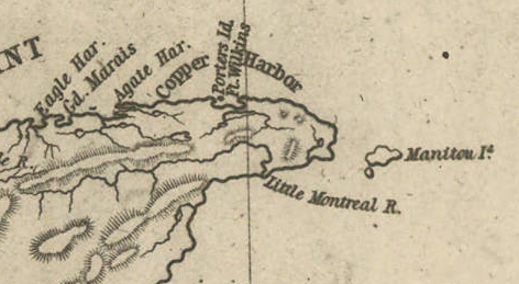
Detail of Porter’s Island, Fort Wilkins, Copper Harbor, Agate Harbor, Eagle Harbor, and Little Montreal River along the tip of the Keweenaw Peninsula from Map of the Mineral Lands Upon Lake Superior Ceded to the United States by the Treaty of 1842 With the Chippeway Indians.
~ Wisconsin Historical Society
The agency being on a narrow small island, half a mile from the mainland, makes it very inconvenient. The island does not afford sufficient timber for fire-wood, and in winter is isolated by ice, &c. It should by all means be removed to the main shore, and placed near Fort Wilkins, which is nearly two miles distant on the main land, or removed up to Eagle Harbor, which is a far preferable and more convenient site for the agency.
There is no question by the great range of trap-rock, running parallel with the southern shore of Lake Superior for a great distance, is [????????] with many valuable veins of copper ore; but to find them and develop them, must be the work of time. The impenetrable stunted forest seems to be little else than a thick, universal hedge, formed by the horizontal interlocked limbs of dwarf white cedars, intermingled with tamarack, birch, and maple. Persons who attempt to penetrate through them, without being protected by a mail of dressed buck-skin, have their clothes soon slit and torn from their bodies in shreds.
Painting of Professor Douglass Houghton by Robert Thom. Houghton first explored the south shore of Lake Superior in 1840, and died on Lake Superior during a storm on October 13, 1845. Chequamegon Bay’s City of Houghton was named in his honor, and is now known as Houghton Falls State Natural Area.
Dr. Houghton says, so considerable is the attraction of the trap-rock for the needle, that, on many places, when surveying over its ranges, he cannot rely upon it, and is compelled to run his lines by the sun and stellar observations.
So far as practicable mining operations have progressed in the country, the following seems to be the result:
At Eagle river several locations are being worked, superintended by Col. Gratiot, and on which from 70 to 80 men are employed.
At Agate Harbor another company have this season commenced operations under the direction of Mr. Larned, of New York, in whose service from 15 to 20 laborers find employment.
At Copper Harbor a company from Pittsburg are working a vein of black oxide of copper, under the superintendence of Dr. Pettit, who has from 30 to 40 hands employed under him. Besides these, there are other small parties at work in various directions. So that it would appear that mining in the United States copper mineral lands has fairly commenced.
Up to this time, the returns made to the agency by two of the above companies – the Eagle River, alias Boston Company, and the Pittsburg Company – amount to the following quantities of ore: The former have raised 500,000 lbs. of ore, worth not less than $125 per ton. The latter company have raised 6,670 lbs. of the black oxide copper ore, the value of which I do not exactly know.
Other companies are organizing for mining purposes, and will probably commence operations the present, or early in the next season.
The country still in the possession of the Chippewa Indians, embraced between the northwestern part of the lake and the British frontier, along Pigeon river, might be easily obtained from them by treaty. And, if poor in mineral wealth, it is a very rich soil and a good agricultural country; and by its acquisition we should at once extend and square out our possession and settlements to the British frontier, which should be protected by detached forts, extending along our lines, towards the Lake of the Woods. According to the present Indian boundary, it is made to pass along the water-line of the lake shore, from Pigeon river, around Fond du Lac; and when some distance east and south of the lake, strikes a straight line west from the Mississippi. The United States, by being cut off by this water-line from all landing sites for harbors or fortifications for one or two hundred miles of the western and northern shore of the lake, will be subject to great inconvenience.
The number of persons at present exploring or visiting the mineral region of Lake Superior, is supposed to amount to five hundred or more. The water of the lake, especially in deep places is remarkably fine and cool for drinking. The surface of the water in the upper part of the lake is said to be 900 feet above the level of the Atlantic. The shores of this great lake are, at many places, bold, high, grand, and solitary – the favorite resort of large eagles, several of which we saw – one, in particular, was a splendid specimen of the bald eagle. The lake abounds in white fish, trout, siskomit, and bass.

The Siscowet, or Fat Trout, is a subspecies of Lake Trout. Drawn by David Starr Jordan, and Barton Warren Evermann, 1911.
~ University of Washington
We caught fine trout almost every day during our voyage, by trailing a hook and line at the end of our boat. On the 13th inst., (the day before reaching Copper Harbor) we caught four fine large trout.
The scenery, climate, &c., of Lake Superior, strike the traveller as being peculiar, and something very different from what is met with in any part of the United States. Game is not abundant. With the exception of a porcupine, and a squirrel or two, we succeeded in killing nothing. Wild fowl, pigeon, and ducks are more plentiful. we killed many of the former, and two pheasants, during our trip. Our half-breed Indians skinned and dressed our porcupine for us, whose flesh we found quite palatable.
At one point I purchased the hind-quarters of a beaver, which some Indians had killed. The tail being considered a great delicacy, I sent it to Mr. Ord and party, who were then travelling in a separate boat, in company with us. We found the beaver meat, when dressed, most delicious food.
Our party, although sleeping in and exposed to showers for a day or two, all enjoyed excellent health. Many voyageurs are attacked with dysentery, but it is very slight, and easily overcome by the use of simple medicine.
I remain yours,
Very truly and respectfully,
MORGAN.
