Bishop Baraga Crosses Lake Superior
February 18, 2025
Collected & edited by Amorin Mello

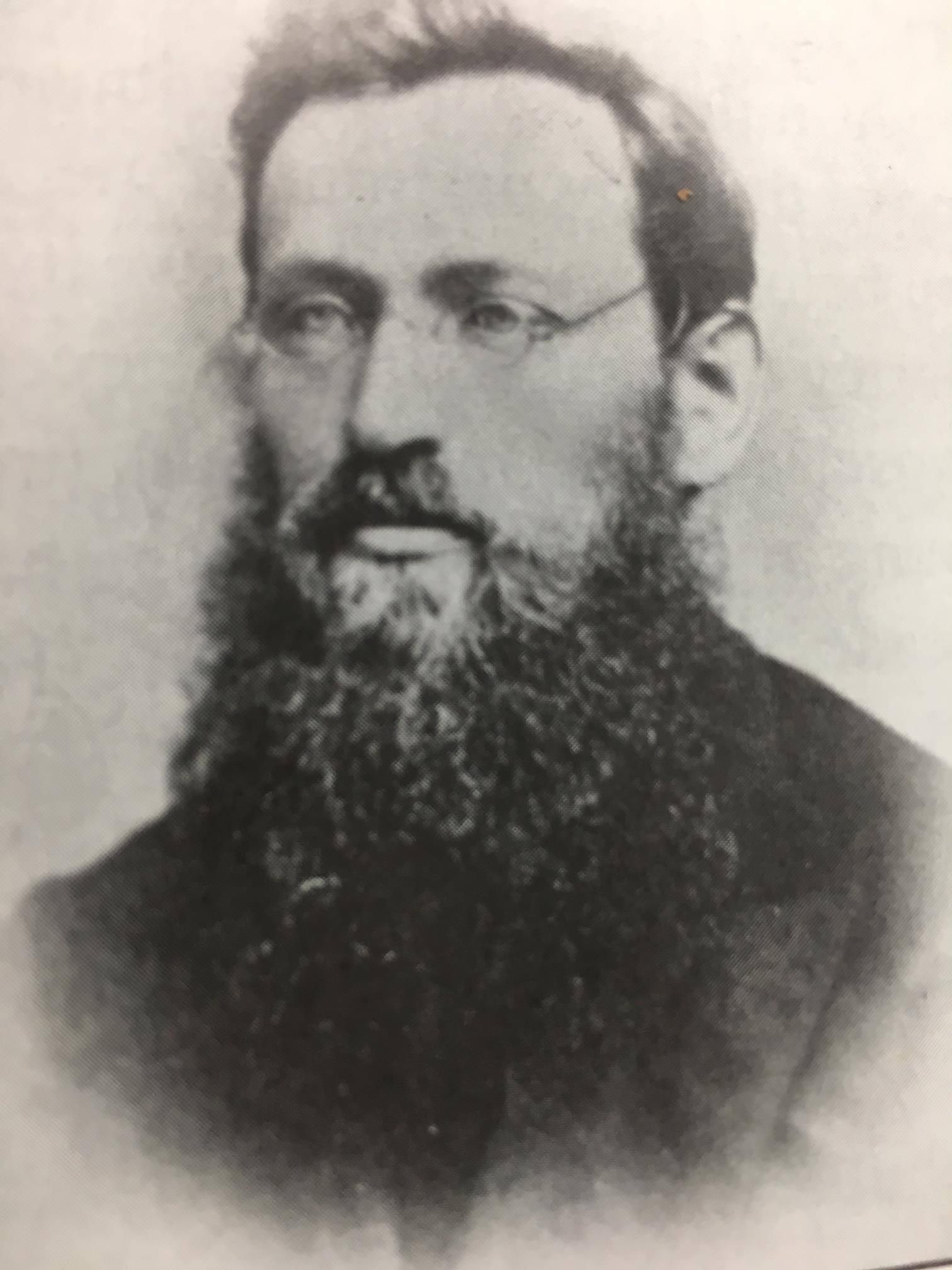
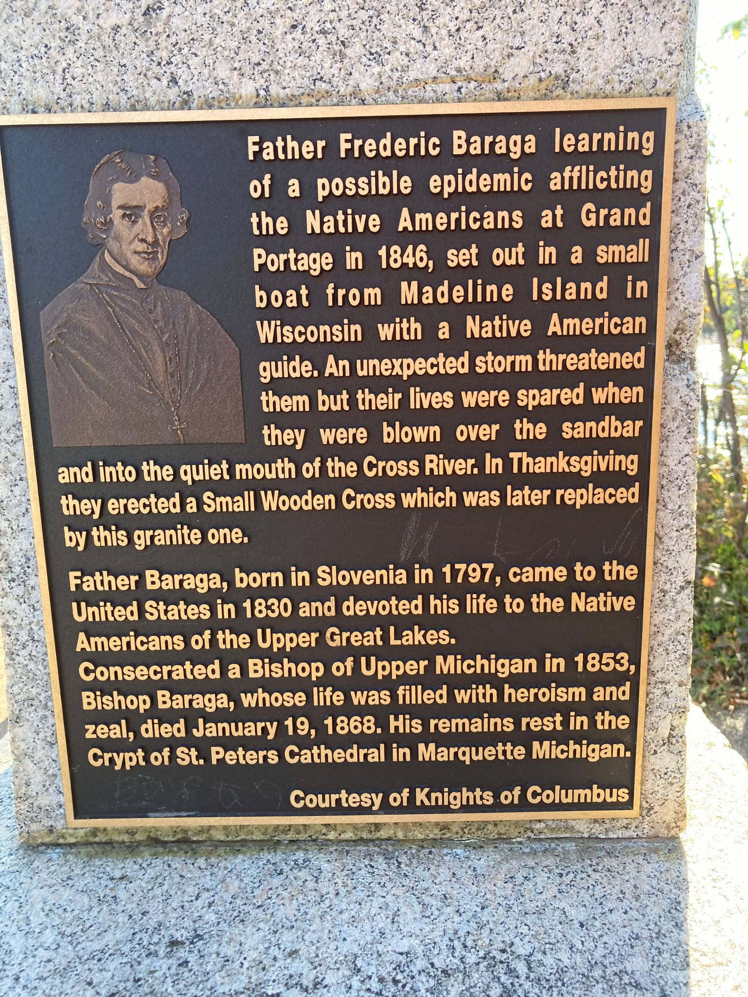
Bishop Irenaeus Frederic Baraga
~ Madeline Island Museum
This post features oral legends recorded about two of Bishop Irenaeus Frederick Baraga’s traverses from La Pointe across Lake Superior:
A) to Minnesota’s Cross River by canoe.
B) to Michigan’s Ontonagon River by ice.
In chronological order of publication, the first record was from a German traveloguer, the next two were from Catholic missionaries, and the last two were from Bad River tribal members.
- Kitchi-Gami, by Johann Georg Kohl, 1859/1860.
- Life and Labors of Bishop Baraga, by Rev. Chrysostom Verwyst, 1896.
- Life and Labors of Rt. Rev. Frederick Baraga, by Rev. Verwyst, 1900.
- Chippewa Indian Historical Project, by United States WPA, 1936-1942.
- Chippewa Indian Historical Project, by United States WPA, 1936-1942.

Originally published in German as
Kitschi-Gami; Oder, Erzählungen Vom Obern See
by Johann Georg Kohl, 1859.
Translated and republished in English as
Kitch-Gami: Wanderings Round Lake Superior,
By Johann Georg Kohl, 1860,
Pages 180-183.

German traveloguer
Johann Georg Kohl
Du Roy: “Do you known the summer voyage our most reverend friend, your companion, once made in a birch-bark canoe right across Lake Superior? Ah! that is a celebrated voyage, which everybody round the lake is acquainted with. Indeed, there is hardly a locality on the lake which is not connected with the history of his life, either because he built a chapel there, or wrote a pious book, or founded an Indian parish, or else underwent danger and adventures there, in which he felt that Heaven was protecting him.
“The aforesaid summer voyage, which I will tell you here as companion to his winter journey, was as follows:
“He was staying at that time on one of the Islands of the Apostles, and heard that his immediate presence was required at one of the little Indian missions or stations on the northern shore of the lake. As he is always ready to start at a moment, he walked with his breviary in his hand, dressed in his black robe, and with his gold cross fastened on his breast – he always travels in this solemn garb, on foot or on horseback, on show-shoes or in a canoe – he walked, I say, with his breviary in his hand and his three-corned hat on his head, into the hut of my cousin a well-known Voyageur, and said to him: ‘Dubois, I must cross the lake, direct from here to the northern shore. Hast thou a boat ready?’
” ‘My boat is here,’ said my cousin, ‘but how can I venture to go with you straight across the lake? It is seventy miles, and the weather does not look very promising. No one ever yet attempted this “traverse” in small boats. Our passage to the north shore is made along the coast, and we usually employ eight days in it.’
” ‘Dubois, that is too long; it cannot be. I repeat it to thee. I am called. I must go straight across the lake. Take thy paddle and “couverte,” and come!’ And our reverend friend took his seat in the canoe, and waited patiently till my obedient cousin (who, I grant, opened his eyes very wide, and shook his head at times) packed up his traps, sprang after him and pushed the canoe on the lake.
“Now you are aware, monsieur, that we Indians and Voyageurs rarely make greater traverses across the lake than fifteen miles from cape to cape, so that we may be easily able to pull our boats ashore in the annoying caprices of our weather and water. A passage of twenty-five or thirty miles we call a ‘grand traverse,’ and one of seventy miles is a impossibility. Such a traverse was never made before, and only performed this once. My cousin, however, worked away obediently and cheerfully, and they were soon floating in their nutshell in the middle of the lake like a loon, without compass and out of sight of land. Very soon, too, they had bad weather.
“It began to grow stormy, and the water rose in high waves. My cousin remarked that he had prophesied this, but his pious, earnest passenger read on in his breviary quietly, and only now and then addressed a kind word of encouragement to my cousin, saying that he had not doubted his prophecy about the weather, but he replied to it that he was called across the lake, and God would guide them both to land.
“They toiled all night through the storm and waves, and, as the wind was fortunately with them, they moved along very rapidly, although their little bark danced like a feather on the waters. The next morning they sighted the opposite shore. But how? With a threatening front. Long rows of dark rocks on either side, and at their base a white stripe, the dashing surf of the terribly excited waves. There was no opening in there, no haven, no salvation.
” ‘We are lost, your reverence,’ my cousin said, ‘for it is impossible for me to keep the canoe balanced in those double and triple breakers; and a return is equally impossible, owing to the wind blowing so stiffly against us.’
” ‘Paddle on, dear Dubois – straight on. We must get through, and a way will offer itself.’
“My cousin shrugged his shoulder, made his last prayers, and paddled straight on, he hardly knew how. Already they heard the surf dashing near them; they could no longer understand what they said to each other, owing to the deafening noise, and my cousin slipped his couverte from his shoulders, so as to be ready for a swim, when, all at once, a dark spot opened out in the white edge of the surf, which soon widened. At the same time the violent heaving of the canoe relaxed, it glided on more tranquilly, and entered in perfect safety the broad mouth of a stream, which they had not seen in the distance, owing to the rocks that concealed it.
” ‘Did I not say, Dubois, that I was called across, that I must go, and that thou wouldst be saved with me? Let us pray!’ So the man of God spoke to the Voyageur after they had stepped ashore, and drawn their canoe comfortably on the beach. They then went into the forest, cut down a couple of trees, and erected a cross on the spot where they landed, as a sign of their gratitude.
“Then they went on their way to perform their other duties. Later, however, a rich merchant, a fur trader, came along the same road, and hearing of this traverse, which had become celebrated, he set his men to work, and erected at his own expense, on the same spot, but on a higher rock, a larger and more substantial cross, which now can be seen a long distance on the lake, and which the people call ‘the Cross of —–‘s Traverse.’”

Historical Collections and Researches of Michigan Pioneer and Historical Society: Vol. XXVI,
by Michigan State Historical Society, 1896,
pages 541-542.
LIFE AND LABORS OF BISHOP BARAGA
A short sketch of the life and labors of Bishop Baraga
The Great Indian Apostle of the Northwest.
By Rev. Chrysostom Verwyst O.S.F. of Ashland, Wis.
Father John Chebul arrived on Lake Superior at the Sault in October 1859 to assist his fellow Slovanian Bishop Baraga. Chebul spent the winter at Ontonagon with miners before arriving at La Pointe in May 1860.
On another occasion Father Baraga went to Ontonagon from La Pointe. We will relate the incident as told to the writer by Rev. John Cebul, of Newberry, Mich. He was well acquainted with Bishop Baraga, being a fellow countryman who had been sent to La Pointe in 1860, where he labored amongst the Chippewas of that island and Bayfield, Bad River Reserve, Superior and other places, for about thirteen years, being universally loved and esteemed by all. He says:
Bishop Baraga was intending to go on the ice to Ontonagon. He was accompanied by a man from the island. The reason they took to the ice was because it was much nearer and the walking a great deal better than on the main land. During March and April the ice on Lake Superior becomes honey-combed and rotten. If a strong wind blows, it cracks and moves from the shore if the wind blows from the land. Such fields of ice does not notice that he is in danger till he comes to the edge of the ice and then to his horror discovers a large expanse of open water between him and the mainland. Should the ice float out towards the middle of the lake or break up, he is lost. Father Baraga and his companion had traveled on the ice for some time, thinking all was right. All at once they came to the edge of the ice and saw it was impossible to reach land, as the wind had driven the ice from the shore out into the Lake. His companion became greatly alarmed. Father Baraga remained calm, praying, no doubt, fervently to Him who alone could save them. Finally the wind changed and drove the cake of ice on which they were floating to the shore. They landed at Cadotte point, about 20 or 30 miles from Ontonagon, having been carried by the wind on their ice raft about sixty miles. “See,” said the good priest to his companion, “we have traveled a great distance and yet have not labored.” It seems the good God wanted to save the saintly missionary a long and painful walk, by giving him a ride of sixty miles on a cake of ice.

Life and labors of Rt. Rev. Frederic Baraga
by P. Chrysostomus Verwyst, 1900,
pages 219-222.
“Louis Gaudin“ was one of several legendary children born to Jean Baptiste Gaudin, Sr. and Awenishen (a sister of Hole-in-the-day):
– Antoine Gordon
– Elizabeth (Gordon) Belanger
– Louison Gordon, Sr.
– Harriet (Gordon) Lemon
– John Baptiste Gordon, Jr.
– Angelique Gordon
– Joseph GordonLouison Gordon, Sr. (1814-1899) married Julia Brebant, whose sisters were married to Henry Bresette and Judge John W. Bell.Wizon is an objibwecized form of the francophone name Louison.
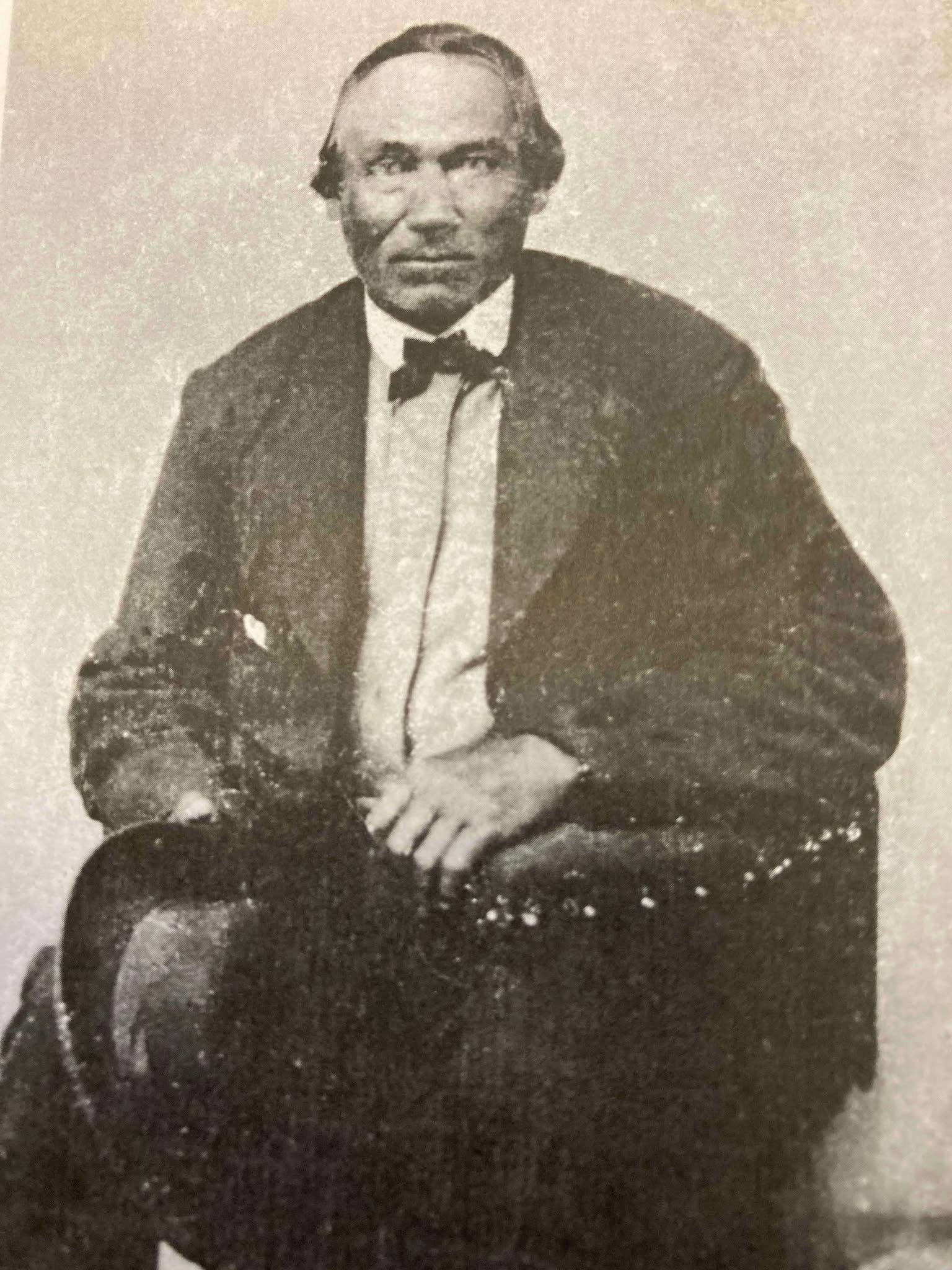
Undated photo from the Gordon Museum thought to be a brother of Antoine Gordon:
possibly Louis Gordon?

Chippewa Entrepreneur
Antoine Gordon
~ Noble Lives of a Noble Race (pg. 207) published by the St. Mary’s Industrial School in Odanah, 1909.
We learn from F. Baraga’s letter, written in October, 1845, that he intended to go to Grand Portage, Minn., the next fall to build a church there. It is, therefore, highly probable that he made that trip in the fall of 1846. He first went to La Pointe, where, no doubt, he spent some time attending to the spiritual wants of the good people. He then engaged a half-breed Indian, named Louis Gaudin, to go with him to Grand Portage. They had but a small fishing boat with a mast and sail, without keel or centre-board. Such a boat might do on a river or small lake, but would be very unsafe on a large lake, where it would easily founder or be driven lake a cork before the wind. The boat was but eighteen feet long. When they started from La Pointe, the people laughed at them for attempting to make the journey. They said it would take them a month to make the voyage, as they would have to keep close to the shore all the way, going first west some seventy miles to the end of the lake and then, doubling, turn northward, coasting along the northern shore of Lake Superior. this would make the distance about two hundred miles, perhaps even more.
However, Father Baraga and his guide set out on their perilous journey. At Sand Island they awaited a favorable wind to cross the lake, which is about forty miles wide at that place. By so doing they would save from eight to one hundred miles, but would expose themselves to great danger, as a high wind might arise, whilst they were out on the open lake, and engulf their frail bark.
They set sail on an unusually calm day. Father Baraga steered and Louis rowed the boat. Before they got midway a heavy west wind arose and the lake grew very rough. They were constantly driven leeward and when they finally reached the north shore they were at least thirty miles east of their intended landing place, having made a very perilous sail of seventy miles during that day.
While in the height of the storm, in mid-ocean, it might be said, Louis became frightened and exclaimed in Chippewa to the Father, who was lying on his back in the boat, reciting his office in an unconcerned manner: “Nosse, ki ga-nibomin, gananbatch” – Father, perhaps we are going to perish!” The Father answered quietly: “Kego segisiken, Wizon” (Chippewa for Louis) – “Don’t be afraid, Wizon; the priest will not die in the water. If he died here in the water the people on the other shore, whither we are going, would be unfortunate.”
When nearing the north shore the danger was even greater than out on the open water, for there were huge breakers ahead. Louis asked the Father whither to steer, and, as if following a certain inspiration, F. Baraga told him to steer straight ahead for the land. Through a special disposition of Divine Providence watching over the precious life of the saintly missionary, they passed through the breakers unharmed and ran their boat into the mouth of a small river, heretofore unnamed, but now called Cross River.
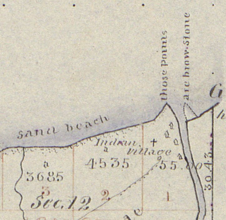
1859 PLSS detail of trees at the mouth of “Cross River”.
Full of gratitude for their miraculous escape, they at once proceeded to erect a cross. Hewing a tree in a rough manner, they cut off the top as far up as they could reach, and taking a shorter piece, they nailed it cross-wise to the tree. “Wizon,” said the Father, “let us make a cross here that the Christian Indians may know that the priest coming from La Pointe landed here.” The cross was, it is true, unartistic, but it was emblem of their holy faith and it gave the name, Tchibaiatigo-Sibi, “Cross River,” to the little stream where they landed.
They arrived none too soon. Ascending an eminence and looking out on the immense lake they saw that the storm was increasing every moment; high waves with white caps, which would surely have engulfed their little bark. They landed about six o’clock in the evening. Having spent the night there, they continued their journey next day, and in two days arrived at Grand Portage, having made the whole journey in three days. May we not think with Louis Gaudin that their safe passage across the stormy lake, and their deliverance from a watery grave, was due to a special intervention of Divine Providence in favor of the saintly missionary?

Missionary Labors of Fathers Marquette, Menard and Allouez, in the Lake Superior Region by Rev. Chrysostom Verwyst of Bayfield, 1886.
In 1667 Father Claude Allouez, S. J., then stationed at the mission of the Holy Ghost at the head of Chequamegon Bay, made the voyage across the lake from Sand Island. He made the voyage in a birch-canoe with three Indians. He remarks that they paddled their canoe all day as hard as they could without intermission, for fear of losing any of the beautiful calm weather they had. It took them twelve hours to make the trip across. The Father was then on his way to visit some Christian Indians residing at Lake Nipigon – “Animibigong” in Chippewa. For the particulars of this journey we refer the reader to “Missionary Labors of Fathers Marquette, Allouez, and Menard in the Lake Superior Region.”
The following narrative is not to be found in any of Baraga’s published letters, but the writers has it from the mouth of trustworthy persons, among whom is Father Chebul, a countryman of F. Baraga, who was stationed at Bayfield for many years. We will give the account, as we have it from Rev. F. Chebul.
Francois Newago, Sr. is the “man named Newagon” from Madeline Island, as his children were still young teenagers then.One time F. Baraga was going to Ontonagon in company with an Indian half-breed in the month of March or April. At that season of the year the ice, though thick, becomes honey-combed and rotten. Some say that Baraga’s companion was a man named Newagon. They went on the ice at La Pointe Island. As the walking on the sandy beach would have been very fatiguing and long, they determined to make straight for Ontonagon over the ice. By so doing they would not only have better walking, but also shorten their way a great deal.
A strong southwest wind was blowing at the time, and the ice, becoming detached from the shore, began drifting lakeward. After they had traveled for some time, they became aware of what hat happened, for they could see the blue waters between them and the shore. Newagon became greatly alarmed, for almost certain death stared them in the face. Had the wind continued blowing in the same direction, the ice would have been driven far out into the lake and broken up into small fragments. They would surely have perished.
To encourage the drooping spirit of his companion, F. Baraga kept telling him that they would escape all right and that they must trust in God, their loving Father and Protector. He also sang Chippewa hymns to divert Newagon’s attention and calm his excitement. Finally the wind shifted and blew the field of ice back towards the shore.
1847 PLSS detail of brownstone points, village, cross, and trailhead at the mouth of Iron River.
“Cadotte Point, near Union Bay“
appears to be located at what is now Silver City at the mouth of Iron River and eastern trailhead to the Porcupine Mountains.Michel Cadotte, Sr. ran a trading post by the Old French Fort on Madeline Island around 1800 and smaller stations scattered along the Wisconsin / Michigan shoreline of Lake Superior. Cadotte first worked for the British North West Company and later the American Fur Company after The War of 1812.They landed near Cadotte Point, near Union Bay, a short distance from Ontonagon, which they reached that same day. “See,” said the missionary to his companion, “we have traveled a great distance and have worked little.” The distance from La Pointe to Ontonagon is about sixty or seventy miles by an air line. Had they been obliged to walk the whole distance around the bend of the lake, it would probably have taken them two or three days of very hard and fatiguing traveling. So what at first seemed to threaten certain death was used by God’s fatherly providence to shorten and facilitate the saintly priest’s journey.
United States. Works Progress Administration:
Chippewa Indian Historical Project Records 1936-1942
(Northland Micro 5; Micro 532)
Reel 1, Envelop 3, Item 5
BISHOP BARAGA’S TRIP TO ONTONAGON
As related by William Obern to John Teeple.
Francois Belanger, Sr.
and Elizabeth (Gordon) Belanger. The Belanger Settlement was founded by their son Frank Belanger, Jr. and Elizabeth (Morrow) Belanger.
The journey I am about to describe is taken from the many experiences of Bishop Baraga, which were related to me by my grandfather. It deals with a journey made at an almost impossible time for ice travel on any of the Great Lakes, and portrays the important part the elements can play in a man’s life, for good or bad, for weal or for woe, as well as Bishop Baraga’s unfaltering confidence in Divine Providence.
The season of the year in which this incident took place was in the spring – along in April. Bishop Baraga and his faithful guide, Louis Gordon, started from LaPointe enroute to Ontonagon, Michigan, a distance of some eighty or ninety miles from LaPointe, straight across as the crow flies over the frozen water of Lake Superior. Dogs were used to a very large extent in those days for the purpose of transportation.
On account of the prevailing soft weather, the ice on the lake was not very solid, and with the right kind of wind, a general break-up was apt to occur at any time. In this instance, when the Bishop and his guide were about ten miles from LaPointe a south-west wind began to blow, increasing in velocity with each passing hour. The ice broke away from the shore, and began drifting outward into the open waters of Lake Superior, carrying its passengers with it. The guide, seeing the danger, suggested to the Bishop that they land on one of the islands, but the Bishop told him not to worry and to keep going in the direction of Ontonagon; that with the help of God they would reach their destination in safety.
With the coming of night the wind increased, and the two travelers were drifting out into the open waters with considerable speed. Soon the mainland was lost to view, and the guide knew that to remain on the ice mean ultimate death by freezing or drowning, but it was too late to do anything now. They had passed up the opportunity of getting off.
The missionary told Louis to look out for the dogs, and after taking a lunch, he wrapped himself up and went to sleep. He advised the guide to do likewise. The guide wrapped himself up, but he did not sleep. He kept constant vigil; about midnight the wind changed, coming from the opposite direction.

Detail of Porcupine Mountains, Iron River and Ontonagon River on the Map of the Mineral Lands Upon Lake Superior Ceded to the United States by the Treaty of 1842 With the Chippeway Indians, 1845.
The guide woke Bishop Baraga, telling him that the wind had changed. The priest asked his guide from what direction it was blowing, and upon being told that it was coming from the north-east remarked, “It is just what I hoped for and suspected.” He again told his guide to lie down and go to sleep, but the guide fearing that the plate of ice they were on might break up, would not sleep. They began to drift back almost in the same direction they had come, and when daylight came the outline of the Porcupine Mountains could be plainly seen in the distance. They were traveling at a very high rate of speed, and about mid afternoon they landed on the south shore of Lake Superior, one mile from Ontonagon, their destination.
“There,” said the bishop after they got off the ice and stepped on to the mainland, “this is just what I expected.”
At the time of this narrative, Ontonagon was a small settlement of Indians with but a few white men, who were engaged in the fur trade with the Indians and represented the American Fur Company.
* According to the description furnished by the guide, the piece of ice they were on was about one hundred by two hundred feet.
United States. Works Progress Administration:
Chippewa Indian Historical Project Records 1936-1942
(Northland Micro 5; Micro 532)
Reel 1, Envelop 3, Item 6
Cross River
ORIGIN OF THE NAME
Related by William Obern
To John Teeple.
Ojibwe, Activist, Priest
The Life of Father Philip Bergin Gordon, Tibishkogijik
by Tadeusz Lewandowski, 2019.
The story I am about to relate deals with an incident of one of the many experiences of Bishop Baraga. The narrative was related to me by my grandmother, Elizabeth Bellanger, who before her marriage was Elizabeth Gordon. She was a blood relative of Father Philip Gordon. The Gordon family consisted of the parents; sons, John, Louis and Antoine, and daughters My grandmother (Elizabeth) and Angelique.
Louis Gordon acted as the guide and all-around servant of Bishop Baraga, the missionary priest. The latter had a very large territory to cover; the northern and southern shores of Lake Superior, thence to the Dakotas and down to the waters known as Chippewa River, which emptied into the Mississippi below St. Paul.
Louis Gordon, the guide, (my grand-uncle) told of many of the experiences he had on these trips with Bishop Baraga. In speaking of my grand-uncle, Louis Gordon, I wish to state first, upon my honor as a gentleman, that he was a Christian in every sense of the word; he never took a drink of intoxicating liquor in his life; and never used profane language.
The stories related to me by my grandmother I well remember, and coming from a man like my grand-uncle, I believe them.
One day Bishop Baraga and his guide, Louis Gordon, started from LaPointe, on the western end of Lake Superior, near the place now known as Bayfield, on the shore of the lake, and about twenty-five miles from the present city of Ashland. At the time of this incident there were no white settlements to speak of at the western end of Lake Superior and the “head of the lakes” region. Bayfield, Washburn, Ashland, Superior and Duluth did not exist in those days. There were few white men among the Indians, and those few represented the American Fur Company. A few, mostly Frenchmen, had in former years settled in Minnesota and Wisconsin.
As formerly stated the trip started from LaPointe. It was to be made by water, and the boat used by the missionary and his guide, from the description given, could not have been more than 16 or 18 feet long. It was just large enough to accommodate the Bishop and his guide and to take care of their camping equipment, and although small, it came out the victor in many storms, proving itself quite seaworthy. These voyagers had a make-shift sail, which furnished them power when the wind was fair, probably a blanket which was raised on a pole; but in calm weather, or when the seas became too rough, the craft was usually propelled with oars. Wind and weather conditions in those days controlled lake travel largely, and when the lake became too rough and the seas too choppy, the voyageurs usually made a landing in some bay or stream outlet.
In this instance, the missionary and his guide were headed for Grand Marias, on the north shore of Lake Superior, a distance of fifty or fifty-five miles from the group of islands known as “Apostle Islands.” Leaving LaPointe, it was necessary for them to cross Lake Superior, traveling directly North. In the event of a severe storm, there is, of course, no place for shelter in the open waters of Lake Superior, and when once started it was necessary for them to continue their voyage until they reached Grand Marias, the point of their destination.
When the Bishop and his guide were about to leave the Apostle Islands, Louis Gordon, the guide, said to Bishop Baraga: “No-say,” (meaning father in Chippewa), “it would not be safe for us to cross the lake in this small boat today. The wind is from the south-west, and it is getting stronger. The lake will become very rough, the seas high, and I am afraid we may perish if we venture out in this wind. We had better not leave this island today, or else follow the south shore around to the end of the lake, so we can find a place to land should the seas become too rough.”
Bishop Baraga replied, “My son, have faith in God. Across that lake my Indians are waiting they must be expecting me, and it is my duty to get there as soon as possible. It would be a waste of time for us to go along the south shore, then along the north shore from the St. Louis River to Grand Marias, when we can cross here and save many miles of hard rowing and precious time. We will trust in God and make the crossing in safety.”
So, Louis Gordon, having unbounded faith in the Bishop, obeyed him, and they began their voyage across the lake, notwithstanding the fact that the wind was increasing in fury and the seas becoming higher and rougher with each passing moment. After they got into the open waters, the guide had considerable difficulty in manning the boat and keeping it from being swamped by the breaking seas. He stood up, and turning to Bishop Baraga said, “No-say, we will never reach the shore.” The Bishop was sitting at the stern of the boat, reciting his breviary. “Louis,” he said, “do not lose faith in God; fear not, He is with us.” The guide was kept busy in keeping the boat in its course, and bailing it out, to prevent it from being filled as the white caps would break over it. He headed it to a point west of Grand Marias in order that he might be better able to ride the crest of the seas, praying and hoping that when they reached the shore, which he hoped would be before dark, they would find a place to land in safety.
I wish to state here that I have seen the north shore of Lake Superior. After leaving Duluth, going east along the north shore, one will find a very rugged shore, ledges of rock from 20 to 200 feet in height standing perpendicularly along the shore line. In these rock ledges are great caves that have been fashioned by angry waves of Lake Superior during centuries. To fully appreciate this story it is well for the reader to know a little concerning the dangers of Lake Superior. Salt-water sailors who have been on the five oceans prefer to be on the ocean in a storm rather than on Lake Superior. The fact that Lake Superior is more dangerous than the oceans is conceded by sailors generally, particularly in the fall of the year. In the ocean, the billows are longer with great spaces between them; while on Lake Superior they are short, choppy, and heavy; and create much more hazard.
Night overtook the missionary and the guide before they reached the north shore; the wind became stronger and the billows higher. The only light they had to guide them was the distant glimmer of the stars, and the guide was able to keep his course by keeping his craft nosed in the direction of the North Star.
After many hours of hard pulling on the oars, the guide knew that they were reaching the shore because he was familiar with the shoreline, and knew that the noise which was all but deafening was created by the breakers dashing against the rock-bound shore.
The guide said to his companion, “No-say, we are nearing the shore, but I am sure we are many miles from Grand Marias. There is no river known in this region and on account of the precipitous formation of the shore line, we have no place to land in safety in this storm.” Bishop Baraga answered, “My son, do as I say, and we will make a landing in safety.” The guide obeyed. His hand were blistered; his strength was leaving his body, but he managed to keep up his struggle against the angry seas. The back-wash created by the billows dashing against the perpendicular rocks of the shore-line made conditions more perilous. The guide said, “Father, there is nothing but certain death ahead of us. We cannot survive this storm.” The noise was so great that it was impossible for the two voyagers to hear each other without shouting, though they were only fifteen or sixteen feet apart; but the Bishop simply said, “Louis, keep going straight ahead.”
Much water had entered their little boat, and it was coming in faster now that they were nearing the ledges of rocks, and the seas, augmented by the back-wash, were becoming rougher, so that destruction seemed imminent. Then amid the tumult and tossing of the boat upon the choppy seas, the boat was suddenly driven from the rough sea into tranquil waters, seemingly guided by some supernatural power. The guide knew that the craft was not being directed by his efforts, and that they were nearing the shore with each sweep of the waves. To his amazement, the boat grounded, and by feeling the depth of the water with his oar he knew that they were in shallow water, but he was unable to determine whether they were in a cave or at the mouth of some stream.
“Father,” Louis cried delightedly, “it seems to me that we are in a cave or at the mouth of some stream, because by feeling around with my oar I can feel a current coming from the land direction.” The missionary then told him to take out their bundle, and light the lantern so that they could see where they were and explore their surroundings.
After lighting the lantern, they made a survey of their surroundings and found that they were at the mouth of a large stream. They climbed out of the river and to higher ground, and there made their camp for the night.
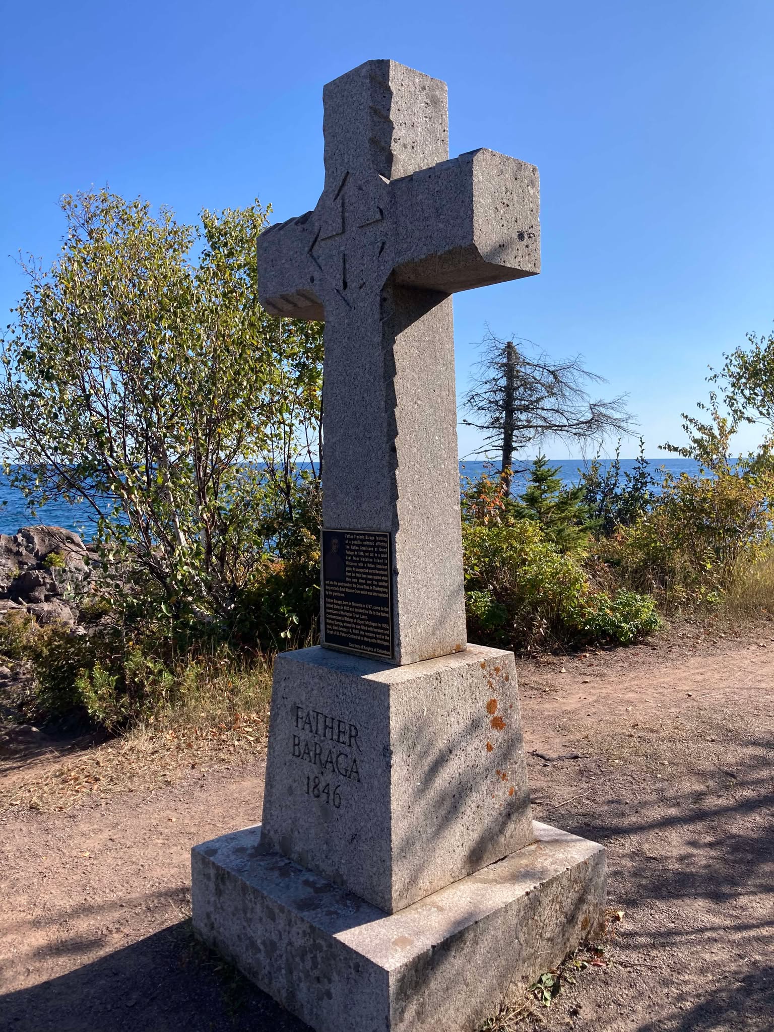
Cross River Historical Marker
Photo by Brian Finstad, 2024.
The following morning, Bishop Baraga told his guide that they would stay there that day, that they would construct and erect a cross in token of thanksgiving to God for his help and guidance to safety. So, all that day they worked. They cut down some large cedar trees and erected a large cedar cross, which they set up on the shore at the mouth of the stream. The next morning Bishop Baraga and his guide went down to the site of the cross they had erected, and again offered thanks to God for their safe deliverance. The missionary told his guide: “Hereafter this stream shall be known as “Cross River”. It has been thus known from that time on.
About twenty or twenty-five years ago, a large number of people from Duluth, Superior, and other towns and cities in the Lake Superior region, regardless of creed, made a trip to Cross River and erected a substantial cross there in place of the old cedar cross set up by Bishop Baraga and his guide, Louis Gordon, in thanksgiving to God for the wonderful guidance and loving care of his servants who landed safely at the mouth of this stream after such a perilous voyage.
Bishop Baraga stopped at Superior on their way back from the North Shore. They did not venture another lake-crossing. This zealous Lake Superior Chippewa Indian Missionary died at Marquette, Michigan, on January 19, 1868.
Cross River Historical Marker
Photo by Brian Finstad, 2024.
An Old Indian Settler
January 15, 2017
By Amorin Mello

“Joe Stoddard 1941″
~ Bad River Tribal Historic Preservation Office
United States. Works Progress Administration:
Chippewa Indian Historical Project Records 1936-1942
Envelope 19, Item 1
An Old Indian Settler
Statement of Joseph Stoddard
by James Scott
On the afternoon of Sunday, February 28, 1937, I visited Joseph Stoddard, one of the oldest residents of the Bad River Reservation. He is a man of full blood Indian descent, and a full-fledged member of the Bad River Band of Lake Superior Chippewas. He has always been respected for his wisdom concerning matters affecting his fellow Chippewas; as always recognized as a headman in the councils of the band, and is today an outstanding figure. He related to me many experiences of his early days, and has a distinct recollection of the incidents attending the closing deliberations leading up to the signing of the last treaty affecting the Bad River Band of Chippewas, which was concluded at Madeline Island, Sept. 30, 1854.
He relates: In this treaty with the Lake Superior Chippewas, Henry C. Gilbert and David B. Harriman represented the United States. According to Mr. Stoddard‘s version, Mr. Gilbert stood at one end of a small writing table, and Chief Buffalo on the other end, joining hands in mutual grip of friendship.

Henry C. Gilbert
Mackinac Indian Agent
~ Branch County Photographs
Commissioner Gilbert held in his hand the signed treaty, which was rolled and tied with red, white and blue ribbons. He expressed confidence that the Chippewas of Lake Superior and the Mississippi would always remain friendly toward the United States, and assured the Indians that the obligations of the United States under this treaty would be fulfilled to the latter. Using the rolled treaty as a pointer, Mr. Gilbert pointed to the East, to the West, to the North and to the South. The gesture circumscribing the Great White Father’s domain, explaining that the treaty just concluded was backed by the integrity of the U.S. and promising that the Great Father would see that the stipulations in the document would be taken care of at the time indicated. Mr. Stoddard asks: “Has the government carried out the promises embraced in the treaties?” And he answers his own question by saying, “No. Many of the most important provisions which were agreed upon at Madeline Island were stricken from the treaty, not at the Island, perhaps, but at some other point; and the whole document was so changed that every provision leaned to the advantage of the United States.” Mr. Stoddard says further, “As a Christian, I dislike to say that the field representatives of the United States were grafters and crooks, but the stories related about unfulfilled treaties, stipulations entirely ignored, and many other things that the Indians have just cause to complain about, seem to bear out my impressions in this respect.”
~ Wikipedia.org
The experience of the Indians in dealing with the United States government, contends Mr. Stoddard, has been anything but satisfactory, and this is the reason why the Reorganization Act does not appeal to many of our Indians, and the experience of Indians in different parts of the country must have been similar, as on some reservations of other tribes, the Reorganization Act has not even been given serious consideration. The Indians fear that this is just another ruse on the part of the Government to further exploit the Indians; that there is a hidden meaning between the lines, and that the Act, as a whole, is detrimental to the Indians’ interests and development.
For a person of his age, Mr. Stoddard has a wonderful memory and gives a clear portrayal of incidents connected with the treaty. He states that:
“Chief Buffalo worked so hard during the drafting of the treaty of 1854, that he suffered a general health break-down, and lived only a short time after the completion and signing of the document. The Chief felt highly elated after the work was completed, thinking that every word of the treaty would be carried out, affording permanence and security to his people.
“At the death of this venerable old chief, the funeral service attending his burial was very impressive. The pall bearers were all leading warriors who had seen and experienced the strife of battle. Those who paid tribute formed
[line(s) of text missing from bottom of page 2]
the mortal remains of the famous chief were laid to rest.

“Kiskitawag” in Washington D.C. circa 1880.
Which Giishkitawag is this?
Joseph‘s grandfather,
or Joe White?
~ C.M. Bell, Smithsonian Digital Collections
“After the death of Chief Buffalo, my grandfather, Kishketuhwig, became a leader of the Chippewa tribe. He was widely known throughout the Indian country, and well did the Sioux nation know him for this bravery and daring, having out-generalled the Sioux on many different occasions. To the whites he was known as “Cut-ear,” that being the interpretation of his Indian name, Kishketuhwig. He was born in 1770 and died in 1868.
“When nearing his ninetieth milestone, he would call me to his bed-side many times in the evenings, and often during the day, to advise and counsel me. Once he said, “My son, I can foresee the path that is leading straight ahead of you. I can see that you are going to be of great value and assistance to your people. You must make a serious effort, therefore, to familiarize yourself with the contents and stipulations of the different Chippewa treaties. My first experience in treaty negotiations was in 1785, at early dawn one day, there far off on the blue waters of Lake Superior several strange canoes. They were first sighted by a couple of fishermen, who were raising their nets at this early hour, on the east side of Madeline Island. When the fishermen were sure that the approaching canoes were those of strangers, their coming was immediately reported to the thousands of Chippewa who made their homes on the west shores of the island. The alarm was given, and a number of the most daring warriors were instructed to meet the party, and be prepared for the worst. Chief Buffalo was also notified.
“As the party came nearer, it was noted that the fleet consisted of five large, strangely designed canoes, and at the bow of the leading canoe, stood a stalwart brave in great dignity. In front of him, upon an upright rack, a war council pipe could be plainly seen, and as they approached the shore line the sounding of war drums were heard, and sacred peace songs were being sung as the party
[line(s) of text missing from bottom of page 3]
his hand high above his head, the gesture indicating the question, “Are we welcome to enter your land of liberty?” One of the Chippewa warriors acting as a lieutenant, answered in similar fashion, conveying the message, “you are welcome.”
These were visitors from the Algonquin-speaking Odawa nation. Their ancestors once lived at Grant’s Point on Madeline Island with the Wyandot people as refugees during the mid-17th century.
“After the strangers pulled their canoes onto high land, the Ojibways and the visitors clasped hands in a bond of friendship, saying Na-gay-ma, meaning ‘welcome, my friend.’ After the lieutenant was satisfied that there was no mischief connected with this party, he extended them the welcome of the village. With an apparent feeling of deep appreciation, the newcomers accepted the invitation, but indicated the wish that they preferred to prepare and eat their breakfasts first before entering the great Chippewa village. The spokesman explained that their ancestors once lived here.
“After their breakfast was over they were escorted to the village and lead to the lodge of Chief Buffalo. They explained the purpose of their visit, and Chief Buffalo indicated an open space where the meeting was to take place on the day following. Runners of the village were instructed to pass this information from lodge to lodge.
“On the day of the council, there emerged from the numerous lodges, naked figures of Chippewa warriors, looking fit for whatever the occasion required, wrapped close in their gaudy blankets, and their heads adorned with American Eagle feathers. The war-paint make-up was also conspicuous, and over the back of every brave, ‘quivers‘ were slung, while resting in the shallow of their arms were war-clubs stained with human blood.
“All were soon seated in a very wide circle upon the green grass, row after row, forming a grim assemblage. Each warrior’s face seemed carved in stone, and no one could have detected the deep and fiery emotions hidden beneath the surface of their expressionless faces.
“In the customary manner, pipes with ornamented stems were lighted and of the visitors, a young brave, arose, and walked into the midst of the council assemblage. He was not tall, but the symmetrical lines of his body spoke loudly of great strength and vigor. In complexion, he was darker than the average of his race, which we learned later was due to the fact that he belonged to the black bear clan or totem. The men and women of the Chippewa nation who belonged to the same clan accepted him as a brother and as one of the family.
“His expression was bold and confident, and as he stood in the middle of the circle, he pointed towards the heavens saying,
(Beaver, Pennsylvania)
“Constructed in 1778, it was the first fort built by the Continental Army north of the Ohio River, as a direct challenge to the British stronghold at Detroit. It was the headquarters of the largest army to serve west of the Alleghenies. Its purpose was to protect the western frontier from possible attacks by the British and from raids by their Native American allies. The fort, large for a frontier setting, at one time had a garrison of about 1,500 men.
[…]
“The fort was the scene of a historic event in January 1785 — the signing of the ‘Treaty of Fort McIntosh‘ by chiefs of the Delaware, Wyandot, Ottawa and Chippewa nations, along with treaty commissioners George Rogers Clark, Richard Butler and Arthur Lee. As a direct result, the way was cleared for Congress to enact the Land Ordinance of 1785. This became the pattern for ultimately opening all the western territories to boundary surveys and orderly settlement, and marked the real beginning of the westward migration that continued for the next 100 years.“
~ Beaver Area Heritage Foundation
‘My faith is in God, who is the creator of mankind, the maker of the heavens, the earth, the trees, the lakes and the rivers. I am very proud that the opportunity to address you is mine. I never thought that I would ever be accorded this privilege. I am sent here by my father to deliver a most humble message to your chief and to your nation. My father did not dare to leave. He is guarding his people in the East. The white man is encroaching upon our lands, and if he is not stopped, his invasion will soon reach you. My father needs your assistance. Will you join him, or will you remain passive and watch your children suffer? It is an invitation to a national council of the Algonquin nation, and it also means that you should prepare for the worst. The Grand National Council will take place as Sog-ga-nash-she Ah-ka-wob-be-win-ning, or English Look-out Tower, at Fort MacIntosh, on the last quarter of Gitche Manitou Gee-sis, meaning January.’
“The wampum belt consisted of cylindrical pieces of sea shells, a quarter of an inch long and in diameter less than the width of an ordinary pipe stem. These were drilled lengthwise to permit stringing on a sinew thread. The wampum belt was an article in general use among many tribes, not merely for ornamentation, but for graver purposes. They played an important part in national councils and in treaty negotiations. They were made of fragments of shells
[line(s) of text missing from bottom of page 5]
The color scheme was that of white, black with white tips, dark purple and violet. The only time these belts were exposed was on public gatherings, such as general councils effecting the welfare of the tribes. Only an Indian of distinction was permitted to administer the rites of the wampum belt ceremonies, and to perpetuate the history of the relation they bore to the particular council in which they were used, the belts were stored away, like other important documents. They were generally kept in custody of some old man who could interpret their meaning.
“The brave from the East continued in loud, clarion tones:
‘My father has received a message from the Great White Father. He said that he heard the voices of his red children pleading that they were in dire want, and in response to their entreaties he will come with a cargo of merchandise with his war vessels as soon as navigation opens.
‘The Algonquin Nation had agreed at one time to eat out of the same dish, so this will be our first opportunity to see what kind of a dish we are going to be offered. I thank God for the privilege of being able to deliver this message to you.’
“The speaker raised his right hand and looked straight into the heavens. He pivoted, and executing a right-turn, and with his right hand still held in the same position, walked back to his place and sat down.
“Chief Buffalo ordered that the Lake Superior Chippewa War Pipe be lighted and passed around. As it made a complete circle, the servant then presented the pipe to the strange young man. Chief Buffalo then arose, and as he walked in the midst of the council, he pointed into the heavens, saying, ‘I leave everything to God who rules my destiny. This is the very first time that this sacred war pipe is ever to leave this island.’ Chief Buffalo continued,
‘Shortly after the creation of mankind, the Great Spirit, or Gitche-manitou, sent a message to his red children, that, to insure their future security, they should establish a government of their own. The advices of the Great Spirit were
[line(s) of text missing from bottom of page 6]
regarded sacred, and the substance of the whole was carved in a pink colored agate, a rare and beautiful stone, and buried in Madeline Island. Incorporated in this document are the ten moral laws: Religion, tobacco, pipe, earth, wampum, herbs, water, fire, animals and forest. The law embracing religion stipulated that a chief shall be created, selecting one whose clan is of the Albina Loon, or Ah-ah-wek or mong. He is designated as the emancipator of the Indian race. One selected from the bear clan, is to be a leading war general; one selected from the Bull-head fish clan, a captain; wolf clan, a lieutenant, and so on down the line.’
“Like the former speaker, Chief Buffalo, at the conclusion of his speech, raised his hand heavenward and walked to his seat.
“The leading war general, Ah-num-me-me Wan-na-kwad, meaning Thunder Head Cloud, rose to his feet and walked to the center of the assemblage. Gently addressing the young brave from the visiting nation, he said,
‘This sacred pipe has been presented to you. You may take it back with you and interpret the statement you have just heard to your father, and say to your people that my great chief and his people will be fully prepared to come and assist your father. He will bring back with him the invitation emblem, your wampum peace belt, and your war pipe.’
“Immediately one of the announcers of the tribe stepped forward and announced that on the following day a feast in honor of the visitors would be had. The sounding of the war drums would be heard and a brave dance would take place. He told the people that provisions were being collected for the use of their friends upon their return voyage. Early in the morning, the day after the banquet, the strangers embarked, pointing their canoes homeward.
“During that fall many young braves were preparing to join the proposed war party. I was making clandestine preparations myself, being then about sixteen or seventeen years of age. I begged my grandmother to make me t least a dozen pairs of moccasins. When I advised her of my intentions, she shed tears saying, ‘Son, you are much too young.’ I was very anxious to see real action. Through rumors I learned that there were already eight thousand volunteers, ready to take up arms, if anything happened. If war was inevitable, it would be the first time in the history of the Lake Superior Chippewas that they would bear arms against their white brothers. There were more rumors to the effect that various bands were forming war parties to join their head chief at his command.
“Chief Buffalo told the runners of the various bands to deliver his message: that he needed only a few men at the outset. He promised that he would contact someone at the Island through his spiritual power to determine the exact time he would need his army. He advised them, however, to be on the alert. Everyone was apparently satisfied with the plans made by the chief.
“It was shortly after New Years that the alarm was given by the leading war general, Neg-ga-neg O Gitch dow, that when the moon attained a certain size, the journey should be started. Four or five days before the departure, war ceremonial dances should be held. The chief intimated that he needed a party of only one hundred to make up a visiting party. How I hated to ask permission from my grandfather to join this party, or even to tell him that I was planning on going. I finally decided to keep the information from him, because I knew that I would be terribly disappointed if he refused to allow me to join the party. Of course my grandmother was my confidant, and secretly we made the preparations. The tension of my anxiety was so high that I was unable to sleep nights. I would lie awake nights, listening to the beat of the war-drums, thinking that any moment the party might begin the journey. About two days before the appointed time, Chief Buffalo selected his visiting party, which was composed of orators and councilmen.
“The night previous to the day of departure, I went on ahead. It
[line(s) of text missing from bottom of page 8]
as far as the eye could discern. I started in the direction of Porcupine Mountains, and arrived there early the next day. After preparing, and having something to eat, I resumed my journey, my next objective being Ontonagon, or do-nagon-ning. There I waited for the party to arrive.
“I hunted and killed four deer, and when I saw them coming I sliced the meat, and placed it on hardwood sticks, standing the meat through which the stick ran, close to the fire to roast. I knew that my smoke would attract the party and guide them to my temporary camping place. When the party landed, I handed a piece of meat to each of the party, and to Chief Buffalo, who gave me a grunt and a smile in acknowledgement to my greeting, I gave a piece of meat which I had especially selected for him. I also gave him a large piece of plug tobacco, and after bestowing these favors I felt more confident that my request to join his party would be favorably considered. I told the chief that I desired to join his party, and he gave me his assent, saying that inasmuch as I was such a good cook I might join the party. I felt highly elated over the compliment the Chief paid me.
“After the repast, we started in the direction of Ontonagon. For a while we walked on the ice, and then cut across the country. It seemed that luck was with us. On the second day of our journey we ran across a group of Indian families, and as the afternoon was well on, our leader decided to camp with them that night. A couple of the men from this group presented tobacco to our chief, declaring that they had decided to join our party. The women were busy making extra pairs of moccasins, and before we retired for the night, war songs were sung, and a dance was started in one of the larger wigwams.
“The following morning saw us again on our way. We hugged the shore line closely, but very often the leader would make a short cut through the forest. The snow as not deep enough to hinder good traveling, and on the way the men hunted for fresh meat. A camping site was always located before the night.
“After traveling several days we came upon an Indian village, occupied by Indians called ‘Ba-we-tigo-we-ni-ning-wug,’ meaning Salt Ste. Marie men. We stopped at their village for a few days, and on our resuming the journey several of the men joined our party. They seemed to know all about our journey. I recall that on the morning of the day before we reached Fort MacIntosh, our leader commanded that we were not to travel very far that day, as he desired to arrive at Sog-ga-nash-she ak-ka-wab-be-we-ning, or the English Look-out Tower.
“During that night I got up to put some more wood into the fire place. Pausing, I could hear a dog barking in the far distance, and I concluded that there must be an encampment of some kind in the direction from whence the dog’s bark proceeded. I noticed also that all was talking in subdued tones. After resuming our journey the following morning, we had not traveled very far when we came to a river. Smoke was issuing from many different places. One of the younger members of our party told me that the smoke rose from the camp fires of a large Indian encampment on many tribes. In obedience to orders issued by our commander, we were to remain where we were until we received further orders. Each man had a pack of provisions weighing about twenty pounds. A camping site was immediately started. We built a hundred-foot wigwam, covering it with pine, cedar, spruce, and balsam boughs. For mattresses we used cedar boughs. We built about ten fire places, which furnished plenty of heat when the fires were all burning. Some gathered fuel, while others engaged in making water pails, dishes and cups, out of birch bark. In a short time everything was ship-shape: our lodge was in complete readiness, fuel gathered and the dishes and other receptacles required were made.
“Chief Pe-she-kie then sent one of his warriors to make inquiry where the leading chief of the Ottawa Nation resided. It wasn’t too long before the warrior returned with two strange braves, who came to invite our chief to the Ottawa camping ground. Chief Buffalo refused, saying, ‘Not until you have held your grand council, as you said when you invited my people.’ ‘Yes,’ they answered. ‘Our chief has been awaiting your arrival. We shall again come, and let you know when we shall hold the grand council.’ They returned to their encampment, and the length of time they were gone was about the time it would require to burn two pipe-fulls of tobacco. They reported back saying, ‘Not today, but tomorrow. When the morning sun shall have reached the tree tops, the grand council shall be called to order.’ This would mean about nine o’clock in the morning.
“That evening a funny thing happened. Two braves were placed on sentry duty, one on each end of our wigwam which was built long and narrow, the single door-ways on each end being covered with blankets. That night everything was quiet, and the occasional hoot of an owl, or the call of the whip-per-will were the only sounds that disturbed the deep silence of the night. I was not asleep and as I listened, I could distinctly hear a noise such as might be made by dragging some object on the ground. I gave this matter no serious thought, as I was under the impression that one of our tribesmen was dragging poles for the fires which needed more fuel. I found out later that one of our sentries located on the east side of the wigwam, saw someone peeping in the door-way. The sentry was covered up with a blanket in a sitting position, and underneath his blanket he held his light war-club. Like a flash we sprang, and taking the peeping person entirely by surprise, he tapped him on the head with his war-club, not hard enough to kill him, but with sufficient force to knock him in a state of coma for a few moments. Tying his victim with his pack-strap, he dragged him in his wigwam and laid him lengthwise in the center of the lodge. With the coming of day-light the next morning, some of the men rekindled the fires after which they sad down for their morning smoke. For centuries it has been the habit of the Indians to have their morning smoke first before anything else was attempted. Every one saw the strange Indian laying there, but nothing was said. The party soon began the preparation of breakfast, and while all were busy, it was noticed that one of the warriors was busy, sharpening his famous scalping knife, and was edging closer and closer to the stranger. Someone asked him why he was sharpening his knife, and he replied saying, ‘Oh, I’m going to have a good breakfast this morning. I think I will have some nice roast meat,’ and so saying, he started to feel and examine the leg of the victim lying in the wigwam, indicating he would supply the fresh roast. The captive became so frightened that he let out a howl and began to scream. A couple of men then came over with a large load of fish, which they presented to the chief. Seeing the stranger thus tied, screaming and begging for mercy, the two men who brought the fish began to show uneasiness. The sentry who captured this man then explained just what had taken place during the night. He said that there were two of them, but one got away. The two braves were requested to report to their people just what happened during the night at the Chippewa camping site, find out what tribe the victim belonged, and ask them to come over and get him, or that he would die on the spot if he was lying. It was not long before a party came with a large load of blankets and many other useful things which were offered to the chief with an apology and an expression of hope that he would overlook and forgive the actions of their two tribesmen.
~ Wikipedia.org
They belonged to the Kickapoo tribe. Our chief interfered, saying, ‘We did not come here to collect ransom. Go and take your child back to your home,’ and he ordered his release immediately.
“Early the next morning a runner came in our wigwam and lighted a large peace pipe. First he made inquiry as to where the leading chief sat.
[line(s) of text missing from bottom of page 12]
him first, and invited him to the national council, then he passed the pipe around the rest of us.
“We started across the river just before the position of the sun attained the tree tops. The Chippewas wore blankets of bright and many colors. Their weapons were concealed, and the quivers were the only things visible. These were slung over the backs of the warriors. As they arrived in the council ring, they were seated in the order of their arrival. In the center, was a rack, which was regarded as a sacred stand, and upon this lay a large peace pipe. This was made from light blue granite, decorated with selected eagle feathers. The pipe itself bore an engraving of the American Eagle.
“Along towards noon twenty men entered the ring, each carrying a large kettle. They served us three of the kettles, which were filled with well cooked food, consisting of fresh meat, fish, potatoes, squash and other edibles, which I cannot just now recall. The ceremonial invocation was said by Chief Ottawerriri, or Ottawa Race, who walked to the center of the ring and spoke in a loud clear voice. Saluting the heavens, he said:
‘I have faith in God, the Creator of mankind, and I hope that he will protect and guide us. In two days we are invited to meet our great White Father’s children. They tell me that they have a message which they wish to convey to us: that this message is directly from Washington.’
“According to the white man’s measurements of distance, I would say that we were about two miles from Fort MacIntosh, which the Indians called Sog-ga-nash-she Ak-ka-wob-be-we-ning, or English Look-out Tower.
“It was almost noon when the Ottawa chief called upon his war general, Neg-ga-neg-o-getche-dow, to deliver the Lake Superior War Pipe to the Chippewa chief. The general rose to his feet and walked to the center of the ring. In his hand he held the noted pipe. He filled it with tobacco and lit a good sized punk, in Chippewa Sug-ga-tog-gone, which was to be used in lighting the pipe later. As the general placed the punk in the pipe, he made four circles around the council ring and ended by handing the pipe to Chief Buffalo. The Chief took the pipe, and after drawing three or four puffs or whiffs from the pipe, and after drawing three or four puffs or whiffs from the pipe, handed it to one of his attendant chiefs, Nah-sho-ah-ade, the interpretation of whose name being ‘Three Sounding Winds.’ This chief rose to his feet, and coming to an erect position, addressed the assembly saying:
‘I trust in God. He has heard me. What pledge I made to you and my people, I am here ready to carry out and to stand by you. Whatever may happen, my people, and the other Indian nation, are ready to obey my command.’
“He then ordered his leading war general to light up the Ottawa war pipe, which he did. Then he went through the same performance as the Ottawa war general, except in the hollow of his are the Ottawa Wampum peace belt and presented both the pipe and the peace belt to the Ottawa war chief who accepted them, smoked for a minute or two, then stood up and thanked our chief. A short prayer was offered by one of the Ottawa headmen, at the conclusion of which everyone said: ‘Oh’, meaning ‘Amen’. Then all the people assembled for the morning meal. The prayer uttered by the Ottawa headman was a festive ceremonial offering. After dinner the chief of the Ottawa nation bid all to adjourn and return to their camping sites until summoned to visit the fort.
Early one bright morning, shortly after the break of day, we heard the sound of the Indian War Eagle, Kie-shik-kie-be-be-gwan. The meaning of this was clearly understood by all of the Algonquin nations. Shortly after the bugle call, a runner came to tell the chief that each tribe was to leave immediately after finishing breakfast for the white man’s council house. We hurried with our breakfasts and as soon as we were through we started out for Sog-ga-nash-she Ak-ak-wob-be-we-ning, or the English Look-out Tower. When we got near there, all I could observe was a sea of eagle feathers, which were really the head-gears of those already there. So magnificent were the head-gears, and so numerous were the eagle feathers adorning them, that a birds-eye view of the assembled group presented rather a field of eagle feathers than a group of warriors, or counselors.
“We were about the last party to arrive, and in a few minutes the meeting was called to order. This white man’s wigwam was a packed house. No business was taken up that day, the purpose of the meeting being to promote better acquaintance among the different bands. Runners from the various bands were invited to follow a few She-mog-gun-ne-shug, or soldiers. Our runners asked me to accompany them, and the white men brought us to another white man’s wigwam. I was never so surprised in all of my life, and in all of my days I never saw so much food stuffs. The soldiers told us through interpreters that our Great White Father was going to feed us from now on. They invited us to take anything that our chiefs and warriors could eat. Out of pure astonishment I hesitated for a moment. I didn’t know which way to move, or how to get started.
“I saw before me a large quantity of fresh pork, and spreading the top blanket I had on me, upon the ground, I placed several large pieces of the meat on the blanket, as well as tea, sugar, tobacco, and some bread which was as hard as the hip bone of a horse. The interpreter laughed at me, and told me to take some, saying
‘When you cook your meat, put the bread in with it. I know you will like it. The white man likes it that way, and calls it Ba-tay-be-qua-zhe-gun or hard-tack.’
“Just as we were about to go, one of our men came in and offered to [??? ??? ???] told him to take a couple of the large kettles to cook with which he did. He told us that we might just as well go to our camping grounds, as he had been instructed to come and tell us that nothing further would be done officially by the conference for several days. Arriving at our camp site, we cooked a bountiful meal, including meat, potatoes and hominy, which we brought from the fort earlier in the afternoon, and when the rest of the party arrived we had our supper.
“In about a week or so we were again notified that the council was to convene the following morning, that matters of vital importance were to be taken up, and that the council would be called to order by one of the white father’s children. We started early on the morning of the day indicated. When we got there, everything was in readiness and the council began in earnest. Johnson, representing the United States government, arose, and after making his salutation, he said:
‘I bid you a hearty welcome to this place, and I ask, pray and trust that the Great Spirit will allow us to meet in this friendly spirit more frequently. The Great White Father has now let down the bars, thus enabling all the tribes to meet his representatives in one common community, for the purpose of discussing the problems which affects them individually or as a tribe. The Great White Father is your guardian and adviser, and henceforth all of you are under his protection.’
“Mr. Johnson remained standing as Chief Ha-ro-en-yan, of the Wyandot Nation, arose and began to speak: ‘I respectfully request that the Lake Superior Chief, Ne-gie-chi ne-cieh (meaning my great brother), make the opening address.’ He also remained standing until Chief Buffalo stood up and addressed the gathering, thus: ‘Ne-she-may-yence-see-doug’ (my young brothers), and turning to Commissioner Johnson, he continued, ‘Ne-gie-ki-wayzis,’ (my friendly brother), ‘
If your intentions are right and earnest, the Great Spirit will know; and if you neglect these promises in the future, he will punish you severely. I have in my right hand a peace pipe made from a birth rights of the blue-blood clans of the Lake Superior Chippewas. I am going to fill this sacred pipe, but before I light it I am going to tell you what my ancestors conveyed to my forefathers, and that is this: Many generations ago, long before the white man ever conceived the idea that the world was round, and that across the Atlantic new lands might be found, our great ancestors knew of the white man’s coming in the future. Standing on the shores of the great Atlantic, they saw the coming of a strange craft, fluttering many white wings, and at the bow of the craft they saw a white man standing, holding in his hand a book — the word of God. The build of this white man was the same as the Indians’, the only difference being that his complexion was light, or white, and that hair grew on his face. Gitche-manitou, the Great Spirit, spoke to these old Indians, telling them that those they could see coming from the far East were their brothers, and that they should treat they courteously when they landed. I shall light this noble pipe, and pledge again our friendship to the White Man, if you will carry our your promises.’
“Chief Buffalo then lit the sog-ga-tog-gon (punk), placed it on top of the tobacco in the pipe bowl, and making a circle with the pipe covering the four points of the compass, he presented the pipe to Mr. Johnson. He received it with bowed head, and after taking a few whiffs, he returned it to Chief Buffalo, who in turn handed it to the Wyandot chief. After the Wyandot had taken several puffs, he returned the pipe to Chief Buffalo, who now also took a few whiffs from it. The Chippewa war general then stepped up, and the peace pipe was handed to him to pass to the chiefs and warriors, and to the other white men participating in the council. Commissioner Johnson still stood up, and requesting the attention of the assembly, reached out his right hand to Chief Buffalo in token of friendship, saying
‘I am the proudest man that ever stood on two legs. The pleasure of grasping your hand in this friendly spirit is all mine; and I only hope that we, as well as the rising and future generations, will always continue in this spirit of harmony. Before returning to the Great White Father I must have some evidence to show what I have accomplished here, and I have therefore prepared a document for your acknowledgement. In this document are embodied the promises the Great White Father has made to you through me. It describes the boundary lines of your lands wherein you may hunt at will and in peace, and you may rest assured that the promises held out in this document shall be fulfilled to the letter.’
“After the treaty had been signed, a peace pipe ceremonial was performed, as a sanctification of the work done there. Immediately thereafter the distribution of goods and food began, and the leading chiefs of each tribe were instructed to deliver a message to their people, that as soon as the water-ways became navigable, more goods would be delivered to various points for distribution to the Indians who were parties to this treaty.
“We lost no time in returning to our homes in Madeline Island. It was then the latter part of February. To handle their loads better, the Indians made tobaggons, or Nab-bug-gie-dob-bon. I had a large load of goods on my tobaggon, and when I got home a distribution was made to our relatives and friends, making an equal division of the goods and food I had brought. As far as I can now recall, that was the last benefit we ever got out of the treaty so solemnly concluded.”
“The foregoing is an account of the activities of the Indians within the dates mentioned, part of which was related to me by my grandfather, and a part relating my own experiences. In conclusion, I wish to state a few facts concerning the establishment of the Bad River Reservation.
“In the winter of 1854 a general survey was made of the Bad River Indian Reservation. My father was a member of the survey crew, but was unable to take up his work on account of the fact that he injured himself while he
[line(s) of text missing from bottom of page 18]
“As he could not join the survey crew, and realizing that I owed my parents a debt for the many sacrifices they made in my behalf in the early period of my life, I determined to join this party if possible. I asked my father to speak to the foreman for me, and when my application was accepted, no one in the world was happier than I was. I was happy in the thought that I would be able to support my family, and reciprocate to a small extent, at least, for their care of me from infancy.
“A half-breed Frenchman, named Antoine Soulier, was the cook. The crew consisted of five white men, and about the same number of Indians. My duties were to provide water for the crew, and to attend to the chores around the camp.
2nd Clause of Article 2;
“For the La Pointe band, and such other Indians as may see fit to settle with them, a tract of land bounded as follows: Beginning on the south shore of Lake Superior, a few miles west of Montreal River, at the mouth of a creek called by the Indians Ke-che-se-be-we-she, running thence south to a line drawn east and west through the centre of township forty-seven north, thence west to the west line of said township, thence south to the southeast corner of township forty-six north, range thirty-two west, thence west the width of two townships, thence north the width of two townships, thence west one mile, thence north to the lake shore, and thence along the lake shore, crossing Shag-waw-me-quon Point, to the place of beginning. Also two hundred acres on the northern extremity of Madeline Island, for a fishing ground.”
“It did not take very long to run the original boundary line of the reservation. There was a crew of surveyors working on the west side, within the limits of the present city of Ashland, and we were on the east side. The point of beginning was at a creek called by the Indians Ke-che-se-be-we-she (large creek), which is located east of Grave Yard Creek. The figure of a human being was carved on a large cedar tree, which was allowed to stand as one of the corner posts of the original boundary lines of the Bad River Reservation.
“After the boundary line was established, the head surveyor hastened to Washington, stating that they needed the minutes describing the boundary for insertion in the treaty of 1854.
“We kept on working. We next took up the township lines, then the section lines, and lastly the quarter lines. It took several years to complete the survey. As I grew older in age and experience, I learned to read a little, and when I ready the printed treaty, I learned to my surprise and chagrin that the description given in that treaty was different from the minutes submitted as the original survey. The Indians today contend that the treaty description of the boundary is not in accord with the description of the boundary lines established by our crew, and this has always been a bone of contention between the Bad River Band and the government of the United States.”
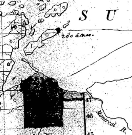
Detail of La Pointe Band Reservation including Gichi-ziibiiwishenhnyan (Saxon Harbor) in a letter dated March 30th, 1855, from the Commissioner John Wilson of the General Land Office to General Surveyor Warner Lewis at Dubuque, Iowa:
“For the Lapointe and other Indians, the body of land on the shore of Lake Superior, immediately west of Montreal river together with 200 acres on the Northern extremity of Madeline Island (all full colored blue on diagram A.) under the 2nd clause of the 2nd Article of the Treaty.”
~ National Archives Microfilm Publications; Microcopy No. 27; Roll 16; Volume 16.
Early Trails and Water Routes
August 3, 2016
By Amorin Mello

United States. Works Progress Administration:
Chippewa Indian Historical Project Records 1936-1942
(Northland Micro 5; Micro 532)
Abstract
“Records of a WPA project to collect Chippewa Indian folklore sponsored by the Great Lakes Indian Agency and directed by Sister M. Macaria Murphy of St. Mary’s Indian School, Odanah, Wisconsin. Included are narrative and statistical reports, interview outlines, and operational records; and essays concerning Chippewa religious beliefs and rituals, food, liquor, transportation, trade, clothing, games and dances, and history. Also includes copies of materials from the John A. Bardon collection concerning the Superior, Wisconsin region, La Pointe baptismal records, the family tree of Qui-ka-ba-no-kwe, and artwork of Peter Whitebird.”
Reel 1, Envelope 2, Item 1
Editor’s Note: This article is the result of the information given by the staff, also gleanings from the “Bardon Collection.”
EARLY TRAILS AND WATER ROUTES
~ Fifty Years in the Northwest, by W. H. C. Folsom, 1888, page 258.
Bardon in his Collections says, “From the earliest times, the waterways were the Red Man’s highways: naturally the fur-trader, explorer, and missionary followed the same routes.”
For hundreds of years before the white man came to live in this country, the Indians rarely traveled on land except to portage their canoes in taking short cuts from one body of water to another, thus cutting off considerable distance for extensive traveling. Then, too, game was plentiful on the banks of rivers and lakes. For these reasons the Indian preferred traveling by water to that of land.
For the white man in the early 50’s as well as for the Indian, transportation could be carried on only by water in the lowlands and by trails in the uplands, therefore, canoes were extensively used in the former and quite commonly employed in the latter, for the highlands, too, and their lakes and streams.
Water Routes
An important route connecting the Great Lakes and the Mississippi was by way of the Brule and the St. Croix Rivers. This water route began at Lake Superior, ascended the Brule River to Lake St. Croix then descended the St. Croix River to the Mississippi. The first eastern settler, missionaries, explorers, traders and Indians used this route very extensively.
Another route connecting Lake Superior and the Mississippi River was made by the historian, Schoolcraft, over a hundred years ago. This historic water route began at Chequamegon Bay, ascended the Bad River, and descended the Namekagon and the St. Croix Rivers to the Mississippi.
A route by way of Fish Creek from Chequamegon Bay was also important. Indian travelers portaged their canoes from Fish Creek to White River and down this river for several miles and again portaged to Lake Namakagon, from thence to Namakagon River, thence to the St. Croix and down to the Mississippi. This same route could be taken to the Flambeau and the Wisconsin Rivers by going upstream on the St. Croix.
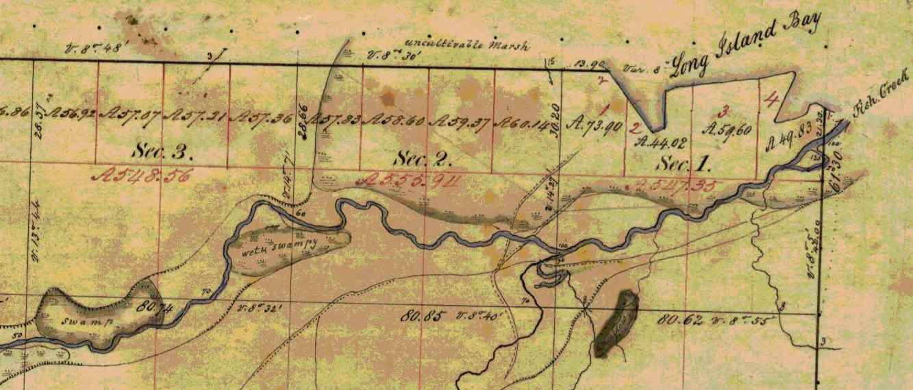
Several trails converged at the mouth of Fish Creek on Chequamegon Bay. ~ Wisconsin Public Land Survey Records
Trails
In traveling by trail most Indians traveled on foot, but many used dog-teams and toboggans, and in some cases, ponies. The Lake Superior region was a permanent camping ground for the Chippewa. This country for many miles around, and numerous trails branching off in all directions, far too many for us to mention each individually. Here we shall point out only the more important ones.
Talking Trail
“Talking Trail”, was so named on account of its beginning at a popular meeting or camping site situated where the city of Washburn now stands. “Talking Trail” began at this camping ground, thence it extended south, to Fish Creek, then south-west for a few miles, finally west to Superior, thus connecting Chequamegon Bay and Superior.
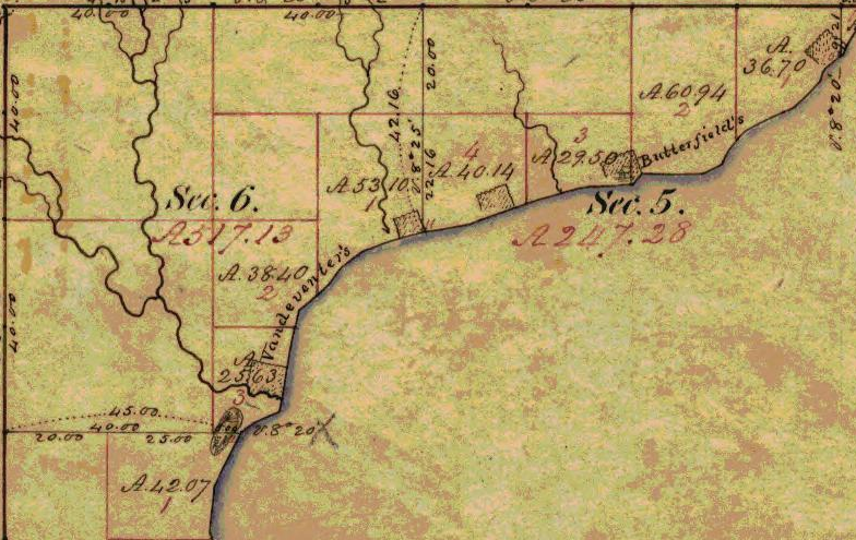
The “Talking Trail” began at the mouth of Vanderventer Creek near Washburn, and was also known as the “Council Trail.”
~ Wisconsin Public Land Survey Records
Bad River Trail
Whether or not this old trail was specifically known as designated above, the title is quite appropriate, since it began at the Leihy Mill on Bad River, Odanah, ran south to Tyler’s Forks, thence to Lake Namakagon and on to Lac Court Oreilles Reservation.
Indian War Trail
The reason for this name is evident: This trail was much used by the Chippewa in time of strife with the Sioux. The War Trail ran east to Montreal River and on to Porcupine Mountains, then to Ontonagon, thence to the copper country, including L’Anse and Marquette, Michigan. Mrs. Frank La Fernier of the Bad River Reservation, (1937) whose father, Mr. James lived to the age of one hundred-three years, corroborated this statement. Mr. James carried United States mail over this trail from our section of the country.
Moccasin Mike Trail

Chief Joseph Ozaagii was a cosigner of the 1854 Treaty at La Pointe on behalf of the Fond Du Lac Band.
~ Geni.com
“Moccasin Mike Trail”, was only another name for the “Osaugee1 Trail”. It was one of the most historic trails, and was evidently named after the local chief, Osaugee, who was the father-in-law of Charles Lord, a latter resident of Solon Springs, but originally a pioneer Quebec trader and voyageur.
This famous trail extended from the south of the St. Louis River, down Wisconsin Pointe, thence along the southern shore of Lake Superior to La Pointe, Bayfield, Ashland, Ontonagon, and the “Copper Country” of Michigan.
A branch of this trail led south, along the Montreal River to central Wisconsin, and was the route of the fur trader from Lake Superior to Green Bay. In the late 50’s and early 60’s, this trail was the land route East and South, and was much used by the early missionaries, traders and pioneer settlers. It became the regular mail route between all “south shore” points. Owen Sheridan and R.S. Mclean were two of the early mail carriers on this trail, packing on foot during the summer and fall, and travelling by dog team in winter.

“Osawgee Beach” postcard, circa 1920.
~ Zenith City Online
When Superior was started in 1853, a new branch of this trail began at the Nemadji River crossing and followed the mainland east, practically along the present high-ways 10 and 2, through what is now Alloues and Itasca, then east over the route of the present drive to an intersection with the main trail near Dutchman’s Creek. The early settlers remember it well. The density of the woods through which it passed kept the trail free from drifting snows and cutting winter winds. Snow shoes, toboggans, and dog teams were a powerful aid to travelers over this early trail.

Detail of Michael S. Bright Sr.‘s trading post on Saint Louis Bay near Oneota (West Duluth).
~ General Land Office Records
With the march of civilization, the settler, and the coming of regularly laid out roads, this intensely historic trail became practically eliminated. In the early 90’s, the Board of Douglas County in conjunction with the city of Superior saw the need of an all-year-round road to Lake Superior and Wisconsin Point. The project was sponsored by Michael S. Bright, now of Duluth, then a member of the County Board from the second ward of Superior. As the Supervisor of the Ward was always dubbed some Indian name, Mr. Bright fell heir to the sobriquet of “Moccasin Mike”. Because the rejuvenated road followed the old Osaugee Trail, and Mr. Bright had been very active in its building, the County Board officially designated the new road: “The Moccasin Mike Trail”.
1 Chief Osaugee was one of the signers of the important Treaty with the Chippewa in 1854. In Vol 2 “Treaties”, compiled by Chas. J. Kappler, the chief’s name is spelled: O sau’gee. The Chippewa spelling is: Osagi, the a being pronounced like a in ah, and the i like e in he.
TRAILS BECOME HIGHWAYS
“… the navigable waters leading into the Mississippi and St. Lawrence, and the carrying places between the same, shall be common highways and forever free …”
Many of the old Indian trails, especially those bordering on the southern shores of Lake Superior, have become permanent highways, and a number of these took their rise in our own village of Odanah. One of these led to Lac du Flambeau, and is now our present U.S. No. 2.
Over-Ridge Trail
This one-time Indian trail ran through Hurley, Wisconsin, Ironwood, Bessemer, Wakefield, and beyond Marinesco, Michigan, where it turned south to Lac du Flambeau. The Indians called the trail: “Ka-ke-way-wa-jwie-no-con”, meaning – “Over Ridge Trail”. At the turning point, it was necessary to cross a small river called “Ka-ba-no-ti-go-ge-wung” or “Presque Isle River”.
White River Trail
Another old Indian trail, leading West out of Odanah followed the [????] of our present U.S. No. 2; after crossing the Chicago and North Western railroad just a few feet west of the steel Railroad Bridge at the west entrance of the village, this trail entered the outskirts of Ashland where it turned directly towards Lake Superior. From thence it followed what is now Front Street in Ashland, turning south at the present site of the Knight Hotel. Following Ellis Avenue, it later crossed “Wa-bi-si-bi,” or White River. Mr. Scott, one of our historical staff says, “At that time there was a solid jam of flood wood at that point. Elm trees blew down on top of the jam, making it sufficiently solid for all kinds of Indian traffic.”

Detail of trails in Ashland east to Odanah and south to the White River. ~ Wisconsin Public Land Survey Records
This Indian Trail ran through Fifield, Wisconsin then straight east to Lac du Flambeau, from thence to Wausau, which was one of the trading posts of the early days. It is now our present U.S. Highway, No. 13.
N.B. An old wagon road known as the St. Paul Road was once a trail when the United States mail was carried on foot. In later years a wagon road was constructed by the War Department for military purposes.
See article following on “Military or St. Paul Road,” By W.P. Bigboy.
Reel 1, Envelope 2, Item 2
MILITARY, OR ST. PAUL, ROAD
By W.P. Bigboy
The road referred to in the “Recollections of Joseph Bell,” was the old military, or St. Paul, road, built by the government during the Civil War.
It followed the trail blazed out in earlier years by “Old Michel Buskey,” later identified as a keeper of a stopping place along this route. These hostelries could be found along the entire route and were for the accommodation and convenience of the early mail packers and travelers, who in the pursuit of their regular missions found the water ways or routes an impediment in the early and proper discharge of their assigned duties. Their locations were spaced by about twenty miles, and in most cases homesteads located near lakes were designated as such. Here mail carriers and other weary travelers, becoming too fatigued to continue farther, could pause and rest, and then continue on their way.
Leaving Bayfield, the first stopping place was at Moose Lake and the second at Loon Lake. These two places were located between Iron River and Bayfield, somewhere in the “Barrens.” The third stop was at Spider Lake. Here lived “Old Michel Buskey,” original trail blazer. His sunny disposition led to the designation of his cheery home as one of the stopping places; and for many years, not only the mail carriers, but many other weary travelers enjoyed the hospitality rendered by this family.
Leaving this place the next stopping place was at Island Lake, near Barnes of today. The next or fifth stop was at Gordon considered the crossroad of the country. Here the traveler usually made an over-night-stop, and enjoyed the hospitality of the village founder, Antoine Gordon.
From Gordon the road continued in a southwesterly direction until it reach near where the Namakagon empties into the St. Croix River. Here John Morrison, the grandfather of the Odanah Morrison, maintained a small hostelry for the accommodation of the traveling public for years. From there the road continued on to Yellow Lake, where another stopping place was located, then the road continued on to St. Croix Falls, where the traffic was ferried across the St. Croix, thence continuing on to St. Paul.
The road was not turnpiked as are the roads of today, but deep gullies and ravines were bridged with stout timbers and lumber, strong enough to bear the heavier armament of the United States Army in the event it became necessary to use the road for the transportation of army equipment.
Reel 1, Envelope 12, Item 3.
EARLY EXPERIENCE
Statement of Joseph Bell, [90?] yrs.
Interviewed by Dan Morrison.
I am in no position to give you much of a story that anyone would care to read, as I am not educated. During my childhood days we did not have the opportunity of going to school that the children now have, and all that I know is what I picked up myself. I have a few things in mind, however, that may be of interest to the present and succeeding generations, pertaining to some old people who were brought up at La Pointe on Madeline Island.
Portrait of Antoine Gordon from Noble Lives of a Noble Race by St. Mary’s Industrial School (Odanah), page 207.
I will tell you about William Gordon’s father raised on Madeline Island, who belongs ot the Lake Superior Band of Chippewa Indians. In the very early days when the United States Government caused roads to be built for the purpose of opening up the country, one of the first roads to be constructed ran from Bayfield to Eau Claire Lakes. This road opened up a vast section of the country, and when new roads were built in those times, people, as a rule, followed in quest for new locations and homes. William Gordon’s [illegible] father did just this. He followed the road from the starting point at Bayfield, running south for some distance, thence west to what they call Moose Lake. This was known as the first station and stopping place. The second station or stopping place was Moon Lake. The third station was at Spider Lake, known now as Silver Lake. The fourth place was Gordon’s, where William Gordon’s father settled. The present town of Gordon represents the first settlement of William Gordon’s father. The fifth stopping place was Yellow River; the sixth, Grantsburg and the seventh, was St. Croix Falls. This was the last stopping place as far as I remember.

The 1820 Cass-Schoolcraft expedition mapped the “Great Trail to the Folle Avoines Country” beginning at the mouth of the Sioux River.
~ Narrative journal of travels from Detroit northwest through the great chain of American lakes to the sources of the Mississippi River in the year 1820, by Henry Rowe Schoolcraft, page 105.
As I said before, these roads opened up a beautiful section of the country, full of wild game, plenty of fur-bearing animals, with many lakes and rivers where fishing was at its best. one could easily make a good living by hunting and trapping, and there was always plenty to eat. Many of the Indians who lived at La Pointe on Madeline Island left the island, following the direction of the newly constructed road. Though they were members of the La Pointe Band of the Lake Superior Chippewa, many remained in the new settlements, and the Indians remaining along the St. Croix River and other adjacent places finally lost their identity on the La Pointe Band and were later known as the “Lost Tribe.”
My great grandfather told me that the Chippewa lived on the south side of Lake St. Croix and the Sioux Indians lived on the north side, both claiming ownership of the St. Croix River. The question of full right of the St. Croix River kindled a feeling of animosity between the two tribes, and failing to arrive at any suitable agreement, war was declared between them, the aim of which was to settle the ownership of the river once and for all. In these encounters the Chippewa conquered the Sioux, driving them out of the country entirely. In their retreat, the Sioux followed a westerly direction, finally stopping where the city of St. Paul stands today.
The Removal Order of 1849
March 12, 2016
By Amorin Mello
United States. Works Progress Administration:
Chippewa Indian Historical Project Records 1936-1942
(Northland Micro 5; Micro 532)

12th President Zachary Taylor gave the 1849 Removal Order while he was still in office. During 1852, Chief Buffalo and his delegation met 13th President Millard Fillmore in Washington, D.C., to petition against this Removal Order.
~ 1848 presidential campaign poster from the Library of Congress
Reel 1; Envelop 1; Item 14.
The Removal Order of 1849
By Jerome Arbuckle
After the war of 1812 the westward advance of the people of the United States of was renewed with vigor. These pioneers were imbued with the idea that the possessions of the Indian tribes, with whom they came in contact, were for their convenience and theirs for the taking. Any attempt on the part of the aboriginal owners to defend their ancestral homes were a signal for a declaration of war, or a punitive expedition, which invariably resulted in the defeat of the Indians.
“Peace Treaties,” incorporating terms and stipulations suitable particularly to the white man’s government, were then negotiated, whereby the Indians ceded their lands, and the remnants of the dispossessed tribe moved westward. The tribes to the south of the Great Lakes, along the Ohio Valley, were the greatest sufferers from this system of acquisition.
Another system used with equal, if less sanguinary success, was the “treaty system.” Treaties of this type were actually little more than receipt signed by the Indian, which acknowledged the cessions of huge tracts of land. The language of the treaties, in some instances, is so plainly a scheme for the dispossession and removal of the Indians that it is doubtful if the signers for the Indians understood the true import of the document. Possibly, and according to the statements handed down from the Indians of earlier days to the present, Indians who signed the treaties were duped and were the victims of treachery and collusion.
By the terms of the Treaties of 1837 and 1842, the Indians ceded to the Government all their territory lying east of the Mississippi embracing the St. Croix district and eastward to the Chocolate River. The Indians, however, were ignorant of the fact that they had ceded these lands. According to the terms, as understood by them, they were permitted to remain within these treaty boundaries and continue to enjoy the privileges of hunting, fishing, ricing and the making of maple sugar, provided they did not molest their white neighbors; but they clearly understood that the Government was to have the right to use the timber and minerals on these lands.

Entitled “Chief Buffalo’s Petition to the President“ by the Wisconsin Historical Society, the story behind this now famous symbolic petition is actually unrelated to Chief Buffalo from La Pointe, and was created before the Sandy Lake Tragedy. It is a common error to mis-attribute this to Chief Buffalo’s trip to Washington D.C., which occurred after that Tragedy. See Chequamegon History’s original post for more information.

Detail of Benjamin Armstrong from a photograph by Matthew Brady (Minnesota Historical Society). See our Armstrong Engravings post for more information.
Their eyes were opened when the Removal Order of 1849 came like a bolt from the blue. This order cancelled the Indians’ right to hunt and fish in the territory ceded, and gave notification for their removal westward. According to Verwyst, the Franciscan Missionary, many left by reason of this order, and sought a refuge among the westernmost of their tribe who dwelt in Minnesota.
Many of the full bloods, who naturally had a deep attachment for their home soil, refused to budge. The chiefs who signed the treaty were included in this action. They then concluded that they were duped by the Treaty Commissioners and were given a faulty interpretation of the treaty passages. Although the Chippewa realized the futility of armed resistance, those who chose to remain unanimously decided to fight it out. A few white men who were true friends of the Indians, among these was Ben Armstrong, the adopted son of the Head Chief, Buffalo, and he cautioned the Indians against any show of hostility.
At a council, Armstrong prevailed upon the chiefs to make a trip to Washington. Accordingly, preparations for the trip were made, a canoe of special make being constructed for the journey. After cautioning the tribesmen to remain calm, pending their return, they set out for Washington in April, 1852. The party was composed of Buffalo, the head Chief, and several sub-chiefs, one of whom was Oshoga, who later became a noted man among the Chippewa. Armstrong was the interpreter and director of the party. The delegation left La Pointe and proceeded by way of the Great Lakes as far as Buffalo, N. Y., and then by rail to Washington. They stopped at the white settlements along the route and their leader, Mr. Armstrong, circulated a petition among the white people. This petition, which was to be presented to the President, urged that the Chippewa be permitted to remain in their own country and the Removal Order reconsidered. Many signatures were obtained, some of the signers being acquaintances of the President, whose signatures he later recognized.
Despite repeated attempts of arbitrary agents, who were employed by the government to administer Indian affairs, and who endeavored to return them back or discourage the trip, they resolutely persisted. The party arrived at Buffalo, New York, practically penniless. By disposing of some Indian trinkets, and by putting the chief on exhibition, they managed to acquire enough money to defray their expenses until they finally arrived at Washington.
Here it seemed their troubles were to begin. They were refused an audience with those persons who might have been able to assist them. Through the kind assistance of Senator Briggs of New York, they eventually managed to arrange for an interview with President Fillmore.

United States Representative George Briggs was helpful in getting an audience with President Millard Fillmore.
~ Library of Congress
At the appointed time they assembled for the interview and after smoking the peace pipe offered by Chief Buffalo, the “Great White Father” listened to their story of conditions in the Northwest. Their petition was presented and read and the meeting adjourned. President Fillmore, deeply impressed by his visitors, directed that their expenses should be paid by the Government and that they should have the freedom of the city for a week.
![Vincent Roy, Jr., portrait from "Short biographical sketch of Vincent Roy, [Jr.,]" in Life and Labors of Rt. Rev. Frederic Baraga, by Chrysostom Verwyst, 1900, pages 472-476.](https://chequamegonhistory.com/wp-content/uploads/2016/03/vincent-roy-jr.jpg)
Vincent Roy, Jr., was also on this famous trip to Washington, D.C. For more information, see this excerpt from Vincent Roy Jr’s biography.
Their mission was accomplished and all were happy. They had achieved what they sought. An uprising of their people had been averted in which thousands of human lives might have been cruelly slaughtered; so with light hearts they prepared for their homeward trip. Their fare was paid and they returned by rail by way of St. Paul, Minnesota, which was as near as they could get by rail to their homes. From St. Paul they traveled overland, a distance of over two hundred miles, overland. Along the route they frequently met with bands of Chippewa, whom they delighted with the information of the successes of their trip. These groups they instructed to repair to Madeline Island for the treaty at the time stipulated.
Upon their arrival at their own homes, the successes of the delegation was hailed with joy. Runners were dispatched to notify the entire Chippewa nation. As a consequence, many who had left their homes in compliance with the Removal Order now returned.
When the time for the treaty drew near, the Chippewa began to arrive at the Island from all directions. Finally, after careful deliberations, the treaty of 1854 was concluded. This treaty provided for several reservations within the ceded territory. These were Ontonagon and L’Anse, in the present state of Michigan, Lac du Flambeau, Bad River or La Pointe, Red Cliff, and Lac Courte Oreille, in Wisconsin, and Fond du Lac and Grand Portage in Minnesota.
It was at this time that the Chippewa mutually agreed to separate into two divisions, making the Mississippi the dividing line between the Mississippi Chippewa and the Lake Superior Chippewa, and allowing each division the right to deal separately with the Government.
Early Settlement of the Bad River Indian Reservation
March 9, 2016
By Amorin Mello
United States. Works Progress Administration:
Chippewa Indian Historical Project Records 1936-1942
(Northland Micro 5; Micro 532)

Details of early settlements on the La Pointe Reservation from Charles Whittlesey‘s 1860 Geological Map of the Penokie Range.
Reel 1; Envelope 1; Item 30.
EARLY SETTLEMENT OF THE BAD RIVER INDIAN RESERVATION
by James Scott
The Bad River Indian Reservation was set aside for the use of the Indians in the year 1854. The legal proceedings for this venture were ratified by Congress in 1855. (See Indian Treaty Laws, Chippewa Treaty, 1854, P. 646.)
Many years before the White Man ever came in contact with the Ojibway Indians of Lake Superior, our forefathers inhabited an island now known as Madeline Island, or La Pointe. They were the ancestors of our present Chippewa now located on the Bad River Reservation, and they came to this location by the way of Shau-boo-mi-ni-ka-ning (Gooseberry Landing Point), which is situated at the extreme South of Madeline Island. From there they traveled across to Chi-gee-wa-ne-kung (a long and shallow sandy point). This is the point where the Great Lakes Light House is now situated. The white people call it Chequamegon Point. From Chequamegon Point, the Indians came to this locality by way of the Ka-ka-gon and Bad rivers. The Indians called this location Kie-tig-ga-ning, (Agricultural Paradise). They had good reason for this title, since the ground was fertile, fish were abundant, game plentiful, and invariably there was a good crop of berries and small fruits. In fact, Kie-tig-ga-ning was their home in the warm months. They planted their gardens here.
The original site for the Bad River Village was located west of the present Chicago & North-western Railroad steel bridge crossing the Bad River just a few rods north of the White River.
The first Indian to make a permanent home here was Ba-bom-ni-go-ni-boy (Spreading Eagle). Having selected a suitable location, he built a large wigwam out of elm bark. After completing his home which was situated between what is now Walker’s store and the railroad bridge, he brought his family.
Not long after, more Indian families from Madeline Island, which was the original habitation of the Ojibwas of Lake Superior, moved to Bad River and settled here with Spreading Eagle. Each year more families came, built their wigwams and bark houses and lived along the banks of the Bad River, near where St. Mary’s School is now located. As the population grew, wigwams multiplied, until they extended from the Bad River to the Ka-ka-gon River, and along the south side of what was known as Blackbird’s field. The village grew so rapidly that wigwams and bark houses were built on both sides of the Bad River, and extended about one-half mile above the west side of the White River.
About this time, secret emissaries from the French and English governments came here as fur traders. The Indians surmised that these people might be representatives of some foreign government. They mingled with the Indians; they looked down upon them as an inferior race; consequently the Indians hated the English.
The French, on the other hand, were very friendly with the Indians. They treated them like brothers and even adopted their ways and customs and married the Indian women. They settle d here permanently, and began to build log cabins. It was undoubtedly from them that the Indians learned how to build the log house besides many other useful things. There are a few of these log-cabins still standing that were built by the early French and Indians settlers. But most of them have been remodeled many times, by covering them inside and out with pine lumber, and building additions to them.

Detail of Nigikoon‘s sawmill and Bad River Falls omitted from Joel Allen Barber’s survey of “The Gardens”.
Several years before the final treaty was signed by the Chippewas of Lake Superior, a strange gentleman appeared in the Indian country: He was a white man and became very well acquainted with some of the Indians His name was Ervin Leihy, but the Indians called him Neg-gi-goons (a young otter). When he saw that the Indians were making their homes on each side of the Bad River, as far up as the Bad River Falls, he too decided to build a little home for himself on the bank at the foot of the Falls. He cleared a small piece of land, built his house and in time erected a saw mill which was run by water power. There he lived for many years cultivating the soil and manufacturing lumber. He was never bothered by any of the Indians because he never gave them any cause for unfriendliness. He associated mostly with the young men of the tribe, learned their language, and spoke it quite fluently. He was soon familiar with Indian ways and habits and adopted many of them.
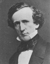
Senator Henry Mower Rice
~ United States Senate Historical Office
On September 30, 1854, the final treaty between the Chippewa of Lake Superior and the United States was concluded, (ratified Jan. 10, 1855). The preliminaries required thirty days of deliberation.
Before the last conference, a gentleman by the name of Henry M. Rice, approached the chiefs and headmen of the La Pointe Band at night, and held a secret conference with them. He coached and advised them to be on the alert should a question arise concerning the selection of a reservation.
“I have been secretly approached,” he said, “by a certain band of Chippewa to assist them in securing the land where you have maintained your homes for years. It would be a shame if another band should cheat you out of this place where you have built your homes and lived so long. Any band, or member of such band, which is a part of the Lake Superior Chippewa who reside in the territory you are now ceding to the United States government, have equal rights to make a selection anywhere in the territory the United States is reserving for you.”
When the conference convened the next day, the question of selecting reservations was in order. Immediately after the announcement was made by the official interpreter, Chief Blackbird of the Bad River Band was on his feet shouting and pointing in different directions with a large flat ceremonial pipe which he held in his right hand, describing the boundary lines of his reservation. (See Article 2, paragraph 2, page 648, Chippewa Treaty of 1854).1
As soon as Chief Blackbird arose, Chief Moni-don-se (Small Bug) of the Lac du Flambeau Band, also arose at the same time, and tried hard to discourage Chief Blackbird. Chief Moni-don-se claimed that he was supposed to make the selection that Chief Blackbird was now making. Then both chiefs became angry and exchanged unpleasant words with one another. One of the Government officials intervened. Chief Moni-don-se claimed that his people had as much right to select this land as Chief Blackbird had. Moni-don-se was finally over-ruled, so he had to settle on the Lac du Flambeau Reservation. Chief Blackbird then thanked Mr. Henry M. Rice for his advice and assistance.
Vincent Roy, Jr. was Henry Mower Rice’s interpreter during the 1854 Treaty with the Chippewas at La Pointe, according to The Sawmill Community at Roy’s Pointe, by Mary Carlson, 2009, page 21.
A few years after the reservations were set aside for the Chippewa people, the construction of more log houses was begun, even being used to bring the timber required for this purpose from the forest. Many new homes were built along the Bad River, the location of the houses extending as far as the Falls. The then existing homes were not lost from view in this movement, and houses needing repairs were given attention. A sub-agent was appointed and placed in charge of the Bad River Reservation, whose duty it was to assist the Indians in agricultural pursuits, as well as guide and advise them in matters concerning such pursuits. None was known as the Government Farmer.
The Indians always took the responsibility and care of his children quite seriously. He taught them early the rudiments of the hunt and the trapping of wild game. He instilled into them from infancy a love of the traditions and customs of their forefathers; he brought before their young minds the organization of the tribe and clans and their duties. He also taught them early in life to be grateful to the Great Spirit and appreciate his many gifts.
Sunday, 21 Apr. 1918
“ASHLAND, Wis., April 20. – Chief Adam Scott, of the Chippewa tribe of Indians is dead. He passed away at his home in Odanah after a short illness of pneumonia at the age of 76 and was buried today.
Chief Scott was one of the head chiefs of the Chippewas since the death of his father who was a head chief of the Chippewa tribe when they were uncivilized. His father was Ka-ta-wa-ba-bay Scott and he lived to see his tribe emerge from a savage state to civilization. His son has been one of the chief advisors of the tribe and has made many trips to Washington on tribal business. Chief Adam Scott leaves one son who becomes chief. Chief Scott was born on Madeline Island and has lived either at Madeline Island or on the Bad River reservation all his life.”
Gic-he-chi-gie-nig Cah-dub-wah-be-da Scott, my father, who died at the age of seventy-six years and ten months, (born June 12, 1840; died April 16, 1916, told me the following:

Kiskitawag (Giishkitawag: “Cut Ear”) signed multiple treaties as a warrior of the Ontonagon Band but afterwards was associated with the Bad River Band. Photograph circa 1880.
~ C.M. Bell, Smithsonian Digital Collections
About four years after the signing of the Treaty of 1854, in the spring of 1858, Chief Keesh-ke-tow-wug (Cut Ear), one of the signers of the treaty, sent invitations through his runner, George Cedar Root (Ke-ka-geese, meaning young Raven) to tell all the people he could contact, to come to his home on a certain day. He had his wife and daughters prepare a great feast and opened up a large Mo-kuk (birch bark container for maple sugar) of maple sugar. About a hundred people ate at his feast that day.
Chief Keesh-ke-tow-wug ordered his runner to light his personal ceremonial pipe and pass it to each of his male guests. After the pipe ceremony he arose in a very dignified manner. He was a tall, lanky old gentleman, and when standing erect was over six feet tall. He said:
“My children, I want you to listen to me. The proposition I am about to present will benefit all of you, and I need your cooperation. I would like to have you donate your labor to clear land for a large community garden, where every family, or any one who wishes can plant. The place I would suggest is that swampy flat, near the cemetery. It will take time to drain it and dry out but I know it will make good garden plats.”
The people approved of the idea and gave him the assurance that they would cooperate with him to carry out his plans. The old chief was more than pleased. he designated a date on which to start.
When they started clearing the ground for this purpose, many things had to be done. The land was covered with willows and scrubby tamarack and water. Long ditches had to be dug to furnish adequate drainage into both rivers, the Ka-ka-gon and the Bad. It was not long before a tract of land of about eighty acres was prepared for the plow and under actual cultivation.
This community garden extended from Mrs. Armstrong’s dwelling on the U. S. Highway No. 2 to where the steel and concrete bridge now crosses the Bad River on the east; and north-west to Waish-ki Martin’s house. This old community clearing is now known as the “Blackbird Field.” The Indians used this ground for their gardens about twenty-five years.

Detail of Chief James Blackbird from an 1899 photo by De Lancey Gill.
~ Smithsonian Collections
In the years 1888 to 1890, Gic-caw-kie-yesh-sheese (Minor Surface Wind), son of the old chief Ma-ca-day-pe-nay-se (Blackbird), filed on this community clearing as his allotment. He was later known as Chief James Blackbird. The selection was approved by the Indian Department and a patent issued, covering the greater portion of the community garden, in the name of James Blackbird. (see Article 3, granting of allotments, in the Chippewa Treaty of 1854, page 649).1
Under the stipulations of the Treaty of 1854, the chiefs with the assistance of a field Indian Agent constituted an allotment committee, who made membership rolls and gave allotments to those who were recognized as members of the Bad River band. Tracts of eighty acres of land were allotted to each.

The Cass-Schoolcraft Expedition identified “Chippewa Gardens” at the location of Odanah. This map is several decades older than Kiskitawag‘s proposal to pursue agriculture at the same location.
~ Narrative journal of travels from Detroit northwest through the great chain of American lakes to the sources of the Mississippi River in the year 1820, by Henry Rowe Schoolcraft, page 105.
First Sawmills on the Bad River Reservation
March 5, 2016
By Amorin Mello
United States. Works Progress Administration:
Chippewa Indian Historical Project Records 1936-1942
(Northland Micro 5; Micro 532)
Abstract
“Records of a WPA project to collect Chippewa Indian folklore sponsored by the Great Lakes Indian Agency and directed by Sister M. Macaria Murphy of St. Mary’s Indian School, Odanah, Wisconsin. Included are narrative and statistical reports, interview outlines, and operational records; and essays concerning Chippewa religious beliefs and rituals, food, liquor, transportation, trade, clothing, games and dances, and history. Also includes copies of materials from the John A. Bardon collection concerning the Superior, Wisconsin region, La Pointe baptismal records, the family tree of Qui-ka-ba-no-kwe, and artwork of Peter Whitebird.”
Reel 1; Envelope 8; Item 4.
FIRST SAWMILLS ON THE BAD RIVER RESERVATION
By Jerome Arbuckle
Detail of Ervin Leihy’s sawmill at Bad River Falls omitted by the General Land Office.
– Ervin Leihy, one of the first white settlers to come to the northern part of Wisconsin died at his home in this city last week. He was born in Oswego county, N. Y., October 12, 1822. His early life was passed on a farm and at 18 moved to Illinois. Later he bought a farm at Bad River, Ashland county, and in 1846 moved onto it. In 1870 he moved to Bayfield, built his present home and opened a general store which he conducted for a number of years. While living at Bad River he was a member of the town and county boards of Ashland county for a number of years and in 1871 and 1872 was a member of the town board of Bayfield. Besides these he held numerous other offices. He was a public-spirited man, had plenty of means and was always ready to assist in anything that would tend to advance the interests of the town in which he resided.”
~ Wisconsin Weekly Advocate, June 6, 1901.
The first sawmill on the Bad River Reservation was operated by a Mr. Leihy at the rapids of Bad River, which is approximately fifteen miles from the village of Odanah. The power was furnished by a paddle-wheel which was propelled by the force of the stream. The saw was of the old vertical style. With these rude methods, the sawing of six to ten logs into lumber was considered a good daily average. Mr. Leihy was known to the Indians as “Nig-gig-goons” or “Little Otter”. He married a woman of Indian blood, and he apparently enjoyed great favor among the Indians of this region.
The lumber was placed on rafts made of large cedar logs and guided down Bad River when the conditions for such a venture were favorable. A long oar or sculler was used in the stern to assist in propelling the raft and to act as a rudder.
From the mouth of Bad River the raft emerged into Lake Superior provided the wind conditions were favorable, then along the shore line to Chequamegon point and thence across to Madeline Island. The channel between the point and the island was considerably narrower at the time than it is at the present. The lumber thus landed was carried to other points on the Lake by sailboats.

Detail of Albert “Wabi-gog” McEwen‘s sawmill on the White River omitted by the General Land Office.
According to the oldest residents of Odanah, another sawmill was located some distance up the White River. This mill was operated by a man known to the Chippewa as “Wabi-gog” or “The White Porcupine.” This mill was operated practically the same as the Leihy mill. The lumber was also rafted down White River to the confluence with Bad River, thence to Lake Superior and to Madeline Island. During the winter the lumber from this mill was hauled on sleighs by oxen to what is now the city of Ashland.
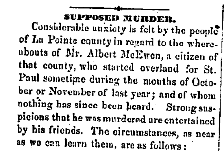
Read about Benjamin Armstrong’s investigation of Wabi-gog‘s supposed murder in Poor McEwen.
“Wabi-gog” was in the habit of making trips on foot to St. Paul, where he purchased the necessaries for his project. He used a trail that intersected what was known as the “Military Road” which led to St. Paul.
On one of these trips he failed to arrive at his destination and no trace of him was ever found. It was surmised that he had been waylaid and murdered, as he usually carried a considerable sum of money on his person.
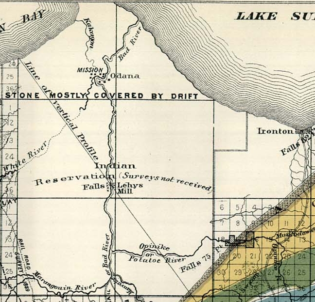
Detail of the La Pointe Indian Reservation from Charles Whittlesey‘s 1860 “Geological Map of the Penokie Range“ from Geology of Wisconsin, Volume III, plate XX-214: “Lehys Mill” is identified at the Falls on the “Mauvaise or Bad River”. The White River was partly surveyed upstream from the Mission at “Odana”, up to Albert “Wabi-gog” McEwen‘s sawmill, but did not identify it. Whittlesey may have had a copy of Joel Allen Barber’s missing 1856 survey of The Gardens at Odanah.
