American Fur Company: 1834 Reinvention of La Pointe
October 4, 2023
Collected & edited by Amorin Mello
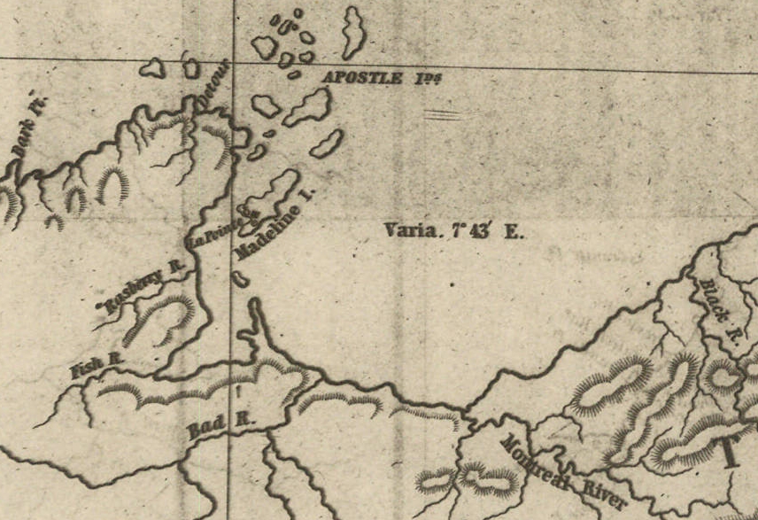
The below image from the Wisconsin Historical Society is a storymap showing La Pointe in 1834 as abstract squiggles on an oversized Madeline Island surrounded by random other Apostle Islands, Bayfield Peninsula, Houghton Point, Chequamegon Bay, Long Island, Bad River, Saxon Harbor, and Montreal River.

“Map of La Pointe”
“L M Warren”
“~ 1834 ~”
Wisconsin Historical Society
citing an original map at the New York Historical Society
My original (ongoing) goal for publishing this post is to find an image of the original 1834 map by Lyman Marcus Warren at the New York Historical Society to explore what all of his squiggles at La Pointe represented in 1834. Instead of immediately achieving my original goal, this post has become the first of a series exploring letters in the American Fur Company Papers by/to/about Warren at La Pointe.
New York Historical Society
American Fur Company Papers: 1831-1849
America’s First Business Monopoly
#16,582

Map of Lapointe
by L M Warren
~ 1834 ~
New York Historical Society
scanned as Gale Document Number GALE|SC5110110218
#36

Ramsay Crooks
~ Madeline Island Museum
Lapointe Lake Superior
September 20th ’34
Ramsey Crooks Esqr
Dear Sir
Starting in 1816, the American Fur Company (AFC) operated a trading post by the “Old Fort” of La Pointe near older trading posts built by the French in 1693 and the British in 1793.
In 1834, John Jacob Astor sold his legendary AFC to Ramsay Crooks and other trading partners, who in turn decided to relocate the AFC’s base of operations at Mackinac Island to Madeline Island, where our cartographer Lyman Marcus Warren was employed as the AFC’s trader at La Pointe.
Instead of improving any of the older trading posts on Madeline Island, Warren decided to move La Pointe to the “New Fort” of 1834 to build new infrastructure for growing business demands.

GLO PLSS 1852 survey detail of the “Am Fur Co Old Works” near Old Fort.
on My Way In as Mr Warren was was detained So Long at Mackinac I did not Wait for him at this Place as time was of So Much Consequence to me to Get my People Into the County that I Proceeded Immediately to Fond Du Lac with the Intention with the Intention of Returning to this Place When I Had Sent the Outfit off but When I Got There I Had News from the Interior Which Required me to Go In and Settle the Business there; the [appearance?] In the Interior for [????] is tolerable. Good Provision there is [none?] Whatever I [have?] Seen the [Country?] [So?] Destitute. The Indians at [Fort?] [?????] Disposed to give me Some trouble when they found they have to Get no Debts and buy their amunition and tobacco and not Get it For Nothing as usual but at Length quieted down [?????] and have all gone off to their Haunts as usual.
I Received your Instructions contained in your Circular and will be very Particular In Following them. The outfits were all off when I Received them but the men’s acts and the Invoices of the Goods Had all been Settled according to your Wishes and Every Care Will be taken not to allow the men to get In Debt the Clerks Have Strict orders on the Subject and it is made known to them that they will be Held for any of the Debts the men may Incur.
I Enclose to you the Bonds Signed and all the Funds we Received from Mr Johnston Excepting those Which Had been given to the Clerks and I could not Get them Back In time to Send them on at Present.
Mr Warren And myself Have Committed on What is to be done at this Place and I am certain all that Can be done Will be done by him. I leave here tomorrow For the Interior of Fond Du Lac Where I must be as Soon as possible.
I have written to Mr Schoolcraft as he Inquested me. Mr Brewster’s men would not Give up their [??????] and [???] [????] is [??] [?????] [????] [????] [to?] [???????] [?????] [to?] [persuade?] [more?] People for Keeping [his?] [property?] [Back?] [and] [then?] [???] by some [???] ought to be sent out of the Country [??] they are [under?] [the?] [???] [?] and [Have?] [no?] [Right?] to be [????] [????] they are trouble [????] [???] [their?] [tongues?].

GLO PLSS 1852 survey detail of the AFC’s new “La Point” (New Fort) and the ABCFM’s “Mission” (Middleport).
The Site Selected Here For the Buildings by Mr Warren is the Best there is the Harbour is good and I believe the work will go on well.
as For the Fishing we Will make Every Inquiry on the Subject and I Have no Doubt on My Mind of Fairly present that it will be more valuable than the Fur trade.
In the Month of January I will Write you Every particular How our affairs stand from St Peters. Bailly Still Continues to Give our Indians Credits and they Bring Liquor from that Place which they Say they Get from Him.
Please let Me know as Early as possible with Regard to the Price of Furs as it will Help me In the trade. the Clerks all appear anxious to do their Duty this year as the wind is now Falling and I am In Haste I Will Write you Every particular of our Business In January.
Wishing that God may Long Prosper you and your family.
In health and happiness.
I remain most truly,
and respectfully
yours $$
William A. Aitken
#42
Lake Superior
LaPointe Oct 16 1834
Ramsey Crooks Esqr
Agent American Fur Co
Honoured Sir
Your letter dated Mackinac Sept [??] reached me by Mr Chapman’s boat today.-
I will endeavour to answer it in such a manner as will give you my full and unreserved opinion on the different subjects mentioned in it.
I feel sorry to see friend Holiday health so poor, and am glad that you have provided him a comfortable place at the Sault. As you remark it is a fortunate circumstance that we have no opposition this year or we would certainly have made a poor resistance. I can see no way on which matters would be better arranged under existing circumstances than the way in which you have arranged it. If Chaboillez, and George will act in unison and according to your instructions, they will do well, but I am somewhat affeared, that this will not be the case, as I think George might perhaps from jealously refuse to obey Chaboillez or give him the proper help. Our building business prevents me from going there myself. I suppose you have now received my letter of last Sept, in which I mentioned that I had kept the Doctor here. I shall send him in a few days to see how matters comes on at the Ance. The Davenports are wanted at present in FDLac should it be necessary to make any alteration. I shall leave the Doctor at the Ance.

Undated photograph of the ABCFM Presbyterian Mission Church at it’s original 1830s location along the shoreline of Sandy Bay.
~ Madeline Island Museum

Reverend Sherman Hall
~ Madeline Island Museum
In addition to the AFC’s new La Pointe, Warren was also committed to the establishment of a mission for the American Board of Commissioners for Foreign Missions (ABCFM) as a condition of his 1827 Deed for Old La Pointe from his Chippewa wife’s parents; Madeline & Michel Cadotte.
Starting in 1830, the ABCFM built a Mission at La Pointe’s Middleport (second French fort of 1718), where they were soon joined by a new Catholic Mission in 1835.
Madeline Island was still unceded territory until the 1842 Treaty of La Pointe. The AFC and ABCFM had obtained tribal permissions to build here via Warren’s deed, while the Catholics were apparently grandfathered in through French bloodlines from earlier centuries.
I think we will want about 2 Coopers but as you suggest I if they may be got cheaper than the [????] [????]. The Goods Mr Hall has got is for his own use that is to say to pay his men [??]. The [??] [??????] [has?] to pay for a piece of land they bot from an Indian woman at Leech Lake. As far as my information goes the Missionaries have never yet interfered with our trade. Mr Hall’s intention is to have his establishment as much disconnected with regular business as he possibly can and he gets his supplies from us.
[We?] [have?] received the boxes [Angus?] [??] [???]. [You?] mention also a box, but I have not yet received it. Possible it is at the Ance.
The report about Dubay has no doubt been exaggerated. When with me at the Ance he mentioned to me that Mr Aitkin told him he had better tell the Indians not to kill their beaver entirely off and thereby ruin their country. The idea struck me as a good one and as far as I recollect I told him, it would perhaps be good to tell them so. I have not yet heard from any one, that he has tried to prevent the Indians from paying their old Debts and I should not be astonished to fend the whole is one of those falsehoods which Indians are want to use to free themselves from paying old Debts. I consider Dubay a pretty active man, but the last years extravagancies have made it necessary to have an eye upon him to prevent him from squandering.

“The Doctor” Charles William Wulff Borup, M.D.
~ Madeline Island Museum
My health had been somewhat impaired by my voyage from the Sault to this place. Instead of going to Lac Du Flambeau myself as I intended I sent the Doctor. He has just now returned and tells me that Dubay gets along pretty well, though there were some small difficulties which toke place, but which the Dr settled. The prospect are very discouraging, particularly on a/c of provisions. We have plenty opposition and all of them with liquor in great abundance. It is provoking to see ourselves restricted by the laws from taking in liquor while our opponents deal in it as largely as ever. The traders names are as far as could be ascertained Francois Charette and [Chapy?]. The liquor was at Lac du Flambeau while the Doctor was there. I have furnished Dubay with means to procure provisions, as there is actually not 1 Sack of Corn or Rice to be got.
The same is the case on Lac Courtoreilie and Folleavoigne no provisions and a Mr Demarais on the Chippeway River gives liquor to the Indians.
You want my ideas upon the fishing business. If reliance can be put in Mr Aitkin’s assertions we will at least want the quantity of Net thread mentioned in our order. Besides this we will want for our fishing business 200 Barrels Flour, [??] Barrels Pork, 10 Kegs Butter, 1000 Bushels Corn, [??] Barrels Lard, 10 or 11 Barrels Tallow.

Undated photograph of the ABCFM mission house built in 1832.
~ Madeline Island Museum
Besides this we want over and above the years supply an extra supply for our summer Establishments. say about 80 Barrels Flour, 30 Barrels Pork, 1500 # Butter, 400 Bushels Corn, 5 Barrels Lard, 5 Barrels Tallow. This will is partly to sell. be sold.
Mr Roussain will be as good as any if not better in my opinion for our business than Holiday. Ambrose Davenport might take the charge of the Ance but Roussain will be more able on account of his knowledge in fishing. I would recommend to take him as a partner. say take Holidays share if he could not be got for less.
I have not done much yet toward building. The greatest part of my men have been in the exterior to assist our people to get in. But they have now all arrived. We have got about 4 acres of land cleared, a wintering house put up and a considerable quantity of boards sawed. Mr Aitkin did not supply me with two Carpenters as he promised at Mackinac. I will try to get along as well as I can without them. I engaged Jos Dufault and Mr Aitkin brot me one of Abbott’s men, who he engaged. But I will still be under the necessity of hiring Mr Campbell of the mission to make our windows sashes and to superintend The framing of the buildings. Mr Aitkins have done us considerable damage by not fulfilling his promise in this respect. I told you in Mackinac that Mr Aitkin was far from being exact in business. Your letter to him I will forward by the first opportunity. I think it will have a good effect and you do right in being thus plain in stating your views. His contract deserves censure, and I will hope that your plain dealing with him will not be lost upon him. Shall I beg you to be as faithfull to me by giving me the earliest information whenever you might disapprove of any transaction of mine.
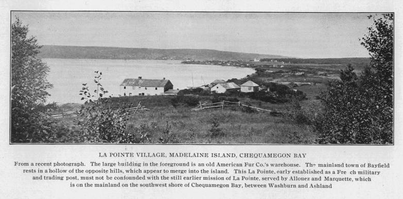
Photograph of La Pointe from Mission Hill circa 1902.
~ Wisconsin Historical Collections, Volume XVI, page 80.
I have received a supply of provisions from Mr Chapmann which will enable me to get through this season. The [?] [of?] [???] [next?], the time you have set for the arrival of the Schooner, will be sufficient, early for our business. The Glass and other materials for finishing of the buildings would be required to be sent up in the first trip but if [we?] [are?] [??] better to have them earlier. If these articles could be sent to the Sault early in the Spring a boat load might be formed of [Some?] and Provisions and sent to the Ance. From there men could be spared at that season of the year to bring the load to this place. In that way there would be no heavy expense incurred and I would be able to have the buildings in greater forwardness.
If the plan should meet your approbation please let me know by the winter express. While Mr Aitkin was here we planned out our buildings. The House will be 86 feet by 26 feet in the clear, the two stores will be put up agreeable to your Draft. We do not consider them to large.
I am afraid I shall not be able to build a wharf in season, but shall do my best to accomplish all that can be done with the means I have.

Undated photograph of Captain John Daniel Angus’ boat at the ABCFM mission dock.
~ Madeline Island Museum
I would wish to call your attention towards a few of the articles in our trade. I do not know how you have been accustomed to buy the Powder whether by the Keg or pound. If a keg is estimated at 50#, there is a great deception for some of our kegs do not contain more than 37 or 40 #s.
Our Guns are very bad particularly the barrels. They splint in the inside after been fired once or twice.
Our Holland twine is better this year than it has been for Years. One dz makes about 20 fathoms, more than last year. But it would be better if it was bleached. The NW Company and old Mr Ermantinger’s Net Thread was always bleached. It nits better and does not twist up when put into the water. Our maitre [??] [???] are some years five strand. Those are too large we have to untwist them and take 2 strands out. Our maitre this year are three strand they are rather coarse but will answer. They are not durable nor will they last as long as the nets of course they have to be [renewed?]. The best maitres are those we make of Sturgeon twine. We [?????] the twine and twist it a little. They last twice as long as our imported maitres. The great object to be gained is to have the maitres as small as possible if they be strong enough. Three coarse strands of twisted together is bulky and soon nits.
Our coarse Shoes are not worth bringing into the country. Strong sewed shoes would cost a little more but they would last longer. The [Booties?] and fine Shoes are not much better.
Our Teakettles used to have round bottoms. This year they are flat. They Indians always prefer the round bottom.
In regard to the observations you have made concerning the Doctor’s deviating from the instructions I gave him on leaving Mackinac, I must in justice to him say that I am now fully convinced in my own mind that he misunderstood me entirely, merely by an expression of mine which was intended by me in regard to his voyage from Mackinac to the Sault but by him was mistaken for the route through Lake Superior. The circumstances has hurt his feelings much and as he at all times does his best for the Interest of the Outfit I ought to have mentioned in my last letter, but it did not strike my mind at that time.

Detail from Carte des lacs du Canada by Jacques Nicolas Bellin in 1744.
When Mr Aitkin was here he mentioned to me some information he had obtained from somebody in Fond du Lac who had been in the NW Co service relating to a remarkable good white fish fishery on the “Milleau” or “Millons” Islands (do not know exactly the proper name). They lay right opposite to Point Quiwinau. a vessel which passes between the island and the point can see both. Among Mr Chapmann’s crew here there is an old man who tells me that he knew the place well, he says the island is large, say 50 or 60 miles. The Indian used to make their hunts there on account of the great quantity of Beaver and Reindeer. It is he says where the NWest Co used to make their fishing for Fort William. There is an excellent harbour for the vessel it is there where the largest white fish are caught in Lake Superior. Furthermore the old man says the island is nearer the American shore than the English. Some information might be obtained from Capt. McCargo. If it proves that we can occupy the grounds I have the most sanguine hopes that we shall succeed in the fisheries upon a large scale.
I hope you will gather all the information you can on the subject. Particular where the line runs. If it belongs to the Americans we must make a permanent post on the Island next year under the charge of an active person to conduct the fisheries upon a large scale.
Jh Chevallier one of the men I got in Mackinac is a useless man, he has always been sick since he left Sault. Mr Aitkin advised me to send him back in Chapman’s Boat. I have therefore send him out to the care of Mr Franchere.
By the Winter Express I will to give you all the informations that I may be able to give. I will close by wishing you great health and prosperity. Please present my Respects to Mr Clapp.
I remain Dear Sir.
Very Respectfully Yours
Most Obedient Servant
Lyman M. Warren
To be Continued in 1835…
Wisconsin Territory Delegation: The Copper Region
April 17, 2016
By Amorin Mello
A curious series of correspondences from “Morgan”
… continued from Copper Harbor.

The Daily Union (Washington D.C.)
“Liberty, The Union, And The Constitution.”
August 21, 1845.
EDITOR’S CORRESPONDENCE.
—
[From our Regular Correspondent.]
THE COPPER REGION.
La Pointe, Lake Superior
July 28, 1845.

Map of the Mineral Lands Upon Lake Superior Ceded to the United States by the Treaty of 1842 With the Chippeway Indians.
~ Wisconsin Historical Society
In my last brief letter from this place, I had not time to notice many things which I desired to describe. I have now examined the whole coast of the southern shore of Lake Superior, extending from the Sault Ste. Marie to La Pointe, including a visit to the Anse, and the doubling of Keweena point. During the trip, as stated previously, we had camped out twenty-one nights. I examined the mines worked by the Pittsburg company at Copper harbor, and those worked by the Boston company at Eagle river, as well as picked up all the information I could about other portions of the mineral district, both off and on shore. The object I had in view when visiting it, was to find out, as near as I could, the naked facts in relation to it. The distance of the lake-shore traversed by my part to La Pointe was about five hundred miles – consuming near four weeks’ time to traverse it. I have still before me a journey of three or four hundred miles before I reach the Mississippi river, by the way of the Brulé and St. Croix rivers. I know the public mind has been recently much excited in relation to the mineral region of country of Lake Superior, and that a great many stories are in circulation about it. I know, also, that what is said and published about it, will be read with more or less interest, especially by parties who have embarked in any of the speculations which have been got up about it. It is due to truth and candor, however, for me to declare it as my opinion, that the whole country has been overrated. That copper is found scattered over the country equal in extent to the trap-rock hills and conglomerate ledges, either in its native state, or in the form of a black oxide, as a green silicate, and, perhaps, in some other forms, cannot be denied;- but the difficulty, so far, seems to be that the copper ores are too much diffused, and that no veins such as geologist would term permanent have yet positively been discovered.

Detail of a Survey of Location No. 4 for the Pittsburgh & Boston Copper Harbor Mining Co. Image digitized by the Detroit Public Library Burton Historical Collection for The Cliff Mine Archeology Project Blog.
The richest copper ore yet found is that raised from a vein of black oxide, at Copper harbor, worked by the Pittsburg company, which yields about seventy per cent. of pure copper. But this conglomerate cementation of trap-rock, flint, pebbles, &c., and sand, brought together in a fused black mass, (as is supposed, by the overflowings of the trap, of which the hills are composed near this place,) is exceedingly hard and difficult to blast. An opinion seems to prevail among many respectable geologist, that metallic veins found in conglomerate are never thought to be very permanent. Doctor Pettit, however, informed me that he had traced the vein for near a mile through the conglomerate, and into the hill of trap, across a small lake in the rear of Fort Wilkins. The direction of the vein is from northwest to southeast through the conglomerate, while the course of the lake-shore and hills at this place varies little from north and south. Should the doctor succeed in opening a permanent vein in the hill of trap opposite, of which he is sanguine, it is probable this mine will turn out to be exceedingly valuable. As to these matters, however, time alone, with further explorations, must determine. The doctor assured me that he was at present paying his way, in merely sinking shafts over the vein preparatory to mining operations; which he considered a circumstance favorable to the mine, as this is not of common occurrence.
The mines at Copper harbor and Eagle river are the only two as yet sufficiently broached to enable one to form any tolerably accurate opinion as to their value or prospects.
~ Encyclopedia of the Earth
Other companies are about commencing operations, or talk of doing so – such as a New York, or rather Albany company, calling themselves “The New York and Lake Superior Mining Company,” under the direction of Mr. Larned, of Albany, in whose service Dr. Euhts has been employed as geologist. They have made locations at various points – at Dead river, Agate harbor, and at Montreal river. I believe they have commenced mining to some extent at Agate harbor.
One or two other Boston companies, besides that operating at Eagle river, have been formed with the design of operating at other points. Mr. Bernard, formerly of St. Louis, is at the head of one of them. Besides these, there is a kind of Detroit company, organized, it is said, for operating on the Ontonagon river. It has its head, I believe, in Detroit, and its tail almost everywhere. I have not heard of their success in digging, thus far; though they say they have found some valuable mines. Time must determine that. I wish it may be so.

Boston Mining Company stock issued by Joab Bernard in 1846.
~ Copper Country Reflections
From Copper harbor, I paid a visit to Eagle river – a small stream inaccessible to any craft larger than a moderate-sized Mackinac boat. There is only the open lake for a roadstead off its mouth, and no harbor nearer than Eagle harbor, some few miles to the east of it. In passing west from Copper harbor along the northern shore of Keweena point, the coast, almost from the extremity of Keweena point, to near Eagle river, is an iron-bound coast, presenting huge, longitudinal, black, irregular-shaped masses of trap-conglomerate, often rising up ten or fifteen feet high above water, at some distance from the main shore, leaving small sounds behind them, with bays, to which there are entrances through broken continuities of the advanced breakwater-like ledges. Copper harbor is thus formed by Porter’s island, on which the agency has been so injudiciously placed, and which is nothing but a conglomerate island of this character; with its sides next the lake raised by Nature, so as to afford a barrier against the waves that beat against it from without. The surface of the island over the conglomerate is made up of a mass of pebbles and fragmentary rock, mixed with a small portion of earth, wholly or quite incapable of cultivation. Fort Wilkins is located about two miles from the agency, on the main land, between which and the fort communication in winter is difficult, if not impossible. Of the inexcusable blunder made in putting this garrison on its present badly-selected site, I shall have occasion to speak hereafter.
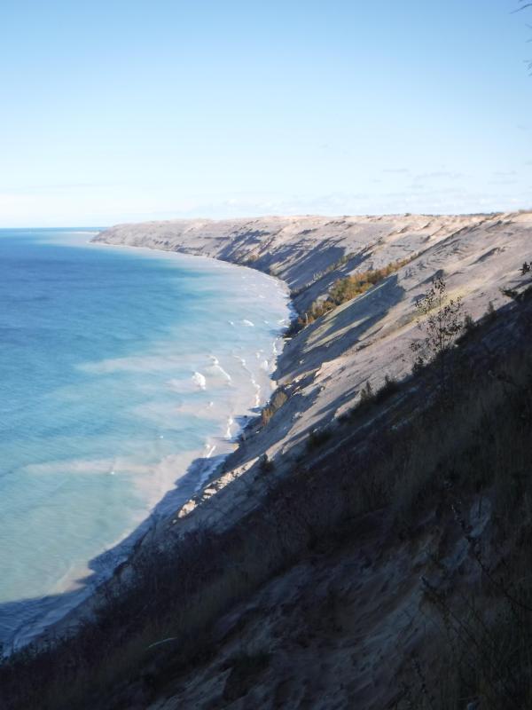
“Grand Sable Dunes”
~ National Park Service
In travelling up the coast from Sault Ste. Marie, the first 50 or 100 miles, the shore of Lake Superior exhibits, for much of the distance, a white sandy beach, with a growth of pines, silver fir, birch, &c., in the rear. This beach is strewed in places with much whitened and abraded drift-wood, thrown high on the banks by heavy waves in storms, and the action of ice in winter. This drift-wood is met with, at places, from one end of the lake to the other, which we found very convenient for firewood at our encampments. The sand on the southern shore terminates, in a measure, at Grand Sables, which are immense naked pure sand-hills, rising in an almost perpendicular form next to the lake, of from 200 to 300 feet high. Passing this section, we come to white sand-stone in the Pictured Rocks. Leaving these, we make the red sand-stone promontories and shore, at various points from this section, to the extreme end of the lake. It never afterwards wholly disappears. Between promontories of red stone are headlands, &c., standing out often in long, high irregular cliffs, with traverses of from 6, 7, to 8 miles from one to the other, while a kind of rounded bay stretches away inland, having often a sandy beach at its base, with pines growing in the forest in the rear. Into these bays, small rivers, nearly or quite shut in summer with sand, enter the lake.
The first trap-rock we met with, was near Dead river, and at some few points west of it. We then saw no more of it immediately on the coast, till we made the southern shore of Keweena point. All around the coast by the Anse, around Keweena bay, we found nothing but alternations of sand beaches and sand-stone cliffs and points. The inland, distant, and high hills about Huron river, no doubt, are mainly composed of trap-rock.

Detail from Map of the Mineral Lands Upon Lake Superior Ceded to the United States by the Treaty of 1842 With the Chippeway Indians.
~ Wisconsin Historical Society
Going west from Eagle river, we soon after lost both conglomerate and trap-rock, and found, in their stead, our old companions – red sand-stone shores, cliffs, and promontories, alternating with sandy or gravelly beaches.

Detail of the Ontonagon River, “Paul’s Cabin,” the Ontonagon Boulder, and the Porcupine Mountains from Map of the Mineral Lands Upon Lake Superior Ceded to the United States by the Treaty of 1842 With the Chippeway Indians.
~ Wisconsin Historical Society
The trap-rock east and west of the Portage river rises with, and follows, the range of high hills running, at most points irregularly, from northeast to southwest, parallel with the lake shore. It is said to appear in the Porcupine mountain, which runs parallel with Iron river, and at right angles to the lake shore. This mountain is so named by the Indians, who conceived its principal ridge bore a likeness to a porcupine; but, to my fancy, it bears a better resemblance to a huge hog, with its snout stuck down at the lake-shore, and its back and tail running into the interior. This river and mountain are found about twenty miles west of the Ontonagon river, which is said to be the largest stream that empties into the lake. The site for a farm, or the location of an agency, at its mouth, is very beautiful, and admirably suited for either purpose. The soil is good; the river safe for the entrance and secure anchorage of schooners, and navigable to large barges and keel-boats for twelve miles above its mouth. The trap range, believed to be as rich in copper ores as any part of Lake Superior, crosses this river near its forks, about fifteen miles above its mouth. The government have organized a mineral agency at its mouth, and appointed Major Campbell as agent to reside at it; than whom, a better selection could not have been made.
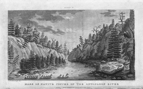
“Engraving depicting the Schoolcraft expedition crossing the Ontonagon River to investigate a copper boulder.”
~ Wisconsin Historical Society
Detail of the Montreal River, La Pointe, and Chequamegon bay from from Map of the Mineral Lands Upon Lake Superior Ceded to the United States by the Treaty of 1842 With the Chippeway Indians.
~ Wisconsin Historical Society
The nearest approach the trap-rock hills make to the lake-shore, beyond the Porcupine mountain, is on the Montreal river, a short distance above the falls. Beyond Montreal river, to La Pointe, we found red-clay cliffs, based on red sand-stone, to occur. Indeed, this combination frequently occurred at various sections of the coast – beginning, first, some miles west of the Portage.
From Copper harbor to Agate harbor is called 7 miles; to Eagle river, 20 miles; to the Portage, 40 miles; to the Ontonagon, 80 miles; to La Pointe, from Copper harbor, 170 miles. From the latter place to the river Brulé is about 70 miles; up which we expect to ascend for 75 miles, make a portage of three miles to the St. Croix river, and descend that for 300 miles to the Mississippi river.

Painting of Professor Douglass Houghton by Robert Thom. Houghton first explored the south shore of Lake Superior in 1840, and died on Lake Superior during a storm on October 13, 1845. Chequamegon Bay’s City of Houghton was named in his honor, and is now known as Houghton Falls State Natural Area.
Going back to Eagle river, at the time of our visit, we found at the mine Mr. Henshaw, Mr. Williams, and Dr. Jackson of Boston, and Dr. Houghton of Michigan, who was passing from Copper harbor to meet his men at his principal camp on Portage river, which he expected to reach that night. The doctor is making a rapid and thorough survey of the country. This work he is conducting in a duplicate manner, under the authority of the United States government. It is both a topographical and geological survey. All his surveyors carry sacks, into which they put pieces of rock broken from every prominent mass they see, and carry into camp at night, for the doctor’s examination, from which he selects specimens for future use. The doctor, from possessing extraordinary strength of constitution, can undergo exposure and fatigue sufficient to break down some of the hardiest men that can be found in the West. He wears his beard as long as a Dunkard’s; has a coat and patched pants made of bed ticking; wears a flat-browned ash-colored, wool hat, and a piece of small hemp cord off a guard chain; and, with two half-breed Indians and a small dog as companions, embarks in a small bark, moving and travelling along the lake shore with great celerity.
Probably no company on Lake Superior has had a longer and harder struggle against adversity than the Phœnix. The original concern, the Lake Superior Copper Company, was among the first which operated at Lake Superior after the relinquishment of the Indian rights to this country in 1843. The trustees of this early organization were David Henshaw and Samuel Williams of Boston, and D. G. Jones and Col. Chas. H. Gratiot, of Detroit; Dr. Charles T. Jackson examined the veins on the property, and work was begun in the latter part of the year 1844. The company met with bad luck from the start, and, the capital stock having become exhausted, it has been reorganized several times in the course of its history.”
~ The Lake Superior Copper Properties: A Guide to Investors and Speculators in in Lake Superior Copper Shares Giving History, Products, Dividend Record and Future Outlook for Each Property, by Henry M. Pinkham, 1888, page 9.
We all sat down to dinner together, by invitation of Mr. Williams, and ate heartily of good, wholesome fare.
After dinner we paid a visit to the shafts at the mine, sunk to a considerable depth in two or three places. Only a few men were at work on one of the shafts; the others seemed to be employed on the saw-mill erecting near the mouth of the river. Others were at work in cutting timbers, &c.
They had also a crushing-mill in a state of forwardness, near the mine.
It is what has been said, and put forth about the value of this mineral deposite, which has done more to incite and feed the copper fever than all other things put together.
Professor Charles Thomas Jackson.
~ Contributions to the History of American Geology, plate 11, opposite page 290.
Dr. Jackson was up here last year, and has this year come up again in the service of the company. Without going very far to explore the country elsewhere, he has certainly been heard to make some very extravagant declarations about this mine,- such as that he “considered it worth a million of dollars;” that some of the ore raised was “worth $2,000 or $3,000 per ton!” So extravagant have been the talk and calculations about this mine, that shares (in its brief lease) have been sold, it is said, for $500 per share! – or more, perhaps!! No doubt, many members of the company are sincere, and actually believe the mine to be immensely valuable. Mr. Williams and General Wilson, both stockholders, strike a trade between themselves. One agrees or offers to give the other $36,000 for his interest, which the other consents to take. This transaction, under some mysterious arrangement, appears in the newspapers, and is widely copied.
Without wishing to give an opinion as to the value and permanency of this mine, (in which many persons have become, probably, seriously involved,) even were I as well qualified to do so as some others, I can only state what are the views of some scientific and practical gentlemen with whom I fell in while in the country, who were from the eastern cities, and carefully examined the famous Eagle river silver and copper mine. I do not allude to Dr. Houghton; for he declines to give an opinion to any one about any part of the country.
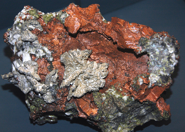
“The remarkable copper-silver ‘halfbreed’ specimen shown above comes from northern Michigan’s Portage Lake Volcanic Series, an extremely thick, Precambrian-aged, flood-basalt deposit that fills up an ancient continental rift valley.”
~ Shared with a Creative Commons license from James St. John
They say this mine is a deposite mine of native silver and copper in pure trap-rock, and no vein at all; that it presents the appearance of these metals being mingled broadcast in the mass of trap-rock; that, in sinking a shaft, the constant danger is, that while a few successive blasts may bring up very rich specimens of the metals, the succeeding blast or stroke of the pick-axe may bring up nothing but plain rock. In other words, that, in all such deposite mines, including deposition of diffused particles of native meteals, there is no certainly their PERMANENT character. How far this mine will extend through the trap, or how long it will hold out, is a matter of uncertainty. Indeed, time alone will show.
It is said metallic veins are most apt to be found in a permanent form where the mountain limestone and trap come in contact.
I have no prejudice against the country, or any parties whatever. I sincerely wish the whole mineral district, and the Eagle mine in particular, were as rich as it has been represented to be. I should like to see such vast mineral wealth as it has been held forth to be, added to the resources of the country.
Unless Dr. Pettit has succeeded in fixing the vein of black oxide in the side of the mountain or hill, it is believed by good judges that no permanent vein has yet been discovered, as far as has come to their knowledge, in the country!! That much of the conglomerate and trap-rock sections of the country, however, presents strong indications and widely diffused appearances of silver and copper ores, cannot be denied; and from the great number of active persons engaged in making explorations, it is possible, if not probable, that valuable veins may be discovered in some portions of the country.
To find such out, however, if they exist, unless by accident, must be the work of time and labor – perhaps of years – as the interior is exceedingly difficult, or rather almost impossible, to examine, on account of the impenetrable nature of the woods.
During our long and tedious journey, we were favored with a good deal of fine weather. We however experienced, first and last, five or six thunderstorms, and some tolerably severe gales.
Coasting for such a great length, and camping out at night, was not without some trials and odd incidents – mixed with some considerable hardships.
On the night before we reached La Pointe, we camped on a rough pebbly beach, some six or eight miles east of Montreal river, under the lea of some high clay cliffs. We kindled our fire on what appeared to be a clear bed of rather large and rounded stones, at the mouth of a gorge in the cliffs.

Topographic map of the gorge in the cliffs at Little Girl’s Point County Park.
~ United States Geological Survey
Next morning early, the fire was rekindled at the same spot, although some rain had falled in the night it being still cloudy, and heavy thunder rolling, indicating an approaching storm. I had placed some potatoes in the fire to roast, while some of the voyageurs were getting other things ready for breakfast; but before we could get anything done, the rain down upon us in torrents. We soon discovered that we had kindled our fire in the bed of a wet weather creek. The water rapidly rose, put out the fire, and washed away my potatoes.
We had then to kindle a new fire at a higher place, which was commenced at the end of a small crooked log. One of the voyageurs had set the frying-pan on the fire with an Indian pone or cake an inch thick, and large enough to cover the bottom it. The under side had begun to bake; another hand had mixed the coffee, and set the coffee-pot on to boil; while a third had been nursing a pot boiling with pork and potatoes, which, as we were detained by rain, the voyageurs thought best to prepare for two meals. One of the part, unfortunately, not observing the connexion between the crooked pole, and the fire at the end of it, jumped with his whole weight on it, which caused it suddenly to turn. In its movement, it turned the frying-pan completely over on the sand, with its contents, which became plastered to the dirt. The coffee-pot was also trounced bottom upwards, and emptied its contents on the sand. The pot of potatoes and pork, not to be outdone, turned over directly into the fire, and very nearly extinguished it. We had, in a measure, to commence operations anew, it being nearly 10 o’clock before we could get breakfast. When near the Madelaine islands, (on the largest of which La Pointe is situated,) the following night, our pilot, amidst the darkness of the evening, got bewildered for a time, when we thought best to land and camp; which, luckily for us, was at a spot within sight of La Pointe. Many trifling incidents of this character befell us in our long journey.
Lake Bands:
“Ki ji ua be she shi, 1st [Chief].
Ke kon o tum, 2nd [Chief].”
Pelican Lakes:
“Kee-che-waub-ish-ash, 1st chief, his x mark.
Nig-gig, 2d chief, his x mark.“
Lac Courte Oreilles Band:
At the mouth of the Montreal river, we fell in with a party of seventeen Indians, composed of old Martin and his band, on their way to La Pointe, to be present at the payment expected to take place about the 15th of August.
They had their faces gaudily painted with red and blue stripes, with the exception of one or two, who had theirs painted quite black, and were said to be in mourning on account of deceased friends. They had come from Pelican lake (or, as the French named it, Lac du Flambeau,) being near the headwaters of the Wisconsin river, and one hundred and fifty miles distant. They had with them their wives; children, dogs, and all, walked the whole way. They told our pilot, Jean Baptiste, himself three parts Indian, that they were hungry, and had no canoe with which to get on to La Pointe. We gave them some corn meal, and received some fish from them for a second supply. For the Indians, if they have anything they think you want, never offer generally to sell it to you, till they have first begged all they can; then they will produce their fish, &c., offering to trade; for which they expect an additional supply of the article you have been giving them. Baptiste distributed among them a few twists of tobacco, which seemed very acceptable. Old Martin presented Baptiste with a fine specimen of native copper which he had picked up somewhere on his way – probably on the headwaters of the Montreal river. He desired us to take one of his men with us to La Pointe, in order that he might carry a canoe back to the party, to enable them to reach La Pointe the next day, which we accordingly complied with. We dropped him, however, at his own request, on the point of land some miles south of La Pointe, where he said he had an Indian acquaintance, who hailed him from shore.
Having reached La Pointe, we were prepared to rest a few days, before commencing our voyage to the Mississippi river.
Of things hereabouts, and in general, I will discourse in my next.
In great haste I am,
Very respectfully,
Your obedient servant,
MORGAN.
To be continued in La Pointe…
Early Settlement of the Bad River Indian Reservation
March 9, 2016
By Amorin Mello
United States. Works Progress Administration:
Chippewa Indian Historical Project Records 1936-1942
(Northland Micro 5; Micro 532)
Details of early settlements on the La Pointe Reservation from Charles Whittlesey‘s 1860 Geological Map of the Penokie Range.
Reel 1; Envelope 1; Item 30.
EARLY SETTLEMENT OF THE BAD RIVER INDIAN RESERVATION
by James Scott
The Bad River Indian Reservation was set aside for the use of the Indians in the year 1854. The legal proceedings for this venture were ratified by Congress in 1855. (See Indian Treaty Laws, Chippewa Treaty, 1854, P. 646.)
Many years before the White Man ever came in contact with the Ojibway Indians of Lake Superior, our forefathers inhabited an island now known as Madeline Island, or La Pointe. They were the ancestors of our present Chippewa now located on the Bad River Reservation, and they came to this location by the way of Shau-boo-mi-ni-ka-ning (Gooseberry Landing Point), which is situated at the extreme South of Madeline Island. From there they traveled across to Chi-gee-wa-ne-kung (a long and shallow sandy point). This is the point where the Great Lakes Light House is now situated. The white people call it Chequamegon Point. From Chequamegon Point, the Indians came to this locality by way of the Ka-ka-gon and Bad rivers. The Indians called this location Kie-tig-ga-ning, (Agricultural Paradise). They had good reason for this title, since the ground was fertile, fish were abundant, game plentiful, and invariably there was a good crop of berries and small fruits. In fact, Kie-tig-ga-ning was their home in the warm months. They planted their gardens here.
The original site for the Bad River Village was located west of the present Chicago & North-western Railroad steel bridge crossing the Bad River just a few rods north of the White River.
The first Indian to make a permanent home here was Ba-bom-ni-go-ni-boy (Spreading Eagle). Having selected a suitable location, he built a large wigwam out of elm bark. After completing his home which was situated between what is now Walker’s store and the railroad bridge, he brought his family.
Not long after, more Indian families from Madeline Island, which was the original habitation of the Ojibwas of Lake Superior, moved to Bad River and settled here with Spreading Eagle. Each year more families came, built their wigwams and bark houses and lived along the banks of the Bad River, near where St. Mary’s School is now located. As the population grew, wigwams multiplied, until they extended from the Bad River to the Ka-ka-gon River, and along the south side of what was known as Blackbird’s field. The village grew so rapidly that wigwams and bark houses were built on both sides of the Bad River, and extended about one-half mile above the west side of the White River.
About this time, secret emissaries from the French and English governments came here as fur traders. The Indians surmised that these people might be representatives of some foreign government. They mingled with the Indians; they looked down upon them as an inferior race; consequently the Indians hated the English.
The French, on the other hand, were very friendly with the Indians. They treated them like brothers and even adopted their ways and customs and married the Indian women. They settle d here permanently, and began to build log cabins. It was undoubtedly from them that the Indians learned how to build the log house besides many other useful things. There are a few of these log-cabins still standing that were built by the early French and Indians settlers. But most of them have been remodeled many times, by covering them inside and out with pine lumber, and building additions to them.

Detail of Nigikoon‘s sawmill and Bad River Falls omitted from Joel Allen Barber’s survey of “The Gardens”.
Several years before the final treaty was signed by the Chippewas of Lake Superior, a strange gentleman appeared in the Indian country: He was a white man and became very well acquainted with some of the Indians His name was Ervin Leihy, but the Indians called him Neg-gi-goons (a young otter). When he saw that the Indians were making their homes on each side of the Bad River, as far up as the Bad River Falls, he too decided to build a little home for himself on the bank at the foot of the Falls. He cleared a small piece of land, built his house and in time erected a saw mill which was run by water power. There he lived for many years cultivating the soil and manufacturing lumber. He was never bothered by any of the Indians because he never gave them any cause for unfriendliness. He associated mostly with the young men of the tribe, learned their language, and spoke it quite fluently. He was soon familiar with Indian ways and habits and adopted many of them.
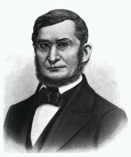
Senator Henry Mower Rice
~ United States Senate Historical Office
On September 30, 1854, the final treaty between the Chippewa of Lake Superior and the United States was concluded, (ratified Jan. 10, 1855). The preliminaries required thirty days of deliberation.
Before the last conference, a gentleman by the name of Henry M. Rice, approached the chiefs and headmen of the La Pointe Band at night, and held a secret conference with them. He coached and advised them to be on the alert should a question arise concerning the selection of a reservation.
“I have been secretly approached,” he said, “by a certain band of Chippewa to assist them in securing the land where you have maintained your homes for years. It would be a shame if another band should cheat you out of this place where you have built your homes and lived so long. Any band, or member of such band, which is a part of the Lake Superior Chippewa who reside in the territory you are now ceding to the United States government, have equal rights to make a selection anywhere in the territory the United States is reserving for you.”
When the conference convened the next day, the question of selecting reservations was in order. Immediately after the announcement was made by the official interpreter, Chief Blackbird of the Bad River Band was on his feet shouting and pointing in different directions with a large flat ceremonial pipe which he held in his right hand, describing the boundary lines of his reservation. (See Article 2, paragraph 2, page 648, Chippewa Treaty of 1854).1
As soon as Chief Blackbird arose, Chief Moni-don-se (Small Bug) of the Lac du Flambeau Band, also arose at the same time, and tried hard to discourage Chief Blackbird. Chief Moni-don-se claimed that he was supposed to make the selection that Chief Blackbird was now making. Then both chiefs became angry and exchanged unpleasant words with one another. One of the Government officials intervened. Chief Moni-don-se claimed that his people had as much right to select this land as Chief Blackbird had. Moni-don-se was finally over-ruled, so he had to settle on the Lac du Flambeau Reservation. Chief Blackbird then thanked Mr. Henry M. Rice for his advice and assistance.
![Vincent Roy, Jr., portrait from "Short biographical sketch of Vincent Roy, [Jr.,]" in Life and Labors of Rt. Rev. Frederic Baraga, by Chrysostom Verwyst, 1900, pages 472-476.](https://chequamegonhistory.com/wp-content/uploads/2016/03/vincent-roy-jr.jpg)
Vincent Roy, Jr. was Henry Mower Rice’s interpreter during the 1854 Treaty with the Chippewas at La Pointe, according to The Sawmill Community at Roy’s Pointe, by Mary Carlson, 2009, page 21.
A few years after the reservations were set aside for the Chippewa people, the construction of more log houses was begun, even being used to bring the timber required for this purpose from the forest. Many new homes were built along the Bad River, the location of the houses extending as far as the Falls. The then existing homes were not lost from view in this movement, and houses needing repairs were given attention. A sub-agent was appointed and placed in charge of the Bad River Reservation, whose duty it was to assist the Indians in agricultural pursuits, as well as guide and advise them in matters concerning such pursuits. None was known as the Government Farmer.
The Indians always took the responsibility and care of his children quite seriously. He taught them early the rudiments of the hunt and the trapping of wild game. He instilled into them from infancy a love of the traditions and customs of their forefathers; he brought before their young minds the organization of the tribe and clans and their duties. He also taught them early in life to be grateful to the Great Spirit and appreciate his many gifts.
Sunday, 21 Apr. 1918
“ASHLAND, Wis., April 20. – Chief Adam Scott, of the Chippewa tribe of Indians is dead. He passed away at his home in Odanah after a short illness of pneumonia at the age of 76 and was buried today.
Chief Scott was one of the head chiefs of the Chippewas since the death of his father who was a head chief of the Chippewa tribe when they were uncivilized. His father was Ka-ta-wa-ba-bay Scott and he lived to see his tribe emerge from a savage state to civilization. His son has been one of the chief advisors of the tribe and has made many trips to Washington on tribal business. Chief Adam Scott leaves one son who becomes chief. Chief Scott was born on Madeline Island and has lived either at Madeline Island or on the Bad River reservation all his life.”
Gic-he-chi-gie-nig Cah-dub-wah-be-da Scott, my father, who died at the age of seventy-six years and ten months, (born June 12, 1840; died April 16, 1916, told me the following:

Kiskitawag (Giishkitawag: “Cut Ear”) signed multiple treaties as a warrior of the Ontonagon Band but afterwards was associated with the Bad River Band. Photograph circa 1880.
~ C.M. Bell, Smithsonian Digital Collections
About four years after the signing of the Treaty of 1854, in the spring of 1858, Chief Keesh-ke-tow-wug (Cut Ear), one of the signers of the treaty, sent invitations through his runner, George Cedar Root (Ke-ka-geese, meaning young Raven) to tell all the people he could contact, to come to his home on a certain day. He had his wife and daughters prepare a great feast and opened up a large Mo-kuk (birch bark container for maple sugar) of maple sugar. About a hundred people ate at his feast that day.
Chief Keesh-ke-tow-wug ordered his runner to light his personal ceremonial pipe and pass it to each of his male guests. After the pipe ceremony he arose in a very dignified manner. He was a tall, lanky old gentleman, and when standing erect was over six feet tall. He said:
“My children, I want you to listen to me. The proposition I am about to present will benefit all of you, and I need your cooperation. I would like to have you donate your labor to clear land for a large community garden, where every family, or any one who wishes can plant. The place I would suggest is that swampy flat, near the cemetery. It will take time to drain it and dry out but I know it will make good garden plats.”
The people approved of the idea and gave him the assurance that they would cooperate with him to carry out his plans. The old chief was more than pleased. he designated a date on which to start.
When they started clearing the ground for this purpose, many things had to be done. The land was covered with willows and scrubby tamarack and water. Long ditches had to be dug to furnish adequate drainage into both rivers, the Ka-ka-gon and the Bad. It was not long before a tract of land of about eighty acres was prepared for the plow and under actual cultivation.
This community garden extended from Mrs. Armstrong’s dwelling on the U. S. Highway No. 2 to where the steel and concrete bridge now crosses the Bad River on the east; and north-west to Waish-ki Martin’s house. This old community clearing is now known as the “Blackbird Field.” The Indians used this ground for their gardens about twenty-five years.

Detail of Chief James Blackbird from an 1899 photo by De Lancey Gill.
~ Smithsonian Collections
In the years 1888 to 1890, Gic-caw-kie-yesh-sheese (Minor Surface Wind), son of the old chief Ma-ca-day-pe-nay-se (Blackbird), filed on this community clearing as his allotment. He was later known as Chief James Blackbird. The selection was approved by the Indian Department and a patent issued, covering the greater portion of the community garden, in the name of James Blackbird. (see Article 3, granting of allotments, in the Chippewa Treaty of 1854, page 649).1
Under the stipulations of the Treaty of 1854, the chiefs with the assistance of a field Indian Agent constituted an allotment committee, who made membership rolls and gave allotments to those who were recognized as members of the Bad River band. Tracts of eighty acres of land were allotted to each.

The Cass-Schoolcraft Expedition identified “Chippewa Gardens” at the location of Odanah. This map is several decades older than Kiskitawag‘s proposal to pursue agriculture at the same location.
~ Narrative journal of travels from Detroit northwest through the great chain of American lakes to the sources of the Mississippi River in the year 1820, by Henry Rowe Schoolcraft, page 105.
