Opinike (or Potatoe) River Property
March 20, 2016
By Amorin Mello

“Map Showing the Succession of Layers Along Potato River” by R. D. Irving, 1873. Reproduced from the Geology of Wisconsin: Volume III.

OPINIKE
(OR POTATOE)
RIVER PROPERTY,
TOWN 46, NORTH RANGE 1, WEST, SECTIONS 16 & 17,
480 ACRES,
ASHLAND COUNTY, WISCONSIN.
————–

Detail of the Opinike River Property and the Ironton trail in Township 45 North, Range 1 West, from Charles Whittlesey’s 1860 Geological Map of the Penokie Range.
The “Charter Oak” Mining Company occupied these premises in 1845-6 under permits from the government. The reports of the agents of the Company at that time state that copper bearing veins were found in the trap rocks next above the lower Falls. In geological characters and position, the rocks are the same here as at the Upper Falls of the Montreal, herein described. Next below the sandstone is the same black slate; below this the conglomerate, then alternating bands of sandstone and trap, and beneath them the main body of brown and amygdaloid trap. Like the Montreal River beds, they are here tilted up at a high angle to the North-west, their line of outcrop bearing North-east. They are, however, reduced in thickness materially, the conglomerate being about 600 feet, and the bands f sandstone are fewer in number. over the conglomerates, and over the trap, there are several falls and chutes in the river, amounting to 125 or 130 feet in a mile.
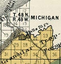
Detail of the Upper Falls (Saxon Falls) on the Montreal River and the Old Flambeau Trail in Township 47 North, Range 1 East from Charles Whittlesey’s 1860 Geological Map of the Penokie Range.
Here, as at the Montreal, the best trap is above the chutes, where it is well exposed in the channel of the river. For one mile above the Lower Falls the trap is of a favorable character ; but above this is not visible until the old Ironton trail is reached. The thickness of the productive trap is not as great as it is at the Montreal River. I judge that this tract covers the entire breadth of the soft brown amygdaloid trap. So far as I can form an opinion from the eternal character of the rocks, they promise as well as any part of this range. No part of the ground has been tested by recent explorations for veins, but there is abundant encouragement for a thorough trial. It must be remembered that it is only in the streams that the rocks composting the best part of this copper range are visible. From the Montreal to the Opinike River, neither the conglomerate nor the trap rises above the level of the country. From the Opinike to the forks of Bad River on Section 17, Town 45, Range 2, West, a distance South-easterly of about nine (9) miles, the productive belt of trap does not show itself above the drift materials, which over the country. The process of exploration is therefore much more tedious than it would be if the uplift was elevated into a high mountain ridge, with rocky cliffs exposed to view.
Ironton is the proper landing for works at the Opinike Falls, as well as for the Montreal River, and the distance is about nine miles. About two miles up the river, the Ironton trail to the Iron Range, crosses the River Opinike. It is highly probable the Ashland Copper Mining Company, which is now at work at the forks of Bad River, will seek an outlet this way. Although there is not a natural harbor at Ironton Landing, there is an angle in the cast which gives shelter to all but Northern winds, and the deep water approaches near the shore. Piers that were sunk there in 1857, have not yet been moved from their foundations by storms or by floating ice. This is the natural outlet for that part of the Iron Range which is East of the Penokie Gap. Although the country is somewhat mountainous, there are no serious obstacles to prevent highways, plank-roads or railroads from being built. Whatever mines may be developed on either the Copper or the Iron Range East of the Bad River, will find this the most convenient route to reach the lake. The water-power of the Opinike is at the upper chutes twenty-eight (28) feet and the lower seventy-five (75) feet – the latter being over the conglomerate rock and the former over trap. It is about three-fourths of a mile between them, and in the distance the river is rapid over a rocky bed. There is sufficient timber on the tract for all mining purposes, and a portion of the soil is equal to any in the country.

Detail of Ervin “Nigigoons” Leihy’s saw mill.
From the falls of the Opinike to Lehy’s saw-mill, at the falls of Bad River, is about nine (9) miles, in a North-westerly direction. Batteaux can reach Lehy’s mill from the lake during the ordinary stage of water. There is an Indian trail from Lehy’s to the falls, over a level country, somewhat more feasible for a road than the route to Ironton, but for the purposes of a mine the Ironton landing is much preferable. The flow of water in the Opinike is not equal to that of the Montreal, but the total fall is greater. Should workable mineral be found here – as appearances lead me confidently to anticipate – the location has advantages of position and water-power such as to place it next the Montreal River property for economical mining.
CHAS. WHITTLESEY,
Geologist and Mining Engineer.
Cleveland, Jan’y 1st, 1865.
Tyler’s Fork Location: Copper Lands
March 19, 2016
By Amorin Mello

“Map and Section Showing the Formations at the Junction of Bad River and Tylers Fork” by R. D. Irving, 1873. Reproduced from the Geology of Wisconsin: Volume III.
LETTER OF J. A. BAILEY, ESQ.,
IN REFERENCE TO THE
TYLER’S FORK PROPERTY.
———–
Office of Ashland Copper Mining Company,
Ashland County, Wis., Oct. 20, 1864.
Messrs. A. Whittlesey F. W. Bartlett,
Gentlemen:
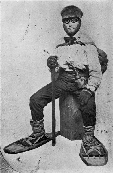
“Asaph Whittlesey dressed for his journey from Ashland to Madison, Wisconsin, to take up his seat in the state legislature. Whittlesey is attired for the long trek in winter gear including goggles, a walking staff, and snowshoes.” Circa 1860.
~ Wisconsin Historical Society
I have made an examination of the trap beds exposed between this and your location, upon the Copper Range, in Sections 15, 16 and 21, Town 45, North, Range 2, West, in this County, and have collected specimens (which are herewith forwarded) from the Ashland Company’s location, and from various points Eastward to your location.
The accompanying sketch of the territory referred to will assist you in locating the several points from which these specimens were taken, the figures upon the sketch indicating the points referred to.

Detail of the Ashland Copper Mine from 1873; located around what is now the main picnic area within Copper Falls State Park.
The specimens No. 1, are from the rocks in place in the bed of the West branch of Bad River, above the falls, near shaft No. 1, and contain a good per centage of native Copper. The copper bearing belt, exposed here across the formation, embraces a breadth of about 500 feet.
Specimens No. 2, are vein rock, from the transverse vein, in which our shaft No. 1 is being sunk. This shaft is now 35 feet deep, carrying small quantities of fine Copper all the way.
Specimens No. 3, are from the outcrop of the Herbert vein, near the junction of the East and West branches of Bad River, containing “gray ore,” or “gray sulphuret of copper.”
Specimens Nos. 4, 5 and 6 are of trap, taken from the rock in place, along Tyler’s Fork, at the points indicated on the sketch of corresponding numbers.
My explorations and survey have been extended only to a short distance East of the Section line dividing Sections 16 and 17.
The surveys have been carefully made with theodolite and chain, with the view to determine the true course of the copper bearing belt through the “Ashland Company’s” property, and that adjoining on the East; and as near as I can determine from the measurements and the character of the rocks exposed, the course of this belt is East and West, or nearly so, through Section 17, with indications of a curve to the Northward, as we approach to, and enter Section 16.
I have indicated on the sketch the position of what I consider the North line of the outcrop of the copper bearing belt. The South line is not determined, the rocks being covered by drift, sand, &c.
It will be proper for me to add that the productive trap formation, found in place above the falls, in the West branch, corresponds fully with the formation at the same elevation in Tyler’s Fork, on the Western boundary of Section 16; and I am clearly of the opinion that at that point the trap formation, when penetrated to a depth corresponding to that at the falls of the West branch, will be alike productive of copper, and that the most productive veins will be found running parallel with the formation.
Very respectfully, Yours, &c.,
J. A. BAILEY,
Supt. & Engineer A. C. M. Co.
—————-
A letter from Mr. E. Leehy, of Bad River Falls, dated Jan’y 6, 1865, states that in shaft No. 2, on the Ashland mine, several hundred feet South of No. 1, and in the productive belt, the copper rock was reached at 20 feet in depth, and the first blast threw out several pounds of native copper in pieces from the size of an egg down.

“Property on which ‘Silver Lead’ has recently been discovered.”
TYLER’S FORK LOCATION.
——-~~0~~——-
COPPER LANDS,
IN
SECTIONS 15 16 AND 21, TOWN 45, NORTH, RANGE 2, WEST.
640 ACRES.
ASHLAND COUNTY, WISCONSIN.

Detail of Township 45 North, Range 2 West, from Charles Whittlesey’s 1860 Geological Map of the Penokie Range.
This location covers a great part, if not all of the breadth of the productive trap formation. The outcrop of the strata is here nearly East and West, with a curve to the North-Eastward on or near this land. The greatest length of the location is North and South, and therefore crosses the formation nearly at right angles. At the Northern end, is the conglomerate and sand rock, which overlies the trap beds. These beds are better exposed at the West, in Section 17, on the Ashland Copper Company’s land, where they are now working and whatever developments may be made there will apply to this property. The strata have a sharp dip to the North, and are thus exposed at the edges, being nearly vertical. Next below, and South of the conglomerate, is a band of black and red trap, of a compact and rather flinty structure, about three hundred (300) feet thick, in which there are numerous transverse veins, cutting the strata at various angles. These are visible in a deep gulf formed on both forks of Bad River, that unite in Section 17. Somme of these cross veins carry copper, both native and as an ore in the form of grey sulphuret. They also carry as vein matter, chlorite, cale, spar, and flucan, or red and green magnesian clay. There are also narrow beds of trap, interstratified with the hard ores, which are softer, owing to a large portion of laumonite. I do not regard the true veins in the upper beds, as likely to furnish mining ground; but as highly valuable indications, which are to be followed into the more promising strata lower down in the system. Next below the hard beds, to the South, is a belt of trap rocks, whose composition and texture I regard as highly favorable.
The Ashland Company is sinking on a cross or transverse vein, at the Southern border of the hard beds; which in the course of 75 or 100 feet along their inclined shaft, will enter what I consider productive ground. The thickness of this ground is not determined, but what I have seen in the branches of the river exceeds half a mile. It is not, however, all alike, as there are in it layers possessing different characters, corresponding in this respect other parts of the trap range in Michigan and Wisconsin.
The stratum at the head of the falls, on the West fork, where the Ashland Company is at work, has been closely examined over a breadth of about 50 feet, and carries small pieces or nuggets of native copper throughout. It is a soft brown amyglaloid, which small bunches of chlorite, spar and laumonite; some prehnite and quartz, in which the copper is found. Lumps weighing one to two pounds have been obtained from this bed away from any appearances of a vein. This is the general character of the mineral belt on Section 17, which I consider as the true mining ground of this part of the range. All these beds are embraced in our location, at a distance of ¼ to ⅓ of a mile on the East. In Sections 16 and 21, the exposure of rock is not as extensive as it is upon 17, for the rocks are covered by drift clay, sand and gravel, except in the streams.
There is no canoe navigation on Tyler’s Fork, or the Upper Bad River, so swift is the current and narrow and crooked are the channels.
Tyler’s Fork comes out of the mountains about twelve miles southeast by south from Woods’s [at Leihy’s Saw Mill], in a chasm, two hundred feet deep deep, in the red sand-rock and conglomerate. The junction of its ten branches takes place in this narrow gulf or ‘cañon,’ the eastern branch making a plunge of forty-two feet, succeeded, as you ascend, by a series of chutes over trap-rocks forty feet in one-fourth of a mile. Mr. D. Tyler, of the Charter Oak Company, made a location here, and built a rude cabin at the edge of the falls.”
Geological Report on That Portion of Wisconsin Bordering on the South Shore of Lake Superior. Surveyed in the Year 1849, Under the Direction of David Dale Owen, United States Geologist, by Charles Whittlesey, Head of Sub-Corps, page 433.
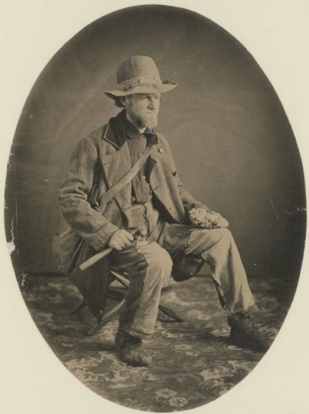
“Studio portrait of geologist Charles Whittlesey dressed for a field trip.” Circa 1858.
~ Wisconsin Historical Society
The East, or “Tyler’s” Fork, shows the trap beds in its channel a large part of the way through Section 16; and they are visible in the small creek that empties into it on Section 21, from the South. To examine the metal-bearing bed, of which I have spoken, after it reaches this location, the rocks must be uncovered by trenches or shafts in the sand and gravel, after having determined the true course of the bed. The search for cross veins can be easily made in the channel of Tyler’s Fork. This is a stream of considerable value for water power, the fall in your property being sufficient for two dams, and the flow of water sufficient for a saw mill. The Exploration of the porous laumonite beds, will be somewhat tedious; but the close proximity to those on the Ashland Company’s property will be of great assistance. As soon as it is demonstrated that these deposits of fine and nugget copper are remunerative at one point on the range, it gives new value to the whole system. Copper deposited in this mode, in other mining districts, has been found to be more uniform over long distances, than it is in veins; because these ores are liable to pass out of the property formations, and into a diabase rock. These copper-bearing longitudinal courses should therefore be most thoroughly searched. In this region, stamp mills can be worked in most cases by water power; a heavy and regular bed can be stoped and broken up ready for the mill, at a much cheaper rate per fathom, than vein matter. The improved stamps, crushers and washers, have of late years much reduced the expence of working mineral-bearing rock. The absence of masses of native copper in the Ashland district, is not now so important as it was when the first explorers made their location here. On this property, the length of the copper-bearing beds is something over a mile, and their breadth at least half a mile. As they extend to a greater depth than any mine can be worked, there is no fear of exhaustion.
CHAS. WHITTLESEY
Geologist and Mining Engineer.
Cleveland, Ohio, Jan. 1st, 1865.
The Woman In Stone
March 15, 2016
By Amorin Mello & Leo Filipczak
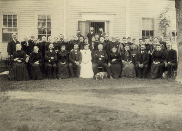
Photograph of the Wheeler and Wood Families from the Wheeler Family Papers at the Wisconsin Historical Society. The woman dressed in white is Harriet Martha Wheeler, according to the book about her mother, Woman in the Wilderness: Letters of Harriet Wood Wheeler, Missonary Wife, 1832-1892, by Nancy Bunge, 2010.
![Leonard Hemenway Wheeler ~ Unnamed Wisconsin by [????]](https://chequamegonhistory.com/wp-content/uploads/2016/03/leonard-hemenway-wheeler-from-unnamed-wisconsin.jpg)
Leonard Hemenway Wheeler: husband of Harriet Wood Wheeler, and father of author Harriet Martha Wheeler.
~ Unnamed Wisconsin, by John Nelson Davidson, 1895.
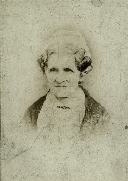
Harriet Wood Wheeler: wife of Leonard Wheeler, and mother of author Harriet Martha Wheeler.
~ Wisconsin Historical Society
This is a reproduction of the final chapter from Harriet Martha Wheeler’s 1903 book, The Woman in Stone: A Novel. If you want to read the entire novel without spoiling the final chapter featured here, you can download it here as a PDF file: The Woman in Stone: A Novel. Special thanks to Paul DeMain at Indian Country Today Media Network for making the digitization of this novel possible for the public to read with convenience.
“Hattie” was named after her mother, Harriet Wood Wheeler; the wife of Reverend Leonard Hemenway Wheeler. Hattie was born in 1858 at Odanah, shortly after the events portrayed in her novel. Hattie’s experiences and writings about the Lake Superior Chippewa are summarized in an academic article by Nancy Bunge, published in The American Transcendental Quarterly , Vol. 16, No. 1 , March 2002: Straddling Cultures: Harriet Wheeler’s and William W. Warren’s Renditions of Ojibwe History

William Whipple Warren (c. 1851)
~ Wikimedia.org
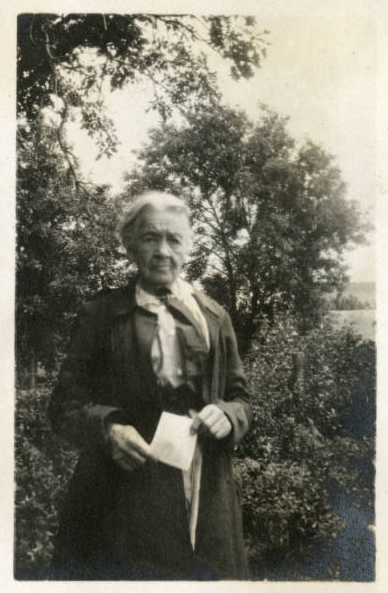
“Mary Warren English, White Earth, Minnesota”
~ University of Minnesota Duluth, Kathryn A. Martin Library, NEMHC Collections
Harriet Wheeler and William W. Warren not only both lived on Ojibwe reservations in northern Wisconsin during the nineteenth century, but their families had strong bonds between them. William Warren’s sister, Mary Warren English, writes that her brother returned to La Pointe, Wisconsin, from school on the same boat Harriet’s parents took to begin their mission work. The Wheelers liked him and appreciated his help: “He won a warm and life-long friendship–with these most estimable people–by his genial and happy disposition–and ever ready and kindly assistance–during their long and tedious voyage” (Warren Papers). When Mary Warren English’s parents died, she moved in with the Wheelers, and, long after she and Harriet no longer shared the same household, she began letters to Harriet with the salutation, “Dear Sister.” But William Warren’s History of the Ojibwe People (1885) and Harriet Wheeler’s novel The Woman in Stone (1903) reveal that this shared background could not overcome the cultural differences between them. Even though Wheeler and Warren often describe the same events and people, their accounts have different implications. Wheeler, the daughter of Congregational missionaries from New England, portrays the inevitable and necessary decline of the Ojibwe, as emissaries of Christianity help civilization progress; Warren, who had French and Ojibwe ancestors, as well as Yankee roots, identifies growing Anglo-Saxon influence on the Ojibwe as a cause of moral decay.
Hattie’s book appears to provide some valuable insights about certain events in Chequamegon history, yet it is clearly erroneous about other such events. According to the University of Wisconsin – Madison, Harriet’s novel is “based on discovery of petrified body of Indian woman in northern Wisconsin.” This statement seems to acknowledge this peculiar event as being somewhat factual. However, Hattie’s novel is clearly a work of fiction; it appears that some of her references were to actual events. At this point in time, this mystery of the forest may never be thoroughly confirmed or debunked.
An incomplete theater screenplay, with the title “Woman in Stone,” was also written by Hattie. It appears to be based on her novel, can be found at the Northern Great Lakes Visitor Center Archives, in the Wheeler Family Papers: Northland Mss 14; Box 10; Folder 19. However, only several pages of this screenplay copy still exist in the archive there. A complete copy of Hattie’s screenplay may still exist somewhere else yet.
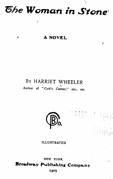
The Woman in Stone: A Novel by Harriet Martha Wheeler, 1903.
[Due to the inconsistencies found in Hattie’s novel, we have omitted most of this novel for this reproduction. We shall skip to the final chapter of Hattie’s novel, to the rediscovery of long lost “Wa-be-goon-a-quace,” the Little Flower Girl. If you want to read the entire novel first, before spoiling this final chapter, you can download it here: The Woman in Stone: A Novel, by Harriet Wheeler, 1903. Special thanks to Paul DeMain at Indian Country Today Media Network for making the digitization of this novel possible for the public to read with convenience.]
(Pages 164-168)
CHAPTER XX.
THE DISCOVERY OF THE WOMAN IN STONE
A hundred years swept over the island Madelaine, bringing change and decay in their train. But, nature renews the waste of time with a prodigal hand and robed the island in verdant loveliness.

Madelaine still towers the queen of the Apostle group, with rocky dells and pine clad shores and odorous forests, through which murmur the breezes from the great lake, and over all hover centuries of history, romance, and legendary lore.
Jean Michel Cadotte was Madelaine’s father-in-law, not husband. Madelaine Cadotte’s Ojibwe name was Ikwezewe, and she was still alive at La Pointe, in her ’90s, during Hattie‘s childhood in Odanah. It’s kind of disturbing how little of this Hattie got right considering Mary Warren (Madeline’s granddaughter) was basically Hattie’s stepsister.
Evolution toward the spiritual is the destiny of humanity and in this trend of progress the Red Men are vanishing before the onward march of the Pale Face. In the place of the blazing Sacred Fire stands the Protestant Mission. The settlers’ cabin supplants the wigwam. No longer are heard the voyageur’s song and the rippling canoes. This is the age of steam, and far and near echoes the shrill whistle. Overgrown mounds mark the sites of the forts of La Ronde and Cadotte. In the spacious log cabin of Jean and Madelaine Cadotte lives their grandson, John Cadotte.

“Dirt trail passing log shack that was probably the home of Michael and Madeline Cadotte, La Pointe,” circa 1897.
~ Wisconsin Historical Society
A practical man is John. He tills his garden, strings his fish-net in the bay, and acts as guide, philosopher and friend for all the tourists who visit the island.
Hildreth Huntington and his father may have been fictionalized, or they may be actual people from the Huntington clan:
by the Huntington Family Association, 1915.
On a June morning of the year 1857, John sat beneath a sheltering pine mending his fish-net. he smoked a cob-pipe, which he occasionally laid by to whistle a voyageur’s song. A shrill whistle sounded and a tug steamed around the bend to the wharf. John laid aside his fish-net and pipe and strolled to the beach. Two gentlemen, clad in tourist’s costume, stepped from the tug and approached John.
“Can you direct us to Mr. John Cadotte?” said the elder man.
“I am your man,” responded John.
Augustus Hamilton Barber had copper and land claims around the Montreal and Tyler Forks Rivers before his death in 1856. It is possible that this father and son pair in Hattie’s novel actually represent Joel Allen Barber and his father, Giles Addison Barber. They were following up on their belated Augustus’ unresolved business in this area during June of 1857. This theory about the Barber family is explored in more details with “Legend of the Montreal River,” by George Francis Thomas.
“My name is Huntington. This young man is my son, Hildreth. We came from New York, and are anxious to explore the region about Tyler’s fork where copper has been discovered. We were directed to you as a guide on whom we might depend. Can we secure your services, sir?” asked the stranger.
“It is also proper to state in addition to what has been already mentioned, that at, or about this time [1857], a road was opened by Mr. Herbert’s order, from the Hay Marsh, six miles out from Ironton, to which point one had been previously opened, to the Range [on the Tyler Forks River], which it struck about midway between Sidebotham’s and Lockwood’s Stations, over which, I suppose, the 50,000 tons as previously mentioned, was to find its way to Ironton, (in a horn).“
~ Penokee Survey Incidents: IV
“I am always open to engagement,” responded John.
“Very well, we will start at once, if agreeable to you.”
“I will run up to the house and pack my traps,” said John.
The stranger strolled along the beach until John’s return. Then all aboard the tug and steamed away towards Ashland. John entertained the strangers with stories and legends of those romantic and adventurous days which were fading into history.
“The company not being satisfied with Mr. Herbert as agent, he was removed and Gen. Cutler appointed in his place, who quickly selected Ashland as headquarters, to which place all the personal property, consisting of merchandise principally, was removed during the summer by myself upon Gen. C.’s order – and Ironton abandoned to its fate.”
~ Penokee Survey Incidents: I
The party left the tug at Ashland and engaged a logger’s team to carry them to Tyler’s Forks, twenty miles away. A rough road had been cut through the forest where once ran an Indian trail. Over this road the horses slowly made their way. Night lowered before they had reached their destination and they pitched their tents in the forest. John kindled a camp-fire and prepared supper. The others gathered wood and arranged bough beds in the tent. They were wearied with the long and tedious journey and early sought this rude couch.
John’s strident tones summoned them to a sunrise breakfast. They broke camp and resumed their journey, arriving at the Forks at noon.
The tourists sat down on the banks of the river and viewed the beautiful falls before them.
“This is the most picturesque spot I have seen, Hildreth. It surpasses Niagara, to my mind,” said Mr. Huntington.

The preface to this novel is a photograph of Brownstone Falls, where the Tyler Forks River empties into the Bad River at Copper Falls State Park. George Francis Thomas’ “A Mystery of the Forest” was originally published as “Legend of the Montreal River“ (and republished here). It suggests that the legend takes place at the Gorge on the Tyler Forks River, where it crosses the Iron Range; not where it terminates on Bad River along the Copper Range.
They gazed about them in wondering admiration. The forest primeval towered above them. Beyond, the falls rolled over their rocky bed. The ceaseless murmur of the rapids sounded below them and over all floated the odors of the pines and balsam firs.
“This description will, I think, give your readers a very good understanding of the condition as well as the true inwardness of the affairs of the Wisconsin & Lake Superior Mining and Smelting Co., in the month of June, 1857.”
[…]
“Rome was not built in a day, but most of these cabins were. I built four myself near the Gorge [on Tyler Forks River], in a day, with the assistance of two halfbreeds, but was not able to find them a week afterwards. This is not only a mystery but a conundrum. I thinksome traveling showman must have stolen them; but although they werenon est we could swear that we had built them, and did.“
~ Penokee Survey Incidents: IV
After dinner the party began their explorations under John’s leadership. Two days were spent in examining the banks of Bad River. On the third morning they came to the gorge. Here, the river narrowed to a few feet and cut its way through high banks of rock. The party examined the rocks on both sides. John climbed to the pool behind the gorge and examined the rocks lying beneath the shallow water. He rested his hand on what seemed to be a water-soaked log and was surprised to find the log a solid block of stone. He examined it carefully. The stone resembled a human form.
“Mr. Huntington, come down here,” he called.
“Have you struck a claim, John?” asked Mr. Huntington.
“Not exactly. Look at this rock. What do you call it, sir?”
Mr. Huntington, his son and the teamster climbed down to the pool and examined the rock.
“A petrification of some sort,” exclaimed Mr. Huntington. “Let us lift it from the water.”
The men struggled some time before they succeeded in raising the solid mass. They rested it against the rocky bank.
Wabigance: Little Flower Girl
Hattie identified this character as “Wa-be-goon-a-quace.” In the Ojibwemowin language, Wabigance is a small flower. Wabigon or Wabegoon is a flower. Wabegoonakwe is a flower that is female.
“A petrified Indian girl,” exclaimed Mr. Huntington.
The men bent low over the strange figure, examining it carefully.
“Look at her moccasins, father,” exclaimed Hildreth, “and her long hair. Here is a rosary and cross about her neck. Evidently she was a good Catholic.”
“Holy Mother,” exclaimed John, “it is the Little Flower Girl.”“And who was she?” asked Mr. Huntington.
“She was my grandmother Madelaine’s cousin. I have heard my grandmother tell about her many times when I was a boy. The Little Flower Girl lost her mind when her pale-faced lover died in battle. She was always hunting for him in the island woods. One evening she disappeared in her canoe and never returned.”
“How came she by this cross?”

Portrait of Jacques Marquette
~ Wikipedia.org
“The Holy Father Marquette gave it to her grandmother, Ogonã. The Little Flower Girl wore it always. She thought it protected her from evil and would lead her to her lover, Claude.”
And so it has. The cross has led the Little Flower Girl up yonder where she has found her Claude and life immortal.
“A touching romance, worthy to be embalmed in stone,” said Hildreth.
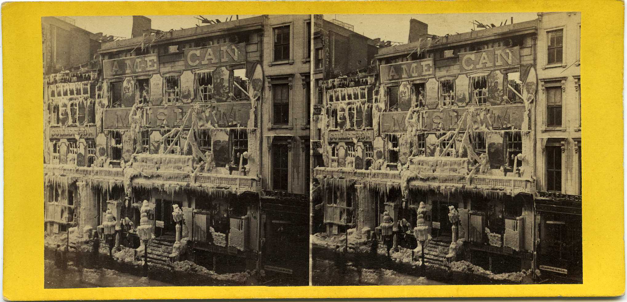
“Barnum’s Museum Fire, New York City, 1868 Incredible view of the frozen ruins of Barnum’s ‘American Museum’ just after the March, 1868 fire. 3-1/4×6-3/4″ yellow-mount view published by E & HT Anthony; #5971 in their series of ‘Anthony’s Stereoscopic Views.’ Huge ice formations where the water sprays hit the building; burned out windows and doors.”
~ CraigCamera.com
“Yes, and worthy of a better resting place,” responded Mr. Huntington. “We must take the Little Flower Girl with us, Hildreth. Her life belongs to the public. Our great city will be better for this monument of her romantic, tragic, sorrowing life.”
Over the forest road, where her moccasined feet had strayed one hundred years before, they bore the Little Flower Girl. And the eyes of the Holy Father shone on her as she crossed the silvery water where her “Ave Maria” echoed long ago. Back to the island Madelaine they carried her, and on, down the great lakes, the Little Flower Girl followed in the wake of her lover, Claude. To the great city of New York they bore her. In one of that great city’s museum rests the Woman in Stone.

Wabigance below the Gorge on the Tyler Forks River.
~ Photograph by M. Matusewic © December 2013.
Reproduced with permission.
The Removal Order of 1849
March 12, 2016
By Amorin Mello
United States. Works Progress Administration:
Chippewa Indian Historical Project Records 1936-1942
(Northland Micro 5; Micro 532)

12th President Zachary Taylor gave the 1849 Removal Order while he was still in office. During 1852, Chief Buffalo and his delegation met 13th President Millard Fillmore in Washington, D.C., to petition against this Removal Order.
~ 1848 presidential campaign poster from the Library of Congress
Reel 1; Envelop 1; Item 14.
The Removal Order of 1849
By Jerome Arbuckle
After the war of 1812 the westward advance of the people of the United States of was renewed with vigor. These pioneers were imbued with the idea that the possessions of the Indian tribes, with whom they came in contact, were for their convenience and theirs for the taking. Any attempt on the part of the aboriginal owners to defend their ancestral homes were a signal for a declaration of war, or a punitive expedition, which invariably resulted in the defeat of the Indians.
“Peace Treaties,” incorporating terms and stipulations suitable particularly to the white man’s government, were then negotiated, whereby the Indians ceded their lands, and the remnants of the dispossessed tribe moved westward. The tribes to the south of the Great Lakes, along the Ohio Valley, were the greatest sufferers from this system of acquisition.
Another system used with equal, if less sanguinary success, was the “treaty system.” Treaties of this type were actually little more than receipt signed by the Indian, which acknowledged the cessions of huge tracts of land. The language of the treaties, in some instances, is so plainly a scheme for the dispossession and removal of the Indians that it is doubtful if the signers for the Indians understood the true import of the document. Possibly, and according to the statements handed down from the Indians of earlier days to the present, Indians who signed the treaties were duped and were the victims of treachery and collusion.
By the terms of the Treaties of 1837 and 1842, the Indians ceded to the Government all their territory lying east of the Mississippi embracing the St. Croix district and eastward to the Chocolate River. The Indians, however, were ignorant of the fact that they had ceded these lands. According to the terms, as understood by them, they were permitted to remain within these treaty boundaries and continue to enjoy the privileges of hunting, fishing, ricing and the making of maple sugar, provided they did not molest their white neighbors; but they clearly understood that the Government was to have the right to use the timber and minerals on these lands.

Entitled “Chief Buffalo’s Petition to the President“ by the Wisconsin Historical Society, the story behind this now famous symbolic petition is actually unrelated to Chief Buffalo from La Pointe, and was created before the Sandy Lake Tragedy. It is a common error to mis-attribute this to Chief Buffalo’s trip to Washington D.C., which occurred after that Tragedy. See Chequamegon History’s original post for more information.

Detail of Benjamin Armstrong from a photograph by Matthew Brady (Minnesota Historical Society). See our Armstrong Engravings post for more information.
Their eyes were opened when the Removal Order of 1849 came like a bolt from the blue. This order cancelled the Indians’ right to hunt and fish in the territory ceded, and gave notification for their removal westward. According to Verwyst, the Franciscan Missionary, many left by reason of this order, and sought a refuge among the westernmost of their tribe who dwelt in Minnesota.
Many of the full bloods, who naturally had a deep attachment for their home soil, refused to budge. The chiefs who signed the treaty were included in this action. They then concluded that they were duped by the Treaty Commissioners and were given a faulty interpretation of the treaty passages. Although the Chippewa realized the futility of armed resistance, those who chose to remain unanimously decided to fight it out. A few white men who were true friends of the Indians, among these was Ben Armstrong, the adopted son of the Head Chief, Buffalo, and he cautioned the Indians against any show of hostility.
At a council, Armstrong prevailed upon the chiefs to make a trip to Washington. Accordingly, preparations for the trip were made, a canoe of special make being constructed for the journey. After cautioning the tribesmen to remain calm, pending their return, they set out for Washington in April, 1852. The party was composed of Buffalo, the head Chief, and several sub-chiefs, one of whom was Oshoga, who later became a noted man among the Chippewa. Armstrong was the interpreter and director of the party. The delegation left La Pointe and proceeded by way of the Great Lakes as far as Buffalo, N. Y., and then by rail to Washington. They stopped at the white settlements along the route and their leader, Mr. Armstrong, circulated a petition among the white people. This petition, which was to be presented to the President, urged that the Chippewa be permitted to remain in their own country and the Removal Order reconsidered. Many signatures were obtained, some of the signers being acquaintances of the President, whose signatures he later recognized.
Despite repeated attempts of arbitrary agents, who were employed by the government to administer Indian affairs, and who endeavored to return them back or discourage the trip, they resolutely persisted. The party arrived at Buffalo, New York, practically penniless. By disposing of some Indian trinkets, and by putting the chief on exhibition, they managed to acquire enough money to defray their expenses until they finally arrived at Washington.
Here it seemed their troubles were to begin. They were refused an audience with those persons who might have been able to assist them. Through the kind assistance of Senator Briggs of New York, they eventually managed to arrange for an interview with President Fillmore.

United States Representative George Briggs was helpful in getting an audience with President Millard Fillmore.
~ Library of Congress
At the appointed time they assembled for the interview and after smoking the peace pipe offered by Chief Buffalo, the “Great White Father” listened to their story of conditions in the Northwest. Their petition was presented and read and the meeting adjourned. President Fillmore, deeply impressed by his visitors, directed that their expenses should be paid by the Government and that they should have the freedom of the city for a week.
![Vincent Roy, Jr., portrait from "Short biographical sketch of Vincent Roy, [Jr.,]" in Life and Labors of Rt. Rev. Frederic Baraga, by Chrysostom Verwyst, 1900, pages 472-476.](https://chequamegonhistory.com/wp-content/uploads/2016/03/vincent-roy-jr.jpg)
Vincent Roy, Jr., was also on this famous trip to Washington, D.C. For more information, see this excerpt from Vincent Roy Jr’s biography.
Their mission was accomplished and all were happy. They had achieved what they sought. An uprising of their people had been averted in which thousands of human lives might have been cruelly slaughtered; so with light hearts they prepared for their homeward trip. Their fare was paid and they returned by rail by way of St. Paul, Minnesota, which was as near as they could get by rail to their homes. From St. Paul they traveled overland, a distance of over two hundred miles, overland. Along the route they frequently met with bands of Chippewa, whom they delighted with the information of the successes of their trip. These groups they instructed to repair to Madeline Island for the treaty at the time stipulated.
Upon their arrival at their own homes, the successes of the delegation was hailed with joy. Runners were dispatched to notify the entire Chippewa nation. As a consequence, many who had left their homes in compliance with the Removal Order now returned.
When the time for the treaty drew near, the Chippewa began to arrive at the Island from all directions. Finally, after careful deliberations, the treaty of 1854 was concluded. This treaty provided for several reservations within the ceded territory. These were Ontonagon and L’Anse, in the present state of Michigan, Lac du Flambeau, Bad River or La Pointe, Red Cliff, and Lac Courte Oreille, in Wisconsin, and Fond du Lac and Grand Portage in Minnesota.
It was at this time that the Chippewa mutually agreed to separate into two divisions, making the Mississippi the dividing line between the Mississippi Chippewa and the Lake Superior Chippewa, and allowing each division the right to deal separately with the Government.
Chief Buffalo Picture Search: Busted Again
March 12, 2016
By Amorin Mello
This post is one of several that seek to determine how many images exist of Great Buffalo, the famous La Pointe Ojibwe chief who died in 1855. To learn why this is necessary, please read this post introducing the Great Chief Buffalo Picture Search.
Posts on Chequamegon History are generally of the obscure variety and are probably only interesting to a handful of people. We anticipate this one could cause some controversy as it concerns an object that holds a lot of importance to many people who live in our area. All we can say about that is that this post represents our research into original historical documents. We did not set out to prove anybody right or wrong, and we don’t think this has to be the last word on the subject. This post is simply our reasoned conclusions based on the evidence we’ve seen. Take from it what you will.

“Chippewa man in Washington, D.C.”
Carte de visite by Charles D. Fredricks & Co., 1862
10 cm x 6 cm
From the Charles W. Jenks carte de visite collection
Photo. 126.194
~ Massachusetts Historical Society Collections Online
The above image has been shared on Facebook and Pinterest social media networks as a photograph of Chief Buffalo from La Pointe. Evidently, it originally came from the Massachusetts Historical Society, and was labeled as an unidentified Chippewa man in Washington D.C. However, it is dated as 1862, which was several years after the death of Chief Buffalo from La Pointe.
On the other hand… it was pointed out to me that the person in the above photograph bears a strong resemblance to a certain painting of Chief Buffalo publicly available for viewing in the main lobby of the Tribal Administration Building in Red Cliff (or here, for convenience). The artist of this modern painting is a living member of Chief Buffalo’s family, is a tribal member of the Red Cliff Band of Lake Superior Chippewa, and has attributed the painting’s appearance to two busts of Chief Buffalo found in Washington D.C.
These inspiring busts were featured previously in Chief Buffalo Picture Search: The Capital Busts, by Leo Filipczak, and are summarized with the three following images:

Be sheekee, or Buffalo by Francis Vincenti, Marble, Modeled 1855, Carved 1856 (United States Senate)
Not Chief Buffalo from La Pointe. This is Chief Buffalo from Leech Lake.
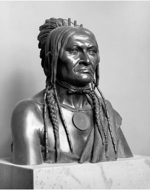
Be Sheekee: A Chippewa Warrior from the Sources of the Mississippi, bronze, by Joseph Lassalle after Francis Vincenti, House wing of the United States Capitol (U.S. Capitol Historical Society).
Not Chief Buffalo from La Pointe. This is Chief Buffalo from Leech Lake.

Be-She-Kee (Buffalo), Head Chief of the Leech Lake Chippewas c. 1863 (Whitney’s Gallery, St. Paul)
Not Chief Buffalo from La Pointe. This is Chief Buffalo from Leech Lake.
Unfortunately, we are not any closer to finding a photograph of Chief Buffalo from La Pointe.
The good news is:
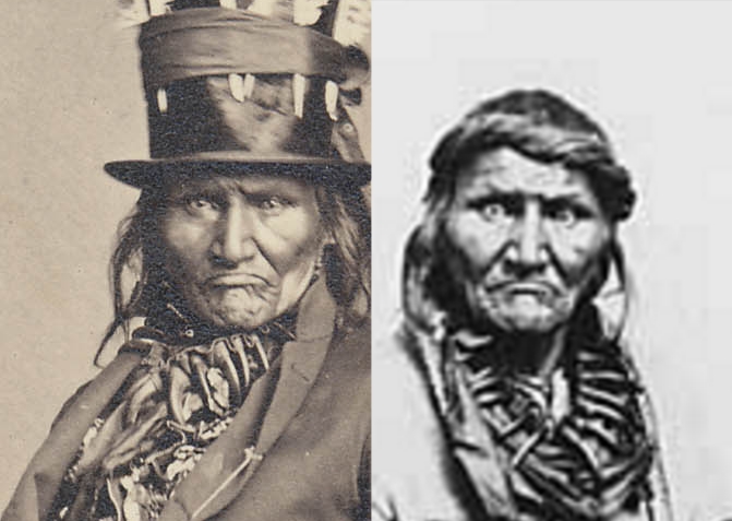
The photograph in question can safely be identified as Chief Buffalo… from Leech Lake.
Not Chief Buffalo from La Pointe. This is Chief Buffalo from Leech Lake.
Early Settlement of the Bad River Indian Reservation
March 9, 2016
By Amorin Mello
United States. Works Progress Administration:
Chippewa Indian Historical Project Records 1936-1942
(Northland Micro 5; Micro 532)
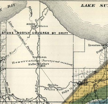
Details of early settlements on the La Pointe Reservation from Charles Whittlesey‘s 1860 Geological Map of the Penokie Range.
Reel 1; Envelope 1; Item 30.
EARLY SETTLEMENT OF THE BAD RIVER INDIAN RESERVATION
by James Scott
The Bad River Indian Reservation was set aside for the use of the Indians in the year 1854. The legal proceedings for this venture were ratified by Congress in 1855. (See Indian Treaty Laws, Chippewa Treaty, 1854, P. 646.)
Many years before the White Man ever came in contact with the Ojibway Indians of Lake Superior, our forefathers inhabited an island now known as Madeline Island, or La Pointe. They were the ancestors of our present Chippewa now located on the Bad River Reservation, and they came to this location by the way of Shau-boo-mi-ni-ka-ning (Gooseberry Landing Point), which is situated at the extreme South of Madeline Island. From there they traveled across to Chi-gee-wa-ne-kung (a long and shallow sandy point). This is the point where the Great Lakes Light House is now situated. The white people call it Chequamegon Point. From Chequamegon Point, the Indians came to this locality by way of the Ka-ka-gon and Bad rivers. The Indians called this location Kie-tig-ga-ning, (Agricultural Paradise). They had good reason for this title, since the ground was fertile, fish were abundant, game plentiful, and invariably there was a good crop of berries and small fruits. In fact, Kie-tig-ga-ning was their home in the warm months. They planted their gardens here.
The original site for the Bad River Village was located west of the present Chicago & North-western Railroad steel bridge crossing the Bad River just a few rods north of the White River.
The first Indian to make a permanent home here was Ba-bom-ni-go-ni-boy (Spreading Eagle). Having selected a suitable location, he built a large wigwam out of elm bark. After completing his home which was situated between what is now Walker’s store and the railroad bridge, he brought his family.
Not long after, more Indian families from Madeline Island, which was the original habitation of the Ojibwas of Lake Superior, moved to Bad River and settled here with Spreading Eagle. Each year more families came, built their wigwams and bark houses and lived along the banks of the Bad River, near where St. Mary’s School is now located. As the population grew, wigwams multiplied, until they extended from the Bad River to the Ka-ka-gon River, and along the south side of what was known as Blackbird’s field. The village grew so rapidly that wigwams and bark houses were built on both sides of the Bad River, and extended about one-half mile above the west side of the White River.
About this time, secret emissaries from the French and English governments came here as fur traders. The Indians surmised that these people might be representatives of some foreign government. They mingled with the Indians; they looked down upon them as an inferior race; consequently the Indians hated the English.
The French, on the other hand, were very friendly with the Indians. They treated them like brothers and even adopted their ways and customs and married the Indian women. They settle d here permanently, and began to build log cabins. It was undoubtedly from them that the Indians learned how to build the log house besides many other useful things. There are a few of these log-cabins still standing that were built by the early French and Indians settlers. But most of them have been remodeled many times, by covering them inside and out with pine lumber, and building additions to them.
Detail of Nigikoon‘s sawmill and Bad River Falls omitted from Joel Allen Barber’s survey of “The Gardens”.
Several years before the final treaty was signed by the Chippewas of Lake Superior, a strange gentleman appeared in the Indian country: He was a white man and became very well acquainted with some of the Indians His name was Ervin Leihy, but the Indians called him Neg-gi-goons (a young otter). When he saw that the Indians were making their homes on each side of the Bad River, as far up as the Bad River Falls, he too decided to build a little home for himself on the bank at the foot of the Falls. He cleared a small piece of land, built his house and in time erected a saw mill which was run by water power. There he lived for many years cultivating the soil and manufacturing lumber. He was never bothered by any of the Indians because he never gave them any cause for unfriendliness. He associated mostly with the young men of the tribe, learned their language, and spoke it quite fluently. He was soon familiar with Indian ways and habits and adopted many of them.
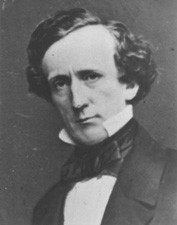
Senator Henry Mower Rice
~ United States Senate Historical Office
On September 30, 1854, the final treaty between the Chippewa of Lake Superior and the United States was concluded, (ratified Jan. 10, 1855). The preliminaries required thirty days of deliberation.
Before the last conference, a gentleman by the name of Henry M. Rice, approached the chiefs and headmen of the La Pointe Band at night, and held a secret conference with them. He coached and advised them to be on the alert should a question arise concerning the selection of a reservation.
“I have been secretly approached,” he said, “by a certain band of Chippewa to assist them in securing the land where you have maintained your homes for years. It would be a shame if another band should cheat you out of this place where you have built your homes and lived so long. Any band, or member of such band, which is a part of the Lake Superior Chippewa who reside in the territory you are now ceding to the United States government, have equal rights to make a selection anywhere in the territory the United States is reserving for you.”
When the conference convened the next day, the question of selecting reservations was in order. Immediately after the announcement was made by the official interpreter, Chief Blackbird of the Bad River Band was on his feet shouting and pointing in different directions with a large flat ceremonial pipe which he held in his right hand, describing the boundary lines of his reservation. (See Article 2, paragraph 2, page 648, Chippewa Treaty of 1854).1
As soon as Chief Blackbird arose, Chief Moni-don-se (Small Bug) of the Lac du Flambeau Band, also arose at the same time, and tried hard to discourage Chief Blackbird. Chief Moni-don-se claimed that he was supposed to make the selection that Chief Blackbird was now making. Then both chiefs became angry and exchanged unpleasant words with one another. One of the Government officials intervened. Chief Moni-don-se claimed that his people had as much right to select this land as Chief Blackbird had. Moni-don-se was finally over-ruled, so he had to settle on the Lac du Flambeau Reservation. Chief Blackbird then thanked Mr. Henry M. Rice for his advice and assistance.
Vincent Roy, Jr. was Henry Mower Rice’s interpreter during the 1854 Treaty with the Chippewas at La Pointe, according to The Sawmill Community at Roy’s Pointe, by Mary Carlson, 2009, page 21.
A few years after the reservations were set aside for the Chippewa people, the construction of more log houses was begun, even being used to bring the timber required for this purpose from the forest. Many new homes were built along the Bad River, the location of the houses extending as far as the Falls. The then existing homes were not lost from view in this movement, and houses needing repairs were given attention. A sub-agent was appointed and placed in charge of the Bad River Reservation, whose duty it was to assist the Indians in agricultural pursuits, as well as guide and advise them in matters concerning such pursuits. None was known as the Government Farmer.
The Indians always took the responsibility and care of his children quite seriously. He taught them early the rudiments of the hunt and the trapping of wild game. He instilled into them from infancy a love of the traditions and customs of their forefathers; he brought before their young minds the organization of the tribe and clans and their duties. He also taught them early in life to be grateful to the Great Spirit and appreciate his many gifts.
Sunday, 21 Apr. 1918
“ASHLAND, Wis., April 20. – Chief Adam Scott, of the Chippewa tribe of Indians is dead. He passed away at his home in Odanah after a short illness of pneumonia at the age of 76 and was buried today.
Chief Scott was one of the head chiefs of the Chippewas since the death of his father who was a head chief of the Chippewa tribe when they were uncivilized. His father was Ka-ta-wa-ba-bay Scott and he lived to see his tribe emerge from a savage state to civilization. His son has been one of the chief advisors of the tribe and has made many trips to Washington on tribal business. Chief Adam Scott leaves one son who becomes chief. Chief Scott was born on Madeline Island and has lived either at Madeline Island or on the Bad River reservation all his life.”
Gic-he-chi-gie-nig Cah-dub-wah-be-da Scott, my father, who died at the age of seventy-six years and ten months, (born June 12, 1840; died April 16, 1916, told me the following:

Kiskitawag (Giishkitawag: “Cut Ear”) signed multiple treaties as a warrior of the Ontonagon Band but afterwards was associated with the Bad River Band. Photograph circa 1880.
~ C.M. Bell, Smithsonian Digital Collections
About four years after the signing of the Treaty of 1854, in the spring of 1858, Chief Keesh-ke-tow-wug (Cut Ear), one of the signers of the treaty, sent invitations through his runner, George Cedar Root (Ke-ka-geese, meaning young Raven) to tell all the people he could contact, to come to his home on a certain day. He had his wife and daughters prepare a great feast and opened up a large Mo-kuk (birch bark container for maple sugar) of maple sugar. About a hundred people ate at his feast that day.
Chief Keesh-ke-tow-wug ordered his runner to light his personal ceremonial pipe and pass it to each of his male guests. After the pipe ceremony he arose in a very dignified manner. He was a tall, lanky old gentleman, and when standing erect was over six feet tall. He said:
“My children, I want you to listen to me. The proposition I am about to present will benefit all of you, and I need your cooperation. I would like to have you donate your labor to clear land for a large community garden, where every family, or any one who wishes can plant. The place I would suggest is that swampy flat, near the cemetery. It will take time to drain it and dry out but I know it will make good garden plats.”
The people approved of the idea and gave him the assurance that they would cooperate with him to carry out his plans. The old chief was more than pleased. he designated a date on which to start.
When they started clearing the ground for this purpose, many things had to be done. The land was covered with willows and scrubby tamarack and water. Long ditches had to be dug to furnish adequate drainage into both rivers, the Ka-ka-gon and the Bad. It was not long before a tract of land of about eighty acres was prepared for the plow and under actual cultivation.
This community garden extended from Mrs. Armstrong’s dwelling on the U. S. Highway No. 2 to where the steel and concrete bridge now crosses the Bad River on the east; and north-west to Waish-ki Martin’s house. This old community clearing is now known as the “Blackbird Field.” The Indians used this ground for their gardens about twenty-five years.

Detail of Chief James Blackbird from an 1899 photo by De Lancey Gill.
~ Smithsonian Collections
In the years 1888 to 1890, Gic-caw-kie-yesh-sheese (Minor Surface Wind), son of the old chief Ma-ca-day-pe-nay-se (Blackbird), filed on this community clearing as his allotment. He was later known as Chief James Blackbird. The selection was approved by the Indian Department and a patent issued, covering the greater portion of the community garden, in the name of James Blackbird. (see Article 3, granting of allotments, in the Chippewa Treaty of 1854, page 649).1
Under the stipulations of the Treaty of 1854, the chiefs with the assistance of a field Indian Agent constituted an allotment committee, who made membership rolls and gave allotments to those who were recognized as members of the Bad River band. Tracts of eighty acres of land were allotted to each.

The Cass-Schoolcraft Expedition identified “Chippewa Gardens” at the location of Odanah. This map is several decades older than Kiskitawag‘s proposal to pursue agriculture at the same location.
~ Narrative journal of travels from Detroit northwest through the great chain of American lakes to the sources of the Mississippi River in the year 1820, by Henry Rowe Schoolcraft, page 105.
Bayfield’s Beginnings
March 6, 2016
By Amorin Mello
This is a reproduction of Captain Robinson Darling Pike’s speech for the 50th anniversary celebrations of Bayfield, Wisconsin on March 24th, 1906. It was originally digitized and reproduced onto RootsWeb.com by John Griener, a great-grandson of Currie G. Bell. The Bayfield County Press was in the Bell family from the Fall of 1882 until July of 1927. Pike’s obituary was not included in this reproduction.

Portrait of Bayfield from History of Northern Wisconsin, by the Western Historical Company, 1881, page 80.
Capt. R. D. PIKE on
Bayfield’s Beginnings
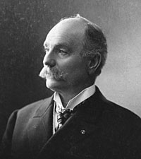
Captain Robinson Derling Pike
~ A gift that spawns Great Lakes fisheries:The legacy of Bayfield pioneer R.D. Pike, by Julia Riley, Darren Miller and Karl Scheidegger for the Wisconsin Department of Natural Resources, October 2011.
Robinson Darling PIKE, son of Judge Elisha and Elizabeth Kimmey PIKE, was a lumbering giant in early Bayfield history. Capt. R. D. Pike, as his name appeared weekly in the Press, was one of the most influential men in the county, associated not only with timber interests, but with the Bayfield Brownstone Company, the electric light company, the fish hatchery, etc. Just before his death on March 27, 1906, he wrote the following recollections of early Bayfield. The paper was read at the Bayfield 50th anniversary celebrations and was published in the March 30, 1906 issue of the Press along with Capt. PIKE’s obituary:
I regret very much not being able to be with you at the celebration of the fiftieth anniversary of the town of Bayfield. As you may be aware, I have been ill for the past few weeks, but am pleased to state at this time I am on the gain and hope to be among you soon. If my health permitted I would take great pleasure in being present with you this evening.
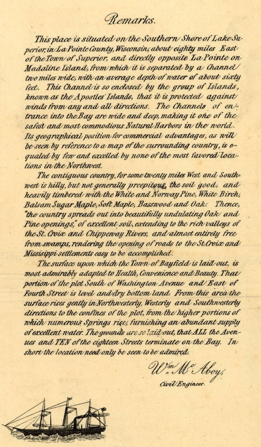
Detail from Major William McAboy‘s 1856 Map of Bayfield.
Senator Henry Mower Rice
~ United States Senate Historical Office
I remember very distinctly that the first stake was driven in the town of Bayfield by Major McABOY who was employed by the Bayfield Townsite Company to make a survey and plat same, (the original plat being recorded at our county seat.) This Bayfield Townsite Company was organized with Hon. Henry M. RICE of St. Paul at the head and some very enterprising men from Washington D.C. Major McABOY arrived here about the first of March and made his headquarters with Julius AUSTRIAN of LaPointe. Julius AUSTRIAN in those days being the Governor General of all that part of the country west of Ontonagon to Superior; Ashland and Duluth being too small to count The major spent probably two weeks at LaPointe going back and forth to Bayfield with a team of large bay horses owned by Julius AUSTRIAN, being the only team of horses in the country.
For more information about Julius Austrian, see other Austrian Papers.
I remember very well being in his office at LaPointe with father, (I being then a mere lad of seventeen,) and I recollect hearing them discuss with Mr. AUSTRIAN the question of running the streets in Bayfield north and south and avenues east and west, or whether they should run them diagonally due to the topography of the country, but he decided on the plan as the town is now laid out. Mr. AUSTRIAN and quite a little party from LaPointe came over here on the 24th of March, 1856, when they officially laid out the town, driving the first stake and deciding on the name Bayfield, named after Lieutenant Bayfield of the Royal Navy who was a particular friend of Senator RICE, and it was he who made the first chart for the guidance of boats on Lake Superior.

“Map of Bayfield situate in La Pointe County, Wisconsin” by Major William McAboy, 1856 for the Bayfield Land Company.
~ Wisconsin Historical Society

For more information about Indian interpreter Frederick Prentice, see his appearances in the Barber Papers.
~ Portrait of Prentice from History of the Maumee Valley by Horace S Knapp, 1872, pages 560-562.
The summer of 1855 father was in poor health, filled up with malaria from the swamps of Toledo, and he was advised by Mr. Frederick PRENTICE, now of New York, and known by everybody here as “the brownstone man,” to come up here and spend the summer as it was a great health resort, so father arrived at LaPointe in June, 1855, on a little steamer that ran from the Soo to the head of the lakes, the canal at that time not being open, but it was opened a little later in the season.

Detail of “Austrian’s Saw Mill” on Pike’s Creek, Chequamegon Bay, Lake Superior, circa 1852.
~ Wisconsin Public Land Survey Records
Upon arrival at LaPointe father entered into an agreement with Julius AUSTRIAN to come over to Pike’s creek and repair the little water mill that was built by the North American Fur Company, which at that time was owned by Julius AUSTRIAN. He made the necessary repairs on the little mill, caught plenty of brook trout and fell in love with the country on account of the good water and pure air and wrote home to us at Toledo glowing letters as to this section of the country. Finally he bought the mill and I think the price paid was $350 for the mill and forty acres of land, and that largely on time; however the mill was not a very extensive affair. Nearly everything was made of wood, except the saw and crank-pin, but it cut about two thousand feet of lumber in twelve hours. Some of the old shafting and pulleys can be seen in the debris at the old mill site now. Remember these were not iron shafts as we used wooden shafts and pulleys in those days. This class of the mill at the time beat whip-sawing, that being the usual way of sawing lumber.
Father left LaPointe some time in September 1855 for Toledo to move his family to Pike’s creek, which stream was named after we moved up here. Onion river and Sioux river were named before that time. On father’s arrival from Toledo from this country we immediately began to get ready to move. We had a large fine yoke of red oxen and logging trucks. He sold out our farm at Toledo, packed up our effects, and boarded a small steamer which took us to Detroit. Our family then consisted of father, mother, grandma PIKE, and my sister, now Mrs. BICKSLER, of Ashland. We stayed several days in Detroit to give father time to buy supplies for the winter; that is feed for the oxen and cow and groceries for the family to carry us through until Spring.
We then boarded the steamer Planet, which was a new boat operated by the Ward Line, considered the fastest on the lake. It was about two hundred fifty tons capacity. We came to Sault Ste. Marie, it being the Planet‘s first trip through the Soo, the canal as I remember was completed that fall. During this year the Lady Elgin was running from Chicago and the Planet and North Star running from Detroit, they being about the only boats which were classed better than sail boats of the one hundred and fifty tons.

Portrait of the Steamer North Star from American Steam Vessels, by Samuel Ward Stanton, page 40.
~ Wikimedia.org
We arrived at LaPointe the early part of October, 1855. On our way up we stopped at Marquette, Eagle Harbor, Eagle River, and Ontonagon. We left Ontonagon in the evening expecting to arrive at LaPointe early the next morning, but a fearful storm arose and the machinery of the Planet became disabled off Porcupine mountains and it looked for a while as though we were never going to weather the storm, but arrived at LaPointe the next day. There were some parties aboard for Superior who left LaPointe by sail.
We remained at LaPointe for a week or ten days on account of my mother’s health and then went to Pike’s bay with all our supplies, oxen and cow on what was known as the Uncle Robert MORRIN’s bateau. Uncle Robert and William MORRIN now of Bayfield, and if I remember rightly, each of the boys pulled an oar taking us across. We landed in Pike’s bay just before sundown, hitched up the oxen and drove to the old mill. Now, this was all in the fall of 1855.

Detail from William McAboy‘s 1856 Map of Bayfield.
“HON. JOHN W. BELL, retired, Madeline Island, P.O. La Pointe, was born in New York City, May 3, 1805, where he remained till he was eight years of age. His parents then took him to Canada, where his father died. He had gotten his education from his father and served an apprenticeship at three trades – watchingmaking, shipbuilding, and coopering. He then moved to Ft. La Prairie, and started a cooper shop, where he remained till 1835, when he came to La Pointe, on the brig “Astor,” in the employ of the American Furn Company as cooper, for whom he worked six months, when he took the business into his own hands, and continued to make barrels as late as 1870. It was in 1846 or 1847 that Robert Stewart, then Commissioner, granted him a license, and he opened a trading post at Island River, and became interested in the mines. he explored and struck a lead in the Porcupine Range, on Onion River, which he sold to the Boston Company, and then came back to La Pointe. In 1854 he was at the treaty between the Chippewas of Lake Superior and the Mississippi River, and was appointed Enrolling Agent on their new reservation, on the St. Louis River, where he went, but soon came back, as the Indians were not willing to stay there. He was then appointed by the Indians to look up their arrearages, and while at this work visited the national capital. He was appointed to County Judge for La Pointe County, and helt till 1878. He was elected on the town board in 1880. Has been Register of Deeds a great many years. Has held most all the different county and town offices, and at one time held or did principally the business for the whole county. He has seen La Pointe in all of its glory dwindle down to a little fishing hamlet; is now Postmaster at his island home, where he occupies a house put up by the old fur company. He was married in 1837 to Miss Margaret Brebant, in the old Catholic Church, by Rev. Bishop Baraga. They had seven children – John(deceased), Harriette (now Mrs. La Pointe), Thomas (deceased), Alfred (now Town Clerk), Sarah F., Margaret (deceased), and Mary (now Mrs. Denome).”
~ History of Northern Wisconsin, by the Western Historical Company, 1881.
As I said before, the town was laid out on March 24th, 1856, and record made same at LaPointe by John W. BELL, who at that time was the “Witte” of all the country between Ontonagon and Superior; Julius AUSTRIAN being the “Czar” of those days and both God’s noblemen. [Note: This was a reference to Count Sergei Witte and Tsar Nicholas II, contemporaries of Capt. Pike. Witte was responsible for much industrial development of Tsarist Russia in the 1890’s.] The Territory now comprising the town of Bayfield was taken from LaPointe county. There were a number of very prominent men interested in laying out the townsite and naming our avenues and streets, such as Hon. H. M. RICE and men of means from Washington after whom some of our avenues were named.
Very soon after this they wished to build a large mill in order to furnish lumber necessary for building up the town. The Washington people decided upon a man by the name of CAHO, an old lumberman of Virginia, so he was employed to come up here and direct the building of the mill. A hotel was built directly across from the courthouse by the Mr. BICKSLER who afterwards married my sister. The saw mill was built about a block west of where my saw mill now stands. The mill had a capacity of five or six thousand feet per day and I think the machinery came from Alexandria, Virginia. Joe LaPOINTE was the only man recognized as being capable of running a mill from the fact that he could do his own filing and sawing. While they were constructing the mill they had a gang of men in the woods getting out hard wood for fuel, not thinking of using any of the sawdust, and they piled the sawdust out with the slabs as useless. Charley DAY, whom many of you will remember, who was the party who got out the hardwood as fuel for the mill.
Time has wrought many changes in our midst. As far as I know, I am the only white man living who was here at the time the town was laid out.
In conclusion I wish to say that at a banquet given in Bayfield some two or three years ago, I made the statement that when the last pine tree was cut from the peninsula on which Bayfield is located the prosperity of our town and vicinity will have just commenced. The pine has gone and now we are cutting the hemlock and hardwood which will last ten to fifteen years; and long before this is exhausted the cut over lands will be taken up and farms tilled, as is the history of other sections of the country.

“Elisha and R.D. Pike owned a private fish hatchery [at Julius Austrian’s former sawmill] in Bayfield County from the 1860s to 1895. The Wisconsin State Legislature mandated the construction of a fish hatchery in northern Wisconsin in 1895, so R.D. Pike donated 405 acres (1.64 km2) from his hatchery to serve as the state hatchery. The state built the main hatchery building in 1897 using brownstone from nearby Pike’s Quarry. The Chicago, St. Paul, Minneapolis and Omaha Railway built a siding to the hatchery, and a special railcar known as The Badger brought fish from the hatchery to Wisconsin waterbodies. In 1974, new buildings and wells were constructed to modernize the hatchery. The hatchery was renamed in honor of longtime Wisconsin Department of Natural Resources secretary Les Voigt in 2006, and the main building was named for R.D. Pike in 2011. The hatchery currently spawns five types of trout and salmon and also includes a visitor’s center and aquarium.”
~ Wikipedia.org
Baash-ki-taa-go-zi, the Firecracker
March 5, 2016
By Amorin Mello

Original sketch of Detroit’s flag, by David Emil Heineman, 1907.
~ Detroit Historical Society
This is a reproduction of biographical sketches from “Jewish Beginnings in Michigan Before 1850,” by Hon. David Emil Heineman. It was transcribed from Publications of the American Jewish Historical Society: Number 13, 1905, pages 57-63. The author’s father, E. S. Heineman, and Kanter were business partners. For more information about Kanter while working for the Leopolds and Austrians families, see the Edward Kanter Papers, 1847-1848.

——-
Jewish Beginnings in Michigan Before 1850
——-
Beginnings Of The Immigration Preceding The Year 1850.
An account of the Jews who came to Michigan in the years immediately succeeding 1850 would be of secondary interest to a society such as this. Such an account would be more proper for a local than a national society; it would deal with the extensive immigration, principally German, of that period, and be made up of long lists of names, birthplaces, and dates of arrival. It would be a recital common at a somewhat earlier date to most of the then Western States telling of the humble beginnings of prosperous merchants, successful professional men, and communal leaders, in largest measure, valuable and valued citizens. The beginnings of congregations would be accurately set down and the memory of man would still suffice to amend the errors due to a neglect of local history. Inasmuch as there has hitherto been a woeful neglect of proper investigation, the writer does not hesitate to enlarge upon the commencement of this immigration and upon a few pioneers therein, all prior to 1850.
The Leopold And Austrian Families.

1843 Drawing of Mission Point Beach at Mackinac Island, Michigan ~ Wikimedia.org
We again recur to Mackinac, and in 1845 find at this point members of the Leopold and Austrian families1 which afterwards became prominent as owners of Lake Michigan vessels and merchants in the ports of the Great Lakes. Lewis F. Leopold, his wife, who was a Miss Babette Austrian,and their son of less than a year old, together with his sister Hannah and his brother Samuel, were located at the island in the year mentioned. Samuel F. Leopold soon after his arrival at Mackinac purchased a one-mast sloop, the “Agate,” with which he gathered up the product of the different fishing points, becoming the first pioneer at this locality in the fishery business, which since that time has grown to such a great industry. The brothers sent down to Cleveland a thousand barrels of salted fish each season, no insignificant industry for those days. This venture, together with the sale of supplies to fishermen, Indian trading, and the purchase of furs, laid the foundations for an extensive business. Samuel F. Leopold left Mackinac in 1853, joining his brothers, Henry and Aaron, and Julius Austrian, who had married Miss Hannah Leopold in 1849, in their recently undertaken business ventures at La Pointe and Fond du Lac, Wisconsin, where they were among the first white settlers.
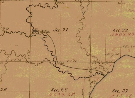
Detail of the “Austrian’s Saw Mill” (formerly the American Fur Company’s sawmill) on Pike’s Creek in the Town of Bayfield, La Pointe County, circa 1852. ~ Wisconsin Public Land Survey Records
Stories about the Austrians’ sawmill and home in Bayfield are shared in Joseph Austrian’s Memoir, and in Benjamin Armstrong’s Memoir.
The town of Bayfield, Wisconsin, was platted shortly thereafter, Marks and Julius Austrian being the preemptors, and Mrs. Julius Austrian the first white woman resident at that place. The history of these enterprising and prominent families, it will thus be seen, falls properly to Wisconsin, but in addition to what has been mentioned, it should be stated that within a few years after 1850 they had established leading stores in Michigan, at Eagle River, Eagle Harbor, the Cliff Mine, Calumet, and at Hancock, Mr. Joseph Austrian having selected at the latter place the site for its first store and warehouse. The Leopolds came from Baden where their name was Freudenthaler; the Austrians, whose name originally was Oesterreicher, came from Wittelshofen, Bavaria. As is obvious, the name in each instance was changed purely for convenience.

Map of the City of Bayfield, La Pointe Co., Wisconsin : Showing the Situation of Lands of Lyman C. Dayton of St. Paul, Minnesota, in and Adjoining the Same, drawn by Wellman and Johnson, surveyors, circa 1856. ~ Wisconsin Historical Society
Sketch Of Edward Kanter.2
There was a young man at Mackinac who in 1846 worked for the parties just mentioned and whose name was Edward Kanter. He had come to Detroit in the fall of 1844 and remained a citizen of Michigan until his death, 52 years later. Always a modest man, he never, in spite of his prominence as a citizen, permitted the publication of his biography and the interesting facts of his career certainly deserve such preservation as the records of this Society afford. They are here set forth for the first time.
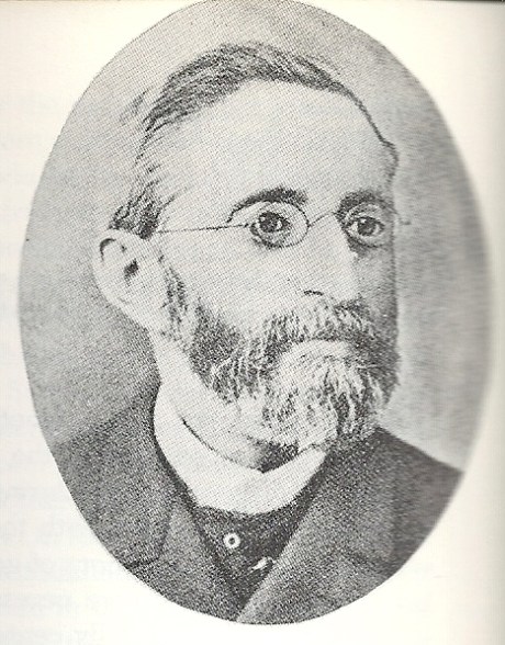
Edward Kanter “Photo published in Katz, Irving I. The Jewish Soldier from Michigan in the Civil War. Detroit, Mich.: Wayne State University Press, 1962. Page 8. Kanter served as vice-president of a Detroit soldier recruitment organization and was the first Jewish member of the Michigan Legislature. Added by: Hebrew Heritage Foundation”
~ Findagrave.com
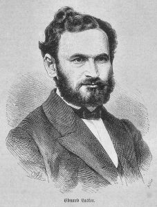
Edward Kanter was related to German Parliamentarian Eduard Lasker (originally Jizchak Lasker).
~ Wikipedia.org
Edward Kanter was born in Breslau in 1824. His father was Louis Kanter, a prosperous linen merchant and a member of the Linen Merchants’ Guild. His mother was Helena Lasker, a near kinswoman of Edward Lasker, the German Parliamentarian, of whose birthplace she was also a native. Young Kanter graduated from the Breslau Gymnasium, equipped among other things with a knowledge of Greek, Latin, German, English, French, and Hebrew. In later years he was often heard to remark that it was his education above all things which helped him out in emergencies. A wild spirit of adventure seized him early in life with the result that he ran away from home and made his way to Paris where his knowledge of the language obtained him employment in a lawyer’s office. Six months later saw him at Havre where, as he was strolling about the wharves, a sudden impulse prompted him to go aboard a vessel bound for New Orleans. He hid behind a coil of rope until well out at sea when he was discovered and at once given a further taste of the rope accompanied by an assortment of curses in several languages. As he was able to turn away wrath with soft answers in all of the respective tongues, it instantly dawned upon the mate at the other end of the rope that he had found a much-needed interpreter for the immigrants of various nations with whom the ship was crowded. The rest of the trip was pleasant sailing for the young stowaway.
The Occident and American Jewish Advocate, Vol. IX. No. 8: Elul 5611, September 1851
——-
“Isaac Hart, Esq., of New Orleans.—We lately intimated that Mr. Hart would be presented with a token of regard from the congregation over which he had been president for several years. The presentation took place on Sunday, the 21st of September, and the following extract from the New Orleans Bee will give our readers all the particulars which have reached us:
Presentation of a Silver Pitcher.— On Sunday last, we were witness of a highly-interesting ceremony. Everybody knows Mr. Isaac Hart, of Canip Street, and most persons are aware that he is an active, zealous, and intelligent member of the German Hebrew Congregation of this city. To his unwearied exertions, his liberality, and his unflagging energy, that Congregation is indebted, in a great degree, for its present prosperity, and for the possession of a spacious and beautiful Temple for the worship of the GOD of Israel. Mr. HART retained the honorable post of President of the Congregation, devoting himself to its welfare, until its leading objects were secured. He then resigned his office, leaving to his successors a noble example of the successful fruits of diligence, religious faith, and indefatigable perseverance.
The members of the congregation, desirous of testifying their grateful appreciation of the efforts of their ex-president, subscribed toward the construction of a massive silver pitcher of exquisite workmanship, having on one side an appropriate inscription, and on the other a beautiful representation of the German Synagogue, and enriched all over with tasteful devices. On Sunday, the officers of the Congregation assembled at Mr. Hart’s residence, and Mr. George G. Levi, on behalf of that body, tendered the pitcher to that gentleman, accompanying the gift with some feeling and eloquent remarks, in which he set forth the valuable services of Mr. Hart, and the high sense of his merits entertained by the association of which he had been selected the interpreter. The donee, in accepting the splendid token, responded warmly and sincerely. He sketched the history and progress of the Congregation, from the days when, obscure and almost nameless, it first struggled into existence, up to the present time, when its members assemble weekly in a noble edifice, consecrated to the Almighty, to solemnize their Sabbath and offer up devotion and prayer to the Most High. He claimed little merit for himself, but said, that like a general in battle, he only led his soldiers, while they had won the victory by their courage and resolution. At the conclusion of the ceremony, the gentlemen and ladies present were conducted by Mr. Hart into another room, where they were entertained with cordial and profuse hospitality.”
On arriving at New Orleans, he found himself with but a single shilling which he gave to be changed to one of the sailors on the ship. The sailor did not return and so the lad landed on the soil of America with literally not a single penny in his pocket. Hardly ashore, he was laid low with yellow fever. He was taken care of by a relief committee of Jewish citizens of New Orleans, among them Mr. Isaac Hart, afterwards a resident of Detroit, a gentleman most kindly remembered by Detroiters. Upon his recovery, the same committee set him to peddling cigars until a congenial place was found for him in a drug store. The place was too congenial; he was much given to chemical experiments, reminiscences perhaps of the Breslau Gymnasium. Presently one of the experiments resulted in a bad explosion of the drug store, from the wreck of which the young scientist rushed terrified to the levee. He went aboard the first boat which happened to need a waiter. Because of his excellent penmanship he was soon promoted to the position of clerk and as such he continued to sail up and down the Red River until one day the boat happened to blow up opposite Helena. He swam ashore, worked his way to St. Louis, took a steamer to Pekin, Illinois, and walked thence to Chicago, where he shipped on the steamer Wisconsin until the close of navigation, 1844. He was now only twenty years of age, but had certainly obtained a few lessons in the larger university of life.
Jewish Virtual Library: Detroit
——-
“German Jews arrived in Detroit in significant numbers in the 1840s. Charles E. Bresler, a settler of the Ann Arbor-Ypsilanti area in the 1830s, moved to Detroit in 1844. He dealt in horses, furs, and wool, and made a fortune importing steel pens. He was one of the incorporators of Detroit’s first Jewish congregation, Temple Beth El. Edward Kanter arrived in Detroit that same year, moving to Mackinac the following year where he was employed by the American Fur Company. Later he worked for the Leopold Brothers, pioneers on the island of Mackinac in the fishery business, and fur traders. Kanter returned to Detroit in 1852 and became Detroit’s first Jewish banker and the first Michigan Jew to serve in the state legislature. Kanter Street is named after him.”
He spent the winter of 1844 in Detroit. The English he had learned at Breslau had always given him trouble, or more properly speaking, had always given trouble to those to whom he spoke, and so he profited by his stay in Detroit to take some lessons from Chas. E. Bresler, a Jewish resident of Michigan, originally from the same part of Europe as Kanter. The ensuing spring saw him again on the lakes, this time as clerk of the steamer Illinois. He left this position, however, taking employment the same year at Mackinac as clerk and interpreter for the American Fur Company, the successor to John Jacob Aster’s venture. Here again his French and English stood him in good stead. His remarkable faculty for languages revealed itself in the rapidity with which he picked up the Indian tongues. In a short time he had mastered the Huron, Chippewa, and Pottawatomie languages and even in later life could on occasion unconcernedly carry on a fluent conversation in any of them. He visited at this time Duluth and the Apostle Islands and was a passenger on the first trip of the “Julia Palmer,” the second boat to be carried on rollers around the Falls at Sault Ste. Marie.
In 1846, as has been stated, he worked for the Leopolds and Austrians. The following year he had been placed in charge of a stock of goods at the island by some eastern parties who suddenly decamped without notice to their creditors. When the latter arrived, they were so impressed by the honesty and zeal wherewith young Kanter had guarded their interests that they voluntarily turned the entire stock and store over to him on easy terms of payment, and so in July, 1847, he opened his books with a cash capital of $200. On these prospects he married a month later the daughter of former State Senator Lyman Granger of the neighboring Bois Blanc Island. He remained at Mackinac until 1852. In that year the late Mr. E. S. Heineman,3 father of the writer, recently arrived at Detroit, was sent to Mackinac to be present at the Indian payment. Mr. Kanter and he immediately became warm friends. The Indians had given Mr. Kanter, because of his bustling activity, the name of “Bosh-bish-gay-bish-gon-sen,” meaning “Fire Cracker,” and Mr. Heineman being somewhat shorter in stature than Mr. Kanter, but of equal activity, was immediately dubbed “Little Firecracker.”
Edward Kanter’s father-in-law was Senator Lyman Granger.
~ Findagrave.com
The red men always had a great liking for Mr. Kanter; they never missed an opportunity to call on him in Detroit or to send greetings to him. The merchants of Detroit in the early 60’s were at a loss one day to account for a circle of Indians gravely squatted in front of Mr. Kanter’s store on the chief business street, Mr. Kanter making one of the circle, the whole company smoking and maintaining a dense silence, until they were informed that a delegation of chiefs on their way to see the Great Father at Washington would not pass through Detroit without smoking a pipe of peace with “Firecracker.”
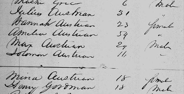
Julius Austrian also went to Germany during 1853 to liquidate his recently deceased father’s estate, and to bring the rest of his family back to settle upon the Great Lakes. Did Edward Kanter travel with the Austrian family?

German-American Bank, possibly Detroit, circa 1900-1920.
~ Library of Congress
In 1853 Mr. Kanter visited his parents in Europe. On his return he continued his successful business career. He became the founder of the German-American Bank, of which one of his sons continues at present to be a principal officer. He entered actively into political life at about this time. He was elected to the legislature of 1857, and though not a member of the prevailing party, presented and so persistently drove home a minority report on certain wrongdoings in the State treasury that the matter ended with the guilty party’s being sent to prison. He was twice made a candidate for the office of State Treasurer, but being a Democrat, the nomination was against hopeless odds. Mr. Kanter was long and conspicuously connected with the Democratic party organization. In the sixties he was Secretary of the Democratic State Central Committee; he was a delegate to the National Convention that nominated Tilden, for eight years was the member from Michigan of the Democratic National Committee. He was Commissioner from Michigan to the New Orleans Exposition, a member of the Board of the House of Correction of Detroit, and in general a constant and valuable participator in public affairs. He was Vice-President and Treasurer of Congregation Beth El in Detroit in 1855 and an unfailing contributor towards its needs. He died in June, 1896. Respected by all who knew him, he left a name synonymous with strict integrity.

“German American Bank, Detroit. Organized February 3, 1883.”
~ Annual Report of the Commissioner of the Banking Dept
By Michigan. Banking Dept, 1891, page 56.
Detail from Congregation Beth El
by Temple Beth El (Detroit, Mich.), 1900, page 54.
1 Data obtained through the kindness of our fellow-member, Rev. Dr. Jos. Stolz, from Mrs. Julius Austrian (Hannah Leopold), and other members of the Austrian family.
2 Data supplied mainly by Hon. Henry L. Kanter of Detroit, son of Edward Kanter.
3 Farmer’s History of Detroit, Vol. II, p. 1155. The friendship of these two young men, thus meeting on this distant and savage island, was a most natural one. Both had been born in the same year, both had received a superior education in Europe, and both had left homes of comfort and luxury, having been equally unfitted by temperament to endure the political and other conditions then prevailing abroad. Their friendship endured until 1896, being terminated by death, Mr. Kanter surviving his friend only a few days.
Legend of the Montreal River
March 5, 2016
By Amorin Mello & Leo Filipczak
This is a reproduction of “Legend of the Montreal River” by George Francis Thomas from his book: Legends of the Land of Lakes, Or History, Traditions and Mysteries, Gleaned from Years of Experience Among the Pioneers, Voyageurs and Indians: With Descriptive Accounts of the Many Natural Curiosities Met with from Lake Huron to the Columbia River. And the Meaning and Derivation of Names of Rivers, Lakes, Towns, Etc., of the Northwest, 1884, pages 70-73.
Old Treaty Hall, La Pointe, Madeline Island, cirica 1922.
“At some point in its history the building came into the hands of George Francis Thomas, who in turn presented it to the [Daughters of the American Revolution], but it was destroyed by fires shortly thereafter.”
~ Wisconsin Historical Society
——-
George Francis Thomas married Sarah E. Bell at La Pointe in 1882. Sarah was the daughter of Judge John William Bell of La Pointe and Maraget Brebant of the Sandy Lake Band of Chippewa Indians. Thomas inherited Treaty Hall at La Pointe from the Bell family after his in-laws and wife died. Thomas also inherited many legends from his marriage at La Pointe.

—
Legend of the Montreal River.
—
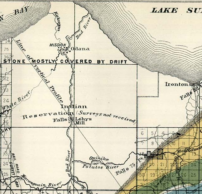
Detail of Odanah, Ironton, and Leihy‘s settlements on the La Pointe Reservation from Charles Whittlesey‘s 1860 “Geological Map of the Penokie Range“ from Geology of Wisconsin, Volume III, plate XX-214. Ironton is located near the mouth of the Montreal River.
Long ago, perhaps fifty years, before a single house or wigwam stood where the city of Ashland now spreads its mammoth protecting wings, there was an Indian settlement on Bad River and another near the beautiful falls on the Montreal. A short distance above its mouth and within sight of the lake, the red sandstone rocks rise boldly to the height of eighty feet, forming a ledge over which the entire volume of water is precipitated into a deep, circular basin or amphitheater, presenting a scene novel and strikingly beautiful. About three miles up the stream is another similar fall, very beautiful, but not so interesting as the first.
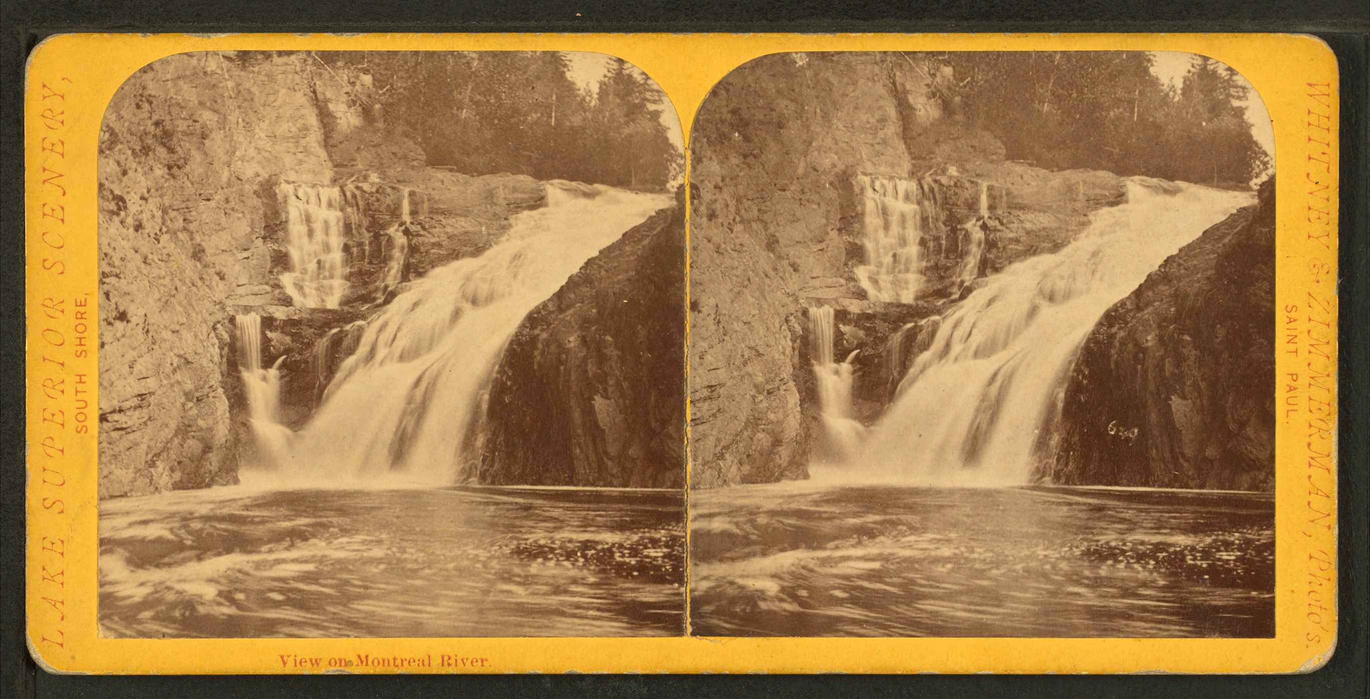
Superior Falls at the mouth of the Montreal River; featured in the stereograph titled “View on Montreal River” by Whitney & Zimmerman from St. Paul, circa 1870.
~ Wikimedia Commons
“Skirting the southern shore of the lake, past the now famous Pictured Rocks, [Pierre d’Esprit, Sieur Radisson, and his sister’s husband, Medard Chouart, Sieur de Groseilliers] carried across Keweenaw Point, visited a band of [Cree] Indians not far from the mouth of Montreal River, now the far western boundary between Upper Michigan and Wisconsin, and, portaging across the base of the Chequamegon Island of to-day, – then united to the mainland,- entered beautiful Chequamegon Bay.”
~ The Story of Chequamegon Bay by Reuben Gold Thwaites.
Below this lovely waterfall and near the shore of the lake, once dwelt the chief a Chippewa band, and near his wigwam were clustered a number of his warriors. Their time was passed in the chase and in fishing; the squaws made mats, canoes, and in the spring time maple sugar; and all were happy and prosperous. In this quiet, peaceful circle was enacted the only real love tragedy recorded during many years upon these shores; and this was caused by the cruel inconstancy of a white man, who had won the heart of an innocent child of nature only to break it, and leave her to mourn and die, as many a fairer, but no less pure maiden had been left before.

Detail of the Rivière du Montreal (Montreal River) from the Carte de l’Amerique Septentrionnale by Jean Baptiste Louis Franquelin, 1688.
~ Library of Congress
It seems that the simple girl had been won by the gew-gaws and glitter – so attractive to the forest maiden – brought here by a young American for trade. At first she only sought his wares, of which, owing to her standing in the tribe as the chief’s daughter, she was enabled to purchase a full share. Decked out in all the latest finery of civilization, she, woman-like no doubt, began to exhibit her new acquisitions in a spirit of rivalry, which, of course, soon begat jealousy in the hearts of her female companions. At this point Cupid came to the front; for if there is one thing more than another which a woman delights in, it is to monopolize the attention of the beau of society. In this particular society, for such really exists among the children of the forest, in a manner at least, the young trader reigned supreme. He was sought by all the beauties of the camp, and had no rival; for be it known that the old beaux and stand-bys are always laid on the shelf when a dashing cavalier from civilization appears – especially when he is an American, and of course rich – for all Americans are either rich or worthless in the eyes of the natives. This bold, bad man was the favored one, no Frenchman or half-caste Indian stood the least show, and ere the joyful days of spring time had gone, two hearts beat as one. The chief’s daughter and the young American were to be married, the gossips said. Time passed and the white man went below to buy goods. He returned, and went once more after many happy hours and days had rolled by; but the maid now began to get impatient. She dreamed that the white man loved another, which may have been true, for he never returned again. At their last parting she bade him farewell, never intimating her suspicions until his canoe was launched upon the waters, and as he paddled away her song of reproach, full of melody and pathos greeted his most unwilling ears. The notes, clear and sweet, floated out over the rising billows, until the truant lover was far beyond. Her words in part were these:
“That water on whose bosom bright,
With joy I’ve seen your bark appear;
You cross no longer with delight,
Nor I with joy, your greeting hear.False words are thine; tho’ now you sigh
I know your grief is not sincere;
‘Tis well our dreaded parting’s nigh;
I bid farewell to pleasure dear.When o’er the waters wide and deep,
Far, thine Ojibway maid shall be,
New loves will make you please to weep,
Nor e’er again remember me.”
With this the fairest of all the tribe, the beloved child of a kind father, confiding and loving, thoughtless and innocent, the merry chirping bird of the forest, and the forsaken fawn, left to die of a wounded heart, wandered far away and was lost in the impenetrable pine forest.
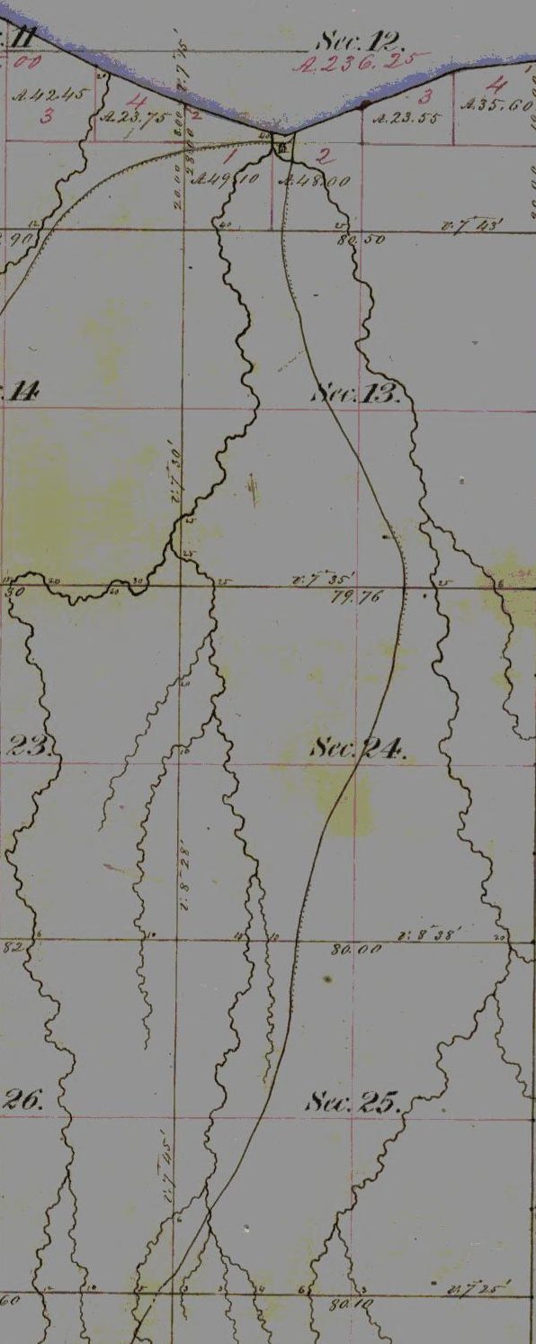
Detail of the Chippewa village (Ironton), at Saxon Harbor, near the mouth of the Montreal River and Superior Falls; with footpaths leading East towards Odanah, and South into the Penokee Mountains …
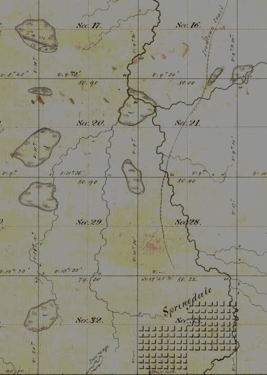
… leading to the Wisconsin & Lake Superior Mining & Smelting Company‘s town-site Springdale at The Gorge on Tyler Forks River.
~ Wisconsin Public Land Survey Records
[…]
“Rome was not built in a day, but most of these cabins were. I built four myself near the Gorge [on Tyler Forks River], in a day, with the assistance of two halfbreeds, but was not able to find them a week afterwards. This is not only a mystery but a conundrum. I think some traveling showman must have stolen them; but although they were non est we could swear that we had built them, and did.“
~ Penokee Survey Incidents: IV
Years afterwards, about 1857, there was considerable excitement in these regions on account of copper discoveries in the range near where it crosses Bad River. Buildings were erected on the banks of Tyler’s Fork, and near the falls, the remains of which are visible at the present day. Mines were opened with fair prospects, but there was no use to try to stem the tide, the current was too strong, transportation was too primitive, and the mines were abandoned. Not, however, until a strange discovery had been made. One day while engaged in exploring below the falls, a workman noticed in a pool what he at first took for a water-soaked section of a log. It was covered by some two feet of water and on closer contact was found to be a solid rock, but in form and size of a human being; in fact it was a petrified Indian woman. How it came there is a mystery. Only a few ever knew of the discovery, for it was kept a secret until it was carried away and sold to a New York Museum. Those who saw the petrified body and knew the story of the chief’s daughter failed not to connect here the two mysteries of the pine forest.
Bad River1 receives its waters partially from a marsh just south of the Penokee range, and besides being dark in color, it possesses some peculiar qualities which may have caused the petrifaction of the body of the young girl after she had drowned herself, as she most likely did.
1 The Chippewa name for Bad River is Mus-ke-ze-bing, meaning river from the marsh. Because the water was discolored the white men thought the Indian name meant dirty or impure water.

Wabigance below the Gorge on the Tyler Forks River.
~ Photograph by M. Matusewic © December 2013.
Reproduced with permission.
First Sawmills on the Bad River Reservation
March 5, 2016
By Amorin Mello
United States. Works Progress Administration:
Chippewa Indian Historical Project Records 1936-1942
(Northland Micro 5; Micro 532)

Abstract
“Records of a WPA project to collect Chippewa Indian folklore sponsored by the Great Lakes Indian Agency and directed by Sister M. Macaria Murphy of St. Mary’s Indian School, Odanah, Wisconsin. Included are narrative and statistical reports, interview outlines, and operational records; and essays concerning Chippewa religious beliefs and rituals, food, liquor, transportation, trade, clothing, games and dances, and history. Also includes copies of materials from the John A. Bardon collection concerning the Superior, Wisconsin region, La Pointe baptismal records, the family tree of Qui-ka-ba-no-kwe, and artwork of Peter Whitebird.”
Reel 1; Envelope 8; Item 4.
FIRST SAWMILLS ON THE BAD RIVER RESERVATION
By Jerome Arbuckle
Detail of Ervin Leihy’s sawmill at Bad River Falls omitted by the General Land Office.
– Ervin Leihy, one of the first white settlers to come to the northern part of Wisconsin died at his home in this city last week. He was born in Oswego county, N. Y., October 12, 1822. His early life was passed on a farm and at 18 moved to Illinois. Later he bought a farm at Bad River, Ashland county, and in 1846 moved onto it. In 1870 he moved to Bayfield, built his present home and opened a general store which he conducted for a number of years. While living at Bad River he was a member of the town and county boards of Ashland county for a number of years and in 1871 and 1872 was a member of the town board of Bayfield. Besides these he held numerous other offices. He was a public-spirited man, had plenty of means and was always ready to assist in anything that would tend to advance the interests of the town in which he resided.”
~ Wisconsin Weekly Advocate, June 6, 1901.
The first sawmill on the Bad River Reservation was operated by a Mr. Leihy at the rapids of Bad River, which is approximately fifteen miles from the village of Odanah. The power was furnished by a paddle-wheel which was propelled by the force of the stream. The saw was of the old vertical style. With these rude methods, the sawing of six to ten logs into lumber was considered a good daily average. Mr. Leihy was known to the Indians as “Nig-gig-goons” or “Little Otter”. He married a woman of Indian blood, and he apparently enjoyed great favor among the Indians of this region.
The lumber was placed on rafts made of large cedar logs and guided down Bad River when the conditions for such a venture were favorable. A long oar or sculler was used in the stern to assist in propelling the raft and to act as a rudder.
From the mouth of Bad River the raft emerged into Lake Superior provided the wind conditions were favorable, then along the shore line to Chequamegon point and thence across to Madeline Island. The channel between the point and the island was considerably narrower at the time than it is at the present. The lumber thus landed was carried to other points on the Lake by sailboats.

Detail of Albert “Wabi-gog” McEwen‘s sawmill on the White River omitted by the General Land Office.
According to the oldest residents of Odanah, another sawmill was located some distance up the White River. This mill was operated by a man known to the Chippewa as “Wabi-gog” or “The White Porcupine.” This mill was operated practically the same as the Leihy mill. The lumber was also rafted down White River to the confluence with Bad River, thence to Lake Superior and to Madeline Island. During the winter the lumber from this mill was hauled on sleighs by oxen to what is now the city of Ashland.
Read about Benjamin Armstrong’s investigation of Wabi-gog‘s supposed murder in Poor McEwen.
“Wabi-gog” was in the habit of making trips on foot to St. Paul, where he purchased the necessaries for his project. He used a trail that intersected what was known as the “Military Road” which led to St. Paul.
On one of these trips he failed to arrive at his destination and no trace of him was ever found. It was surmised that he had been waylaid and murdered, as he usually carried a considerable sum of money on his person.
Detail of the La Pointe Indian Reservation from Charles Whittlesey‘s 1860 “Geological Map of the Penokie Range“ from Geology of Wisconsin, Volume III, plate XX-214: “Lehys Mill” is identified at the Falls on the “Mauvaise or Bad River”. The White River was partly surveyed upstream from the Mission at “Odana”, up to Albert “Wabi-gog” McEwen‘s sawmill, but did not identify it. Whittlesey may have had a copy of Joel Allen Barber’s missing 1856 survey of The Gardens at Odanah.

