1854 Treaty Lands at Apostle Islands National Lakeshore
March 20, 2026
Collected & edited by Amorin Mello
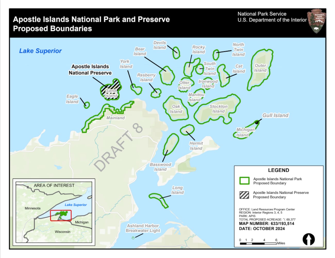 The Chequamegon area’s Apostle Islands National Lakeshore has been in the news lately due to the reintroduction of Congressman Tom Tiffany’s proposed Apostle Islands National Park and [Sand Island] Preserve Act. This proposed Act has been controversial due to strong opposition from local governments citing lack of consultation and insufficient infrastructure, among other concerns.
The goal of this post is to raise awareness about how the current Apostle Islands National Lakeshore contains roughly 3,000 acres of tribal lands reserved by the 1854 Treaty of La Pointe, and should consider returning these tribal lands back to the Lake Superior Chippewa before making any changes to become the proposed Apostle Islands National Park and Sand Island Preserve.
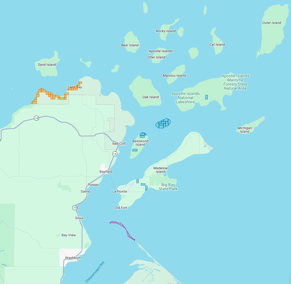
The current Apostle Islands National Lakeshore contains 3 types of lands reserved by the 1854 Chippewa Treaty of La Pointe:
29 Allotments (red) within the Red Cliff Reservation,
14 Allotments (blue) on Stockton, Hermit, & Basswood Islands,
and the disputed Bad River Reservation (purple) on Long Island.
All of the Apostle Islands are part of the ceded territory from the 1842 Treaty of La Pointe covering roughly 22,000 square miles in northern Wisconsin and Michigan. The historical context of this 1842 ceded territory was to allow Americans to move into copper-rich areas while still retaining hunting, fishing and gathering rights for the Lake Superior Chippewa on those same lands. In modern context, this 1842 ceded territory has natural resource managed jointly between the States of Michigan and Wisconsin, the Lake Superior Chippewa, and Great Lakes Indian Fish & Wildlife Commission (GLIFWC).
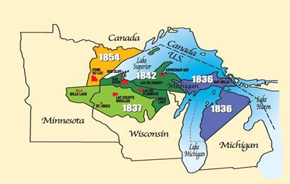
Map of 1836, 1837, 1842, and 1854 ceded territories jointly managed by the Great Lakes Indian Fish & Wildlife Commission (GLIFWC).
The 1854 Treaty of La Pointe reclaimed certain lands within the 1842 ceded territory to be reserved as permanent homelands for the Lake Superior Chippewa Bands in the form of Reservations and Allotments. For more information, we have covered the debates and circumstances leading up to the creation of these Reservations and Allotments in great detail on this blog, such as the Sandy Lake Tragedy and Ojibwe Removal events. Unfortunately much of those Reservations and Allotments have become “checkerboarded” or alienated from the Lake Superior Chippewa despite the original intention of being permanent homelands.
In this post we will examine roughly 3,000 acres of those Reservations and Allotments from the 1854 Treaty of La Pointe that are contained within the Apostle Islands National Lakeshore today. For clarification, there is a Reservation and several Allotments on Madeline Island, which are outside of the Apostle Islands National Lakeshore and will be discussed at a later date instead of in this post. Nor are we including any of the 1887 Dawes Act Allotments on the Apostle Islands in this post, because they are not from the 1854 Treaty.
Without further ado…
Zaagawaamikong-neyaashi
(roughly translated as “long soft beaver dam point”)
a.k.a. Chequamegon Point and Long Island
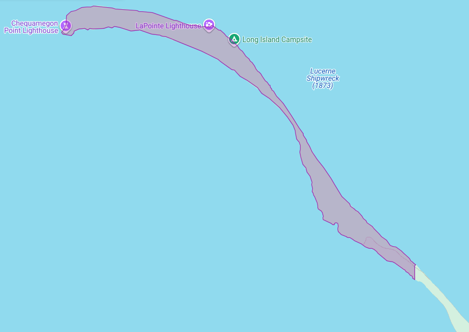
The Apostle Islands National Lakeshore contains Chequamegon Point (roughly 300 acres) on Long Island located at the Bad River Reservation (a.k.a. Mashkiiziibii).
Currently, federal maps of Long Island depict Chequamegon Point to lie outside the Bad River Reservation boundaries. Ownership of Chequamegon Point has been disputed between Bad River and the Federal Government for many generations since the 1854 Treaty.
This dispute is based on how the Second Clause of the Second Article of the 1854 Treaty of La Pointe defined the boundaries of the Bad River Reservation to follow “along the lake shore, crossing Shag-waw-me-quon [Chequamegon] Point, to the place of beginning“. In recent years, Bad River has been conducting a Historical Background Study about the 1854 Treaty of La Pointe and the Chippewa understanding of how they negotiated with Federal negotiators to include Chequamegon Point in Bad River’s lakeshore reservation boundaries.
We have mentioned this ongoing dispute in past posts, and will continue to examine historic records in support of Bad River’s efforts to repatriate tribal ownership of Chequamegon Point.
Gaa-giishkidaawangaa-wiikwedong
(roughly translated as “sand bay”)
a.k.a. Sand Point, Sand Bay, and Little Sand Bay
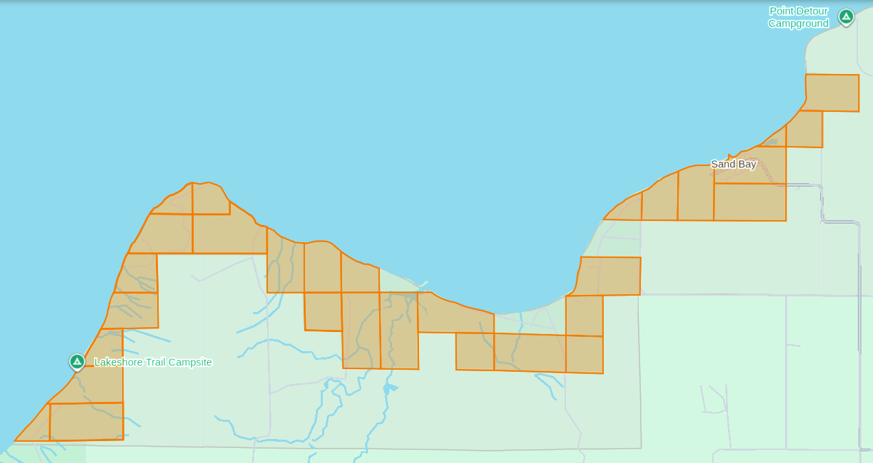
The Apostle Islands National Lakeshore’s Mainland Unit contains 29 Allotments (roughly 1,550 acres) located at the Red Cliff Reservation (a.k.a. Gaa-miskwaabikaang). The Sand Bay shoreline contains three Allotments (uncolored) that are owned by Red Cliff.
The media often cites the 1887 Dawes Act when describing how Allotments on the Lake Superior Chippewa Reservations became alienated from tribal ownership. That is factually incorrect, because these Allotments came from the 1854 Treaty of La Pointe, which precedes the 1887 Dawes Act by several decades. The key difference here is how these 1854 Chippewa Treaty Allotments were designed to reserve tribal land that would never be taken away later, while the later 1887 Dawes Act Allotments were designed to be alienated/sold after a period of 25 years. Unfortunately the 1854 Treaty Allotments were mismanaged by non-tribal governments as being temporary instead of permanent.
This mismanagement has caused much damage over time in the form of “checkerboarded” tribal land bases, which explains the legacy of how these 29 Allotments inside the Red Cliff Reservation fell out of tribal ownership and became part of the original boundaries of the Apostle Islands National Lakeshore.
In 1970, two additional Allotments along the Sand Bay shoreline were targeted to become part of the original boundaries of Apostle Islands National Lakeshore, but ultimately never became alienated from tribal ownership. Today these two Allotments still remain excluded from the boundaries of the current Apostle Islands National Lakeshore and proposed National Park.
In 2018, a third Allotment along Sand Bay that had fallen out of tribal ownership due to “checkerboarding” was repatriated from Town of Russell ownership back to tribal ownership, and is now a Tribal Management Unit of the Apostle Islands National Lakeshore.
The proposed boundaries of the Apostle Islands National Park and [Sand Island] Preserve Act contain this repatriated Allotment, but not the two Allotments that were never alienated from tribal ownership.
Wiisaakodewan-minis
(roughly translated as “half-burnt wood island”)
a.k.a. Stockton Island or Presque Isle
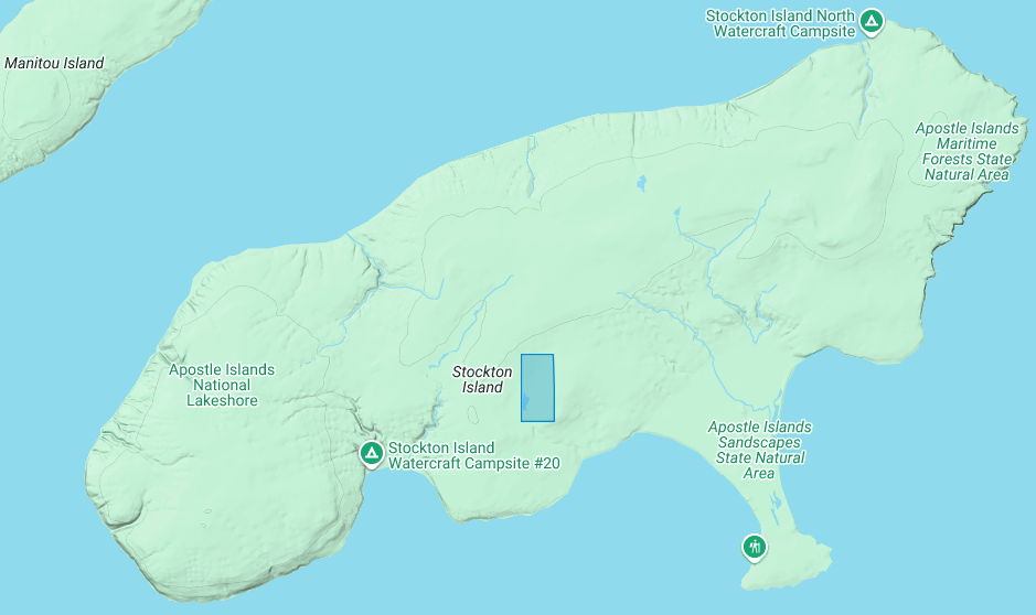
The Apostle Islands National Lakeshore contains one allotment (roughly 80 acres) on Stockton Island:
1) Joseph Gauthier (a.k.a. Gokee) Senior
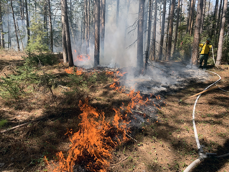
A prescribed fire on Stockton Island conducted by National Park Service and Tribal partners.
~ Photo by Dave Cooper at NPS
The root word of island’s traditional name, Wiisaakodewan (half-burnt wood), refers to Stockton Island’s historic appearance of being partially burnt. In recent years, the Apostle Islands National Lakeshore and the Lake Superior Chippewa have jointly reintroduced the practice of using prescribed fire management to promote the growth of blueberries and other traditional ecological resources on the cultural landscape of Stockton Island.
Wiisaakodewan also happens to be the root word of a pejorative slang term describing the Mixed Blood people of Lake Superior Chippewa. At the time of the Treaty Era, the Mixed Bloods of the Lake Superior Chippewa held a strong connection to this island via the tribal fishing industry. For example, the surveyor Joel Allen Barber described how “the bays on Presque Isle [Stockton Island] are a favorite resort of fishermen” in connection to the tribal fishing grounds of the La Pointe Indian Reservation on Madeline Island’s north end.
Wiigobiish-minis
(roughly translated as “basswood island”)
a.k.a. Basswood Island
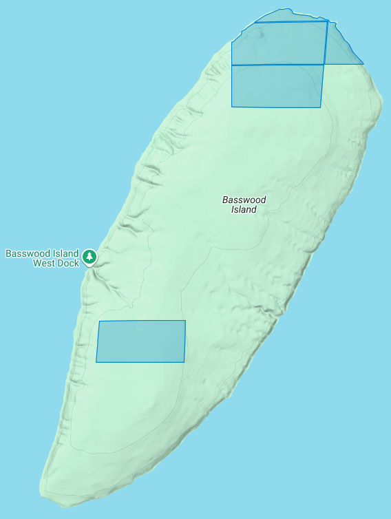
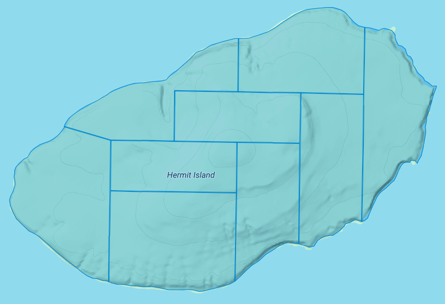
The Apostle Islands National Lakeshore contains four allotments (roughly 290 acres) on Basswood Island:
1) John Baptist Berriot
2) Henry Bresette (a.k.a. Brisette)
3) John Baptist Lemieux
4) Louis Neveaux
In a previous post we briefly mentioned that the infamous John Breckenridge made national news with his land speculation on Basswood Island immediately following the 1854 Treaty of La Pointe. In a few short years Breckinridge would become Vice President of the United States, and also a Confederate States Army brigadier general during the Civil War.
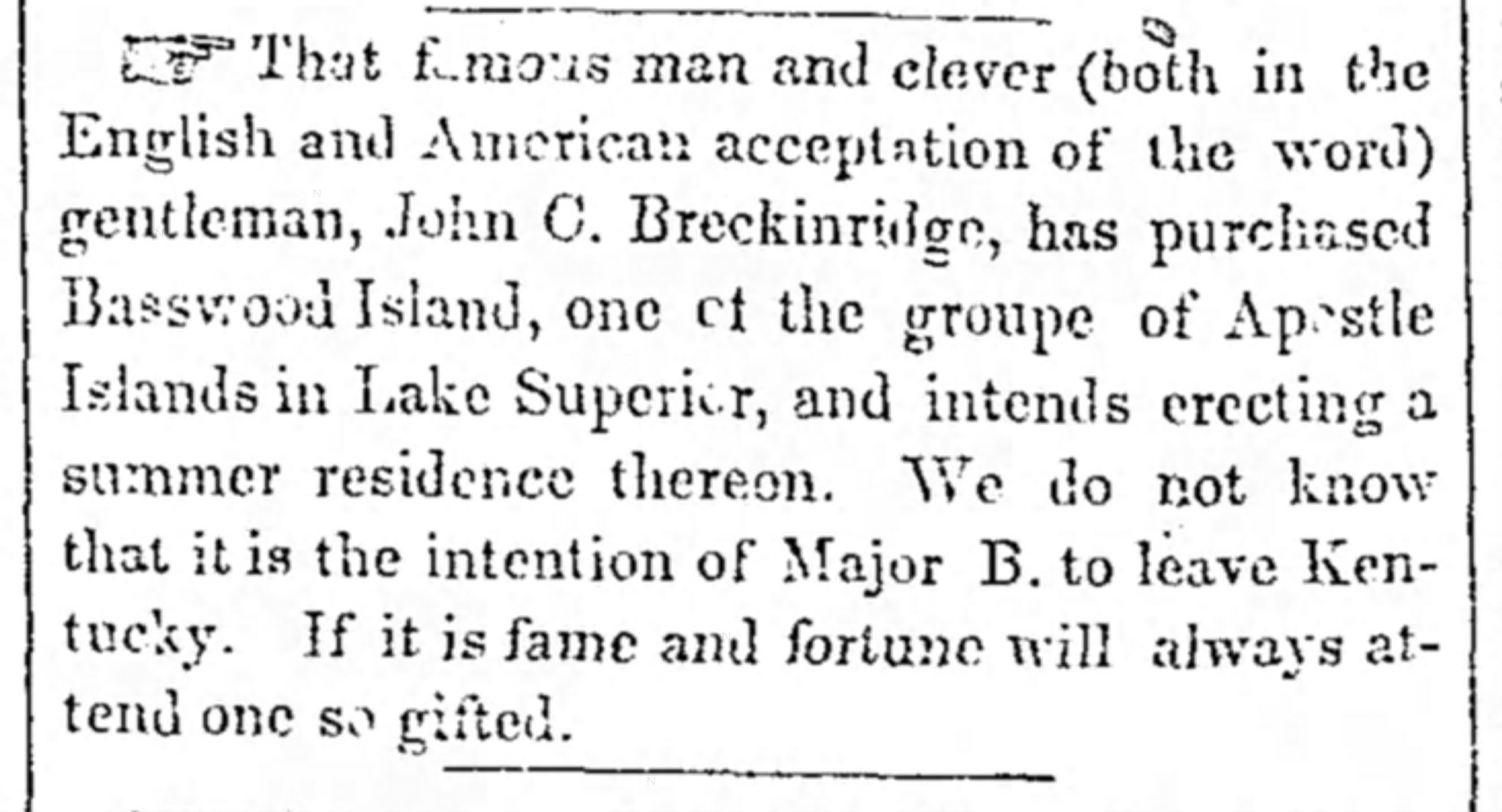
The Louisville Daily Courier [Kentucky], August 14th 1855, Page 4.
Eshkwegwindeg-minis
(roughly translated as “floating at the end or behind island”)
a.k.a. Hermit Island
f.k.a. Austrian Island
The Apostle Islands National Lakeshore contains nine allotments (roughly 780 acres) covering all of Hermit Island:
1) Josette Deefoe (a.k.a. Defoe)
2) Michael Defoe
3) Francois Dejadin (a.k.a. Artishon) Junior
4) Charles Dingley
5) Mary Dingley
6) Mary DuBay
7) Louis Gaudin (a.k.a. Gordon)
8) John Baptist Goslin (a.k.a. Gauslin)
9) Elizabeth (a.k.a. Isabella) Tremble
The traditional name of Eshkwegwindeg appears to be referencing this island’s location between the mainland and several other Apostle Islands. Today it still remains a central hub between the Red Cliff Reservation, the La Pointe Reservation on the north end of Madeline Island, and the other Apostle Islands with Allotments. It is noteworthy how the entirety of this Island is covered by Allotments, unlike the other aforementioned Islands.
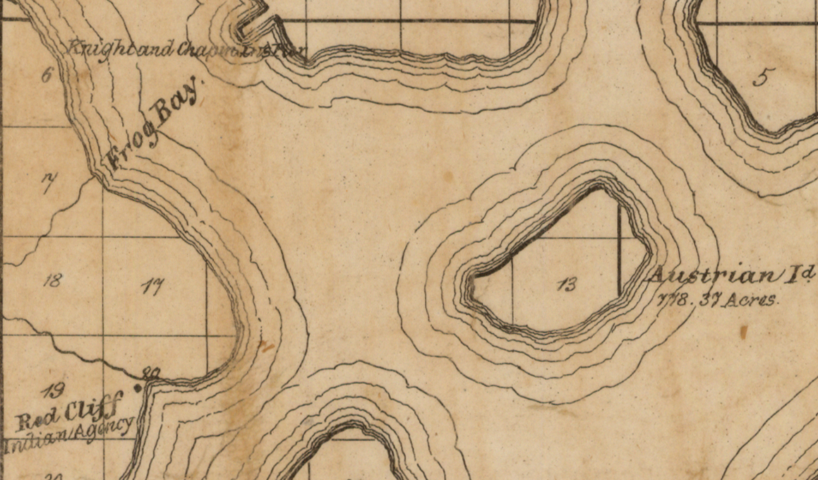
Austrian Island on Asaph Whittlesey’s 1871 map of Apostle Islands and Harbor of Bayfield and Its Surroundings.
~ Wisconsin Historical Society
Modern maps call this Hermit Island in reference to the colorful story of how William Wilson was ostracized from La Pointe and relocated to this Island to live out a solitary life during the Treaty Era. The famous “brownstone king” Frederick Prentice‘s connection to this Island in later decades is also a popular story being told by tour guides in modern times. However, I personally am more interested in exploring the history of how this Island was know as “Austrian Island” between the Wilson and Prentice eras, because it illustrates Julius Austrian’s abuse of Allotments to take private ownership of what should be tribal lands for personal profit.
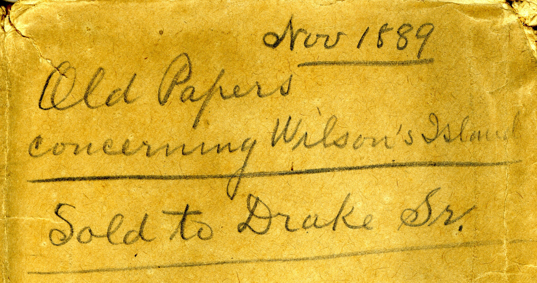
Madeline Island Museum
JULIUS AUSTRIAN PAPERS (2011.158.A) Folder 5:
PAPERS RELATING TO WILSON’S ISLAND (HERMIT ISLAND IN THE APOSTLE ISLANDS ARCHIPELAGO), WISCONSIN (1870-1888)
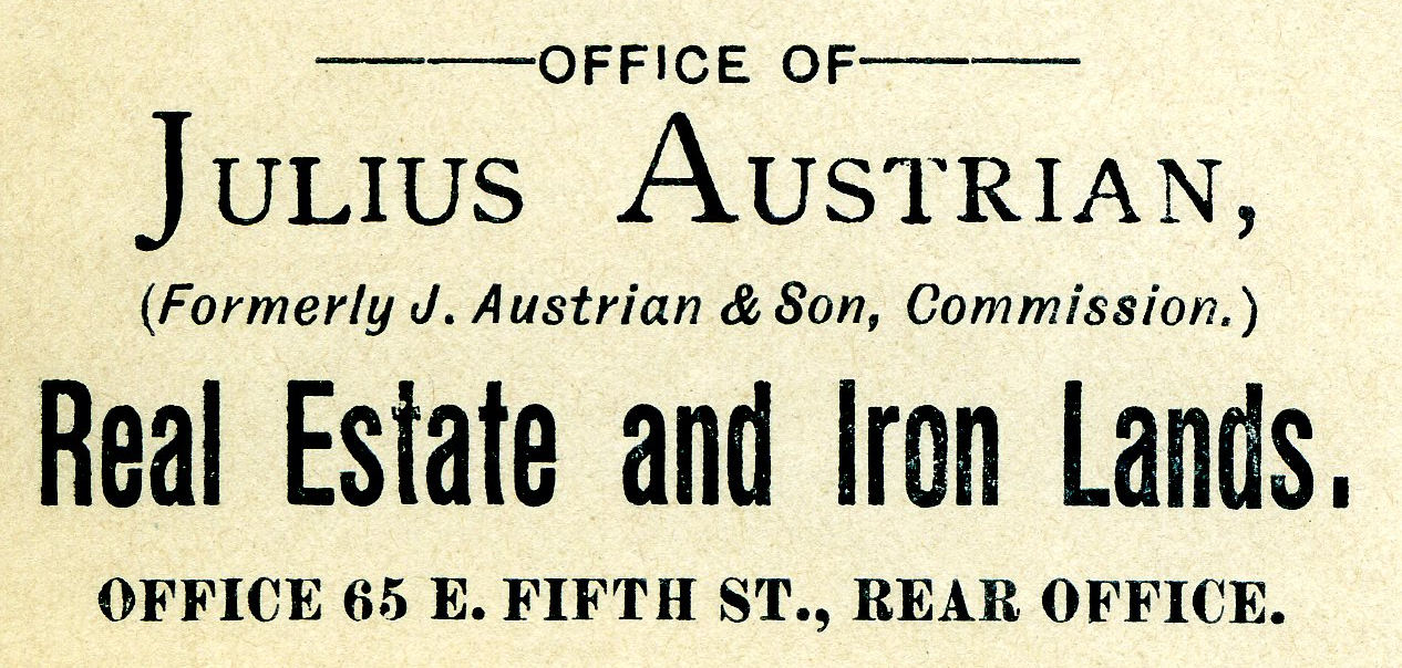
Julius Austrian’s corporate letterhead circa 1888 advertising Allotments for sale.
I personally became very interested in Chequamegon history specifically because of Julius Austrian and his abuse of Allotments to take private ownership of what should be tribal lands in the Penokee Mountains for personal profit, and how that legacy evolved to become what is still known as the La Pointe Iron Company today.
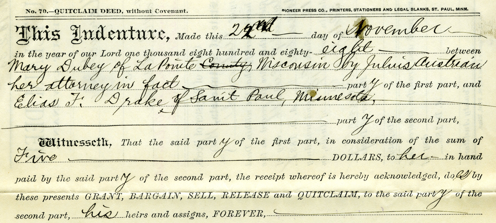
Example of Julius Austrian using Power Of Attorney to buy Mary DuBay’s Allotment for $5 so he could later flip it for profit as private property.
Austrian’s land speculation on Hermit Island follows the same trend of using Allotments via power of attorney over Mixed Blood tribal members of the Lake Superior Chippewa to grab ownership of prime real estate before other land speculators. In the Penokees example, Austrian gave each Mixed Blood $100 to sell their Allotments via Power of Attorney, but here we see how Austrian gave Mary DuBay only $5 for her Allotment on Hermit Island.
My research has been the foundation of academic research in Larry Nesper’s book Our Relations…the Mixed Bloods, and I will continue to post more on this topic in the Austrian Papers on this website.
So what?
Regular readers of Chequamegon History know that my writing style is to post historic documents enhanced with multimedia and sidebars, but omit my own interpretations and and just let readers reach their own conclusions. Leo, on the other hand, is more inclined to speak out about the implications, such as in his posts 19th Century Deer in the Headlights and Slavery, Debt Default, and the Sandy Lake Tragedy. However, in this case, due to Congressman Tom Tiffany’s ongoing efforts despite strong opposition from local governments, I felt it was important to expound on this issue a bit more than I usually do.
Righting a Wrong: Restoring Lands to the Leech Lake Band of Ojibwe
In 2020, the Leech Lake Band of Ojibwe Reservation Restoration Act (Public Law 116-255) returned approximately 11,760 acres of allotted lands wrongfully taken by the Chippewa National Forest back to Tribal ownership and management. The same concept should be applied to repatriate tribal lands in the Apostle Islands National Lakeshore before moving forward with the proposed Apostle Islands National Park and Preserve Act.
Lac Court Oreilles Band of Lake Superior Chippewa v. Walker, Evers
Tribes of the 1854 Chippewa Treaty in Michigan and Wisconsin have won two important lawsuits in recent years due to the fact that their tribal lands should have been reserved under the 1854 Treaty of La Pointe instead of becoming “checkerboarded” from illegal taxation/foreclosures.
Red Cliff Band of Lake Superior Chippewa Indians v. Bayfield County
What started off as a dispute about zoning authority over tribal lands has developed into a constructive partnership. Bayfield County and Red Cliff have developed a Memorandum of Understanding that has led to repatriation of tribal lands within the Red Cliff Reservation. This has led to 2,500 acres being returned by the County to Red Cliff in recent years, with the last 900 acres being completed in 2022.
While returning all County-owned surface rights within the Reservation back to the Tribe has been a tremendous achievement, the County still owns mineral rights within the Red Cliff Reservation. Mineral rights supersede land rights under Wisconsin law, so more work still remains to be done in these land repatriation efforts between Bayfield County and Red Cliff.
Bayfield County should promote their efforts in recent years to help Red Cliff repatriate 2,500 acres of County-owned lands back to tribal ownership, and encourage the Apostle Islands National Lakeshore to return their 3,000 acres of Reservation/Allotments back to tribal ownership.
Frog Bay Tribal National Park
Congressman Tom Tiffany claims that his proposed Apostle Islands National Park and Preserve Act would create the first National Park in Wisconsin. However, Red Cliff already earned that claim to fame in 2012 by establishing the Frog Bay Tribal National Park through an innovative partnership to repatriate Allotments on their Reservation from non-native landowners.
We would much rather see the establishment of a Sand Bay Tribal National Park in Red Cliff, a Chequamegon Point Tribal National Park in Bad River, and Tribal National Parks for the Apostle Islands Allotments, before the proposed Apostle Islands National Park and Preserve. Ultimately these Tribal Lands should be returned to the Lake Superior Chippewa and let them decide whether to manage them as Tribal National Parks or not.

Amorin, Thank you for this. Yes, you raise questions th
Thanks for this Amorin – good case for at a minimum, tribal and federal co-ownership and management of Apostle Islands NL