By Amorin Mello
A curious series of correspondences from “Morgan”
… continued from Saint Croix Falls.

The Daily Union (Washington D.C.)
“Liberty, The Union, And The Constitution.”
July 31, 1845.
To the Editor of the Union:

Andrew Belcher Gray published the Map of the Mineral Lands Upon Lake Superior Ceded to the United States by the Treaty of 1842 With the Chippeway Indians in 1845.
~ Wisconsin Historical Society
SIR: In your paper of Tuesday evening, I have observed a communication from Copper Harbor, (Lake Superior,) so pregnant with errors or misrepresentations, that I am constrained, by a regard to truth and the public interests, to ask the use of your columns to correct some of them. I know not who your correspondent is; but, judging from the extraordinary zeal with which he labors to forestall public opinion of certain government agents on Lake Superior, whose conduct has recently become obnoxious to very grave suspicion, I think it no unwarrantable conclusion that he has either been most egregiously imposed upon, or that he is animated in his encomiums upon the officers alluded to, by motives much more special than in his admiring comments upon the handsome scenery and novel life upon the lake. He is evidently more than indifferently anxious to vindicate and extol General Stockton and his faithful deputy, Mr. Gray. Otherwise, what necessity would there be for asserting facts which do not exist? Your correspondent states that
“The only tenement on the island is a miserable log-cabin, in which General Stockton, for the want of better quarters, is compelled to keep his office. The room which he occupies, is only about eight feet square – just large enough to admit a narrow bed for himself, a table, and two or three chairs. In this salt-box of a room, he is compelled to transact all the business relating to the mineral lands embraced within this important agency. As many as a dozen men at a time are pressing forward to his ‘bee gum’ apartment, endeavoring to have their business transacted.
“The office of the surveyor of this mineral lands, in charge of Mr. Gray, at this agency, is still worse adapted to the transaction of public business. He is compelled to occupy the garret of the log-cabin,” &c.
Now, so far from this being true, “the miserable log cabin” of which your fastidious correspondent speaks, is an excellent hewed log house, well finished and ceiled, with three good-sized rooms below, and three above stairs, amply sufficient and convenient for all intended purposes. The construction of this house cost the government some fifteen hundred dollars, and was designed as the agency-house; whereas General Stockton has converted it into a sort of hotel – doubtless as a means of augmenting the perquisites of his station. Hence he has stinted himself, and the convenience of the government service, to his “bee-gum” and “salt-box” penetralia of “eight feet square.” So much for this misrepresentation.

Painting of Professor Douglass Houghton by Robert Thom. Houghton first explored the south shore of Lake Superior in 1840. Houghton died on Lake Superior during a storm on October 13, 1845. The City of Houghton on Chequamegon Bay was named in his honor, and is now known as the Houghton Falls State Natural Area.
Your correspondent expresses a like sympathy for the privations and long-suffering of Mr. Surveyor Gray. The apartment which Mr. Gray occupies above stairs, is an ample room, some fifteen or more feet square, and is quote comfortable – nay, quite luxurious quarters, when compared to those of the other surveyors, who are where Mr. Surveyor Gray should be, if he was faithfully discharging his duties – out in the woods and the weather, among the rocks and swamps, driving the compass and chain through almost impenetrable wilds. It may, perhaps, be a question with the government, as it certainly will be with the public, why Mr. Gray should be lolling at his ease in the agency-house on Porter’s island, while Dr. Houghton, the other surveyor, is traversing large tracts of the mineral lands, and sustaining all the hardships and perils which pertain to his employment? And it may become a further question, while I am on this head, why Mr. Gray, who was an unrelenting tool of the whig party, and neglected the public service, for which he was receiving a handsome salary, last year, to mingle in the orgies of federal-Clay-clubites, should not only be so sedulously retained in office, but be admitted to the privilege of almost total exemption from labor, which he is employed and paid to perform? It is a fact, that up to the 3d of July, Mr. Gray had surveyed only two miles, whereas Dr. Houghton had measured some five hundred miles of the mineral lands! And this is the gentleman against whose discomfort your correspondent so pathetically appeals, forsooth, because he is occupying at his ease an excellent apartment in a very comfortable house.
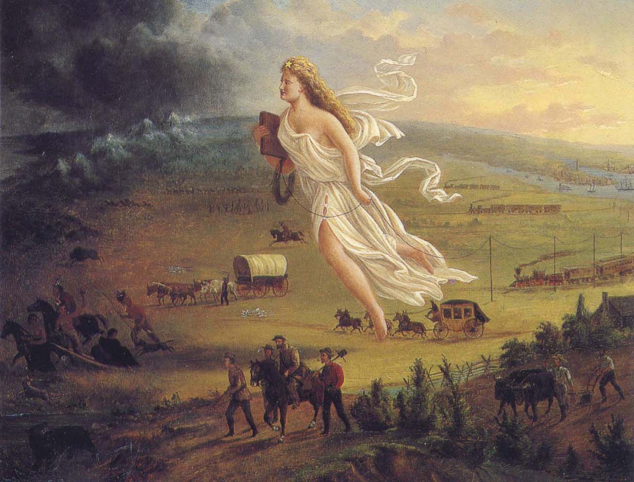
American Progress by John Gast, 1872
“This painting shows ‘Manifest Destiny’ (the belief that the United States should expand from the Atlantic to the Pacific Ocean. In 1872 artist John Gast painted a popular scene of people moving west that captured the view of Americans at the time. Called ‘Spirit of the Frontier’ and widely distributed as an engraving portrayed settlers moving west, guided and protected by Columbia (who represents America and is dressed in a Roman toga to represent classical republicanism) and aided by technology (railways, telegraph), driving Native Americans and bison into obscurity. It is also important to note that Columbia is bringing the ‘light’ as witnessed on the eastern side of the painting as she travels towards the ‘darkened’ west.”
~ Commons.Wikimedia.org
The design of this letter from Copper Harbor is perfectly apparent to me. It is the sequel to a movement which was made last June, viz: to white-wash and to shield from a just reprehension the present superintendent of the Lake Superior mineral lands. On the very day that General Stockton opened his office, a sort of soi-disant public meeting was gotten up there, in compliment to the General, in which the president of the New York and Lake Superior Mining Company was the prime mover. When it is known that General Stockton has certified to the Ordnance Department locations by this company of between one and three hundred square miles, upon which leases were granted, when not a single foot had been actually located, in flagrant violation of all the laws and regulations, some opinion may be formed of the secret of this most disinterested and valuable tribute to the official worth of this superintendent. What might have been the potency of this expression of public opinion (!) in protecting Gen. Stockton’s official conduct from censure and investigation up to the period of its dispensation, I will not now say. But, certain it is, that large and glaring spots which have begun to attract scrutiny and invoke exposure, have rendered his escutcheon needful of a new coat of white-washing; and hence this effort of your correspondent to forestall examination into his conduct, by pathetic epics of his patiently-endured privations iin the public service, and the ignorant or else sinister commendations of his conduct.
In animadverting upon the conduct of General Stockton and others, I do not mean to include Major Campbell, of whom everything that your correspondent has said is hereby confirmed.
POSTEA PLUS.
———

William Learned Marcy was the 20th United States Secretary of War during Polk’s presidency.
~ Wikipedia.org
We have omitted a large portion of the above communication, in which the writer proceeds to complain of the survey of the mineral lands, and arraigns the agents of the government for gross malversation in office. These charges are of a serious character, and they demand a full and rigid investigation. But, as it might lead to a protracted and angry war in the papers, in which crimination would be followed by recrimination; and as we are advised that the Secretary of War is determined to investigate the justice of these complaints and the truth of them – as he will receive any specifications in writing which may be submitted, and is determined to go to the bottom of the subject; and, with that view, will appoint a commission of two of the most respectable gentlemen he can obtain, who will go upon the lands, and probe everything for themselves, – we have thought it best to let matters take that turn. We have not the slightest doubt that the attention of the department is thoroughly exited to the importance of the duties which may devolve upon it, and that it will unquestionably discharge them. It is scarcely necessary, therefore, for the press to mingle at present in a discussion, which might occupy much space, lead to much excitement, and, after all, fail to lead to the best and wisest results.
– UNION.

The Daily Union (Washington D.C.)
“Liberty, The Union, And The Constitution.”
August 1, 1845.
THE COPPER REGION.

James Knox Polk:
11th President of the United States.
~ Wikipedia.org
We have been inconsiderately drawn into a subject of some importance to the United Sates. We have struck a vein, however, which promises to be rich in its resources. The reader will recollect a very long and interesting letter which we published on Tuesday evening, from one of our regular correspondents, who is now on a trip from New York to Lake Superior, in which he gave us a description of its peculiar and striking scenery, and made some remarks upon the copper lands in its vicinity, and upon the agents of the United States who have been charged with the care of the mineral lands belonging to the government. This letter drew forth a reply in our last evening’s paper; but we declined the publication of the whole communication, for the reasons which we then stated. The writer of that article charged the United States agent with many acts of mismanagement, and even malversation of office; and as we were aware that our government was about to appoint a commission to visit the country, and investigate the conduct of the agents, we deemed it most advisable to refer to another tribunal, (for the present, at least,) a full inquiry into these matters. In the mean time, a new scene was opened before us. We were scarcely aware of the existence of these mineral resources, – much less of their extent. But our curiosity is now being aroused. The public documents connected with them have been politely placed in our possession, and we shall prepare an article for the “Union” for the purpose of calling the attention of the country to this very interesting subject. The lead-mines belonging to the United States in Wisconsin, Illinois, Iowa, &c., have been longer known and are better understood than the copper region. They have been worked to a considerable extent, and their produce is so abundant, that they can not only supply our own market with lead, but afford a large export for the consumption of foreign nations. Perhaps no mines in the world are equal to those of the belt on both sides of the Mississippi.
Engraving depicting the 1820 Cass/Schoolcraft expedition crossing the Ontonagon River to investigate the famous copper boulder.
~ Wisconsin Historical Society
The purchase of this rock from the Chippewa Indians was made in 1841. The treaty with these Indians, ceding this portion of the country to the United States, was not made until October, 1842, after the second expedition to that country for the purpose of removing this rock. The Indians say that they did [not] reserve this rock in the treaty of 1842, as they had already sold it to a citizen of the United States, and they conceived that they had no further control over it. They say that, by their treaty, they only sold their lands, and suppose that all moveable property of this kind, which had been previously the subject of individual negotiation, would be allowed to be removed by the individuals making the purchase of them, as readily as they would be allowed to remove their lodges or canoes.
J. ELDRED, for self and sons.“
~ Public Documents Printed by Order of the Senate of the United States: First Session of the Twenty-Eigth Congress, 1844.

The Ontonagon Copper Boulder at the Smithsonian Institution National Museum of Natural History. Photograph by Ian Shackleford, 2011; shared with a Creative Commons license.
~ Wikipedia.org
The copper region is probably more important than the lead-mines. It is supposed by some geologists to extend from Lake Superior to Texas, crossing the Mississippi diagonally at a lower point than the lead-mines, and forming a vein of from thirty to forty miles of average width. The ore is said to be unusually rich. In some places it is mixed with veins of silver, so abundant that the precious metal alone is sufficient to pay all the expenses of working the vein – the ore itself making a yield of 60 or 70 per cent. of copper. An immense boulder of this metal is now deposited in the public yard between the War and Navy Departments, and is well worthy the inspection of all curious observers who happen to visit Washington. It weighs more than 3,700 lbs., and is so rich in the metal that a plate of copper is smoothed off on its surface like the copper-plate of the engraver. It was transported to Washington from the banks of the Ontonagon river, about forty miles from the Eagle river. The two principal points where the richest ore has yet been developed, are on Eagle river, and near Copper Harbor, on Lake Superior. But the richest portion of the copper region, as far as it is explored, is reputed to be Isle Royale, in Lake Superior, much nearer the Canada side than our own; but the boundary line runs north of the island, so that it falls within the limits of the United States. Isle Royale is estimated to be about thirty miles in length, and five miles broad – singularly rich in copper, which is constantly cropping out on the surface. The department has decided that no patents should be granted, and no leases taken, on this singular island.
Two large companies have been formed for leasing and working the mines in the Lake Superior Copper Region – the one which operates in New York, and the other in Boston. So valuable have shares become in some cases, that a gentleman in Boston, who is said to own about eighty shares, has been offered more than $600 for a single share. The supervision of these mines is devolved on the Ordnance Bureau, (Col. Talcott,) attached, of course to the War Department. Some important regulations have been made about the leasing of the mines, but further legislation will be required from Congress. The Secretary of War grants the permits to applicants to go upon the lands; and upon presenting a certificate from the agent of the United States that the tract has not been previously occupied, a lease may be granted for three years, upon condition of paying 6 per cent. of the nett proceeds of the metal, after it is smelted from the ore. If the lease be renewed for another three years, the rent is extended to 10 per cent. The leaseholders were originally confined to the smelting of the ore in the neighborhood of the mines; but it was found that, owing to the want of fuel, and other appliances, it was best to transport the ore to New York or Boston. The secretary yielded at last to the application – the government still receiving its 6 per cent. of rent, in the metal itself, free of all expense of transportation.
On the 21st of March last, it was determined by the Secretary of War to grant no more permits which would authorize a selection of more than one square mile; and between that time and 18th ult., seven hundred and sixty such permits were issued. It was then determined to stop the further issue. The cause of this is expressed in the printed circular from the Secretary of War, which we have already published. It states that,
“should locations be made pursuant to the permits already issued from this department, to select lands in the Lake Superior mineral district, the quantity required to satisfy them would exceed one million one hundred thousand acres It is apprehended that the whole region open for lation may not contain this quantity of mineral lands. Explorations and surveys of these lands have been ordered, and it has been determined to suspend the further issue of permits until the results shall be made known. The applications for permits received at the department subsequent to the 17th instant, will be filed in the office; and if the disclosures of the examinations shall warrant the further issue of permits for the Lake Superior region, they will be considered in the order in which they have been or shall be received. It is not expected that the results of the examinations and surveys to ascertain the probable quantity of mineral lands in the region, and to make the locations pursuant to the permits already issued, can be completed for some time to come.”
This is to certify, that on the 1st day of September last, while attending the payment of the Chippewa Indians at Lapointe, Lake Superior, Okondókon, being the head chief of the band of that tribe, and who resided at the mouth of the Ontonagon River, state, in my presence, that he had sold to Julius Eldred, of Detroit, in the summer of 1841, the celebrated copper rock; and that he had received, at the time of the sale, a portion of the sum agreed upo, and that there remained due him one hundred and five dollars, which was to be paid him whenever Mr. Eldred removed the rock to the shore of the lake; which sum of one hundred and five dollars Mr. Eldred did pay to Okondókon a few days thereafter, at the Ontonagon agency, in pursuace of the agreement made between them in 1841.
I further certify, that, on the 10th day of September last, Julius Eldred paid to Messrs. Hammond & Co. seventeen hundred and sixty-five dollars, for the services which they rendered in removing the rock, as well as to obtain peaceable possession of the same.
The removal of this copper rock has been attended with very great risk as well as expense, and is one of the most extraordinary performances of the age, and one which, in my opinion, should entitle him to great praise as well as liberal compensation.
WALTER CUNNINGHAM.“
~ Public Documents Printed by Order of the Senate of the United States: First Session of the Twenty-Eigth Congress, 1844.
It seems that Walter Cunningham, the first superintendent of these lands, kept no record of the permits he granted, or of the selection of tracts to which he certified as not interfering with the claims of others; and, in consequence of the absence of this information, it appears that his successor (Stockton) has, in two or three instances, certified for others, tracts previously certified by Mr. Cunningham; and this has given rise, as may be supposed, to some complaint. The certificates of the latter have been dropping in for a week or two past, but we know that very few or more can be in existence.
Mr. Gray (the only one of the assistants assigned to the superintendent, who possessed any competent knowledge of the surveying or platting) has been busily engaged in preparing maps, and locating the leases, and claims to leases thereon, to save from the risk of granting certificates which will interfere; and another competent surveyor has recently been sent to that country, in order that the operations may be expedited as fast as possible. It is also understood that Dr. Houghton is carrying on surveys under the orders of the General Land Office, which will soon extend into Stockton’s district, and will probably throw much additional light upon the extent of this interesting region of country.
We are informed that, as regards Mr. Gray’s mingling in any way with politicians, (as was stated by our correspondent of last evening,) it can scarcely be true. “He is a young man, who has been constantly moving about, and acquired no right to give a vote in any location. Modest and retiring, he is the last man in the world to do anything of the kind charged upon him.”
It will be seen, from this very rapid sketch, on imperfect data, that the copper region of the United States abounds with interest; that, from the abundance and the richness of the ore, it is probably calculated to furnish copper enough for our own consumption, and for a large exportation to foreign countries. Of course, great interests are growing up in that wonderful region – much speculation, large companies, strong contests for the possession of the titles – the same mine sometimes shingled over with several claims – some violence and some fraud. And even the agents of the government have not escaped the suspicion of mismanagement and malversation. The executive is about to do its duty in these respects. It is contemplated to employ two highly respectable commissioners to inspect the lands, to receive and investigate all complaints, and make a report to the War Department. A more complete report also, of the mineral resources of the West, the quality and extent of the mines, and the best way of working them, will probably be obtained, under the auspices of the vigilant Secretary of War, to be submitted to the next Congress. The statistics will, no doubt, be found valuable; and, in fact, the whole subject is every day assuming a new and a more expanding interest.
Two additional articles were published by The Daily Union on August 2 and August 11 regarding the Copper Region. They include extensive quotes from United States government agents involved in surveying the Copper Region, but are not directly related to the correspondences of “Morgan” or his accuser “Postea Plus” and therefore are not reproduced here on Chequamegon History.
The Daily Union (Washington D.C.)
“Liberty, The Union, And The Constitution.”
August 26, 1845.
[From our regular correspondent.]
GALENA, ILL., August 14, 1845.
Not having time to say more at present about the country through which I passed in coming from the falls of St. Croix to this place, I beg leave to refer to a notice taken of a portion of a letter written by me to the “Union,” from Copper harbor, by some correspondent opposed to Gen. Stockton and Mr. Gray.
It seems that deserved praise bestowed upon these officers of a government has proved offensive to the said correspondent.
I deem his publication worth no other notice than to say, that he speaks falsely and malignantly of “Morgan,” when he attributes his praise of Stockton and Gray to “sinister motives.”
It is known that an attempt was made by members of a certain small band of speculators to locate a mineral lease on a town site at the falls, or Sault St. Marie, where no copper or other mineral has been found, for the purpose of making a speculation of it. And when told by Gen. Stockton that it was not put down in the mineral region, that it was beyond his jurisdiction, and that he could not consent to grant a location for it, they got made, spluttered about their influence at Washington, hinted at his removal, &c. Several other applications were made to him by the same and other parties, equally as absurd and ridiculous, which he had the firmness to deny. Hence, those foiled in using him to suit their own purposes, are most loud in his condemnation. They probably wish some pliant tool to occupy his place.
I am glad to see that a commission is to be appointed to visit Copper harbor, for the purpose of investigating the affairs of the mineral agency. I have no question it is the very thing Gen. Stockton and Mr. Gray themselves would solicit, in the event of charges being made against them, and without the least apprehension as to the result.
I could say more on this subject; but respectfully leave the whole matter in the hands of the government, where it belongs.
I learn from the worthy superintendent of the United States lead-mines at this place, that he thinks the amount of lead shipped from this district the present year will reach 60,000,000 of pounds, which, at 3 cents per pound, would amount to one million eight hundred thousand dollars. The quantity shipped last year was 43,000,000 of pounds.
Galena is growing, and, as a thriving business place, may be considered (of its size) one of the first in the western country; containing, as it does for a new place, an intelligent, active, and enterprising population.
“In the early 1800s Southwestern Wisconsin miners were too busy digging the ‘gray gold’ to build houses. Like badgers, they moved into abandoned mine shafts for shelter. As a result, Wisconsin was nicknamed ‘The Badger State.'”
Wisconsin Historical Society
Wisconsin is a flourishing Territory, and is going to make a splendid State, being rich in mineral, in farming land, and in fine timber, with a plenty of good water, health, &c. Emigrants are pouring into it from all parts of Europe.
Iowa has rejected her constitution, and elected a democratic governor.
I remain yours, very truly and respectfully,
MORGAN.
To be continued in The Upper Mississippi River…
Wisconsin Territory Delegation: Saint Croix Falls
April 28, 2016
By Amorin Mello
A curious series of correspondences from “Morgan”
… continued from La Pointe.
The Daily Union (Washington D.C.)
“Liberty, The Union, And The Constitution.”
August 27, 1845.
EDITOR’S CORRESPONDENCE.
—
(From our regular correspondent.)
FALLS, ST. CROIX, W. T., Aug. 7, 1845.
We left La Pointe on the afternoon of the day on which my last letter was dated. We had about 70 miles (English,) or 63 of French voyageur’s miles, to travel westward on the lake, before reaching the Brulé river, which we were to ascend for 75 miles, to make the portage to the St. Croix; the latter river being, from its source to the Mississippi river, including the Lake St. Croix at its mouth, about 300 miles long – thus making a journey before us of about 445 miles to reach the Mississippi. To La Pointe we had already coasted from Sault St. Marie, including the curves, bends, bays, &c , with the entire circuit of Keweena point, the distance of at least 500 miles. The two added together, give 945 miles of travel, in open boats by day, and under tents by night, with the exception of the three miles portage between the two rivers. We left the Sault on the 4th July, and reached this place within 50 miles of the Mississippi, making the whole time consumed one month and about three or four days, by the time we will have reached the “father of waters.”

Detail of the shoreline between La Pointe and the Bois Brulé River from Map of the Mineral Lands Upon Lake Superior Ceded to the United States by the Treaty of 1842 With the Chippeway Indians.
~ Wisconsin Historical Society
The distance, in a direct line, from the head of the bay opposite La Pointe, to the portage at the head of the Brulé, by land, is only 80 miles; while by the lake and river, it is about 145. The whole distance, in a direct line, by land, from La Pointe to the falls of St. Anthony, or to the mouth of the St. Peter’s, does not exceed, by the Indian trail alluded to, over 200 miles.
The first day we left La Pointe we were only enabled to reach Raspberry river, a small stream emptying into the lake 15 miles west of La Pointe, inside the group of islands.
We first encountered a prodigious thick fog, with a head wind. We had no sooner landed and raised our tent, than a thunder-storm, with a heavy rain, burst upon us. The voyageurs, as is their custom, had puled the bark canoes out of the water, and turned them over, placing provisions and other articles under them for shelter. The Indians, in travelling with their canoes, invariably pull them out of the water at night, turn them bottom upwards, and in bad weather, sleep under them; as our voyageurs (especially Jocko, our Indian voyageur) did on the night in question. In such cases, they turn water like the roof of a house. We had, late in the afternoon, doubled some frowning sandstone cliffs alluded to in my other letter, with the grottoes, caves, and excavations wrought out near the water’s edge, by the combined action of the waves and frost. Another high sandstone promontory still lay just ahead of us, which Ribedoux, our head man, said extended for six miles without affording a landing-place for a boat.
Next morning we found a severe gale blowing from the north-northeast, accompanied with rain. This compelled us to remain where we were till about 3 or 4 o’clock in the afternoon, when we set out. The wind had died away, but the sea was running very high, over which our canoes danced along at a great rate – riding them, however, like swans. The heaviest rolls would be mounted and slid over with as much ease as though the canoes were feathers, as they were propelled forward by the oars and paddles of our skillful voyageurs.
One canoe being small, only admitted of the use of paddles. The larger craft allowed a pair of oars to be used in front, while a paddle was employed in the stern. The usual plan of working canoes is to have only two persons to attend to one canoe. They are always steered with a paddle. One voyageur seats himself in the bow; while another does the same thing in the stern – the baggage, provisions, passengers, &c., being stored amidships, low in the hull. Thus arranged, the men apply their paddles with great skill, driving the canoe forward at a pretty rapid speed.
The Voyageurs by Charles Deas, 1846.
~ Commons.Wikimedia.org
The Indians display a deal of skill in the construction of their bark canoes. Their hulls have great symmetry of form; and, under careful handling, which the Indians perfectly understand and practise, they are very light and very strong.
The birch bark, from which they are principally made, is found of excellent quality on the shores and tributaries of Lake Superior, and is extensively used by the Indians for building their lodges, &c., as well as for canoes. In the latter application, the inside of the bark is exposed to the water and weather; while, in the former case, the outside of the bark is turned to the weather. Their lodges are of a hemispherical shape, with an opening at the top for the escape of smoke, with a door opening on one side of them, before which a blanket is usually suspended. The floor of the lodge, with the wealthier class, is usually covered with fine large richly-colored rush mats, on which the Indians recline or sit like Turks on them. The men, when at home, do little else than recline on the mats and smoke, while the squaws and half-grown children perform all the necessary manual labor. If an Indian brings in game or fish, he throws it down near his lodge, and troubles himself no more about it; or, if it be troublesome to carry, he leaves it in the woods, returns to the lodge, and sends his squaw for it.
The females among the Indians invariable exhibit the most modest and retiring deportment – equally as much so, I have thought, as is seen or met with among the most civilized whites. Neither males nor females, when you enter their villages or lodges, ever fix upon you that rude glare, or gaze, which white people often do upon the sudden appearance of a stranger. The usual salutation of the Chippewa, on meeting you, is “Bojour, bojour, bojour,” at the same time extending his hand to you in friendship. And if there are fifty men in company, they will all do the same thing. The exclamations they use is a corruption of the French salutation of “bon jour,” “good day;” or, in English parlance, “how d’ye do.”
The Indians are very fond of bathing and swimming, and they do not consider it the least indelicate for all sexes to bathe at the same time in the immediate vicinity of each other. I am told, on such occasions, the females wear dresses prepared for the purpose. The men also are partly clad.
“There are indications that Granville served as a teacher in a school unrelated to ABCFM on or near the Mackinaw Island from the fall of 1834 to the fall of 1835. His first connection with ABCFM dates from September 1835, and he was officially appointed by ABCFM as a missionary assistant some time in 1836. Granville took a leave between July 1837 and June 1838, then returned to La Pointe with his newly wed wife, Florantha nee Thompson. After one unsuccessful pregnancy, Florantha had two healthy daughters, in October 1842, and March 1844. Granville and Florantha retired from the mission in the summer of 1846.”
~ The Sproats at La Pointe: From pages of the Missionary Herald, Boston
I was told by Mr. Grote, who has resided at the Presbyterian mission at La Pointe for some 10 or 12 years, that the Indians, during long peace, and when little surrounds them of a nature to arouse or excite their energies, become, in general, very lethargic, and sink apparently (from ennui) into premature old age, few of them attaining to the years of advanced life. Among the chiefs I saw at La Pointe, was an old man of sixty. His hair was quite gray. He was introduced to me by a friend, at his own request. He wanted to know where I was from, and whether I had been sent to carry off the Indians. He was told that I had come on no such errand, but merely to visit and see the country, and that I was a “medicine man,” a “mushkiwinini:” this announcement put me on a very friendly footing with him. He bore a strong resemblance to Robert Dale Owen, the lecturer.
I was told by Mr. Grote that this old chief retained very strong predilections in favor of the British; that he frequently spoke of the good old times when they received fine presents and cheap goods from their great father, the King over the water; and that he annually paid a visit to the Hudson Bay Company’s trading-post at Fort William, or at the Sault, and received presents to some small amount. he nevertheless professed much friendship for the Americans.

“Mainland sea caves from the water.”
~ Apostle Islands National Lakeshore
We left Raspberry river between 3 and 4 p.m., and passed one among the most picturesque cliffs of sand-stone it was our lot to see during the voyage. It spread along the shore for 6 or 7 miles, varying in height from 50 to 100 feet. Its base was carved into holes and grottoes of every variety of form, into which the heavy rolls of the waves were pitching with a rumbling and heavy sound; while the white spray flew in foaming whiteness about the outward rocks. Making a beach near dark at the bottom of the bay, beyond the cliffs, we landed and camped. Early next morning we were again under way. In the afternoon we passed four Indian canoes loaded with Indians bound for La Pointe. They were from Fond-du-Lac.
Making Cranberry river, we found Capt. Stanard and his party of voyageurs, who had preceded us from La Pointe, and were bound for Fond-du-Lac, had stopped for dinner. We concluded to land at the same place for the same purpose.
We were told by Capt. S that he had, on his way, visited an encampment of Indians from Fond-du-Lac, who stated that the Chippewas at that place were laboring under a good deal of excitement. It seemed that two Indians of that place had been on a visit to the falls of St. Croix, where liquor was freely sold to the Indians; that one of the Indians and a white man quarrelled about a dog; that the latter mauled and beat the former most unmercifully, when the other Indian attempted to interfere, whom the white man attacked and commenced beating also. The last Indian thereupon stabbed the white man in the breast with a knife, the point of which struck a bone and glanced. The white man then drew a pistol, and fired it at the Indian, wounded him severely in the thigh. The Indians then left the falls, and returned to Fond-du-Lac highly incensed, and swearing vengeance against the whites; saying their relations numbered thirty warriors, who would aid them, if necessary, in seeing justice done. They also said that, some time ago, a Sioux Indian had killed a Chippewa, and that the whites did nothing with him for it. When the brother of the deceased Chippewa went over to St. Peter’s, and killed the Sioux, the whites had taken up two Chippewas, and had them in jail, which they thought very hard of. It was also said that sometimes, when the Chippewas left their homes to go to the payment, the Sioux followed them, with a view of annoying and harassing them in the rear.
Captain S. said that he had intended to visit the falls of the Brulé, to fish for trout; but that, owing to these reported difficulties, he should proceed directly to Fond-du-Lac. It seems that the whole foundation of the troubles on the St. Croix, with the Chippewas, has grown out of the circumstance of grog-shops having been opened at different places along that stream – say one at the falls, another at Wolf river, eighteen or twenty miles above, and a third at the Rising Sun, twenty-five miles above the falls – by low and villanous white men, or half-breeds engaged in their service. It seems that, some years since, the Chippewas made a treaty, ceding all their lands to the United States, south of a line running due south some fifty miles from the extreme west end of Lake Superior, and from that southern point due west to the mouth of Crow-wing river, on the Upper Mississippi, cutting nearly through the centre of Mille Lake in its course. There is a proviso in the treaty of cession, which authorizes the Indians to remain in the occupancy of the ceded territory till it is wanted by the government. I understood Mr. Hays (the Indian agent at La Pointe) to say that he had no power to stop the sale of ardent spirits to the Indians, by the white squatters in the ceded country. These drunken outrages, if not put a stop to on the St. Croix, will, ere long, lead to serious and disastrous consequences. The Indians and whites will soon become embroiled in a border “guerrilla” war, and the poor savages, in the end, be butchered and driven out of the country – all, too, growing out of the cupidity of a few rascally men, who aim to cheat and rob the Indians of their last blanket, by selling them the hellish poison of whiskey. What is the massacre of innocent whites, with the ruin and degradation of Indians, to them, provided they can turn a penny by dealing out rum!! Mr. Hays lives almost too remote from the St. Croix to prevent these outrages, even if he had the power. But it does seem to me, that the Indian agent at St. Peter’s, who resides within a day or two’s journey of these outrages, might do something to prevent them.
With due vigilance and firmness on his part, it would appear probable, at least, that Indian murders would not transpire within gun-shot of his agency at St. Peter’s.
The War Department should adopt immediate measures to break up the sale of whiskey to the Indians on the St. Croix, and other parts of that ceded territory, or very serious consequences will follow. One poor Indian from Fond-du-Lac, on a visit to one of the grogeries on the St. Croix, was made beastly drunk, who, in his helplessness, fell with his face on the fire; having his cheek, with one eye, awfully disfigured and burnt; leaving his whole visage an object of loathing and disgust for life.
As our course to the Mississippi lay along the St. Croix, directly through the whiskey district, the reports of present and prospective difficulties were not very pleasant. We nevertheless made up our minds to persevere, and meet whatever might happen.
Negwanebi (Quill)
Wazhashkokon (Muskrat’s Liver, aka Pítad in Dakota);
Noodin (Wind).
Towards sunset, we made the mouth of the Brulé, where we found about thirty Chippewa Indians with two or three chiefs encamped, who were on their way to La Pointe; from Leech Lake and Mille Lake. They belonged to the band denominated “pillageurs,” so nicknamed from their alleged propensity to steal small matters. We landed on the opposite side of the river to their camp, on a flat – the stream being about twice as wide as the Tiber in good water at Washington. We were soon joined by Captain Stanard, whose men pitched his tent near ours, and cooked supper by the same fire. We had scarcely kindled our camp fire, before the chiefs of the “pillageurs” manned their canoes, and came over, crying out, as they came up; “Bojour,” “bojour,” and giving us their hands, which we accepted. They looked poor and dirty, some of whom were nearly naked. They said they had nothing to eat, and were very hungry, and wished us to give them some flour, which we complied with. No sooner did the rest find out we were dispensing “farine,” as the French voyageurs term it, than the whole [posse?] kept coming over in instalments, till we had the whole camp upon our hands – women, children, and all.
We gave them all round about a pint of flour, from Captain S.’s and our own supply, and then gave them to understand we wished them to retire to their own side of the river; they all left us, except some old chiefs, who were privileged to remain, and appeared desirous of smoking their pipes before our fire, and talking over news with Jocko, our Indian voyageur, and one of Captain S.’s half-breeds.
In their camp opposite – out of joy, I suppose, over the flour we had given them – they commenced beating a drum, and singing in a most wild and monotonous manner, which they kept up till near ten p.m., when all became silent. We all fell fast asleep; and when I awoke next morning, calling the hands for an early start, all was quiet in the Indian camp. Captain Stanard prepared to depart at the same time, and before sunrise he was off to Fond-du-Lac, and we to the Mississippi. Whatever the “pillageurs” may have done elsewhere, we will do them the justice to say that they stole nothing from us; for next morning, on packing up, we missed nothing whatever. Many of them had pleasing and honest countenances, whatever else may be said about them.

Detail of the Bois Brulé River (aka “Wissakude [Wisakoda] or Burnt Wood”) and the portage over the Great Divide (a continential divide between the Lake Superior Basin and Missisippi River Basin) to the Saint Croix River from Hydrographical Basin of the Upper Mississippi River from Astronomical and Barometrical Observations Surveys and Information by Joseph Nicolas Nicollet, 1843.
~ David Rumsey Map Collection
At many places the rapids were so powerful, and the channel so crooked and narrow, that the voyageurs had to wade in the water frequently to their waist, and push the canoes forward with their hands. Sometimes their feet would slip from the spurs of trap-rock boulders, and they would go into holes of deep water, nearly to their arm-pits or chins.
We worked forward in this way over rapids, for about thirty miles; and having passed three portages, around which we had to walk and carry our baggage, with still the fourth and last severe one before us, we finally struck up a camp near the head of the third portage, where all were sufficiently fatigued to sleep most soundly. At this last portage rapid, there appeared in the bottom of the river a mass of trap crossing it, over which the water fell two or three feet nearly perpendicular.
We were off next morning early, after having examined the bottoms of our canoes, and patched and gummed the leaky places with birch bark and Canada balsam-tree rosin. The small canoe had to be patched and pitched two or three times, having been punched with holes by the rocks.
“In consideration of the cession aforesaid, the United States agree to make to the Chippewa nation, annually, for the term of twenty years, from the date of the ratification of this treaty, the following payments.
1. Nine thousand five hundred dollars, to be paid in money.
2. Nineteen thousand dollars, to be delivered in goods.
3. Three thousand dollars for establishing three blacksmiths shops, supporting the blacksmiths, and furnishing them with iron and steel.
4. One thousand dollars for farmers, and for supplying them and the Indians, with implements of labor, with grain or seed; and whatever else may be necessary to enable them to carry on their agricultural pursuits.
5. Two thousand dollars in provisions.
6. Five hundred dollars in tobacco.
The provisions and tobacco to be delivered at the same time with the goods, and the money to be paid; which time or times, as well as the place or places where they are to be delivered, shall be fixed upon under the direction of the President of the United States.
The blacksmiths shops to be placed at such points in the Chippewa country as shall be designated by the Superintendent of Indian Affairs, or under his direction.
If at the expiration of one or more years the Indians should prefer to receive goods, instead of the nine thousand dollars agreed to be paid to them in money, they shall be at liberty to do so. Or, should they conclude to appropriate a portion of that annuity to the establishment and support of a school or schools among them, this shall be granted them.”
“Whereas the whole country between Lake Superior and the Mississippi, has always been understood as belonging in common to the Chippewas, party to this treaty; and whereas the bands bordering on Lake Superior, have not been allowed to participate in the annuity payments of the treaty made with the Chippewas of the Mississippi, at St. Peters July 29th 1837, and whereas all the unceded lands belonging to the aforesaid Indians, are hereafter to be held in common, therefore, to remove all occasion for jealousy and discontent, it is agreed that all the annuity due by the said treaty, as also the annuity due by the present treaty, shall henceforth be equally divided among the Chippewas of the Mississippi and Lake Superior, party to this treaty, so that every person shall receive an equal share.”
Towards noon, we began to find the rapids less frequent and difficult, till we finally came into a beautiful low bottom, or meadow land, of elm trees, which lasted us for many miles; when, towards night, we again passed some severe rapids, and then entered a long lake of irregular width, formed by the expansion of the river at this point – in no case being more than from seventy-five to one hundred yards wide, with generally a swamp on one side, and considerable sloping pine hills or bluffs on the other. We found this river, and especially the lake part of it, to be very full of brook trout, some of which we caught, and found them not only beautiful in color, but most excellent to eat; they were continually jumping above the water. During this day and yesterday, we met several parties of half-breeds and Indians on their way to La Pointe. On inquiring of them about the fight at the falls, and the difficulties at St. Peter’s, they gave us the most favorable accounts of the quiet and peaceful disposition of the Indians, and said that we might travel just where we pleased, without the least danger whatever. At any rate, there was one guarantee of their good conduct for a few weeks to come – and that was the forthcoming payment at La Pointe, to which they go up with as much eagerness as the Jews of old did to the Passover. Any serious disturbance at the present time, or probably at any time, would jeopard the receipt of their annuity, and likely lead to their expulsion from the country. Besides, at the payment they have an opportunity of laying their numerous grievances before the father, who has to promise them to speak for them in the ear of the great father at Washington. So matters progress from one year to another, till many grievances of a minor or trivial nature are forgotten.
We camped on a sloping pine ridge, on the east side of the lake part of the river, about 7 p.m. We found all the nights on the Brulé cool and pleasant. The water throughout we found as cold as the best mountain spring-water.
We continued our ascent at an early hour next morning, and by noon found our little stream very much diminished in size and volume of water, dwindling first into a small creek, and afterwards into a mere meadow-brook, nearly choked up by the hanging and interlocked alder bushes, the limbs of which we had to push out of our way to enable us to pass. The little river on this swampy meadow-land also became very crooked. In going a mile, we very often had to traverse the meadow nearly a dozen times.

“Recreation of a voyageur carrying two 90 lb packs of fur across a portage to avoid rapids or move to another river.”
~ Saint Croix National Scenic Riverway
About half-past 2 p.m., however, we arrived at the portage, or the place where we were to take our canoes out, transport them, and afterwards their contents, on our backs, across hill-sides, and over the summit of one or two pine, sand, and pebble hills, about one hundred and fifty feet above the level of the swamp in which the St. Croix and Brulé head. The two rivers are said to have a common origin in one spring. But the swamp, in which they both head, is no doubt full of springs – some running one way and some running another. This swamp is wide, extending from one river to the other, nearly north and south. On the east side of this swamp, and parallel with it, are found the range of pine hills by the sides, and over the summits of which the portage path crosses. Still to the east of this short range of hills, is a small lake, which empties into the river Brulé at some distance below the portage, called by the voyageurs White-fish lake. Near the head of streams of the St. Croix river is Upper St. Croix lake, to which our portage path descended at the northeast corner, descending to it down the southern side of the hills spoken of, being three miles from the place of debarkation on the Brulé. The sources of these rivers are laid down in Mr. Nicollet’s map as being nine hundred feet above the Atlantic. They are also said to be two hundred and seventy-five feet above the level of the lake; but I am inclined to believe that they are higher than stated – especially so above the level of the lake, if the high land we crossed be included in the estimate. Most of the maps are in error about the geography of this part of the country, both with regard to the heading of the rivers; as well as to their size and course.
The course of the Brulé is from south-southeast to north-northwest from the portage to the lake, being comparatively a small river. The course of the St. Croix, from its head to the Mississippi is south-southwest, and is by no means so crooked low down as represented. It is so large, for fifty or seventy-five miles above the falls, as to compare very favorably with the Ohio; which, at some points, it much resembles. It, and its tributaries, have a deal of fine pine timber growing along its banks; a good deal of which has been cut, to supply the mills below. Mr. Nicollet’s map, which is generally very correct, lays down hills between the waters of the Brulé and St. Croix, where none exist. I believe he did not visit the portage in person, but relied on the information of voyageurs.
It was an agreeable reflection to know, when standing on the highest point of hills on the portage, that we could overlook the course of one river sweeping away to the north, on its vast journey to the Gulf of the St. Lawrence; while to the south were seen the waters of the St. Croix, just gathered into a pretty, quiet lake, from its conglomerate of springs near by about to speed its waters to the Mississippi, and down it to the Gulf of Mexico! and when once there, perchance, gathered in the Gulf stream, and be again wafted by it to the banks of Newfoundland, where it may again unite with the water of its kindred Brulé!
What a wonderful continent is this of ours! What cast rivers and lakes intersect it! To appreciate their lengths, magnitude, scenery, &c., they must be travelled over to be understood. In June, I was at the Falls of Niagara; in a few days I shall probably be at the Falls of St. Anthony – passing from one to the other by water, with the exception of three miles!
Having, on August the 2d, succeeded in getting everything over the portage, including canoes, luggage, &c.; and it being towards sundown; we concluded to camp, and get ready for an early start next morning. Sunday morning, the 3d of August, found us descending the beautiful upper lake St. Croix, bordered in the distance with rolling pine-hills.
Detail of the upper Saint Croix River, Brule Bog portage, and “Chipeway Village” from Hydrographical Basin of the Upper Mississippi River From Astronomical and Barometrical Observations Surveys and Information by J.N. Nicollet, 1843. Also shown is the Grand Footpath (long dotted line) between Chequamegon Bay and Saint Anthony Falls.
~ David Rumsey Map Collection
We soon began to meet large parties of Indians in their canoes, bound to La Pointe, to be present at the payment. As Mr. Hays (the Indian agent at La Pointe) had told us that he expected the Rev. Mr. Ely, who had charge of a Presbyterian missionary station on the Percagaman, or Snake river, to be over at the payment, and thought it probable that we might meet him; and learning that some of the Indians we met were from Snake river, I asked them if they knew whether Mr. Ely had left. They told me he had, and that he was at his camp down the river, which we would soon reach.
We continued on, amidst fields of wild rice in full bloom, which covered the lake for acres upon acres on each side of the channel. This wild rice (rizania aquatica) is of great importance to the Indians, who gather large quantities of it when ripe, in autumn, for their winter food. Its soft stem and watery roots are immersed about 2 to 2½ feet under water, while the blades, head, and stalk reach about a foot to a foot and a half above water. In flowering, its heads present a singular appearance. Its pistils, or grain part of the flower, are clustered on a long, sharp-pointed spicular, terminating in a sharp cone at the very head of the stalk; while the pollen appears attached to the stalk below the head.
Why could not this rice be sown and cultivated in the lakes of western New York and in New England? Besides the value of the grain for poultry and various other purposes, its tops or blades would make the richest and sweetest fodder for cattle. I chewed the blades, and found them tender, and as sweet as the tender blades of green corn. The experiment might be worth the trial.

Reverend Edmund Franklin Ely.
~ Duluth Public Library
About the middle of the afternoon we reached the first rapids in descending the St. Croix, now contracted from a lake into a narrow river, strewed here and there with black boulders of trap. We here had the pleasure of finding Mr. Ely encamped on the west bank of the river, who had remained still all day, as it was Sunday. He had in company with him the Rev. Mr. Rosselle, a young clergyman from Ogdensburg, New York, to whom he introduced me. Mr. Rosselle informed me that he had been to the falls of St. Anthony, from whence he had gone on a steamboat “Still-water,” at the head of the lower Lake St. Croix, and from thence to the missionary station on the Pergacaman, or Snake river, where he concluded to accompany the Rev. Mr. Ely to La Pointe, and be present at the Indian payment. From La pointe he expected to make his way home by the Sault St. Marie, Mackinac, &c. Mr. Ely had some Indians along with him, who were evidently attached to the mission. He said the success of the mission had been interfered with, to some extend, by the dread in which the Chippewas held the Sioux in that part of the country; that in constant fear of their natural enemy, they disliked making permanent settlements and to improve them. After some other general conversation, we continued our journey over rapids, till near night, when we camped (as was often the case) on an old Indian camping-ground, and saw lying about us dog bones, on the meat of which the Indians had feasted. An innumerable swarm of horseflies surrounded our tent and camp-fire, which the voyageurs at first mistook for bumble bees, whose nest, they conceived, they had disturbed, and, for fear of being stung, they fled; but, on ascertaining they were merely noisy flies, they came back again.
We made an early start next morning, to resume our descent over rapids dashing over trap and granite boulders. We met a half-breed and his wife, who had a keg of whiskey in his canoe. They were going to La Pointe, where Mr. Hays suffers no liquor to land. The man offered to treat my voyageurs, one of whom was known to him. I consented that they might take one dram each, but no more. This being given them, we thanked him, and proceeded on our journey. About noon, we passed the last severe rapids, and the mouth of a large tributary from the east, called the Macagon, about 100 miles above the falls, and within 50 miles of Snake river.

Detail of the Saint Croix River with tributaries Snake River and Kettle River from Hydrographical Basin of the Upper Mississippi River From Astronomical and Barometrical Observations Surveys and Information by J.N. Nicollet, 1843. Also shown is the Grand Footpath (long dotted line) between Chequamegon Bay and Saint Anthony Falls.
~ David Rumsey Map Collection
The St. Croix, from this point down, became a larger, more beautiful, and more interesting stream. The bottoms, too, became wide and rich, but subject to inundation at very high water. The stratified red sandstone was seen to skirt the margins of the river, all along the rapids; while boulders of trap and granite were strewn over the centre of the channel. But, as we approached Kettle and Snake rivers, we began to notice the appearance of white sandstone on the shores of the river, which continued to appear till near the falls, and again rose in high cliffs below them, and continued to the Mississippi. At night, we camped on a high pine bluff on the right bank of the river, a large swamp being on the opposite side. Here we were nearly devoured by mosquitoes, and were glad to make our escape next morning without breakfast – intending to stop and cook at a place, if possible, less infested by them; which we did, on the pebbly beach of an island.
We had a showery forenoon, but continued our journey. We met with several long rapids, and, passing Kettle river, reached the mouth of Snake river, about 10 a.m. – where we found a body of Indians encamped, going to La Pointe. We exchanged some meal for some fish, and gave an old woman some sugar for a sick child. Then, wishing them a “bon voyage,” we put off. About 25 miles above the falls, we passed Sunrise river, with splendid and extensive bottom-land opposite to it on the left bank, lying high and dry above high-water mark.
The next place we made was Wolf river, about 18 or 20 miles above the falls. Here we found a rude village, on a rich piece of land, settled by half-breeds, Indians, and a Frenchman or two. They had lots of liquor, and offered to sell me some; but I declined to purchase, or to let my voyageurs buy any; and, though late in the afternoon, moved for some 8 or 10 miles further, and camped just within the first rapid or two, at the commencement of the falls. From the head of the rapids to the falls is 9 miles.

Detail of Saint Croix Falls with tributaries Sunrise River (“Memokage”) and Wolf Creek (“Attanwa”) from Hydrographical Basin of the Upper Mississippi River From Astronomical and Barometrical Observations Surveys and Information by J.N. Nicollet, 1843. Also shown is the Grand Footpath (long dotted line) between Chequamegon Bay and Saint Anthony Falls.
~ David Rumsey Map Collection
~ Fifty Years in the Northwest by William H. C. Folsom, 1888, page 87.
We reached the falls next morning to breakfast, where I made the acquaintance of Mr. Purinton, to whom I bore a letter of introduction, and found him a very clever and enterprising man. He has done more to develop this part of the country, and to enhance its value and settlement, than any other man in it. The falls afford a splendid water-power, fully equal to that yielded by the falls of the Merrimac at Lowell. Mr. Purinton is the proprietor, and has a saw-mill running with five saws, in separate frames. His logs come down the St. Croix.
There is a trap formation in place, crossing the river at the falls, obliquely from northwest to southeast. It is lost a short distance to the northwest of the river, but runs off in a range of 20 miles to the southeast of the falls. It differs a good deal from the trap-formation on Lake Superior. It is of a bluish and lighter color than the trap on the lake in the high perpendicular cliffs of this stone, which faces the river at, and for some little distance below the falls, may be seen strong indications of a columnar structure in its form; while in the trap on Lake Superior, the same rock is uniformly amorphous in its form.
Besides, the trap on Lake Superior appears uniformly to have had an upheaval through red sandstone; while that at the falls has been borne up through white sandstone, very distinct in its character from the red sandstone of the lake. It is probable, therefore, that there is no continuous connexion or homogeneousness of character between the trap-rock of the falls, and that on Lake Superior; and that they may have been raised at far different and distinct periods. Be this as it may, however, I found the trap at the falls of St. Croix to give very favorable indications of the existence of copper ore. Mr. Purinton gave me some very interesting specimens of the ore found in the vicinity of his mill.
While rambling about the falls, I discovered, also, one or two very fine mineral chalybeate springs.

Detail of the Saint Croix River from the Falls to the head of Saint Croix Lake (Stillwater, Minnesota) from Hydrographical Basin of the Upper Mississippi River From Astronomical and Barometrical Observations Surveys and Information by J.N. Nicollet, 1843. Also shown is the Grand Footpath (long dotted line) between Chequamegon Bay and Saint Anthony Falls (Minneapolis, Minnesota.
~ David Rumsey Map Collection
Having paid off my voyageurs at the falls, and sent them back in one of the canoes, I prepared to descend the river to the head of the lake, or to Stillwater, in the other; which I reached next day. There is a saw-mill at this place, and two others between it and the falls – all being turned by streams which enter the river on one side or the other. At Stillwater, a town not quite a year old, there is a tavern, two stores, a blacksmith-shop, one lawyer, one doctor, no preacher, no schoolmaster, no justice of the peace or mayor, one saw-mill, no school, a large cool spring, and a very pretty place for the town to grow on. We here met the steamboat Lynx, on which we took passage, after disposing of my canoe.
The land on the west side of Lake St. Croix is beautiful all the way to the Mississippi, and is fast settling up. This beautiful sheet of water is 22 miles long, and from one and a half to two miles wide.
I am, very respectfully and sincerely, yours,
MORGAN.
To be continued in Copper Harbor Redux…
Wisconsin Territory Delegation: La Pointe
April 23, 2016
By Amorin Mello
A curious series of correspondences from “Morgan”
… continued from The Copper Region.
The Daily Union (Washington D.C.)
“Liberty, The Union, And The Constitution.”
August 9, 1845.
La Pointe, Lake Superior
July 26, 1845
To the Editor of the Union:

View of La Pointe, circa 1843.
“American Fur Company with both Mission churches. Sketch purportedly by a Native American youth. Probably an overpainted photographic copy enlargement. Paper on a canvas stretcher.”
~ Wisconsin Historical Society
I have just time to state that, having spent five days at Copper Harbor, examining the copper mine, &c. at that place, and having got everything in readiness, we set off for this place, along the coast, in an open Mackinac boat, travelling by day, and camping out at night. We reached this post on yesterday, the 25th instant. We have now been under tents 21 nights. In coming up the shore of the lake, we on one occasion experienced a tremendous rain accompanied with thunder, which wetted our things to a considerable extent, and partly filled the boat with water.
On our way we spent a good part of a day at Eagle river, and examined the mine in the process of being worked at that place, but found it did not equal our expectations.
We also stopped at the Ontonagon, the mineral region bordering which, some fifteen miles from the lake, promises to be as good as any other portion of the mineral region, if not better.
I have not time at present to enter fully into the results of observations I have made, or to describe the incidents and adventures of the long journey I have performed along the lake shore for the distance of about 500 miles, from Sault Ste. Marie to La Pointe. There are many things I wish to say, and to describe, &c.; but as the schooner “Uncle Tom,” by which I write, is just about leaving, I have not time at present. I must reserve these things for a future opportunity.
I am, very respectfully,
Your obedient servant,
MORGAN.
P.S. – I set off in a day or two for the Mississippi and Falls of St. Anthony, via the Brulé and St. Croix rivers.
Yours, &c., M.
The Daily Union (Washington D.C.)
“Liberty, The Union, And The Constitution.”
August 25, 1845
EDITOR’S CORRESPONDENCE
—
[From our regular Northern correspondant.]
La Pointe, Lake Superior,
July 28, 1845.
Map of the Mineral Lands Upon Lake Superior Ceded to the United States by the Treaty of 1842 With the Chippeway Indians.
~ Wisconsin Historical Society
In what I said in my last letter of this date, in relation to the extent, value, and prospects of the copper-mines opened on Lake Superior, I had no wish to dampen the ardor, would the feelings or injure the interest of any one concerned. My only wish is to state facts. This, in all cases, I feel it my duty to do; although, in so doing, as in the present case, my individual interest suffers thereby. Could I have yielded to the impulses and influences prevailing in the copper region, I might have been greatly benefited in a pecuniary point of view by pursuing a different course ; but, knowing those whom I represented, as well as the public and the press for which I write, wanted the truth, the whole truth, and nothing but the truth, I could do nothing less than make the statement I did. Previous to visiting the country, I could, of course, know nothing of its real character. I had to judge, like others, from published reports of its mineral wealth, accompanied with specimens, &c., which appeared very flattering; but which, I am now convinced, have been rather overdrawn, and the mineral region set out larger and richer than it really is. The authors of the reports were, doubtlessly, actuated by pure motives. They, no doubt, had a wish, in laying down the boundaries of the mineral region, so to extend it as to leave out no knoll or range of trap-rock, or other formation, if any indicative of mineral deposites, which usually appear in connexion with them, occurred.
I consider, in conclusion, that the result thus far is this: that the mines opened may possibly, in their prosecution, lead to rich and permanent veins; and probably pay or yield something, in some cases, while exploring them. But, however rich the specimens of one raised, at present there is nothing in them, geologically speaking, that indicates, conclusively, that they have reached a vein, or that the mines will continue permanently as rich as they are at present. This would be my testimony, according to the best of “my knowledge and belief,” on the witness’s stand, under oath.
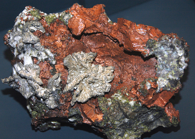
“The remarkable copper-silver ‘halfbreed’ specimen shown above comes from northern Michigan’s Portage Lake Volcanic Series, an extremely thick, Precambrian-aged, flood-basalt deposit that fills up an ancient continental rift valley.”
~ Creative Commons from James St. John
That the region, as before said, is rich in copper and silver ores, cannot be denied. And I think the indications that veins may or do exist somewhere in great richness, are sufficiently evident to justify continued explorations in search of them, by those who have the means and leisure to follow them up for several years. To find the veins, and most permanent deposites, must be the work of time; and as the season is short, on Lake Superior, for such operations, several years may be necessary before a proper and practical examination can be made of the country.
The general features of Lake Superior are very striking, and differ very much in appearance from what I have ever met with in any other part of the continent. The vastness and depth of such a body of pure fresh cold water so far within the continent, is an interesting characteristic. When we consider it is over 900 feet deep, with an area of over 30,000 square miles, and yet that, throughout its whole extent, it presents as pure and as fresh-tasted water as though it were taken from a mountain brook, the question naturally arises, Where can such a vast supply of pure water come from? It is true, it has great many streams flowing into it, but they are nearly all quite small, and would seem to be wholly inadequate to supply such a vast mass of water, and preserve it in such a state of purity. The water supplied by most of the rivers is far less pure than that in the lake itself. East of Keweena point, we found the water of the rivers discolored, being tinged by pine and other roots, clay, &c., often resembling the hue of New England rum. Such rivers, or all combined, would seem to be inadequate to supply such a vast quantity of pure clear water as fills this inland ocean!
~ United States Geological Survey
It is possible that this great lake is freely supplied with water from subterranean springs opening into it from below. The river St. Mary’s also seems inadequate, from its size, to discharge as much water as comes into the lake from the rivers which it receives. In this case, evaporation may be so great as to diminish the water that would otherwise pass out at it.
As relates to tides in the other lakes, we have nothing to say; but, as far as Lake Superior is concerned, we feel assured, from observation, as well as from the reports of others upon whom we can rely, that there are tides in it – variously estimated at from 8 to 12 inches; influenced, we imagine, by the point of observation, and the season of the year at which such tides are noticed.
The Voyageurs (1846) by Charles Deas.
~ Commons.Wikimedia.org
What strikes the voyageur with the most interest, in the way of scenery, is the wild, high, bold, and precipitous coast of the southern shore, for such much of the whole distance between Grand Sable and La Pointe, and, indeed, for some distance beyond La Pointe ; the picturesque appearance of which often seemed heightened to us, as on a clear morning, or late afternoon, or voyageurs would conduct our boat for miles near their bases. Above us, the cliffs would rise in towering heights, while the bald eagle would be soaring in grand circular flights above their summits; our voyageurs, at the same time, chanting in chorus many of their wildest boat songs, as we glided along on the smooth and silent bosom of the lake. I have heard songs among various nations, and in various parts of the world; but, whether it was the wild scenery resting in solemn grandeur before me, with the ocean-like waste of water around us, which lent wilderness to the song, I never listened to any which appeared to sing a verse in solo, and then repeat a chorus, in which the whole crew would join. This would often be continued for several miles at a time, as the boat glided forward over smooth water, or danced along over the gentle swells of a moderate sea; the voyageurs, at the same moment, keeping time with their oars.
Jean Baptiste, our pilot, had an excellent voice, full, loud, and strong. He generally led off, in singing; the others falling in at the choruses. All their songs were in French, sometimes sentimental or pathetic, sometimes comic, and occasionally extempore, made, as sung, from the occurrences of the preceding day, or suggested by passing scenes.
The Chippewa Indians are poor singers; yet they have songs (such as they are) among them; one of which is a monotonous air repeated at their moccasin games.
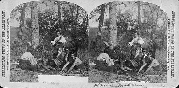
Stereographic view of a moccasin game, by J. H. Hamilton, 1880.
~ University of Minnesota Duluth
Next to the love of liquor, many of the Indians have a most unconquerable passion for gambling. While at La Pointe, I had an opportunity of seeing them play their celebrated moccasin game. They were to the number of two, or three aside, seated on the ground opposite to each other, which a blanket spread out between them, on which were placed four or five moccasins. The had two lead bullets, one of which was made rough, while the other remained smooth. Two f the gamesters were quite young men, with their faces painted with broad horizontal red and blue stripes, their eyelashes at the same time being dyed of a dark color. They played the game, won and lost, with as much sang froid as old and experienced gamblers. Those who sat opposite, especially one of them, was much older, but no means a match, at the time of my visit, for the young rascals, his antagonists. One takes the balls in his hands, keeps his eye directly on the countenance of the opposite party, at the same time tossing the balls in his hands, and singing, in a changing voice, words which sound somewhat like “He-he-hy-er-he-he-hy-er-haw-haw-haw-yer. He-he-hy-er,” &c. During which he keeps raising, shifting, and putting down the moccasins, till, finally, he raises his hands, having succeeded in concealing the balls under two of the moccasins, for which the other proceeds to search; and if he succeeds, on the first trial, in finding the rough ball, he wins. Then he takes the balls to hide, and commences singing himself. If he fails, he loses; and the first party repeats the song and the secretion of the balls. They hold in their hands small bundles of splinters of wood. When one loses, he gives to the winner so many sticks of wood. A certain number of them gained by any one of the party, wins the game. When I saw them, they had staked up their beads, belts, garters, knife-cases, &c. Their love of gaming is so strong, as to cause them to bet and lose everything they possess in the world – often stripping the last blanket from their naked backs, to stake on the game. It is said that some Indians acquire so much dexterity at this game, that others addicted to it refuse to play with them. In playing the game, they keep up a close watch on each other’s eyes, as being the best index to the movement of the hands. The song is repeated, no doubt, to diver the attention of the antagonists.
Among other peculiarities of Lake Superior, and one of its greatest recommendations, is the abundance and superiority of its fish, consisting of trout of large size, white fish, siskomit, ( a species of salmon,) and bass. The trout and siskomit are the finest and noblest fresh-water fish I ever saw. Almost every day we could catch trout by trailing a hook and line in the water behind out boat. In this way we caught one fine siskomit. Its meat, when fresh-cooked, we found about the color of salmon. The fish itself is about as heavy as a common-sized salmon, but less flat, being more round in form.

Detail of “The 12 Apostles” from Captain Jonathan Carver’s journal of his travels with maps and drawings, 1766.
~ Boston Public Library
If you will look at a map of Lake Superior, you will find, near its upper end, a labyrinth of islands, called by the early French voyageurs, of whom P. Charlevoix was one, (a Jesuit,) “the Madelaine islands.” They are sometimes called “the Twelve Apostles.” The largest island is now generally known as “the Madelaine island” – being the largest of the group. Just inside, and near its southern extremity, at the head of a large, regular bay, with a sandy beach, with an open and gently-rising scattered pine and spruce land in the rear of the beach, stands La Pointe – one of the most pleasant, beautiful, and desirable places for a residence on Lake Superior, and the very place where Fort Wilkins should have been placed, instead of its present location, which must be conceded, by every impartial person, to be among the very worst that could have been selected on the whole lake.
The garrison at Copper harbor, located, as it is, upon the rocky surface of trap conglomerate, affording a surface so scantily supplied with soil amidst masses of pebbly rock and trap fragments as to be wholly unfit for any sort of cultivation whatever, is altogether out of place. It is wholly inaccessible by land, and can only be reached by water in summer. It is at a spot where Indians usually never passed within forty miles of it, till since its occupation.
Detail of the Indian trail or “mail route” between La Pointe and St. Anthony Falls.
~ A new map of the State of Wisconsin, by Thomas, Cowperthwait & Co., 1850
The very next Congress should direct its prompt removal to La Pointe. Here, from the foot of the bay in front of the Madelaine island, there is an Indian trail, connecting La Pointe with St. Anthony’s Falls, and over which the mail is carried in winter by voyageurs on foot. La Pointe is the favorite resort of the Indians. Their lodges, in villages, bark canoes, &c. are found here the year round.
They delight to paddle and sail their canoes about the beautiful bays, harbors, &c. of these islands, employing their time in canoe building, hunting, fishing, &c. At every annual payment of their annuities, they flock to La Pointe in great numbers. Not only is that section of the great Chippewa nation sharing in the annuities brought together, but large parties of the same tribe, who receive no annuity, come at the same time from the British possessions to the north of Pigeon river. The Chippewas, called the “Pillageurs,” (so called from their thievish propensities,) inhabiting the country about Mille and Leech lakes, also attend – to meet relations, to traffic , and, perhaps, to steal a little. The great advantage of a government outpost is felt in the moral effect it exercises over the Indians. I know of no place where this influence would be more decidedly and beneficially exerted than at La Pointe. here should be daily unfurled the “stars and stripes,” and the sound of the evening gun be heard over the beautiful bays, and along the shores of the Twelve Apostles, which the Indians would learn to reverence with little less respect than they do the voice of the Manitou – the guardian spirit of the mines, embowelled in the dark trap hills of the lake.
Here, too, is an exceedingly healthy place, a good soil, and every convenience for raising the finest potatoes, turnips, and every kind of garden stuff.

1856 oil painting of Doctor Charles William Wulff Borup, a native of Copenhagen, Denmark. Borup married Elizabeth Beaulieu, a Lake Superior Chippewa daughter of Bazil Hudon Beaulieu and Ogimaagizzhigokwe. Borup and his brothers-in-law Charles Henry Oakes and Clement Hudon Beaulieu were co-signers of the 1842 Treaty with the Chippewa at La Pointe. Borup and Oakes became the first bankers of Minnesota.
Dr. Borup, the agent for the American Fur Company, (who have an extensive trading-post at this place,) has a superb garden. In walking through it with him, I saw very fine crops of the usual garden vegetables growing in it. His red currant bushes were literally bent down beneath their weight of ripe fruit. His cherry-trees had also borne well. Gooseberries also succeed well. The doctor also had some young apple-trees, that were in a thriving condition. Poultry, likewise, does well. Mrs. B. had her yard well stocked with turkeys, geese, ducks, and chickens. There was also a good garden at the mission-house of the American board.
However infinitely better is such a place for a United States garrison than Copper harbor, located, as it were, on a barren rock, where no Indians are seen, unless induced to go there by the whites – where there is nothing to protect – where intercourse is cut off in winter, and food can only reach it in summer – where there is no soil on which to raise a potato or a cabbage. I can only say that a greater blunder, in the location of a military post, was probably never committed. And if made (of which I am assured it was not) by a military man, he ought to be court-martialed and cashiered.
The mouth of the Ontonagon river is a far better spot for the fort than Copper harbor. It has a good soil, and a beautiful site for a fort. Furthermore, the country between it and Fort Winnebago, on the Wisconsin river, is favorable to the construction of a military road, which ought, at no distant day, to be opened. Another road should be cut from Fort Snelling, near the falls of St. Anthony, to La Pointe. In cutting these roads, it would seem to me as if the United States soldiers themselves might be usefully employed.
~ FortWiki.com
While at Copper harbor, I frequently visited Fort Wilkins, in command of Captain Cleary, whom I consider in every way an ornament and an honor to the service. In the brief space of time he has been at this post, and with the slender materials at command afforded by the country, he has nevertheless succeeded in making an “oasis” in a wilderness. He has erected one of the neatest, most comfortable, and best-planned garrisons it has been my lot to enter on the western frontier. He keeps all in excellent condition. His men look clean, healthy, and active. He drills them daily, and keeps them under most excellent discipline. He seems to take both pleasure and ride in the service. He says he never has any difficulty with is soldiers while he can exclude ardent spirits from them, as he succeeds in doing here, notwithstanding the great number of visitors to Copper harbor this summer.
To all travellers who are interested in objects of leading curiosity, the character of the Indians they fall in with cannot fail to arrest a share of attention.
The Chippewas are the only Indians now met with from the Sault Ste. Marie and Mackinac, extending from thence west along the southern shore of Lake Superior, to Fond du Lac, and from thence, in the same direction, to the Mississippi river. Within the United States they extend over the country south from the British boundary, to the country low down on the St. Croix and Chippewa rivers. The same tribe extends from our boundary northwest of the lake, entirely around its northern shore on British territory, till they reach the Sault Ste. Marie, opposite the American shore. It is said this tribe, spread over such a vast tract of country, is a branch of the powerful race of the Algonquins. They are sometimes called O-jib-was. They do not exist as a consolidated nation, or strictly as a confederation of bands. The entire nation on both sides of the line is divided into a great number of bands, with a chief at the head of each, which not uncommonly go by his name, such as “Old Martin’s band,” “Hole in the Day’s band,” &c.
The chief’s son, especially if he exhibits the right qualities, is expected to succeed his father at the head of the band; but very frequently the honor is reached by usurpation. The whole nation, which widely differ in circumstances, according to the part of the country they inhabit, nevertheless all speak the Chippewa language, and have extensive connexion by marriage, &c. The bands inhabiting the southern shore of Lake Superior are by far the best of any others. Though polygamy still prevails among them, and especially among their chiefs, it is nevertheless said to be becoming less common, especially where they are much influenced by Catholic and other missions. While at La Pointe, an Indian wedding was consummated, being conducted according to the ceremonies of the Catholic church, and performed by the missionary priest of that persuasion stationed at the Pointe.
There is one trait of character possessed by the Chippewas, (if we except, perhaps, the band of “pillageurs,” who have a kind of “Bedouin Arab” reputation among their countrymen,) which, I am sorry to say, the whites do not possess in an equal degree – that is, “very great honesty.”
White men can travel among them with the most perfect safety as to life and property. I will venture to say, that a man may carry baskets filled with gold and silver, and set them down in Indian villages, or leave them lying where he likes, or go to sleep by them, with Indians encamped all around him, and not one cent will be touched. Such a thing as a house being broken open and robbed at a Chippewa Indian trading-post was never heard of – within between two and three years’ intercourse with them – in time of peace. Dr. Borup said he would not be afraid, if concealed to look on, to leave his store door open all night; and the fact alone of its being left open, might be made known to the Indians at the Pointe. He would expect to see no Indian enter the store, nor would he expect to lose anything; such was his confidence in their honesty!!
Last winter, flour at the Pointe rose to $40 per barrel. The poor Indians were nearly famished for bread, but were unable to purchase it at such a price. They knew the American Fur Company had a considerable lot in store, guarded by nothing stronger than a padlock, yet they never offered the least violence towards the company’s agents or store! Would white people have acted as honestly? The poor Indians, by nature honest, have too often known the whites by the wrongs inflicted upon them, which God can forgive, but time can never blot out! They are very superstitious, but not as basely and insanely so, but a great deal, as the Mormons, Millerites, and other moon-stricken sects among the whites. They believe in one Great and Good Spirit, or a Being who can at will inflict good or evil on mankind; and there’s an end of it. They often denominate the mysterious spirit of evil import the Manitou, making him to dwell in the wild hills, islands, grottoes, and caves of Lake Superior.
From these huge birds the Indians obtained their first knowledge of fire, which they kindled with fire-sticks. These mythical birds were the most powerful of the animal deities of the Indians of the woodlands and of the plains. When the weather was stormy they flew about high in the heavens. When they flapped their great wings, one heard the crashes of thunder, when they opened and closed their eyes flashes of lightning were seen. Some carried lakes of water on their backs, these slopped over and caused downpours of rain. Their arrows, or thunderbolts, were the eggs which they dropped in their flight. These shattered the rocks and set fire to the forests and prairies.
A Chippewa Indian hunter, who was carried away to his nest by a Thunderer, saved his life by killing one of the young birds and flying back to earth in its feathered hide.
In the Smoky Mountains, a wild and rugged region in the southwestern part of Bayfield County, was the home of Winneboujou (Nenebozho), the fabled hero of the Ojibwa Indians. This all-powerful manitou was a blacksmith, and had his forge on the flat top of the highest mountain. Here he shaped the native copper of the Lake Superior region into useful implements for his Indian children. Much of his work at his forge was done at night, and the ringing blows of his great hammer could be heard throughout the Brule Valley and Lake Superior region. The fire of his forge reddened the sky. When he was not busy at his forge he was away hunting or seeking other adventures. Many stories of the exploits of this giant manitou have been told by the Chippewa and other Wisconsin Algonquian tribes.”
~ Legends of the Hills of Wisconsin by Dorothy Moulding Brown; The Wisconsin Archaeologist, Volume 18, Number 1, 1937, pages 20-21.
At times, it is said, a peculiar noise issues from the Porcupine mountains, and from the high hills on the main land, both east and west of La Pointe, some distance off. It is said to resemble the distant discharge of ordnance, or thunder. At one time, they said it was so loud and frequent, that they mistook it for signal guns fired from the brig Astor, which they thought might be in distress, and actually sent out a boat in search of her.
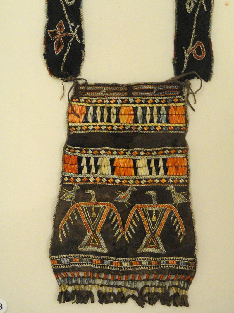
“Ojibwe shoulder pouch depicting two thunderbirds in quillwork, Peabody Museum, Harvard University.”
~ Commons.Wikimedia.org
These sounds the Indians believe to be the voice of the spirit “Manitou,” who guards the deposites of mineral wealth embowelled beneath the hills, and to whom any attempt made to dig them up, and carry them off, would be highly offensive, and followed by some kind of punishment. I have never yet heard of an Indian’s leading a white man to a locality of copper, or telling where he has found a piece when picked up!
Some have supposed that the noise in question arises from volcanic action; but, as no vibration is felt in the earth, and no other proof exists of such being the case, we are led to believe that the noise is produced by the lashing of the waves of the lake after a storm, as they are driven forward into the grottoes, caves, &c. of the tall sandstone cliffs, formed at their bases by the disintegrating effects of water and ice. Some distance east of La Pointe, about the Little Girl’s Point and Montreal river, as well as west of the same place, some fifteen or twenty miles, high red sandstone cliffs occur. At their bases, near the water’s edge, a great many curiously-shaped caves and grottoes appeared. In places, the sandstone had been so cut away, that only pillars remained standing at some ten or fifteen feet in the lake, from the top of which a high rude arch would extend to the main shore, and beneath which boats could easily pass. This was particularly the case near where the islands are parted with going west up the southern shore of the lake. Some caves, with small openings for mouths, run for a long distance back beneath the hills, expanding, likely, into large halls with high vaulted roofs, &c. After a storm, a heavy sea continues to roll into these grottoes and caverns, the waves lashing themselves against their sides and roofs – thus producing sounds resembling those heard at La Pointe, &c.
As the weather is generally calm after a storm, before the sea goes down, it is likely at such times these sounds are heard.
We had occasion to pass these places when a considerable sea would be on, close to the cliffs, and could hear the hollow heavy sounds of the waves as they broke into the caverns within the cliffs and hills. Every day, while we remained, parties of Indians continued to arrive, to be present at the payment.
We finally became prepared to leave for the Mississippi, having bought two bark canoes, and hired four new voyageurs – two for each canoe – one Indian, one half-breed, and two descendants of Canadian French; and, with a stock of provisions, we were ready to be off. From this place, I sent back three voyageurs to the Sault Ste. Marie, all that I hired to come as far as La Pointe. So, after paying our respects to Mr. Hays, our worthy Indian agent, and to Dr. Borup, (to both of whom I had borne letters of introduction,) and having many “bon voyages” heaped upon us by our friends and the friends of the voyageurs, we bade adieu to La Pointe.
You will not hear from me again till I reach the Falls of St. Croix.
I am yours, very truly, &c.
MORGAN.
To be continued in Saint Croix Falls…
Wisconsin Territory Delegation: The Copper Region
April 17, 2016
By Amorin Mello
A curious series of correspondences from “Morgan”
… continued from Copper Harbor.

The Daily Union (Washington D.C.)
“Liberty, The Union, And The Constitution.”
August 21, 1845.
EDITOR’S CORRESPONDENCE.
—
[From our Regular Correspondent.]
THE COPPER REGION.
La Pointe, Lake Superior
July 28, 1845.
Map of the Mineral Lands Upon Lake Superior Ceded to the United States by the Treaty of 1842 With the Chippeway Indians.
~ Wisconsin Historical Society
In my last brief letter from this place, I had not time to notice many things which I desired to describe. I have now examined the whole coast of the southern shore of Lake Superior, extending from the Sault Ste. Marie to La Pointe, including a visit to the Anse, and the doubling of Keweena point. During the trip, as stated previously, we had camped out twenty-one nights. I examined the mines worked by the Pittsburg company at Copper harbor, and those worked by the Boston company at Eagle river, as well as picked up all the information I could about other portions of the mineral district, both off and on shore. The object I had in view when visiting it, was to find out, as near as I could, the naked facts in relation to it. The distance of the lake-shore traversed by my part to La Pointe was about five hundred miles – consuming near four weeks’ time to traverse it. I have still before me a journey of three or four hundred miles before I reach the Mississippi river, by the way of the Brulé and St. Croix rivers. I know the public mind has been recently much excited in relation to the mineral region of country of Lake Superior, and that a great many stories are in circulation about it. I know, also, that what is said and published about it, will be read with more or less interest, especially by parties who have embarked in any of the speculations which have been got up about it. It is due to truth and candor, however, for me to declare it as my opinion, that the whole country has been overrated. That copper is found scattered over the country equal in extent to the trap-rock hills and conglomerate ledges, either in its native state, or in the form of a black oxide, as a green silicate, and, perhaps, in some other forms, cannot be denied;- but the difficulty, so far, seems to be that the copper ores are too much diffused, and that no veins such as geologist would term permanent have yet positively been discovered.

Detail of a Survey of Location No. 4 for the Pittsburgh & Boston Copper Harbor Mining Co. Image digitized by the Detroit Public Library Burton Historical Collection for The Cliff Mine Archeology Project Blog.
The richest copper ore yet found is that raised from a vein of black oxide, at Copper harbor, worked by the Pittsburg company, which yields about seventy per cent. of pure copper. But this conglomerate cementation of trap-rock, flint, pebbles, &c., and sand, brought together in a fused black mass, (as is supposed, by the overflowings of the trap, of which the hills are composed near this place,) is exceedingly hard and difficult to blast. An opinion seems to prevail among many respectable geologist, that metallic veins found in conglomerate are never thought to be very permanent. Doctor Pettit, however, informed me that he had traced the vein for near a mile through the conglomerate, and into the hill of trap, across a small lake in the rear of Fort Wilkins. The direction of the vein is from northwest to southeast through the conglomerate, while the course of the lake-shore and hills at this place varies little from north and south. Should the doctor succeed in opening a permanent vein in the hill of trap opposite, of which he is sanguine, it is probable this mine will turn out to be exceedingly valuable. As to these matters, however, time alone, with further explorations, must determine. The doctor assured me that he was at present paying his way, in merely sinking shafts over the vein preparatory to mining operations; which he considered a circumstance favorable to the mine, as this is not of common occurrence.
The mines at Copper harbor and Eagle river are the only two as yet sufficiently broached to enable one to form any tolerably accurate opinion as to their value or prospects.
~ Encyclopedia of the Earth
Other companies are about commencing operations, or talk of doing so – such as a New York, or rather Albany company, calling themselves “The New York and Lake Superior Mining Company,” under the direction of Mr. Larned, of Albany, in whose service Dr. Euhts has been employed as geologist. They have made locations at various points – at Dead river, Agate harbor, and at Montreal river. I believe they have commenced mining to some extent at Agate harbor.
One or two other Boston companies, besides that operating at Eagle river, have been formed with the design of operating at other points. Mr. Bernard, formerly of St. Louis, is at the head of one of them. Besides these, there is a kind of Detroit company, organized, it is said, for operating on the Ontonagon river. It has its head, I believe, in Detroit, and its tail almost everywhere. I have not heard of their success in digging, thus far; though they say they have found some valuable mines. Time must determine that. I wish it may be so.

Boston Mining Company stock issued by Joab Bernard in 1846.
~ Copper Country Reflections
From Copper harbor, I paid a visit to Eagle river – a small stream inaccessible to any craft larger than a moderate-sized Mackinac boat. There is only the open lake for a roadstead off its mouth, and no harbor nearer than Eagle harbor, some few miles to the east of it. In passing west from Copper harbor along the northern shore of Keweena point, the coast, almost from the extremity of Keweena point, to near Eagle river, is an iron-bound coast, presenting huge, longitudinal, black, irregular-shaped masses of trap-conglomerate, often rising up ten or fifteen feet high above water, at some distance from the main shore, leaving small sounds behind them, with bays, to which there are entrances through broken continuities of the advanced breakwater-like ledges. Copper harbor is thus formed by Porter’s island, on which the agency has been so injudiciously placed, and which is nothing but a conglomerate island of this character; with its sides next the lake raised by Nature, so as to afford a barrier against the waves that beat against it from without. The surface of the island over the conglomerate is made up of a mass of pebbles and fragmentary rock, mixed with a small portion of earth, wholly or quite incapable of cultivation. Fort Wilkins is located about two miles from the agency, on the main land, between which and the fort communication in winter is difficult, if not impossible. Of the inexcusable blunder made in putting this garrison on its present badly-selected site, I shall have occasion to speak hereafter.
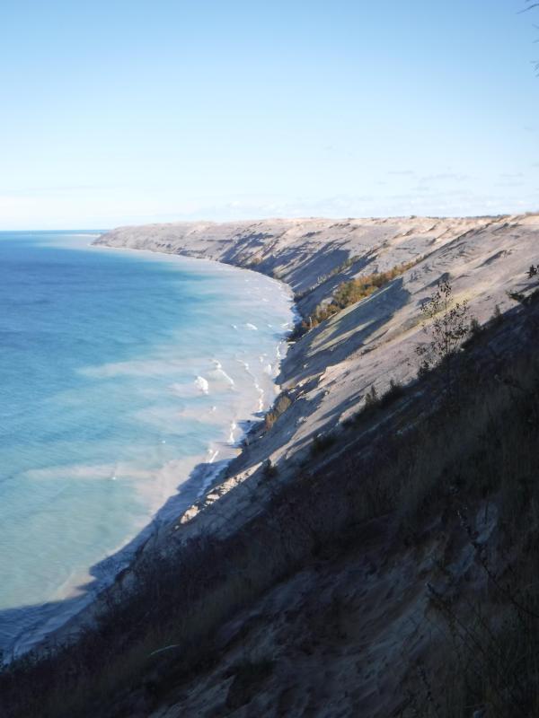
“Grand Sable Dunes”
~ National Park Service
In travelling up the coast from Sault Ste. Marie, the first 50 or 100 miles, the shore of Lake Superior exhibits, for much of the distance, a white sandy beach, with a growth of pines, silver fir, birch, &c., in the rear. This beach is strewed in places with much whitened and abraded drift-wood, thrown high on the banks by heavy waves in storms, and the action of ice in winter. This drift-wood is met with, at places, from one end of the lake to the other, which we found very convenient for firewood at our encampments. The sand on the southern shore terminates, in a measure, at Grand Sables, which are immense naked pure sand-hills, rising in an almost perpendicular form next to the lake, of from 200 to 300 feet high. Passing this section, we come to white sand-stone in the Pictured Rocks. Leaving these, we make the red sand-stone promontories and shore, at various points from this section, to the extreme end of the lake. It never afterwards wholly disappears. Between promontories of red stone are headlands, &c., standing out often in long, high irregular cliffs, with traverses of from 6, 7, to 8 miles from one to the other, while a kind of rounded bay stretches away inland, having often a sandy beach at its base, with pines growing in the forest in the rear. Into these bays, small rivers, nearly or quite shut in summer with sand, enter the lake.
The first trap-rock we met with, was near Dead river, and at some few points west of it. We then saw no more of it immediately on the coast, till we made the southern shore of Keweena point. All around the coast by the Anse, around Keweena bay, we found nothing but alternations of sand beaches and sand-stone cliffs and points. The inland, distant, and high hills about Huron river, no doubt, are mainly composed of trap-rock.

Detail from Map of the Mineral Lands Upon Lake Superior Ceded to the United States by the Treaty of 1842 With the Chippeway Indians.
~ Wisconsin Historical Society
Going west from Eagle river, we soon after lost both conglomerate and trap-rock, and found, in their stead, our old companions – red sand-stone shores, cliffs, and promontories, alternating with sandy or gravelly beaches.

Detail of the Ontonagon River, “Paul’s Cabin,” the Ontonagon Boulder, and the Porcupine Mountains from Map of the Mineral Lands Upon Lake Superior Ceded to the United States by the Treaty of 1842 With the Chippeway Indians.
~ Wisconsin Historical Society
The trap-rock east and west of the Portage river rises with, and follows, the range of high hills running, at most points irregularly, from northeast to southwest, parallel with the lake shore. It is said to appear in the Porcupine mountain, which runs parallel with Iron river, and at right angles to the lake shore. This mountain is so named by the Indians, who conceived its principal ridge bore a likeness to a porcupine; but, to my fancy, it bears a better resemblance to a huge hog, with its snout stuck down at the lake-shore, and its back and tail running into the interior. This river and mountain are found about twenty miles west of the Ontonagon river, which is said to be the largest stream that empties into the lake. The site for a farm, or the location of an agency, at its mouth, is very beautiful, and admirably suited for either purpose. The soil is good; the river safe for the entrance and secure anchorage of schooners, and navigable to large barges and keel-boats for twelve miles above its mouth. The trap range, believed to be as rich in copper ores as any part of Lake Superior, crosses this river near its forks, about fifteen miles above its mouth. The government have organized a mineral agency at its mouth, and appointed Major Campbell as agent to reside at it; than whom, a better selection could not have been made.
“Engraving depicting the Schoolcraft expedition crossing the Ontonagon River to investigate a copper boulder.”
~ Wisconsin Historical Society
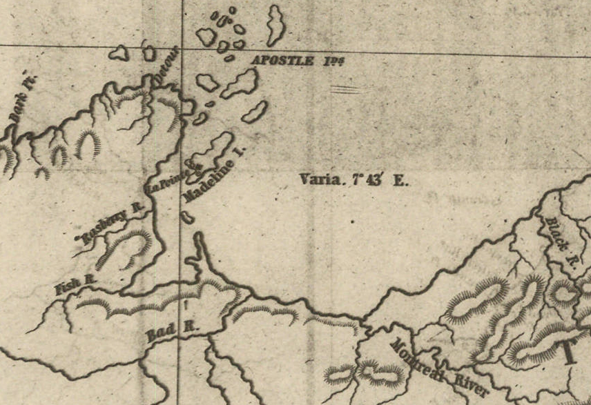
Detail of the Montreal River, La Pointe, and Chequamegon bay from from Map of the Mineral Lands Upon Lake Superior Ceded to the United States by the Treaty of 1842 With the Chippeway Indians.
~ Wisconsin Historical Society
The nearest approach the trap-rock hills make to the lake-shore, beyond the Porcupine mountain, is on the Montreal river, a short distance above the falls. Beyond Montreal river, to La Pointe, we found red-clay cliffs, based on red sand-stone, to occur. Indeed, this combination frequently occurred at various sections of the coast – beginning, first, some miles west of the Portage.
From Copper harbor to Agate harbor is called 7 miles; to Eagle river, 20 miles; to the Portage, 40 miles; to the Ontonagon, 80 miles; to La Pointe, from Copper harbor, 170 miles. From the latter place to the river Brulé is about 70 miles; up which we expect to ascend for 75 miles, make a portage of three miles to the St. Croix river, and descend that for 300 miles to the Mississippi river.
Painting of Professor Douglass Houghton by Robert Thom. Houghton first explored the south shore of Lake Superior in 1840, and died on Lake Superior during a storm on October 13, 1845. Chequamegon Bay’s City of Houghton was named in his honor, and is now known as Houghton Falls State Natural Area.
Going back to Eagle river, at the time of our visit, we found at the mine Mr. Henshaw, Mr. Williams, and Dr. Jackson of Boston, and Dr. Houghton of Michigan, who was passing from Copper harbor to meet his men at his principal camp on Portage river, which he expected to reach that night. The doctor is making a rapid and thorough survey of the country. This work he is conducting in a duplicate manner, under the authority of the United States government. It is both a topographical and geological survey. All his surveyors carry sacks, into which they put pieces of rock broken from every prominent mass they see, and carry into camp at night, for the doctor’s examination, from which he selects specimens for future use. The doctor, from possessing extraordinary strength of constitution, can undergo exposure and fatigue sufficient to break down some of the hardiest men that can be found in the West. He wears his beard as long as a Dunkard’s; has a coat and patched pants made of bed ticking; wears a flat-browned ash-colored, wool hat, and a piece of small hemp cord off a guard chain; and, with two half-breed Indians and a small dog as companions, embarks in a small bark, moving and travelling along the lake shore with great celerity.
Probably no company on Lake Superior has had a longer and harder struggle against adversity than the Phœnix. The original concern, the Lake Superior Copper Company, was among the first which operated at Lake Superior after the relinquishment of the Indian rights to this country in 1843. The trustees of this early organization were David Henshaw and Samuel Williams of Boston, and D. G. Jones and Col. Chas. H. Gratiot, of Detroit; Dr. Charles T. Jackson examined the veins on the property, and work was begun in the latter part of the year 1844. The company met with bad luck from the start, and, the capital stock having become exhausted, it has been reorganized several times in the course of its history.”
~ The Lake Superior Copper Properties: A Guide to Investors and Speculators in in Lake Superior Copper Shares Giving History, Products, Dividend Record and Future Outlook for Each Property, by Henry M. Pinkham, 1888, page 9.
We all sat down to dinner together, by invitation of Mr. Williams, and ate heartily of good, wholesome fare.
After dinner we paid a visit to the shafts at the mine, sunk to a considerable depth in two or three places. Only a few men were at work on one of the shafts; the others seemed to be employed on the saw-mill erecting near the mouth of the river. Others were at work in cutting timbers, &c.
They had also a crushing-mill in a state of forwardness, near the mine.
It is what has been said, and put forth about the value of this mineral deposite, which has done more to incite and feed the copper fever than all other things put together.
Professor Charles Thomas Jackson.
~ Contributions to the History of American Geology, plate 11, opposite page 290.
Dr. Jackson was up here last year, and has this year come up again in the service of the company. Without going very far to explore the country elsewhere, he has certainly been heard to make some very extravagant declarations about this mine,- such as that he “considered it worth a million of dollars;” that some of the ore raised was “worth $2,000 or $3,000 per ton!” So extravagant have been the talk and calculations about this mine, that shares (in its brief lease) have been sold, it is said, for $500 per share! – or more, perhaps!! No doubt, many members of the company are sincere, and actually believe the mine to be immensely valuable. Mr. Williams and General Wilson, both stockholders, strike a trade between themselves. One agrees or offers to give the other $36,000 for his interest, which the other consents to take. This transaction, under some mysterious arrangement, appears in the newspapers, and is widely copied.
Without wishing to give an opinion as to the value and permanency of this mine, (in which many persons have become, probably, seriously involved,) even were I as well qualified to do so as some others, I can only state what are the views of some scientific and practical gentlemen with whom I fell in while in the country, who were from the eastern cities, and carefully examined the famous Eagle river silver and copper mine. I do not allude to Dr. Houghton; for he declines to give an opinion to any one about any part of the country.
“The remarkable copper-silver ‘halfbreed’ specimen shown above comes from northern Michigan’s Portage Lake Volcanic Series, an extremely thick, Precambrian-aged, flood-basalt deposit that fills up an ancient continental rift valley.”
~ Shared with a Creative Commons license from James St. John
They say this mine is a deposite mine of native silver and copper in pure trap-rock, and no vein at all; that it presents the appearance of these metals being mingled broadcast in the mass of trap-rock; that, in sinking a shaft, the constant danger is, that while a few successive blasts may bring up very rich specimens of the metals, the succeeding blast or stroke of the pick-axe may bring up nothing but plain rock. In other words, that, in all such deposite mines, including deposition of diffused particles of native meteals, there is no certainly their PERMANENT character. How far this mine will extend through the trap, or how long it will hold out, is a matter of uncertainty. Indeed, time alone will show.
It is said metallic veins are most apt to be found in a permanent form where the mountain limestone and trap come in contact.
I have no prejudice against the country, or any parties whatever. I sincerely wish the whole mineral district, and the Eagle mine in particular, were as rich as it has been represented to be. I should like to see such vast mineral wealth as it has been held forth to be, added to the resources of the country.
Unless Dr. Pettit has succeeded in fixing the vein of black oxide in the side of the mountain or hill, it is believed by good judges that no permanent vein has yet been discovered, as far as has come to their knowledge, in the country!! That much of the conglomerate and trap-rock sections of the country, however, presents strong indications and widely diffused appearances of silver and copper ores, cannot be denied; and from the great number of active persons engaged in making explorations, it is possible, if not probable, that valuable veins may be discovered in some portions of the country.
To find such out, however, if they exist, unless by accident, must be the work of time and labor – perhaps of years – as the interior is exceedingly difficult, or rather almost impossible, to examine, on account of the impenetrable nature of the woods.
During our long and tedious journey, we were favored with a good deal of fine weather. We however experienced, first and last, five or six thunderstorms, and some tolerably severe gales.
Coasting for such a great length, and camping out at night, was not without some trials and odd incidents – mixed with some considerable hardships.
On the night before we reached La Pointe, we camped on a rough pebbly beach, some six or eight miles east of Montreal river, under the lea of some high clay cliffs. We kindled our fire on what appeared to be a clear bed of rather large and rounded stones, at the mouth of a gorge in the cliffs.

Topographic map of the gorge in the cliffs at Little Girl’s Point County Park.
~ United States Geological Survey
Next morning early, the fire was rekindled at the same spot, although some rain had falled in the night it being still cloudy, and heavy thunder rolling, indicating an approaching storm. I had placed some potatoes in the fire to roast, while some of the voyageurs were getting other things ready for breakfast; but before we could get anything done, the rain down upon us in torrents. We soon discovered that we had kindled our fire in the bed of a wet weather creek. The water rapidly rose, put out the fire, and washed away my potatoes.
We had then to kindle a new fire at a higher place, which was commenced at the end of a small crooked log. One of the voyageurs had set the frying-pan on the fire with an Indian pone or cake an inch thick, and large enough to cover the bottom it. The under side had begun to bake; another hand had mixed the coffee, and set the coffee-pot on to boil; while a third had been nursing a pot boiling with pork and potatoes, which, as we were detained by rain, the voyageurs thought best to prepare for two meals. One of the part, unfortunately, not observing the connexion between the crooked pole, and the fire at the end of it, jumped with his whole weight on it, which caused it suddenly to turn. In its movement, it turned the frying-pan completely over on the sand, with its contents, which became plastered to the dirt. The coffee-pot was also trounced bottom upwards, and emptied its contents on the sand. The pot of potatoes and pork, not to be outdone, turned over directly into the fire, and very nearly extinguished it. We had, in a measure, to commence operations anew, it being nearly 10 o’clock before we could get breakfast. When near the Madelaine islands, (on the largest of which La Pointe is situated,) the following night, our pilot, amidst the darkness of the evening, got bewildered for a time, when we thought best to land and camp; which, luckily for us, was at a spot within sight of La Pointe. Many trifling incidents of this character befell us in our long journey.
Lake Bands:
“Ki ji ua be she shi, 1st [Chief].
Ke kon o tum, 2nd [Chief].”
Pelican Lakes:
“Kee-che-waub-ish-ash, 1st chief, his x mark.
Nig-gig, 2d chief, his x mark.“
Lac Courte Oreilles Band:
At the mouth of the Montreal river, we fell in with a party of seventeen Indians, composed of old Martin and his band, on their way to La Pointe, to be present at the payment expected to take place about the 15th of August.
They had their faces gaudily painted with red and blue stripes, with the exception of one or two, who had theirs painted quite black, and were said to be in mourning on account of deceased friends. They had come from Pelican lake (or, as the French named it, Lac du Flambeau,) being near the headwaters of the Wisconsin river, and one hundred and fifty miles distant. They had with them their wives; children, dogs, and all, walked the whole way. They told our pilot, Jean Baptiste, himself three parts Indian, that they were hungry, and had no canoe with which to get on to La Pointe. We gave them some corn meal, and received some fish from them for a second supply. For the Indians, if they have anything they think you want, never offer generally to sell it to you, till they have first begged all they can; then they will produce their fish, &c., offering to trade; for which they expect an additional supply of the article you have been giving them. Baptiste distributed among them a few twists of tobacco, which seemed very acceptable. Old Martin presented Baptiste with a fine specimen of native copper which he had picked up somewhere on his way – probably on the headwaters of the Montreal river. He desired us to take one of his men with us to La Pointe, in order that he might carry a canoe back to the party, to enable them to reach La Pointe the next day, which we accordingly complied with. We dropped him, however, at his own request, on the point of land some miles south of La Pointe, where he said he had an Indian acquaintance, who hailed him from shore.
Having reached La Pointe, we were prepared to rest a few days, before commencing our voyage to the Mississippi river.
Of things hereabouts, and in general, I will discourse in my next.
In great haste I am,
Very respectfully,
Your obedient servant,
MORGAN.
To be continued in La Pointe…
Bayfield’s Beginnings
March 6, 2016
By Amorin Mello
This is a reproduction of Captain Robinson Darling Pike’s speech for the 50th anniversary celebrations of Bayfield, Wisconsin on March 24th, 1906. It was originally digitized and reproduced onto RootsWeb.com by John Griener, a great-grandson of Currie G. Bell. The Bayfield County Press was in the Bell family from the Fall of 1882 until July of 1927. Pike’s obituary was not included in this reproduction.

Portrait of Bayfield from History of Northern Wisconsin, by the Western Historical Company, 1881, page 80.
Capt. R. D. PIKE on
Bayfield’s Beginnings
Captain Robinson Derling Pike
~ A gift that spawns Great Lakes fisheries:The legacy of Bayfield pioneer R.D. Pike, by Julia Riley, Darren Miller and Karl Scheidegger for the Wisconsin Department of Natural Resources, October 2011.
Robinson Darling PIKE, son of Judge Elisha and Elizabeth Kimmey PIKE, was a lumbering giant in early Bayfield history. Capt. R. D. Pike, as his name appeared weekly in the Press, was one of the most influential men in the county, associated not only with timber interests, but with the Bayfield Brownstone Company, the electric light company, the fish hatchery, etc. Just before his death on March 27, 1906, he wrote the following recollections of early Bayfield. The paper was read at the Bayfield 50th anniversary celebrations and was published in the March 30, 1906 issue of the Press along with Capt. PIKE’s obituary:
I regret very much not being able to be with you at the celebration of the fiftieth anniversary of the town of Bayfield. As you may be aware, I have been ill for the past few weeks, but am pleased to state at this time I am on the gain and hope to be among you soon. If my health permitted I would take great pleasure in being present with you this evening.
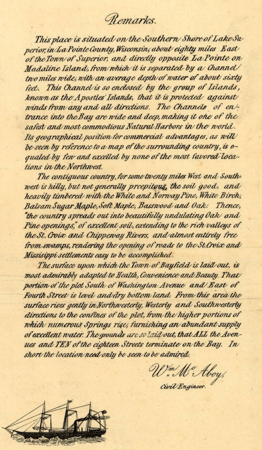
Detail from Major William McAboy‘s 1856 Map of Bayfield.
Senator Henry Mower Rice
~ United States Senate Historical Office
I remember very distinctly that the first stake was driven in the town of Bayfield by Major McABOY who was employed by the Bayfield Townsite Company to make a survey and plat same, (the original plat being recorded at our county seat.) This Bayfield Townsite Company was organized with Hon. Henry M. RICE of St. Paul at the head and some very enterprising men from Washington D.C. Major McABOY arrived here about the first of March and made his headquarters with Julius AUSTRIAN of LaPointe. Julius AUSTRIAN in those days being the Governor General of all that part of the country west of Ontonagon to Superior; Ashland and Duluth being too small to count The major spent probably two weeks at LaPointe going back and forth to Bayfield with a team of large bay horses owned by Julius AUSTRIAN, being the only team of horses in the country.
For more information about Julius Austrian, see other Austrian Papers.
I remember very well being in his office at LaPointe with father, (I being then a mere lad of seventeen,) and I recollect hearing them discuss with Mr. AUSTRIAN the question of running the streets in Bayfield north and south and avenues east and west, or whether they should run them diagonally due to the topography of the country, but he decided on the plan as the town is now laid out. Mr. AUSTRIAN and quite a little party from LaPointe came over here on the 24th of March, 1856, when they officially laid out the town, driving the first stake and deciding on the name Bayfield, named after Lieutenant Bayfield of the Royal Navy who was a particular friend of Senator RICE, and it was he who made the first chart for the guidance of boats on Lake Superior.

“Map of Bayfield situate in La Pointe County, Wisconsin” by Major William McAboy, 1856 for the Bayfield Land Company.
~ Wisconsin Historical Society

For more information about Indian interpreter Frederick Prentice, see his appearances in the Barber Papers.
~ Portrait of Prentice from History of the Maumee Valley by Horace S Knapp, 1872, pages 560-562.
The summer of 1855 father was in poor health, filled up with malaria from the swamps of Toledo, and he was advised by Mr. Frederick PRENTICE, now of New York, and known by everybody here as “the brownstone man,” to come up here and spend the summer as it was a great health resort, so father arrived at LaPointe in June, 1855, on a little steamer that ran from the Soo to the head of the lakes, the canal at that time not being open, but it was opened a little later in the season.

Detail of “Austrian’s Saw Mill” on Pike’s Creek, Chequamegon Bay, Lake Superior, circa 1852.
~ Wisconsin Public Land Survey Records
Upon arrival at LaPointe father entered into an agreement with Julius AUSTRIAN to come over to Pike’s creek and repair the little water mill that was built by the North American Fur Company, which at that time was owned by Julius AUSTRIAN. He made the necessary repairs on the little mill, caught plenty of brook trout and fell in love with the country on account of the good water and pure air and wrote home to us at Toledo glowing letters as to this section of the country. Finally he bought the mill and I think the price paid was $350 for the mill and forty acres of land, and that largely on time; however the mill was not a very extensive affair. Nearly everything was made of wood, except the saw and crank-pin, but it cut about two thousand feet of lumber in twelve hours. Some of the old shafting and pulleys can be seen in the debris at the old mill site now. Remember these were not iron shafts as we used wooden shafts and pulleys in those days. This class of the mill at the time beat whip-sawing, that being the usual way of sawing lumber.
Father left LaPointe some time in September 1855 for Toledo to move his family to Pike’s creek, which stream was named after we moved up here. Onion river and Sioux river were named before that time. On father’s arrival from Toledo from this country we immediately began to get ready to move. We had a large fine yoke of red oxen and logging trucks. He sold out our farm at Toledo, packed up our effects, and boarded a small steamer which took us to Detroit. Our family then consisted of father, mother, grandma PIKE, and my sister, now Mrs. BICKSLER, of Ashland. We stayed several days in Detroit to give father time to buy supplies for the winter; that is feed for the oxen and cow and groceries for the family to carry us through until Spring.
We then boarded the steamer Planet, which was a new boat operated by the Ward Line, considered the fastest on the lake. It was about two hundred fifty tons capacity. We came to Sault Ste. Marie, it being the Planet‘s first trip through the Soo, the canal as I remember was completed that fall. During this year the Lady Elgin was running from Chicago and the Planet and North Star running from Detroit, they being about the only boats which were classed better than sail boats of the one hundred and fifty tons.

Portrait of the Steamer North Star from American Steam Vessels, by Samuel Ward Stanton, page 40.
~ Wikimedia.org
We arrived at LaPointe the early part of October, 1855. On our way up we stopped at Marquette, Eagle Harbor, Eagle River, and Ontonagon. We left Ontonagon in the evening expecting to arrive at LaPointe early the next morning, but a fearful storm arose and the machinery of the Planet became disabled off Porcupine mountains and it looked for a while as though we were never going to weather the storm, but arrived at LaPointe the next day. There were some parties aboard for Superior who left LaPointe by sail.
We remained at LaPointe for a week or ten days on account of my mother’s health and then went to Pike’s bay with all our supplies, oxen and cow on what was known as the Uncle Robert MORRIN’s bateau. Uncle Robert and William MORRIN now of Bayfield, and if I remember rightly, each of the boys pulled an oar taking us across. We landed in Pike’s bay just before sundown, hitched up the oxen and drove to the old mill. Now, this was all in the fall of 1855.

Detail from William McAboy‘s 1856 Map of Bayfield.
“HON. JOHN W. BELL, retired, Madeline Island, P.O. La Pointe, was born in New York City, May 3, 1805, where he remained till he was eight years of age. His parents then took him to Canada, where his father died. He had gotten his education from his father and served an apprenticeship at three trades – watchingmaking, shipbuilding, and coopering. He then moved to Ft. La Prairie, and started a cooper shop, where he remained till 1835, when he came to La Pointe, on the brig “Astor,” in the employ of the American Furn Company as cooper, for whom he worked six months, when he took the business into his own hands, and continued to make barrels as late as 1870. It was in 1846 or 1847 that Robert Stewart, then Commissioner, granted him a license, and he opened a trading post at Island River, and became interested in the mines. he explored and struck a lead in the Porcupine Range, on Onion River, which he sold to the Boston Company, and then came back to La Pointe. In 1854 he was at the treaty between the Chippewas of Lake Superior and the Mississippi River, and was appointed Enrolling Agent on their new reservation, on the St. Louis River, where he went, but soon came back, as the Indians were not willing to stay there. He was then appointed by the Indians to look up their arrearages, and while at this work visited the national capital. He was appointed to County Judge for La Pointe County, and helt till 1878. He was elected on the town board in 1880. Has been Register of Deeds a great many years. Has held most all the different county and town offices, and at one time held or did principally the business for the whole county. He has seen La Pointe in all of its glory dwindle down to a little fishing hamlet; is now Postmaster at his island home, where he occupies a house put up by the old fur company. He was married in 1837 to Miss Margaret Brebant, in the old Catholic Church, by Rev. Bishop Baraga. They had seven children – John(deceased), Harriette (now Mrs. La Pointe), Thomas (deceased), Alfred (now Town Clerk), Sarah F., Margaret (deceased), and Mary (now Mrs. Denome).”
~ History of Northern Wisconsin, by the Western Historical Company, 1881.
As I said before, the town was laid out on March 24th, 1856, and record made same at LaPointe by John W. BELL, who at that time was the “Witte” of all the country between Ontonagon and Superior; Julius AUSTRIAN being the “Czar” of those days and both God’s noblemen. [Note: This was a reference to Count Sergei Witte and Tsar Nicholas II, contemporaries of Capt. Pike. Witte was responsible for much industrial development of Tsarist Russia in the 1890’s.] The Territory now comprising the town of Bayfield was taken from LaPointe county. There were a number of very prominent men interested in laying out the townsite and naming our avenues and streets, such as Hon. H. M. RICE and men of means from Washington after whom some of our avenues were named.
Very soon after this they wished to build a large mill in order to furnish lumber necessary for building up the town. The Washington people decided upon a man by the name of CAHO, an old lumberman of Virginia, so he was employed to come up here and direct the building of the mill. A hotel was built directly across from the courthouse by the Mr. BICKSLER who afterwards married my sister. The saw mill was built about a block west of where my saw mill now stands. The mill had a capacity of five or six thousand feet per day and I think the machinery came from Alexandria, Virginia. Joe LaPOINTE was the only man recognized as being capable of running a mill from the fact that he could do his own filing and sawing. While they were constructing the mill they had a gang of men in the woods getting out hard wood for fuel, not thinking of using any of the sawdust, and they piled the sawdust out with the slabs as useless. Charley DAY, whom many of you will remember, who was the party who got out the hardwood as fuel for the mill.
Time has wrought many changes in our midst. As far as I know, I am the only white man living who was here at the time the town was laid out.
In conclusion I wish to say that at a banquet given in Bayfield some two or three years ago, I made the statement that when the last pine tree was cut from the peninsula on which Bayfield is located the prosperity of our town and vicinity will have just commenced. The pine has gone and now we are cutting the hemlock and hardwood which will last ten to fifteen years; and long before this is exhausted the cut over lands will be taken up and farms tilled, as is the history of other sections of the country.

“Elisha and R.D. Pike owned a private fish hatchery [at Julius Austrian’s former sawmill] in Bayfield County from the 1860s to 1895. The Wisconsin State Legislature mandated the construction of a fish hatchery in northern Wisconsin in 1895, so R.D. Pike donated 405 acres (1.64 km2) from his hatchery to serve as the state hatchery. The state built the main hatchery building in 1897 using brownstone from nearby Pike’s Quarry. The Chicago, St. Paul, Minneapolis and Omaha Railway built a siding to the hatchery, and a special railcar known as The Badger brought fish from the hatchery to Wisconsin waterbodies. In 1974, new buildings and wells were constructed to modernize the hatchery. The hatchery was renamed in honor of longtime Wisconsin Department of Natural Resources secretary Les Voigt in 2006, and the main building was named for R.D. Pike in 2011. The hatchery currently spawns five types of trout and salmon and also includes a visitor’s center and aquarium.”
~ Wikipedia.org
Baash-ki-taa-go-zi, the Firecracker
March 5, 2016
By Amorin Mello

Original sketch of Detroit’s flag, by David Emil Heineman, 1907.
~ Detroit Historical Society
This is a reproduction of biographical sketches from “Jewish Beginnings in Michigan Before 1850,” by Hon. David Emil Heineman. It was transcribed from Publications of the American Jewish Historical Society: Number 13, 1905, pages 57-63. The author’s father, E. S. Heineman, and Kanter were business partners. For more information about Kanter while working for the Leopolds and Austrians families, see the Edward Kanter Papers, 1847-1848.

——-
Jewish Beginnings in Michigan Before 1850
——-
Beginnings Of The Immigration Preceding The Year 1850.
An account of the Jews who came to Michigan in the years immediately succeeding 1850 would be of secondary interest to a society such as this. Such an account would be more proper for a local than a national society; it would deal with the extensive immigration, principally German, of that period, and be made up of long lists of names, birthplaces, and dates of arrival. It would be a recital common at a somewhat earlier date to most of the then Western States telling of the humble beginnings of prosperous merchants, successful professional men, and communal leaders, in largest measure, valuable and valued citizens. The beginnings of congregations would be accurately set down and the memory of man would still suffice to amend the errors due to a neglect of local history. Inasmuch as there has hitherto been a woeful neglect of proper investigation, the writer does not hesitate to enlarge upon the commencement of this immigration and upon a few pioneers therein, all prior to 1850.
The Leopold And Austrian Families.

1843 Drawing of Mission Point Beach at Mackinac Island, Michigan ~ Wikimedia.org
We again recur to Mackinac, and in 1845 find at this point members of the Leopold and Austrian families1 which afterwards became prominent as owners of Lake Michigan vessels and merchants in the ports of the Great Lakes. Lewis F. Leopold, his wife, who was a Miss Babette Austrian,and their son of less than a year old, together with his sister Hannah and his brother Samuel, were located at the island in the year mentioned. Samuel F. Leopold soon after his arrival at Mackinac purchased a one-mast sloop, the “Agate,” with which he gathered up the product of the different fishing points, becoming the first pioneer at this locality in the fishery business, which since that time has grown to such a great industry. The brothers sent down to Cleveland a thousand barrels of salted fish each season, no insignificant industry for those days. This venture, together with the sale of supplies to fishermen, Indian trading, and the purchase of furs, laid the foundations for an extensive business. Samuel F. Leopold left Mackinac in 1853, joining his brothers, Henry and Aaron, and Julius Austrian, who had married Miss Hannah Leopold in 1849, in their recently undertaken business ventures at La Pointe and Fond du Lac, Wisconsin, where they were among the first white settlers.
Detail of the “Austrian’s Saw Mill” (formerly the American Fur Company’s sawmill) on Pike’s Creek in the Town of Bayfield, La Pointe County, circa 1852. ~ Wisconsin Public Land Survey Records
Stories about the Austrians’ sawmill and home in Bayfield are shared in Joseph Austrian’s Memoir, and in Benjamin Armstrong’s Memoir.
The town of Bayfield, Wisconsin, was platted shortly thereafter, Marks and Julius Austrian being the preemptors, and Mrs. Julius Austrian the first white woman resident at that place. The history of these enterprising and prominent families, it will thus be seen, falls properly to Wisconsin, but in addition to what has been mentioned, it should be stated that within a few years after 1850 they had established leading stores in Michigan, at Eagle River, Eagle Harbor, the Cliff Mine, Calumet, and at Hancock, Mr. Joseph Austrian having selected at the latter place the site for its first store and warehouse. The Leopolds came from Baden where their name was Freudenthaler; the Austrians, whose name originally was Oesterreicher, came from Wittelshofen, Bavaria. As is obvious, the name in each instance was changed purely for convenience.

Map of the City of Bayfield, La Pointe Co., Wisconsin : Showing the Situation of Lands of Lyman C. Dayton of St. Paul, Minnesota, in and Adjoining the Same, drawn by Wellman and Johnson, surveyors, circa 1856. ~ Wisconsin Historical Society
Sketch Of Edward Kanter.2
There was a young man at Mackinac who in 1846 worked for the parties just mentioned and whose name was Edward Kanter. He had come to Detroit in the fall of 1844 and remained a citizen of Michigan until his death, 52 years later. Always a modest man, he never, in spite of his prominence as a citizen, permitted the publication of his biography and the interesting facts of his career certainly deserve such preservation as the records of this Society afford. They are here set forth for the first time.
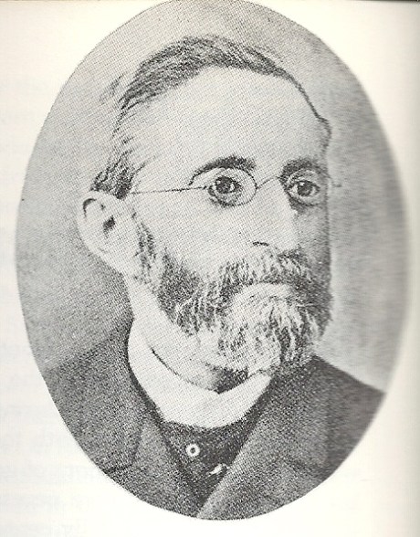
Edward Kanter “Photo published in Katz, Irving I. The Jewish Soldier from Michigan in the Civil War. Detroit, Mich.: Wayne State University Press, 1962. Page 8. Kanter served as vice-president of a Detroit soldier recruitment organization and was the first Jewish member of the Michigan Legislature. Added by: Hebrew Heritage Foundation”
~ Findagrave.com

Edward Kanter was related to German Parliamentarian Eduard Lasker (originally Jizchak Lasker).
~ Wikipedia.org
Edward Kanter was born in Breslau in 1824. His father was Louis Kanter, a prosperous linen merchant and a member of the Linen Merchants’ Guild. His mother was Helena Lasker, a near kinswoman of Edward Lasker, the German Parliamentarian, of whose birthplace she was also a native. Young Kanter graduated from the Breslau Gymnasium, equipped among other things with a knowledge of Greek, Latin, German, English, French, and Hebrew. In later years he was often heard to remark that it was his education above all things which helped him out in emergencies. A wild spirit of adventure seized him early in life with the result that he ran away from home and made his way to Paris where his knowledge of the language obtained him employment in a lawyer’s office. Six months later saw him at Havre where, as he was strolling about the wharves, a sudden impulse prompted him to go aboard a vessel bound for New Orleans. He hid behind a coil of rope until well out at sea when he was discovered and at once given a further taste of the rope accompanied by an assortment of curses in several languages. As he was able to turn away wrath with soft answers in all of the respective tongues, it instantly dawned upon the mate at the other end of the rope that he had found a much-needed interpreter for the immigrants of various nations with whom the ship was crowded. The rest of the trip was pleasant sailing for the young stowaway.
The Occident and American Jewish Advocate, Vol. IX. No. 8: Elul 5611, September 1851
——-
“Isaac Hart, Esq., of New Orleans.—We lately intimated that Mr. Hart would be presented with a token of regard from the congregation over which he had been president for several years. The presentation took place on Sunday, the 21st of September, and the following extract from the New Orleans Bee will give our readers all the particulars which have reached us:
Presentation of a Silver Pitcher.— On Sunday last, we were witness of a highly-interesting ceremony. Everybody knows Mr. Isaac Hart, of Canip Street, and most persons are aware that he is an active, zealous, and intelligent member of the German Hebrew Congregation of this city. To his unwearied exertions, his liberality, and his unflagging energy, that Congregation is indebted, in a great degree, for its present prosperity, and for the possession of a spacious and beautiful Temple for the worship of the GOD of Israel. Mr. HART retained the honorable post of President of the Congregation, devoting himself to its welfare, until its leading objects were secured. He then resigned his office, leaving to his successors a noble example of the successful fruits of diligence, religious faith, and indefatigable perseverance.
The members of the congregation, desirous of testifying their grateful appreciation of the efforts of their ex-president, subscribed toward the construction of a massive silver pitcher of exquisite workmanship, having on one side an appropriate inscription, and on the other a beautiful representation of the German Synagogue, and enriched all over with tasteful devices. On Sunday, the officers of the Congregation assembled at Mr. Hart’s residence, and Mr. George G. Levi, on behalf of that body, tendered the pitcher to that gentleman, accompanying the gift with some feeling and eloquent remarks, in which he set forth the valuable services of Mr. Hart, and the high sense of his merits entertained by the association of which he had been selected the interpreter. The donee, in accepting the splendid token, responded warmly and sincerely. He sketched the history and progress of the Congregation, from the days when, obscure and almost nameless, it first struggled into existence, up to the present time, when its members assemble weekly in a noble edifice, consecrated to the Almighty, to solemnize their Sabbath and offer up devotion and prayer to the Most High. He claimed little merit for himself, but said, that like a general in battle, he only led his soldiers, while they had won the victory by their courage and resolution. At the conclusion of the ceremony, the gentlemen and ladies present were conducted by Mr. Hart into another room, where they were entertained with cordial and profuse hospitality.”
On arriving at New Orleans, he found himself with but a single shilling which he gave to be changed to one of the sailors on the ship. The sailor did not return and so the lad landed on the soil of America with literally not a single penny in his pocket. Hardly ashore, he was laid low with yellow fever. He was taken care of by a relief committee of Jewish citizens of New Orleans, among them Mr. Isaac Hart, afterwards a resident of Detroit, a gentleman most kindly remembered by Detroiters. Upon his recovery, the same committee set him to peddling cigars until a congenial place was found for him in a drug store. The place was too congenial; he was much given to chemical experiments, reminiscences perhaps of the Breslau Gymnasium. Presently one of the experiments resulted in a bad explosion of the drug store, from the wreck of which the young scientist rushed terrified to the levee. He went aboard the first boat which happened to need a waiter. Because of his excellent penmanship he was soon promoted to the position of clerk and as such he continued to sail up and down the Red River until one day the boat happened to blow up opposite Helena. He swam ashore, worked his way to St. Louis, took a steamer to Pekin, Illinois, and walked thence to Chicago, where he shipped on the steamer Wisconsin until the close of navigation, 1844. He was now only twenty years of age, but had certainly obtained a few lessons in the larger university of life.
Jewish Virtual Library: Detroit
——-
“German Jews arrived in Detroit in significant numbers in the 1840s. Charles E. Bresler, a settler of the Ann Arbor-Ypsilanti area in the 1830s, moved to Detroit in 1844. He dealt in horses, furs, and wool, and made a fortune importing steel pens. He was one of the incorporators of Detroit’s first Jewish congregation, Temple Beth El. Edward Kanter arrived in Detroit that same year, moving to Mackinac the following year where he was employed by the American Fur Company. Later he worked for the Leopold Brothers, pioneers on the island of Mackinac in the fishery business, and fur traders. Kanter returned to Detroit in 1852 and became Detroit’s first Jewish banker and the first Michigan Jew to serve in the state legislature. Kanter Street is named after him.”
He spent the winter of 1844 in Detroit. The English he had learned at Breslau had always given him trouble, or more properly speaking, had always given trouble to those to whom he spoke, and so he profited by his stay in Detroit to take some lessons from Chas. E. Bresler, a Jewish resident of Michigan, originally from the same part of Europe as Kanter. The ensuing spring saw him again on the lakes, this time as clerk of the steamer Illinois. He left this position, however, taking employment the same year at Mackinac as clerk and interpreter for the American Fur Company, the successor to John Jacob Aster’s venture. Here again his French and English stood him in good stead. His remarkable faculty for languages revealed itself in the rapidity with which he picked up the Indian tongues. In a short time he had mastered the Huron, Chippewa, and Pottawatomie languages and even in later life could on occasion unconcernedly carry on a fluent conversation in any of them. He visited at this time Duluth and the Apostle Islands and was a passenger on the first trip of the “Julia Palmer,” the second boat to be carried on rollers around the Falls at Sault Ste. Marie.
In 1846, as has been stated, he worked for the Leopolds and Austrians. The following year he had been placed in charge of a stock of goods at the island by some eastern parties who suddenly decamped without notice to their creditors. When the latter arrived, they were so impressed by the honesty and zeal wherewith young Kanter had guarded their interests that they voluntarily turned the entire stock and store over to him on easy terms of payment, and so in July, 1847, he opened his books with a cash capital of $200. On these prospects he married a month later the daughter of former State Senator Lyman Granger of the neighboring Bois Blanc Island. He remained at Mackinac until 1852. In that year the late Mr. E. S. Heineman,3 father of the writer, recently arrived at Detroit, was sent to Mackinac to be present at the Indian payment. Mr. Kanter and he immediately became warm friends. The Indians had given Mr. Kanter, because of his bustling activity, the name of “Bosh-bish-gay-bish-gon-sen,” meaning “Fire Cracker,” and Mr. Heineman being somewhat shorter in stature than Mr. Kanter, but of equal activity, was immediately dubbed “Little Firecracker.”

Edward Kanter’s father-in-law was Senator Lyman Granger.
~ Findagrave.com
The red men always had a great liking for Mr. Kanter; they never missed an opportunity to call on him in Detroit or to send greetings to him. The merchants of Detroit in the early 60’s were at a loss one day to account for a circle of Indians gravely squatted in front of Mr. Kanter’s store on the chief business street, Mr. Kanter making one of the circle, the whole company smoking and maintaining a dense silence, until they were informed that a delegation of chiefs on their way to see the Great Father at Washington would not pass through Detroit without smoking a pipe of peace with “Firecracker.”
Julius Austrian also went to Germany during 1853 to liquidate his recently deceased father’s estate, and to bring the rest of his family back to settle upon the Great Lakes. Did Edward Kanter travel with the Austrian family?

German-American Bank, possibly Detroit, circa 1900-1920.
~ Library of Congress
In 1853 Mr. Kanter visited his parents in Europe. On his return he continued his successful business career. He became the founder of the German-American Bank, of which one of his sons continues at present to be a principal officer. He entered actively into political life at about this time. He was elected to the legislature of 1857, and though not a member of the prevailing party, presented and so persistently drove home a minority report on certain wrongdoings in the State treasury that the matter ended with the guilty party’s being sent to prison. He was twice made a candidate for the office of State Treasurer, but being a Democrat, the nomination was against hopeless odds. Mr. Kanter was long and conspicuously connected with the Democratic party organization. In the sixties he was Secretary of the Democratic State Central Committee; he was a delegate to the National Convention that nominated Tilden, for eight years was the member from Michigan of the Democratic National Committee. He was Commissioner from Michigan to the New Orleans Exposition, a member of the Board of the House of Correction of Detroit, and in general a constant and valuable participator in public affairs. He was Vice-President and Treasurer of Congregation Beth El in Detroit in 1855 and an unfailing contributor towards its needs. He died in June, 1896. Respected by all who knew him, he left a name synonymous with strict integrity.

“German American Bank, Detroit. Organized February 3, 1883.”
~ Annual Report of the Commissioner of the Banking Dept
By Michigan. Banking Dept, 1891, page 56.
Detail from Congregation Beth El
by Temple Beth El (Detroit, Mich.), 1900, page 54.
1 Data obtained through the kindness of our fellow-member, Rev. Dr. Jos. Stolz, from Mrs. Julius Austrian (Hannah Leopold), and other members of the Austrian family.
2 Data supplied mainly by Hon. Henry L. Kanter of Detroit, son of Edward Kanter.
3 Farmer’s History of Detroit, Vol. II, p. 1155. The friendship of these two young men, thus meeting on this distant and savage island, was a most natural one. Both had been born in the same year, both had received a superior education in Europe, and both had left homes of comfort and luxury, having been equally unfitted by temperament to endure the political and other conditions then prevailing abroad. Their friendship endured until 1896, being terminated by death, Mr. Kanter surviving his friend only a few days.
Legend of the Montreal River
March 5, 2016
By Amorin Mello & Leo Filipczak
This is a reproduction of “Legend of the Montreal River” by George Francis Thomas from his book: Legends of the Land of Lakes, Or History, Traditions and Mysteries, Gleaned from Years of Experience Among the Pioneers, Voyageurs and Indians: With Descriptive Accounts of the Many Natural Curiosities Met with from Lake Huron to the Columbia River. And the Meaning and Derivation of Names of Rivers, Lakes, Towns, Etc., of the Northwest, 1884, pages 70-73.
Old Treaty Hall, La Pointe, Madeline Island, cirica 1922.
“At some point in its history the building came into the hands of George Francis Thomas, who in turn presented it to the [Daughters of the American Revolution], but it was destroyed by fires shortly thereafter.”
~ Wisconsin Historical Society
——-
George Francis Thomas married Sarah E. Bell at La Pointe in 1882. Sarah was the daughter of Judge John William Bell of La Pointe and Maraget Brebant of the Sandy Lake Band of Chippewa Indians. Thomas inherited Treaty Hall at La Pointe from the Bell family after his in-laws and wife died. Thomas also inherited many legends from his marriage at La Pointe.

—
Legend of the Montreal River.
—
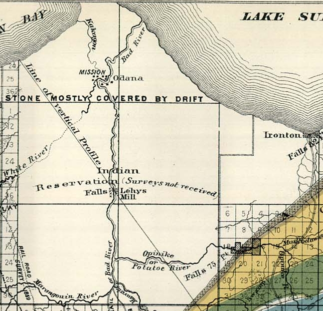
Detail of Odanah, Ironton, and Leihy‘s settlements on the La Pointe Reservation from Charles Whittlesey‘s 1860 “Geological Map of the Penokie Range“ from Geology of Wisconsin, Volume III, plate XX-214. Ironton is located near the mouth of the Montreal River.
Long ago, perhaps fifty years, before a single house or wigwam stood where the city of Ashland now spreads its mammoth protecting wings, there was an Indian settlement on Bad River and another near the beautiful falls on the Montreal. A short distance above its mouth and within sight of the lake, the red sandstone rocks rise boldly to the height of eighty feet, forming a ledge over which the entire volume of water is precipitated into a deep, circular basin or amphitheater, presenting a scene novel and strikingly beautiful. About three miles up the stream is another similar fall, very beautiful, but not so interesting as the first.
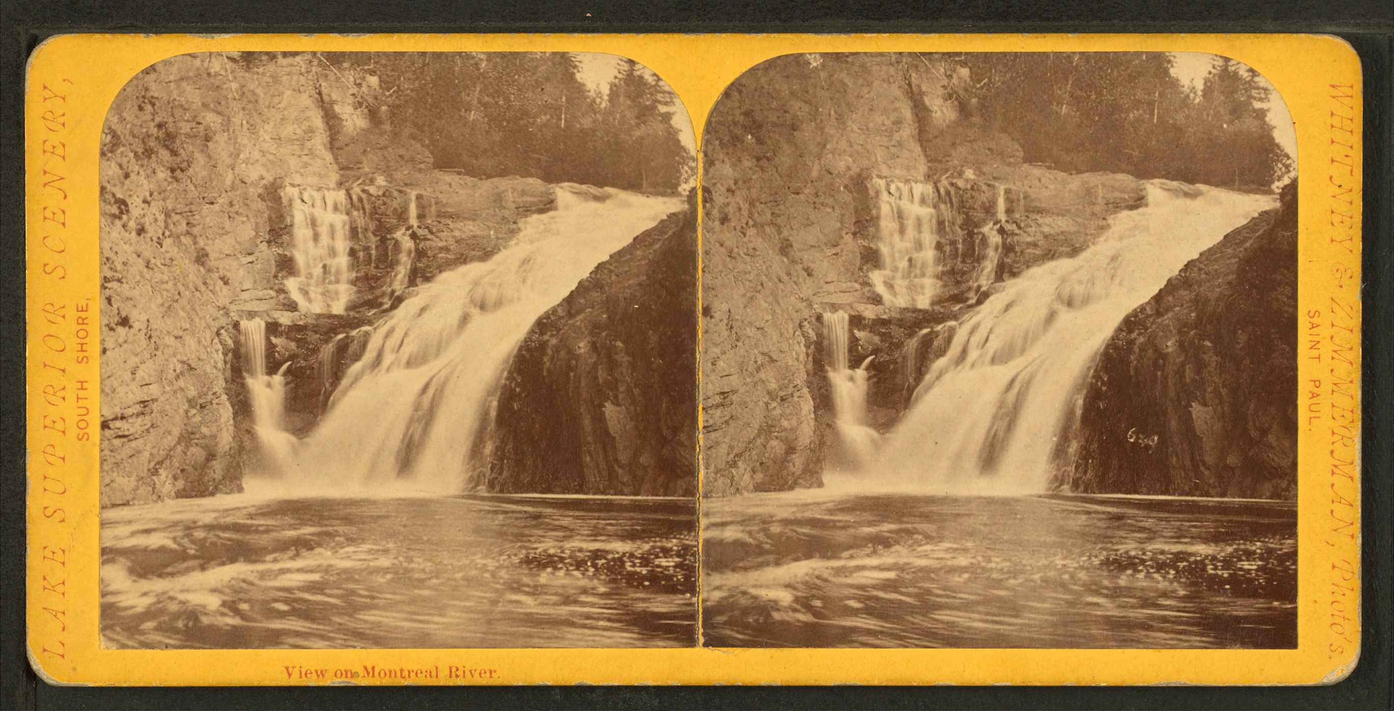
Superior Falls at the mouth of the Montreal River; featured in the stereograph titled “View on Montreal River” by Whitney & Zimmerman from St. Paul, circa 1870.
~ Wikimedia Commons
“Skirting the southern shore of the lake, past the now famous Pictured Rocks, [Pierre d’Esprit, Sieur Radisson, and his sister’s husband, Medard Chouart, Sieur de Groseilliers] carried across Keweenaw Point, visited a band of [Cree] Indians not far from the mouth of Montreal River, now the far western boundary between Upper Michigan and Wisconsin, and, portaging across the base of the Chequamegon Island of to-day, – then united to the mainland,- entered beautiful Chequamegon Bay.”
~ The Story of Chequamegon Bay by Reuben Gold Thwaites.
Below this lovely waterfall and near the shore of the lake, once dwelt the chief a Chippewa band, and near his wigwam were clustered a number of his warriors. Their time was passed in the chase and in fishing; the squaws made mats, canoes, and in the spring time maple sugar; and all were happy and prosperous. In this quiet, peaceful circle was enacted the only real love tragedy recorded during many years upon these shores; and this was caused by the cruel inconstancy of a white man, who had won the heart of an innocent child of nature only to break it, and leave her to mourn and die, as many a fairer, but no less pure maiden had been left before.

Detail of the Rivière du Montreal (Montreal River) from the Carte de l’Amerique Septentrionnale by Jean Baptiste Louis Franquelin, 1688.
~ Library of Congress
It seems that the simple girl had been won by the gew-gaws and glitter – so attractive to the forest maiden – brought here by a young American for trade. At first she only sought his wares, of which, owing to her standing in the tribe as the chief’s daughter, she was enabled to purchase a full share. Decked out in all the latest finery of civilization, she, woman-like no doubt, began to exhibit her new acquisitions in a spirit of rivalry, which, of course, soon begat jealousy in the hearts of her female companions. At this point Cupid came to the front; for if there is one thing more than another which a woman delights in, it is to monopolize the attention of the beau of society. In this particular society, for such really exists among the children of the forest, in a manner at least, the young trader reigned supreme. He was sought by all the beauties of the camp, and had no rival; for be it known that the old beaux and stand-bys are always laid on the shelf when a dashing cavalier from civilization appears – especially when he is an American, and of course rich – for all Americans are either rich or worthless in the eyes of the natives. This bold, bad man was the favored one, no Frenchman or half-caste Indian stood the least show, and ere the joyful days of spring time had gone, two hearts beat as one. The chief’s daughter and the young American were to be married, the gossips said. Time passed and the white man went below to buy goods. He returned, and went once more after many happy hours and days had rolled by; but the maid now began to get impatient. She dreamed that the white man loved another, which may have been true, for he never returned again. At their last parting she bade him farewell, never intimating her suspicions until his canoe was launched upon the waters, and as he paddled away her song of reproach, full of melody and pathos greeted his most unwilling ears. The notes, clear and sweet, floated out over the rising billows, until the truant lover was far beyond. Her words in part were these:
“That water on whose bosom bright,
With joy I’ve seen your bark appear;
You cross no longer with delight,
Nor I with joy, your greeting hear.False words are thine; tho’ now you sigh
I know your grief is not sincere;
‘Tis well our dreaded parting’s nigh;
I bid farewell to pleasure dear.When o’er the waters wide and deep,
Far, thine Ojibway maid shall be,
New loves will make you please to weep,
Nor e’er again remember me.”
With this the fairest of all the tribe, the beloved child of a kind father, confiding and loving, thoughtless and innocent, the merry chirping bird of the forest, and the forsaken fawn, left to die of a wounded heart, wandered far away and was lost in the impenetrable pine forest.
Detail of the Chippewa village (Ironton), at Saxon Harbor, near the mouth of the Montreal River and Superior Falls; with footpaths leading East towards Odanah, and South into the Penokee Mountains …
… leading to the Wisconsin & Lake Superior Mining & Smelting Company‘s town-site Springdale at The Gorge on Tyler Forks River.
~ Wisconsin Public Land Survey Records
[…]
“Rome was not built in a day, but most of these cabins were. I built four myself near the Gorge [on Tyler Forks River], in a day, with the assistance of two halfbreeds, but was not able to find them a week afterwards. This is not only a mystery but a conundrum. I think some traveling showman must have stolen them; but although they were non est we could swear that we had built them, and did.“
~ Penokee Survey Incidents: IV
Years afterwards, about 1857, there was considerable excitement in these regions on account of copper discoveries in the range near where it crosses Bad River. Buildings were erected on the banks of Tyler’s Fork, and near the falls, the remains of which are visible at the present day. Mines were opened with fair prospects, but there was no use to try to stem the tide, the current was too strong, transportation was too primitive, and the mines were abandoned. Not, however, until a strange discovery had been made. One day while engaged in exploring below the falls, a workman noticed in a pool what he at first took for a water-soaked section of a log. It was covered by some two feet of water and on closer contact was found to be a solid rock, but in form and size of a human being; in fact it was a petrified Indian woman. How it came there is a mystery. Only a few ever knew of the discovery, for it was kept a secret until it was carried away and sold to a New York Museum. Those who saw the petrified body and knew the story of the chief’s daughter failed not to connect here the two mysteries of the pine forest.
Bad River1 receives its waters partially from a marsh just south of the Penokee range, and besides being dark in color, it possesses some peculiar qualities which may have caused the petrifaction of the body of the young girl after she had drowned herself, as she most likely did.
1 The Chippewa name for Bad River is Mus-ke-ze-bing, meaning river from the marsh. Because the water was discolored the white men thought the Indian name meant dirty or impure water.

Wabigance below the Gorge on the Tyler Forks River.
~ Photograph by M. Matusewic © December 2013.
Reproduced with permission.
1848 La Pointe Annuity Payments
March 2, 2016
By Amorin Mello

American Fur Company Papers: “Map of La Pointe”
drawn by Lyman Marcus Warren, 1834.
~ Wisconsin Historical Society
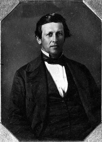
Hercules Louis Dousman
“In 1827, the American Fur Company (AFC) achieved a monopoly on the fur trade in what is now Minnesota. The Company suddenly increased its prices by 300 percent; American Indians, returning from the hunt with expectations of trading for their yearly supplies, found themselves cast into a debt cycle that would increase in the decades ahead. American Indians would receive virtually unlimited credit as long as they maintained the most precious collateral: land.
As game was overhunted and demands for furs changed, the system collapsed under a burden of debt. In 1834, AFC departments were sold to partners who included the Chouteaus, Henry Sibley, and Hercules Dousman. The business strategy of the reorganized companies changed from fur trading to treaty making. In 1837, economically stressed Dakota and Ojibwe people began selling land in what became Minnesota. Fur traders, through their political connections, were able to divert government payments for American Indian land into their own pockets. In effect, land cession treaties became a vast government bailout of fur trade corporations.”
~ Relations: Dakota & Ojibwe Treaties
Henry Hastings Sibley Papers 1826-1848

Henry Hastings Sibley
~ Minnesota Historical Society
Northern Great Lakes Visitor Center
History Center & Archives
“Papers of Minnesota’s first governor during his years as a fur trader, consisting primarily of correspondence among the various American Fur Company agents located in the Wisconsin Territory. Correspondence concerns internal company business; business with Hudson Bay Fur Company; company agreements with the Dakota Indians; company interest in United States government treaties with the Dakota, Ojibwa, and Winnebago Indians; attempts by the company to prevent war between the Dakota and the Sauk and Fox Indians; relations with missionaries to the Indians of the region; and company disputes with Indian agents Henry R. Schoolcraft and Lawrence Taliaferro.
Correspondents prominent in the early history of Minnesota and Wisconsin include William Aitken, Frederick Ayer, Alexis Bailly, Bernard Brisbois, Ramsay Crooks, Henry Dodge, James Doty, Hercules Dousman, Jean Faribault, Alexander Faribault, Joseph Nicollet, Henry Rice, Joseph Rolette, Henry Schoolcraft, Lawrence Taliaferro, and Lyman Warren.”
New York April 17, 1848
To Geo Ebninger Esq.
Assignee Am. Fur Co.
Dear Sir,

Pierre Chouteau, Jr.; son of French Creole fur trader, merchant, politician, and slaveholder Jean-Pierre Chouteau.
~ Wikipedia.org
We hasten to reply to you, of this date offering to sell “The American Fur Co Establishments at Lapointe” all the Northern Outfit Posts: – “The whole for twenty five hundred dollars ($2500)” provided we will take the goods remaining on hand there after this spring’s trade at New York cash for sound Merchantable goods everything else as its fair actual value & say that we regret you waited until the moment our senior was leaving for the west before making the above proposition & also some days after the departure of Mr. Rice. It is probable, if your letter had been received during his stay here, that we would have accepted it or made other propositions which would have been agreeable. We thought if you were desirous of selling the Establishments & goods that you would have apprised us earlier of your intentions & given us time to consult or reflect upon it. And we expect, and hope that you will give us time to communicate your proposition to the persons interested with us in Upper Mississippi & particularly with Mr. Rice who alone has visited the posts & has a correct idea of their value.
Believing that the delay we ask will not or cannot be prejudicial to your interests we will wait your answer.
Very respectfully
yr obd svt
P Chouteau Junr
New York 28th June, 1848
Mister P Chouteau Jr & Co
New York
Gentlemen,
Agreeably to what I had the pleasure to address you on the 14th April last, copy of which letter is annex I will sell you the late American Fur Company’s Establishment at La Pointe & as the terms and conditions as before named, delivery to be made to you or your agent on a date to be hereafter agreed upon between the First day of September and Fifteenth day of October next and ending Payments for the same to be made in New York to me in October or November next.
Please let me have your written reply to this proposition.
I am gentlemen bestly
Your Obedt Servt
George Ebninger
Assignee to P Chouteau Jr, St Louis
New York 30th June, 1848
To George Ebninger Esq.
Assignee Am Fur Co.Dear Sir,
View of La Pointe, circa 1843.
“American Fur Company with both Mission churches. Sketch purportedly by a Native American youth. Probably an overpainted photographic copy enlargement. Paper on a canvas stretcher.”
~ Wisconsin Historical Society
In reply to yours of 28th inst (with copy annexed of similar letters under date 14th April last) we have to say that under advises lately received from our Saint Louis house we accept in general terms your proposition for the sale of the American Fur Co’s trading Establishment at Lapointe and interior for the sum offered, of Twenty Five Hundred dollars. It may be well enough to observe how ever that we consider the sale as dating only from the time of delivery to our authorized agents. Until then received we shall consider the posts as the property of Late American Fur Co and to be as their risk and any destruction of property between now and the time you may fix for delivery to be their loss and not ours.
The terms of payments proposed by you are entirely acceptable. But we think it might be better to make it more definite and accordingly suggest that our agents who received the property draw upon us as forty days & nights for the amount. Hoping that these slights exchanged may meet your sanctions and that you will name an early day for the delivery of posts & we remain very truly,
Your Obedt Servt
P. Chouteau Jr & Co
New York 5th July 1848
P Chouteau Jr Esq
Saint LouisDear Sir

“Ramsey Crooks (also spelled Ramsay) was born in Scotland in 1787. He immigrated to Canada in 1803 where he worked as a fur trader and explorer around the Great Lakes. He began working for the American Fur Company, which was started by John Jacob Astor, America’s first multi-millionaire, and made an expedition to the Oregon coast from 1809-1813 for the company. By doing so he also became a partner in the Pacific Fur Company. In 1834 he became acting president of the American Fur Company following Astor’s retirement to New York. A great lakes sailing vessel the Ramsey Crooks was constructed in 1836 by the American Fur Co. A nearly identical sister ship was built in the same year and was called the Astor. Both ships were sold by the dissolving fur company in 1850. Ramsay Crooks passed away in 1859, but had made a name for himself in the fur trade not only in Milwaukee and the Great Lakes, but all the way to the Pacific Ocean.” ~ Milwaukee County Historical Society
On the 28th June I sold to your house the Establishments of the late American Fur Company at Lapointe agreeably to the letter I had written to you on the 14th April. Cash delivery to be made at some period to be agreed upon hereafter between the first day of September and fifteenth day of October next. I hope that it may be in my power to get to Lapointe and attend to the delivery to your agents but if not we must select some other to act for me, Mr. Crooks and myself are not on good terms in [cou-bethee?] ease as he has been opposed to the sale being made by from the bush. I have lately heard that Mr. Crooks has written the Establishment & at Lapointe (Mr. [Ludgem?] of Detroit told me so while in the city lately) and he must have written to him shortly after the offer was made to you here, and it remains to be seen what authority he can have to dish use of the property which has been assigned to me and over which I have acted as assignee for nearly the last six years. Mr. Crooks acts of leaving here shortly for the Northern Posts. Before then I shall know what he proposes to do to annul the sale I have (under the authority vested in me as assignee) made to you, and which has been made agreeably to his only Suggestions on the 14th day of April last, and the only objection he can make to the Sale is that you did not as once accepts of his but required only a reasonable time to reply to which I was willing to grant and would again give under such circumstances you being there on the eve of leaving here, but it was clear enough that Mr. Crooks never wished that you should have the Northern Outfit Establishment, but that his friend Borrup should. I shall however do all that I can to oppose his injust views on that score.
I am In Most Truly
Your Obedt Servt
George Ebninger

Aspring politician and future Senator Henry Mower Rice represented the Chippewas at the 1847 Treaty of Fond du Lac, and appears frequently here on Chequamegon History.
~ United States Senate Historical Office
St. Louis July 14, 1848
Mr.s Sibley & Rice
St. PetersDr. Sirs
We had this pleasure of the 7th inst by [Shamus Highland Many?] enclosing Invoice & Bill of Landing of C.O. English goods which we hope you will have received in good order and due time – The same day and as the time the boat was pushing off we addressed you a few lines in haste, advising you of the purchase made by our House in New York, of the posts at Lapointe. We have just received several documents in relation to that purchase of which you will find copies herewithin.
You will perceive from their contents how Mr. Crooks has acted in the matter, and that it has become urgent for us to take such steps as will answer the possession of the said posts. How we will be able to succeed, Doctr. Borrup being now in possession & having apparently purchased from Mr. Crooks, is a matter of doubt and can only be ascertained at Lapointe. We have purchased Bona Fide from Mr. G. Ebninger, the only person authorized to make sale, as the assigner of the late American F. Co. Mr. Borrup we are afraid, will (as you can see by Mr. Sanford’s letter) refuses to give possession, and in that case, in a country where there is no way of enforcing law, we may not be able to obtain possession before next year. Now, would it be desirable or advantageous to make the purchase and not get possession before that time? We think not.
Oil painting of Doctor Charles William Wulff Borup from the Minnesota Historical Society:
“Borup and Oakes were headmen for the [American Fur Company]. All voyageurs, ‘runners,’ as they were called, were employed by said company. They would leave La Pointe about the beginning of September, stay away all fall and winter among the Indians in their respective districts, collect furs, and return about the beginning of June. They would take along blankets, clothes, guns, etc., to trade with the Indians for their furs. They took along very little provisions, as they depended mostly on hunting, fishing, wild reice, and trade with the Indians for their support. There were several depots for depositing goods and collecting furs, for instance at Fond du Lac (Minnesota,) Sandy Lake, Courtes Oreilles, Lac du Flambeau Mouth of Yellow River, etc.”
~ Proceedings of the [Wisconsin Historical] Society at its Sixty-fourth Annual Meeting, 1917, pages 177-9
We are writing this day to our home in New York and to Mr. G. Ebninger that he must proceed immediately to Lapointe so as to be here from the 1st to the 15th September, and claim himself & in person the delivery of the posts. Any agent would not probably succeed, or objections would no doubt be made by Doctr. Borrup which said agent could not face or answer. You will therefore do the necessity of either of you going to Lapointe and meet them with Mr. Ebninger on the time appointed above.
Very truly yours,
P. Chouteau Jr & Co
It was only on the 10th inst that we were handed your forms of 25 june enclosing packing ‘℅’ of the U.S. postal M.R. #01037 for ℅ St Louis ℅ Chippewa outfit. Capt. Ludwick ought to be more particular with papers confided to his care.
Bernard Walter Brisbois was an agent for the American Fur Company.
Duplicates of this letter and documents enclosed, sent to the care of Mr. Brisbois of Prairie du Chien, by mail
You will notice by copy of telegraphic dispatch of the 10th that the Chippewa annuity will be paid at Lake Superior as heretofore.
[Illegible]
The New York Times
September 29, 1851
“Indian Moneys”
There is no greater abuse in the governmental policy of the United States, than the past and present system of Indian payments; and the Indians would be benefited if the money thus appropriated were cast into the Lakes, rather than made the cause of such much distress and swindling as it is.
The author of this article is not identified.
In the August of 1848 we were present at a payment at La Pointe, and we have no hesitation in saying that every dollar paid to the Indians there was a disadvantage rather than a benefit to them.
The payment was fixed for August, and Indians from West of the Mississippi were called together at La Pointe to receive it. They gathered at the appointed time, and the payment was not made for three weeks after the time specified.
The money collected at the Saut Ste. Marie Land Office, the most convenient point, had been transported, as per Government order, to Chicago, and the Paymaster received drafts on that point where he was compelled to go for the specie, and the payment was thus delayed.

La Pointe Beaver Money of the American Fur Company’s Northern Outfit from “The Beaver in Early Wisconsin” by A. W. Schorger, Wisconsin Academy of Science, Arts, & Letters, Volume 54, page 159.
Meantime, the Indians gathered at La Pointe were without the necessaries of life, and the agents of the North American Fur Company, and a few old traders who were posted in the business, supplied them with provisions at exorbitant rates, and forced them to buy with every ounce of pork or flour which they needed, an equal amount of dry-goods and gewgaws, which had no value for them. These sales were made on credit, to be settled at the pay-table. At the payment, some $30,000 in cash, and a stipulated quantity of blankets, guns, powder, tin pails, calicoes, ribbons, &c., were distributed; and this American Fur Company, and the favored traders, raked from the Paymaster’s table as it was counted out to the bands, over $12,000 for provisions furnished to, and trash forced upon the Indians, while they were delayed after being summoned to the payment.
Some $14,000 more was spent among forty traders and the remaining $4,000 the Indians carried home; about one dollar each.
Their blankets, about the only valuable thing they received in the way of dry goods, were on the night after payment, mostly transferred to a mercenary set of speculators, at a cost of a pint of whiskey each, and came down to the Saut as private property on the same propeller that took them up as government gratuity.
Such was the result of a payment for which thousands of Indians traversed many miles of forest, wasted six weeks’ time, and lost the crop of wild rice upon which they depended for their winter’s subsistence.
If a white man with a white soul, writes the history of the Indians of the West, the American government will gain little credit from his record of Indian payments.
For more context about these American Fur Company partners and their affairs following the 1848 La Pointe annuity payments, please read pages 133-136 of Last Days of the Upper Mississippi Fur Trade by Rhonda R. Gilman, Minnesota History, Winter 1970.
But the swindle of 1848 was not gross enough to suit certain grasping parties. La Pointe was too easy of access. So many traders sought a market for their goods there, that the old monopolists could not obtain a thousand per cent on the goods they sold; and even in 1848, it was whispered that they were using all their influence to have the future payments made at some point so far West that competition would not force them to be content with moderate profits.
For more context about the Lake Superior Chippewa following the 1848 La Pointe annuity payments, please read our The Sandy Lake Tragedy and Ojibwe Removal series here on Chequamegon History.
To effect this it was necessary to remove the Chippewas further West, and by some influence, not, perhaps, distinctly marked, but yet more than suspected, this order of removal was secured.
It was uncalled for, useless, and abominable; and we are glad, for the sake of humanity and justice, that the Administration have resolved that for the present the edict shall not be enforced. We trust it may never be.
The Story of Chequamegon Bay
March 1, 2016
By Amorin Mello
This is a reproduction of Reuben Gold Thwaites’ 1895 “The Story of Chequamegon Bay” to demonstrate how our local history has been institutionalized and portrayed since the end of the 19th century. Thwaites’ professional legacy as a journalist is embedded in many institutions, including the following:
- American Library Association
- American Antiquarian Society
- University of Wisconsin
- Wisconsin State Journal
- Wisconsin Historical Society
- Mississippi Valley Historical Association
According to Wikipedia:
Thwaites was well-known for not being a mere academic, but rather as a historian who attempted to understand history by experiencing those aspects that he could, and bringing those experiences to life. In 1888 he took canoe trips on the Wisconsin, Fox and Rock rivers. In 1892 he took a bicycle trip across England. In 1903 he took a trip down the Ohio River in a rowboat.
Thwaites’ approach and work has been questioned, to some degree by his contemporaries but more so in modern times. His summaries include phraseology such as “[Europeans] left the most luxurious country in Europe to seek shelter in the foul and unwelcome huts of one of the most wretched races of man.” When editing the Jesuit Relations, he included background information that is generally credible and thorough with respect to events and Europe, but is far less thorough in regard to the disruptions from disease and other sources that the indigenous people themselves were facing. In other words, the criticism is that the original works were insensitive, and Thwaites failed to fully account for the prejudicial and inaccurate reporting in the Relations. However, Thwaites is also recognized as being the pioneer in an approach to using the Relations that is continuing to be enriched by modern scholarship, and so in a sense he started a process by which his very work could be corrected and improved as historians learn more about the periods in question.
The purpose of reproducing this story is to serve as an introduction to Chequamegon Bay history, and as a reference point for modern scholarship and primary research about Chequamegon Bay before 1860.
The Story about Chequamegon Bay was originally published in Collections of the State Historical Society of Wisconsin: Volume XIII, by Reuben Gold Thwaites, 1895, pages 397-425.
The Story Of Chequamegon Bay.
by the Editor.

Reuben Gold Thwaites
~ Wisconsin Historical Society
WE commonly think of Wisconsin as a young State. In a certain sense she is. There are men now living, two or three of whom I meet almost daily, who were blazing paths through the Wisconsin wilderness, only sixty years ago: men who cleared the forests and broke the prairies; who founded frontier communities which have developed into cities; who upon this far away border sowed the seeds of industries which to-day support tens of thousands of their fellows; who threw up their hats when the Territory was erected; and who sat in the convention which gave to the new State a constitution. The Wisconsin of to-day, the Wisconsin which we know, is indeed young; for the lively octogenarians who were in at the birth will not admit that they are now old. But there was an earlier, a less prosaic, a far more romantic Wisconsin,—the French Wisconsin; and it had flourished in its own fashion for full two centuries before the coming of the Anglo-Saxon, who, brusquely crowding the Creole to the wall, made of his old home an American Commonwealth.
In 1634, when the child born upon the Mayflower was but in her fourteenth year, Jean Nicolet, sent out by the enterprising Champlain as far as Wisconsin,— a thousand miles of canoe journey west from Quebec,— made trading contracts, such as they were, with a half-score of squalid tribes huddled in widely-separated villages throughout the broad wilderness lying between Lakes Superior and Michigan. It was a daring, laborious expedition, as notable in its day as Livingstone’s earliest exploits in Darkest Africa ; and although its results were slow of development,—for in the seventeenth century man was still cautiously deliberate,— this initial visit of the forest ambassador of New France to the country of the Upper Lakes broke the path for a train of events which were of mighty significance in American history.1

“Jean Nicolet, landing at the Bay of Green Bay in 1634. Painted by Franz Edward Rohrbeck (1852-1919) in 1910 into the mural in the rotunda of the Brown County Courthouse, Green Bay, Wisconsin. It shows Nicolet wearing a Chinese damask tunic strewn with flowers and birds, and discharging two pistols into the air.”
~ Wikipedia.org
Let us examine the topography of Wisconsin. The State is situated at the head of the chain of Great Lakes. It is touched on the east by Lake Michigan, on the north by Lake Superior, on the west by the Mississippi, and is drained by interlacing rivers which so closely approach each other that the canoe voyager can with case pass from one great water system to the other; he can enter the continent at the Gulf of St. Lawrence, and by means of numerous narrow portages in Wisconsin emerge into the south-flowing Mississippi, eventually returning to the Atlantic through the Gulf of Mexico. From Lake Michigan, the Fox-Wisconsin river system was the most popular highway to the great river; into Lake Superior, there flow numerous turbulent streams from whose sources lead short portage trails over to the headwaters .of feeders of the Mississippi. From the western shore of Lake Superior, Pigeon River invites to exploration of the Winnipeg country, whence the canoeist can by a half-hundred easy routes reach the distant regions of Athabasca and the Polar Sea. In their early voyages to the head of lake navigation, it was in the course of nature that the French should soon discover Wisconsin; and having discovered it, learn that it was the key-point of the Northwest — the gateway to the entire continental interior. Thus, through Wisconsin’s remarkable system of interlacing waterways, to which Nicolet led the way, New France largely prosecuted her far-reaching forest trade and her missionary explorations, securing a nominal control of the basin of the Mississippi at a time when Anglo-Saxons had gained little more of the Atlantic slope than could be seen from the mast-head of a caravel. Thus the geographical character of Wisconsin became, early in the history of New France, an important factor. The trading posts and Jesuit missions on Chequamegon Bay2 of Lake Superior, and on Green Bay of Lake Michigan, soon played a prominent part in American exploration. The career of Green Bay is familiar to us all.3 I have thought it well hastily to summarize, in the brief space allowed me, the equally instructive story of Chequamegon Bay.

“Outline Map showing the position of the ancient mine-pits of Point Keweenaw, Michigan”
~ Ancient Mining on the Shores of Lake Superior, by Charles Whittlesey
The sandstone cliffs of Lake Superior were, many geologists think, among the first Laurentian islands to arise from the ancient ocean; if this be so, then the rim of our greatest inland sea is one of the oldest spots on earth. In its numerous mines of copper, prehistoric man long delved and wrought with rude hammers and chisels of stone, fashioning those curious copper implements which are carefully treasured in American museums of archaeology;4 and upon its rugged shores the Caucasian early planted his stake, when between him and New England tidewater all was savagery.
Pierre d’Esprit Sieur Radisson
~ Dictionary of Canadian Biography
After the coming to Wisconsin of Nicolet, a long period followed, in which the energies of New France were devoted to fighting back the Iroquois, who swarmed before the very gates of Quebec and Montreal. Exploration was for the time impossible. A quarter of a century passes away before we have evidence of another white man upon Wisconsin soil. In the spring of 1659, the Indians of the valley of the Fox were visited by two French fur-traders from the Lower St. Lawrence – Pierre d’Esprit, Sieur Radisson, and his sister’s husband, Medard Chouart, Sieur de Groseilliers. In all American history there are no characters more picturesque than these two adventurous Creoles, who, in their fond desire to “travell and see countries,” and “to be known as the remotest people,” roamed at will over the broad region between St. Jame’s seaway and the Wisconsin River, having many curious experiences with wild beasts and wilder men. They made several important geographical discoveries, – among them, probably, the discovery of the Mississippi River in 1659, fourteen years before the visit of Joliet and Marquette; and from a trading settlement proposed by them to the English, when their fellow-countrymen no longer gave them employment, developed the great establishment of the Hudson’s Bay Company. The unconsciously-amusing narrative which Radisson afterwards wrote, for the editication of King Charles II, of England, is one of the most interesting known to American antiquaries.5

“Arrival of Radisson in an Indian camp, 1660”
by Charles William Jefferys
~ Wikimedia.org
Two years after Radisson and Groseilliers were upon the Fox River, and made their notable trip to the Mississippi, they were again in the Northwest (autumn of 1661), and this time upon Lake Superior, which they had approached by carrying around the Sault Ste. Marie. Skirting the southern shore of the lake, past the now famous Pictured Rocks, they carried across Keweenaw Point, visited a band of Christino Indians6 not far from the mouth of Montreal River, now the far western boundary between Upper Michigan and Wisconsin, and, portaging across the base of the Chequamegon Island of to-day, – then united to the mainland,- entered beautiful Chequamegon Bay. Just where they made their camp, it is impossible from Radisson’s confused narrative to say; but that it was upon the mainland no Wisconsin antiquary now doubts, and we have reason to believe that it was upon the southwest shore, between the modern towns of Ashland and Washburn.7

“Close-up of the Radisson and Groseilliers house historic site marker, commemorating the first house built in Wisconsin by white men. The house was believed to have stood in the vicinity of Ashland at the mouth of Fish Creek where it empties into Chequamegon Bay.”
~ Wisconsin Historical Society
Our chronicler writes, with a particularity of detail suggestive of De Foe:
“We went about to make a fort of stakes, w’ was in this manner. Suppose that the watter-side had ben in one end; att the same end there should be murtherers, and att need we made a bastion in a triangle to defend us from assault. The doore was neare the watter side, our fire was in the midle, and our bed on the right hand, covered. There were boughs of trees all about our fort layed acrosse, one uppon an other. Besides those boughs, we had a long cord tyed w’ some small bells, w’ weare sentereys. Finally, we made an ende of that fort in 2 dayes’ time.”
“Front view of the Radisson cabin, the first house built by a white man in Wisconsin. It was built between 1650 and 1660 on Chequamegon Bay, in the vicinity of Ashland. This drawing is not necessarily historically accurate.”
~ Wisconsin Historical Society
Modernize this statement, and in imagination we can see this first dwelling erected by man on the shores of Lake Superior; a small log hut, built possibly on the extremity of a small rocky promontory; the door opens to the water front, while the land side, to the rear of the hut, is defended by a salient of palisades stretching from bank to bank of the narrow promontory; all about the rude structure is a wall of pine boughs piled one upon the other, with a long cord intertwined, and on this cord are strung numbers of the little hawk-bells then largely used in the Indian trade for purposes of gift and barter. It was expected that in case of a night attack from savages, who might be willing to kill them for the sake of their stores, the enemy would stir the boughs and unwittingly ring the bells, thus arousing the little garrison. These ingenious defenses were not put to the test, although no doubt they had a good moral effect; in keeping the thieving Hurons at a respectful distance.
Winter was just setting in. The waters of the noble bay were taking on that black and sullen aspect peculiar to the season. The beautiful islands, later named for the Twelve Apostles,8 looked gloomy indeed in their dark evergreen mantles. From the precipitous edges of the red-sandstone cliffs, which girt about this estuary of our greatest inland sea, the dense pine forests stretched westward and southward for hundreds of miles. Here and there in the primeval depths was a cluster of starveling Algonkins, still trembling from fear of a return of the Iroquois, who had chased them from Canada into this land of swamps and tangled woods, where their safety lay in hiding. At wide intervals, uncertain trails led from village to village, and in places the rivers were convenient highways; these narrow paths, however, beset with danger in a thousand shapes, but emphasized the unspeakable terrors of the wilderness.
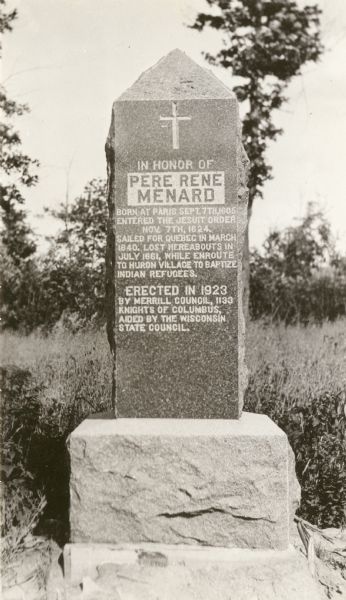
Père René Ménard
“The Search for Wisconsin’s First Priest”
~ Wisconsin Historical Society
Radisson and Groseilliers, true coureurs de bois, were not daunted by the dangers which daily beset them. After caching their goods, they passed the winter of 1661-62 with their Huron neighbors, upon a prolonged hunt, far into the Mille Lacs region of Minnesota. The season was phenomenally severe, and the Indians could not find game enough to sustain life. A famine ensued in the camp, the tragical details of which are painted by our friend Radisson with Hogarthian minuteness. In the spring of 1662, the traders were back again at Chequamegon, and built another fortified shelter, this time possibly on the sand-spit of Shagawaumikong,9 from which base they once more wandered in search of adventures and peltries, going as far northwest as Lake Assiniboine, and later in the season returning to their home on the Lower St. Lawrence.
When Radisson’s party went to Lake Superior, in the autumn of 1661, they were accompanied as far as Keweenaw Bay by a Jesuit priest. Father Pierre Ménard, who established there a mission among the Ottawas. The following June, disheartened in his attempt to convert these obdurate tribesmen, Ménard set out for the Huron villages on the upper waters of the Black and Chippewa, but perished on the way.10
It was not until August of 1665, three years later, that Father Claude Allouez, another Jesuit, was sent to reopen the abandoned Ottawa mission on Lake Superior. He chose his site on the southwestern shore of Chequamegon Bay, possibly the same spot on which Radisson’s hut had been built, four years previous, and piously called his mission and the locality La Pointe du Saint Esprit, which in time was shortened to La Pointe.11

Detail of La Pointe du Saint Esprit
from Claude Allouez map’s of New France, 1669.
~ Research Laboratories of Archaeology

Portrayal of Claude Allouez
~ National Park Service
At the time of Radisson’s visit, the shores of Chequamegon Bay were uninhabited save by a few half-starved Hurons ; but soon thereafter it became the centre of a considerable Indian population, residents of several tribes having been drawn thither, first, by the fisheries, second, by a fancied security in so isolated a region against the Iroquois of the East and the wild Sioux of the West. When Allouez arrived in this polyglot village, October 1, he found there Chippewas, Pottawattómies, Kickapoos, Sauks, and Foxes, all of them Wisconsin tribes; besides these were Hurons, Ottawas, Miamis, and Illinois,— victims of Iroquois hate who had fled in droves before the westward advances of their merciless tormentors.

Jacques Marquette
aka James (Jim) or Père Marquette
~ Wikipedia
Despite his large congregations, Allouez made little headway among these people, being consoled for his hardships and ill-treatment by the devotion of a mere handful of followers. For four years did he labor alone in the Wisconsin wilderness, hoping against hope, varying the monotony of his dreary task by occasional canoe voyages to Quebec, to report progress to his father superior. Father James Marquette, a more youthful zealot, was at last sent to relieve him, and in September, 1669, arrived at La Pointe from Sault Ste. Marie, after spending a full month upon, the journey,—so hampered was he, at that early season, by snow and ice. Allouez, thus relieved from a work that had doubtless palled upon him, proceeded upon invitation of the Pottawattomies to Green Bay, where he arrived early in December, and founded the second Jesuit mission in Wisconsin, St. Francis Xavier, on the site of the modern town of Depere.12
Marquette had succeeded to an uncomfortable berth. Despite his strenuous efforts as a peacemaker, his dusky parishioners soon unwisely quarreled with their western neighbors, the Sioux,13 with the result that the La Pointe bands, and Marquette with them, were driven like leaves before an autumn blast eastward along the southern shore of the great lake: the Ottawas taking up their home in the Manitoulin Islands of Lake Huron, the Hurons accompanying Marquette to the Straits of Mackinaw, where he established the mission of St. Ignace.
With La Pointe mission abandoned, and Lake Superior closed to French enterprise by the “raging Sioux,” the mission at Depere now became the centre of Jesuit operations in Wisconsin, and it was a hundred and sixty-four years later (1835), before mass was again said upon the forest-fringed shores of Chequamegon Bay.
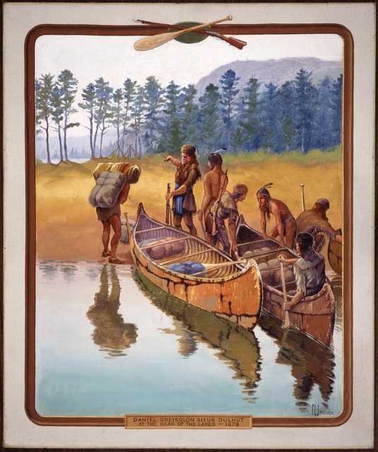
“‘Daniel Greysolon Sieur Dulhut at the Head of the Lakes – 1679.’ Painted by artist Francis Lee Jaques, c.1922.”
~ Minnesota Historical Society
Although the missionary had deserted La Pointe, the fur trader soon came to be much in evidence there. The spirit of Radisson and Groseilliers long permeated this out-of-the-way corner of the Northwest. We find (1673), three years after Marquette’s expulsion. La Salle’s trading agent, Sieur Raudin, cajoling the now relentent Sioux at the western end of Lake Superior. In the summer of 1679, that dashing coureur de bois, Daniel Grayson du l’ Hut,14 ascended the St. Louis River, which divides Wisconsin and Minnesota, and penetrated with his lively crew of voyageurs to the Sandy Lake country, being probably the first white trader upon the head-waters of the Mississippi. The succeeding winter, he spent in profitable commerce with the Assiniboines, Crees, and other northern tribes in the neighborhood of Grand Portage,15 on the boundary between Minnesota and Canada. In June, 1680, probably unaware of the easier portage by way of the Mille Lacs and Rum River, Du I’ Hut set out at the head of a small company of employees to reach the Mississippi by a new route. Entering the narrow and turbulent Bois Brulé,16 half-way along the southern shore of Lake Superior, between Red Cliff and St. Louis River, he with difficulty made his way over the fallen trees and beaver dams which then choked its course. From its head waters there is a mile-long portage to the upper St. Croix; this traversed. Du l’ Hut was upon a romantic stream which swiftly carried him, through foaming rapids and deep, cool lakes, down into the Father of Waters. Here it was that he heard of Father Louis Hennepin’s captivity among the Sioux, and with much address and some courage rescued that doughty adventurer, and carried him by way of the Fox-Wisconsin route in safety to Mackinaw.
…
“In 1693, Le Sueur founded a trading post on the site of present-day La Pointe on Madeline Island, the largest of Chequamegon Bay’s Apostle Islands. After hearing reports of what he believed were valuable deposits of copper ore south of Lake Superior, he traveled to France in 1697, where the French government granted him permission to mine these resources.”
~ Encyclopedia of Exploration, vol. 1, 2004.
An adventurous forest trader, named Le Sueur, was the next man to imprint his name on the page of Lake Superior history. The Fox Indians, who controlled the valleys of the Fox and Wisconsin Rivers, had for various reasons become so hostile to the French that those divergent streams were no longer safe as a gateway from the Great Lakes to the Great River. The tendency of the prolonged Fox War was to force fur trade travel to the portages of Chicago and St. Joseph’s on the south, and those of Lake Superior on the north.17 It was with a view to keeping open one of Du l’ Hut’s old routes, – the Bois Brulé and St. Croix Rivers,- that Le Sueur was despatched by the authorities of New France in 1693. He built a stockaded fort on Madelaine island, convenient for guarding the northern approach,18 and another on an island in the Mississippi, below the mouth of the St. Croix, and near the present town of Red Wing, Minnesota. The post in the Mississippi soon became “the centre of commerce for the Western parts”; and the station in Chequamegon Bay also soon rose to importance, for the Chippewas, who had drifted far inland into Wisconsin and Minnesota with the growing scarcity of game,- the natural result of the indiscriminate slaughter which the fur trade encouraged, – were induced by the new trading facilities to return to their old bay shore haunts, massing themselves in an important village on the southwestern shore.
This incident strikingly illustrates the important part which the trader early came to play in Indian life. At first an agriculturalist in a small way, and a hunter and fisher only so far as the daily necessities of food and clothing required, the Indian was induced by the white man to kill animals for their furs, – luxuries ever in great demand in the marts of civilization. The savage wholly devoted himself to the chase, and it became necessary for the white man to supply him with clothing, tools, weapons, and ornaments of European manufacture; the currency as well as the necessities of the wilderness.19 These articles the savage had heretofore laboriously fashioned for himself at great expenditure of time; no longer was he content with native manufactures, and indeed he quickly lost his old-time facility for making them. It was not long before he was almost wholly dependent on the white trader for the commonest conveniences of life; no longer being tied to his fields, he became more and more a nomad, roving restlessly to and fro in search of fur-bearing game, and quickly populating or depopulating a district according to the conditions of trade. Without his trader, he quickly sank into misery and despair; with the advent of the trader, a certain sort of prosperity once more reigned in the tepee of the red man. In the story of Chequamegon Bay, the heroes are the fur trader and the missionary; and of these the fur trader is the greater, for without his presence on this scene there would have been no Indians to convert.
~ State of Wisconsin Blue Book, 1925, page 66.
Although Le Sueur was not many years in command upon Chequamegon Bay,20 we catch frequent glimpses thereafter of stockaded fur trade stations here, – French, English, and American, in turn, – the most of them doubtless being on Madelaine Island, which was easily defensible from the mainland.21 We know that in 1717 there was a French trader at La Pointe – the popular name for the entire bay district—for he was asked by Lt. Robertel de la Noüe, who was then at Kaministiquoya, to forward a letter to a certain Sioux chief. In September, 1718, Captain Paul Legardeur St. Pierre, whose mother was a daughter of Jean Nicolet, Wisconsin’s first explorer, was sent to command at Chequamegon, assisted by Ensign Linctot, the authorities of the lower country having been informed that the Chippewa chief there was, with his fellow-chief at Keweenaw, going to war with the Foxes. St. Pierre was at Chequamegon for at least a year, and was succeeded by Linctot, who effected an important peace between the Chippewas and Sioux.22
The Indians at La Pointe told the French of an island of copper guarded by spirits; La Ronde, when he heard of the mineral, requested permission from the French Government to combine his duties at the fort with mining. he was not given permission to operate the mines until 1733, and in 1740 his mining activities were halted by an outbreak between the Sioux and the Chippewa. Nonetheless, La Ronde is known as the first practical miner on Lake Superior, and the man who opened this region for settlement by white men.”
~ The WPA Guide to Wisconsin, by Federal Writers’ Project, 2013, page 348.
~ Dictionary of Canadian Biography
Whether a garrisoned fort was maintained at Chequamegon Bay, from St. Pierre’s time to the close of the French domination, it is impossible to say; but it seems probable; for the geographical position was one of great importance in the development of the fur trade, and the few records we have mention the fort as one of long standing.23 In 1730, it is recorded, that a nugget of copper was brought to the post by an Indian, and search was at once made for a mine; but October 18, 1731, the authorities of New France wrote to the home office in Paris that, owing to the superstitions of the Indians, which led them to conceal mineral wealth from the whites, no copper mine had thus far been found in the neighborhood of Chequamegon Bay. The commandant of Chequamegon at this time was Sieur La Ronde Denis, known to history as La Ronde,— like his predecessors, for the most part, a considerable trader in these far Western parts, and necessarily a man of enterprise and vigor. La Ronde was for many years the chief trader in the Lake Superior country, his son and partner being Denis de La Ronde. They built for their trade a boat of 40 tons, which was without doubt “the first vessel on the great lake, with sails larger than an Indian blanket.” 24 On account of the great outlay they had incurred in this and other undertakings in the wilderness, the post of Chequamegon, with its trading monopoly, had been given to the elder La Ronde, according to a despatch of that day, “as a gratuity to defray expenses.” Other allusions to the La Rondes are not infrequent: in 1736,25 the son is ordered to investigate a report of a copper mine at Iron River, not far east of the Bois Brulé; in the spring of 1740, the father is at Mackinaw on his return to Chequamegon from a visit to the lower country, but being sick is obliged to return to Montreal;26 and in 1744, Bellin’s map gives the name “Isle de la Ronde” to what we now know as Madelaine, fair evidence that the French post of this period was on that island.

Detail of Isle de la Ronde from Carte des lacs du Canada by Jacques-Nicolas Bellin, 1744.
~ Wisconsin Historical Society
Pierre-Joseph was the son of Joseph Hertel de St.Francois & Catherine Philippe, born in Trois-Rivieres. He married Catherine-Madeleine Jarrot (daughter of Jean Bte.Jarrot, sieur de Vercheres & Madeleine Francoise d’Ailleboust de Manthet) in 1751. [Her father commanded the post at Green Bay in 1747].
Pierre-Joseph followed in his families tradition and was a captain on a raid of Albany in 1756 during the King George’s War. From 1756 to 1758 he was commander of the post of Lapointe (in today’s northern Wisconsin) and sailed for France after the loss of Canada to the British.”
~ [Unknown].
We hear nothing more of importance concerning Chequamegon until about 1756, when Hertel de Beaubassin, the last French commandant there, was summoned to Lower Canada with his Chippewa allies, to do battle against the English.27 For several years past, wandering English fur traders had been tampering with the Chippewas of Lake Superior, who in consequence frequently maltreated their old friends, the French;28 but now that the tribe were summoned for actual fighting in the lower country, with extravagant promises of presents, booty, and scalps, they with other Wisconsin Indians eagerly flocked under the French banner, and in painted swarms appeared on the banks of the St. Lawrence, with no better result than to embarrass the French commissariat and thus unwittingly aid the ambitious English.
New France was tottering to her fall. The little garrison on Madelaine Island had been withdrawn from the frontier, with many another like it, to help in the defense of the lower country ; and the Upper Lakes, no longer policed by the fur trade monopoly, were free plunder for unlicensed traders, or coureurs des bois. Doubtless such were the party who encamped upon the island during the autumn of 1760. By the time winter had set in upon them, all had left for their wintering grounds in the forests of the far West and Northwest, save a clerk named Joseph, who remained in charge of the stores and the local traffic. With him were his little family,—his wife, who was from Montreal, his child, a small boy, and a man-servant, or voyageur. Traditions differ as to the cause of the servant’s action,— some have it, a desire for wholesale plunder; others, the being detected in a series of petty thefts, which Joseph threatened to report; others, an unholy and unrequited passion for Joseph’s wife. However that may be, the servant murdered first the clerk, and then the wife; and in a few days, stung by the piteous cries of the child, the lad himself. When the spring came, and the traders returned to Chequamegon, they inquired for Joseph and his family, but the servant’s reply was unsatisfactory and he finally confessed to his horrid deed. The story goes, that in horror the traders dismantled the old French fort as a thing accursed, sunk the cannon in a neighboring pool, and so destroyed the palisade that to-day naught remains save grassy mounds. Carrying their prisoner with them on their return voyage to Montreal, he is said to have escaped to the Hurons, among whom he boasted of his deed, only to be killed as too cruel a companion even for savages.29

Detail of “The 12 Apostles” from Captain Jonathan Carver’s journal of his travels with maps and drawings, 1769. ~ Boston Public Library

Alexander Henry , The Elder.
~ Wikipedia.com
New France having now fallen, an English trader, Alexander Henry, spent the winter of 1765-66 upon the mainland, opposite the island.30 Henry had obtained from the English commandant at Mackinaw the exclusive trade of Lake Superior, and at Sault Ste. Marie took into partnership with him Jean Baptiste Cadotte,31 a thrifty Frenchman, who for many years thereafter was one of the most prominent characters on the Upper Lakes. Henry and Cadotte spent several winters together on Lake Superior, but only one upon the shores of Chequamegon, which Henry styles “the metropolis of the Chippeways.”32

John Johnston
~ Homestead.org
The next dweller at Chequamegon Bay, of whom, we have record, was John Johnston, a Scotch-Irish fur trader of some education. Johnston established himself on Madelaine Island, not far from the site of the old French fort; some four miles across the water, on the mainland to the west, near where is now the white town of Bayfield, was a Chippewa village with whose inhabitants he engaged in traffic. Waubojeeg (White Fisher), a forest celebrity in his day, was the village chief at this time, and possessed of a comely daughter whom Johnston soon sought and obtained in marriage. Taking his bride to his island home, Johnston appears to have lived there for a year or two in friendly commerce with the natives, at last retiring to his old station at Sault Ste. Marie.33
Mention has been made of Jean Baptiste Cadotte, who was a partner of Alexander Henry in the latter’s Lake Superior trade, soon after the middle of the century. Cadotte, whose wife was a Chippewa, after his venture with Henry had returned to Sault Ste. Marie, from which point he conducted an extensive trade through the Northwest. Burdened with advancing years, he retired from the traffic in 1796, and divided the business between his two sons, Jean Baptiste and Michel.

Michel Cadotte
~ Findagrave.com
About the opening of the present century,34 Michel took up his abode on Madelaine Island, and from that time to the present there has been a continuous settlement upon it. He had been educated at Montreal, and marrying Equaysayway, the daughter of White Crane, the village chief of La Pointe,35 at once became a person of much importance in the Lake Superior country. Upon the old trading site at the southwestern corner of the island, by this time commonly called La Pointe,— borrowing the name, as we have seen, from the original La Pointe, on the mainland, and it in turn from Point Chequamegon,—Cadotte for over a quarter of a century lived at his ease; here he cultivated a “comfortable little farm,” commanded a fluctuating, but often far-reaching fur trade, first as agent of the Northwest Company and later of Astor’s American Fur Company, and reared a considerable family, the sons of which were, as he had been, educated at Montreal, and became the heads of families of Creole traders, interpreters, and voyageurs whom antiquarians now eagerly seek when engaged in bringing to light the French and Indian traditions of Lake Superior.36
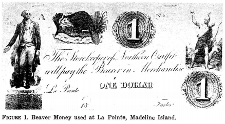
La Pointe Beaver Money
Northern Outfit, American Fur Company
~ Wisconsin Academy of Science, Arts, & Letters, volume 54, page 159.
In the year 1818 there came to the Lake Superior country two sturdy, fairly-educated37 young men, natives of the Berkshire hills of Massachusetts,—Lyman Marcus Warren, and his younger brother, Truman Abraham. They were of the purest New England stock, being lineally descended from Richard Warren, one of the “Mayflower” company. Engaging in the fur trade, the brothers soon became popular with the Chippewas, and in 1821 still further entrenched themselves in the affections of the tribesmen by marrying the two half-breed daughters of old Michel Cadotte,—Lyman taking unto himself Mary, while Charlotte became the wife of Truman. At first the Warrens worked in opposition to the American Fur Company, but John Jacob Astor’s lieutenants were shrewd men and understood the art of overcoming commercial rivals. Lyman was made by them a partner in the lake traffic, and in 1824 established himself at-La Pointe as the company’s agent for the Lac Flambeau, Lac Courte Oreille, and St. Croix departments, an arrangement which continued for some fourteen years. The year previous, the brothers had bought out the interests of their father-in-law, who now, much reduced in means, retired to private life after forty years’ prosecution of the forest trade.38

American Fur Company “Map of La Pointe”
by Lyman Marcus Warren, 1834.
~ Wisconsin Historical Society
The brothers Warren were the last of the great La Pointe fur traders.39 Truman passed away early in his career, having expired in 1825, while upon a voyage between Mackinaw and Detroit. Lyman lived at La Pointe until 1838, when his connection with the American Fur Company was dissolved, and then became United States sub-agent to the Chippewa reservation on Chippewa River, where he died on the tenth of October, 1847, aged fifty-three years.40

Iu Otoshki-Kikindiuin Au Tebeniminvng Gaie Bemajiinung Jesus Christ, Ima Ojibue Inueuining Giizhitong:
The New Testament of Our Lord and Saviour Jesus Christ
by Sherman Hall and Henry Blatchford, 1856.
~ Archive.org
Lyman Marcus Warren was a Presbyterian, and, although possessed of a Catholic wife, was the first to invite Protestant missionaries to Lake. Superior. Not since the days of Allouez had there been an ordained minister at La Pointe; Warren was solicitous for the spiritual welfare of his Chippewa friends, especially the young, who were being reared without religious instruction, and subject to the demoralizing influence of a rough element of white borderers. The Catholic Church was not just then ready to reenter the long-neglected field; his predilections, too, were for the Protestant faith. In 1830, while upon his annual summer trip to Mackinaw for supplies, be secured the cooperation of Frederick Ayer, of the Mackinaw mission, who returned with him in his batteau as lay preacher and school-teacher, and opened at La Pointe what was then the only mission upon the shores of the great lake. Thither came in Warren’s company, the latter part of August, the following year (1831), Rev. Sherman Hall and wife, who served as missionary and teacher, respectively, and Mrs. John Campbell, an interpreter.41
La Pointe was then upon the site of the old French trading post at the southwest corner of Madelaine Island; and there, on the first Sunday afternoon after his arrival, Mr. Hall preached “the first sermon ever delivered in this place by a regularly-ordained Christian minister.” The missionaries appear to have been kindly received by the Catholic Creoles, several of whom were now domiciled at La Pointe. The school was patronized by most of the families upon the island, red and white, who had children of proper age. By the first of September there was an average attendance of twenty-five. Instruction was given almost wholly in the English language, with regular Sunday-school exercises for the children, and frequent gospel meetings for the Indian and Creole adults.
We have seen that the first La Pointe village was at the southwestern extremity of the island. This was known as the “Old Fort” site, for here had been the original Chippewa village, and later the fur-trading posts of the French and English. Gradually, the old harbor became shallow, because of the shifting sand, and unfit for the new and larger vessels which came to be used in the fur trade.

The American Fur Company therefore built a “New Fort” a few miles farther north, still upon the west shore of the island, and to this place, the present village, the name La Pointe came to be transferred. Half-way between the “Old fort” and the “New fort,” Mr. Hall erected (probably in 1832) “a place for worship and teaching,” which came to be the centre of Protestant missionary work in Chequamegon Bay.

Leonard Hemenway Wheeler
~ Unnamed Wisconsin by John Nelson Davidson, 1895.
At that time, the Presbyterians and Congregationalists were, in the American Home Missionary Society and the American Board, united in the conduct of Wisconsin missions, and it is difficult for a layman to understand to which denomination the institution of the original Protestant mission at La Pointe may properly be ascribed. Warren was, according to Neill, a Presbyterian, so also, nominally, were Ayer and Hall, although the last two were latterly rated as Congregationalists. Davidson, a Congregational authority, says: “The first organization of a Congregational church within the present limits of Wisconsin took place at La Pointe in August, 1833, in connection with this mission”;42 and certainly the missionaries who later came to assist Hall were of the Congregational faith; these were Rev. Leonard Hemenway Wheeler and wife, Rev. Woodbridge L. James and wife, and Miss Abigail Spooner. Their work appears to have been as successful as such proselyting endeavors among our American Indians can hope to be, and no doubt did much among the Wisconsin Chippewas to stem the tide of demoralization which upon the free advent of the whites overwhelmed so many of our Western tribes.
James’ family did not long remain at La Pointe. Wheeler was soon recognized as the leading spirit there, although Hail did useful service in the field of publication, his translation of the New Testament into Chippewa (completed in 1836) being among the earliest of Western books. Ayer eventually went to Minnesota. In May, 1845, owing to the removal of the majority of the La Pointe Indians to the new Odanah mission, on Bad River, Wheeler removed thither, and remained their civil, as well as spiritual, counselor until October, 1866, when he retired from the service, full of years and conscious of a record of noble deeds for the uplifting of the savage. Hall tarried at La Pointe until 1853, when he was assigned to Crow Wing reservation, on the Mississippi, thus ending the Protestant mission on Chequamegon Bay. The new church building, begun in 1887, near the present La Pointe landing, had fallen into sad decay, when, in July, 1892, it became the property of the Lake Superior Congregational Club, who purpose to preserve it as an historic treasure, being the first church-home of their denomination in Wisconsin.

Not far from this interesting relic of Protestant pioneering at venerable La Pointe, is a rude structure dedicated to an older faith. Widely has it been advertised, by poets, romancers, and tourist agencies, as “the identical log structure built by Père Marquette”; while within there hangs a picture which we are soberly told by the cicerone was “given by the Pope of that time to Marquette, for his mission church in the wilderness.” It is strange how this fancy was born; stranger still that it persists in living, when so frequently proved unworthy of credence. It is as well known as any fact in modern Wisconsin history,— based on the testimony of living eyewitnesses, as well as on indisputable records,—that upon July 27, 1835, five years after Cadotte had introduced Ayer to Madelaine Island, there arrived at the hybrid village of La Pointe, with but three dollars in his pocket, a worthy Austrian priest. Father (afterwards Bishop) Frederic Baraga. By the side of the Indian graveyard at Middleport, he at once erected “a log chapel, 50×20 ft. and 18 ft. high,” and therein he said mass on the ninth of August, one hundred and sixty-four years after Marquette had been driven from Chequamegon Bay by the onslaught of the Western Sioux.43 Father Baraga’s resuscitated mission, still bearing the name La Pointe, as had the mainland missions of Allouez and Marquette,—throve apace. His “childlike simplicity,” kindly heart, and self-sacrificing labors in their behalf, won to him the Creoles and the now sadly-impoverished tribesmen; and when, in the winter of 1836-37, he was in Europe begging funds for the cause, his simpIe-hearted enthusiasm met with generous response from the faithful.

“Bishop Frederic Baraga, three-quarter length portrait, facing three-quarters to right, seated, in clerical robes, holding his Dictionary of the Otchipwe Language”
~ Library of Congress
Returning to La Pointe in 1837, he finished his little chapel, built log-houses for his half-starved parishioners, and lavished attentions upon them; says Father Verwyst, himself an experienced missionary among the Chippewas : “In fact, he gave them too much altogether—so to say— spoiled them by excessive kindness.” Four years later, his chapel being ill-built and now too small, he had a new one constructed at the modern village of La Pointe, some of the materials of the first being used in the second. This is the building, blessed by Father Baraga on the second Sunday of August, 1841, which is to-day falsely shown to visitors as that of Father Marquette. It is needless to say that no part of the ancient mainland chapel of the Jesuits went into its construction; as for the picture, a “Descent from the Cross,” alleged to have once been in Marquette’s chapel, we have the best of testimony that it was imported by Father Baraga himself from Europe in 1841, he having obtained it there the preceding winter, when upon a second tour to Rome, this time to raise funds for the new church.44 This remarkable man though later raised to a missionary bishopric, continued throughout his life to labor for the uplifting of the Indiana of the Lake Superior country with a self-sacrificing zeal which is rare in the annals of any church, and established a lasting reputation as a student of Indian philology. He left La Pointe mission in 1853, to devote himself to the Menomonees, leaving his work among the Chippewas of Chequamegon Bay to be conducted by others. About the year 1877, the white town of Bayfield, upon the mainland opposite, became the residence of the Franciscan friars who were now placed, in charge. Thus, while the Protestant mission, after a relatively brief career of prosperity, has long, since been removed to Odanah, the Catholics to this day retain possession of their ancient field in Chequamegon Bay.
View of La Pointe, circa 1843.
“American Fur Company with both Mission churches. Sketch purportedly by a Native American youth. Probably an overpainted photographic copy enlargement. Paper on a canvas stretcher.”
~ Wisconsin Historical Society
In closing, let us briefly rehearse the changes in the location of La Pointe, and thus clear our minds of some misconceptions into which several historians have fallen.
- As name-giver, we have Point Chequamegon (or. Shagawaumikong). Originally a long sand-spit hemming in Chequamegon Bay on the east, it is now an island. The most conspicuous object in the local topography, it gave name to the district; and here, at the time of the Columbian discovery, was the Chippewa stronghold.
- The mission of La Pointe du St. Esprit, founded by Allouez, was, it seems well established, on the mainland at the southwestern corner of the bay, somewhere between the present towns of Ashland and Washburn, and possibly on the site of Radisson’s fort. The point which suggested to Allouez the name of his mission was, of course, the neighboring Point Chequamegon.
- The entire region of Chequamegon Bay came soon to bear this name of La Pointe, and early within the present century it was popularly attached to, the island which had previously borne many names, and to-day is legally designated Madelaine.
- When Cadotte’s little trading village sprang up, on the southwestern extremity of the island, on the site of the old Chippewa village and the old French forts, this came to be particularly designated as La Pointe.
- When the American Fur Company established a new fort, a few miles north of the old, the name La Pointe was transferred thereto. This northern village was in popular parlance styled “New Fort,” and the now almost-deserted .southern village “Old Fort”; while the small settlement around the Indian graveyard midway, where Father Baraga built his first chapel, was known as “Middleport.”
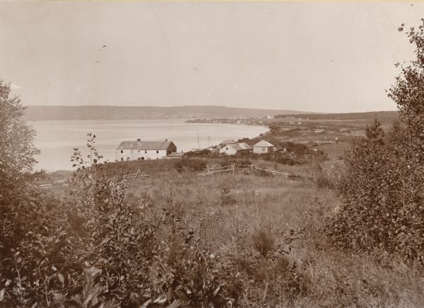
La Pointe, Madelaine Island, Chequamegon Bay, circa 1898.
“The large building in the foreground is an old American Fur Company’s warehouse. The mainland town of Bayfield rests in a hollow of the opposite hills, which appears to merge into the island. This La Pointe, early established as a French military and trading post, must not be confounded with the still earlier missions of La Pointe served by Allouez and Marquette, which is on the mainland on the southwest shore of Chequamegon Bay, between Washburn and Ashland.”
~ Wisconsin Historical Collections, Volume XVI, page 80.
La Pointe has lost much of its old-time significance. No longer is it the refuge of starveling tribes, chased thither by Iroquois, harassed by unneighborly Sioux, and consoled in a measure by the ghostly counsel of Jesuit fathers; no longer a centre of the fur-trade, with coureurs de bois gayly dight, self-seeking English and American factors, Creole traders dispensing largesse to the dusky relatives of their forest brides, and rollicking voyageurs taking no heed of the morrow. Its forest commerce has departed, with the extinction of game and the opening of the Lake Superior country to industrial and agricultural occupation; the Protestant mission has followed the majority of the Indian islanders to mainland reservations; the revived mission of Mother Church has also been quartered upon the bay shore. But the natural charms of Madelaine island, in rocky dell, and matted forest, and sombre, pine-clad shore, are with us still, and over all there floats an aroma of two and a half centuries of historic association, the appreciation of which we need to foster in our materialistic West, for we have none too much of it.
1 The chief authority on Nicolet is Butterfield’s Discovery of the Northwest (Cincinnati, 1881). See also Wis. Hist. Colls., xi, pp. 1-25.
2 In his authoritative “History of the Ojibway Nation,“ in Minn. Hist. Colls., v., Warren prefers the spelling “Chagoumigon,” although recognizing “Shagawaumikong” and “Shaugahwaumikong.” “Chequamegon” is the current modern form. Rev. Edward P. Wheeler, of Ashland, an authority on the Chippewa tongue and traditions, says the pronunciation should be “Sheh-gu-wah-mi-kung,” with the accent on the last syllable.
3 See Nevill and Martin’s Historic Green Bay (Milwaukee,1894); and various articles in the Wisconsin Historical Collections.
4 See Minn. Hist. Colls., v., pp.98, 99, note, for account of early copper mining on Lake Superior by Indians. In the summer of 1892, W. H. Holmes, of the Smithsonian Institution, found on Isle Royale no less than a thousand abandoned shafts which had been worked by them; and “enough stone implements lay around, to stock every museum in the country.”
5 Radisson’s Voyages was published by the Prince Society (Boston, 1895); that portion relation to Wisconsin is reproduced, with notes, in Wis. Hist. Colls., xi. See also Jesuit Relations, 1660, for Father Lallemant’s report of the discoveries of the “two Frenchmen,” who had found “a fine river, great, broad, deep, and comparable, they say, to our great St. Lawrence.”
In Franquelin’s map of 1688, what is now Pigeon River, a part of the international boundary between Minnesota and Canda, is called Groseilliers. An attempt was made by members of the Wisconsin State Historical Society, in the Wisconsin Legislature,during the session of 1895, to have a proposed new county called Radisson; the name was adopted by the friends of the bill, but the measure itself failed to pass.
6 Now called Crees.
7 Radisson’s Voyages plainly indicates that the travelers portaged across the long, narrow sand-spit formerly styled Shagawaumikong, in their day united with the mainland, but now insular, and bearing the name Chequamegon Island; this Radisson describes as “a point of 2 leagues long and some 60 paces broad,”and later he refers to it as “the point that forms that Bay, wch resembles a small lake.” After making this portage of Shagawaumikong, they proceeded in their boats, and “att the end of this bay we landed.” The Ottawas of the party desired to cross over to their villages on the head-waters of the Black and Chippewa, and no landing-place was so advantageous for this purpose as the southwest corner of the bay. It is plain from the narrative that the Frenchmen, now left to themselves, built their fortified hut at or near the place of landing, on the mainland. The Chippewa tradition of the coming of Radisson and Groseilliers, as given by Warren in Minn. Hist. Colls., v., pp. 121, 122, places the camp of the first white men on the eastern extremity of Madeline (or La Pointe) Island. The tradition runs close to the fact in most other particulars; but in the matter of location, Radisson’s journal leaves no room to doubt that the tradition errs.
See post, Father Verwyst’s article, “Historic Sites on Chequamegon Bay,”with notes on the site of Radisson’s fort, by Sam. S. Fifield and Edward P. Wheeler. Verwyst thinks the location to have been “somewhere between Whittlesey’s Creek and Shore’s Landing;” Fifield and Wheeler are confident that it was at Boyd’s Creek.
8 Apparently by Johnathan Carver, in the map accompanying his volume of Travels.
9 Says Warren (Minn. Hist. Colls., v., p. 102): “Shag-a-waum-ik-ong is a narrow neck or point of land about our miles long, and lying nearly parallel to the island of La Pointe, toward the western end of which it converges, till the distance from point to point is not more than two miles.” In first entering the bay, the previous autumn, Radisson describes the point of Shagawaumikong, and says: “That point should be very fitt to build & advantageous for the building of a fort, as we did the spring following.” But later on in his journal, in describing the return to the bay from their winter with the Indians in the Mille Lacs region, he does not mention the exact location of the new “fort.” While in this fort, they “received [news] that the Octanaks [Ottawas] [had] built a fort on the ponit that forms that Bay, wch resembles a small lake. We went towards it with all speede,” – and had a perilous trip thither, across thin ice. This would indicate that the French camp was not on the point. As with many other passages in the journal, it is impossible to reconcile these two statements. Verwyst thinks that the traders were stationed on Houghton Point.
Warren, who had an intimate acquaintance with Chippewa traditions’ believed that that tribe, driven westward by degrees from the shores of the Gulf of St. Lawrence, reached Lake Superior about the time of the Columbian discovery, and came to a stand on Shagaqaumikong Point. “On this spot they remained not long, for they were harassed daily by their warlike foes, and for greater security they were obliged to move their camp to the adjacent island of Mon-in-wun-a-kauning (place of the golden-breasted woodpecker, but known as La Pointe). Here, they chose the site of their ancient town, and it covered a space about three miles long and two broad, comprising the western end of the island.” – (Minn. Hist. Colls., v., p. 96). They remained in this large town “for the space of three generations, or one hundred and twenty years,” but for various reasons (see Ibid, p. 108 et seq., for the details) evacuated the place, and settling on the adjacent mainland came to regard La Pointe Island (now Madeline) as an abode of evil spirits, upon which, it is said, until the days of Cadotte, no Indian dare stay over night alone. Gradually, as the beaver grew more scarce, the Chippewas radiated inland, so that at the time of Radisson’s visit the shores of the bay were almost unoccupied, save during the best fishing season, when Chippewas, Ottawas, Hurons, and others congregated there in considerable numbers.
10 The route which Ménard took, is involved in doubt. Verwyst, following the Jesuit Relations, thinks he ascended some stream flowing into Lake Superior, and portaged over to the head-waters of Black river. Others, following Tailhan’s Perrot, believe that he crossed over to Green Bay, then ascended the Fox, descended the Wisconsin, and ascended the Mississippi to the mouth of the black. If the latter was his route, his visit to the Mississippi preceded Joliet’s by eleven years.
11 Neill (in Minn. Hist. Colls., v., p. 116) is of the opinion that Allouez “built a bark chapel on the shores of the bay, between a village of Petun Hurons and a village composed of three bands of Ottawas.” That Allouez was stationed upon the mainland, where the Indians now were, is evident from his description of the bay (Jesuit Relations for 1666-67): “A beautiful bay, at the bottom of which is situated the great village of the savages, who there plant their fields of Indian corn, and lead a stationary life. There are there, to the number of eight hundred men bearing arms, but collected from seven different nations, who dwell in peace with each other.” Verwyst, whose local knowledge is thorough, thinks that Allouez’s mission was at the mouth of Vanderventer’s Creek, and I have followed him in this regard.
There has always been some confusion among antiquarians as to what particular topographical feature gave name to the region. In christening his mission “La Pointe,” he had reference, I think, not to the particular plot of ground on which his chapel lay, but to the neighboring sandy point of Shagawaumikong, hemming in the bay on the east, in which he must have had a poetic interest, for tradition told him that it was the landfall of the Chippewas, and the place where, perhaps a century before, had been fought a great battle between them and the Dakotah’s (or Sioux), relics of which were to be found in our own day, in the human bones scattered freely through the shifting soil; doubtless in his time, these were much in evidence.
The map of in the Jesuit Relations for 1670-71 styles the entire Bayfield peninsula, forming the west shore of the bay, “La Pointe du St. Esprit,” of 1688, more exact in every particular, places a small settlement near the southwestern extremity of the bay. See also Verwyst’s Missionary Labors of Fathers Marquette, Ménard, and Allouez (Milwaukee, 1886), p. 183.
In 1820, Cass and Schoolcraft visited Chequamegon Bay, and the latter, in his Narrative, says: “Passing this [Bad] River, we continued along the sandy formation to its extreme termination, which separates the Bay of St. Charles [Chequamegon] from that remarkable group of islands called the Twelve Apostles by Carver. It is this sandy point which is called La Pointe Chagoimegon by the old French authors, a term no shortened to La Pointe.”
12 By this time, fear of the Iroquois had subsided, and many Hurons had lately returned with the Pottawattomies, Sauks, and Foxes, to the oldhaunts of the latter, on Fox River. Cadillac, writing in 1703 from Detroit, says (Margry, v., p. 317): “It is proper that you should be informed that more than fifty years since [about 1645] the Iroquois by force of arms drove nearly all of the other Indian nations from this region [Lake Huron] to the extremity of Lake Superior, a country north of this post, and frightfully baren and inhispitable. About thirty-two years ago [1671] these exiled tribes collected themselves together at Michillimakinak.”
13 “The cause of the perpetual war, carried on between these two nations, is this, that both claim, as their exclusive hunting ground, the tract of country which lies between them, and uniformly attack each other when they meet upon it.” – Henry’s Travels and Adventures (N. Y., 1809), pp. 197, 198.
14 From whom the city of Duluth, Minn. was named.
15 For an account of Grand Portage see Wis. Hist. Colls., xi., pp. 123-125.
16 See ante, p. 203, note, for description of the Bois Brulé-St. Croix route.
17 See Parkman’s Half Century of Conflict, and Hebberd’s Wisconsin under French Domination (Madison, 1890).
18 Neill, in Minn. Hist. Colls., v. p 140, says that soon after St. Lusson’s taking possession of the Northwest for France, at Sault. Ste. Marie (1671), French traders built a small fort set about with cedar palisades, on which a cannon was mounted, “at the mouth of a small creek or pond midway between the present location of the American Fur Company’s establishment and the mission-house of the American Board of Foreign Missions.”
19 Minn. Hist. Colls., v., p. 125. Originally, the Indians of Lake Superior went to Quebec to trade; but, as the whites penetrated westward by degrees, these commercial visits were restricted to Montreal, Niagara, Detroit, Mackinaw, Sault Ste. Marie, as each in turn became the outpost of French influence; finally trading-posts were opeend at La Pointe, St. Louis River, and Pigeon River, and in time traders even followed the savages on their long hunts after the ever-decreasing game.
20 In July, 1695, Chingouabé, Chief of the Chippewas, voyaged with Le Sueur to Montreal, to “pay his respects to Onontio, in the name of the young warriors of Point Chagouamigon, and to thank him for having given them some Frenchmen to dwell with them; and to testify their sorrow for one Jobin, a Frenchmen killed at a feast. It occurred accidentally, not maliciously.” In his reply (July 29), Governor Frontenac gave the Chippewas some good advice, and said that he would again send Le Sueur “to command at Chagouamigon.” – Minn. Hist. Colls., v., p. 421.
21 It is evident that hereafter Madelaine Island was the chief seat of French power in Chequamegon Bay, but it was not until the present century that either the name La Pointe or Madelaine was applied to the island. Franquelin’s map (1688) calls it “Isle Detour ou St Michel.” Bellin’s French map of Lake Superior (in Charlevoix’s Histoire et Description Générale de Nouvelle France, Paris, 1744) calls the long sand-point of Shagawaumikong (now Chequamegon Island), “Pointe de Chagauamigon,” and styles the present Madelain Island “Isle La Ronde” after the trader La Ronde; what is now Basswood Island, he calls “Isle Michel,” and at the southern extremity of the bay indicates that at that place was once an important Indian village. In De l’ Isle’s map, of 1745, a French trading house (Maison Francoise) is shown on Shagawaumikong Point itself. Madelaine Island has at various times been known as Monegoinaiccauning (or Moningwnakauning, Chippewa for “golden-breasted woodpecker”), St. Michel, La Ronde, Woodpecker, Montreal, Virginia (Schoolcraft, 1820), Michael’s (McKenney, 1826), Middle (because midway between the stations of Saulte Ste. Marie and Fort William, at Pigeon River), Cadotte’s, and La Pointe (the latter because La pointe village was situated thereon).
22 Minn. Hist. Colls., v., pp. 423-425.
23 It was during this period the only fur-trading station on the south shore of Lake Superior, and was admirably situated for protecting not only the west end of the lake, but the popular portage route between Lake Superior and the Mississippi River, – the Bois Brulé and the St. Croix Rivers.
24 J. D. Butler’s “Early Shipping on Lake Superior,” in Wis. Hist. Soc. Proc., 1894, p. 87. The rigging and material were taken in canoes from the lower country to Sault Ste. Marie, the vessel being built at Point aux Pins, on the north shore, seven miles above the Sault. Butler shows that Alexander Henry was interested with a mining company in launching upon the lake in May, 1771, a sloop of 70 tons. After this, sailing vessels were regularly employed upon Superior, in the prosecution of the fur trade and copper mining. The Hudson’s Bay Company’s “Speedwell” was upon the lake as early as 1789; the Northwest Company’s principal vessel was the “Beaver.”
25 In this year there were reported to be 150 Chippewa braves living on Point Chagouamigon. — N. Y. Colon. Docs., ix.
26 Martin MSS., Dominion Archives, Ottawa, – letter of Beauharnois. For much of the foregoing data, see Neill’s “History of the Ojibways,” Minn. Hist. Colls., v.
27 N. Y. Colon. Docs., x., p. 424
28 Says Governor Galissoniére, in writing to the colonial office at Paris, under date of October, 1748: “Voyageurs robbed and maltreated at Sault Ste. Marie, and elsewhere on Lake Superior; in fine there appears to be no security anywhere.” – N. Y. Colon. Docs., x. p. 182.
29 See the several versions of this tale, Wis. Hist. Colls., viii., pp. 224 et seq.; and Minn. Hist. Colls., v., pp. 141-145, 431-432. Warren says that some Chippewa traditions ascribe this tragedy to the year 1722, but the weight of evidence is as in the text above.
30 “My house, which stood in the bay, was sheltered by an island of fifteen miles in length, and betwen which and the main the channel is four miles broad. On the island there was formerly a French trading post, much frequented; and in its neighborhood a large Indian village.” – Henry’s Travels, p. 199. Henry doubtless means that formerly there was an Indian village on the island; until after the coming of Cadotte, Warren says, the island was thought by the natives to be bewitched.
31 Jean Baptiste Cadotte (formerly spelled Cadot) was the son of one Cadeau, who is said to have come to the Northwest in the train of Sieur de St. Lusson, who took possession of the region centring at Sault Ste. Marie, in 1671. See St. Lusson’s procés verbal in Wis. Hist. Colls., xi., p. 26. Jean Baptiste, who was legally married to a Chippewa woman, had two sons, Jean Paptiste and Michel, both of whom were extensive traders and in their turn married Chippewas. See Minn. Hist. Colls., v., index.
32 “On my arrival at Chagouenig, I found fifty lodges of Indians there. These people were almost naked, their trade having been interrupted first by the English invasion of Canada, and next by Pontiac’s war.” – Travels, p. 193.
33 McKenny, in History of the Indian Tribes (Phila., 1854), i., pp. 154, 155, tells the story. He speaks of Johnston as “the accomplished Irish gentleman who resided so many years at the Sault de Ste. Marie, and who was not better known for his intelligence and polished manners than for his hospitality.” See also, ante, pp. 180, 181, for Schoolcraft and Doty’s notices of Johnston, who died ([ae]t. 66) at Sault Ste. Marie, Sept. 22, 1828. His widow became a Presbyterian, and built a church of that denomination at the Sault. Her daughter married Henry B. Schoolcraft, the historian of the Indian tribes. Waubojeeg died at an advanced age, in 1793.
34 Warren thinks he settled there about 1792 (Minn. Hist. Colls., v., p.111), but there is good evidence that it was at a later date.
35 “The Cranes claim the honor of first having pitched their wigwam and lighted the fire of the Ojibways, at Shaug-ah-waum-ik-ong, a sand point or peninsula lying two miles immediately opposite the Island of La Pointe.” – Warren in Minn. Hist. Colls., v., p. 86.
36 “Kind-hearted Michel Cadotte,” as Warren calls him, also had a trading-post at Lac Courte Oreille. He was, like the other Wisconsin Creole traders, in English employ during the War of 1812-15, and was at the capture of Mackinaw in 1812. He died on the island, July 8, 1837, aged 72 years, and was buried there. As with most of his kind, he made money freely and spent it with prodigality, partly in high living, but mainly in supporting his many Indian relatives; as a consequence, he died poor, the usual fate of men of his type. – (Minn. Hist. Colls., v., p. 449.) Warren says (Ibid., p. 11), the death occurred “in 1836,” but the tombstone gives the above date.
Cass, Schoolcraft, and Doty visited Chequamegon Bay in 1820. Schoolcraft says, in his Narrative, pp. 192, 193: “Six mile beyond the Mauvaise is Pointe Che-goi-me-gon, once the grand rendezvous of the Chippeway tribe, but now reduced to a few lodges. Three miles further west is the island of St. Michel (Madelaine), which lies in the traverse across Chegoimegon Bay, where M. Cadotte has an establishment. This was formerly an important trading post, but is now dwindled to nothing. There is a dwelling of logs, stockaded in the usual manner of trading-housess, besides several out-buildings, and some land in cultivation. We here also found several cows and horses, which have been transported with great labor.” See ante, pp. 200, 201, for Doty’s account of this visit.
37 Alfred Brunson, who visited Lyman Warren at La Pointe, in 1843, wrote: “Mr. Warren had a large and select library, an unexpected sight in an Indian country, containing some books that I had never before seen.” – Brunson, Western Pioneer (Cincinnati, 1879), ii., p. 163.
38 Minn. Hist. Colls., v., pp. 326, 383, 384, 450. Contemporaneously with the settlement of the Warrens at La Pointe, Lieutenant Bayfield of the British navy made (1822-23) surveys from which he prepared the first accurate chart of Lake Superior; his name is preserved in Bayfield peninsula, county, and town.
39 Borup had a trading-post on the island in 1846; but the forest commence had by this time sadly dwindled.
40 He left six children, the oldest son being William Whipple Warren, historian of the Chippewa tribe. See William’s “Memoir of William W. Warren,” in Minn. Hist. Colls., v.
41 See Davidson’s excellent “Missions on Chequamegon Bay,” in Wis. Hist. Colls., xii., to which I am chiefly indebted for information concerning the modern La Pointe missions. Mr. Davidson has since given us, in his Unnamed Wisconsin (Milw., 1895), fuller details of this mission work.
42 Wis. Hist. Colls., xii., p. 445. Mr. Davidson writes to me that in his opinion Ayer leaned to independency, and was really a Congregationalist; Hall is registered as such in the Congregational Year Book for 1859. “As to the La Pointe-Odanah church,” continues Mr. Davidson, in his personal letter, “its early records make no mention of lay elders, – of organization it was independent, rather than strictly Congregational. This could not be otherwise, with no church nearer than the one at Mackinaw. That was Presbyterian, as was its pastor, Rev. William M. Ferry. The La Pointe church adopted articles of faith of its own choosing, instead of holding itself bound by the Westminster confession. Moreover, the church was reorganized after the mission was transferred to the Presbyterian board. For this action there may have been some special reason that I know nothing about. But it seems to me a needless procedure if the church were Presbyterian before.”
43 See Verwyst’s Missionary Labors, pp. 146-149. This chapel was built partly of new logs, and partly of material from an old building given to Father Baraga by the American Fur Company
44 See Wis. Hist. Colls., xii., pp. 445, 446, note, also, Verwyst’s Missionary Labors, pp. 183, 184. Father Verwyst also calls attention to certain vestments at La Pointe, said to be those of Marquette: “That is another fable which we feel it our duty to explode. The vestments there were procured by Bishop Baraga and his successors; not one of them dates from the seventeenth century.”
Barber Papers: “A Southern Confederacy” Winter of 1857
January 27, 2016
By Amorin Mello
Selected letters of the Joel Allen Barber Papers
… continued from the Fall of 1856.
Sandusky Dec 22nd 1856
My dear Son
You will see by date of this letter, that I have progressed somewhat towards home.

Portrait of U.S. Representative James Meacham from the History of the Town of Middlebury: In the Country of Addison, Vermont by Samuel Swift, 1859, after page 388. “Much to my astonishment I now find that Mr Meacham is a habitual private tippler and is often such a condition from drink as to occasion general notice and remark […] Is it not wonderful our state has had a long list of such members, Mallory, Nole, Buck, Phelps, &c.” from 1856 letter in the University of Vermont Libraries’ Center for Digital Initiative.

U.S. Representative Alvah Sabin was mentioned earlier in the Barber Papers during the Spring and Summer of 1855. ~ Eighty-Three Years a Servant, or, the Life of Rev. Alvah Sabin by Alvah Sabin Hobart, 1885
I left Lancaster in company with E. D. Lowry for Galena last Wednesday morning & on getting to Galena found that the cars had not run for 5 days on account of snow, but they got in toward morning & at 9 AM I started & only got through to Chicago next day at night, when not running we were in snow drifts. I arrived here Saturday evening & am having a very comfortable visit with your Uncle’s family. Shall leave at 7 tonight for the East & shall make all speed for Vermont. Your Uncle’s folks are looking for Jay house tomorrow night to spend the holiday & then return again. There is something in the Tribune of last week concerning the termination of the Eastern RailRoad on the Northern boundary & laying it down as pretty certain that the road would be carried to the Mouth of Montreal River. If I can find the paper before mailing this, I will send you the article, & did I know that the road would be run to your town I would take all possible means to apprise you of the fact so that you might not dispose of your interest in the great haste. If you have sold none, when this reaches you, I trust you will act in reference to the above information, and I would advise you to keep dark, till further advice, & as fast as I can learn anything relative to your interests I will communicate the same to you. I have heard nothing from you yet, since parting with you at La Pointe, but hope to get letters from you when I get home. I have left money with Cyrus to pay your taxes, & will have him pay on Jo’s. Tell Mr. Wheeler, that I have learned the trouble concerning Hon Jas. Meacham that he & I talked about at his house. He had become a confirmed & miserable drunkard & drank himself out of the world. This is from one of his colleagues Hon A. Sabin, and is but too true.
Reverend Leonard Wheeler & Government Carpenter John Stoddard lived at the Gardens.
Give my last respects to Mr. Wheeler & family also to Mr. & Mrs. Stoddard & tell them that I have not escaped a hard winter as [?????? ?????? ??????] but do not fear starvation like I did on L. Superior.
I expect you are all buried in deep snows by this time, so that you can do nothing at Surveying. The Snow was 2 ft deep at Lancaster when I left, but it rained all day Friday like July Showers & the ground is entirely bare about this place. Her Bay is frozen over. Keep a strict acct of all the expense of resurveying on the last winters contract, if you get a new one & undertake it, as I am informed that I can get relief from Congress by a special act, paying me all that it will cost to do the work over again, which will be as much for you interest as anybody’s of this please say nothing to any one.
Now My dear Son I again implore you to be careful of your life & health. Do provide yourself with enough to make yourself comfortable & easy & above all good warm clothing & bedding, be careful of exposing yourself, where you there is danger of being lost & freezing, or of getting through the ice. Do my son heed the requests of your parents & only brother who feel more interest for you than you are aware of, & who are in hopes to yet enjoy your society in a more genial soil & climate.
I think that one visit to Lancaster will be sufficient to wean you from the frozen, famine stricken, regions around the Great Lake. I overhauled my agates yesterday giving lots of them to the children, also specimens &c. I gave them some chrorastrolites & shall give them some more. They prize them very high. The stone that Jo gave Lucy & she to your Uncle, has been cut & set in two rings. 1 for Aunt Em & 1 for Lina… Aunt E’s ring cost $12.00 besides the stone. It is a splendid affair.
Do write as often as you can, for be assured that your letters will be always joyfully rec’d & read by your parents & Hiram.
Farewell my dear Son & may God preserve your life & health
G. A. Barber
Respect to the boys.
Cambridge Dec 29th 1856
My dear Son
It is now about 2 months since I left you at La Pointe, since which time I have not heard one word from you, whether you were in the land of the living, or had got cast away on your journey to Montreal River. I was very anxious to get intelligence from you while at Lancaster & could not feel reconciled to come away till I had heard from you. But having left directions with our friends there to forward your letters, if any came, to me. I finally ventured to start for Vermont. I stopped over 48 hours at Sandusky, & wrote you from there, on matters pertaining to Ironton, which will reach you long before this does. If you have not sold any shares, it would be best to rest easy till you see how the matter turns, but if the road is likely to terminate at the Mouth of Montreal River, some shark will be after all the shares he can get, & at the lowest prices. I left Sandusky Monday night (22nd) at 7, was in Buffalo at 7 next morning & Albany at 10 P.M. Rutland at [morn?] Wednesday. Called on Mrs. Temple & Nancy Green, got to Burlington at 8 P.M. on the 24th & home on Christmas at sunset, found all well and tired out with looking for me. Every thing looks as natural as ever, except that our Prairies are more rolling & the bottoms greatly shrunken in dimensions.
[…]
Mr. Whiting had a partner, B. E. Fullington, an honest, God-fearing, upright man, and their plan was to engage in farming–raising corn for the Government post at Fort Riley. Mr. Fullington soon became disgusted with the meager success that attended their efforts, and after one season returned East, leaving Mr. Whiting to conduct the business. Mr. Fullington agreed to furnish the capital while Mr. Whiting was to manage the business connected with the partnership. But Kansas looked better to Mr. Fullington after he got to Vermont and he came back the next spring to spend a long and useful life here.”
~ A Standard History of Kansas and Kansans by William E. Connelley, 1918, transcribed by Baxter Springs Middle School students, 1997.
While on the platform at Essex Junction, who should I run into again? but Mr. Bradly & Fullington direct from Kansas when he left Albe! Left him well, on the land they had claimed, another man a neighbor had gone into the shanty with Albe to [book/back?] it together this winter, & take care of their cattle
Matters are more quiet there now. Gov. Geary proves a better man than was anticipated. Prospects for Terr. Kansas are brightening. I sent you the message of the infamous Frank Pierce, from Lancaster, & hope your patience permitted you to read it through. Still it is the meanest vilest paper that ever emanated from our Government and will go down to posterity with its author excerated by all good & honest persons. Folks are well around. Levi & Oscar were here last night till after 9. Of course I gave them some specimens of copper, agates &c. Mary Buck from Galesburgh Ill. sister to Mrs. Kingsbury keeps the school, from 6 to 10 scholars, & enough for such a “marm.” Ed. Bryant teaches the best school at the Center. Pat Coldwell is in a Store at Waterbury. Dr. C.L. Fisher is teaching in Johnson. Helen Whiting is about going to “Kaintucky” to teach in a family. I do not mean of her own, but in a private school.
~ Collections of the Kansas State Historical Society, Volume 12, by Kansas State Historical Society, page 119.
I am going to Johnson to day & must be brief but will perhaps do better another time. If mails are regular you will get as many as one letter per week, while I have ability to scribble for I have learned by experience how good it seems to have letters from “friends & sacred home.” Again I caution you to take care of yourself, you can read my back letters for particulars. Your mother will write soon now when she knows where you are, & I will make Amherst do likewise.
Your affectionate father
G. A. Barber
[ca. 1856]
My Dear Son.
I hardly know whether to write again to you before hearing or knowing something of your situation.
It seems too much like writing to the dear departed. But I know that if it were possible you would have sent us news of your self before now. I feel assured that it is not your fault that we do not get letters.
I often imagine you shut in from the world by deep snows – perhaps you and your party frozen – disabled from work or even from the use of the pen. But the thought of the good Christian Missionary near you makes me hope that you would not be allowed to perish with cold or hunger and that, should any great misfortune happens to you he would inform us of it. How very long and tedious must the winter have been to you all and how often the vainly have I wished you had complied with our wishes and returned to spend the winter at home. Oh! How much more pleasure and comfort might we all have then.
I mentioned in a former letter my wish to go to Lan. next summer and my great desire to meet you there. I do not know that I will take the trouble and incur the expense of such a journey if I must come back without seeing you, so do not let me be disappointed. If you will If I felt sure that you would meet me there and would return with us to spend next winter I should feel that I had something to live for. But the thought of going there and returning to live in this old, desolate, neglected, forsaken looking place without you, with no prospect if there ever being any improvement in its appearance under the present administration makes me quite indifferent to life. I am very sorry that we cannot get another woman here – one who would be agreeable and friendly with me, or whom I could confide in as a good and honest dairy woman. I should then feel quite satisfied to leave the business with her, and less unwilling to return again. But your father will not let any one else come – tho he has had some very good offers.
How I do wish that you would come and live with me and befriend me & I really need to have one friend.
Good night
Mother
Cambridge Jan 6th 1857
Dear Son
I have determined to wait in hopes to hear from you, before writing back again. It really seems strange, that we do not get something from you in all this long time, your last being dated Nov-. Your Mother & I wrote repeatedly while at Sandusky & I hope you get the letters, but why do I not get something from you?
I am extremely anxious to know how you are & how you are getting along this winter, whether you have yet recd that long expected draft & whether you have done anything at surveying the Indian Reservation whether you are boarding at Mr Maddock’s yet, or what you are doing & have spending the long & hard winter. The date of this will show you that I have once more got home, and am now a dweller among the G. Mountains.
After being at your Uncle’s in Sandusky 10 weeks and I had so far recovered that I could walk across the river your Mother was away to have me start for home & I was hurried away before I was sufficiently strong to endure the fatigues of such a journey. On Sunday 27th ult I first ventured out of doors Monday 28th was stormy so that I could not go out & yet I had to start Tuesday, or trouble would endear, so I was off and that night at Midnight I was in Buffalo (leaving station at noon). Left B. at 9 A.M. & was in Albany 10 ½ P.M next Morning started at 7 & was snugly quartered at the Lomied of N.E.N’ Esq on the [????] by the college on Burlington. My feet & legs [???] badly swollen all the way caused by debility I remained there 2 nights & spent [???????] with them. Saturday we continued in the stage with [Sen/Tom?] Andrews to the Centre where we [??? ?????? ??? ??????? ???] house unfit to occupy, as his had “Batnies” all over the floor drying your Brother & I went to Mr Wetherby’s (in the Miner house) & stayed till next day when Mr Green brought his woman here & she & Amherst worked at the house while Mr G. went to the centre for your Mother. I was brought up toward night, and am a close prisoner ever since on account of my swelled legs & lameness but I am free from that infernal pain that troubled me at La Pointe & only feel a soreness in my walking apparature.
I could scarcely believe the fact was so, when I found I could put my legs feet down on the floor without excruciating pain, but I have reason to hope I have seen the last of that tormentor. My appetite is shrunk so much, my strength is returning & when I shall regain part of my flesh and my legs get sound I shall be nearly as good as new. I was reduced almost to a shadow by the “little gobbel,” but they did not make me any sicker than before as the Allopathic Medicines would have done. Their effect was produced silently, and though I was run down pretty low & weak I at no time felt any distressing sickness save in my legs till I imprudently ate too many preserved tomatoes that distressed me 2 or 4 days. But my greatest gratification was to get Amherst home with me once more, after he had been a wanderer & outcast for months in his own neighborhood. We found him living at Griswold’s where he was enjoying himself tolerably well & was useful about the storm & handed &c. He was all [?????] at our [????] house by the shore [devil?] that [punished?] in the [Kitchen?]
He always found a welcome at Atwood’s & was urged to stay there & too at [Supuien’s?] but Mrs P. in the woods wanted take paints to make him understand that they did not want him to consume much of their grub, I always knew she was a stingy old satan & now I think I shall request her whenever a good opportunity offers. I think he was as glad to see us, as we to see him, & that we will take as much solid comfort together as the nature of the case will present.
7th
I shall look earnestly for a letter from you till I get one & though my letters may be a long time in reaching you I shall keep a stream of them running to your country that you may have something once in a while to refresh your memory of home and those so dear to you who are now sojourning here. There have been but few changes by death or marriage that I hear of since my leaving last spring. I wrote to you of the death of Mr Chase Old Mr John Safford died in Dec aged 92 years & old Mrs Darker also very aged. David Griswold & Mary Ann Chadwick were yoked at Christmas. I do not hear of any others in town, who have got married, that you know, but I will tell you if your patience will permit, a little something of one Rodney [Casde?] whom you will recollect. He was living with [Gad?] on the Mirriam farm & by chance became enamored of [Clena?] Scott & she as much of him, they were thick, & had the time set for marriage, but she finding some of his great [fertensing?], doubtful, flared up & was off entirely, whereupon he threatened 1st to go to her door & spill his heart blood on the door stones, next he threatened a suit for breach of promise, went down to Burlington to consult Lawyers & Morrisville & finally gave it up and fizzled out.
The poor boy is doubly consorted since, for he has got religious & been baptised into the Methodist Church, and has at last got married to somebody in Stowe. The tragedy is all over.
Major Watrous, Speaker of the Minnesota House of Representatives, was in the cars with me from Sandusky to Cleveland & from him I heard some things from the great Lake later than I had formerly known. He was on his way to Washington, having his chair temporarily filled during his absence. He is dead against old Buchanan & his southern Masters on the Kansas question & probably uttered the sentiment of the party in the territory.
The winter except a few days of the latter part of Nov that were unusually severe has been remarkably mild with no snow to do any good till Jan 1st. There is now a sufficient quantity of 8 or 10 in. & sleighing is 1st rate so that there are from 50 to 100 sleighs whirling by us daily, without giving us a chance to see their pretty faces, or knowing them. Your Mother is more than ever troubled & careful about many things, nothing suits. She says we are the poorest off of any family in town except Ed Davis’ folks, she wants to stay here & not have the farm let another year, but you know she is for lack of strength & power of endurance wholly uncapably of carrying on the dairy & there is not much prospect of my being capable of much labor. Dow is the best tenant after all that we can get, if I find him honest when I settle with him but his wife is a (but his wife is a) little tough and withal “narrow” home there can be that little peace in the funerals department of the house.
Amherst has promised to write something to go with this.
I remain your affectionate father
Giles A. Barber
Do write often about yourself your affairs & about everything that will interest me
Give my respects to all friends
Especially to Mr Maddocks
Cambridge Jan 10th Saturday night 1857
My Dear Son
Contrary to my intention, I have let slip One Sunday without writing to you. My excuse for it is just this Your Uncle & Aunt Burr were here over Sunday and I could really find no very good time to write. But I will make amends as far as I can by being more punctual in future. We are all three quite well, have removed our quarters from the west room to the East room which as well as the west room is now papered and looks com-fort-a-ble.
Since I got home Dow has killed one 5.00 lbs [quarter?] & sold it at 8 ½ $42.50 & the Alcorn Cow very fat, & I wish you & your party had part of it instead of your everlasting “salt [rusty?] pork”. We sold 812 ½ bs Butter this week at 21 ¢ & yesterday I sold our oxen that we have had so long for $140.00 to be delivered tomorrow morning.
The second Vermont State House before and after the fire. “However, on the night of January 6, 1857, disaster struck. A special session to revise the Vermont Constitution had been scheduled for the following day. The stove was loaded with wood and left to warm the building before the legislators arrived the next morning. By evening the stove became so hot that the timbers near it caught fire. The flames quickly spread to the rest of the capitol destroying all but the granite sections.” ~ Vermont Historical Society
The State House at Montpelier was burned down last Tuesday. The fire taking around the furnace & getting such hold that all efforts to save the edifice were unavailing. The Library & State archives & most of the furniture were saved, the walls are not badly injured. The House was being warmed up for the constitutional Convention which was to occupy the Representatives Hall the next day, but they have gone into the Court House to hold their session.
Sunday 11th
I have not been to any meeting since leaving Superior where I enjoyed the labors of brothers Peet and McCorkle. Did think of going to day to hear Mr Whitney an old Methodist man who preached here some years ago, but finally concluded it would not pay. Rebellions are the order of the day & they are trying hard to inaugurate one at the Centre, but I believe without any success thus far. They are doing a tolerable business at the Borough & at Johnson.
They have tried their best for some weeks, have secured Old Man Daniels and made Sissy Hunt snivel once or twice. Old Benton says they can never make a one horse rebellion do anything in Johnson, & I am of nearly the same mind. The fact is, the people, (I mean those of any mind, at all) are becoming every year more loyal, & less liable to be excited to meeting & open rebellion. Mother finds fault with what I am here said about revival. I do not wish to be understood as discarding all religious notions whatever, far from it. I feel that we are called upon every moment of our lives for deep heartfelt gratitude to the great Author of our existence who crowns our lives with the richest blessings, that to feel our dependence upon him & realize that it is from him that we receive all, every comfort, and all that we have, & do toward our fellow men as we would wish to have them do unto us. This I say in my opinion is, as good religion to live by as any of their newly patented article, obtained at modern rebellions & I cannot but think it will be much better to light our feet through the dark valley that we must all pass, sooner or later.
Of all the profession of religion, especially men, How many are there, who by their deal with their neighbors, or their every day walk, would evince any superiority of Character or better show for happiness hereafter than the calm stoid person who adores his God and submits himself & all he has into his care & keeping? Amherst has just returned from Meeting & says he read in a Montpelier paper that the collection of the State Naturalist was destroyed, but it was thought that the House could be rebuilt by filling up the inside, walls all good. I went to the Borough yesterday and sat as sole referee in a case between Jonas Gobs & school district & also between S. Stratton Jr & same, did not decide as there were 2 law questions involved in such case & I wanted time to look it over.
The winter has been pretty severe in Vermont thus far, down to 20* & 24* below zero. There is not much snow in the fields. The ground all covering but not deep. Sleighing good as ever was. Went up to Johnson last Monday & staid at Judge Tom’s over night & had B.E. Fullington told his story about Kansas to a crowded room (the Valley). Col Ferner, Col Stoddard, Tom Baker, Judge Caldwell & old Homer teased him with foolish questions, & would have kept him on the stand all night if they could, to learn whether wild game were plenty, whether [frungh him?] grow well & [??] the ladies were contented &c &c. Mr F. thinks Kansas will be free in any confident it will be so. I presented Herman’s wife with the handsomest Chorastrolite. I brought home with me the little fine spackled one that had a ball on the backside & I gave Aunt Ellen a very nice one both on condition that this would get them set in rings. I gave your Aunt Martha her [???] in all but one sent some to the little girls with some agates. I saw the stone out & set that Jo gave to your Aunt Lucy, & it is the right ring I have seen. I made up a package of specimens & sent up to the old Dr last week but have heard nothing from him.
Amherst is in extacy with his Embroidered Shirt & wears it all the time & to all places, Meeting, Lycum, & to work in every day. I have bought materials for another he will soon long rejoice in a pair of them.
The school is rather a feeble concern in our district this winter.
Kept (I cannot say taught) by a Miss Buck sister to Mrs Kingsbury on the Wetherby farm. Attendance of Scholars from 2 to 7 or 5. By the way we have some excellent neighbors Mr & Mrs K. both young and better mates for you & Am than for old people. Miss Buck’s folks at the foot of the hill are also very good neighbors so your mother says. At Old Grim farm there is Lucy & her 4 boys. Mr Green is on his place but is going off it, having let it out. Dow wants this place again.
Have just had a good supper of hogs face with we could have had you to make even our number. Oh Allen I will not answer to how you remain up in that miserable frozen region longer than till you can so arrange your affairs so as to get away advantageously.
Your mother in constant alarm about you, at times thinking you gone to join our dear lost Augustus & no more to bless us with with your presence here, but to day she has prepared 4 blinds for you & your comrades to wear in the gloom of Feb & March. We got a short letter from you dated Nov 9th saying that you & 4 others were to start that day for your work on Bad River. I saw by the papers that the Old Manhattan was wrecked on one of the piers at the mouth of the Harbor in Cleveland, total loss. This makes two of your regular boats of the 3 that used to churn the sight of the dwellers of Lake Superior now gone to ruin. ([????]) I saw that among the saved on the Superior was a Foster. I suppose the young surveyor you & I conversed with on our passage down to La Pointe. But there was a [??????] Foster lost whether wife, or sister to him or none related I knew not. I am going to send you a paper – when I can get one. I now send you Life Illustrated, this letter one from Amherst for this time. Hope to do better thereafter. I think it would be condusive to the interests of us all to sell the farm & place a good share of the proceeds at interest in Wisconsin. What say you? Do you want to come & help carry it on? The Secretary of the Interior recommends that the clauses for the graduation law requiring residence on the land be reproofed, which if done, will be all in your favor. I shall watch the Tribune eagerly for anything interesting to you & communicate all valuable information immediately.
Do my dear son be careful & prudent, father G.A. Barber
My respects to the boys, Mr Wheeler’s & Mr Stoddard’s families.
Write.
Cambridge Jan 18th 1857
My dear Son
Since writing you last Sunday I have recd two letters from you, one dated Nov 9th directed to me at Lancaster & forwarded by father & the other dated Nov 22nd directed to your mother. You may bet high that your letters were gladly recd & that our minds were much easier about you than before. Still we should feel much better, were you here with us, to have a good warm bed to sleep on, and enough of the best that Vermont produces to satisfy your appetite, and with all the genial influence of our eastern society that I should think in some respects preferable to the general run of society about L. Superior. Still further there are rebellions in progress on all sides of us, and an interest in some of them would be quite an item in the adventures of the east over the west. They have broken out considerably with it at the centre, but I fear the infection is not genuine, and that it will not result in anything very good. They have got enough to talk in meeting so far as this “if there is anything on religion I am determined to get it” &c. Elias C. & wife & Mrs F. Wetherby and some others have had something to say, & the Minister has labored very hard to get all creation on his anxious seats. Mad. Heath is on tiptoe among them, almost an apostle. I went down yesterday to the Borough to give my decision in an arbitration, carried your mother down to Thode’s where we staid all night & went to Meeting to day A.M. to Meth. Chapel P.M. to Cong. House. They are getting hot among the Methodists & trying to do something judging from the groans & grunts of one of the ministers while the other was hoping rumbling the howls of distressed or enraged wild animals.
John Chase got home yesterday from California have not seen him, but understand that he talks of going back again in March. Did you ever hear what Emily Ellsworth did with herself? I never heard till a few days ago that she married a Doran one of the [Paddis?] out in “Senate Ireland” nearly two years ago.
I have got the watch repaired by Scott, who says it is now as good as ever it was. I would be glad if I could get it into your hands. Furs are monstrous dear this winter as you have doubtless seen by the papers. Mink skins [Prim?] are worth $4.00 a piece. Muskrat from 10 ¢ to 20 ¢. Martins must be worth $5.00 or $6.00. How if you had the [Shonis?] to purchase some furs this winter & spring you might buy some at prices that would pay you a good sound profit. I have no doubt but you could get Sable for 1.50 to 2.00 & mink for 1.00. Otter skins are generally called about here $1.00 per foot measuring from the nose to the end of the tail. They ought to be cheaper there.
Our district school wound up yesterday for want of scholars having had but 2 the last week. Julius G. & Martin P. & in day Julius alone. The teacher was the greatest failure of all.
We are getting very cold weather about now, but how cold I cannot say, as our thermometer has got broken by your Mother’s hanging it up on the side of the house for the wind to blow down, instead of hanging it inside the door casing where I had kept it so long. I feel lost without it & shall get one when I go down to St Albans which will probably be within one or two weeks. Think to day the coldest of the winter so far, at any rate it was cold enough for comfort coming up from Thode’s to night.
Monday Morning Jan 19th 1857
We are having a great snow storm to day, so thick as to make it quite dark.
We are all well, living very com-fort-a-ble in our close quarters & expect to be more so soon for I got 5 new curtains Saturday & you know they are always essential.
Your Mother says you must get some kind of fur and cover your mittens & also fur as much as you can to keep out the pinching frost. I am afraid you will suffer for clothes socks &c (by the way, you had better save the tops of all your socks, that are new and good down as far as they are good & have them footed up again & if you are short for yarn to mend with you can ravel some). The Stage will be here soon & I must close.
Have I told you that Charley Turner & Helen Sabin are married? Even so, & they are in [clover?].
Give my respects to the boys & you may rest assured of my eternal regard and paternal solicitude.
Giles A. Barber
Cambridge Jan 26th 1857
My dear Son
I wrote you yesterday one good long letter & because there was something in it about the 1 horse “Rebellion” at the Centre and some other things to tedious to mention your Mother destroyed it last night after I went to bed. So I have to repair the damage as well as I can this morning, but writing in such a hurry I cannot think of half I want to write, & shall only send you a small apology for a letter this time. I have suffered much in my mind on your account for a few days, fearing that you & your party must have undergone great distress from cold weather. It has been colder within a few days than ever before known in Cambridge. At 11 o’clock last Friday night the mercury was at 40* below 0, next Morning at 38* below. And you may be assured I should have felt much better if you had been at home with us in good quarters. Oh Allen I hope you will not find it necessary to spend another winter in that region of frost and famine, but will spend your winters henceforth in a country of more genial in climate, society, & Grub.
If I were assured of our safety from freezing & suffering for want of clothing, blankets, or provisions, I should rest much easier about you than I now do. Still I know you are in a party of good fellows & in the midst of kind friends who will be ready to befriend you.
Everything remains about as usual in Cambridge. On the whole I think the town about holds its own. The dairymen are growing rich on the high prices that Butter & Cheese are selling for, & well they may. Dr Safford has sold $150.00 worth of Butter from 3 cows & supplied his family with Milk & Butter beside. H. Montague at North Bend has realized $50. per head from his cows (20) but to make this out he counts his calves, & [Pork?] made from the dairy. Our dairy has done better this season than ever before but as I have not settled with Dow I cannot yet state the nett proceeds.
The rebels convicted are as yet only two, Mr.s E Chadwick & George Reynolds, they have a few more on trial, & are seeking indictments against lots of others. Mr Dow takes this & will probably mail it at Richmond so do not think strange of that. I wish to say one word of Amherst. He is at home & does not much, but chops all the wood we burn, runs about to mill & too meeting.
He is attending the Lycum at the Centre & writes some very good pieces for them which exercises I think worth a good deal to him. He grows like a weed & will soon be as large as you. I persuaded him to write to you, as you will see if the letter soon reaches you. I had nearly forgotten to tell you that we are all well, living cozily in the East Room secure from cold & hunger, & only wanting your presence to enable us to feel quite at home again. I said wrong. There is one gone from us forever in the world. I cannot yet feel as though any place was home so long as he is gone. But my time is up and I must close by writing you, health & prosperity.
G.A.B.
Cambridge Feb 1st 1857
Dear Son
Another Sunday gives me an opportunity to sit down to give you a brief narration of things transpiring in this outer world. Though you will see that nothing really worth mentioning occurs from week to week, yet to you who are without the visible world & the pale of comparison almost any thing from the old home of your childhood will be interesting. Within the past week the weather has been much milder & even quite pleasant till yesterday, when we had a terrific storm of wind & snow, but from what quarter I could not determine, as the wind blew all ways. The roads are all full & traveling almost suspended. Amherst & I got all ready to go to St. Albans but the storm increased so fast that we did not start, so we went over & staid with Oscar till this morning & I went down & made Mr Heath a visit, found him just as he was one year ago, unable to speak except in a low whisper, says he under goes much pain in the region of the heart. I went to see Uncle Enoch, how he progressed in the divine life, for there has been a desperate effort made to enlist him on the side of “the Lord” & much said about his being in deep distress &c &c found no changes, except that he is ready to talk candidly & give his views on religious matters.
Our last letter from you was dated Nov 22nd & we are growing very uneasy at not hearing anything from you in all this long time & especially when we consider what an awful cold winter we are having. Oh Allen my heart is pained when I think of you at times, when the sky is convulsed with storms & when it is so cold that mercury congeals, that you should be up there suffering for aught I know, when you could be so much better off elsewhere.
The Rebellion here blown over, almost a failure. 2 or 3 concerts as they are called & as many backsliders reclaimed, constitutes the amount of damage done to the Kingdom of darkness, rather small potatoes when we consider who have been here at work for the salvation of souls, for we have the word of the good folks that no less a person than the 2nd on the glorious [Frinsty?] has been here for weeks at work, to say nothing of 3 methodist ministers & Luther [Brevoter?]. When will men & women cease to insult the God that made them by their impious & blasphemous fooleries to cheat mortals into this or that church under the specious pretext of saving their souls.
Marm says of this last sentence, that it shows that I am in a some what excited state or I would not write to you so much on the subject. Kinni butch, I do not know how to spell this word, but you do, but I claim to be tolerably free from believing & falling in with every new thing that comes nor am I greatly given to running after every new minister, lecturer, or concert singer that happens to favor the world with their marvellous works. “Oh the folly of Sinners” & (I wish Saints were wholly divested of the article) I was up in Johnson last Wednesday, saw some of the old familiar faces. There are some sick, more in that village now than in La Pointe & Douglas Counties in 6 months, & yet when the west is mentioned a Johnsonian will start with alarm at the bare thought or name of so sickly a place. Mrs Tracy is soon to wind up her pilgrimage, (consumption). She had been sick, was getting smart, a girl in the house, broke a [flaid?] lamp, set her clothes on fire, Mr & Mrs T. got their hands burned in putting out the fire. Mrs T. held hers in cold water all night, & took such a cold that she must die in consequence. Poor Helen Pillsbury whose health has not been the finest for 2 years, was still able to work & keep about her usual [????tions], till this winter feeling it her duty to “come up to the help of the Lord against the mighty” in their feeble rebellion. She overdid herself or exposed her health, so that it is found that her life will be the penalty. Poor Girl, she is going as I fear the way of Merrill & Mary, & yet that damnable, mean, thievish help “Vet” must live to be a curse to his parents & to the world.

Joel Allen Barber’s uncle U.S. Representative Joel Allen Barber was a member of the State Senate in 1856-57.
It is an economy of Providence that I cannot comprehend why such persons who bid fair for usefulness in the world, who are a pride & blessing to their friends & all who know them should be removed from this world, while others who are a pest to their friends & the world & not worth the powder to shoot them, should remain as secure, as though death could not reach them. But God knows, & perhaps we may hereafter, understand what to us now appears so dark and mysterious. I see by the Tribune that your Uncle Allen was not elected U.S. Senator, but J.R. Doolittle was. I know not whether I wrote to you what your Grand father wrote about your Uncle, that he was going to take Thode Burr to Madison with him & get him a place as assistant Clerk if he could, & further that he (Father) was afraid that Allen would never get home alive, his health was such, but I should have more hopes of him while there than when at home, for he would be more likely to do something for himself & get better Medical advice. I hope he will do something in season. Amherst & I shall go to St Albans to morrow or next day & stay a day or two & make a call or two on the way in Georgia & Fairfax. I expect Mr Burr is going to Lancaster this month, to determine upon his future course whether to finally go there to reside & go into business, or to give up all thoughts of it, and settle himself down quietly in this country for woe or weal.
It is yet a matter of uncertainty what I shall do with the farm another year. Dow wants it another year & in some respects he is as good a man as I can get, and on some accounts he is quite objectionable. He is a very industrious man & a good hand to take care of the stock, make pork &c his wife is not 1st rate for Butter & cheese, but middling. Dow is too much disposed to [skin?] the farm, or keep, more land under the place than can be manured & is rather too tight & [fizzish?] while his woman is quite & altogether too much so besides your Mother & she have been at variance almost through the entire year, & in this case I think Mrs. D was very much in the wrong, & that she is a little stingy nervous, wilful jade. It would be idle to think of ever living in the house with them another year.
Think some of hiring a good Man & girl & carrying on the whole ourselves. This is your Mother’s notion but I have before now heard her declare that she would not be burdened with the care of so much work. I would so far as I am concerned rather sell the farm cows & all and go to Lancaster to live on our little farm, where our dear Augustus did so much to make it valuable & attractive. When Offered $35. per acre for the place, I looked at those young apple trees planted by his hands expressly for our advantage & comfort & said to myself that $50. per acre shall not deprive me of it at present. I shall like to know your mind upon these matters, but of course cannot in season for the coming spring. I have some thoughts of getting Mr Perry to take the farm if he will do so. Then I should feel all safe. Your Mother & Am are drawing a pattern for his embroidered shirt that is now making, & after his is made, you are to have two made. Am is toasting cheese & stuffing himself with it. I wish you had a shake in that, as well as your abundance of good fat beef pork sausages, butter & milk. Oh My Son, I think of you whenever it is cold or stormy, & when I lay me down at night in a warm bed or sit down at home or abroad to a good regular meal of victuals gotten up by the hand of a woman, other than Nancy.
Am is doing quite a business in peeling muskrats, he shot & caught 17 in the fall & sold them for 10 ¢ each. He has just peeled 3 more & is on the qui vive for more. They are worth 20 or 25 now. If I get to St Albans I will start a paper or two off for you, and some for others in your country.
May God bless & preserve you
G. A. Barber
Cambridge Feb 8th 1857
Dear Son
Another Sunday has come around & I am again trying to place on this sheet a few scratches, that you may know that we are all well at home, & that we are not forgetting you our poor exiled son.
Joseph Alcorn
William W Ward
Larry Marston
Edward L Baker
We were very glad to receive a letter from you day before yesterday, that had been nearly two months on the passage, dated Dec 13th at Mr Stoddard’s. We have felt much uneasiness on your account for a long time it has been so very cold, & have been afraid that you must have suffered; but our fears are happily relieved by learning that you are doing so well and survived but such a band of invincibles. Who could have fears for such a crowd as Jo, William, Larry Marston’s? I am very happy to add Baker too! I am really glad to hear Mr. Baker has got back with you again & hope it may be for his advantage, that he braves the perils of another polar winter, & I am confident it will be for yours. You will see that I was mistaken about your Uncle Allen’s being elected Senator. But I was not more so than many others. I see by the Grant Co Herald that there is a bill introduced into Congress, to make good all entries under the Graduation Law without any further requirements, & there is little doubt of its passage.
This will be a good thing for you, if it becomes a law…

U.S. Representative Augustus Young ~ Findagrave.com
Amherst & I went down to St Albans last Monday & drove Kitty and got home Friday, had to stay longer than we expected on account of storms, winds, drifts &c found all the folks well at Mr Burr’s. Went down to the Bay & found all well there but Mr Young, who was quite feeble, but much better than I had expected to find him. He is now confined to the house during the cold weather, but I should think he might get some better in the spring. I would like to see him in LaPointe County about two months next spring & witness the effect of that climate on him, & I would see it if he was alive & I were able to take him there. I carried down some specimens to him that pleased him much. Little Augustus Stevens is living with Mr Young now & will probably remain with him while he lives.
Uncle Amherst W. willed $100.00 a year to Mr Young during his natural life, and $50.00 a year to your Aunt Betsey as long as she lives. The rest of his property is given to various benevolent purposes. The interest of $10,000.00 to the Episcopal Institute at Burlington. The interest of $1,000.00 to the Brattleborough Insane Asslyum. & the use of remainder principally to support Preaching at East B. All this is well enough. If he thought a few thousand could pave the way to heaven, it was his duty to down with the dust when he found he could hold it no longer himself.
While at St Albans I took the Ambrotype copy that your Aunt Martha had taken from our daguerreotype of Augustus & had a good likeness taken, that I have done up for my Mother & shall send to Morrow also One on Mira that is set in a gold pin for your Mother, one other put up in a case, both good copies, & 10 other copies all ambrotypes one of which I shall enclose in this letter for you, that you can keep till we can furnish you with a larger one in a case. That Daguerreotype taken by Merrill & Wilson you know was good & these copies are most of them copies are equally so.
~ Zenith City Weekly
I got a letter from Mr Hayes last Friday saying that he had called in November and tendered the 120 acre warrant & $58. in gold to the Land Officer & was told that they would attend to it. So as to send off the entry in their returns that Month, & again in Dec. he called and wiged repeatedly that it should be done & was all along told that it should be attended to, but at or near Jan 1st when again pressing the subject upon them, he was told that an appeal was taken by the Dutchman and sent to Washington for a hearing there. This is the state of the case. I had some little confidence in Mr Shaw as an Officer but but cannot have much now, since he has conducted in such a manner in my Land Suit. As to E. B. Dean I was always satisfied that he was a d‘d scoundrel any way it could be fixed, & the history of his transactions in Madison goes very far to justify such an opinion.
I feel as though in duty bound to go to Washington to see to having every thing done there to protect our rights, that can be done, I am fully satisfied that somebody beside the little Dutchman is the person or persons in interest now pushing it up to Washington where they hope by some trick to cheat us out of the Land. I wrote yesterday to Elder Sabin to have him attend to it for me but he his now Lawyer & may not have time to do anything… Mr Hayes has written to a Lawyer in Washington but who knows how far a Lawyer in Washington may be trusted, when sure of a fee on one side & perhaps a double one on the other, & there is no doubt, that who ever carries that case to D.C. will have nothing continued to effect his purposes. I am surprised to find that all that has been done, goes for naught & that the case is yet undated. Still if I have a fair chance I should not fear, but if there was anything unfair, or any undue advantage being taken, I ought to be there, I suppose it would cost about $40.00 to go.
All is very quiet in the religious world at present. The rebellion has not amounted to any thing serious after all the noise & confusion in the Saint’s Camp. Madison Heath is bent on pulling down strongholds and setting up the standard of the Cross, & as one of the first steps in the warfare he & his frau came up & made us a visit last Friday night & undertook to [sumed?] me upon matters of faith, doctrine, &c. I am thankful for his good intentions, but would prefer to listen to him “after a little” than now, when it is a new thing to him, & he scarce knows what he is about. We are having a great thaw, the snow is nearly gone in the fields and pretty well done to in the roads.
The river is very high & threatens to break up.
Mr Burr talks of going to Lancaster two weeks from to morrow, but is very faithless about liking the place well enough to ever go there to live. If he does not like, he will take Thode home with him, and go into business of some kind in St. Albans. He is in great purplexity. When at St Albans the other day I got some papers and sent to you, P.B. Van, Esq Felt, Charly Post, H Fargo & Pat O’Brian, and a new Ballou’s Pictorial to my good young friend Stick in The Mud. I have many other good friends about the Lake that I remember with much pleasure, and would be glad to recompense for their uniform kindness toward me.
Ballou’s Pictorial was published during the 1850s in Boston, Massachusetts. ~ HistoricNewEngland.org
I am glad that you make your quarters with Mr Stoddard some of the time. You could find no better place in that country. Give my respects to him & wife, also to Mr Wheeler & family & Mr Davis & family if there. Give my best respects to Mr Baker & all the other boys & be assured of the best wishes for your welfare & happiness, and success in business, of your ever affectionate Father
Giles A. Barber
Has Gen. Lewis even sent you that contract?
Cambridge Feb 12th 1858
Dear Son
This week is about gone & have not yet written one word to you. I hope you will pardon the neglect. I have not much to write that you will care about reading. Still I intend to furnish you with some thing from home every week, i.e. if it ever reaches you.
The most important item of news is that we are all well as usual (myself excepted) & that has been so long stereotype that it has ceased to be news, & yet I presume it is none the less welcome to you. My health & strength are gradually on the gain, & for a week past my swelled legs have been much better.
I went up to Dr Chamberlin (as I wrote you I intended) last week Wednesday and stayed close in his house till the next Sunday night, & recd great benefit from his ministrations.
He pronounced my trouble, as wholly arising from debility & torpor of the small veins and absorbment in my feet & legs & immediately applied bandages & a wash of Alcohol & [Garm My sch?] I was well satisfied with the Dr’s performance & think he did as well as any who make more noise in the world. It was very gratifying to him, having a patient from a distance. Consequently his steps, always very short when in good spirits, were reduced ⅓ in length and quickened ¼.
Many “good old fellows“ of the village called to see me & I had a very agreeable time of it, besides being greatly benefitted by the long protracted visit.
I have been improving since I came home! Amherst is my Dr now he rubs & bathes my legs 4 times a day and applies the bandages with considerable skill & alacrity.
Amherst chops the wood at the door & is quite a chopper his time is occupied with that, Skating, playing pasteboard, & backgammon, reading & some study. I have promised him that when he gets the front yard filled with good stove wood I will go with him to Georgia & visit every body there, from Hon A. Sabin, down to those little ones growing up around my old associates & friends. Such a visit will be very pleasant to me & would do him no harm, but if my legs do not get well or better than now I am afraid “I cannot get to go” this winter.
There is a great temperance agitation throughout the State this winter, & hired lecturers are traversing it in all directions “but as the movement” began before I got home, & I have been unable to attend, any meetings, it it is impossible for me to tell what particular object of the temperance people are driving at.
I think that in Johnson & this town those who formerly were most open & vindictive against the cause, have no subsided into acqueiscince with public opinion, and have become ashamed to be seen tippling or opposing the law. Even Uncle Enoch has ceased to rail constantly about the abridgement of his liberties, and would give his old hat if it (alcohol) could be kept for ever from George, who has now got to be a complete sot when he can obtain the “outter” so as to go to bed before noon or hide himself in the haymow. Last fall he George set out in the evening for Montpelier with his skin full of rotgut & about 10 oclock he was found lying in a puddle near Morgan’s Store by Graw who alarmed the villagers. George was got into the tavern & his horse & sulky were found near by the Academy. The horse feeding quietly in the Morning George came to & to put the best look on the [can pisned?] himself sick, went to bed & had physicians attend him all day.
There are rebellions progressing in a few places about the country. St Albans Bay, Bakersfield, the South East part of the town and that neighborhood in what was once Sterling near Sanford Waterman’s. Ralph Lasell is said to be one of the trophies they boast about.
The most curious thing aster is the strange predicament in which Judge Stowell of the Borough finds himself, he being a widower has for some over a year been playing [policies?] with one widow Goodrich a daughter & only child of David [T?????] & the day of the wedding twice fed upon the cake made & [Risd?] engaged but his precocious son Henry threatens wonderful things if his father marries the widow.. A suit is threatened but he Judge contending to worry the young widow & keep her easy so that she will not move in the matter, although Frank her father is swift for compelling him to marry or fork over. Stowell is in trouble. The ravings of French about town amaze him.
13th
Yesterday I went up to Mr Green’s visiting & drove my own team (Kate 2nd but my hands and arms are so weak that I shall not dare to try it again. I could do just nothing at holding a horse that was disposed to go too fast, or where I did not wish to have it. Kitty as we call the mare, is a larger nice beast, strong as a Moose, a good traveler, kind & true in every place, & would be just the creature we should want to carry on the little farm in Lancaster, for with her could every thing be done easily. But then shall we ever occupy that farm? Or shall we always have to clamber up rocks & hills, so long as I live? There is manifested in a certain quarter the same disposition to withhold any opinions or wish in regard to that question as there, save when it is known to be in direct conflict with mine.
(Night.)
I have been down to Mr Heath’s this afternoon & made a short visit, found him about as he was last winter, still unable to speak louder than a whisper. He is able to be up most of the time and to ride about some when Madison can go & drive for him… Mad has a fine fat gal baby, a perfect wonder to its grand parents. Marion has no such good luck (or all luck ) to boast of. The weather has been very mild till day before yesterday when the Ther. was down -12* Yesterday it was -24* & this Morning -16* & prospect of a cold night again. Sleighing that has been poor most of the winter is now tolerable & teams are constantly passing as in older times.
14th
Last evening Uri Perry & woman made us a visit. Martin & Jot living at home with them. Wyman is still in Ill. Susan lives at North Bend, & Amanda married last fall to a young man named Bosworth son of a rich Merchant in Boston, so the story goes.
The Defendant & wife have just made us a short call, their boy now able to talk, is a very fine looking smart fellow. We have been having some talk about Weston’s coming here to work for me next season. I shall see him again & ascertain what we can do in the way of agreement. I got a letter from Cyrus last monday asking about the disposition of the little farm another year. He says he put up 166 baskets of corn for me the basket ½ Bus which would be so many Bus of shell corn. There were [??] Bus of wheat for me, which Cyrus got ground at your mothers request & sold at the store at 24 pr lb for which he account to me.

Honorable James Buchanan Jr was the newly-elected fifteenth President of the United States (1857-1861). Buchanan’s vice president John Cabell Breckinridge was already involved in Chequamegon land speculations. ~ U.S. National Archives and Records Administration
It is still a source of unhappiness to me that you are doomed to pass the long gloomy winter around that gloomy Lake. I should feel much better if you were down at Lancaster or in the good little State of Vermont, where you could enjoy your friends and some of the comforts [???] I could wish all the comforts of civilized life. But you are Surveying and prosperous I know you are making a better winters job of it than you could any where else were it not for the sufferings you must [??????????] made go in [isading?] in the snow [?? ?? ?? ??? ????ing ????] of sleeping at [??????] Such cold nights & mornings as the last week has given us makes me humble for you & your party, and perhaps miles from any lands or aid in case of any [????] of prusing or seeking to which you are in your situation. So [??????????ly] exposed [?????????] I am anxiously waiting for more letters from you to know how you are braving the perils of your third polar winter, & I had thought that [?????] you went up to Superior i.e. if you have to go there for your drafts, you would just do us a ½ a doz letters to make up for past remissness in little writing. I wrote a while ago to E.R. Bradford of Superior for information in relation to Superior [????] Starving populations I want to hear from there once in a dog’s age even if I do not like the inhabitants quite so well. I have been in hopes that some of your paper would get along so that I could by them learn what was going on in the copper regions but as yet none have reached me, & probably will not this winter. I hope Mr Tylor & his friends will be able to sustain themselves & their paper too, in spite of the combined powers of hell & its minions on earth, Buchanan, & all the unterrified & unwashed & E. B. Dean in [???] to the bargain.
Amen.
Summary of the Topeka Constitution, aka “the Kansas struggle”, from CivilWarOnTheWesternBorder.org:
- Date originally drafted: October 1855
- Stance on slavery: prohibited
- Suffrage for women: none
- Suffrage for African Americans: none
- Suffrage for Native Americans: “every civilized male Indian who has adopted the habits of the white man”
- Settlement by free African Americans: prohibited by an “exclusion clause” that was approved by Kansas voters
- Status: failed to achieve federal recognition by January 1857

U.S. Senator Stephen Arnold Douglas ~ Library of Congress
The Kansas struggle seems drawing to a close. Matters have arrived at that stage when a final settlement of the great issue is most able. The prospection now favorable for the cause of freedom & for the abolishment of human bondage from the territory forever, & if that glorious result is finally obtained, it will be through the influence & talents of Douglas, the Northern Senator, who was mainly instrumental in opening the country to the inroad of Slavery, nor is it certain now that his [???????? ???? ?????] in his espousal of the Kansas Free State cause than long were in 1854. Still whatever may be his policy in things on the right side over in his political compass, I am thankful enough for such aid in this time of need. Probably no other man could have caused the [???????] to abandon the President as he has done when the d’d old [??????? ??? ????] is fairly laid on his back & the darling [??????] of his administration by which he had hoped to secure to himself the adoration and support of the entire south [??????] in wild as of the great unterrified & unwashed of the few states then if Douglas will conduct himself properly I should not care so much if he was the [????????] aspirant for the Presidency. Senator said lately in the Senate that within the year there would be 19 Free States to 15 Slave States, by the admission of Minnesota, Kansas, & [???????], as [????? ????] states. The Southern [??????] are alarming and talk loudly of a Southern Confederacy. The Democracy generally throughout the Southern states are in opposition to their stupid Presidents on the Kansas question, & nothing but Douglas’ carrying his point will save this party from utter defeat & ruin. While at the same time the party will be rid of its most obsiquious satans of southern [????] if the Poor devils and find any place to go to. Perhaps they may get up a [????] of Secession party to catch the scum of the Democracy.
Do write as often as you can and as long as you can. That is one great fault with your letters. They are too short & do not tell [??] half about yourself business & prospects, that we would be glad to learn.
~ Fifty Years in the Northwest by Elijah Evan Edwards, page 250.
When you are at leisure you must begin and write little by little, till you would get a respectable letter [?????] size & length. Anything would be interesting from the lake region even to the health of any of the Indians or half breeds, how my old Sombre friends [Chochiguenion?] Newaga & old [Renase?] & George Day ([?????]) are & how my Superior stranded friends are passing the winter. Does the Judge indulge in a good drink occasionally? Are Mr Maddock’s people all well? Does Mr M work with his gang on the Pointe this winter? Is Houghton stock rising? Have you got your $800. [?????] begun yet? I trust you will know too much to be drawn into [???????] arguments, I am willing he should make as much as pleases out of his wildcat town, but I do not want you should have anything to do with it any way or any how. How does Dr Ellis get along with his Mill? Do the hard times pinch operations & speculations around you this winter? Is there any less Whiskey consumed than previously? Does Dawson deal out the stuff with remembering to wet his own whistle? Is Herbert blasting around La Pointe or is he down at Ironton? & finally how are things in general all around you? When you are engaged in surveying I cannot expect you to have much spare time for writing, but I repeat the request that when you have the time to spare, you will give us longer letters so you must remember to write as often as you conveniently can, and when you do write, give us a letter long as a strong or as long as Amhert’s [???????] whiplash.
15th

“IN MEMORY OF AUGUSTUS H. BARBER of Cambridge, Vt. U.S. Deputy Surveyor who was drowned in Montreal River Apr. 22. A.D. 1856 Aged 24 yrs. & 8 ms.” ~ FindAGrave.com
Yesterday a little sister of Ballard’s was buried. She died of Scarlet fever, that is prevailing in N [????]. Ballard is at homer’s tells great stories how he sold property in those new towns [Samtagia?] & [San Colana?] (that he was concerned in taking up test summer with [????] her, ward [???]) in N.Y. City & how he recd payments in real estate in Brooklyn. If he got any such property in Brooklyn, it must have been when the tide plains on some very distant part of a salt marsh for it does not look very [??? ????] that he would [? ?? ?? ??? ???] The eyes of Brights his so as to sell paper [??? lots for [???] valuable [?? ???????] I [??? ?????? ??? ???? ???? ??? ???? ???? ??? ????] make my visit to my old [???? ] in [??? ???] as I now contemplate doing. You have [??? ??? ???? ????] your [???????] should for you or [????? ???] you [???? ???? ?????????] to have along [???? ????? ?? ???? ?? ????] How have you informed me [??? ??? ??? ??????? ?? ????] & [???? ?? ??] the grave of your dear Augustus. How [??? ??? ???] his previous remains are at Lancaster. [? ???] in Cambridge & [???] I would [????] I could prevent on you to leave there, never wish to see the Lake again or anything about it, but so long as Augustus is buried on the shore of that [???????? ????] I shall feel as though there is as some thing that [???? ?? ??] and [?????? ?? ??] have it so long as I stay.
This very long letter may be dismal for you to take at one dose. So if you find your strength failing before you are through, reserve parts for another time when you feel better able to wade through these 8 pages. Give my respects to all friends. Tell John [C?????] I give my respect to his good old father, & to tell him that I do not forget my old friends. Tell Mrs Maddock I wish I could convey one of my large cheeses to her. I think cheese would suit you very well [?????] and prosperity & believe me your ever affectionate and anxious father
G. A. Barber
Cambridge Sunday Feb 15 1857
My dear Son
I again sit down to give you a short history of matters & things in this glorious land of liberty, of laws, Bibles, & Sabbaths. In the 1st place we are all well, & when I write that word, that means so much, I cannot but wish that I knew, it could with equal truth be applied to you. Our last from you was dated Dec 13th & in that two months following, so very cold here, how much you have suffered, or how you have endured the cold, fatigues, & privations of a surveyor’s life, is a subject of much solicitude in your paternal mansion, as well as among your numerous friends in Lamoille County. But I hope soon to get another letter from you assuring us of your safety & welfare, down to a much later period. I hope the winter has broken in your region as it has here, & that you will have a better time for prosecuting your surveys.
Last week I wrote something about those who had purchased under the graduation law having their titles confirmed without further requirement, & that such a law would probably pass, but now it looks “like” it would not pass that the purchasers would be held strait up to the mark &c. Your Uncle Allen says you had better build a house, for that is what you need, & will add to the value of the farm all it will cost, & save your paying out the [??? ?????] to save what you have already paid which would be $201.38 if I have figured right & then you would have no house or improvement. Perhaps the Law may be passed or some relief granted to the many who would suffer severely if the Law as it now stands is enforced.
Your friend Levi with Oscar have been over here a good share of the day, & have been viewing by day light the agates & curiosities I brought home with me.
This is the 3rd good visit from Levi since I got home. His health is much better now than formerly, but if he is not well this spring I will try to have him go up & visit you.
Our winter is on its wane & spring like days are upon us & yet I have not settled what will or shall be done with the farm. Dow wishes to remain, & would so far as he is concerned be as good a man as I could expect to find any where but his little woman is a small specimen of she tiger as venomous as hell, to all whom she dislikes.
There is now talk of having Mr Perry & Wyman for tenants though nothing certain yet, shall know soon.
I wrote you last week of the appeal having been taken from the Superior Land Office. I have since written to Elder Sabin again enquiring how it stands now, when there will be a hearing in the case & whether my being present would be of any advantage &c. If the Officers at at Superior have done anything to my prejudice, have left out anything material to my side of the case, or presented anything on the Dutchman’s side that should not be in or in any way connived to wrong me out of the Land why then I ought to be on the spot ready to meet it. I want to prevail in that suit, after all the opposition, delay & rascality I have encountered from the other side. I would sooner trust a dog with my dinner than any of my rights or interests in the hands of such a man as E. B. Dean & I know not as Shaw is any better.
When I wrote to you last we were having a heavy thaw that broke up the Hudson and did $2,000,000 damage in the City of Albany alone & immense damage at Troy & other places on the river & on all the rivers south as far as heard from including Cincinnati where there was great damage done, by crushing boats &c.
That thaw took cold Sunday night, & it has been down to 20* below 0. since, but to day we are having another thaw & raining so that sleighing will be “pone” after this if there is any. The Legislature Extra Session convenes at Montpelier next Wednesday to do something to provide for a place in which to hold their future sessions, & such a stripe as will be manifested the present week, the state never saw. Among the towns claiming the future State house are Montpelier Burlington Northfield St Johnsbury, Rutland Woodstock Windsor & Bellows Falls. The principal stripe will be between Montpelier & Burlington & I should not wonder if the latter should carry the day. Of course all below Hydepark are for B. & a general desire through the state has long been expressed for a removal of the Capitol from M, but possibly a sympathy for M. may operate on the minds of the Members thinking it hard to take it away when they have built & spread themselves so much thinking their fine Granite house was as durable as the Green Mountains. On the Contrary it can be said that M. has had the S. House 50 years and that is a long time, & should be the reason of giving to some other town. When I write next Sunday I may be able to tell you more about it, though it is not likely the question will be settled by that time.
I sent you in my letter of last Sunday a beautiful Ambrotype copy, from the Daguerrotype of Augustus, which I hope will reach you in safety. I sent one to my Mother in a good case & one to Alvira like yours, & Am. is going to send one to Helen Whiting, who has written him some of the most touching & beautiful letters in relation to the death of our dear unfortunate Augustus. I knew she was a girl great powers of mind, but did not think she would interest herself so much in the griefs of our family. I wish you could read her letters to Amherst. She is now at Greenupsburg write to her Greenups Co. Ky. in the extreme N.E. part of the State, teaching in a family school.
I got a letter from your Grand Pa last Friday by which we are advised of the continued good health of all the good folks in Lancaster up to Feb 4th He says that they are now talking of building an Academy there. Mr Myers who married Marthy Phelps has offered to give $150.00. and teach German & French two years. He is a wealthy, educated & refined Gentleman from the faderland & by his liberality I should think would shame some of the close fisted skinflints who might by such liberality have made Lancaster a “heap” smarter place than it is now.
16th
You cannot imagine how Hiram enjoys his new Red embroidered shirts, they can keep him him warm enough in winter weather without anything else. Hoping to hear from you soon I will defer writing more till another Sunday unless something “turns up.” You have so many letters sent & so few mails, they must come in chunks or gobs as Jo Doane says. Give my respects to all the boys & friends in La Pointe Co!
Your father Giles A Barber
Cambridge Sunday Feb 22 1857
My Dear Son
I will continue to trouble you with my letters, if I do not get anything from you & I hope to have you receive as many letters during your prolonged, painful absence from home as there are weeks, and though I am unable to fill them with matter interesting to you. Still I know from experience that when in exile, in a distant strange land, any such mementoes from home & those dear to us, bring all the familiar faces of friends visibly to mind & for a moment almost make us forget [????] the distance that stretches out between us. I suppose there is no item of news that gives you more pleasure than the two short words “All well” when you understand that it applies to our family & yet you have had it so often reiterated, that were it anything else, it would have become quite stale, if not absolutely painful. We want to get such news from you oftener than we do, or rather we would be very happy to know of your continued well being & be so near you that the knowledge would be more direct, than hearsay.
Your Mother is constantly apprehensive of dire misfortunes to you, of suffering, from cold, hunger, fatigue & privations. Yet, after all, I cannot help feeling much solicitude for your welfare fearful of the effect of this unprecented cold winter upon your health as well as comfort & convenience. Still no letter from you of later date than Dec 13th. Hope to get one very soon, with good news from you & the young men of your party.
For about 3 weeks the thaws have been so severe as to carry off all the snow except a little in the woods & the mud was like April, but we have some snow fallen again that has laid an embargo on waggons. The river has run over the meadows during the past week.. A thing unusual in winter.
As yet we have made no disposition of the farm for the coming year. Mr Dow has done much better in a pecuniary point of view, than either other tenant. I was looking over matters with him last night & find that the product of the Dairy, &c has been sold for $616.00 to say nothing of 18 Bu’s Wheat, 150 Bus Potatos, a good lot of corn & Oats 7 yearlings the cold, &c &c. The cold is a very good one, worth as much as any one I ever knew of its gender, but as I may have to pay Dow for ½ of him I am confident about “letting on.” So far as I can see, the man has been honest enough, is a very careful man with cattle & horses, a good judge of both, is a sober, temperate, cool, calculating Yankee. And yet his wife is a different sort of woman from what I should like to have around, & has not treated your mother & Amherst as she should considering the obligations she was under to do otherwise. She is a little waspied, petulant, conceited, niggardly body, as one would meet in a summer’s day, not strictly confined within the limits of truth, somewhat nervous & in case of trouble in domestic matters rather inclined to sick headache & hysterias. But she keeps things in much better shape than Mrs Dickinson did, every way & in the main, would wish to pass off for a very nice little woman. It is hard to think of having her another year, after all her insulting talk to your Mother, & perhaps equally hard for her to ask to stay, after so often saying that she would not do so, on any consideration. I have no trouble with her & will not with her or her husband while they are around, or I have any thing to do with them.. Another Man Harrison Putnam cousin to Aaron was here yesterday while I was gone to Johnson, wishing to take the farm, but whether the change would be advantagous is problematical. One thing I have set down as a fixed fact, it is one of the last places in which I would look for perfection, in a tenant, & as all are wide of the mark it only remains to take them making the [????] affirmation.
Our Extra Session of the Legislature is battling for a location for the future State house, with what success I do not learn since the 2nd day, when an informal ballot was taken in the senate, each Senator giving his ballot with the name of the town he would prefer for State Capitol written on it, whole number voting 29, of which Burlington took 12, Montpelier 11, the remaining 6 for 6 different towns. I fear that a foolish sympathy for M. because they have had the capitol so long inducing them to build extravagantly will induce many to vote against removal, without considering that Burlington has never had but 1 Session of the Legislature (in 1802) while Montpelier has had it in uninterrupted succession 49 years, or a half century. “Let her rip” I hope to survive it, let it go either way, but my [??inx’] are for Burlington.
“Plain truth to speak” there is nothing of consequence to write, any how either about Cambridge or Johnson folks.. Times are barren of news I take the Semi Weekly Tribune in which we have murder & robberies committed in the latest fashion, by the garrote applied to the victim. Some humorous articles entitled “Witches of New York” in numbers the last of which recd is 9. They bear evident marks of coming from the pen of Mortimer Thompson author of Doesticks.
Oh there is one thing you will rejoice to hear & I should have informed you since. The sugar that you & Mother prepared for the N.Y. Market has been sold & the cash recd when I was at St Albans on the [??d] inst from Mr Ladd. It shows how much better it is to do things scientifically than otherwise for this sugar something about 300 [??] brought the astonishing sum of $15.00 after paying freight & Mr Ladd had hard work to get that. Such Sugar as that is now worth up to 12% [cts?] here at home. I got a letter from Mr Sabin Friday relative to that land claim now before the General Office at Washington, expect another soon to let me know when a hearing may be had.
I suspended writing till Amherst had returned from the P.O. in hopes he would bring a letter from you but disappointed in that I go at it again to finish it up ready for the mail. I ought to correct an improper that I got on my mind & imparted to you, was that young Chadwick was an infamous character. He is on the one that Mr Lowry had seen in Milwaukee, as he has never lived there but is & has been in Chicago ever since he went there three years ago. I know not but I have made this correction before. Give my respect to all my friends in Siberia. Be a good boy, keep a stiff upper lip and take good care of yourself. Write whenever you can. Remember that unless Congress passes some law for the relief of Graduation purchases, you will have to come down & build a house on your land, sure as fate.
May God bless and preserve you
G.A. Barber
Dear Son
I take it for granted that if you live till spring you will go to Lancaster as it will probably be necessary for you to attend to your land as soon as possible. Now if you do not think you can come home after you have been there, I feel as tho’ I must go there myself and see you. I do not see any thing to prevent my doing so, now, and if nothing happens to prevent I hope to have the pleasure of seeing you.
If you can come here next summer I should defer my visit until some future time ‘tho I should like much to see L. and some of its inhabitants before long as I may like the place well enough to wish to stay. Tell me what you think of the place.
Your affectionate Mother
Cambridge Sunday March 1st 1857
My Dear Son
Do you get any letters from home this long cold winter? If you do you are more fortunate than we have been, for since my parting with you we have had but 4 letters 2 dated Nov 9th 1 Nov 22 & 1 Dec 13th & now there is a tedious period of 77 days in which we have known nothing of your health, your welfare or sufferings, or even of your existence. You may be assured that we are growing very impatient to get letters from you, & think they will arrive soon, & in the meantime will console ourselves with the thought or rather hopes that you are yet alive & well, that we shall yet have good tidings from you, when the mail are to be carried around the shores of the Lake & through the forests.
There is nothing new, to write to you to day, only the same old story that we are all three well as could be expected under the circumstances. Our snow went off the 1st week in Feb and we have only a few days good traveling since.
The snow is gone in the woods so that we can get around with perfect ease anywhere, & the prospect is that it will be the best season for Sugaring that we have had for 10 years. Amherst & I are thinking of rigging up another small sugar place up in the woods east of the Gooseberry Hill, & making a few pounds of the delicious article. Sugar is now worth from 10 to 12 ½ cts and they are ready to contract for it at 10 ½ now. There has been some made the last week, though but few have commenced as yet.
Wyman Perry talks of starting in a few days for the Great West, he is here now, & I am advising him to go to Lancaster, thinking there will be a land call for Carpenters [?????] to build all the Buildings that are to dot the graduated lands.
I have just been reading three of the last letters written by our dear Augustus home, & to see the high hopes he had of doing well there & the indomitable energy that led him on, as he & any body else might have supposed, to affluence & and an honorable position in the world, and then to see all those bright hopes & prospects crushed in an hour & what is infinetely and painfully worse to lose him who was the light & hopes of us all. Oh the thought that he who was suffering such hardships and privations in hopes of seeing brighter & happier days should be stricken down in a strange land, far from friends [?????] home, called in a moment to bid adieu to this bright earth, to all hopes of seeing friends & home & keep to the dark watery grave & into that unknown future world, where realms are forever sealed from the knowledge of the living, the thought I say is almost insupportable. May God keep you from such a fate my dear Son. Do be careful of your precious life & health & if our dear Augustus is gone where we may never see him again, we have his good examples, his virtues, & his valuable letters & papers, that are worthy of our highest regard & from which we may still derive instruction & benefit though he is as I [?????] believe in a happier state of being.
I do believe there was never any young man or any man in Cambridge whose death caused such a profound grief throughout the entire circle of his acquaintances as did the Melancholy death of our dear departed one, & well may humanity mourn his loss for he was one of [???] noblest specimens, & the loss of one such is more to be lamented than that of a regiment of senseless fops & rowdies who are suffered to curse the earth with their hated presence. That we may all meet him, in another & better world is a fond hope to which I most fondly cling.
Monday 2nd March
I believe this is somebody’s birth day. Oh that you were here to spend it with your parents & surviving brother. How much joy it would be to us all, yourself included I trust. We had a letter from Alvira last week by which we learn that She has been something of a rambler since September 1st for she says that with her husband she went to Wis. as far as Beaver Dam, thence back to Chicago & from there to Quincy Ill. down on the Miss 200 or 300 miles below Galena where they remained till into January when they returned, to Winooski. Brink has since gone to Troy N.Y. to work & [??] is boarding, talkings of coming up here to stay a while this spring in sugaring. Would not you like to be here with us. We are all hands going to getting in at the Cruping Rock to fill an ice house at Bush on the Carlston [???] to day, & that brings to mind the changed condition of our neighborhood. Kingsbury owns the Wetherby farm & lives in the farther house, & two French families live in the Wetherby house. George Busk owns & lives on the Carlston place. Mr Green has let out his farm and moves away this spring. Atwood does not keep a boat so that all communication with them is cut off except by ice (I went over there last night with Am. crossing on a small ice bridge yet remaining at the road & Oscar returned with us) & by wading as Am & Oscar used to do last summer to get together. The school has all dwindled out, there not being more than 20 scholars in the district, beside French children, & taken altogether it does not seem like a very desirable place to spend a long & happy life.
The river is taking off the banks at an alarming rate & within a few years will have carried the whole meadow away.
If this reaches you & the many more I have sent out on Monday Mornings you will have some reading to do & I hope it may stimulate you to write oftener to your
Anxious and Affectionate father
G.A. Barber
It is now in contemplation to build you some good substantial clothing from the beset of [Gibon?] a business coat some pants & a vest, shirts, socks, mitts gloves &c &c & I am going to have about 12 or 15 pr of good stout pants made to carry up for such as may prefer to buy good articles, rather than the twice or thrice ground over rag cloth that scarcely lasts a fellow home. If you come down to Lancaster you will find your & Augustus clothes there to make you a decent rig up while you remain there. I believe I will write to Norman Washburn to engage some lumber for you to use about your house. He lives on the [??????] & is an agent for some body who deals in lumber about 10 miles from your land… Perhaps I will engage a quantity for myself to use at some future day on our pretty little farm at the village.
The Mail will be along soon, so I must have this ready. Once more I say be careful of your life & health. May a Merciful Providence protect you & bless you in all your lawful undertakings.
Giles A. Barber
My respects to the boys & all friends
Cambridge Sunday March 8th 1857
Dear Son Allen.
Why do we get no letters or word from you? It does seem as though we should have had something from you, within 85 days if you had been in the land of the living.
Are you still alive & well? If so, why do you not write? Or are there no mails from where you are, to the habitable portions of the globe? How does this long silence happen? I write these questions as though you could answer them in a few days time, not realising that it may be a month or two before they reach you & that ere that time I may get letters from you fully explaining all the delay of letters & tidings from that winter isolated region of the earth… I have great fears for the safety of yourself & party, the snows have been so deep and the cold so intense, & that if you are alive and well you have been unable to make any progress in the survey for the above reasons. I see by the G. C. Herald that a party of “Engineers on the N.W. Land Grant R.R. have suspended work till spring the great depth of snow & intense cold of the winter offering insurmountable obstacles to their progress.“
I also see an article in relation to graduation lands that is favorable to you, I will cut it out & enclose it to you. By it, you will see that if the law passes, it will have to be shown that the Lands were not entered in good faith, before they can deprive you of yours, & that you will probably have no trouble with having to comply with any requisitions whatever unless perhaps you may deem it best to show that almost from the time of the entry of [?] lands you have been engaged in surveying on the Public Domain & have even designed to improve & reside upon the lands by you entered.
Mr Caleb Blake has just called and staid 2 ½ hours, on his way from the Borough to Lowell where he & family reside. Jo is in New Jersey in an architects office & is going to rival old Greece & Rome in the building art. Mrs Blake is yet living & enjoying a tolerable degree of health, for one who has been sick as long as she has. Tom Edwards came in here last night about sunset & was very sick, greatly distressed with [Albe?], thought he would have to stay all night, but finally went home preferring to get there while he could, have heard nothing from him since, presume he will do a good days work to morrow. Last Sunday [L?????] Parker daughter of Otis Parker (usually called “Cienta”) was buried, she having cut her throat with a case knife, cause probably insanity from severe pain in the back of the head & in the neck. The family is now residing in Belviders.
I got a letter last Tuesday from your Aunt Martha, who says that Mr B. had not gone to Wis. yet, had written to have Thode come home, was waiting till he came, so as not to pass him on the way & then it would chiefly depend on Thode whether they even went west or not, as they are very anxious to settle down somewhere, & have him willing & contented to stay with them. I expect Thode will be at home soon & have that matter settled. It will hard for the poor boy to leave his dear Miss P. & come to Vermont, & that very thing may have some influence in determining their residence. I wrote yesterday by Mail & to day by Kingsbury to St. Albans & by to morrow night shall get answers to them, & to 3 o’clock, the folks i.e. Marm & Am have just got home from Meeting. I chose to send him hoping he would imbibe more good than I could expect to do. He wears the embroidered Red shirt as bold as any half breed to meeting to mills.
I know not but you are tired of receiving so many letters from me, but I do not yet believe “that receiving so many letters will make them of less value than they would be if recd more seldom”, as have heard argued this very day, but it would not be proper for me to state by whom, whether Am. or some body else that thought so much of saving 3 ¢ postage, nor did I think “He (yourself) is not concerned about us & needs not to hear from home so often.” I have written every week but one, since getting home & if there has been great delay of mails, you will get letters by the bundle when they do come & then perhaps you will need a good stock of patience & time to enable you to ever get through them. One thing you may rely upon, the perusal will not pay a great profit.. but you will see that you are not forgotten, if you are out the civilised world. Especially by your
Affectionate father G.A. Barber
Do be careful of yourself
My respects to your companions
And to all friends & acquaintances
Write! Write!! Write!!! oftener if you can.
March 9th 5 o’clock a.m.
All well. Weather cold.
Hard South East Wind. Got Sabrina Chase last night to make you some clothes, & some pants to take up to your country to sell. Mrs Tracy of Johnson was buried yesterday. Deacon Reynolds father to Harry Reynolds died a few days ago aged 91 years.
When shall I hear from you again????
Allen.
We wish very much that we could hear from you to know what you are up to & how you passed this winter & spring. But we hope to get some thing from you soon. I wish you could be here to make sugar with me this spring. I intend to tap a lot of trees a way back in the woods & care it on my self. Wouldn’t that be fun!
Should you wish not be bashful about going to help the squaws that sugar there shall you? I cannot write any thing more at present but I will write when we hear from you.
A.W.B.
Cambridge March 19th 1857
Dear Son
We were happily surprised last night at receiving two letters from you, one a good long one to me dated at La Pointe Feb 13th & the other to Amherst dated at Mr Fargo’s new house on the 22nd ult.
I rec’d also 3 other letters one from your uncle Allen, one from your Aunt Martha & one from Hyde back on business. I am much alarmed for the safety of Friend McEwen & think the prospect of his being alive is very small. The case deserves a rigid investigation to ascertain whether he was murdered by his guides, or was deserted by them & left to perish in the wilderness. The weather was favorable about that time & for some days after. I think he left La Pointe Oct. 14th the day I got back from Montreal River. ‘Poor Mc’
In your Uncle Allen’s letter I find a notice from J. C. Squire Register of the Land Office at Mineral Point dated March 2nd in which he says
“you are hereby called upon to produce testimony to perfect your title to the land entered by you on the 25th day of May 1857 at this office for Certificate of purchase No 25532 for actual settlement & cultivation under the provisions of the act of Congress &c &c. If such testimony be not produced at this Office before the 1st day of June 1857, it will be regarded as an abandonment of your claim to the Land & the case will be reported at the General Land Office, in order that steps may be taken for throwing the land into Market again after proper notice.”
Your Uncle says
“I presume Allen had better make some improvements on his land before June 1st or by making [affe?] that he does not intend immediately to settle & that he desires to pay the bal. $75cts per a & enter in the land, he can do so. I presume some one has complained, who wishes to get the land.
— Congress passed an act authorising patents to issue in all cases where complaints is not made before June as I understand. If Allen will come down & make some improvement probably that would be the cheapest & besides he would have the money on his land.”
Now you have the sum & substance of the matter i.e. if you ever receive this & you will probably do in relation thereto as you deem most expedient.
Cyrus has P. the taxes on your land this winter $15.50 & says “a School house tax has been raised in that neighborhood the cause of it being so much.” Your land will be worth enough more to pay for it. Thode Burr has not got home yet he is in Howe & Barber’s store. Mr Burr has not gone out there as yet but started for N.Y. yesterday with Emily on business for some other man when E. will stay 3 or 4 weeks. Sugaring has begun & it is very nasty rainy weather today.
While in Congress (from March 4, 1853 to March 3, 1857), Honorable Alvah Sabin served as chairman for the Committee on Revisal and Unfinished Business in the Thirty-fourth Congress.
“The Committee on Revisal and Unfinished Business monitored the business of Congress during its early years when unfinished business was terminated at the end of each session, and it recommended procedures to accomplish the work of Congress leaving as little unfinished business as possible.”
~ Guide to House Records
I am glad to learn that Mr Hayes has got through with that Land Claim, if it be really so. But why should he write me that an appeal was taken & cause me the trouble of getting Mr Sabin to attend to it for me in Washington? I have got 1 bag [pr,?] good [Gihow?] pants made to carry up to the lake. Cut & made in the best manner, lined with heavy cotton, pockets of sout drilling. Shall have 2 coats made for you 1 a very fine [Gihow Prown?] & I do [Grey?] for work. If anybody wants good durable pants they will do well to see of me.
I have not much of consequence to write at this time more than you will find in the foregoing. We are all well & com-fort-a-ble.
I have a lame knee, made some worn by going to the top of Billings hill with Amherst & Oscar last Sunday. They were going & wanted one to go to point out to them the different places to be seen from there, & as it was one of the prettiest days in town I went with them.
Amherst is going to carry on a small sugar place where Mr Harvey used to make sugar. Them is a great stripe for making sweet, by everybody who are snatching for Buckets & everything pertaining to the business.
It is about mail time & I must dry up.
Give my inputs to all friends.
Affectionately yours
G. A. Barber
