Indian Agency’s Explanation of the 1854 Treaty
December 13, 2017
By Amorin Mello
Treaty Commissioner Henry C. Gilbert’s
Explanation of the Treaty Concluded in 1854
with the Assistance of David B. Herriman
Transactions of the Wisconsin Academy of Sciences, Arts and Letters:
Volume 79, No. 1, Appendix 5
Office Michigan Indian Agency
Detroit October 17th, 1854
Sir

Mackinac Indian Agent
Henry Clark Gilbert
~ Branch County Photographs
I transmit herewith a treaty concluded at LaPointe on the 30th Ultimo between Mr. Herriman and myself as Commissioners on the part of the United States and the Chippewas of Lake Superior and the Mississippi.
On receiving your letters of August 10th, 12th, and 14th, relative to this treaty, I immediately dispatched a special messenger from this place by way of Chicago, Galena and St. Paul to Mr. Herriman at the Crow wing Chippewa Agency transmitting to him your letter requesting him to meet me at LaPointe with the Chiefs and Headmen of his Agency at as early a day as possible. I adopted this course in preference to sending a messenger from La Pointe on my arrival there for the purpose of saving time and I was thus enabled to secure the attendance of Mr Herriman and the Mississippi Chiefs some 10 or 12 days earlier than I could otherwise have done.
I left for LaPointe on the 26th of August last and arrived there the 1st day of September – Mr Herriman meeting me there the 14th of the same Month.
By this time a large number of Indians had assembled – including not only those entitled to payment but all those from the Interior who live about Lakes de Flambeau and Lake Courteilles. The Chiefs who were notified to attend brought with them in every instance their entire bands. We made a careful estimate of the number present and found there were about 4,000. They all had to be fed and taken care of, thus adding greatly to the expenses attending the negotiations.

Charles William Wulff Borup and Charles Henry Oakes married into the La Pointe mixed blood Beaulieu family; built the American Fur Company’s new La Pointe outfit during the 1830’s; sold La Pointe to Julius Austrian during 1853; and started the first bank in Minnesota during 1854 at St. Paul.
~ 1854 banknote from HeritageAuctions.com
A great number of traders and claim agents were also present as well as some of the persons from St. Paul’s who I had reason to believe attended for the purpose of preventing if possible the consummation of the treaty. The utmost precautions were taken by me to prevent a knowledge of the fact that negotiations were to take place from being public. The Messenger sent by me to Mr Herriman was not only trust worthy but was himself totally ignorant of the purport of the dispatches to Major Herriman. Information however of the fact was communicated from some source and the persons present in consequence greatly embarrassed our proceedings.
After Major Herriman’s arrival we soon found that the Mississippi Indians could not be induced to sell their land on any terms. Much jealousy and ill feeling existed between them and the Lake Superior Indians and they could not even be prevailed upon to meet each other in council. They were all however anxious that a division should be made of the payments to become due under former existing treaties and a specific apportionment made between the Mississippi and the Lake Superior Indians and places of payment designated.
Taking advantage of this feeling we proposed to them a division of the country between them and the establishment of a boundary line, on one side of which the country should belong exclusively to the Lake Superior and on the other side to the Mississippi Indians. We had but little difficulty in inducing them to agree to this proposition and after much negotiation the line designated in the treaty was agreed upon.
We then obtained from the Lake Indians a cession of their portion of the Country on the terms stated in the treaty. The district ceded embraces all the mineral region bordering on Lake Superior and Pigeon river & is supposed to be by far the most valuable portion of their country. But a small portion of the amount agreed to be paid in annuities is payable in coin. The manner of payment is such as in our judgement would most tend to promote the permanent welfare and hasten the civilization of the Indians.
We found the points most strenuously insisted upon by them were first the privilege of remaining in the country where they reside and next the appropriation of land for their future homes. Without yielding these points, it was idle for us to talk about a treaty. We therefore agreed to the selection of lands for them in territory heretofore ceded.
The tract for the Ance and Vieux Desert bands is a the head of Ke, wa, we naw Bay Michigan and is at present occupied by them. I estimate the quantity at about 60,000 acres.
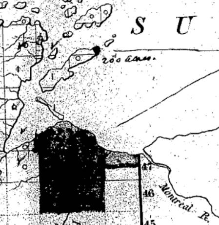
Detail of La Pointe Indian Reservation survey boundaries including Gichi-ziibiiwishenhnyan from a letter dated March 30th, 1855, written by the Commissioner John Wilson of the General Land Office to General Surveyor Warner Lewis.
~ National Archives Microfilm Publications; Microcopy No. 27; Roll 16; Volume 16.
These reservations are located in Wisconsin, the principal of which is for the LaPointe Band on Bad river – A large number of Indians now reside there and I presume it will ultimately become the home of most of the Chippewas residing in that state. It is a tract of land well adapted for Agricultural purposes and includes the present Missionary Station under the care of the American Board of Commissioners for Foreign Missions. About one third of the land however lying on the Lake Superior is swamp and valueless, except as it gives them access to the Lake for fishing purposes.
The other Wisconsin reservations lie on Lac de Flambeau and Lac Courteirelle in the Interior and the whole amount of land reserved in that state I estimate at about 200,000 acres exclusive of the Swamp land included in the LaPointe reservation. in the ceded Country there are two tracts set apart for the Indians – one on St Louis river of 100,000 acres for the Fond DuLac bands and one embracing the point bounded by the Lake and Pigeon river and containing about 120,000 acres.
There are two or three other small reservations to be hereafter selected under the direction of the President. The whole quantity of land embrace within all the tracts set apart we estimate at about 486,000 acres – No portion of the reserved lands are occupied by whites except the Missionary establishment on Bad river.
The provision going to each Half Breed family 80 acres of land was most strenuously insisted upon by the Indians. There are about 200 such families on my pay roll and allowing as many more to the Interior Indians which is a very liberal estimate, the amount of land required will be about 32,000 acres.
A principal source of embarrassment was the provision setting aside a portion of the consideration to be paid as the Chiefs might direct &c. In other words to pay their debts with. We had much difficulty in reducing the amount insisted upon to the sum stated in the treaty. I have no doubt that there are many just claims upon these Indians. The regular payment of their annuities was so long withheld that they were forced to depend to a great extent upon their traders. There claims that were all disposed to acknowledge and insisted upon providing for their payment and without the insertion of the provision referred to, we could not have concluded the treaty.
I regret very much that we could not have purchased the whole country and made the treaty in every particular within the limit of your instructions. But this was absolutely impossible and we were forced to the alternative of abandoning the attempt to treaty or of making the concessions detailed in the treaty.

Bureau of Indian Affairs Director
George W. Manypenny
~ Commons.Wikimedia.org
There are many points respecting which I should like much to make explanations, and for that purpose and in order to make a satisfactory settlement of the accounts for treaty purposes and in order to make a satisfactory settlement of the accounts for treaty expenses I respectfully request the privilege of attending at Washington at such time after making my other annuity payments as you may think proper.
Very Respectfully
Your Obt. Servt.
Henry C. Gilbert
Commissioner
Hon. Geo. W. Manypenny
Com. Ind. Affs.
Washington D.C.

Amorin, Thanks for sending this. Always very interesting, and especially how Gilbert’s attempts at urgency and secrecy must be interpreted with the wider scene that was America at the time. Jackson’s removal policy had been in effect for over 20 years, and the Cherokee fiasco was slipping into the past as the plains wars were heating up. Then there was the animosity between the Mississippi River Bands and the Lake Superior Bands, and of course those grasping traders and other “entrepreneurs” with their hands out. All of this did not allow for many of the usual gawking tourists of the day, but surely there was some of that going on. Gilbert’s estimate of 4,.000 Ojibwe persons on Madeline is also interesting. He laments the expense to feed this huge group. The written record’s description of the commissarial obligations on the part of the US officials at the 1825 Prairie du Chien treaty, with the slaughter of a significant number of cattle, comes to mind. I try to imagine the scene at the Madeline treaty grounds––the US government’s struggle to keep peace. Today with the new plaque in place, when over there I stand and struggle to envision what unfolded in that grassy space over 150 years ago. The Wheeler’s and Warren’s have left a useful––if not downright poignant––eye-witness account. Henry Gilbert’s Civil War death a few years later adds something. Yes, this is all quite interesting, but, again, here we are, pondering this historical event from documents written in American- English offering the view of the non-Ojibwe persons involved. I yearn for the voices of the Ojibwe themselves as they lived those years. The few written examples of the frustration of Buffalo and Blackbird come to mind. The voice we hear from today’s Ojibwe storytellers, writers, singers, artists, and other interpreters of history must be noted.
Sorry for thinking out loud,
HDP
My pleasure, Howard. I am glad to share these primary documents with an audience that is able to give them the analysis that these deserve, such as you. What I find interesting about this report is the lack of naming names as to who caused embarassment; I think Gilbert was alluding to the financial battle between Charles Borup & Charles Oakes with Julius Austrian for ownership of La Pointe during the early 1850’s. When I read primary government records about the 1854 Treaty of La Pointe, I cannot find anything that definitively locates the 30 days of treaty negotiations being at what is now known as the site of Treaty Hall (former home of Charles Oakes). Other records from 1852-1855 locate councils and annuities at or by Julius Austrian’s home (former home of Charles Borup), which leads me to conclude that the 1854 Treaty happened closer to where Tom’s Burnt Down Cafe is now than to where the Treaty Hall plaque is. The history of Treaty Hall as we know it may have been an embellishment made by George Francis Thomas who owned Treaty Hall decades later and was not present at either Treaty of La Pointe. Perhaps Treaty Hall is more closely associated with the 1842 Treaty? Either way, I agree with your thoughts about the need for more Ojibwe perspectives to bring balance to the more commonly found American-English documents in order to have a richer understanding of the 1854 Treaty between all parties involved. There are a few Ojibwe-English documents from persons that were present at the Treaty, such as Joseph Stoddard’s interview: https://chequamegonhistory.wordpress.com/2017/01/15/an-old-indian-settler/ I hope that more of these Ojibwe documents may be shared with a larger audience someday. It is also my hope that reproducing documents from any side of the 1854 Treaty will encourage a larger audience to seek and note the rich voices of Ojibwe oral history today.