Barber Papers: “In a Little Trouble” Winter of 1856
October 9, 2015
By Amorin Mello
Selected letters of the Joel Allen Barber Papers
… continued from Fall of 1855.
Minnesota Point Jan [23rd?] 1856
Dear Parents
It is sometime since I have wrote to you and for a fortnight or more
[???] [two lines on this copy are illegible] [??? ?????]
On arriving at Lapoint we found sheets from home and a good lot of newspapers.
We left Lapoint Thursday afternoon [on a firm of ?????? ? ?? head?] of [?????????] Nagonup the principal chief of all the Chippewas, Augustus and myself [??? ??? ?????] drawn by by two dogs on a dogtrain. At [????? ???????] were joined by one of Nagonup’s [??????].

Photograph of Naagaanab (Minnesota Historical Society).
They were on their way to Washington. Several of them are going accompanied by a gentleman from Lapointe as interpreter. The first night out we stayed in a wigwam with old Chingoon and his interesting family. Friday night we camped. Saturday reached Iron river. Sunday left and [comfortable?] – Monday came here. Augustus has a sore througt, not severe – otherwise we are well as usual notwithstanding our tramp of over [100?] miles. I must now quit writing and try to find one of our dogs which has strayed over to [???].
Under the old permit system, many locations, three miles square, were made on Lake Superior;- several on and near the Montreal river – some on Bad River, south of La Pointe – three on the main land, opposite La Pointe – two or three were made near Superior City, on the Nemadji, or Left Hand river, and one settler’s claim about twenty miles north of Superior.”
~ Mineral Regions of Lake Superior: As Known From Their First Discovery to 1865, by Henry Mower Rice, 1865[?].
Perhaps you wonder what we have made this journey for – perhaps you hope we are going below but that is not the case. Why should we [?????]. It is warmer here than at many places two or three hundred miles south of here. True – one or two thermometers froze up at this place but others did not while at Fort Snelling, the spirit thermometer inside the walls indicated 44 degrees below zero. Augustus wanted to see to his preemption and I had nothing to do but to come along with him. I also wanted to find out a few things concerning a place that I should like to preempt. I suppose there is not a better copper show on the south shore of the lake, but the land is not surveyed and my only sure way to get it is to settle on it and stick to it until it can be legally claimed.
The town lines will be run next summer.
Augustus is in a little trouble about his claim. It appears his declatory statement never reached the land office. But I guess it will all be explained and made right. The dutchman who was to contest his claim has left the country and would stand no chance if he was here. We have a land office here now which saves a great many journeys to Hudson near St. Paul. We shall go back in a few days and commence surveying around the islands. Now don’t fancy that we cannot survey in the winter, for we have tried it and know better.
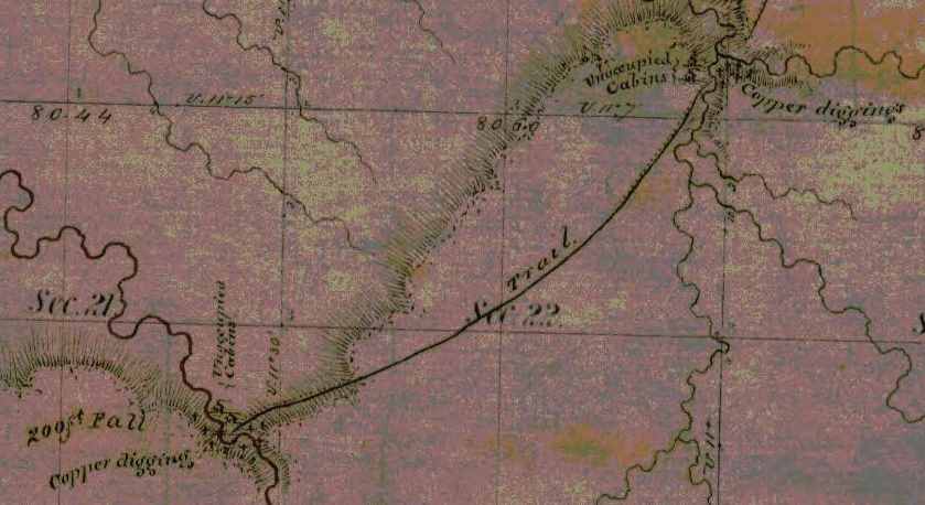
Detail from the Stuntz/Barber survey of T47N R14W.
“J.H. Bardon, a Superior pioneer, stated that ‘at Copper Creek and Black River Falls, twelve or fifteen miles south of Superior, and also near the Brule River, a dozen miles back from Lake Superior, Mr. Stuntz found evidences of mining and exploring for copper on a considerable scale carried on by the American Fur Company, under the direction of Borup and Oaks of La Pointe, in 1845-46. A tote road for the mines was opened from a point ten miles up the Nemadji River to Black River Falls.‘”
~ Duluth and St. Louis County, Minnesota; Their Story and People: An Authentic Narrative of the Past, with Particular Attention to the Modern Era in the Commercial, Industrial, Educational, Civic and Social Development, Volume 1, by Walter Van Brunt, 1921, page 66.
At Bad river we were at work during the coldest weather, and only lost two or three days because of cold but when the thermometer was up to 20* below zero we worked right ahead – sometimes in swamps where we stepped through the snow into the water,
[last line on this page of this copy is cut off]
The weather for a week or more has been fine. Cold enough to cover us with frost but not severe.
Provisions are very scarce – no flour or pork can be had.
They will begin to bring them through from St. Paul in a few days. Flour it is hoped can then be bought for $20 per barrel. Fish are not exactly plenty but they can be obtained for money or labor which is not the case with anything else. The country is flooded with dry goods, [p??y] articles and everything but provisions because they can be bought on time but eatables could only be got by paying cash down.
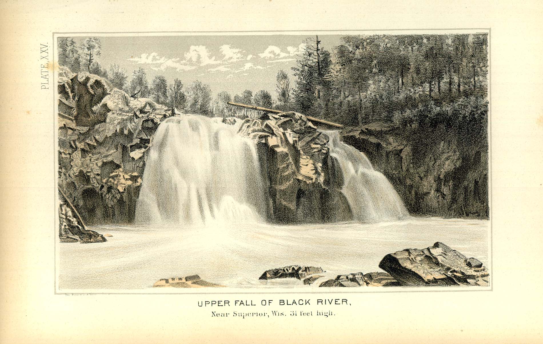
Geology of Wisconsin: Survey of 1873-1879,
Volume III, 1880, page 342[?].

Geology of Wisconsin: Volume 3, page 341.

Geology of Wisconsin: Volume 3, page 345.
The Fon du Lac mine has commenced operations with tolerable fair prospects. It is the only mine in operation this side of Montreal river. Augustus’ claim is on the same vein and for aught anyone knows just as good besides having abundance of water power. All the copper excitement since I come to the country has been directed toward the north shore. This morning I signed 2 petitions, one to congress for the early survey of the north shore and another for a road down that way. I have made a little map of the islands and last summers survey and some other things that I will enclose.
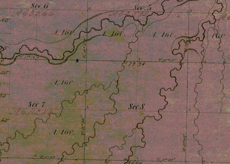
The Fond du Lac copper prospect was located near a small tributary of the Left Hand River on this map detail from T47N R14W, near Pattison State Park. Augustus’ claim was along the same vein of copper but had not been surveyed yet; perhaps it was at Amnicon Falls State Park.
Augustus has begun a letter to send with this. He has just come home with letters now about his claim.
No more at present from
Your affectionate son
J. Allen Barber
Direct to Lapoint
Minnesota Point
Superior County
Minn. Terr.
Sunday Feb 10th 1856
Dear Mother
Augustus has written a letter, and left it for me to enclose and dispatch so I thought I would ship in a few lines before sending it off.
Augustus started today with a young man and two dogs for Lapointe. I shall probably go there in a two or three weeks to return immediately. There are two men going down with a tamlins pony team with provisions from St. Paul for Augustus. The men are going to work for him and I shall probably bring the team back and use it a while. I have at last fixed my mind on a place that I mean to claim. The location is a point at the mouth of Left hand river, known as Left hand point. It contains only 5 or 6 acres in low & swampy and covered only with bushes coarse grass and floodwood. Nothing but the fact of its being a part of Superior city is of any value whatever.

Barber’s sketch of his land claim at the mouth of Left Hand River. This location is now an industrial neighborhood of Superior on the Nemandji River.
As it is $1,000.00 per acre is not an overestimate of its marketable price at present. It joins or is part of the grounds intended for the Railroad buildings when the survey was made here this point was cut off by the meander lines instead of meandered. Therefore according to the [rearns/records?] no such land exists.

A resurvey is to be made and I mean to fasten it by a preemption which is the only way to obtain it before the land sale. I may get cheated out of it and I may throw away my time and money but such chances are scarce and should it transpire that my claim is good I want to have my dish right side up for once. I have written for Uncle Allen’s advice and should I ever find it advisable to drop the matter I can do so without forfeiting my preemption right.
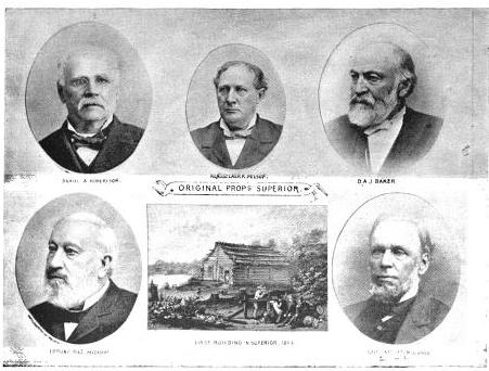
The Eye of the North-west, page 9.
The Superior Company with Company with which I shall probably have to contend is rich, influential, and on good terms with the administration. All that can be done by fair means or foul to defeat any claim will probably be done, but some things can be done as well as others, at any rate we shall see what we shall see.
So my head is so full of business just [snow?] you will please excuse the shortness of this letter and look for more when I have more time.
Your affectionate son
J Allen Barber
Superior Feb. 17th 1856
Dear Brother
It is sometime since I have written anything to you but you have heard of me so often that I suppose it makes no particular difference. It will be nearly sugaring time when you get this.

Makak: a semi-rigid or rigid container: a basket (especially one of birch bark), a box (Ojibwe People’s Dictionary) Photo: Densmore Collection; Smithsonian
I have once more got into a country where sugar is made but not by white men. The Indians make pretty good sugar which is generally done hard and [sinted?] dry and put into birch bark “mo’kucks” holding from 50 to 75 lbs. This bark is also used exclusively for buckets, store trays, gathering pails, &c. The timber in this country is not as equally distributed as in Vermont. The land is mostly covered with evergreens but there are some located portions of country where maple abounds. These “sugar bushes” as they are called are often quite extensive covering several sections and and [they?] only at intervals of 8 or 10 miles, but this is just as well for the Indians are both migratory and gregarious in their habits.
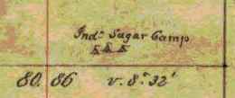
Detail of an Lake Superior Chippewa “sugar bush” from the Barber brothers’ survey of T48N R5W.
I hope you will eat plenty of sugar next spring and take some of the girls to a sugar party or two like I used to. I am doing nothing now most of the time but shall have business enough in a few days when I begin to build my house that is if I conclude to grab for the price of land I am now watching. I am waiting to hear from Uncle Allen and for some other things to transpire. There is not a man in the country whom I could trust that could give me any reliable information such as I want. I want you to hurry and become of age as soon as possible and come out here this spring and make a preemption.
There are some good places left yet, but don’t get married before you make a preemption for it might not be convenient to take your wife out into the woods 30 or 40 miles to live on the place as you would have to do in order to “prove up.” I am going to get up an ice boat before long which will be very useful as I mean to do considerable boating yet this winter, and I might use it to carry lumber and other things up and down the lake. With such winds as we have had a few days ago I could easily go to Lapointe and back in two days. I suppose Augustus got a party started by this time and he will be at it himself in a few days. I am living with a man named Fargo, you have heard of him before. We are living in Stuntz’ store. Board at the hotel is ten dollars per week. Old Steven Bonga is living on the point, he has been something of a traveller having been to Montreal, Hudson Bay, [Oregon?], Prairie du Chien, and all intermediate places.
He is half indian and half negro so you may suppose he is not very white.

Portrait of Stephen Bonga (USDA Forest Service). Additional information about Bonga is available from the Wisconsin Historical Society.
A railroad has been laid out from here to St. Paul and my claim covers the terminus at this end. There have two or three new towns started into existence along its route in imagination. Perhaps they are [surveyed?]. This making towns in a new country is a great business.
What happened in your good town on Christmas and New years eve
Were there any stockings left.
I want to inquire about lots of girls and boys in Johnson and Cambridge but I conclude you will tell me as much as you can in your next letter so with respects to all enquiring friends I remain
Your affectionate brother
Allen
Superior, Douglas Co. Feb. 25th 56
Dear Parents

Detail of Superior City from T49N R1W.
Night before last I got a letter and some papers from Augustus also 2 letters from home which he had read. They were dated Dec. [21st?] & Jan 2nd.
Sad and startling was the news of the death of George Hill. Who could have thought three years ago that such a dark future lay before that family. Every day some sad event warns me of the uncertainty of life. Men have died here who had no friends to mourn their loss, and their death is hardly noticed. I always ask myself why was it not me instead of them and will not my turn come soon. Yes, let it come soon or late as the world reckon, and it will be soon to me.
There is just as much danger or accidents in this country as in any other and no more but as to health there is no better place in the world than this. You seem shocked at the idea of surveying in the winter, but it will be nothing but fun to survey during the rest of the winter. It has been moderate pleasant weather now about two weeks. The snow is going off a little lately and it seems a little like spring. We had some pretty cold weather about new years but we shall have no more such. The lake is more open than it ever was known to be at this season before.
It sometimes freezes across at Lapointe but now it is open within six or eight miles of here. Flour is only $20 per bbl‑ with prospect of falling lower. The Indians chiefs have returned having only been to St. Paul where they found a letter telling them to delay their visit a while.
Poor creatures! They are fooled around by traders and speculators who are with the government in robbing and dwindling them. Any thing like a full account of their wrongs would astonish even them. About my claim I have not [???] today. There is another man after it and it will be no easy thing to carry my point.
Valuable property is troublesome stuff in this country. There is a townsight three miles from there now in litigation for which there is a standing offer of $200,000.
I am still living with Fargo on Minnesota point. I expect to go to Lapointe before long with Albert Stuntz who is going down with some supplies for Augustus which he brought from St. Paul.
It is too dark to write
Good bye
Allen
Superior, March 4th 56
Dear Parents
Not much has happened in this vicinity worth recording. The principle circumstances of note is the burning of a house and all the worldly possessions of a poor [Indian?].
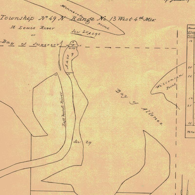
Detail of Left Hand River from Stuntz’s survey; where Barber’s land claim was located.
I have heard nothing of Augustus since writing last but expect to when anybody comes up the lake. About my claim I can say but little my chance is but dull still I don’t mean to give up so large a prize without good reasons.
I have had it surveyed and the notes sent to the Surveyor General with a memorial stating the facts and asking him to [appraise?] the [notes?].
The price contains over 8 acres (8.695).
Perhaps it occurred to you that I am was 22 years old last Sunday. Well such is unquestionably the case although nothing was done to celebrate the day only I had my hair cut for the third time after leaving Vermont. I think I shall have to go to Lancaster this spring but unless I get ousted here it will be difficult to leave.
I wish I could multiply myself by about a dozen in order to hold several valuable claims which are not occupied by any one who can legally hold them. I can’t write here two children [pretting?] and several people [telling?] Albert Stuntz and family are here today. I am perched on a sawhorse writing on a work bench loaded with all manner of [marbles?].
Evening – quiet once more since dark I have written a letter to the Surveyor General to accompany a memorial that I have been circulating. O I wish there was a person in the country that I could depend on to assist me in regard to that claim. There are one or two that I counsel with who know no more than I do and then I do as I think best.
I expect [Lowener?] to find out I have no show, and that will be the last of it I shall [not feel?] that I had lost it for I never had it, but if I don’t get it some body else will get 15 or 20 thousand dollars worth of land that I want.
Provisions are still high and will be higher again before navigation opens which cannot be expected before the 1st of May. Flour is $20/barrel, fresh pork 18 ¾ cents per lb, beef 20 cts milk 20 to 25 cts per qt. &c, &c. Eatables must be higher because there will be little or no sleighing after this over the barrens between here and St. Paul. My mind has been on the [rock?] so much today that I am not in a mood to think much about home so please excuse the shortness and dryness of this letter.
I remain your affectionate son
J Allen Barber
Went to Iron River Thursday 13
Returned 15th
Superior , Douglas Co. March 11 1856
Dear Parents
Yesterday I read a package of letters from Augustus containing one from him & from home one from Albe and one from [Caldridge?]. As Augustus was in town (Lapointe) when he recd. your letters I suppose he has answered them so I cannot tell you much news about him. I am still staying with Fargo – not doing much but hoping to get pay for my time and expense by securing the prize I am after. There is some excitement in town about it, but mighty little is said to me. The Register at the land office gives me good encouragement and says a preemption will hold it. I have taken some steps toward building on it. Today I bought a sack of flour ½ barrel for 12 dollars, I shall get some fish from Lapoint where they are very plenty and cheap and then I shall be almost ready to try housekeeping alone.

I am sorry to hear of the disastrous results of the low price of hops. Although farmers must suffer in consequence yet I believe speculators will make fortunes out of it. If I was in the business of raising them I should stick to it. No articles is so liable to fluctuations in prices as hops but it is well known that the risk fails once in five years on an average so they must come up sometime.
I see you are inclined to believe our country and climate are more in hospitable & forbidding than yours. Such I believe is not the case. We have had some very cold weather but the changes are so moderate and so seldom that we pay but little attention to the weather – in fact we call most all of it very fine weather, as it is. The lake is a great equalizer of temperatures and our cool lake atmosphere in summer causes showers to fall from all the warm, sweaty winds that come here to wash their faces in this big blue pond. People in this country go much better prepared for cold than they ever do in Vermont. I have not worn a boot since leaving Lancaster. We wear shoes in the summer and moccasins in winter.
Boots won’t do for surveyors – they carry too much water unless we stop to empty them after crossing every stream or marsh.
While speaking of clothes perhaps I might as well go on with a few more items of the same sort.
Shoes for this country should have no lining or binding as they are quicker and ae not as stiffwhen dry. We never apply anything to soften them and nothing can preserve them from wearing out in about two months of hard service. They [sell?] about $1.50 per pair. We can get plenty of wool hats which are the only ones we wear.
All manners of shirts can be bought, even the very best quality of red flannel ones, which are universally warm, outside, i.e. by common folks.
The gentry of Superior dress most distressingly.
It is difficult to get good socks any where on the country. I have worn out 6 or 7 pair this summer and lost some more – they cost high bests we don’t wear. I have none. The only cost I have is of [Gihon?] cloth and made by Mrs. Sheldon. Cost are not much more except as an extra garment to wear occasionally.
Good durable pants I find it difficult to get. They are generally poor [ashnet?] and not half put together. Good your mittens would be very acceptable but for want thereof buckskin or blanket mittens are generally warm.
You speak about bringing Kate [in?] to Wisconsin. My advice is to it without fail if you intend coming out to live, nothing should prevent it if I were in your place. The horse that Uncle [Jay?] brought out with him is smarter and tougher than any one he can find to use with him. There is nothing that I regard as more necessary for a family than a first rate horse. I think [Kelty?] will be a very good serviceable animal for work besides being one that you might be proud to ride [after?] over the prairies. Probably Augustus has told you what he thinks about Amherst and other boys coming out here to survey. Butler was so badly disappointed in this country that I have had but little thoughts of [enough?] any one else to come here. Such a disappointment I think would be the fate of 4 out of every 5 that try the business.
A person to be a surveyor must be able to travel all day through the woods and sometimes carry a pack. I would not prevent any from coming here as there is generally business enough besides surveying. A surveyor can make no greater mistake than by hiring any but the best of men. Perhaps Augustus has not told you that he will be out of the business as soon as his present job is done and will devote his time to the improvement of his claim &c. I should like very much to [have?] Amherst here but I dislike to have my parents left entirely alone. As I have [???] two half [sheets?] – when I only [illegible] mind up for the [present?].
[Incomplete copy of letter]
To be continued in the Spring of 1856…
La Pointe Bands Part 1
April 19, 2015
By Leo Filipczak

(Click to Enlarge)
On March 8th, I posted a map of Ojibwe people mentioned in the trade journals of Perrault, Curot, Nelson, and Malhoit as a starting point to an exploration of this area at the dawn of the 19th Century. Later the map was updated to include the journal of John Sayer.
In these journals, a number of themes emerge, some of which challenge conventional wisdom about the history of the La Pointe Band. For one, there is very little mention of a La Pointe Band at all. The traders discuss La Pointe as the location of Michel Cadotte’s trading depot, and as a central location on the lakeshore, but there is no mention of a large Ojibwe village there. In fact, the journals suggest that the St. Croix and Chippewa River basins as the place where the bulk of the Lake Superior Ojibwe could be found at this time.
In the post, I repeated an argument that the term “Band” in these journals is less identifiable with a particular geographical location than it is with a particular chief or extended family. Therefore, it makes more sense to speak of “Giishkiman’s Band,” than of the “Lac du Flambeau Band,” because Giishkiman (Sharpened Stone) was not the only chief who had a village near Lac du Flambeau and Giishkiman’s Band appears at various locations in the Chippewa and St. Croix country in that era.
In later treaties and United State’s Government relations, the Ojibwe came to be described more often by village names (La Pointe, St. Croix, Fond du Lac, Lac du Flambeau, Lac Courte Oreilles, Ontonagon, etc.), even though these oversimplified traditional political divisions. However, these more recent designations are the divisions that exist today and drive historical scholarship.
So what does this mean for the La Pointe Band, the political antecedent of the modern-day Bad River and Red Cliff Bands? This is a complicated question, but I’ve come across some little-known documents that may shed new light on the meaning and chronology of the “La Pointe Band.” In a series of posts, I will work through these documents.
This series is not meant to be an exhaustive look at the Ojibwe at Chequamegon. The goal here is much narrower, and if it can be condensed into one line of inquiry, it is this:
Fourteen men signed the Treaty of 1854 as chiefs and headmen of the La Pointe Band:
Ke-che-waish-ke, or the Buffalo, 1st chief, his x mark. [L. S.]
Chay-che-que-oh, 2d chief, his x mark. [L. S.]
A-daw-we-ge-zhick, or Each Side of the sky, 2d chief, his x mark. [L. S.]
O-ske-naw-way, or the Youth, 2d chief, his x mark. [L. S.]
Maw-caw-day-pe-nay-se, or the Black Bird, 2d chief, his x mark. [L. S.]
Naw-waw-naw-quot, headman, his x mark. [L. S.]
Ke-wain-zeence, headman, his x mark. [L. S.]
Waw-baw-ne-me-ke, or the White Thunder, 2d chief, his x mark. [L. S.]
Pay-baw-me-say, or the Soarer, 2d chief, his x mark. [L. S.]
Naw-waw-ge-waw-nose, or the Little Current, 2d chief, his x mark. [L. S.]
Maw-caw-day-waw-quot, or the Black Cloud, 2d chief, his x mark. [L. S.]
Me-she-naw-way, or the Disciple, 2d chief, his x mark. [L. S.]
Key-me-waw-naw-um, headman, his x mark. [L. S.]
She-gog headman, his x mark. [L. S.]
If we consider a “band” as a unit of kinship rather than a unit of physical geography, how many bands do those fourteen names represent? For each of those bands (representing core families at Red Cliff and Bad River), what is the specific relationship to the Ojibwe villages at Chequamegon in the centuries before the treaty?
The Fitch-Wheeler Letter
Chequamegon History spends a disproportionately large amount of time on Ojibwe annuity payments. These payments, which spanned from the late 1830s to the mid-1870s were large gatherings, which produced colorful stories (dozens from the 1855 payment alone), but also highlighted the tragedy of colonialism. This is particularly true of the attempted removal of the payments to Sandy Lake in 1850-1851. Other than the Sandy Lake years, the payments took place at La Pointe until 1855 and afterward at Odanah.
The 1857 payment does not necessarily stand out from the others the way the 1855 one does, but for the purposes of our investigation in this post, one part of it does. In July of that year, the new Indian Agent at Detroit, A.W. Fitch, wrote to Odanah missionary Leonard Wheeler for aid in the payment:
Office Michn Indn Agency
Detroit July 8th 1857
Sir,
I have fixed upon Friday August 21st for the distribution of annuities to the Chippewa Indians of Lake Supr. at Bad River for the present year. A schedule of the Bands which are to be paid there is appended.
I will thank you to apprise the LaPointe Indians of the time of payment, so that they should may be there on the day. It is not necessary that they should be there before the day and I prefer that they should not.
And as there was, according to my information a partial failure in the notification of the Lake De Flambeau and Lake Court Oreille Indians last year, I take the liberty to entrust their notification this year to you and would recommend that you dispatch two trusty Messengers at once, to their settlements to notify them to be at Bad River by the 21st of August and to urge them forward with all due diligence.
It is not necessary for any of these Indians to come but the Chiefs, their headmen and one representative for each family. The women and children need not come. Two Bands of these Indians, that is Negicks & Megeesee’s you will notice are to be notified by the same Messengers to be at L’Anse on the 7th of September that they may receive their pay there instead of Bad River.
I presume that Messengers can be obtained at your place for a Dollar a day each & perhaps less and found and you will please be particular about giving them their instructions and be sure that they understand them. Perhaps you had better write them down, as it is all important that there should be no misunderstanding nor failure in the matter and furthermore you will charge the Messenger to return to Bad River immediately, so that you may know from them, what they have done.
It is my purpose to land the Goods at the mo. of Bad River somewhere about the 1st of Aug. (about which I will write you again or some one at your place) and proceed at once to my Grand Portage and Fond Du Lac payments & then return to Bad River.
Schedule of the Bands of Chipps. of Lake Supr. to be notified of the payment at Bad River, Wisn to be made Friday August 21st for the year 1854.
____________________________
La Pointe Bands.
__________
Maw kaw-day pe nay se [Blackbird]
Chay, che, qui, oh, [Little Buffalo/Plover]
Maw kaw-day waw quot [Black Cloud]
Waw be ne me ke [White Thunder]
Me she naw way [Disciple]
Aw, naw, quot [Cloud]
Naw waw ge won. [Little Current]
Key me waw naw um [Canoes in the Rain] {This Chief lives some distance away}
A, daw, we ge zhick [Each Side of the Sky]
Vincent Roy Sen. {head ½ Breeds.}
Lakes De Flambeau & Court Oreille Bands.
__________
Keynishteno [Cree]
Awmose [Little Bee]
Oskawbaywis [Messenger]
Keynozhance [Little Pike]
Iyawbanse [Little Buck]
Oshawwawskogezhick [Blue Sky]
Keychepenayse [Big Bird]
Naynayonggaybe [Dressing Bird]
Awkeywainze [Old Man]
Keychewawbeshayshe [Big Marten]
Aishquaygonaybe–[End Wing Feather]
Wawbeshaysheence [Little Marten] {I do not know where this Band is but notify it.}
__________
And Negick’s [Otter] & Megeesee’s [Eagle] Bands, which (that is Negicks and Megeesees Bands only) are to be notified by the same Messengers to go to L’Anse the 7th of Sept. for their payt.
Very respectfully
Your Obedt Servt,
A W Fitch
Indn. Agent
Rev. L H Wheeler
Bad River msn.
Source: Wheeler Family Papers, Wisconsin Historical Society, Ashland, WI
This letter reveals that in 1857, three years after the Treaty of La Pointe called for the creation of reservations for the La Pointe, Lac du Flambeau, and Lac Courte Oreilles Bands, the existence of these bands as singular political entities was still dubious. The most meaningful designation attached to the bands in the instructions to Wheeler is that of the chief’s name.
Canoes in the Rain and Little Marten clearly live far from the central villages named in the treaty, and Nigig (Otter) and Migizi (Eagle) whose villages at this time were near Lac Vieux Desert or Mole Lake aren’t depicted as attached to any particular reservation village.

Edawigijig (Edawi-giizhig “Both Sides of the Sky”), 1880 (C.M. Bell, Smithsonian Digital Collections)
Additionally, Fitch makes no distinction between Red Cliff and Bad River. Jechiikwii’o (Little Buffalo) and Vincent Roy Sr. representing the La Pointe mix-bloods could be considered “Red Cliff” chiefs while the rest would be “Bad River.” However, these reservation-based divisions are clearly secondary to the kinship/leadership divisions.
This indicates that we should conceptualize the “La Pointe Band” for the entire pre-1860 historical period as several bands that were not necessarily all tied to Madeline Island at all times. This means of thinking helps greatly in sorting out the historical timeline of this area.
This is highlighted in a curious 1928 statement by John Cloud of Bad River regarding the lineage of his grandfather Edawi-giizhig (Each Side of the Sky), one of the chiefs who signed the 1854 Treaty), to E. P. Wheeler, the La Pointe-born son of Leonard Wheeler:
AN ABRAHAM LINCOLN INDIAN MEDAL
Theodore T. Brown
This medal was obtained by Rev. E. P. Wheeler during the summer of 1928 at Odanah, on the Bad River Indian Reservation, from John Cloud, Zah-buh-deece, a Chippewa Indian, whose grandfather had obtained it from President Abraham Lincoln. His grandfather, A-duh-wih-gee-zhig, was a chief of the La Pointe band of Chippewa. His name signifies “on both sides of the sky or day.” His father was Mih-zieh, meaning a “fish without scales.” The chieftain- ship of A-duh-wih-gee-zhig was certified to by the U. S. Commissioner of Indian Affairs on March 22, 1880.
His father, Mih-zieh, was one of the three chiefs who led the original migration of the Chippewa to Chequamegon Bay, the others being Uh-jih-jahk, the Crane, and Gih-chih-way-shkeenh, or the “Big Plover.” The latter was also sometimes known as Bih-zih-kih, or the “Buffalo.”
A-duh-wih-gee-zhig was a member of the delegation of Lake Superior Chippewa chiefs who went to Washington to see President Lincoln under the guidance of Benjamin G. Armstrong, during the winter of 1861…
~WISCONSIN ARCHEOLOGIST. Vol. 8, No. 3 pg.103
The three chiefs mentioned as leading the “original migration” are well known to history. Waabajijaak, the White Crane, was the father of Ikwezewe or Madeline Cadotte, the namesake of Madeline Island. According to his great-grandson, William Warren, White Crane was in the direct Crane Clan lineage that claimed chieftainship over the entire Ojibwe nation.
Mih-zieh, or Mizay (Lawyerfish) was a prominent speaker for the La Pointe band in the early 19th Century. According to Janet Chute’s research, he was the brother of Chief Buffalo, and he later settled at Garden River, the village of the great “British” Ojibwe chief Zhingwaakoons (Little Pine) on the Canadian side of the Sault.
Bizhiki, of course, is Chief Buffalo, the most famous of the La Pointe chiefs, who died in 1855. Gichi-Weshkii, his other name, is usually translated meaning something along the lines of “Great First Born,” “Great Hereditary Chief,” or more literally as “Great New One.” John Cloud and E. P. Wheeler identify him as the “Big Plover,” which is interesting. Buffalo’s doodem (clan) was the Loon, but his contemporary Zhingwaakoons was of the Plover doodem (Jiichiishkwenh in Ojibwe). How this potentially relates to the name of Buffalo’s son Jechiikwii’o (identified as “Snipe” by Charles Lippert) is unclear but worthy of further investigation.
The characterization of these three chiefs leading the “original migration” to Chequamegon stands at odds with everything we’ve ever heard about the first Ojibwe arrival at La Pointe. The written record places the Ojibwe at Chequamegon at least a half century before any of these chiefs were born, and many sources would suggest much earlier date. Furthermore, Buffalo and White Crane are portrayed in the works of William Warren and Henry Schoolcraft as heirs to the leadership of the “ancient capital” of the Ojibwes, La Pointe.
Warren and Schoolcraft knew Buffalo personally, and Warren’s History of the Ojibways even includes a depiction of Buffalo and Daagwagane (son of White Crane, great uncle of Warren) arguing over which of their ancestors first reached Chequamegon in the mists of antiquity. Buffalo and Daawagane’s exchange would have taken a much different form if they had been alive to see this “original migration.”
Still, Cloud and Wheeler’s statement may contain a grain of truth, something I will return to after filling in a little background on the controversies and mysteries surrounding the timeline of the Ojibwe bands at La Pointe.
TO BE CONTINUED
Chief Buffalo Picture Search: Introduction
May 26, 2013
Click the question mark under the picture to see if it shows Chief Buffalo.


 ?
?


Buffalo, the 19th-century chief of the La Pointe Ojibwe, is arguably the most locally-famous person in history of the Chequamegon region. He is best known for his 1852 trip to Washington D.C., undertaken when he was thought to be over ninety years old. Buffalo looms large in the written records of the time, and makes many appearances on this website.
He is especially important to the people of Red Cliff. He is the founding father of their small community at the northern tip of Wisconsin in the sense that in the Treaty of 1854, he negotiated for Red Cliff (then called the Buffalo Estate or the Buffalo Bay Reservation) as a separate entity from the main La Pointe Band reservation at Bad River. Buffalo is a direct ancestor to several of the main families of Red Cliff, and many tribal members will proudly tell of how they connect back to him. Finally, Buffaloʼs fight to keep the Ojibwe in Wisconsin, in the face of a government that wanted to move them west, has served as an inspiration to those who try to maintain their cultural traditions and treaty rights. It is unfortunate, then, that through honest mistakes and scholarly carelessness, there is a lot of inaccurate information out there about him.
During the early twentieth century, the people of Red Cliff maintained oral traditions about about his life while the written records were largely being forgotten by mainstream historians. However, the 1960s and ʻ70s brought a renewed interest in American Indian history and the written records came back to light. With them came no fewer than seven purported images of Buffalo, some of them vouched for by such prestigious institutions as the State Historical Society of Wisconsin and the U.S. Capitol. These images, ranged from well-known lithographs produced during Buffaloʼs lifetime, to a photograph taken five years after he died, to a symbolic representation of a clan animal originally drawn on birch bark. These images continue to appear connected to Buffalo in both scholarly and mainstream works. However, there is no proof that any of them show the La Pointe chief, and there is clear evidence that several of them do not show him.
The problem this has created is not merely one of mistaken identity in pictures. To reconcile incorrect pictures with ill-fitting facts, multiple authors have attempted to create back stories where none exist, placing Buffalo where he wasnʼt, in order for the pictures to make sense. This spiral of compounding misinformation has begun to obscure the legacy of this important man, and therefore, this study attempts to sort it out.
Bizhikiwag
The confusion over the images stems from the fact that there was more than one Ojibwe leader in the mid-nineteenth century named Bizhiki (Buffalo). Because Ojibwe names are descriptive, and often come from dreams, visions, or life experiences, one can be lead to believe that each name was wholly unique. However, this is not the case. Names were frequently repeated within families or even outside of families. Waabojiig (White Fisher) and Bugone-Giizhig (Hole in the Day) are prominent examples of names from Buffaloʼs lifetime that were given to unrelated men from different villages and clans. Buffalo himself carried two names, neither of which was particularly unique. Whites usually referred to him as Buffalo, Great Buffalo, or LaBoeuf, translations of his name Bizhiki. In Ojibwe, he is just as often recorded by the name Gichi-Weshkii. Weshkii, literally “new one,” was a name often given to firstborn sons in Ojibwe families. Gichi is a prefix meaning “big” or “great,” both of which could be used to describe Buffalo.

Nichols and Nyholm translate Bizhiki (Besheke, Peezhickee, Bezhike, etc.) as both “cow” and “buffalo.” Originally it meant “buffalo” in Ojibwe. As cattle became more common in Ojibwe country, the term expanded to include both animals to the point where the primary meaning of the word today is “cow” in some dialects. These dialects will use Mashkodebizhiki (Prairie Cow) to mean buffalo. However, this term is a more recent addition to the language and was not used by individuals named Buffalo in the mid- nineteenth century. (National Park Service photo)
One glance at the 1837 Treaty of St. Peters shows three Buffalos. Pe-zhe-kins (Bizhikiins) or “Young Buffalo” signed as a warrior from Leech Lake. “Pe-zhe-ke, or the Buffalo” was the first chief to sign from the St. Croix region. Finally, the familiar Buffalo is listed as the first name under those from La Pointe on Lake Superior. It is these two other Buffalos, from St. Croix and Leech Lake, whose faces grace several of the images supposedly showing Buffalo of La Pointe. All three of these men were chiefs, all three were Ojibwe, and all three represented their people in Washington D.C. Because they share a name, their histories have unfortunately been mashed together.
Who were these three men?

Treaty of St. Peters (1837) For more on Dagwagaane (Ta-qua-ga-na), check out the People Index.
The familiar Buffalo was born at La Pointe in the middle of the 18th century. He was a member of the Loon Clan, which had become a chiefly clan under the leadership of his grandfather Andeg-wiiyas (Crowʼs Meat). Although he was already elderly by the time the Lake Superior Ojibwe entered into their treaty relationship with the United States, his skills as an orator were such that by the Treaty of 1854, one year before his death, Buffalo was the most influential leader not only of La Pointe, but of the whole Lake Superior country.
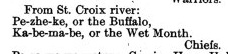
Treaty of St. Peters (1837) For more on Gaa-bimabi (Ka-be-ma-be), check out the People Index.
William Warren, describes the St. Croix Buffalo as a member of the Bear Clan who originally came to the St. Croix from Sault Ste. Marie after committing a murder. He goes on to declare that this Buffaloʼs chieftainship came only as a reward from traders who appreciated his trapping skills. Warren does admit, however, that Buffaloʼs influence grew and surpassed that of the hereditary St. Croix leaders.

Treaty of St. Peters (1837) For more on Flat Mouth, check out the People Index.
The “Young Buffalo,” of the Pillager or Leech Lake Ojibwe of northern Minnesota was a war chief who also belonged to the Bear Clan and was considerably younger than the other two Buffalos (the La Pointe and St. Croix chiefs were about the same age). As Biizhikiins grew into his later adulthood, he was known simply as Bizhiki (Buffalo). His mark on history came largely after the La Pointe Buffaloʼs death, during the politics surrounding the various Ojibwe treaties in Minnesota and in the events surrounding the US-Dakota War of 1862.
The Picture Search
In the coming months, I will devote several posts to analyzing the reported images of Chief Buffalo that I am aware of. The first post on this site can be considered the first in the series. Keep checking back for more.

