Edwin Ellis, M.D.
August 7, 2016
By Amorin Mello
Magazine of Western History Illustrated
November 1888
as republished in
Magazine of Western History: Volume IX, No.1, pages 21-24.
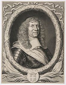
Edwin Ellis.

Portrait of Edwin Ellis, M.D. on page 20.
The subject of this sketch is a native of New England, and one of the “Oxford Bears,” having been in Peru, Oxford county, Maine, in 1824. His birthplace was on the banks of the Androscoggin river, among the mountains, a wild, romantic place. His ancestors came early from England to the Massachusetts colony, about the middle of the seventeenth century.
His maternal grandfather was in the Revolutionary army, and to the end of a long life was intensely patriotic and American in all his acts and thoughts. He bought one hundred and sixty acres of government land at the close of the War of the Revolution, on which he lived for more than seventy years, until his death. It still remains in the family. There were no roads in his neighborhood; and at first he was obliged to carry his corn and wheat to mill, for more than thirty miles, upon his shoulders and by a “spotted line.” He lived to break the ground for a railroad to his town and to see its completion.
Dr. Ellis received his early education in the New England common school, whose term was not more than three months in the year. At the age of fourteen years he began the study of Latin at home, going for occasional recitations to one of the celebrated Abbot family, who was a farmer in the town, some four miles distant. He was inclined to study the law, but his mother, who was a most conscientious woman, thought an honest lawyer could not live by his calling, often repeating to him this couplet –
“If I turn lawyer, I must lie and cheat,
For honest lawyers have no bread to eat.”
This had some influence upon him, and he chose the profession of medicine. He entered Waterville college (now Cobly university) in 1842, pursuing its first year’s course, when he began the study of medicine, teaching school in winter to raise money enough to pay his expenses, in which he was cheerfully assisted by his father to the extent of his means, which were very limited, he being a house carpenter and receiving the usual wages of those days of one dollar to one dollar and fifty cents per day.
Edwin Ellis graduated in medicine at the University of the city of New York, in March, 1846, being nearly twenty-two years of age. He at first settled at North New Portland, Maine. It was a frontier town, and the roads in such condition that he was obliged to travel on horseback, going sometimes forty miles in the night.
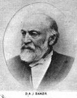
Brother-in-law Daniel A. J. Baker
~ The Eye of the North-west, pg. 9.
At the end of a year he settled in Farmington, Maine, where he had studied his profession, where, in 1847, he was married to Sophia S. Davis, who lived less than two years, leaving a daughter, Sophia Augusta, who married George H. Kennedy, who now lives at Ashland.
Dr. Ellis married Martha B. Baker of New Sharon, Maine, in 1850, a woman who has been a faithful and efficient wife for almost forty years. By her he has three children – Domelia, married to George C. Loranger of Calumet, Michigan; Edwin H., bookkeeper in the First National Bank of Ashland, and J. Scott, engaged in wood and coal at Ashland.
Dr. Ellis continued the practice of his profession in Maine, till 1854, with an increasing practice and fair prospects.
~ Minnesota Historical Society Collections: Volume XV, page 832.
But the west was then attracting much attention and the tide of emigration flowing with a strong current. His wife’s brother, Judge Baker of St. Paul, and been for several years in St. Paul, and his representations and inducements led him to sever his pleasant relations with the east and try his fortunes in the west. He with his family, wife and two children, reached St. Paul early in May, 1854. That year he carried on a farm where Merriam park now is, but he was not at home in this business, and abandoned it in the fall of that year.
The years 1852 to 1857 were years of great speculation throughout the northwest. Towns and cities, at least on paper, were springing up with marvelous rapidity. Men became, or seemed to become, suddenly rich by the rapid rise of farming lands and city lots. It was an era of strange speculation, demoralizing in its effects and leading to the terrible panic of 1857.
!["In 1845 [Warren Lewis] was appointed Register of the United States Land Office at Dubuque. In 1853 he was appointed by President Pierce Surveyor-General for Iowa, Wisconsin and Minnesota and at the expiration of his term was reappointed by President Buchanan." ~ The Iowa Legislature](https://chequamegonhistory.com/wp-content/uploads/2015/10/warner-lewis.jpg)
“In 1845 [Warren Lewis] was appointed Register of the United States Land Office at Dubuque. In 1853 he was appointed by President Pierce Surveyor-General for Iowa, Wisconsin and Minnesota and at the expiration of his term was reappointed by President Buchanan.”
~ The Iowa Legislature

Ellis was issued his title to 125.72 acres of land in Ashland on July 15th, 1858.
~ General Land Office Records

Downtown in Saint Paul during the financial panic of 1857.
~ Minnesota Historical Society
![Leonard Hemenway Wheeler ~ Unnamed Wisconsin by [????]](https://chequamegonhistory.com/wp-content/uploads/2016/03/leonard-hemenway-wheeler-from-unnamed-wisconsin.jpg)
Leonard Hemenway Wheeler
~ Unnamed Wisconsin, by John Nelson Davidson, 1895.
In 1877 he was appointed as county judge of Ashland county, by Governor Smith, to which he has been twice re-elected by his fellow-citizens. He is president of the First National Bank of Ashland. He has retired from the general practice of his profession, but is one of the surgeons of St. Joseph’s hospital, which he visits an hour each day. He is still active and deeply interested in all that concerns Ashland; has aided in securing the Holly system of water-works, the gas and electric works and the street railway. He is a firm believer in the Christian religion and in a personal God, whose guiding hand he recognizes in all the events of his life, and to whom he owes everything and to whom he desires to honor in all his journey of life, and is still alive to all efforts designed to improve and elevate the condition of his fellow-men.

Edwin Ellis, M.D., died in Ashland on May 3rd, 1903. This portrait and a posthumous biography of Dr. Ellis are available on pages 16-18 of Commemorative Biographical Record of the Upper Lake Region by J.H. Beers & Co., 1905.
Early Trails and Water Routes
August 3, 2016
By Amorin Mello

United States. Works Progress Administration:
Chippewa Indian Historical Project Records 1936-1942
(Northland Micro 5; Micro 532)
Abstract
“Records of a WPA project to collect Chippewa Indian folklore sponsored by the Great Lakes Indian Agency and directed by Sister M. Macaria Murphy of St. Mary’s Indian School, Odanah, Wisconsin. Included are narrative and statistical reports, interview outlines, and operational records; and essays concerning Chippewa religious beliefs and rituals, food, liquor, transportation, trade, clothing, games and dances, and history. Also includes copies of materials from the John A. Bardon collection concerning the Superior, Wisconsin region, La Pointe baptismal records, the family tree of Qui-ka-ba-no-kwe, and artwork of Peter Whitebird.”
Reel 1, Envelope 2, Item 1
Editor’s Note: This article is the result of the information given by the staff, also gleanings from the “Bardon Collection.”
EARLY TRAILS AND WATER ROUTES
~ Fifty Years in the Northwest, by W. H. C. Folsom, 1888, page 258.
Bardon in his Collections says, “From the earliest times, the waterways were the Red Man’s highways: naturally the fur-trader, explorer, and missionary followed the same routes.”
For hundreds of years before the white man came to live in this country, the Indians rarely traveled on land except to portage their canoes in taking short cuts from one body of water to another, thus cutting off considerable distance for extensive traveling. Then, too, game was plentiful on the banks of rivers and lakes. For these reasons the Indian preferred traveling by water to that of land.
For the white man in the early 50’s as well as for the Indian, transportation could be carried on only by water in the lowlands and by trails in the uplands, therefore, canoes were extensively used in the former and quite commonly employed in the latter, for the highlands, too, and their lakes and streams.
Water Routes
An important route connecting the Great Lakes and the Mississippi was by way of the Brule and the St. Croix Rivers. This water route began at Lake Superior, ascended the Brule River to Lake St. Croix then descended the St. Croix River to the Mississippi. The first eastern settler, missionaries, explorers, traders and Indians used this route very extensively.
Another route connecting Lake Superior and the Mississippi River was made by the historian, Schoolcraft, over a hundred years ago. This historic water route began at Chequamegon Bay, ascended the Bad River, and descended the Namekagon and the St. Croix Rivers to the Mississippi.
A route by way of Fish Creek from Chequamegon Bay was also important. Indian travelers portaged their canoes from Fish Creek to White River and down this river for several miles and again portaged to Lake Namakagon, from thence to Namakagon River, thence to the St. Croix and down to the Mississippi. This same route could be taken to the Flambeau and the Wisconsin Rivers by going upstream on the St. Croix.
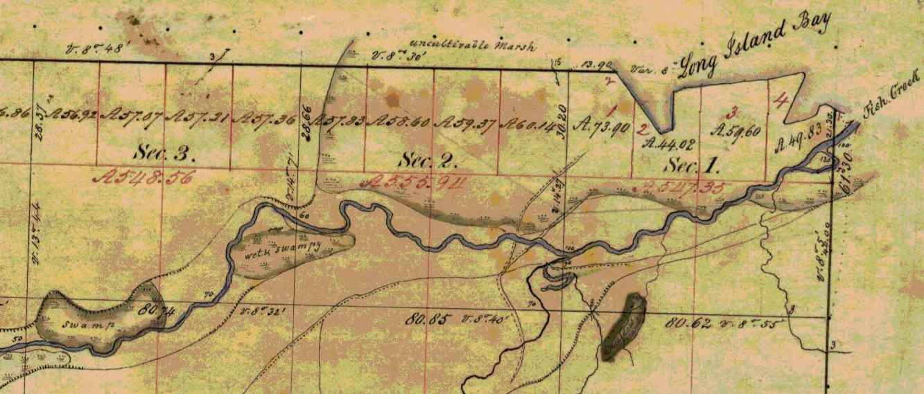
Several trails converged at the mouth of Fish Creek on Chequamegon Bay. ~ Wisconsin Public Land Survey Records
Trails
In traveling by trail most Indians traveled on foot, but many used dog-teams and toboggans, and in some cases, ponies. The Lake Superior region was a permanent camping ground for the Chippewa. This country for many miles around, and numerous trails branching off in all directions, far too many for us to mention each individually. Here we shall point out only the more important ones.
Talking Trail
“Talking Trail”, was so named on account of its beginning at a popular meeting or camping site situated where the city of Washburn now stands. “Talking Trail” began at this camping ground, thence it extended south, to Fish Creek, then south-west for a few miles, finally west to Superior, thus connecting Chequamegon Bay and Superior.
The “Talking Trail” began at the mouth of Vanderventer Creek near Washburn, and was also known as the “Council Trail.”
~ Wisconsin Public Land Survey Records
Bad River Trail
Whether or not this old trail was specifically known as designated above, the title is quite appropriate, since it began at the Leihy Mill on Bad River, Odanah, ran south to Tyler’s Forks, thence to Lake Namakagon and on to Lac Court Oreilles Reservation.
Indian War Trail
The reason for this name is evident: This trail was much used by the Chippewa in time of strife with the Sioux. The War Trail ran east to Montreal River and on to Porcupine Mountains, then to Ontonagon, thence to the copper country, including L’Anse and Marquette, Michigan. Mrs. Frank La Fernier of the Bad River Reservation, (1937) whose father, Mr. James lived to the age of one hundred-three years, corroborated this statement. Mr. James carried United States mail over this trail from our section of the country.
Moccasin Mike Trail

Chief Joseph Ozaagii was a cosigner of the 1854 Treaty at La Pointe on behalf of the Fond Du Lac Band.
~ Geni.com
“Moccasin Mike Trail”, was only another name for the “Osaugee1 Trail”. It was one of the most historic trails, and was evidently named after the local chief, Osaugee, who was the father-in-law of Charles Lord, a latter resident of Solon Springs, but originally a pioneer Quebec trader and voyageur.
This famous trail extended from the south of the St. Louis River, down Wisconsin Pointe, thence along the southern shore of Lake Superior to La Pointe, Bayfield, Ashland, Ontonagon, and the “Copper Country” of Michigan.
A branch of this trail led south, along the Montreal River to central Wisconsin, and was the route of the fur trader from Lake Superior to Green Bay. In the late 50’s and early 60’s, this trail was the land route East and South, and was much used by the early missionaries, traders and pioneer settlers. It became the regular mail route between all “south shore” points. Owen Sheridan and R.S. Mclean were two of the early mail carriers on this trail, packing on foot during the summer and fall, and travelling by dog team in winter.

“Osawgee Beach” postcard, circa 1920.
~ Zenith City Online
When Superior was started in 1853, a new branch of this trail began at the Nemadji River crossing and followed the mainland east, practically along the present high-ways 10 and 2, through what is now Alloues and Itasca, then east over the route of the present drive to an intersection with the main trail near Dutchman’s Creek. The early settlers remember it well. The density of the woods through which it passed kept the trail free from drifting snows and cutting winter winds. Snow shoes, toboggans, and dog teams were a powerful aid to travelers over this early trail.

Detail of Michael S. Bright Sr.‘s trading post on Saint Louis Bay near Oneota (West Duluth).
~ General Land Office Records
With the march of civilization, the settler, and the coming of regularly laid out roads, this intensely historic trail became practically eliminated. In the early 90’s, the Board of Douglas County in conjunction with the city of Superior saw the need of an all-year-round road to Lake Superior and Wisconsin Point. The project was sponsored by Michael S. Bright, now of Duluth, then a member of the County Board from the second ward of Superior. As the Supervisor of the Ward was always dubbed some Indian name, Mr. Bright fell heir to the sobriquet of “Moccasin Mike”. Because the rejuvenated road followed the old Osaugee Trail, and Mr. Bright had been very active in its building, the County Board officially designated the new road: “The Moccasin Mike Trail”.
1 Chief Osaugee was one of the signers of the important Treaty with the Chippewa in 1854. In Vol 2 “Treaties”, compiled by Chas. J. Kappler, the chief’s name is spelled: O sau’gee. The Chippewa spelling is: Osagi, the a being pronounced like a in ah, and the i like e in he.
TRAILS BECOME HIGHWAYS
“… the navigable waters leading into the Mississippi and St. Lawrence, and the carrying places between the same, shall be common highways and forever free …”
Many of the old Indian trails, especially those bordering on the southern shores of Lake Superior, have become permanent highways, and a number of these took their rise in our own village of Odanah. One of these led to Lac du Flambeau, and is now our present U.S. No. 2.
Over-Ridge Trail
This one-time Indian trail ran through Hurley, Wisconsin, Ironwood, Bessemer, Wakefield, and beyond Marinesco, Michigan, where it turned south to Lac du Flambeau. The Indians called the trail: “Ka-ke-way-wa-jwie-no-con”, meaning – “Over Ridge Trail”. At the turning point, it was necessary to cross a small river called “Ka-ba-no-ti-go-ge-wung” or “Presque Isle River”.
White River Trail
Another old Indian trail, leading West out of Odanah followed the [????] of our present U.S. No. 2; after crossing the Chicago and North Western railroad just a few feet west of the steel Railroad Bridge at the west entrance of the village, this trail entered the outskirts of Ashland where it turned directly towards Lake Superior. From thence it followed what is now Front Street in Ashland, turning south at the present site of the Knight Hotel. Following Ellis Avenue, it later crossed “Wa-bi-si-bi,” or White River. Mr. Scott, one of our historical staff says, “At that time there was a solid jam of flood wood at that point. Elm trees blew down on top of the jam, making it sufficiently solid for all kinds of Indian traffic.”

Detail of trails in Ashland east to Odanah and south to the White River. ~ Wisconsin Public Land Survey Records
This Indian Trail ran through Fifield, Wisconsin then straight east to Lac du Flambeau, from thence to Wausau, which was one of the trading posts of the early days. It is now our present U.S. Highway, No. 13.
N.B. An old wagon road known as the St. Paul Road was once a trail when the United States mail was carried on foot. In later years a wagon road was constructed by the War Department for military purposes.
See article following on “Military or St. Paul Road,” By W.P. Bigboy.
Reel 1, Envelope 2, Item 2
MILITARY, OR ST. PAUL, ROAD
By W.P. Bigboy
The road referred to in the “Recollections of Joseph Bell,” was the old military, or St. Paul, road, built by the government during the Civil War.
It followed the trail blazed out in earlier years by “Old Michel Buskey,” later identified as a keeper of a stopping place along this route. These hostelries could be found along the entire route and were for the accommodation and convenience of the early mail packers and travelers, who in the pursuit of their regular missions found the water ways or routes an impediment in the early and proper discharge of their assigned duties. Their locations were spaced by about twenty miles, and in most cases homesteads located near lakes were designated as such. Here mail carriers and other weary travelers, becoming too fatigued to continue farther, could pause and rest, and then continue on their way.
Leaving Bayfield, the first stopping place was at Moose Lake and the second at Loon Lake. These two places were located between Iron River and Bayfield, somewhere in the “Barrens.” The third stop was at Spider Lake. Here lived “Old Michel Buskey,” original trail blazer. His sunny disposition led to the designation of his cheery home as one of the stopping places; and for many years, not only the mail carriers, but many other weary travelers enjoyed the hospitality rendered by this family.
Leaving this place the next stopping place was at Island Lake, near Barnes of today. The next or fifth stop was at Gordon considered the crossroad of the country. Here the traveler usually made an over-night-stop, and enjoyed the hospitality of the village founder, Antoine Gordon.
From Gordon the road continued in a southwesterly direction until it reach near where the Namakagon empties into the St. Croix River. Here John Morrison, the grandfather of the Odanah Morrison, maintained a small hostelry for the accommodation of the traveling public for years. From there the road continued on to Yellow Lake, where another stopping place was located, then the road continued on to St. Croix Falls, where the traffic was ferried across the St. Croix, thence continuing on to St. Paul.
The road was not turnpiked as are the roads of today, but deep gullies and ravines were bridged with stout timbers and lumber, strong enough to bear the heavier armament of the United States Army in the event it became necessary to use the road for the transportation of army equipment.
Reel 1, Envelope 12, Item 3.
EARLY EXPERIENCE
Statement of Joseph Bell, [90?] yrs.
Interviewed by Dan Morrison.
I am in no position to give you much of a story that anyone would care to read, as I am not educated. During my childhood days we did not have the opportunity of going to school that the children now have, and all that I know is what I picked up myself. I have a few things in mind, however, that may be of interest to the present and succeeding generations, pertaining to some old people who were brought up at La Pointe on Madeline Island.

Portrait of Antoine Gordon from Noble Lives of a Noble Race by St. Mary’s Industrial School (Odanah), page 207.
I will tell you about William Gordon’s father raised on Madeline Island, who belongs ot the Lake Superior Band of Chippewa Indians. In the very early days when the United States Government caused roads to be built for the purpose of opening up the country, one of the first roads to be constructed ran from Bayfield to Eau Claire Lakes. This road opened up a vast section of the country, and when new roads were built in those times, people, as a rule, followed in quest for new locations and homes. William Gordon’s [illegible] father did just this. He followed the road from the starting point at Bayfield, running south for some distance, thence west to what they call Moose Lake. This was known as the first station and stopping place. The second station or stopping place was Moon Lake. The third station was at Spider Lake, known now as Silver Lake. The fourth place was Gordon’s, where William Gordon’s father settled. The present town of Gordon represents the first settlement of William Gordon’s father. The fifth stopping place was Yellow River; the sixth, Grantsburg and the seventh, was St. Croix Falls. This was the last stopping place as far as I remember.

The 1820 Cass-Schoolcraft expedition mapped the “Great Trail to the Folle Avoines Country” beginning at the mouth of the Sioux River.
~ Narrative journal of travels from Detroit northwest through the great chain of American lakes to the sources of the Mississippi River in the year 1820, by Henry Rowe Schoolcraft, page 105.
As I said before, these roads opened up a beautiful section of the country, full of wild game, plenty of fur-bearing animals, with many lakes and rivers where fishing was at its best. one could easily make a good living by hunting and trapping, and there was always plenty to eat. Many of the Indians who lived at La Pointe on Madeline Island left the island, following the direction of the newly constructed road. Though they were members of the La Pointe Band of the Lake Superior Chippewa, many remained in the new settlements, and the Indians remaining along the St. Croix River and other adjacent places finally lost their identity on the La Pointe Band and were later known as the “Lost Tribe.”
My great grandfather told me that the Chippewa lived on the south side of Lake St. Croix and the Sioux Indians lived on the north side, both claiming ownership of the St. Croix River. The question of full right of the St. Croix River kindled a feeling of animosity between the two tribes, and failing to arrive at any suitable agreement, war was declared between them, the aim of which was to settle the ownership of the river once and for all. In these encounters the Chippewa conquered the Sioux, driving them out of the country entirely. In their retreat, the Sioux followed a westerly direction, finally stopping where the city of St. Paul stands today.
Historic Sites on Chequamegon Bay
July 25, 2016
By Amorin Mello
Historical Sites on Chequamegon Bay was originally published in Collections of the State Historical Society of Wisconsin: Volume XIII, by Reuben Gold Thwaites, 1895, pages 426-440.
HISTORIC SITES ON CHEQUAMEGON BAY.1
—
BY CHRYSOSTOM VERWYST, O.S.F.
Reverend Chrysostome Verwyst, circa 1918.
~ Wisconsin Historical Society
One of the earliest spots in the Northwest trodden by the feet of white men was the shore of Chequamegon Bay. Chequamegon is a corrupt form of Jagawamikong;2 or, as it was written by Father Allouez in the Jesuit Relation for 1667, Chagaouamigong. The Chippewas on Lake Superior have always applied this name exclusively to Chequamegon Point, the long point of land at the entrance of Ashland Bay. It is now commonly called by whites, Long Island; of late years, the prevailing northeast winds have caused Lake Superior to make a break through this long, narrow peninsula, at its junction with the mainland, or south shore, so that it is in reality an island. On the northwestern extremity of this attenuated strip of land, stands the government light-house, marking the entrance of the bay.

William Whipple Warren, circa 1851.
~ Commons.Wikimedia.org
W. W. Warren, in his History of the Ojibway Nation3, relates an Indian legend to explain the origin of this name. Menabosho, the great Algonkin demi-god, who made this earth anew after the deluge, was once hunting for the great beaver in Lake Superior, which was then but a large beaver-pond. In order to escape his powerful enemy, the great beaver took refuge in Ashland Bay. To capture him, Menabosho built a large dam extending from the south shore of Lake Superior across to Madelaine (or La Pointe) Island. In doing so, he took up the mud from the bottom of the bay and occasionally would throw a fist-full into the lake, each handful forming an island, – hence the origin of the Apostle Islands. Thus did the ancient Indians, the “Gété-anishinabeg,” explain the origin of Chequamegon Point and the islands in the vicinity. His dam completed, Menabosho started in pursuit of the patriarch of all the beavers ; he thinks he has him cornered. But, alas, poor Menabosho is doomed to disappointment. The beaver breaks through the soft dam and escapes into Lake Superior. Thence the word chagaouamig, or shagawamik (“soft beaver-dam”), – in the locative case, shagawamikong (“at the soft beaver-dam”).
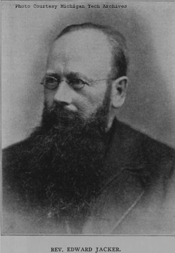
Reverend Edward Jacker
~ FindAGrave.com
Rev. Edward Jacker, a well-known Indian scholar, now deceased, suggests the following explanation of Chequamegon: The point in question was probably first named Jagawamika (pr. shagawamika), meaning “there are long, far-extending breakers;” the participle of this verb is jaiagawamikag (“where there are long breakers”). But later, the legend of the beaver hunt being applied to the spot, the people imagined the word amik (a beaver) to be a constituent part of the compound, and changed the ending in accordance with the rules of their language, – dropping the final a in jagawamika, making it jagawamik, – and used the locative case, ong (jagawamikong), instead of the participial form, ag (jaiagawamikag).4
The Jesuit Relations apply the Indian name to both the bay and the projection of land between Ashland Bay and Lake Superior. our Indians, however, apply it exclusively to this point at the entrance of Ashland Bay. It was formerly nearly connected with Madelaine (La Pointe) Island, so that old Indians claim a man might in early days shoot with a bow across the intervening channel. At present, the opening is about two miles wide. The shores of Chequamegon Bay have from time immemorial been the dwelling-place of numerous Indian tribes. The fishery was excellent in the bay and along the adjacent islands. The bay was convenient to some of the best hunting grounds of Northern Wisconsin and Minnesota. The present writer was informed, a few years ago, that in Douglas county alone 2,500 deer had been killed during one short hunting season.5 How abundant must have been the chase in olden times, before the white had introduced to this wilderness his far-reaching fire-arms! Along the shores of our bay were established at an early day fur-trading posts, where adventurous Frenchmen carried on a lucrative trade with their red brethren of the forest, being protected by French garrisons quartered in the French fort on Madelaine Island.
From Rev. Henry Blatchford, an octogenarian, and John B. Denomie (Denominé), an intelligent half-breed Indian of Odanah, near Ashland, the writer has obtained considerable information as to the location of ancient and modern aboriginal villages on the shores of Chequamegon Bay. Following are the Chippewa names of the rivers and creeks emptying into the bay, where there used formerly to be Indian villages:

Charles Whittlesey documented several pictographs along the Bad River.
Mashki-Sibi (Swamp River, misnamed Bad River): Up this river are pictured rocks, now mostly covered with earth, on which in former times Indians engraved in the soft stone the images of their dreams, or the likenesses of their tutelary manitous. Along this river are many maple-groves, where from time immemorial they have made maple-sugar.
Makodassonagani-Sibi (Bear-trap River), which emptties into the Kakagon. The latter seems in olden times to have been the regular channel of Bad River, when the Bad emptied into Ashland Bay, instead of Lake Superior, as it now does. Near the mouth of the Kakagon are large wild-rice fields, where the Chippewas annually gather, as no doubt did their ancestors, great quantities of wild rice (Manomin). By the way, wild rice is very palatable, and the writer and his dusky spiritual children prefer it to the rice of commerce, although it does not look quite so nice.
Bishigokwe-Sibiwishen is a small creek, about six miles or so east of Ashland. Bishigokwe means a woman who has been abandoned by her husband. In olden times, a French trader resided at the mouth of this creek. He suddenly disappeared, – whether murdered or not, is not known. His wife continued to reside for many years at their old home, hence the name.
Nedobikag-Sibiwishen is the Indian name for Bay City Creek, within the limits of Ashland. Here Tagwagané, a celebrated Indian chief of the Crane totem, used occasionally to reside. Warren6 gives us a speech of his, at the treaty of La Pointe in 1842. This Tagwagané had a copper plate, an heirloom handed down in his family from generation to generation, on which were rude indentations and hieroglyphics denoting the number of generations of that family which had passed away since they first pitched their lodges at Shagawamikong and took possession of the adjacent country, including Madelaine Island. From this original mode of reckoning time, Warren concludes that the ancestors of said family first came to La Pointe circa A. D. 1490.

Detail of “Ici était une bourgade considerable” from Carte des lacs du Canada by Jacques-Nicolas Bellin, 1744.
~ Wisconsin Historical Society
Metabikitigweiag-Sibiwishen is the creek between Ashland and Ashland Junction, which runs into Fish Creek a short distance west of Ashland. At the junction of these two creeks and along their banks, especially on the east bank of Fish Creek, was once a large and populous Indian village of Ottawas, who there raised Indian corn. It is pointed out on N. Bellin’s map (1744)7, with the remark, Ici était une bourgade considerable (“here was once a considerable village”). We shall hereafter have occasion to speak of this place. The soil along Fish Creek is rich, formed by the annual overflowage of its water, leaving behind a deposit of rich, sand loam. There a young growth of timber along the right bank between the bay and Ashland Junction, and the grass growing underneath the trees shows that it was once a cultivated clearing. It was from this place that the trail left the bay, leading to the Chippewa River country. Fish Creek is called by the Indians Wikwedo-Sibiwishen, which means “Bay Creek,” from wikwed, Chippewa for bay; hence the name Wikwedong, the name they gave to Ashland, meaning “at the bay.”

Whittlesey Creek (National Wildlife Refuge) was named after Asaph Whittlesey, brother of Charles Whittlesey. Photo of Asaph, circa 1860.
~ Wisconsin Historical Society
According to Blatchford, there was formerly another considerable village at the mouth of Whittlesey’s Creek, called by the Indians Agami-Wikwedo-Sibiwishen, which signifies “a creek on the other side of the bay,” from agaming (on the other side of a river, or lake), wikwed (a bay), and sibiwishen (a creek). I think that Fathers Allouez and Marquette had their ordinary abode at or near this place, although Allouez seems also to have resided for some time at the Ottawa village up Fish Creek.
A short distance from Whittlesey’s Creek, at the western bend of the bay, where is now Shore’s Landing, there used to be a large Indian village and trading-post, kept by a Frenchman. Being at the head of the bay, it was the starting point of the Indian trail to the St. Croix country. Some years ago the writer dug up there, an Indian mound. The young growth of timber at the bend of the bay, and the absence of stumps, indicate that it had once been cleared. At the foot of the bluff or bank, is a beautiful spring of fresh water. As the St. Croix country was one of the principal hunting grounds of the Chippewas and Sioux, it is natural there should always be many living at the terminus of the trail, where it struck the bay.
From this place northward, there were Indian hamlets strung along the western shore of the bay. Father Allouez mentions visiting various hamlets two, three, or more (French) leagues away from his chapel. Marquette mentions five clearings, where Indian villages were located. At Wyman’s place, the writer some years ago dug up two Indian mounds, one of which was located on the very bank of the bay and was covered with a large number of boulders, taken from the bed of the bay. In this mound were found a piece of milled copper, some old-fashioned hand-made iron nails, the stem of a clay pipe, etc. The objects were no doubt relics of white men, although Indians had built the mound itself, which seemed like a fire-place shoveled under, and covered with large boulders to prevent it from being desecrated.
Boyd’s Creek is called in Chippewa, Namebinikanensi-Sibiwishen, meaning “Little Sucker Creek.” A man named Boyd once resided there, married to an Indian woman. He was shot in a quarrel with another man. One of his sons resides at Spider Lake, and another at Flambeau Farm, while two of his grand-daughters live at Lac du Flambeau.
Further north is Kitchi-Namebinikani-Sibiwishen, meaning “Large Sucker Creek,” but whites now call it Bonos Creek. These two creeks are not far apart, and once there was a village of Indians there. It was noted as a place for fishing at a certain season of the year, probably in spring, when suckers and other fish would go up these creeks to spawn.
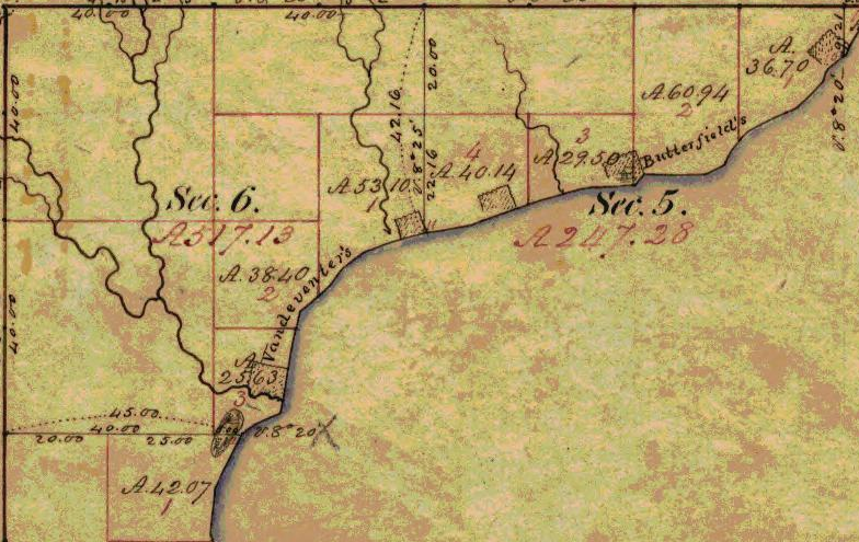
At Vanderventer’s Creek, near Washburn, was the celebrated Gigito-Mikana, or “council-trail,” so called because here the Chippewas once held a celebrated council; hence the Indian name Gigito-Mikana-Sibiwishen, meaning “Council-trail Creek.” At the mouth of this creek, there was once a large Indian village.
There used also to be a considerable village between Pike’s Bay and Bayfield. It was probably there that the celebrated war chief, Waboujig, resided.

John Baptiste Denomie
~ Noble Lives of a Noble Race, A Series of Reproductions by the Pupils of Saint Mary’s, Odanah, Wisconsin, page 213-217.
There was once an Indian village where Bayfield now stands, also at Wikweiag (Buffalo Bay), at Passabikang, Red Cliff, and on Madelaine Island. The writer was informed by John B. Denomie, who was born on the island in 1834, that towards Chabomnicon Bay (meaning “Gooseberry Bay”) could long ago be seen small mounds or corn-hills, now overgrown with large trees, indications of early Indian agriculture. There must have been a village there in olden times. Another ancient village was located on the southwestern extremity of Madelaine Island, facing Chequamegon Point, where some of their graves may still be seen. It is also highly probable that there were Indian hamlets scattered along the shore between Bayfield and Red Cliff, the most northern mainland of Wisconsin. There is now a large, flourishing Indian settlement there, forming the Red Cliff Chippewa reservation. There is a combination church and school there at present, under the charge of the Franciscan Order. Many Indians also used to live on Chequamegon Point, during a great part of the year, as the fishing was good there, and blueberries were abundant in their season. No doubt from time immemorial Indians were wont to gather wild rice at the mouth of the Kakagon, and to make maple sugar up Bad River.

Illustration from The Story of Chequamegon Bay, Collections of the State Historical Society of Wisconsin: Volume XIII, 1895, page 419.
We thus see that the Jesuit Relations are correct when they speak of many large and small Indian villages (Fr. bourgades) along the shores of Chequamegon Bay. Father Allouez mentions two large Indian villages at the head of the bay – the one an Ottawa village, on Fish Creek; the other a Huron, probably between Shore’s Landing and Washburn. Besides, he mentions smaller hamlets visited by him on his sick-calls. Marquette says that the Indians lived there in five clearings, or villages. From all this we see that the bay was from most ancient times the seat of a large aboriginal population. Its geographical position towards the western end of the great lake, its rich fisheries and hunting grounds, all tended to make it the home of thousands of Indians. Hence it is much spoken of by Perrot, in his Mémoire, and by most writers on the Northwest of the last century. Chequamegon Bay, Ontonagon, Keweenaw Bay, and Sault Ste. Marie (Baweting) were the principal resorts of the Chippewa Indians and their allies, on the south shore of Lake Superior.
“Front view of the Radisson cabin, the first house built by a white man in Wisconsin. It was built between 1650 and 1660 on Chequamegon Bay, in the vicinity of Ashland. This drawing is not necessarily historically accurate.”
~ Wisconsin Historical Society
The first white men on the shores of Chequamegon Bay were in all probability Groseilliers and Radisson. They built a fort on Houghton Point, and another at the head of the bay, somewhere between Whittlesey’s Creek and Shore’s Landing, as in some later paper I hope to show from Radisson’s narrative.8 As to the place where he shot the bustards, a creek which led him to a meadow9, I think this was Fish Creek, at the mouth of which is a large meadow, or swamp.10
After spending six weeks in the Sioux country, our explorers retraced their steps to Chequamegon Bay, arriving there towards the end of winter. They built a fort on Houghton Point. The Ottawas had built another fort somewhere on Chequamegon Point. In travelling towards this Ottawa fort, on the half-rotten ice, Radisson gave out and was very sick for eight days; but by rubbing his legs with hot bear’s oil, and keeping them well bandaged, he finally recovered. After his convalescence, our explorers traveled northward, finally reaching James Bay.
The next white men to visit our bay were two Frenchmen, of whom W. W. Warren says:11
“One clear morning in the early part of winter, soon after the islands which are clustered in this portion of Lake Superior, and known as the Apostles, had been locked in ice, a party of young men of the Ojibways started out from their village in the Bay of Shag-a-waum-ik-ong [Chequamegon], to go, as was customary, and spear fish through holes in the ice, between the island of La Pointe and the main shore, this being considered as the best ground for this mode of fishing. While engaged in this sport, they discovered a smoke arising from a point of the adjacent island, toward its eastern extremity.
“The island of La Pointe was then totally unfrequented, from superstitious fears which had but a short time previous led to its total evacuation by the tribe, and it was considered an act of the greatest hardihood for any one to set foot on its shores. The young men returned home at evening and reported the smoke which they had seen arising from the island, and various were the conjectures of the old people respecting the persons who would dare to build a fire on the spirit-haunted isle. They must be strangers, and the young men were directed, should they again see the smoke, to go and find out who made it.
“Early the next morning, again proceeding to their fishing-ground, the young men once more noticed the smoke arising from the eastern end of the unfrequented island, and, again led on by curiosity, they ran thither and found a small log cabin, in which they discovered two white men in the last stages of starvation. The young Ojibways, filled with compassion, carefully conveyed them to their village, where being nourished with great kindness, their lives were preserved.
“These two white men had started from Quebec during the summer with a supply of goods, to go and find the Ojibways who every year had brought rich packs of beaver to the sea-coast, notwithstanding that their road was barred by numerous parties of the watchful and jealous Iroquois. Coasting slowly up the southern shores of the Great Lake late in the fall, they had been driven by the ice on to the unfrequented island, and not discovering the vicinity of the Indian village, they had been for some time enduring the pangs of hunger. At the time they were found by the young Indians, they had been reduced to the extremity of roasting and eating their woolen cloth and blankets as the last means of sustaining life.
“Having come provided with goods they remained in the village during the winter, exchanging their commodities for beaver skins. They ensuing spring a large number of the Ojibways accompanied them on their return home.
“From close inquiry, and judging from events which are said to have occurred about this period of time, I am disposed to believe that this first visit by the whites took place about two hundred years ago [Warren wrote in 1852]. It is, at any rate, certain that it happened a few years prior to the visit of the ‘Black-gowns’ [Jesuits] mentioned in Bancroft’s History, and it is one hundred and eighty-four years since this well-authenticated occurrence.”
So far Warren; he is, however, mistaken as to the date of the first black-gown’s visit, which was not 1668 but 1665.

Portrayal of Claude Allouez
~ National Park Service
The next visitors to Chequamegon Bay were Père Claude Allouez and his six companions in 1665. We come now to a most interesting chapter in the history of our bay, the first formal preaching of the Christian religion on its shores. For a full account of Father Allouez’s labors here, the reader is referred to the writer’s Missionary Labors of Fathers Marquette, Allouez, and Ménard in the Lake Superior Region. Here will be given merely a succinct account of their work on the shores of the bay. To the writer it has always been a soul-inspiring thought that he is allowed to tread in the footsteps of those saintly men, who walked, over two hundred years ago, the same ground on which he now travels; and to labor among the same race for which they, in starvation and hardship, suffered so much.
In the Jesuit Relation for 1667, Father Allouez thus begins the account of his five years’ labors on the shores of our bay:
“On the eight of August of the year 1665, I embarked at Three Rivers with six Frenchmen, in company with more than four hundred Indians of different tribes, who were returning to their country, having concluded the little traffic for which they had come.”
Marquis Alexandre de Prouville de Tracy
~ Wikipedia.org
His voyage into the Northwest was one of the great hardships and privations. The Indians willingly took along his French lay companions, but him they disliked. Although M. Tracy, the governor of Quebec, had made Father Allouez his ambassador to the Upper Algonquins, thus to facilitate his reception in their country, nevertheless they opposed him accompanying them, and threatened to abandon him on some desolate island. No doubt the medicine-men were the principal instigators of this opposition. He was usually obliged to paddle like the rest, often till late in the night, and that frequently without anything to eat all day.
“On a certain morning,” he says, “a deer was found, dead since four or five days. It was a lucky acquisition for poor famished beings. I was offered some, and although the bad smell hindered some from eating it, hunger made me take my share. But I had in consequence an offensive odor in my mouth until the next day. In addition to all these miseries we met with, at the rapids I used to carry packs as large as possible for my strength; but I often succumbed, and this gave our Indians occasion to laugh at me. They used to make fun of me, saying a child ought to be called to carry me and my baggage.”
August 24, they arrived at Lake Huron, where they made a short stay; then coasting along the shores of that lake, they arrived at Sault Ste. Marie towards the beginning of September. September 2, they entered Lake Superior, which the Father named Lake Tracy in acknowledgement of the obligations which the people of those upper countries owed to the governor. Speaking of his voyage on Lake Superior, Father Allouez remarks:
“Having entered Lake Tracy, we were engaged the whole month of September in coasting along the south shore. I had the consolation of saying holy mass, as I now found myself alone with our Frenchmen, which I had not been able to do since my departure from Three Rivers. * * * We afterwards passed the bay, called by the aged, venerable Father Ménard, Sait Theresa [Keweenaw] Bay.”
Speaking of his arrival at Chequamegon Bay, he says:
“After having traveled a hundred and eighty leagues on the south shore of Lake Tracy, during which our Saviour often deigned to try our patience by storms, hunger, daily and nightly fatigues, we finally, on the first day of October, 1665, arrived at Chagaouamigong, for which place we had sighed so long. It is a beautiful bay, at the head of which is situated the large village of the Indians, who there cultivate fields of Indian corn and do not lead a nomadic life. There are at this place men bearing arms, who number about eight hundred; but these are gathered together from seven different tribes, and live in peacable community. This great number of people induced us to prefer this place to all others for our ordinary abode, in order to attend more conveniently to the instruction of these heathens, to put up a chapel there and commence the functions of Christianity.”
Further on, speaking of the site of his mission and its chapel, he remarks:
“The section of the lake shore, where we have settled down, is between two large villages, and is, as it were, the center of all the tribes of these countries, because the fishing here is very good, which is the principal source of support of these people.”
To locate still more precisely the exact site of his chapel, he remarks, speaking of the three Ottawa clans (Outaouacs, Kiskakoumacs, and Outaoua-Sinagonc):
“I join these tribes [that is, speaks of them as one tribe] because they had one and the same language, which is the Algonquin, and compose one of the same village, which is opposite that of the Tionnontatcheronons [Hurons of the Petun tribe] between which villages we reside.”
But where was that Ottawa village? A casual remark of Allouez, when speaking of the copper mines of Lake Superior, will help us locate it.
“It is true,” says he, “on the mainland, at the place where the Outaouacs raise Indian corn, about half a league from the edge of the water, the women have sometimes found pieces of copper scattered here and there, weighing ten, twenty or thirty pounds. It is when digging into the sand to conceal their corn that they make these discoveries.”
Detail of Fish Creek from Township 47 North Range 5 West.
~ Wisconsin Public Land Survey Records
Allouez evidently means Fish Creek. About a mile or so from the shore of the bay, going up this creek, can be seen traces of an ancient clearing on the left-hand side, where Metabikitigweiag Creeek empties into Fish Creek, about half-way between Ashland and Ashland Junction. The writer examined the locality about ten years ago. This then is the place where the Ottawas raised Indian corn and had their village. In Charlevoix’s History of New France, the same place is marked as the site of an ancient large village. The Ottawa village on Fish Creek appears to have been the larger of the two at the head of Chequamegon Bay, and it was there Allouez resided for a time, until he was obliged to return to his ordinary dwelling place, “three-fourths of a league distant.” This shows that the ordinary abode of Father Allouez and Marquette, the site of their chapel, was somewhere near Whittlesey’s Creek or Shore’s Landing. The Huron village was most probably along the western shore of the bay, between Shore’s Landing and Washburn.
Detail of Ashland next to an ancient large village (unmarked) in Township 47 North Range 4 West.
~ Wisconsin Public Land Survey Records
Father Allouez did not confine his apostolic labors to the two large village at the head of the bay. He traveled all over the neighborhood, visiting the various shore hamlets, and he also spent a month at the western extremity of Lake Superior – probably at Fond du Lac – where he met with some Chippewas and Sioux. In 1667 he crossed the lake, most probably from Sand Island, in a frail birch canoe, and visited some Nipissirinien Christians at Lake Nepigon (Allimibigong). The same year he went to Quebec with an Indian flotilla, and arrived there on the 3d of August, 1667. After only two days’ rest he returned with the same flotilla to his far distant mission on Chequamegon Bay, taking along Father Louis Nicholas. Allouez contained his missionary labors here until 1669, when he left to found St. Francis Xavier mission at the head of Green Bay. His successor at Chequamegon Bay was Father James Marquette, discoverer and explorer of the Mississippi. Marquette arrived here September 13, 1669, and labored until the spring of 1671, when he was obliged to leave on account of the war which had broken out the year before, between the Algonquin Indians at Chequamegon Bay and their western neighbors, the Sioux.
1 – See ante, p. 419 for map of the bay. – ED.
2 – In writing Indian names, I follow Baraga’s system of orthography, giving the French quality to both consonants and vowels.
3 – Minn. Hist. Colls., v. – ED.
4 – See ante, p. 399, note. – ED.
5 – See Carr’s interesting and exhaustive article, “The Food of Certain American Indians,” in Amer. Antiq. Proc., x., pp. 155 et seq. – ED.
6 – Minn. Hist. Colls., v. – ED.
7 – In Charlevoix’s Nouvelle France. – ED.
8 – See Radisson’s Journal, in Wis. Hist. Colls., xi. Radisson and Groseilliers reached Chequamegon Bay late in the autumn of 1661. – ED.
9 – Ibid., p. 73: “I went to the wood some 3 or 4 miles. I find a small brooke, where I walked by ye sid awhile, wch brought me into meddowes. There was a poole, where weare a good store of bustards.” – ED.
10 – Ex-Lieut. Gov. Sam. S. Fifield, of Ashland, writes me as follows:
“After re-reading Radisson’s voyage to Bay Chewamegon, I am satisfied that it would by his description be impossible to locate the exact spot of his camp. The stream in which he found the “pools,” and where he shot fowl, is no doubt Fish Creek, emptying into the bay at its western extremity. Radisson’s fort must have been near the head of the bay, on the west shore, probably at or near Boyd’s Creek, as there is an outcropping of rock in that vicinity, and the banks are somewhat higher than at the head of the bay, where the bottom lands are low and swampy, forming excellent “duck ground” even to this day. Fish Creek has three outlets into the bay, – one on the east shore or near the east side, one central, and one near the western shore; for full two miles up the stream, it is a vast swamp, through which the stream flows in deep, sluggish lagoons. Here, in the early days of American settlement, large brook trout were plenty; and even in my day many fine specimens have been taken from these “pools.” Originally, there was along these bottoms a heavy elm forest, mixed with cedar and black ash, but it has now mostly disappeared. An old “second growth,” along the east side, near Prentice Park, was evidently once the site of an Indian settlement, probably of the 18th century.
“I am of the opinion that the location of Allouez’s mission was at the mouth of Vanderventer’s Creek, on the west shore of the bay, near the present village of Washburn. It was undoubtedly once the site of a large Indian village, as was the western part of the present city of Ashland. When I came to this locality, nearly a quarter of a century ago, “second growth” spots could be seen in several places, where it was evident that the Indians had once had clearings for their homes. The march of civilization has obliterated these landmarks of the fur-trading days, when the old French voyageurs made the forest-clad shores of our beautiful bay echo with their boat songs, and when resting from their labors sparked the dusky maidens in their wigwams.”
Rev. E. P. Wheeler, of Ashland, a native of Madelaine Island, and an authority on the region, writes me:
“I think Radisson’s fort was at the mouth of Boyd’s Creek, – at least that place seems for the present to fulfill the conditions of his account. it is about three or four miles from here to Fish Creek valley, which leads, when followed down stream, to marshes ‘meadows, and a pool.’ No other stream seems to have the combination as described. Boyd’s Creek is about four miles from the route he probably took, which would be by way of the plateau back from the first level, near the lake. Radisson evidently followed Fish Creek down towards the lake, before reaching the marshes. This condition is met by the formation of the creek, as it is some distance from the plateau through which Fish Creek flows to its marshy expanse. Only one thing makes me hesitate about coming to a final decision, – that is, the question of the age of the lowlands and formations around Whittlesey Creek. I am going to go over the ground with an expert geologist, and will report later. Thus far, there seems to be no reason to doubt that Fish Creek is the one upon which Radisson hunted.” – ED.
11 – Minn. Hist. Colls., v., pp. 121, 122, gives the date as 1652. – ED.
Among The Otchipwees: III
July 20, 2016
By Amorin Mello
… continued from Among The Otchipwees: II

Magazine of Western History Illustrated
No. 4 February 1885
as republished in
Magazine of Western History: Volume I, pages 335-342.
AMONG THE OTCHIPWEES.
III.
The Northern tribes have nothing deserving the name of historical records. Their hieroglyphics or pictorial writings on trees, bark, rocks and sheltered banks of clay relate to personal or transient events. Such representations by symbols are very numerous but do not attain to a system.
Their history prior to their contact with the white man has been transmitted verbally from generation to generation with more accuracy than a civilized people would do. Story-telling constitutes their literature. In their lodges they are anything but a silent people. When their villages are approached unawares, the noise of voices is much the same as in the camps of parties on pic-nic excursions. As a voyageur the pure blood is seldom a success, and one of the objections to him is a disposition to set around the camp-fire and relate his tales of war or of the hunt, late into the night. This he does with great spirit, “suiting the action to the word” with a varied intonation and with excellent powers of description. Such tales have come down orally from old to young many generations, but are more mystical than historical. The faculty is cultivated in the wigwam during long winter nights, where the same story is repeated by the patriarchs to impress it on the memory of the coming generation. With the wild man memory is sharp, and therefore tradition has in some cases a semblance to history. In substance, however, their stories lack dates, the subjects are frivolous or merely romantic, and the narrator is generally given to embellishment. He sees spirits everywhere, the reality of which is accepted by the child, who listens with wonder to a well-told tale, in which he not only believes, but is preparing to be a professional story-teller himself.
Indian picture-writings and inscriptions, in their hieroglyphics, are seen everywhere on trees, rocks and pieces of bark, blankets and flat pieces of wood. Above Odanah, on Bad River, is a vertical bank of clay, shielded from storms by a dense group of evergreens. On this smooth surface are the records of many generations, over and across each other, regardless of the rights of previous parties. Like most of their writings, they relate to trifling events of the present, such as the route which is being traveled; the game killed; or the results of a fight. To each message the totem or dodem of the writer is attached, by which he is at once recognized. But there are records of some consequence, though not strictly historical.

Charles Whittlesey also reproduced Okandikan’s autobiography in Western Reserve Historical Society Tract 41.
Before a young man can be considered a warrior, he must undergo an ordeal of exposure and starvation. He retires to a mountain, a swamp, or a rock, and there remains day and night without food, fire or blankets, as long as his constitution is able to endure the exposure. Three or four days is not unusual, but a strong Indian, destined to be a great warrior, should fast at least a week. One of the figures on this clay bank is a tree with nine branches and a hand pointing upward. This represents the vision of an Indian known to one of my voyagers, which he saw during his seclusion. He had fasted nine days, which naturally gave him an insight of the future, and constituted his motto, or chart of life. In tract No. 41 (1877), of the Western Reserve Historical Society, I have represented some of the effigies in this group; and also the personal history of Kundickan, a Chippewa, whom I saw in 1845, at Ontonagon. This record was made by himself with a knife, on a flat piece of wood, and is in the form of an autobiography. In hundreds of places in the United States such inscriptions are seen, of the meaning of which very little is known. Schoolcraft reproduced several of them from widely separated localities, such as the Dighton Boulder, Rhode Island; a rock on Kelley’s Island, Lake Erie, and from pieces of birch bark, conveying messages or memoranda to aid an orator in his speeches.
~ New Sources of Indian History, 1850-1891: The Ghost Dance and the Prairie Sioux, A Miscellany by Stanley Vestal, 2015, page 269.
The “Indian rock” in the Susquehanna River, near Columbia, Pennsylvania; the God Rock, on the Allegheny, near Brady’s Bend; inscriptions on the Ohio River Rocks, near Wellsville, Ohio, and near the mouth of the Guyandotte, have a common style, but the particular characters are not the same. Three miles west of Barnsville, in Belmont County, Ohio, is a remarkable group of sculptured figures, principally of human feet of various dimensions and uncouth proportions. Sitting Bull gave a history of his exploits on sheets of paper, which he explained to Dr. Kimball, a surgeon in the army, published in fascimile in Harper’s Weekly, July 1876. Such hieroglyphics have been found on rocky faces in Arizona, and on boulders in Georgia.

Pointe De Froid is the northwestern extremity of La Pointe on Madeline Island. Map detail from 1852 PLSS survey.
~ Report of a geological survey of Wisconsin, Iowa, and Minnesota: and incidentally of a portion of Nebraska Territory, by David Dale Owen, 1852, page 420.
~ Geology of Wisconsin: Paleontology by R. P. Whitfield, 1880, page 58.
While pandemonium was let loose at La Pointe towards the close of the payment we made a bivouac on the beach, between the dock and the mission house. The voyageurs were all at the great finale which constitutes the paradise of a Chippewa. One of my local assistants was playing the part of a detective on the watch for whisky dealers. We had seen one of them on the head waters of Brunscilus River, who came through the woods up the Chippewa River. Beyond the village of La Pointe, on a sandy promontory called Pointe au Froid, abbreviated to Pointe au Fret or Cold Point, were about twenty-five lodges, and probably one hundred and fifty Indians excited by liquor. For this, diluted with more than half water, they paid a dollar for each pint, and the measure was none too large – neither pressed down nor running over. Their savage yells rose on the quiet moon-lit atmosphere like a thousand demons. A very little weak whisky is sufficient to work wonders in the stomach of a backwoods Indian, to whom it is a comparative stranger. About midnight the detective perceived our traveler from the Chippewa River quietly approaching the dock, to which he tied his canoe and went among the lodges. To the stern there were several kegs of fire-water attached, but weighted down below the surface of the water. It required but a few minutes to haul them in and stave the heads of all of them. Before morning there appeared to be more than a thousand savage throats giving full play to their powerful lungs. Two of them were staggering along the beach toward where I lay, with one man by my side. he said we had better be quiet, which, undoubtedly, was good advice. They were nearly naked, locked arm in arm, their long hair spread out in every direction, and as they swayed to and fro between the water line and the bushes, no imagination could paint a more complete representation of the demon. There was a yell to every step – apparently a bacchanalian song. They were within two yards before they saw us, and by one leap cleared everything, as though they were as much surprised as we were. The song, or howl, did not cease. It was kept up until they turned away from the beach into the mission road, and went on howling over the hill toward the old fort. It required three days for half-breed and full-blood alike to recover from the general debauch sufficiently to resume the oar and pack. As we were about to return to the Penoka Mountains, a Chippewa buck, with a new calico shirt and a clean blanket, wished to know if the Chemokoman would take him to the south shore. He would work a paddle or an oar. Before reaching the head of the Chegoimegon Bay there was a storm of rain. He pulled off his shirt, folded it and sat down upon it, to keep it dry. The falling rain on his bare back he did not notice.

Portrait of Stephen Bonga
~ Wisconsin Historical Society
We had made the grand portage of nine miles from the foot of the cataract of the St. Louis, above Fond du Lac, and encamped on the river where the trail came to it below the knife portage. In the evening Stephen Bungo, a brother of Charles Bungo, the half-breed negro and Chippewa, came into our tent. He said he had a message from Naugaunup, second chief of the Fond du Lac band, whose home as at Ash-ke-bwau-ka, on the river above. His chief wished to know by what authority we came through the country without consulting him. After much diplomatic parley Stephen was given some pequashigon and went to his bivouac.

Joseph Granville Norwood
~ Wikipedia.org

Portrait of Naagaanab
~ Minnesota Historical Society
The next morning he intimated that we must call at Naugaunup’s lodge on the way up, where probably permission might be had, by paying a reasonable sum, to proceed. We found him in a neat wigwam with two wives, on a pleasant rise of the river bluff, clear of timber, where there had been a village of the same name. His countenance was a pleasant one, very closely resembling that of Governor Corwin, of Ohio, but his features were smaller and also his stature. Dr. Norwood informed him that we had orders from the Great Father to go up the St. Louis to its source, thence to the waters running the other way to the Canada line. Nothing but force would prevent us from doing this, and if he was displeased he should make a complaint to the Indian agent at La Pointe, and he would forward it to Washington. We heard no more of the invasion of his territory, and he proceeded to do what very few Chippewas will do, offered to show us valuable minerals. In the stream was a pinnacle of black sale, about sixty feet high. Naugaunup soon appeared from behind it, near the top, in a position that appeared to be inaccessible, a very picturesque object pointing triumphantly to some veins of white quartz, which are very common in metamorphic slate.
Those who have heard him, say that he was a fine orator, having influence over his band, a respectable Indian, and a good negotiator. If he imagined there was value in those seams of quartz it is quite remarkable and contrary to universal practice among Chippewas that he should show them to white men. They claim that all minerals belong to the tribe. An Indian who received a price for showing them, and did not give every one his share, would be in danger of his life. They had also a superstitious dread of some great evil if they disclosed anything of the kind. Some times they promise to do so, but when they arrive at the spot, with some verdant white man, expecting to become suddenly rich, the Great Spirit or the Bad Manitou has carried it away. I have known more than one such instance, where persons have been sustained by hopeful expectation after many days of weary travel into the depths of the forest. The editor of the Ontonagon Miner gives one of the instances in his experience:
“Many years ago when Iron River was one of the fur stations, of John Jacob Astor and the American Fur Company, the Indians were known to have silver in its native state in considerable quantities.”
Men are now living who have seen them with chunks of the size of a man’s fist, but no one ever succeeded in inducing them to tell or show where the hidden treasure lay. A mortal dread clung to them, that if they showed white men a deposit of mineral the Great Manitou would punish them with death.
Several years since a half-breed brought in very fine specimens of vein rock, carrying considerable quantities of native silver. His report was that his wife had found it on the South Range, where they were trapping. To test his story he was sent back for more. In a few days he returned bringing with him quite a chunk from which was obtained eleven and one-half ounces of native silver. He returned home, went among the Flambeaux Indians and was killed. His wife refused to listen to any proposals or temptation from friend or foe to show the location of this vein, clinging with religious tenacity to the superstitious fears of her tribe.
When the British had a fort on St. Joseph’s Island in the St. Mary’s River, in the War of 1812, an Indian brought in a rich piece of copper pyrites. The usual mode of getting on good terms with him, by means of whisky, failed to get from him the location of the mineral. Goods were offered him; first a bundle, then a pile, afterwards a canoe-load, and finally enough to load a Mackinaw boat. No promise to disclose the place, no description or hint could be extorted. It was probably a specimen from the veins on the Bruce or Wellington mining property, only about twenty miles distant on the Canadian shore.
Detail of John Beargrease the Younger from stereograph “Lake Superior winter mail line” by B. F. Childs, circa 1870s-1880s.
~ Commons.Wikimedia.org
Crossing over the portage from the St. Louis River to Vermillion River, one of the voyageurs heard the report of a distant shot. They had expected to meet Bear’s Grease, with his large family, and fired a gun as a signal to them. The ashes of their fire were still warm. After much shouting and firing, it was evident that we should have no Indian society at that time. That evening, around an ample camp fire, we heard the history of the old patriarch. His former wives had borne him twenty-four children; more boys than girls. Our half-breed guide had often been importuned to take one of the girls. The old father recommended her as a good worker, and if she did not work he must whip her. Even a moderate beating always brought her to a sense of her duties. All he expected was a blanket and a gun as an offset. He would give a great feast on the occasion of the nuptials. Over the summit to Vermillion, through Vermillion Lake, passing down the outlet among many cataracts to the Crane Lake portage, there were encamped a few families, most of them too drunk to stand alone. There were two traders, from the Canada side, with plenty of rum. We wanted a guide through the intricacies of Rainy Lake. A very good-looking savage presented himself with a very unsteady gait, his countenance expressing the maudlin good nature of Tam O’Shanter as he mounted Meg. Withal, he appeared to be honest. “Yes, I know that way, but, you see, I’m drunk; can’t you wait till to-morrow.” A young squaw who apparently had not imbibed fire-water, had succeeded in acquiring a pewter ring. Her dress was a blanket of rabbit skins, made of strips woven like a rag carpet. It was bound around her waist with a girdle of deer’s hide, answering the purpose of stroud and blanket. No city belle could exhibit a ring of diamonds more conspicuously and with more self-satisfaction than this young squaw did her ring of pewter.
As we were all silently sitting in the canoes, dripping with rain, a sudden halloo announced the approach of living men. It was no other than Wau-nun-nee, the chief of the Grand Fourche bands, who was hunting for ducks among the rice. More delicious morsels never gladdened the palate than these plump, fat, rice-fed ducks. Old Wau-nun-nee is a gentleman among Indian chiefs. His band had never consented to sell their land, and consequently had no annuities. He even refused to receive a present from the Government as one of the head men of the tribe, preferring to remain wholly independent. We soon came to his village on Ash-ab-ash-kaw Lake. No band of Indians in our travels appeared as comfortable or behaved as well as this. Their country is well supplied with rice and tolerably good hunting ground. The American fur dealers (I mean the licensed ones) do not sell liquor to the Indians, and use their influence to aid Government in keeping it from them. Wau-nun-nee’s baliwick was seldom disturbed by drunken brawls. His Indians had more pleasant countenances than any we had seen, with less of the wild and haggard look than the annuity Indians. It was seldom they left their grounds, for they seldom suffered from hunger. They were comfortably clothed, made no importunities for kokoosh or pequashigon, and in gratifying their savage curiosity about our equipments they were respectful and pleasant. In his lodge the chief had teacups and saucers, with tea and sugar for his white guests, which he pressed us to enjoy. But we had no time for ceremonials, and had tea and sugar of our own. Our men recognized numerous acquaintances among the women, and as we encamped near a second village at Round Lake they came to make a draft on our provision chest. We here laid in a supply of wild rice in exchange for flour. Among this band we saw bows and arrows used to kill game. They have so little trade with the whites, and are so remote from the depots of Indian goods, that powder and lead are scarce, and guns also. For ducks and geese the bow and arrow is about as effectual as powder and shot. In truth, the community of which Wau-nun-nee was the patriarch came nearer to the pictures of Indians which poets are fond of drawing than any we saw. The squaws were more neatly clad, and their hair more often combed and braided and tied with a piece of ribbon or red flannel, with which their pappooses delighted to sport. There were among them fewer of those distinguished smoke-dried, sore-eyed creatures who present themselves at other villages.
By my estimate the channel, as we followed it to the head of the Round Lake branch, is two hundred and two mile in length, and the rise of the stream one hundred and eight feet. The portage to a stream leading into the Mississippi is one mile.
At Round Lake we engaged two young Indians to help over the portage in Jack’s place. Both of them were decided dandies, and one, who did not overtake us till late the next morning, gave an excuse that he had spent the night in courting an Indian damsel. This business is managed with them a little differently than with us. They deal largely in charms, which the medicine men furnish. This fellow had some pieces of mica, which he pulverized, and was managing to cause his inamorata to swallow. If this was effected his cause was sure to succeed. He had also some ochery, iron ore and an herb to mix with the mica. Another charm, and one very effectual, is composed of a hair from the damsel’s head placed between two wooden images. Our Lothario had prepared himself externally so as to produce a most killing effect. His hair was adorned with broad yellow ribbons, and also soaked in grease. On his cheeks were some broad jet black stripes that pointed, on both sides, toward his mouth; in his ears and nose, some beads four inches long. For a pouch and medicine bag he had the skin of a swan suspended from his girdle by the neck. His blanket was clean, and his leggings wrought with great care, so that he exhibited a most striking collection of colors.
At Round Lake we overtook the Cass Lake band on their return from the rice lakes. This meeting produced a great clatter of tongues between our men and the squaws, who came waddling down a slippery bank where they were encamped. There was a marked difference between these people and those at Ash-ab-ash-kaw. They were more ragged, more greasy, and more intrusive.
CHARLES WHITTLSEY.
Indian Records of Ontonagon and Bad River
June 11, 2016
By Amorin Mello
![This is a partial reproduction of<strong> <br /> <em>Western Reserve and Northern Ohio</em></strong><br /> <em> <strong> Historical Society</strong></em><br /> <em><strong>[Tract] Number 41</strong></em><br /> <em> <strong> Ancient Earthworks - Northern Ohio</strong></em><br /> by Charles Whittlesey, circa 1877<br /> as published in<br /> <a href="https://books.google.com/books?id=EawKAAAAIAAJ" target="_blank"><strong><span style="text-decoration: underline;">Western Reserve Historical Society Publication, Volume 2</span>,</strong></a><br /> pages 38-39.](https://chequamegonhistory.com/wp-content/uploads/2016/06/wrhs-tract-41.jpg)
This is a partial reproduction of
Western Reserve and Northern Ohio Historical Society
[Tract] Number 41: Ancient Earthworks – Northern Ohio
by Colonel Charles W. Whittlesey, circa 1877,
as republished in
Western Reserve Historical Society Publication, Volume 2,
pages 38-39.
INDIAN RECORDS.
Autobiography of Okandikan
Autobiography of Kundickan, a Chippeway Indian.
The subjoined pictorial record of his life, was made many years since by a Chippeway of Lake Superior. He delivered it to the Hon. A. C. Davis, of Detroit, who placed it in the Museum of the Natural Science Association of that place where it is now. The tracing was made in October, 1875, by Bela Hubbard, of Detroit. The engraving is from a photograph by E. Decker of Cleveland, reduced to one-third the original size.
The signs or characters are cut with a knife on both sides of a flat piece of sugar maple wood, less than one-fourth of an inch thick, wrought out by the Indian himself, for this purpose. The upright lines at a, a, a, appear to be divisions in the narrative, for the purpose of grouping events. He explained to Mr. Davis that this board contained the principal occurrences of his life, which any other Chippeway could read. How it should be read, whether from right to left or the reverse, or whether the inverted parts are to be taken in connection with those below, is not settled. The partitions A and B are colored vermillion red. It corresponds with the general character of the Indian pictorial writing, of which numerous examples are given by Schoolcraft, and shows a close relation to the rock inscriptions of the United States. It embraces the usual variety of uncouth men, animals, and implements which characterize the rock sculptures. Between the two sides of the board there does not appear to be any connection in regard to the sentences or paragraphs, though there must be as to dates. They are all, without much doubt, the work of people in the condition of savages. I saw this Indian on the Ontonagon river in 1845. He purported to have seen Alexander Henry in that region in 1769-70, who was engaged there in mining for copper and silver.

“Pictograph C. Okundekund and his Band of Ontonagon – Michigan,” as reproduced from birch bark by Seth Eastman, and published as Plate 62 in Historical and Statistical Information Respecting the History, Condition, and Prospects of the Indian Tribes of the United States, Volume I., by Henry Rowe Schoolcraft, 1851. Okandian’s pictograph petition was one of several from the 1849 Martell delegation:
“By this scroll, the chief Kun-de-kund of the Eagle totem of the river Ontonagon, of Lake Superior, and certain individuals of his band, are represented as uniting in the object of their visit of Oshcabewis. He is depicted by the figure of an eagle, Number 1. The two small lines ascending from the head of the bird denote authority or power generally. The human arm extended from the breast of the bird, with the open hand, are symbolic of friendship. By the light lines connecting the eye of each person with the chief, and that of the chief with the President, (Number 8,) unity of views or purpose, the same as in pictography Number 1, is symbolized. Number 2, 3, 4, and 5, are warriors of his own totem and kindred. Their names, in their order, are On-gwai-sug, Was-sa-ge-zhig, or The Sky that lightens, Kwe-we-ziash-ish, or the Bad-boy, and Gitch-ee-man-tau-gum-ee, or the great sounding water. Number 6. Na-boab-ains, or Little Soup, is a warrior of his band of the Catfish totem. Figure Number 7, repeated, represents dwelling-houses, and this device is employed to deonte that the persons, beneath whose symbolic totem it is respectively drawn, are inclined to live in houses and become civilized, in other words, to abandon the chase. Number 8 depicts the President of the United States standing in his official residence at Washington. The open hand extended is employed as a symbol of friendship, corresponding exactly, in this respect, with the same feature in Number 1. The chief whose name is withheld at the left hand of the inferior figures of the scroll, is represented by the rays on his head, (Figure 9,) as, apparently, possessing a higher power than Number 1, but is still concurring, by the eye-line, with Kundekund in the purport of pictograph Number 1.”
Inscriptions on Clay Banks, Bad River, Ashland County, Wis.

2
1
A few representations of recently inscribed figures are given for the purpose of comparison with ancient stone inscriptions. A short distance below the portage, across a long, loop-like bend of the Mashkeg or Bad river, above the Odanah Mission, is a perpendicular bluff of clay, on the west bank of the stream. Steep clay and sand bluffs are common through the flat country below the Falls of Bad River. This one has been sheltered by a thick fringe of growing trees, from the wearing effects of storms. It presents quite a smooth, upright face of dry clay; that is easily cut with a knife, about fifty feet long, and about ten to fifteen feet long, and about ten to fifteen feet high. This space is completely covered with picture records, made by the Chippeways. No doubt many of them are old, but most of them have been made recently, or by men now living, often obliterating or cutting new inscriptions over old ones.

4

3
In my explorations on the waters of Bad river in 1846, 1849, and 1860, I passed them repeatedly, but having other objects in view, made only a few sketches. The effigies are grotesque outlines of animals, canoes, birds, fishes, men, women, trees, and other objects, animate and inanimate. My Indians and some of the half-breed voyageurs, professed to be able to read them. They said it was expected that every young man, when he was old enough to become a warrior, should retire to some solitary place and undergo a fast. The length of time he could do without food was a test of his bravery. Sometimes he perched in a tree, day and night, or sat on a rock or on a high mountain, without fire or shelter, in order to show his contempt of pain and exposure. In due time he naturally had visions, in which his destiny or chart of life, was disclosed. Weak constitutions are unable to fast more than three or four days. When the incipient warrior had satisfied himself that his mission on earth was fully disclosed to him, he returned to the tribe and was received a man. Their version of this ceremony, and its consequences agrees generally with that of Chingwauk to Mr. Schoolcraft in 1839, as related in vol. 1, pages 13-14, of his “North American Indians.” The symbols of his destiny were generally put upon record, in such a manner and in such a place as he saw fit, but generally on trees or rocks, along a traveled route. In some cases a full statement of the vision or visions, was written out in this pictorial mode, with his dodem or “totem” attached. I remember the meaning of only one, of which figure No. 2 forms a part. The tree with nine branches, and a hand pointing upward, signifies that the party making it had fasted nine days.

5
There is nothing in their customs to prevent other messages being left in such places. Their records include nothing historical in regards to the nations or their chiefs. Such matters are perpetuated by repetition from the old to the young, until every young man is thoroughly crammed. General story telling, and the recital of their traditions, is the literary life work of an Indian. His memory is a mental record, transmitted from generation to generation. The fidelity of such records is, however, very far from reliable.
Figures one to five are random copies from a large number of the Bad river effigies, not made to scale, but they are fair representatives of Indian pictography.
Among The Otchipwees: II
June 4, 2016
By Amorin Mello
… continued from Among The Otchipwees: I
Magazine of Western History Illustrated
No. 3 January 1885
as republished in
Magazine of Western History: Volume I, pages 177-192.
AMONG THE OTCHIPWEES.
II.
In the fall of 1849, the Bad Water band were in excellent condition, and therefore very happy. Deer were then very abundant on the Menominee. They are nimble animals, able to leap gracefully over obstructions as high as a man’s head standing. But they do not like such efforts, unless there is a necessity for it. The Indians discovered this long ago, and built long brush fences across their trails to the water. When the unsuspecting animal has finished browsing, he goes for a drink with the regularity of an habitué of a saloon. Seeing the obstruction, he walks leisurely along it, expecting to find a low place, or the end of it. The dark eye of the Chippewa is fixed upon him from the top of a tree. This is much the best position, because the deer is not likely to look up, and the wind is less likely to bear his odor to the delicate nostrils of the game. At such close quarters every shot is fatal. Its throat is cut, its legs tied together, and thrown over the head and shoulders of the hunter, its body resting on his back, and he starts for the village. Here the squaws strip off the hide and prepare the carcass for the kettle. With a tin cup full of flour or a pound of pork, we often purchased a saddle of venison, and both parties were satisfied with the trade.
Naagaanab
~ Minnesota Historical Society
~ Executive Documents of the State of Minnesota for the Year 1886, Volume V.: Minnesota Geographical Names Derived from the Chippewa Language, by Reverend Joseph Alexander Gilfillan, 1887, page 457.
“Akwaakwaa” refers to “go a certain distance in the woods.”
~ General Geology: Miscellaneous Papers, Volume 1: A Report of Explorations in the Mineral Regions of Minnesota During the Years 1848, 1859 and 1864 by Colonel Charles Whittlesey, 1866, page 44.
Of course the man of the woods has a preference as to what he shall eat; but when he is suffering from hunger, as he is a large part of his days, he is not very particular. Fresh venison, bear meat, buffalo, moose, caribou, porcupine, wild geese, ducks, rabbits, pigeons, or fish, relish better than gulls, foxes, or skunks. The latter do very well while he is on the verge of starvation, and even owls, crows, dead horses and oxen. The lakes of the interior of Minnesota and Wisconsin produce wild rice spontaneously. When parched it is more palatable than southern rice, and more nutritious. Potatoes grow well everywhere in the north country; varieties of corn ripen as far north as Red Lake. Nothing but a disinclination to labor hinders the Chippewa from always having enough to eat. With the wild rice, sugar, and the fat of animals, well mixed, they make excellent rations, which will sustain life longer than any preparation known to white men. A packer will carry on his back enough to last him forty days. He needs only a tin cup in which to warm water, with which it makes a rich soup. Pemmican is less palatable, and sooner becomes rancid. This is made of smoke or jerked meat pulverized, saturated with fat and pressed into cakes or blocks. Sturgeon are numerous and large, and when well smoked and well pulverized they furnish palatable food even without salt, and keep indefinitely. Voyagers mix it with sugar and water in their cups. In the large lakes, white fish, siskowit, and lake trout are abundant. In the smaller lakes and rivers there are many varieties of fish. With so many resources supplied by nature, if the natives suffer from hunger it is solely caused by indolence. His implicit reliance upon the Great Spirit, which is his good Providence, no doubt encourages improvidence. Nanganob was apparently very desirous to have a garden at Ashkebwaka, for which I sent him a barrel of seed potatoes, corn, pumpkins, and a general assortment of seeds. Precisely what was done with the parcel I do not know, but none of it went into the ground. In most cases everything eatable went into their stomachs as soon as they were hungry. Even after potatoes had been planted, they have been dug out and eaten, and squashes when they were merely out of bloom. If the master of a lodge should be inclined to preserve the seed and a hungry brother came that way, their hospitality required that the garden should be sacrificed. Their motto is that the morrow will take care of itself. After being well fed, they are especially worthless. When corn has been issued to them to carry to their home, they have been known to throw it away and go off as happy as children.

Detail of the Saint Louis River with the Artichoke River (unlabeled) between the Knife Portage and East Savannah River from Hydrographical Basin of the Upper Mississippi River from Astronomical and Barometrical Observations Surveys and Information by Joseph Nicolas Nicollet, 1843.
~ David Rumsey Map Collection
No footgear is more comfortable, especially in winter, than the moccasin. The Indian knows nothing of cold feet, though he has no shoes or even socks. His light loose moccasin is large enough to allow a wrap of one or more thickness of pieces of blankets, called “nepes.” In times of extreme cold, wisps of hay are put in around the “nepes.” In winter the snow is dry, and the rivers and swamps everywhere covered with ice, which is a thorough protection against wet feet. As they are never pinched by the devices of shoemakers, the blood circulates freely. The well tanned deer skin is soft and a good nonconductor, which cannot be said of the footgear of civilization. In summer the moccasin is light and easy to the foot, but is no protection against water. At night it is not dried at the camp-fire only wrung out to be put on wet in the morning. Like the bow and the arrow, these have nearly disappeared since Europeans have furnished bullets, powder and guns. Before that time the war club was a very important weapon. It was of wood, having a strong handle, with a ball or knot at the end. If the Chippewas used battleaxes of stone, they could not have been common. I have rarely seen a light war club with an iron spike well fastened in the knot or ball at the end. In ancient days, when their arrows and daggers were tipped with flint, their battles were like those of all rude people – personal encounters of the most desperate character. The sick are possessed of evil spirits which are driven out by incantations loud and prolonged enough to kill a well person. Their acquaintance with medical herbs is very complete.
One of the customs of the country is that of concubinage as well as polygamy, resembling in this respect the ancient Hebrews and other Eastern nations. The parents of a girl – on proper application and the payment of a blanket, some tobacco and other et ceteras, amounting to “ten pieces” – bestowing their daughter for such a period as her new master may choose. A further consideration is understood that she is to be clothed and fed, and when the parents visit the traders’ post they expect some pork and flour. To a maiden – who, as an Indian wife or in her father’s house is not only a drudge but a slave, compelled to row the canoe, to cut and bring wood, put up the lodge and take it down, and always to carry some burden – this situation is a very agreeable one. If she wishes to marry afterwards, her reputation does not suffer. While Mr. B. was conversing with the Hudson’s Bay man on the bank, some of the girls came coquettishly down to them frisking about in their rabbit skin blankets well saturated with grease. One of them managed to keep in view what she considered a special attraction – a fine pewter ring on her finger. These Chippewas damsels had in some way acquired the art of insinuation belonging to the sex without the aid of a boarding school.
The Indian agent at La Pointe killed a deer of about medium size, which he left in the woods. He engaged an Indian to bring it in. Night came and the next day before the man returned without the deer. “Where is my deer?” “Eat him, don’t suppose me to eat nothing.” Probably that meal lasted him a week. There is among them no regular time for meals or other occupations. If there are provisions in the lodge, each one helps himself; and if a visitor comes, he is offered what he can eat as long as it lasts. This is their view of hospitality. The lazy and worthless are never refused. To do this to the meanest professional dead beat would be the ruin of the character of the host.
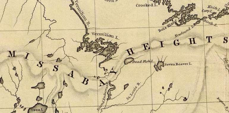
Detail of portage between Lake Vermillion and the Saint Louis River headwaters from Hydrographical Basin of the Upper Mississippi River from Astronomical and Barometrical Observations Surveys and Information by Joseph Nicolas Nicollet, 1843.
~ David Rumsey Map Collection
“Vincent Roy Sr. was born at Leech Lake Minn. in the year 1779 1797, and died at Superior, Wis. Feb. 18th 1872. He was a son of a Canadian Frenchman by the same name as his son bears. When V. Roy, Sr was about 17 or 18 years old, they emigrated to Fort Frances, Dominion of Canada, where he was engaged by the North-West Fur Co. as a trader until the two Companies (the North-West and the Hudson Bay Co joined together) he still worked for the consolidated Company for 12 or 15 years. When the American Traders came out at the Vermillion Lake country in Minnesota Three or four years afterwards he joined the American Traders. For several years he went to Mackinaw, buying goods and supplies for the Bois Fortes bands of Chippeways on Rainy and Vermillion Lake Country. About the year 1839 he came out to the Lake Superior Country and located his family at La Pointe. In winters he went out to Leech Lake Minn., trading for the American Fur Co. For several years until in the year of 1847 when the Hon. H. M. Rice, now of St. Paul, came to this country representing the Pierre Choteau Co. as a fur trading company. V. Roy, Sr. engaged to Pierre Choteau & Co. to trade with his former Indians at Vermillion Lake Country for two years, and then went for the American Fur Company again for one year. After a few years he engaged as a trader again for Peter E. Bradshaw & Co. and went to Red Lake, Minn. for several years. In 1861 he went to Nipigon (on Canadian side) trading for the same company. In a few years, he again went back to his old post at Vermillion Lake, Minn., where he contracted a very severe sickness, in two years afterwards he died at Superior among his Children as stated before &c.”
~ Minnesota Historical Society: Henry M. Rice and Family Papers, 1824-1966; Box 4; Sketches folder; Item “Roy, Vincent, 1797-1872”
Among the Chippewas we hear of man eaters, from the earliest travelers down to this day. Mr. Bushnell, formerly Indian agent at La Pointe, described one whom he saw who belonged on the St. Louis River and Vermillion Lake. The Indians have a superstitious dread of them, and will flee when one enters the lodge. They are hated, but it is supposed they cannot be killed, and no one ventures to make the experiment. it is only by a bullet such as the man eater himself shall designate that his body can be pierced. He is frequently a lunatic, spending days and nights alone in the woods in mid winter without food, traveling long spaces to present himself unexpectedly among distant bands. Whatever he chooses to eat is left for him, and right glad are the inmates of a lodge to get rid of him on such easy terms. The practice is not acquired from choice, but from the terrible necessities of hunger which happen every winter among the northern Indians. Like shipwrecked parties at sea, the weaker first falls a prey to the stronger, and their flesh goes to sustain life a little longer among the remainder. The Chippewas think that after one has tasted human food he has an uncontrollable longing for it, and that it is not safe to leave children alone with them. They say a man eater has red eyes and he looks upon the fat papoose with a demonical glance, and says: “How tender he would be.” One miserable object on the St. Louis River eat off his own lips, and finally became such a source of consternation that one Indian more courageous than the rest buried a tomahawk in his head. Another one who had the reputation of having killed all of his own family, came to the winter fishing ground on Rainy Lake, where Mr. Roy was trading with the Indians. He stayed on the ice trying to take some fish, but without success. Not one of the band dared go out to fish, although they were suffering from hunger. Mr. Roy and all the Indians requested him to go away, but he would not unless he had something to eat. no one but the trader could give him anything, and he was not inclined to do so. Things remained thus during three days, no squaw daring to go on the ice to fish for fear of the man eater. Mr. Roy urged them to kill him, but they said it would be of no use to shoot at him. The man eater dared them to fire. The trader at length lost patience with the cannibal and the terrified Bois Forts. He took his gun and warned the fellow that he would be shot if he remained on the ice. The faith of the savage appears to have been strong in the charm that surrounded his person, for he only replied by a laugh of derision. On the other side Mr. Roy had great faith in his rifle, and discharging it at the body of the man, he fell dead, as might have been expected. The Indians were at once relieved of a dreadful load, and sallied out to fish. No one, however, dared to touch the corpse.
No one of either party can go into the country of the other, and not be discovered. Their moccasins differ and their mode of walking. Their canoes and paddles are not alike, and their camp-fires as well as their lodges differ. The Chippewa lodge or wigwam is made by a circular or oblong row of small poles set in the ground, bending the tops over and fastening them with bark. They carry everywhere rolls of birch bark, which unroll like a carpet. These are wound on the poles next the ground course, and overlapping this a second and third, so as to shed rain. On one side is a low opening covered by a blanket, and at the top a circular place for the smoke to escape. The fire is on the ground at the centre. The work of putting up the lodge is done by the squaws, who gather wood for the fire, spread the mats, and proceed to cook their meals, provided there is anything to cook.

Stereograph of “Chippewa Indians and Wigwams” by Martin’s Art Gallery, circa 1862-1875, shows that they used more than one type of wigwam.
~ Commons.Wikimedia.org
A Sioux lodge is the model of the Sibley tent, with a pole at the centre and others set around in a circle, leaning against the central one at the top, forming a cone. This they cover with skins of the buffalo, deer, elk or moose, wound around like the Chippewa rolls of bark, leaving a space at the top for the smoke to escape, and an entrance at the side. This is stronger and more compact than the Chippewa wigwam, and withstands the fiercest storms of the prairies. In winter, earth is occasionally piled around the base, which makes it firmer and warmer.
We were coming down the Rum River, late in the fall of 1848, when one of our voyageurs discovered the track of a Sioux in the sand. It was at least three weeks old, but nothing could induce him to stay with us, not even an hour. He was not sure but a mortal enemy was then tracking us for the purpose of killing him.
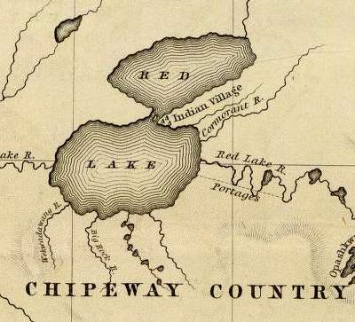
Detail of Red Lake from Hydrographical Basin of the Upper Mississippi River from Astronomical and Barometrical Observations Surveys and Information by Joseph Nicolas Nicollet, 1843.
~ David Rumsey Map Collection
Earlier in the season we were at Red Lake. A cloud of smoke came up from the west, which caused a commotion in the village and mission at the south end of the lake. A war party was then out on a Sioux raid. The chief had lost a son, killed by them. He had managed to get the hand of a Sioux, which he had planted at the head of his son’s grave. But this did not satisfy his revenge nor appease the spirit of his son. He organized a war party to get more scalps, which was then out. A warrior chief or medicine man gains his principal control of the warriors by means of a prophecy, which he must make in detail. If the first of his predictions should fail, the party may desert him entirely. In this case, on a certain day they would meet a bear. When they met the enemy, if they were to be victorious, a cloud of smoke would obscure the sun. It was this darkening of the sky that excited the hopes of the Red Lake band. They were sure there had been a battle and that the Sioux were defeated.
Judge Samuel Ashmun
~ Chippewa County Historical Society
The late Judge Ashmun, of Sault Ste. Marie, while he was a minor, wandered off from his nativity in Vermont to Lake Superior, through it to Fond du Lac, and thence by way of the St. Louis River to Sandy Lake on the Mississippi. Somewhere in that region he was put in charge of one of Astor’s trading posts. In the early winter of 1818 he went on a hunt with a party of seventeen indiscreet young braves, against the advice of the sachems, apparently in a southwesterly direction on the Sioux border, or neutral land. Far from being neutral, it was very bloody ground. At the end of the third day they were about fifty miles from the post. On the morning of each day a rendezvous was fixed upon for the next camp. Each one then commenced the hunt for the day, taking what route pleased himself. The ice on the lakes and marshes was strong and the snow not uncomfortably deep. The principal game was deer, with some pheasants, prairie hens, rabbits and porcupines. What a hunter could not carry he hung upon trees to be carried home upon their return. Their last camp was on the border of a lake in thick woods, with tall dry grass on the margin of the lake. Having killed all the deer they could carry, it was determined to begin the return march the next day. It was not a war party, but they were prepared for their Sioux enemies, of whom no signs had been discerned. There was no whiskey in the camp, but when the stomach of an Indian is filled to its enormous capacity with fresh venison he is always jolly. It was too numerous a party to shelter themselves by a roof of boughs over the fire, but they had made a screen against the wind of branches of pine, hemlock or balsam. Around the fire was a circle of boughs on which they sat, ate and slept. Some were mending their moccasins, other smoking tobacco and kinnikinic, playing practical jokes, telling stories, singing songs and gambling. Mr. Ashmun could get so little sleep that he took Wa-ne-jo, who had a boy of thirteen years, and they made a separate camp. This man going to the lake to drink, was certain that he heard the tramp and felt the vibrations of a party going over the ice, who could be no other than the Sioux. He returned, and after some hesitation Mr. Ashmun reported the news to the main camp. “Oh, Wa-ne-jo is a liar, nobody believes him,” was the universal response. Mr. Ashmun, however, gave credit to the repot. They immediately put out the fire at his bivouac. Even war parties do not place sentinels, because attacks are never made until break of day. In the isolated camp they waited impatiently for the first glimpse of morning. Most of the other party fell asleep with a feeling of security, for which they took no steps to verify. One of them lay down without his moccasins. Mr. Ashmun and his man were just ready to jump for the tall grass when a volley was poured into the other camp, accompanied by the usual savage yell. The darkness and stillness of a faint morning twilight made this burst of war still more terrific. Taking the boy between them, they commenced the race for life under the guidance of Wa-ne-jo, in a direction directly opposite to their home. He well knew the Sioux all night long had been creeping stealthily over the snow and through the thicket, and had formed a line behind the main camp. The Chippewas made a brave defence, giving back their howls of defiance and fighting as they dispersed through the woods. Eight were killed near the camp and a wounded one at some distance, where he had secreted himself. Two fo the wounded were helped away according to custom, and also the barefooted man, whose feet were soon frozen. All clung to their guns, and the frightened boy to his hatchet. They estimated the Sioux party to have been one hundred and thirty, of whom they killed four and wounded seven, but brought in no scalps.

Indians Canoeing in the Rapids painting by Cornelius Krieghoff, 1856.
~ Commons.Wikimedia.org
In his way, the Chippewa is quite religious. He believes in a future world where there is a happy place for good Indians. If he is paddling his canoe against a head wind and can afford it, he throws overboard a piece of tobacco, the most precious thing he has. With this offering there is a short invocation to the good manitou for a fair breeze, when he can raise a blanket for a sail, stop rowing and take a smoke. At the head of many a rapid which it is dangerous to run, are seen pieces of tobacco on the rocks, which were laid there with a brief prayer that they may go safely through. Some of them, which are frightful to white men, they pass habitually. These offerings are never disturbed, for they are sacred. He endeavors also to appease the evil spirit Nonibojan. Fire, rocks, waterfalls, mountains and animals are alive with spirits good and bad. The medicine man, who is prophet, physician, priest and warrior, is an object of reverence and admiration. His prayers are for success in the hunt, accompanied by incantations.

George Bonga
~ Wikipedia.org
Among the stories of a thousand camp-fires, was one by Charlie, a stalwart, half-breed Indian and negro, whose father was an escaped slave. On the shores of Sandy Lake, a party of Chippewas had crossed on the ice in midwinter, and encamped in the woods not far from the north shore. One of them went to the Lake with a kettle of water, and a hatchet to cut the ice. After he filled his kettle, he lay down to drink. The water was not entirely quiet, which attracted his attention at once. His suspicions were aroused, and placing his ear to the ice, he discerned regular pulsations, which his wits, sharpened by close attention to every sight and every sound, interpreted to be the tramp of men. They could be no other than Sioux, and there must be a party larger than their own. Their fire was instantly put out, and they separated to meet at daylight at a place several miles distant. All their conclusions were right. One band of savages outwitted another, having instincts of danger that civilized men would have allowed to pass unnoticed. The Sioux found only the embers of a deserted camp, and saw the tracks of their enemies diverge in so many directions that it was useless to pursue.
In 1839 the Chippewas on the upper Mississippi were required to come to Fort Snelling to receive their payments. That post was in Sioux territory, and the order gave offense to both nations. It required the presence of the United States troops to prevent murders even on the reservation. On the way home at Sunrise River, the Chippewas were surprised by a large force of Sioux, and one hundred and thirty-six were killed.
At the mouth of Crow Wing River, on the east bank of the Mississippi, is a ridge of gravel, on which there were shallow pits. The Indians said that, about fifteen years before, a war party of Sioux was above there on the river to attack the Sandy Lake band. A party of Chippewas concealed themselves in these pits, awaiting the descent of their enemies. The affair was so well managed that the surprise was complete. When the uncautious Sioux floated along within close range of their guns, the Chippewa warriors rose and delivered their fire into the canoes. Some got ashore and escaped through the woods to the westward, but a large portion were killed.
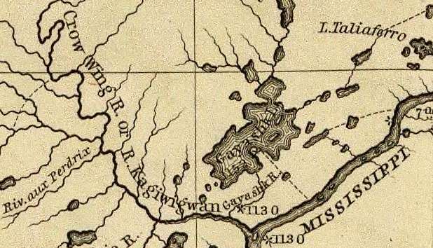
Detail of Crow Wing River from Hydrographical Basin of the Upper Mississippi River from Astronomical and Barometrical Observations Surveys and Information by Joseph Nicolas Nicollet, 1843.
~ David Rumsey Map Collection
While crossing the Elk River, between the falls of St. Anthony and those of St. Cloud, a squaw ran into the water, screaming furiously, followed by a man with a club. This was her lord and master, bent on giving her a taste of discipline very common in Indian life. She succeeded in escaping this time by going into deep water. Her nose had been disfigured by cutting away most of the fleshy portions, as a punishment for unfaithfulness to a husband, who was probably worse than herself.
At the mouth of Crow Wing River was an Indian skipping about with the skin of a skunk tied to one of his ankles. There was also in a camp near the post another Chippewa, who had murdered a brother of the lively man. There is no criminal law among them but that of retaliation. Any member of the family may execute this law at such time and manner as he shall decide. This badge of skunk’s skin was a notice to the murderer that the avenger was about, and that his mission was not fulfilled. Once the guilty man had been shot through the thigh, as a foretaste of what was to follow. The avenger seemed to enjoy badgering his enemy, whom he informed that although he might be occasionally wounded, it was not the intention at present to kill him outright. If the victim should kill his persecutor, he well knew that some other relative would have executed full retaliation.
~ The Assassination of Hole In The Day [the Younger] by Anton Treuer, 2010.
Hole In The Day the Younger
aka Kue-wee-sas (Gwiiwizens [Boy or Lad])
(1825-1868)
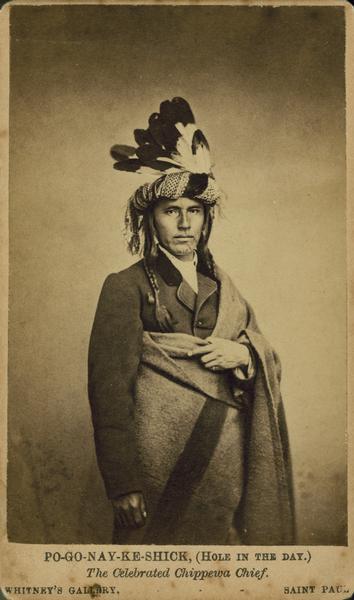
Bagone-giizhig the Younger
~ Wisconsin Historical Society
This Chippewa brave, Bug-on-a-ke-dit, lived on a knoll overlooking the Mississippi River, four miles above Little Rock, where he had a garden. He appeared at the payment at La Pointe, in 1848, with a breech cloth and scanty leggings. This was partially for showing off a very perfect figure, tall, round and lithe, the Apollo of the woods. His scanty dress enabled him to exhibit his trophies in war. The dried ears of his foes, a part of whom were women, were suspended at his neck. Around his tawny arms were bright brass bands, but there was nothing of which he was more proud than a bullet hole just below the right breast. The place of the wound was painted black, and around it circles of red, yellow and purple; other marks on the chest, arms and face told of the numbers he had slain and scalped, in characters well understood by all Chippewas. The numbers of eagle feathers in his hair informed the savage crowd how many battles he had fought. He was not, like Grizzly Bear, a great orator, but resembled him in getting drunk at every opportunity. He managed to procure a barrel of whiskey, which he carried to his lodge. While it was being unloaded it fell upon and crushed him to death. Looking up a grass clad hill, a dingy flag was seen (1848) fluttering on a pole where he was buried. He often repeated with great zest the mode by which the owners of two of the desecrated ears were killed. His party of four braves discovered some Sioux lodges on the St. Peters, from which all the men were absent. The squaws lodged their hereditary enemies over night with their accustomed hospitality. Bug-on-a-ke-dit and his party concealed themselves during the day, and at dark each one attacked a lodge. Seven women and children were slaughtered. His son Kue-wee-sas, or Po-go-noy-ke-schik, was a much more respectable and influential chief.
An hundred years since, the Sioux had an extensive burial ground, on the outlet of Sandy Lake, a few miles east of the Mississippi River. Their dead were encased in bark coffins and placed on scaffolds supported by four cedar posts, five or six feet high. This was done to prevent wolves from destroying the bodies. Thirty years since some of these coffins were standing in a perfect condition, but most of them were broken or wholly fallen, only the posts standing well whitened by age. The Chippewas wrap the corpse in a blanket and a roll of birch bark, and dig a shallow grave in which the dead are laid. A warrior is entitled to have his bow and arrow, sometimes a gun and and a kettle, laid beside him with his trinkets. Over the mound a roof of cedar bark is firmly set up, and the whole fenced with logs or protected in some way against wolves and other wild animals. There is a hole at one or both ends of the bark shelter, in which is friends place various kinds of food. Their belief in a spirit world hereafter is universal. If it is a hunter or warrior, he will need his arms to kill game or to slay his enemies. Their theory is that the dog may go to the spiritual country, as a spirit, also his weapons, and the food which is provided for the journey. To him every thing has its spiritual as well as its material existence. Over all is the great spirit or kitchi-manitou, looking after the happiness of his children here and hereafter.
Stephen Bonga
~ Wisconsin Historical Society
Winter travelling in those northern regions is by no means so uncomfortable as white men imagine. By means of snow shoes the Indian can move in a straight course towards his village, without regard to the trail. In the short days of winter he starts at day break and travels util dark. Stephen said he made fifty miles a day in that way, which is more than he could have done in summer.
At night they endeavor to find a thicket where there is a screen against the wind and plenty of wood. They scoop away the snow with their shoes and start a fire at the bottom of the pit. Around this they spread branches of pine, balsam or cedar, and over head make a shelter of brush to keep off the falling snow. Probably they have a team or more of dogs harnessed to sledges, who take their places around the fire. Here they cook and eat an enormous meal, when they wrap themselves in blankets for a profound sleep. Long before day another heavy meal is eaten. Everything is put in its proper package ready to start as soon as there is light enough to keep their course.
– Freelang Ojibwe-English by Weshki-ayaad, Charles Lippert and Guy T. Gambill
– Ojibwe People’s Dictionary by the Department of American Indian Studies at the University of Minnesota
Many Indian words have originated since the white people came among them. A large proportion of their proper names are very apt expressions of something connected with the person, lake, river, or mountain to which they are applied. This people, in their primitive state, knew nothing of alcohol, coffee, tea, fire-arms, money, iron, and hundreds of other things to which they gave names, generally very appropriate ones. A negro is black meat; coffee is black medicine drink; tea, red medicine drink; iron, black metal; gold, yellow metal. I was taking the altitude of the sun at noon near Red Lake Mission with a crowd of Chippewas standing around greatly interested. They had not seen the liquid metal mercury, used for an artificial horizon in such observations, which excited their especial astonishment, and they had no name for it. One of them said something which caused a general expression of delight, for which I enquired the reason. He had coined a word for mercury on the spot, which means silver water.
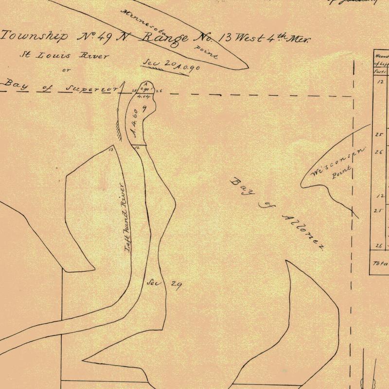
Detail of Minnesota Point during George Stuntz’s survey contract during August-October of 1852.
~ Barber Papers (prologue): Stuntz Surveys Superior City 1852-1854

This family’s sugar bush was located at or near Silver Creek (T53N-R10W).
~ General Land Office Records
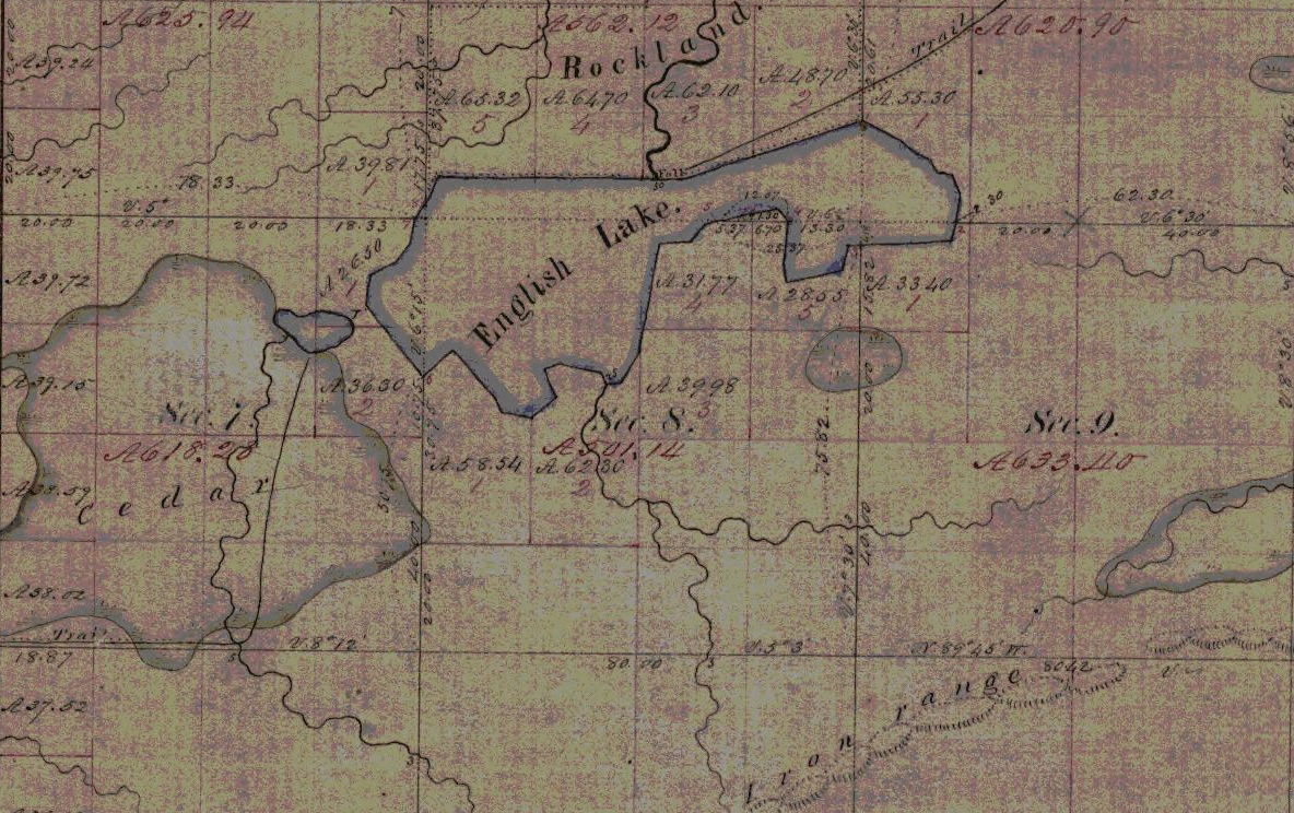
Indian trail to Rockland townsite overlooking English/Mineral Lake and Gogebic Iron Range.
~ Penokee Survey Incidents: Number V
Coasting along the beach northward from the mouth of the St. Louis River, on Minnesota Point, I saw a remarkable mark in the sand and went ashore to examine it. The heel and after part was clearly human. At the toes there was a cleft like the letter V and on each side some had one, others two human toes. Not far distant were Indians picking berries under the pine trees, which then covered the point in its entire length. We asked the berrypickers what made those tracks. They smiled and offered to sell us berries, of which they had several bushels, some in mokoks of birch bark, others in their greasy blankets. An old man had taken off his shirt, tied the neck and arms, and filled it half full of huckleberries. By purchasing some, (not from the shirt or blanket) we obtained an explanation of the nondescript tracks. There was a large family, all girls, whose feet were deformed in that manner. It was as though their feet had been split open when young halfway to the instep, and some of the toes lost. They had that spring met with a great loss by the remorseless bear. On the north shore, thirty miles east of Duluth, they had a fine sugar orchard, and had made an unusual quantity of sugar. A part was brought away, and a part was stored high up in trees in mokoks. There is nothing more tempting than sugar and whiskey to a bear. When this hard working family returned for their sugar and dried apples, moistened with whiskey, to lure bruin on to his ruin. A trap fixed with a heavy log is set up across a pen of logs, in the back end of which this bait is left, very firmly tied between two pieces of wood. This is fastened to a wooden deadfall, supporting one end of a long piece of round timber that has another piece under it. The bear smells the bait from afar, goes recklessly into the pen, and commences to gnaw the pieces of wood; before he gets much of the bait the upper log falls across his back, crushing him upon the lower one, where, if he is not killed, his hind legs are paralyzed. These deadly pens are found everywhere in the western forests. Two bears ranging along the south shore of English Lake, in Ashland County, Wisconsin, discovered some kegs of whiskey which contraband dealers had concealed there. With blows from their heavy paws they broke in the heads of the kegs and licked up the contents. They were soon in a very maudlin state, rolling about on the ground, embracing each other in an affectionate manner and vainly trying to go up the trees. Before the debauch was ended they were easily captured by a party of half-breeds. There are Indians who acknowledge the bear to be a relation, and profess a dislike to kill them. When they do they apologize, and say they do it because they are “buckoda,” or because it is necessary.

Detail of the Porcupine Mountains between the Montreal River and Ontonagon River from Map of the Mineral Lands Upon Lake Superior Ceded to the United States by the Treaty of 1842 With the Chippeway Indians.
~ Wisconsin Historical Society
At Ontonagon, a very sorry looking young Indian came out of a lodge on the west side of the river and expressed a desire to take passage in our boat. There had been a great drunk in that lodge the day before. The squaws were making soup of the heads of white fish thrown away by the white fishermen. Some of the men were up, others oblivious to everything. Our passenger did not become thoroughly sober until towards evening. We passed the Lone Rock and encamped abreast of the Porcupine Mountains. Here he recovered his appetite. The next day, near the Montreal River, a squaw was seen launching her canoe and steering for us. She accosted the young fellow, demanding a keg of whiskey. He said nothing. She had given him furs enough to purchase a couple of gallons and he had made the purchase, but between himself and his friends it had completely disappeared. The old hag was also fond of whiskey. The fraud and disappointment put her into a rage that was absolutely fiendish. Her haggard face, long, coarse, greasy, black hair, voluble tongue and shrill voice perfected that character.
Turning into the mouth of the river we found a party from Lake Flambeau fishing in the pool at the foot of the Great Fall. Their success had not been good, and of course they were hungry. One of our men spilled some flour on the sand, of which he could save but little. The Flambeaus were delighted, and, gathering up sand and flour together, put the mixture in their kettle. The sand settled at the bottom, and the flour formed an excellent porridge for hungry aboriginees.
~ Wisconsin Historical Society
Mushinnewa and Waubannika, Chippewas, lived at Bad River, near Odana. Mushinnewa had a very bad reputation among his tribe. He was not only quarrelsome when drunk, but was not peaceable when sober. He broke Waubannika’s canoe into fragments, which was resented by the wife of the latter on the spot. She made use of the awl with which she was sewing the bark on another canoe, as a weapon, and stabbed old Mushinnewa in several places so severely that it was thought he would die. He threatened to kill her, and she fled with her husband to Lake Flambeau. But Mushinnewa did not die. He had a son as little liked by the Odana band as himself. In a drunken affray at Ontonagon another Indian killed him. The murderer then took the body in his canoe, brought it to Bad River and delivered it to old Mushinnewa. According to custom the Indian handed the enraged father the knife with which his son was killed, and baring his breast told him to strike. The villagers were happy to be rid of the young villain, and took the knife from the hand of his legal avenger. A barrel of flour covered the body, and before night Mushinnewa adopted the Indian as his son.
Two varieties of willow, the red and the yellow, grow on the low land, at the margin of swamps and streams, which have the name of kinnekinic. During the day’s journey, a few sticks are cut and carried to the camp. The outer bark is scraped away from the inner bark, which curls in a fringe around the stick, which is forced in the ground before a hot fire, and occasionally turned. In the morning it is easily crumpled in the hands, and put into the tobacco pouch. If they are rich enough to mix a little tobacco with the kinnekinic, it is a much greater luxury. As they spend a large part of their leisure time in smoking, they are compelled to be content with common willow bark, which is a very weak narcotic. Tobacco is not grown as far north as the country of the Chippewas, but it is probable they had it through traffic with the tribes of Virginia, North Carolina and the Gulf States, in times very remote. Pipes are found in the works of the mounds builders that are very ancient, showing that they had something to smoke, which must have been a vegetable.
Detail of where the “Lake Long” [Lake Owen] and St. Croix foot paths start along Fish Creek.
~ Barber Papers: “Barbers Camp” Fall of 1855
~ History of the Upper Peninsula of Michigan, by Western Historical Co., 1883, page 276
Staggering around in a drunken crowd at La Pointe was a handsome Chippewa buck, as happy as whiskey can make any one. The tomahawk pipe is not an instrument of war, though it has that form. Its external aspect is that of a real tomahawk, intended to let out the brains of the foe. It is made of cast iron, with a round hollow poll, about the size of a pipe. The helm or handle is the stem, frequently decorated in the height of savage art, with ribbons, porcupine quills, paint and feathers. One thoroughly adorned in this manner has aperatures through the handle cross wise, so large and numerous that it is a mechanical wonder how the smoke can be drawn through it to the mouthpiece. No Indian is without a pipe of some kind, very likely one that is an heirloom from his ancestors. It is only in a passion that his knife or tomahawk pipe becomes dangerous. This genial buck had been struck with the poll of such a pipe when all hands were fighting drunk. It had cut a clear round hole in his head, hear the top, sinking a piece of skull with the skin and hair well into his brains. A surgeon with his instrument could not have made a more perfect incision. Inflammation had not set in and he was too busy with his boon companions to think of the wound. It was about twenty-four hours after it occurred when he stepped into his canoe and departed. When Mr. Beasley went up the Fish River, a few days afterwards a funeral was going on at the intersection of the Lake Long and the St. Croix trails, and the corpse had a cut in the head made by the pole of a tomahawk. From this event, no doubt, a family quarrel commenced that may continue till the race is extinct. The injured spirit of the fallen Indian demands revenge. In the exercise of retaliation it may be carried by his relations a little beyond retaliating justice, which will call on the other side for a victim, and so on to other generations.
In a lodge between the agency and the mission there was a young girl very sick. Probably it is my duty to say that she was not only young but beautiful, but at this time she was only wretched. Whether in her best health and estate the term beauty could be applied I very much doubt, as such cases are extremely rare among Indians, compared by our standard. A “grand medicine” had been got up expressly for the purpose of curing her. The medicine lodge was about thirty feet in length, made of green boughs. The feast, without which no evil spirit would budge one inch, had been swallowed, and the dance was at its height, in which some women were mingled with the men. Their shrieks, yelling and gesticulations should have frightened away all the matchi-manitous at La Pointe. The mother of the girl seemed to be full of joy, the bad spirit which afflicted her child was so near being expelled. As they made the circuit of the dance they thrust a large knife into the air towards the northwest, by which they gave the departing demon a stab as he made his escape from the lodge. This powow raged around the poor girl all the afternoon and till midnight, when the medicine man pronounced her safe. Before sundown the next day we saw them law her in a shallow grave, covered with cedar bark.

Father Nicolas Perrot
~ Wikipedia.org
Father Perret, who was among the Natches as far back as 1730, gives a portrait of a medicine man of that tribe at that time. It answers so well for those I have seen among the Chippewas that I give his description at length. For the Chippewa juggler I must except, however, the practice of abstinence and also the danger of losing his head. A feast is the first thing and the most essential.
“This nation, like all others, has its medicine man. They are generally old men, who, without study or science, undertake to cure all complaints. All their art consists in different jugglings, that is to say, they sing and dance night and day about the sick man, and smoke without ceasing, swallowing the smoke of the tobacco. These jugglers eat scarcely anything while engaged with the sick, but their chants and dances are accompanied by contortions so violent that, although they are entirely naked and should suffer from cold, they are always foaming at the mouth. They have a little basket in which they keep what they call their spirits, that is to say, roots of different kinds, heads of owls, parcels of the hair of deer, teeth of animals, pebbles and other trifles. To restore health to the sick they invoke without ceasing something they have in their basket. Sometimes they cut with a flint the part afflicted, suck out the blood, and in returning it immediately to the disk they spit out a piece of wood, straw or leather, which they have concealed under their tongue. Drawing the attention of the sick man, ‘there,’ they say, ‘is the cause of his sickness.’ These medicine men are always paid in advance. If the sick man recovers their gain is considerable, but if he dies they are sure to have their heads cut off by his relations.”
“Osawgee Beach. Superior, Wis.” postcard, circa 1920:
“Ojibwe chief Joseph Osawgee was born in Michigan in 1802 and came to Wisconsin Point as a young boy. There he established Superior’s first shipyard—a canoe-making outfit along the Nemadji River near Wisconsin Point. His birch bark canoes supplied transportation for both Ojibwe trappers and French Voyageurs. Chief Osawgee signed the 1854 Treaty of La Pointe on behalf of the Fond du Lac Ojibwe—and subsequently lost his land. He died in Solon Springs, Wisconsin, in 1876.”
~ Zenith City Online
Joseph Ozaagii
~ Geni.com
~ Indian Country Today Media Network
“Chief O-sau-gie Built First ‘Ships’ in City of Superior (He Was Head of Small Chippewa Band when Superior was Tiny Spot)”
As a rare example of the industry and probity among northern Indians, I take pleasure in recording the name of Osagi. His hunting ground and sugar camp lay to the west of La Pointe, on Cranberry River, where he had a cabin. In traversing that region I had as a guide a rude map and sketch of the streams made by him on a sheet of post office paper with a red pencil. Osagi was never idle and never drunk. Dr. Livermore was at this time the agent for the tribes at the west end of Lake Superior, and related the following instance of attention and generosity which is worthy of being reported. Osagi frequently made the agency presents, and Dr. Livermore, of course, did the same to his Otchipwee friends. Late in the fall, as the fishing season was about to close, he sent a barrel of delicious trout and white fish to the agency, which, by being hung up separately, would in this cool climate remain good all winter. The interpreter left a message from the donor with the fish, that he did not want any present in return, because in such a case there would be on his part no gifts, and he wished to make a gift. Dr. Livermore assented, but replied that if Osagi should ever be in need the agent expected to be informed of it. During the next winter a message came to Dr. Livermore stating that his friend wanted nothing, but that a young man, his cousin, was just in from Vermillion Lake, where he lived. The young man’s father and family could no longer take fish at Vermillion, and had started for Fonddulac. The old man was soon attacked by rheumatism, and for many days the whole party had been without provisions. Would the agent make his uncle a present of some flour? Of course this was done, and the young messenger started with a horse load of eatables for the solitary lodge of his father, on the St. Louis River, two hundred miles distant. This exemplary Indian, by saving his annuities, and by his economy, had accumulated money enough to buy a piece of land, and placed it in the hands of the agent. when the surveyors had subdivided the township opposite La Pointe, on the mainland, he bought a fraction and removed his family to it as a permanent home. In a few months the small pox swept off every member of that family but the mother.
[CHARLES WHITTLESEY.]
To be continued in Among The Otchipwees: III…
Among The Otchipwees: I
May 28, 2016
By Amorin Mello

Magazine of Western History Illustrated
No. 2 December 1884
as republished in
Magazine of Western History: Volume I, pages 86-91.
AMONG THE OTCHIPWEES.
Like all the northern tribes, the Chippewas are known by a variety of names. The early French called them Sauteus, meaning people of the Sault. Later missionaries and historians speak of them as Ojibways, or Odjibwes. By a corruption of this comes the Chippewa of the English.

“No-tin” copied from 1824 Charles Bird King original by Henry Inman in 1832-33. Noodin (Wind) was a prominent Chippewa chief from the St. Croix country.
~ Commons.Wikimedia.org
On the south of the Chippewas, in 1832, across the Straits of Mackinaw, were the Ottawas. Some of this nation were found by Champlain on the Ottawa River of Canada, whom he called Ottawawas. In later years there were some of them on Lake Superior, of whom it is probable the Lake Court Oreille band, in northwestern Wisconsin, is a remainder. The French call them “Court Oreillés,”, or short ears. All combined, it is not a powerful nation. Many of them pluck the hair from a large part of the scalp, leaving only a scalp lock. This custom they explain as a concession to their enemies, in order to make a more neat and rapid job of the scalping process. A thick head of coarse hair, they say, is a great impediment. Probably the true reason is a notion of theirs that a scalp lock is ornamental. The practice is not universal among Ottawas, and is not common with the neighboring tribes. These were the people who committed the massacre of the English garrison at Old Mackinaw, in 1763.
![Mah-kée-mee-teuv, Grizzly Bear, Chief of the [Menominee] Tribe by George Catlin, 1831. ~ Smithsonian Institute](https://chequamegonhistory.com/wp-content/uploads/2016/05/1831-mah-kee-mee-teuv-grizzly-bear-by-george-catlin.jpg)
“Mah-kée-mee-teuv, Grizzly Bear, Chief of the [Menominee] Tribe” by George Catlin, 1831.
~ Smithsonian Institute
The Oneidas, a small remnant of that nation, from New York, were located on Duck River, near Fort Howard, and the Tuscaroras on the south shore of Lake Winnebago.

Detail from “Among The Winnebago [Ho-Chunk] Indians. Wah-con-ja-z-gah (Yellow Thunder) Warrior chief 120 y’s old” stereograph by Henry Hamilton Bennett, circa 1870s.
~ J. Paul Getty Museum
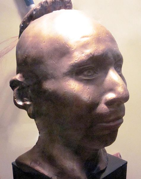
Plaster life cast of Sac leader Black Hawk (Makatai Meshe Kiakiak) reproduced by Bill Whittaker (original was made circa 1830) on display at Black Hawk State Historic Site.
~ Wikipedia.org
Next to the Menominees on the west were the Winnebagoes, a barbarous, warlike and treacherous people, even for Indians. Their northern border joined the Chippewas. Yellow Thunder’s village, in 1832, was on the trail from Lake Winnebago to Fort Winnebago, south of the Fox River about half way. He was more of a prophet, medicine man or priest, than warrior. In the Black Hawk war man of the Winnebago bucks joined the Sacs and the Foxes. Only four years before the United States was obliged to send an expedition against them, and to build a stockade at the portage. Their chiefs, old men, and medicine men, professed to be very friendly to us, but kept up constant communications with Black Hawk. When he was beaten at the Bad Ax River, and his warriors dispersed, they followed the old chief into the northern forest, captured him, and delivered him to the United States forces.
One of the causes of the Black Hawk War in 1832 was the murder of a party of Menominees near Fort Crawford, by the Sacs and Foxes. There was an ancient feud between those tribes which implies a series of scalping parties from generation to generation.

Sac leader “Ke-o-kuk or the Watchful Fox” by Thomas M. Easterly, 1847.
~ Missouri History Museum
As the Menominees were at peace with the United States, and their camps were near the garrison, they were considered to have been under Federal protection, and their murder as an insult to its authority. The return of Keokuk’s band to the Rock River country brought on a crisis in the month of May. The Menominees were anxious to avenge themselves, but were quieted by the promise of the government that the Sacs and Foxes should be punished. They offered to accompany our troops as scouts or spies, which was not accepted until the month of July, when Black Hawk had returned to the Four Lakes, where is now the city of Madison.
On a bright afternoon, about the middle of the month, a company of Menominee warriors emerged in single file from the woods in rear of Fort Howard at the head of Green Bay. They numbered about seventy-five, each one with a gun in his right hand, a blanket over his right shoulder, held across the breast by the naked left arm, and a tomahawk. Around the waist was a belt, on which was a pouch and a sheath, with a scalping knife. Their step was high and elastic, according to the custom of the men of the woods. On their faces was an excess of black paint, made more hideous by streaks of red. Their coarse black hair was decorated with all the ribbons and feathers at their command. Some wore moccasins and leggings of deer skin, but a majority were barefooted and barelegged. They passed across the common to the ferry, where they were crossed to Navarino, and marched to the Indian Agency at Shantytown. Here they made booths of the branches of trees. Captain or Colonel Hamilton, a son of Alexander Hamilton, was their commander. As they had an abundance to eat and were filled with martial prowess, they were exceedingly jubilant.
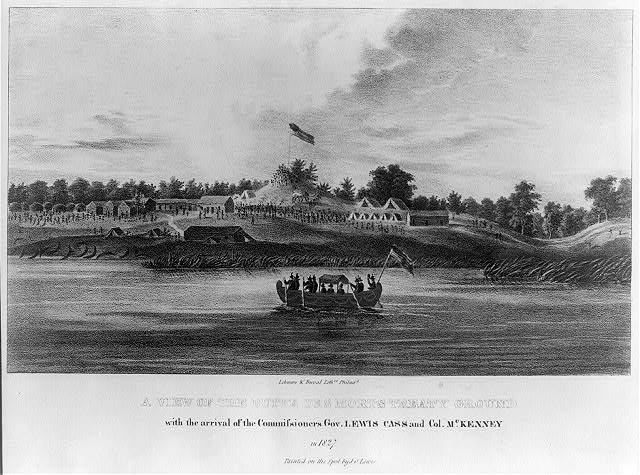
“A view of the Butte des Morts treaty ground with the arrival of the commissioners Gov. Lewis Cass and Col. McKenney in 1827” by James Otto Lewis, 1835.
~ Library of Congress
Their march was up the valley of the river, recrossing above Des Peres, passing the great Kakolin, and the Big Butte des Morts to the present site of Oshkosh. Thence crossing again they followed the trail to the Winnebago villages, past the Apukwa or Rice lakes to Fort Winnebago, making about twenty miles a day. On the route they were inclined to straggle, presenting nothing of military aspect except a uniform of dirty blankets. Colonel Hamilton was not able to make them stand guard, or to send out regular pickets. They were expert scouts in the day time, but at night lay down to sleep in security, trusting to their dogs, their keen sense of hearing and the great spirit. On the approach of day they were on the alert. It is a rule in Indian tactics to operate by surprises, and to attack at the first show of light in the morning.
From Fort Winnebago they moved to the Four Lakes, where Madison now is. Black Hawk had retired across the Wisconsin River, where there was a skirmish on the 21st of July, and the battle of the Bad Ax was being fought.

Photograph of Pierre Jean Édouard Desor (Swiss geologist and professor at Neuchâtel academy) from Wisconsin Historical Society. Desor and others were employed to survey for Report on the geology and topography of a portion of the Lake Superior Land District in the state of Michigan: Part I, Copper Lands; Part II, The Iron Region.
A few miles southwesterly of Waukedah, on the branch railroad to the iron mines of the upper Menominee, is a lake called by the Indians “Shope,” or Shoulder Lake, which I visited in the fall of 1850, in company with the late Edward Desor, a scientist of reputation in Switzerland. It discharges into the Sturgeon River, one of the eastern branches of the Menominee. There was a collection of half a dozen lodges, or wigwams, covered with bark, with a small field of corn, and the usual filth of an Indian village. The patriarch, or “chief” of that clan, came out to meet us, attended by about thirty men, women and children. By the traders he was called “Governor.” His nose was prominently Roman. He stood evenly on both feet, with his limbs bare below the knees. The right arm was also bare, and over the left shoulder was thrown a dirty blanket, covering the chest and the hips. A mass of coarse black hair covered the head, but was pushed away from the face. The usual dark, steady, snakelike, black eye of the race examined us with a piercing gaze. His face, with its large, well proportioned features, was almost grand. his pose was easy, unstudied and dignified, like one’s ideal of the Roman patrician of the time of Cicero, such as sculptors would select as a model.
This band were the Chippewas, but the coast of Green Bay was occupied by Menominees or Menomins, known to the French as “Folle Avoines,” or “Wild Rice” Indians, for which Menomin is the native name. Above the Twin Falls of the Menominee was an ancient village of Chippewas, called the “Bad Water” band, which is their name for a series of charming lakes not far distant, on the west of the river. They said their squaws, a long time since, were on the lakes in a bark canoe. Those on the land saw the canoe stand up on end, and disappear beneath the surface with all who were in it. “Very bad water.” From that time they were called the “Bad Water” lakes.

The Bad Water Band of Lake Superior Chippewa was first documented by Captain Thomas Jefferson Cram in his 1840 report to Congress.
~ Dickinson County Library
Cavalier was a half-breed French and Menominee. He was a handsome young man, and was well aware of it. Though he was married, the squaws received his attentions without much reserve. Half-breeds dress like the whites of the trading post, and not as Indians. Their hair is cut, and instead of a blanket they have coarse overcoats, and wear hats. Many of them are traders, a class mid-way between the whites and Indians.

No Princess Zone: Hanging Cloud, the Ogichidaakwe is a popular feature here on Chequamegon History.
Polygamy is the most fixed of savage institutions, and one that the half-breed and trader does not despise. Chippewa maidens, and even wives, have many reasons for looking kindly upon men who wear citizens’ clothes and trade in finery. Moccasins they can make very beautifully, but shawls and strouds of broadcloth, silk ribbons, pewter broaches, brass rings, and glass beads they cannot. These are the work of the white man. But none of that race, man or maid, has a more powerful passion for the ornamental than the children of the forest, male or female. Let us not judge the latter too harshly – poor, ignorant, suffering slave, with none of the protection which the African slave could sometimes invoke against barbarian cruelty. Their children are as happy and playful as those of the white race. Before they become men and women they are frequently beautiful, the deep brunette of their complexion having, on the cheek, a faint tinge of a lighter color, especially among those from the far north, like the “Bois Forts” of Rainy Lake. Young lads and girls have well formed limbs and straight figures, with agile and graceful movements. At this age the burdens and hardships of the squaws have not deformed them. The smoke of the lodge has not tanned their skin to Arab-like blackness nor inflamed their eyes. In about ten years of drudgery, rowing the canoe, putting up lodges, bearing children, and not infrequent beatings by her lord, the squaw is an old woman. Her features become rough and angular, the melodious voice of childhood is changed to one that is sharp, shrill, piercing and disagreeable. At forty she is a decrepit old woman, and before that time, if her master has not put her away, he may have installed number two as an additional tyrant.
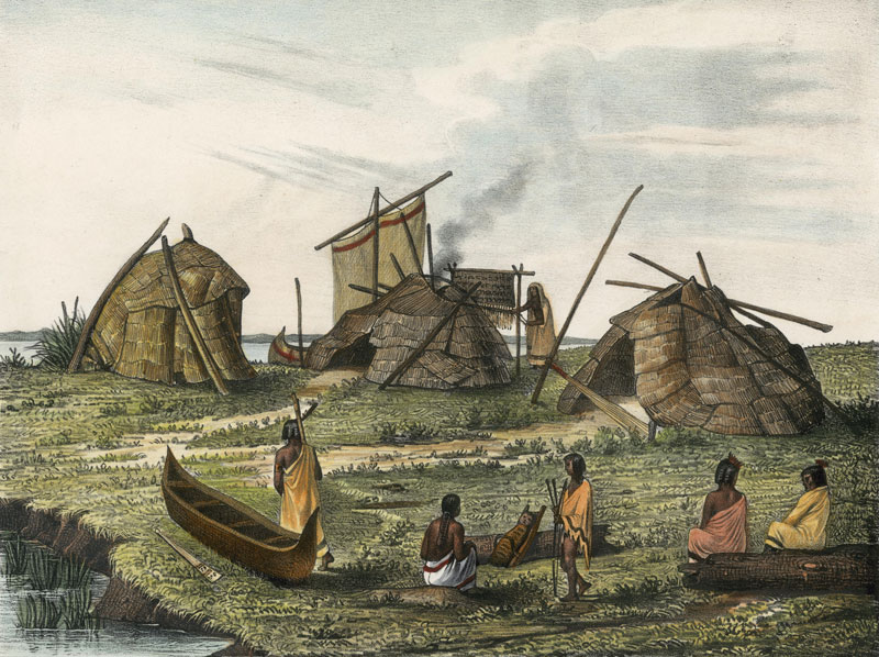
A Menominee village in “Village of Folle-Avoines” by Francis de Laporte de Castelnau, 1842.
~ Wisconsin Historical Society
Well up the Peshtigo, on a rainy, foggy afternoon, we made an early camp near a dismal swamp on the low ground. On the other side of the river, at a considerable distance, was heard the moans of a person evidently in great distress. Cavalier was sent over to investigate. He found a wigwam with a Menominee and two women, both wives. The youngest was on a bridal tour. The old wife had broken her thigh about a month before, which had not been set. She was suffering intensely, the limb very much swollen, and the bridal party wholly neglecting her. It was evident that death was her only relief. A strong dose of morphine gradually moderated her groans, which were more pathetic than anything that ever reached my ears. Before morning she was quiet.
As the water was very low I went through the gorge of the Menominee above the Great Bekuennesec, or Smoky Falls. Near the lower end, and in hearing of the cataract, I saw through the rocky chasm a mountain in the distance to the northeast. My half-breed said the Indians called it Thunder Mountain. They say that thunder is caused by an immense bird which goes there, when it is enveloped by clouds and flaps its wings furiously.
Turning away from the mists of the cataract and its never ceasing roar, we went southwesterly among the pines, over rocks and through swamps, to a time worm trail leading from the Bad Water village to the Pemenee Falls. This had been for many years the land route from Kewenaw Bay to the waters of Green Bay at the mouth of the Menominee River. When the copper mines on Point Kewenaw were opened, in 1844 and 1845, the winter mail was carried over this route on dog trains, or on the backs of men. Deer were very plenty in the Menominee valley. Bands of Pottawatomies scoured the woods, killing them by hundreds for their skins. We did not kill them until near the close of the day, when about to encamp. Cavalier went forward along the trail to make camp and shoot a deer. I heard the report of his gun, and expected the usual feast of fresh venison. “Where is your deer?” “Don’t know; some one has put a spell on my gun, and I believe I know who did it.”
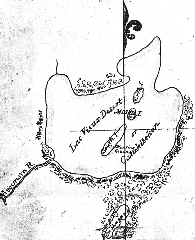
Map of Lac Vieux Desert with “Catakitekon” [Gete-gitigaan (old gardens)] from Thomas Jefferson Cram’s 1840 fieldbook.
~ School District of Marshfield: Digital Time Travelers
The Chippewas are spread over the shores and the rivers of Lake Superior, Lake Nipigon, the heads of the Mississippi, the waters of Red Lake, Rainy Lake and the tributaries of the Lake of the Woods. When Du Lhut and Hennepin first became acquainted with the tribes in that region, the Sioux, Dacotas, or Nadowessioux, and the Chippewas were at war, as they have been ever since. The Sioux of the woods were located on the Rum, or Spirit River, and their warriors had defeated the Chippewas at the west end of Lake Superior. Hennepin was a prisoner with a band of Sioux on Mille Lac, in 1680, at the head of Rum River, called Isatis. When Johnathan Carver was on the upper Mississippi, in 1769, the Chippewas had nearly cleared the country between there and Lake Superior of their enemies. In 1848 their war parties were still making raids on the Sioux and the Sioux upon them.
CHARLES WHITTLESEY.
To be continued in Among The Otchipwees: II…
Colonel Charles Whittlesey
May 27, 2016
By Amorin Mello

C.C. Baldwin was a friend, colleague, and biographer of Charles Whittlesey.
~ Memorial of Charles Candee Baldwin, LL. D.: Late President of the Western Reserve Historical Society, 1896, page iii.
This is a reproduction of Colonel Charles Whittlesey’s biography from the Magazine of Western History, Volume V, pages 534-548, as published by his successor Charles Candee Baldwin from the Western Reserve Historical Society. This biography provides extensive and intimate details about the life and profession of Whittlesey not available in other accounts about this legendary man.
Whittlesey came to Lake Superior in 1845 while working for the Algonquin Mining Company along the Keweenaw Peninsula’s copper region. His first trip to Chequamegon Bay appears to have been in 1849 while doing do a geological survey of the Penokee Mountains for David Dale Owen. Whittlesey played a dramatic role in American settlement of the Chequamegon Bay region. Whittlesey convinced his brother, Asaph Whittlesey Jr., to move from the Western Reserve in 1854 establish what became the City of Ashland at the head of Chequamegon Bay as a future port town for extracting and shipping minerals from the Penokee Mountains. Whittlesey’s influence can still be witnessed to this day through local landmarks named in his honor:
Whittlesey published more than two hundred books, pamphlets, and articles. For additional research resources, the extensive Charles Whittlesey Papers are available through the Western Reserve Historical Society in two series:
Magazine of Western History, Volume V, pages 534-548.
COLONEL CHARLES WHITTLESEY.

Map of the Connecticut Western Reserve in Ohio by William Sumner, September 1826.
~ Cleveland Public Library
![Asaph Whittlesey [Sr], Late of Tallmadge, Summit Co., Ohio by Vesta Hart Whittlesey and Susan Everett Whittlesey, né Fitch, 1872.](https://chequamegonhistory.com/wp-content/uploads/2016/05/asaph-whittlesey-vesta-hart.jpg)
[Father] Asaph Whittlesey [Sr], Late of Tallmadge, Summit Co., Ohio by [mother] Vesta Hart Whittlesey [posthumously] and [stepmother] Susan Everett Whittlesey, né Fitch, 1872.
~ Archive.org
War was then in the west, and his neighbors feared they might be the victims of the scalping knife. But the danger was different. In passing the Narrows, between Pittsburgh and Beaver, the wagon ran off a bank and turned completely over on the wife and children. They were rescued and revived, but the accident permanently impaired the health of Mr. Whittlesey.
Mr. Whittlesey was in Tallmadge, justice of the peace from soon after his arrival till near the close of his life, and postmaster from 1814, when the office was first established, to his death. He was again severely injured, but a strong constitution and unflinching will enabled him to accomplish much. He had a store, buying goods in Pittsburgh and bringing them in wagons to Tallmadge; and an ashery; and in 1818 he commenced the manufacture of iron on the Little Cuyahoga, below Middlebury.
The times were hard, tariff reduced, and in 1828 he returned to his farm prematurely old. He died in 1842. Says General Bierce,
“His intellect was naturally of a high order, his religious convictions were strong and never yielded to policy or expediency. He was plain in speech, sometimes abrupt. Those who respected him were more numerous than those who loved him. But for his friends, no one had a stronger attachment. His dislikes were not very well concealed or easily removed. In short, he was a man of strong mind, strong feelings, strong prejudices, strong affections and strong attachments, yet the whole was tempered with a strong sense of justice and strong religious feelings.”
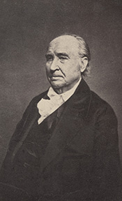
[Uncle] Elisha Whittlesey
~ Collection of the U.S. House of Representatives

Portrait of Reverend David Bacon from ConnecticutHistory.org:
“David Bacon (1771 – August 27, 1817) was an American missionary in Michigan Territory. He was born in Woodstock, Connecticut. He worked primarily with the Ottawa and Chippewa tribes, although they were not particularly receptive to his Christian teachings. He founded the town of Tallmadge, Ohio, which later became the center of the Congregationalist faith in Ohio.”
~ Wikipedia.org
Tallmadge was settled in 1808 as a religious colony of New England Congregationalists, by a colony led by Rev. David Bacon, a missionary to the Indians. This affected the society in which the boy lived, and exercised much influence on the morality of the town and the future of its children, one of whom was the Rev. Leonard Bacon. Rev. Timlow’s History of Southington says, “Mr. Whittlesey moved to Tallmadge, having become interested in settling a portion of Portage county with Christian families.” And that he was a man “of surpassing excellence of character.”
If it should seem that I have dwelt upon the parents of Colonel Whittlesey, it is because his own character and career were strongly affected by their characters and history. Charles, the son, combined the traits of the two. He commenced school at four years old in Southington; the next year he attended the log school house at Tallmadge until 1819, when the frame academy was finished and he attended it in winter, working on the farm in summer until he was nineteen.
The boy, too, saw early life on foot, horseback and with ox-teams. He found the Indians still on the Reserve, and in person witnessed the change from savage life and new settlements, to a state of three millions of people, and a large city around him. One of Colonel Whittlesey’s happiest speeches is a sketch of log cabin times in Tallmadge, delivered at the semi-centennial there in 1857.
~ Annual Report on the Geological Survey of the State of Ohio: 1837 by Ohio Geologist William Williams Mather, 1838, page 22.
In 1827 the youngster became a cadet at West Point. Here he displayed industry, and in some unusual incidents there, coolness and courage. He graduated in 1831, and became brevet second lieutenant in the Fifth United States infantry, and in November started to join his regiment at Mackinaw. He did duty through the winter with the garrison at Fort Gratiot. In the spring he was assigned at Green Bay to the company of Captain Martin Scott, so famous as a shot. At the close of the Black Hawk War he resigned from the army. Though recognizing the claim of the country to the services of the graduates of West Point, he tendered his services to the government during the Seminole Mexican war. By a varied experience his life thereafter was given to wide and general uses. He at first opened a law office in Cleveland, Ohio, and was fully occupied in his profession, and as part owner and co-editor of the Whig and Herald until the year 1837. He was that year appointed assistant geologist of the state of Ohio. Through very uneconomical economy, the survey was discontinued at the end of two years, when the work was partly done and no final reports had been made. Of course most of the work and its results were lost. Great and permanent good indeed resulted to the material wealth of the state, in disclosing the rich coal and iron deposit of southeastern Ohio, thus laying the foundation for the vast manufacturing industries which have made that portion of the state populous and prosperous. The other gentlemen associated with him were Professor William Mather as principal; Dr. Kirtland was entrusted with natural history. Others were Dr. S. P. Hildreth, Dr. Caleb Briggs, Jr., Professor John Locke and Dr. J. W. Foster. It was an able corps, and the final results would have been very valuable and accurate. In 1884, Colonel Whittlesey was sole survivor and said in this Magazine:
“Fifty years since, geology had barely obtained a standing among the sciences even in Europe. In Ohio it was scarcely recognized. The state at that time was more of a wilderness than a cultivated country, and the survey was in progress little more than two years. It was unexpectedly brought to a close without a final report. No provision was made for the preservation of papers, field notes and maps.”
Report of Progress in 1869, by J. S. Newberry, Chief Geologist, by the Geological Survey of Ohio, 1870.
Professor Newbury, in a brief resume of the work of the first survey (report of 1869), says the benefits derived “conclusively demonstrate that the geological survey was a producer and not a consumer, that it added far more than it took from the public treasury and deserved special encouragement and support as a wealth producing agency in our darkest financial hour.” The publication of the first board, “did much,” says Professor Newberry, “to arrest useless expenditure of money in the search for coal outside of the coal fields and in other mining enterprises equally fallacious, by which, through ignorance of the teachings of geology, parties were constantly led to squander their means.” “It is scarcely less important to let our people know what we have not, than what we have, among our mineral resources.”

“Descriptions of Ancient Works in Ohio. By Charles Whittlesey, of the late Geological Corps of Ohio.”
~ Smithsonian Contributions to Knowledge, Volume III., Article 7, 1852.
The topographical and mathematical parts of the survey were committed to Colonel Whittlesey. He made partial reports, to be found in the ‘State Documents’ of 1838 and 1839, but his knowledge acquired in the survey was of vastly greater service in many subsequent writings, and, as a foundation for learning, made useful in many business enterprises of Ohio. He had, during this survey, examined and surveyed many ancient works in the state, and, at its close, Mr. Joseph Sullivant, a wealthy gentleman interested in archaeology, residing in Columbus, proposed that, he bearing the actual expense, Whittlesey should continue the survey of the works of the Mound Builders, with a view to joint publication. During the years 1839 and 1840, and under the arrangement, he made examination of nearly all the remaining works then discovered, but nothing was done toward their publication. Many of his plans and notes were used by Messrs. Squier & Davis, in 1845 and 1846, in their great work, which was the first volume of the Smithsonian Contributions, and in that work these gentlemen said:
“Among the most zealous investigators in the field of American antiquarian research is Charles Whittlesey, esq., of Cleveland, formerly topographical engineer of Ohio. His surveys and observations, carried on for many years and over a wide field, have been both numerous and accurate, and are among the most valuable in all respects of any hitherto made. Although Mr. Whittlesey, in conjunction with Joseph Sullivant, esq., of Columbus, originally contemplated a joint work, in which the results of his investigations should be embodied, he has, nevertheless, with a liberality which will be not less appreciated by the public than by the authors, contributed to this memoir about twenty plans of ancient works, which, with the accompanying explanations and general observations, will be found embodied in the following pages.
“It is to be hoped the public may be put in possession of the entire results of Mr. Whittlesey’s labor, which could not fail of adding greatly to our stock of knowledge on this interesting subject.”

“Marietta Works, Ohio. Charles Whittlesey, Surveyor 1837.”
~ Smithsonian Contributions to Knowledge, Volume I., Plate XXVI.
It will be seen that Mr. Whittlesey was now fairly started, interested and intelligent, in the several fields which he was to make his own. And his very numerous writings may be fairly divided into geology, archaeology, history, religion, with an occasional study of topographical geology. A part of Colonel Whittlesey’s surveys were published in 1850, as one of the Smithsonian contributions; portions of the plans and minutes were unfortunately lost. Fortunately the finest and largest works surveyed by him were published. Among those in the work of Squier & Davis, were the wonderful extensive works at Newark, and those at Marietta. No one again could see those works extending over areas of twelve and fifteen miles, as he did. Farmers cannot raise crops without plows, and the geography of the works at Newark must still be learned from the work of Colonel Whittlesey.
~ Smithsonian Contributions to Knowledge, Volume XIII., Article IV., page 2 of “Ancient Mining on the Shores of Lake Superior” by Charles Whittlesey.
He made an agricultural survey of Hamilton county in 1844. That year the copper mines of Michigan began to excite enthusiasm. The next year a company was organized in Detroit, of which Colonel Whittlesey was the geologist. In August they launched their boat above the rapids of the Sault St. Marie and coasted along the shore to where is now Marquette. Iron ore was beneath notice, and in truth was no then transportable, and they pulled away for Copper Harbor, and then to the region between Portage lake and Ontonagon, where the Algonquin and Douglas Houghton mines were opened. The party narrowly escaped drowning the night they landed. Dr. Houghton was drowned the same night not far from them. A very interesting and life-like account of their adventures was published by Colonel Whittlesey in the National Magazine of New York City, entitled “Two Months in the Copper Regions.” From 1847 to 1851 inclusive, he was employed by the United States in the survey of the country around Lake Superior and the upper Mississippi, in reference to mines and minerals. After that he spent much time in exploring and surveying the mineral district of the Lake Superior basin. The wild life of the woods with a guide and voyageurs threading the streams had great attractions for him and he spent in all fifteen seasons upon Lake Superior and the upper Mississippi, becoming thoroughly familiar with the topography and geological character of that part of the country.
“Pictograph C. Okundekund [Okandikan] and his Band of Ontonagon – Michigan,” as reproduced from birch bark by Seth Eastman, and published as Plate 62 in Historical and Statistical Information Respecting the History, Condition, and Prospects of the Indian Tribes of the United States, Volume I., by Henry Rowe Schoolcraft, 1851. This was one of several pictograph petitions from the 1849 Martell delegation:
“By this scroll, the chief Kun-de-kund of the Eagle totem of the river Ontonagon, of Lake Superior, and certain individuals of his band, are represented as uniting in the object of their visit of Oshcabewis. He is depicted by the figure of an eagle, Number 1. The two small lines ascending from the head of the bird denote authority or power generally. The human arm extended from the breast of the bird, with the open hand, are symbolic of friendship. By the light lines connecting the eye of each person with the chief, and that of the chief with the President, (Number 8,) unity of views or purpose, the same as in pictography Number 1, is symbolized. Number 2, 3, 4, and 5, are warriors of his own totem and kindred. Their names, in their order, are On-gwai-sug, Was-sa-ge-zhig, or The Sky that lightens, Kwe-we-ziash-ish, or the Bad-boy, and Gitch-ee-man-tau-gum-ee, or the great sounding water. Number 6. Na-boab-ains, or Little Soup, is a warrior of his band of the Catfish totem. Figure Number 7, repeated, represents dwelling-houses, and this device is employed to deonte that the persons, beneath whose symbolic totem it is respectively drawn, are inclined to live in houses and become civilized, in other words, to abandon the chase. Number 8 depicts the President of the United States standing in his official residence at Washington. The open hand extended is employed as a symbol of friendship, corresponding exactly, in this respect, with the same feature in Number 1. The chief whose name is withheld at the left hand of the inferior figures of the scroll, is represented by the rays on his head, (Figure 9,) as, apparently, possessing a higher power than Number 1, but is still concurring, by the eye-line, with Kundekund in the purport of pictograph Number 1.”
“Studio portrait of geologist Charles Whittlesey dressed for a field trip.” Circa 1858.
~ Wisconsin Historical Society
His detailed examination extended along the copper range from the extreme east of Point Keweenaw to Ontonagon, through the Porcupine mountain to the Montreal river, and thence to Long lake in Wisconsin, a distance of two hundred miles. In 1849, 1850 and 1858 he explored the valley of the Menominee river from its mouth to the Brule. He was the first geologist to explore the South range. The Wisconsin Geological Survey (Vol. 3 pp. 490 and 679) says this range was first observed by him, and that he many years ago drew attention to its promise of merchantable ores which are now extensively developed from the Wauceda to the Commonwealth mines, and for several miles beyond. He examined the north shore from Fond du Lac east, one hundred miles, the copper range of Minnesota and on the St. Louis river to the bounds of our country. His report was published by the state in 1865, and was stated by Professor Winchill to be the most valuable made.
All his geological work was thorough, and the development of the mineral resources which he examined, and upon which he reported, gave the best proofs of his scientific ability and judgment.

“Outline Map Showing the Position of the Ancient Mine Pits of Point Keweenaw, Michigan by Charles Whittlesey.”
~ Smithsonian Contributions to Knowledge, Volume XIII., Article IV., frontpiece of “Ancient Mining on the Shores of Lake Superior” by Charles Whittlesey, 1863.
With the important results from his labors in Ohio in mind, the state of Wisconsin secured his services upon the geological survey of that state, carried on in 1858, 1859 and 1860, and terminated only by the war. The Wisconsin survey was resumed by other parties, and the third volume of the Report for Northern Wisconsin, page 58, says:
The Contract of James Hall with Charles Whittlesey is available from the Journal of the Assembly of Wisconsin, Volume I, pages 178-179, 1862. Whittlesey was to perform “a careful geological survey of the country lying between the Montreal river on the east, and the westerly branches of [the] Bad River on west”. This contract was unfulfilled due to the outbreak of the American Civil War. Whittlesey independently published his survey of the Penokee Mountains in 1865 without Hall. Some of Whittlesey”s pamphlets have been republished here on Chequamegon History in the Western Reserve category of posts.“The only geological examinations of this region, however, previous to those on which the report is based, and deserving the name, were those of Colonel Charles Whittlesey of Cleveland, Ohio. This gentleman was connected with Dr. D. D. Owen’s United States geological survey of Wisconsin, Iowa and Minnesota, and in this connection examined the Bad River country, in 1848. The results are given in Dr. Owen’s final report, published in Washington, in 1852. In 1860 (August to October) Colonel Whittlesey engaged in another geological exploration in Ashland, Bayfield and Douglass counties, as part of the geological survey of Wisconsin, then organized under James Hall. His report, presented to Professor Hall in the ensuing year, was never published, on account of the stoppage of the survey. A suite of specimens, collected by Colonel Whittlesey during these explorations, is at present preserved in the cabinet of the state university at Madison, and it bears testimony to the laborious manner in which that gentleman prosecuted the work. Although the report was never published, he has issued a number of pamphlet publications, giving the main results obtained by him. A list of them, with full extracts from some of them, will be found in an appendix to the report. In the same appendix I have reproduced a geological map of this region, prepared by Colonel Whittlesey in 1860.”

“Geological Map of the Penokie Range.” by Charles Whittlesey, Dec. 1860.
~ Geology of Wisconsin. Survey of 1873-1879. Volume III., 1880, Plate XX, page 214.
~ Biographical Register of the Officers and Graduates of the United States Military Academy at West Point, New York, since its establishment in 1802 by George W. Cullum, page 496.
“The Baltimore Plot was an alleged conspiracy in late February 1861 to assassinate President-elect Abraham Lincoln en route to his inauguration. Allan Pinkerton, founder of the Pinkerton National Detective Agency, played a key role by managing Lincoln’s security throughout the journey. Though scholars debate whether or not the threat was real, clearly Lincoln and his advisors believed that there was a threat and took actions to ensure his safe passage through Baltimore, Maryland.”
~ Wikipedia.org
Such was Colonel Whittlesey’s employment when the first signs of the civil war appeared. He abandoned it at once. He became a member of one of the military companies that tendered its services to President-elect Lincoln, when he was first threatened, in February, 1861. He became quickly convinced that war was inevitable, and urged the state authorities that Ohio be put at once in preparation for it; and it was partly through his influence that Ohio was so very ready for the fray, in which, at first, the general government relied on the states. Two days after the proclamation of April 15, 1861, he joined the governor’s staff as assistant quartermaster-general. He served in the field in West Virginia with the three months’ men, as state military engineer; with the Ohio troops, under General McClellan, Cox and Hill. At Seary Run, on the Kanawha, July 17, 1861, he distinguished himself by intrepidity and coolness during a severe engagement, in which his horse was shot under him. At the expiration of the three months’ service, he was appointed colonel of the Twentieth regiment, Ohio volunteers, and detailed by General Mitchell as chief engineer of the department of Ohio, where he planned and constructed the defenses of Cincinnati.
“[Brother] Asaph Whittlesey [Jr.] dressed for his journey from Ashland to Madison, Wisconsin, to take up his seat in the state legislature. Whittlesey is attired for the long trek in winter gear including goggles, a walking staff, and snowshoes.” Circa 1860.
~ Wisconsin Historical Society
“SIR: Will you allow me to suggest the consideration of a great movement by land and water, up the Cumberland and Tennessee rivers.
“First, Would it not allow of water transportation half way to Nashville?
“Second, Would it not necessitate the evacuation of Columbus, by threatening their railway communications?
“Third, Would it not necessitate the retreat of General Buckner, by threatening his railway lines?
“Fourth, Is it not the most feasible route into Tennessee?”
This plan was adopted, and Colonel Whittlesey’s regiment took part in its execution.
In April, 1862, on the second day of the battle of Shiloh, Colonel Whittlesey commanded the Third brigade of General Wallace’s division — the Twentieth, Fifty-sixth, Seventy-sixth and Seventy-eighth Ohio regiments. “It was against the line of that brigade that General Beauregard attempted to throw the whole weight of his force for a last desperate charge; but he was driven back by the terrible fire, that his men were unable to face.” As to his conduct, Senator Sherman said in the United States senate.1
The official report of General Wallace leaves little to be said. The division commander says, “The firing was grand and terrible. Before us was the Crescent regiment of New Orleans; shelling us on our right was the Washington artillery of Manassas renown, whose last charge was made in front of Colonel Whittlesey’s command.”
“This is an engraved portrait of Charles Whittlesey, a prominent soldier, attorney, scholar, newspaper editor, and geologist during the nineteenth century. He participated in a geological survey of Ohio conducted in the late 1830s, during which he discovered numerous Native American earthworks. In 1867, Whittlesey helped establish the Western Reserve Historical Society, and he served as the organization’s president until his death in 1886. Whittlesey also wrote approximately two hundred books and articles, mostly on geology and Ohio’s early history.”
~ Ohio History Central
General Force, then lieutenant-colonel under Colonel Whittlesey, fully describes the battle,2 and quotes General Wallace. “The nation is indebted to our brigade for the important services rendered, with the small loss it sustained and the manner in which Colonel Whittlesey handled it.”
Colonel Whittlesey was fortunate in escaping with his life, for General Force says, it was ascertained that the rebels had been deliberately firing at him, sometimes waiting to get a line shot.
Colonel Whittlesey had for some time been in bad health, and contemplating resignation, but deferring it for a decisive battle. Regarding this battle as virtually closing the campaign in the southwest, and believing the Rebellion to be near its end, he now sent it in.
General Grant endorsed his application, “We cannot afford to lose so good an officer.”
“Few officers,” it is said, “retired from the army with a cleaner or more satisfactory record, or with greater regret on the part of their associates.” The Twentieth was an early volunteer regiment. The men were citizens of intelligence and character. They reached high discipline without severity, and without that ill-feeling that often existed between men and their officers. There was no emergency in which they could not be relied upon. “Between them and their commander existed a strong mutual regard, which, on their part, was happily expressed by a letter signed by all the non-commissioned officers.”
“CAMP SHILOH, NEAR PITTSBURGH LANDING, TENNESSEE, April 21, 1862.
“COL. CHAS. WHITTLESEY:
“Sir — We deeply regret that you have resigned the command of the Twentieth Ohio. The considerate care evinced for the soldiers in camp, and, above all, the courage, coolness and prudence displayed on the battle-field, have inspired officers and men with the highest esteem for, and most unbounded confidence in our commander.
“From what we have seen at Fort Donelson, and at the bloody field near Pittsburgh, on Monday, the seventh, all felt ready to follow you unfalteringly into any contest and into any post of danger.
“While giving expression to our unfeigned sorrow at your departure from us, and assurance of our high regard and esteem for you, and unwavering confidence as our leader, we would follow you with the earnest hope that your future days may be spent in uninterrupted peace and quiet, enjoying the happy reflections and richly earned rewards of well-spent service in the cause of our blessed country in its dark hour of need.”
Said Mr. W. H. Searles, who served under him, at the memorial meeting of the Engineers Club of Cleveland: “In the war he was genial and charitable, but had that conscientious devotion to duty characteristic of a West Point soldier.”
Since Colonel Whittlesey’s decease the following letter was received:
“CINCINNATI, November 10, 1886.
“DEAR MRS. WHITTLESEY: — Your noble husband has got release from the pains and ills that made life a burden. His active life was a lesson to us how to live. His latter years showed us how to endure. To all of us in the Twentieth Ohio regiment he seemed a father. I do not know any other colonel that was so revered by his regiment. Since the war he has constantly surprised me with his incessant literary and scientific activity. Always his character was an example and an incitement. Very truly yours,
“M. F. Force.”
Colonel Whittlesey now turned his attention at once again to explorations in the Lake Superior and upper Mississippi basins, and “new additions to the mineral wealth of the country were the result of his surveys and researches.” His geological papers commencing again in 1863, show his industry and ability.
It happened during his life many times, and will happen again and again, that his labors as an original investigator have borne and will bear fruit long afterwards, and, as the world looks at fruition, of much greater value to others than to himself.
~ Report of a geological survey of Wisconsin, Iowa, and Minnesota: and incidentally of a portion of Nebraska Territory, by David Dale Owen, 1852, page 420.
He prognosticated as early as 1848, while on Dr. Owen’s survey, that the vast prairies of the northwest would in time be the great wheat region. These views were set forth in a letter requested by Captain Mullen of the Topographical Engineers, who had made a survey for the Northern Pacific railroad, and was read by him in a lecture before the New York Geographical society in the winter of 1863-4.
He examined the prairies between the head of the St. Louis river and Rainy Lake, between the Grand fork of Rainy Lake river and the Mississippi, and between the waters of Cass Lake and those of Red Lake. All were found so level that canals might be made across the summits more easily than several summits already cut in this country.
In 1879 the project attracted attention, and Mr. Seymour, the chief engineer and surveyor of New York, became zealous for it, and in his letters of 1880, to the Chambers of Commerce of Duluth and Buffalo, acknowledged the value of the information supplied by Colonel Whittlesey.
Says the Detroit Illustrated News:
“A large part of the distance from the navigable waters of Lake Superior to those of Red river, about three hundred and eight miles, is river channel easily utilized by levels and drains or navigable lakes. The lift is about one thousand feet to the Cass Lake summit. At Red river this canal will connect with the Manitoba system of navigation through Lake Winnipeg and the valleys of the Saskatchewan. Its probable cost is given at less than four millions of dollars, which is below the cost of a railway making the same connections. And it is estimated that a bushel of wheat may be carried from Red river to New York by water for seventeen cents, or about one-third of the cost of transportation by rail.”
We approach that part of the life of Colonel Whittlesey which was so valuable to our society. The society was proposed in 1866.3 Colonel Whittlesey’s own account of its foundation is: “The society originally comprised about twenty persons, organized in May, 1867, upon the suggestion of C. C. Baldwin, its present secretary. The real work fell upon Colonel Whittlesey, Mr. Goodman and Mr. Baldwin, Mr. Goodman devoting nearly all of his time until 1872 (the date of his death).” The statement is a very modest one on the part of Colonel Whittlesey. All looked to him to lead the movement, and none other could have approached his efficiency or ability as president of the society.
The society seemed as much to him as a child is to a parent, and his affection for it has been as great. By his learning, constant devotion without compensation from that time to his death, his value as inspiring confidence in the public, his wide acquaintance through the state, he has accomplished a wonderful result, and this society and its collections may well be regarded as his monument.
Mr. J. P. Holloway, in his memorial notice before the Civil Engineer’s club, of which Colonel Whittlesey was an honorary member, feelingly and justly said:
“Colonel Whittlesey will be best and longest remembered in Cleveland and on the Reserve, for his untiring interest and labors in seeking to rescue from oblivion the pioneer history of this portion of the state, and which culminated in the establishment of the present Western Reserve Historical society, of which for many years he was the presiding officer. It will be remembered by many here, how for years there was little else of the Western Reserve Historical society, except its active, hard working president. But as time moved on, and one by one the pioneers were passing away, there began to be felt an increasing interest in preserving not only the relics of a by-gone generation, but also the records of their trials and struggles, until now we can point with a feeling of pride to the collections of a society which owes its existence and success to a master spirit so recently called away.”
The colonel was remarkably successful in collecting the library, in which he interested with excellent pecuniary purpose the late Mr. Case. He commenced the collection of a permanent fund which is now over ten thousand dollars. It had reached that amount when its increase was at once stopped by the panic of 1873, and while it was growing most rapidly. The permanent rooms, the large and very valuable museum, are all due in greatest measure to the colonel’s intelligent influence and devotion.
I well remember the interest with which he received the plan; the instant devotion to it, the zeal with which at once and before the society was started, he began the preparation of his valuable book, The Early History of Cleveland, published during the year.
Colonel Whittlesey was author of — I had almost said most, and I may with no dissent say— the most valuable publications of the society. His own very wide reputation as an archaeologist and historian also redounded to its credit. But his most valuable work was not the most showy, and consisted in the constant and indefatigable zeal he had from 1867 to 1886, in its prosperity. These were twenty years when the welfare of the society was at all times his business and never off his mind. During the last few years Colonel Whittlesey has been confined to his home by rheumatism and other disorders, the seeds of which were contracted years before in his exposed life on Lake Superior, and he has not been at the rooms for years. He proposed some years since to resign, but the whole society would have felt that the fitness of things was over had the resignation been accepted. Many citizens of Cleveland recall that if Colonel Whittlesey could no longer travel about the city he could write. And it was fortunate that he could. He took great pleasure in reading and writing, and spent much of his time in his work, which continued when he was in a condition in which most men would have surrendered to suffering.
Colonel Whittlesey did not yet regard his labors as finished. During the last few years of his life religion, and the attitude and relation of science to it, engaged much of his thought, and he not unfrequently contributed an editorial or other article to some newspaper on the subject. Lately these had taken more systematic shape, and as late as the latter part of September, and within thirty days of his death, he closed a series of articles which were published in the Evangelical Messenger on “Theism and Atheism in Science.” These able articles were more systematic and complete than his previous writings on the subject, and we learn from the Messenger that they will be published in book form. The paper says:
Colonel Charles Whittlesey of this city, known to our readers as the author of an able series of articles on “Theism and Atheism in Science” just concluded, has fallen asleep in Jesus. One who knew the venerable man and loved him for his genuine worth said to us that “his last work on earth was the preparation of these articles . . . which to him was a labor of love and done for Christ’s sake.”
!["The Old Whittlesey Homestead, Euclid Avenue [Cleveland, Ohio]." ~ Historical Collections of Ohio in Two Volumes, by Henry Howe, 1907, page 521.](https://chequamegonhistory.com/wp-content/uploads/2016/05/whittlesey-home-cleveland.jpg)
“The Old Whittlesey Homestead, Euclid Avenue.” [Cleveland, Ohio]
~ Historical Collections of Ohio in Two Volumes by Henry Howe, 1907, page 521.
Colonel Whittlesey was married October 4, 1858, to Mrs. Mary E. (Lyon) Morgan4 of Oswego, New York, who survives him; they had no children.
!["Char. Whittlesey - Cleveland Ohio, Oct. 30, 1895[?] - Geologist of Ohio." ~ Wisconsin Historical Society](https://chequamegonhistory.com/wp-content/uploads/2016/05/charles-whittlesey-geologist.jpg)
Charles Whittlesey died on October 18th, 1886, and was never Ohio’s State Geologist.
“Char. Whittlesey – Cleveland Ohio, Oct. 30, 1895[?] – Geologist of Ohio.”
~ Wisconsin Historical Society
Much of his work does not therefore appear in that complete and systematic shape which would make it best known to the general public. But by scholars in his lines of study in Europe and America, he was well known and very highly respected. “His contributions to literature,” said the New York Herald,5 “have attracted wide attention among the scientific men of Europe and America.”
Whittlesey Culture:
A.D. 1000 to 1600
“‘Whittlesey Culture’ is an archaeological designation referring to a Late Prehistoric (more appropriately: Late Pre-Contact) North American indigenous group that occupied portions of northeastern Ohio. This culture isdistinguished from other so-called Late Prehistoric societies mainly by distinctive kinds of pottery. Many Whittlesey communities were located on plateaus overlooking stream valleys or the shores of Lake Erie. The villages often were surrounded with a pallisade or a ditch, suggesting a need for defense.
“The Whittlesey culture is named for Charles Whittlesey, a 19th century geologist and archaeologist who was a founder of the Western Reserve Historical Society.”
As an American archaeologist, Colonel Whittlesey was very learned and thorough. He had in Ohio the advantage of surveying its wonderful works at an early date. He had, too, that cool poise and self-possession that prevented his enthusiasm from coloring his judgment. He completely avoided errors into which a large share of archaeologists fall. The scanty information as to the past and its romantic interest, lead to easy but dangerous theories, and even suffers the practice of many impositions. He was of late years of great service in exposing frauds, and thereby helped the science to a healthy tone. It may be well enough to say that in one of his tracts he exposed, on what was apparently the best evidence, the supposed falsity of the Cincinnati tablet so called. Its authenticity was defended by Mr. Robert Clarke of Cincinnati, successfully and convincingly, to Colonel Whittlesey himself. I was with the colonel when he first heard of the successful defense and with a mutual friend who thought he might be chagrined, but he was so much more interested in the truth for its own sake, than in his relations to it, that he appeared much pleased with the result.
Whittlesey Culture artifacts: “South Park Village points (above) and pottery fragment (below)”
~ Cuyahoga Valley National Park
Among American writers, Mr. Short speaks of his investigations as of “greater value, due to the eminence of the antiquarian who writes them.” Hon. John D. Baldwin says, “in this Ancient America speaks of Colonel Whittlesey as one of the best authorities.” The learned Frenchman, Marquis de Nadaillac and writers generally upon such subjects quote his information and conclusions with that high and safe confidence in his learning and sound views which is the best tribute to Colonel Whittlesey, and at the same time a great help to the authors. And no one could write with any fullness on the archaeology of America without using liberally the work of Colonel Whittlesey, as will appear in any book on the subject. He was an extensive, original investigator, always observing, thoughtful and safe, and in some branches, as in Ancient Mining at Lake Superior, his work has been the substantial basis of present learning. It is noticeable that the most eminent gentlemen have best appreciated his safe and varied learning. Colonel Whittlesey was early in the geological field. Fifty years ago little was known of paleontology, and Colonel Whittlesey cared little for it, perhaps too little; but in economic geology, in his knowledge of Ohio, its surface, its strata, its iron, its coal and its limestone in his knowledge of the copper and iron of the northwest, he excelled indeed. From that date to his death he studied intelligently these sections. As Professor Lapham said he was studying Wisconsin, so did Colonel Whittlesey give himself to Ohio, its mines and its miners, its manufactures, dealings in coal and iron, its history, archaeology, its religion and its morals. Nearly all his articles contributed to magazines were to western magazines, and anyone who undertook a literary enterprise in the state of Ohio that promised value was sure to have his aid.6
In geology his services were great. The New York Herald, already cited, speaks of his help toward opening coal mines in Ohio and adds,“he was largely instrumental in discovering and causing the development of the great iron and copper regions of Lake Superior.” Twenty-six years ago he discovered a now famous range of iron ore.
“ On the Mound Builders and on the geological character and phenomena of the region of the lakes and the northwest he was quoted extensively as an authority in most of the standard geological and anthropological works of America and Europe,” truthfully says the ‘Biographical Cyclopedia.
Colonel Whittlesey was as zealous in helping to preserve new and original material for history as for science. In 1869 he pushed with energy the investigation, examination and measures which resulted in the purchase by the State of Ohio of the St. Clair papers so admirably, fully and ably edited by Mr. William Henry Smith, and in 1882 published in two large and handsome volumes by Messrs. Robert Clarke and Co. of Cincinnati.
Colonel Whittlesey was very prominent in the project which ended in the publication of the Margry papers in Paris. Their value may be gathered from the writing of Mr. Parkman (La Salle) and The Narrative and Critical History of America, Volume IV., where on page 242 is an account of their publication.7 In 1870 and 1871 an effort to enlist congress failed. The Boston fire defeated the efforts of Mr. Parkman to have them published in that city. Colonel Whittlesey originated the plan eventually adopted, by which congress voted ten thousand dollars as a subscription for five hundred copies, and, as says our history: “at last by Mr. Parkman’s assiduous labors in the east, and by those of Colonel Whittlesey, Mr. O. H. Marshall and others in the west,” the bill was passed.
The late President Garfield, an active member of our society, took a lively interest in the matter, and instigated by Colonel Whittlesey used his strong influence in its favor. Mr. Margry has felt and expressed a very warm feeling for Colonel Whittlesey for his interest and efforts, and since the colonel’s death, and in ignorance of it, has written him a characteristic letter to announce to the colonel, first of any in America, the completion of the work. A copy of the letter follows :
“PARIS, November 4, 1886.
“VERY DEAR AND HONORED SIR: It is to-day in France, St. Charles’ day, the holiday I wished when I had friends so called. I thought it suitable to send you to-day the good news to continue celebrating as of old. You will now be the first in America to whom I write it. I have just given the check to be drawn, for the last leaves of the work, of which your portrait may show a volume under your arm.8 Therefore there is no more but stitching to be done to send the book on its way.
“In telling you this I will not forget to tell you that I well remembered the part you took in that, publication as new, as glorious for the origin of your state, and for which you can congratulate yourself, in thanking you I have but one regret, that Mr. Marshall can not have the same pleasure. I hope that your health as well as that of Madame Whittlesey is satisfactory. I would be happy to hear so. For me if I am in good health it is only by the intervention of providence. However, I have lost much strength, though I do not show it. We must try to seem well.
“Receive, dear and honored sir, and for Madame, the assurance of my profound respect and attachment.
“PIERRE MARGRY.”
Colonel Whittlesey views of the lives of others were affected by his own. Devoted to extending human learning, with little thought of self interest, he was perhaps a little too impatient with others, whose lives had other ends deemed by them more practical. Yet after all, the colonel’s life was a real one, and his pursuits the best as being nearer to nature and far removed from the adventitious circumstances of what is ordinarily called polite life.
He impressed his associates as being full of learning, not from books, but nevertheless of all around — the roads the fields, the waters, the sky, men animals or plants. Charming it was to be with him in excursions; that was really life and elevated the mind and heart.
He was a profoundly religious man, never ostentatiously so, but to him religion and science were twin and inseparable companions. They were in his life and thought, and he wished to and did live to express in print his sense that the God of science was the God of religion, and that the Maker had not lost power over the thing made.
He rounded and finished his character as he finished his life, by joint and hearty affection and service to the two joint instruments of God’s revelation, for so he regarded them. Rev. Dr. Hayden testifies: “He had no patience with materialism, but in his mature strength of mind had harmonized the facts of science with the truths of religion.”

Charles Whittlesey
~ Magazine of Western History, Volume V, page 536.
Colonel Whittlesey’s life was plain, regular and simple. During the last few years he suffered much from catarrhal headache, rheumatism and kindred other troubles, and it was difficult for him to get around even with crutches. This was attributed to the exposure he had suffered for the fifteen years he had been exposed in the Lake Superior region, and his long life and preservation of a clear mind was no doubt due to his simple habits. With considerable bodily suffering, his mind was on the alert, and he seemed to have after all considerable happiness, and, to quote Dr Hayden, he could say with Byrd, “thy mind to me a kingdom is.”
Colonel Whittlesey was an original member of the American Association for the Advancement of Science, an old and valued member of the American Antiquarian society, an honorary member of the Ohio State Archaeological and Historical society, with headquarters at Columbus. He was trustee of the former State Archaeological society (making the archaeological exhibition at the Centennial), and although each of these is necessarily to some extent a rival of his pet society, he took a warm interest in the welfare of each.
He was a member of the Society of Americanites of France, and his judgment, learning and communications were much esteemed by the French members of that society. Of how many other societies he was an honorary or other member I can not tell.
C. C. Baldwin.
1 – Speech of May 9, 1862.
2 – Cincinnati Commercial, April 9, 1862.
3 – The society was organized under the auspices of the Cleveland Library Association (now Case Library). The plan occurred to the writer while vice-president of that association. At the annual meeting in 1867, the necessary changes were made in the constitution, and Colonel Whittlesey was elected to the Case Library board for the purpose of heading the historical committee and movement. The result appears in a scarce pamphlet issued in 1867 by the library association, containing, among other things, an account of the formation of the society and an address by Colonel Whittlesey, which is an interesting sketch of the successive literary and library societies of Cleveland, of which the first was in 1811.
4 – Mary E. Lyon was a daughter of James Lyon of Oswego, and sister of John E. Lyon, now of Oswego but years ago a prominent citizen of Cleveland. She m. first Colonel Theophilus Morgan,6 Theophilus,5 Theophilus,4 Theophilus,3 John,2 James Morgan.1 Colonel Morgan was an honored citizen of Oswego. Colonel Morgan and his wife Mary, had a son James Sherman, a very promising young man, killed in 1864 in a desperate cavalry charge in which he was lieutenant, in Sherman’s march to the sea. Mrs. Whittlesey survives in Cleveland.
5 – October, 19, 1886.
6 – The Hesperian, American Pioneer, the Western Literary Journal and Review of Cincinnati, the Democratic Review and Ohio Cultivator of Columbus, and later the Magazine of Western History at Cleveland, all received his hearty support.
7 – These papers were also described in an extract from a congressional speech of the late President Garfield. The extract is in Tract No. 20 of the Historical society.
8 – Alluding to a photograph of Colonel Whittlesey
then with a book under his arm.
Two Months In The Copper Region
May 21, 2016
By Amorin Mello
This is a reproduction of Colonel Charles W. Whittlesey’s article, “Two Months in the Copper Region,” as published in the National Magazine and Industrial Record, Volume II., Number IX., February 1846, by Redwood Fisher, pages 816-846. For more information about these places and people, please refer to Copper Harbor, The Copper Region, and Copper Harbor Redux in the Wisconsin Territory Delegation, which occurred only a few weeks previous to Whittlesey’s experience.
TWO MONTHS IN THE COPPER REGION.
“Studio portrait of geologist Charles Whittlesey dressed for a field trip.” Circa 1858.
~ Wisconsin Historical Society
It was on the 14th day of August, 1845, that our party went on board a light and well-built yawl, of about four tons, moored in the still water above the rapids of the St. Mary’s river. We were venturing upon an experiment. We could not learn that such a craft had ever put forth alone upon the waters of Lake Superiour, and our intention was, to follow the south coast as far as the season would permit. For hundreds of years this lake had been navigated by the bark canoe, and parties were setting off every day for Copper Harbour, La Pointe, and other remote points, in these apparently frail vessels, but which the experience of centuries, in these apparently frail vessels, but which the experience of centuries had demonstrated to be the safest conveyance known. The Mackinaw boat had long traversed these shores, transporting goods to the Fur Company’s posts, and returning with furs.
These long, narrow, flat-bottomed boats, carry a heavy burden, go well before the wind, and are easily drawn ashore. The bark canoe, as well as the Mackinaw boat, has no keel, and the safety of both consists in being able to make a harbour of every sand beach, in case of a storm. The expert voyager, has a kind of second sight in regard to weather, smelling a storm while it is yet a great way off. It is only when a great saving may be made, and the weather is perfectly fair, that he ventures to leave the vicinity of the shore, and cross from point to point, in the open sea. These passages are called “traverses;” and such si the suddenness with which storms arise, that a traverse of 10 or 15 miles, even in fair weather, and while every indication is favourable, is regarded as a hazardous operation. Some daring boatmen make them of 30 miles.
Of course, the birch canoe and the Mackinaw boat, being without keels, cannot sail upon the wind. Our yawl, with a keel of four inches, having nine men and about a ton of provisions aboard, sank about 16 inches in the water. She was provided with a cotton square-sail, containing about 40 square yards, and had row-locks for six oars. How she would row – how she would sail, and how she would brave the storm, we could only surmise, and the surmises were rather against the little vessel.
The portage, over which goods now pass, from the level of Lake Huron to that of Lake Superiour, is a flat, wet, marshy piece of land, about three-fourths of a mile across. To the westward, the country appears to be low and swampy, as far as the view extends; which, however, is limited by the thick timber, principally spruce, pine, white cedar, birch, and hemlock. But a walk of one mile, in that direction, brought me to a low eminence, rising out of a cedar swamp, composed of masses of rolled granite and other primitive rocks, in size from a small pebble to a diameter of ten feet. The timber among them had been lately blackened by a raging fire. The trunks of these charred trees, some standing erect, some leaning against others, and many prostrate on the rocks, contrasted hideously with the white and nakedness of those immense granite boulders, which covered the surface.
![Detail of Sault Ste Marie from Carver [Jonathan], Captain. Journal of his travels with maps and drawings, 1766. ~ Boston Public Library](https://chequamegonhistory.com/wp-content/uploads/2016/05/carver-detail-of-sault-ste-marie.jpg)
Detail of Sault Ste Marie from Carver [Jonathan], Captain. Journal of his travels with maps and drawings, 1766.
~ Boston Public Library
Our tents were struck at 7 o’clock, A.M., and the journey began. There were other parties scattered about the open space at the warehouse; some had regular tents, some sheltered themselves under a broad piece of India rubber cloth, stretched over a pole like the roof of a house. One party had a conical tent, with an upright pole in the centre, the canvass spread out around the foot; and another, in default of other covering, lay snoring under a cotton bedtick, stretched across the bushes. A party of surveyors were encamped near the landing, from a cruise of three months in the interiour. This party had run a tier of townships, from Mackinaw, northward, into sections of one mile square. These men encamped a few days at this place, to recruit their tattered garments, of which only the shreds and fragments remained. In enterprises of this sort, it is only by physical energy, and great powers of endurance, that the contractor can realize any thing from the prices allowed by Government for its original surveys. They provision themselves, by carrying all on their backs, from the depots on the shore. The thickets through which they pursue their work, week after week, and month after month, would be declared absolutely impracticable to a person not trained in that school, especially in the vicinity of the lake. No beast of burden could pass without bridges, even in case a pathway should be cut through the matted evergreens that cover the ground. To make a path for a horse or mule, would consume more time and labour per mile than the survey itself. There is a hardy class of Frenchmen and half-breeds, cousin-german to the Canadian voyageur, called “packers;” they were bred in the service of the Fur Companies, to carry goods from the nearest landing to the trading post, and return with a pack of furs. The surveyors found these packers indispensable to their operations. They will carry from 50 to 70 pounds, and can travel along in the recesses of the forest, without fear of losing their way.
They are patient, cheerful, and obedient; in fact, they are on land what the voyageur is upon the water. His capacity for food corresponds with his ability to endure fatigue, and his great care is to secure it in sufficient quantity. He makes, with a little instruction, an excellent axeman and chainman. If circumstances prevent a return to the camp, or the rendezvous, he can lie down at the foot of a tree, sleep till daybreak, and resume his tramp without complaint.
The party which joined our encampment here, was a subject for Catlin, the Indian sketcher. More hale, hearty, and jovial fellows, never broke into the limits of civilization. The northern atmosphere had tinged their cheeks with red, they were all young and active men, glowing with that high animal life, that extreme buoyancy of spirits, which is a stranger to the inhabitants of cities – to those who toss upon feather beds, and live upon soups and comfits.
This rugged company, full of fun and frolic, with beards of three months’ cultivation, in red flannel shirts, and fustian trowsers in shreds, white beaver hats, less the border, some in shoes, some in moccasins, and some in boots, from all of which various toes were looking out surprised even the worthy burghers of the Sault. The Sault St. Marie has been a trading post more than two hundred years. The good Catholics Ramboult and Jonges, preached preentance to the Nodowessies, or Sioux, on this spot, in 1641, whom the French traders immediately followed. Here it may be said the borders of civilization have been fixed for two centuries. In consequence, a mixed race has arisen, neither the representatives of refinement nor of barbarism, but of a medium state. It may well be supposed, that a band of jolly fellows, habited as we have described these hardy surveyors, axemen, chainmen, and packers, would not attract here that attention which they would in New-York, or in London. But they appeared to be objects of no little interest and curiosity to the worthy inhabitants of the Sault, especially as some of them were so disfigured that their old friends did not recognize them.
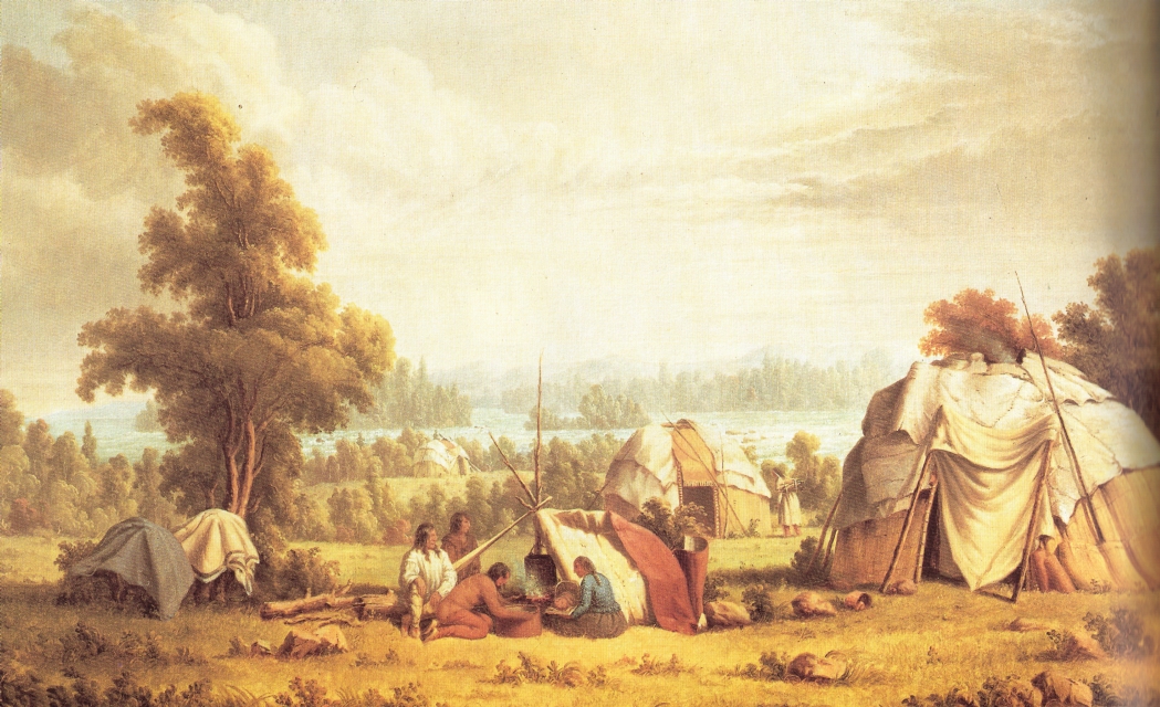
“Ojibwa village near Sault Ste Marie” by Paul Kane in 1845.
~ Commons.Wikimedia.org
Looking back from the water, upon the collection of tents and lodges, we had a view of the group at one glance, and the scene from the new point of observation suggested ideas that had not presented themselves while we formed a part of it. Around some of the camp-fires were gentlemen from the Atlantic shores, with genteel caps and surtouts, shivering in the raw wind of the morning. Poor fellows ! impelled by the hope of wealth to be found in the copper region, they had rushed, at steamboat rates, to the extremity of navigation, of taverns, and permanent habitations.
The reality of copper exploration had now commenced. A night of drizzling rain and fog had been passed, in a cold tent, on wet ground. Among them were seated voyageurs and half-breeds, as happy as a plenty of grub could take them. The raw wind was no annoyance to them, so long as there was a flint and steel to start a fire, and a plentiful stock of provisions. Between the cap and surtout, and the flannel shirt and canvass trousers, was every grade of men represented by a grade of habiliments.
In front of this motley collection of persons and things, lay the frame of a large schooner, on which fifty workmen were laying the plank – all its timbers and lumber brought from the lower lakes; and in the open level space beyond, along a track cleared through the swamp, stood the spars of a vessel, advancing on solid land towards the basin above the falls. This labour and expense of bringing vessels over land, or the timber to construct them with, is unavoidable. As far as known, there is not ship timber enough on Lake Superiour to build a schooner.
The rock which causes the rapids is a close, fine-grained, red sandstone, in thin layers, pitching to the northward. There has been much diversity of opinion among geologists, about the geological position of this rock. As I proceed, I shall again notice this rock, and its analogue, which occupies almost the entire south coast of this lake.

Map of Ohio including the Connecticut Western Reserve, the First Principal Meridian, and the Base Line. Drawn by Jerome S. Higgins, 1887.
~ Wikipedia.org
The 1st principal meridian of the U. States surveys, comes out on the waters of St. Marie’s, at the ship yard, just above the rapids. This is a true meridian, run with great care from the base line, which is about 12 miles north of Detroit. The 1st meridian is about 30 miles west of Detroit, and passing up through the peninsula of Michigan, crosses the straits near Mackinaw. By the Government system of rectangular co-ordinates, referred always to a given base and meridian, an observer knows his exact position, wherever he may be, in the surveyed portions of the U. States. Every township is six miles square, every section one mile square, every quarter section half a mile square. Every section [corner] has permanent marks on some adjacent tree, which gives the situation of that corner from its proper base and meridian. I make this explanation, to give light upon terms that I shall use hereafter. In traversing the American shore of Lake Superiour, we found, as far as the Porcupine Mountains, west of the Ontanagon, that the surveyors had preceded us. During the present and the past year they had extended the township lines to this distance along the coast, and for a part of this distance had subdivided the townships into sections. These surveys had been carried to different distances, interiour. From the base, near Detroit, numbering northward, St. Marie’s is in township No. 47 North, range No. 1 East. But our point of embarkment was on the west side of the meridian, in town 47 North, range 1 West, or 282 miles north of the base line.
We are now fairly under way, and shall be able to keep our reckoning. The river expands, as we ascend against a very gentle current; the shores are low and swampy, or sandy, and covered with stunted pines. In an hour and a half, so easily did our boat row, we were at “Point Aux Pins,” on the British side. At ten o’clock, we were on shore at the “Gros Cap,” looking up a spar, and clambering the red granite ridge, which here projects towards the American shore – the extremity of that range of mountains in view from the rapids, to the eastward. From the height of 500 feet, we could see the continuation of this range, westward, into Michigan, until its summit were lost int eh mist. The western extremity of the American range is “Point Iroquois,” nearly opposite “Gros Cap,” where the Chippeways, by their ancestors, fought a great battle with the Iroquois, long before the French came into these waters. The range is called the “Tequamenon Mountains,” overlooking for some 20 miles a deep bay, known as the Tequamenon Bay. The waters about “Gros Cap” are so clear that the bottom is seen from 50 to 60 feet below the surface.
Before leaving this inhospitable crag, we set fire to a windfall about about two years of age, and consequently in a fine state for a conflagration. This was not done through any republican contempt of the British Queen, or her territory, but from pure benevolence towards subsequent travellers exploring “Gros Cap.” It lay between the ridge and the bay, in a swamp so thickly covered with prostrate trees that one might go a quarter of a mile on them without touching the ground, unless an unlucky misstep should precipitate him into the mud beneath. At one o’clock, we were at “Isle Parisien,” a low island, five miles long, cooking a dinner, and procuring a better spar.
We succeeded here so well in fitting our sail, that the traverse of 15 miles to “White-Fish Point,” ordinarily a hazardous voyage, was safely and pleasantly made, a little after dark; and the wind, though light, being still fair, we ran into the lake without landing, and made along the shore. We were now upon the largest body of fresh water on the globe; called by the Indians, Kitche-goming, by the French, Superieur, or Upper, and corrupted by the English into “Superiour.”
The moon shone dimly through a heavy sky, the water was merely ruffled by a warm southern breeze, and in the distance the flame of the burning windfall shone conspicuously above the mountains. On the Michigan side, several large tracts of burning timbers were seen on the hills, at the head of Tequamenon Bay. It was determined to proceed as long as the wind continued favourable, but in a short time it failed altogether, and we went ashore at half-past eleven, and encamped. The ground here lay in a series of low sand ridges, with scattered pines. Distance from the Sault, 45 miles.
At sunrise every thing was on board, and the sail spread before a fair wind. Along the beach, the surf has piled a ridge of water-washed granitic gravel, five to six feet high, the deep water holding out quite to the shore. In coasting, in an open boat, the traveller must resign all hope of regularity of hours, of meals, and of sleep. His sovereign is the weather: when that is calm, he may proceed with the “white ash queen,” as the sailors say: when the wind is ahead, he can take his ease – provided he is safe on shore! But, when it is fair, he must always be before it. The prevailing winds along this shore are from the west, at this season; and, consequently, they are ahead as you go up the lake.
Breakfast on board, upon cold beans, cold pork, and hard bread.
Towards evening, the wind came so strong ahead as to oblige us to put into the mouth of “Two-Heart” river, a stream sufficiently deep to float a large vessel inside the bar, but not deep enough to carry the yawl with her load. Of the streams discharging into the lake from the south, only two or three are known with open mouths. At most of them it was necessary to lighten the boat and haul her over, with about the same labour and discomfort as though there was no channel; but once inside, a quiet harbour was always found. These mouths are so completely sealed up, and concealed by sand ridges, tat persons may pass them within ten rods of shore, and not discover that a creek is there.
The shore is composed of low monotonous sand ridges; with stunted pines. The bluff is from 50 to 80 feet high, presenting a stratified edge of sand, inclined gently to the east, not exceeding 10 feet in a mile. The ridges run from the interiour nearly perpendicular to the direction of the shore.
We passed several fishing huts, now deserted, with a plenty of empty salt barrels and fish scales scattered around.
A little east of the mouth of the creek we observed, in toiling up, several picketed enclosures, among the pines, on a beautiful ridge. They were Indian graves, thus strongly guarded to keep out the beasts of prey. There are those who doubt whether the Indian is susceptible to the delights of taste – whether he enjoys a bright morning, a clear and moonlight night, a mountain, a vale, or a beautiful river. Was it mere accident that placed this burying-ground upon so enchanting a spot? The lake is about 40 rods distant in front, and about as many feet below the site of the graves. Through the open trees you see its waters, as plainly as if there was no intervening timber – while the shade of its branches is perpetual upon the spot. Even the lowest ripple on the beach reaches the ear as distinctly as the angriest roar of the waves. Every breath of air that moves to and from the lake – the evening and the morning breeze, as well as the northern tempest, plays audibly upon the long and evergreen leaves of these ancient pines. At the head of each grave is a flat shingle or board, with emblems, painted in red, or rudely carved with a knife. On one, there are tree red cross-bows, and two human figures – representing a man and a woman, (doubtless a husband and wife,) with clasped hands. On the reverse, a bear – probably the sign or token of the deceased. On the top, three eagle quills. Some have crosses – indicating that a good Catholic sleeps below.
At an early hour on the morning of the 16th we got out of “Two-Heart” river through a light sea, determined to try the “ash breeze” against the west wind; but, after a couple of miles hard rowing, the regular breeze prevailed: we could no longer make headway, and put about.
Notwithstanding the sand-flies and moschetoes, it was comfortable to lie down once more upon the green grass and fragrant wintergreens of that shore. The weather was warm and heavy. Some wandered through the sand-hills and stumps; some, wrapped in blankets as a defence against the flies, sought in vain for sleep; others, with the fishhook and artificial fly, rowed up the creek in pursuit of speckled trout. A good dinner and supper of these fish was the result of the expedition.
At 8 P.M. the wind became more favourable, and the boat was headed up the coast. At 10 the weather became thick, and running ashore at random, we had the first trial at hauling our craft out of the water by main force. She proved to be as easily handled on land as a Mackinaw of the same capacity; only requiring more care. In camp, we turned her over – one gunwale resting on the sand, about thirty feet from the surf; the other set upon sticks, after the fashion of a trap. Under this we all crawled, spread our blankets, and some of the party went to sleep.
“[Martin] engaged in sailing on Lake Erie from Buffalo to Detroit until 1847, when he went in the interest of a company in the latter city to Lake Superior for the purpose of exploring the copper ranges in the northern peninsula of Michigan. He coasted from Sault Ste. Marie to Ontonagon in a bateau. Remaining in the employ of the company about a year, he then engaged in a general forwarding and commission business for himself.”
Mr. J. R. Dorr, of Detroit, the principal of the expedition, had seen something of this kind of life. Mr. D. P. Bushnell , of the same place, had long been Indian agent at La Pointe; and was, of course, familiar with the country and this mode of travelling. Another gentlemen, well known on the lakes for his wit and vivacity, qualities that generally attend an excitable temperament, not being accustomed to tents, boats, and camps, found it rather uncomfortable. The sand, so soft and yielding to the foot, was as hard as a rock to the bones. The grinding of the gravel, thrown incessantly about by the waves, gave out a grating sound that had no tendency to sooth a man to rest; especially one who had been accustomed to the quiet of the third story of a boarding-house. Besides, there was some chance of the props giving out, and the trap springing upon the legs, arms and bodies projecting from beneath. Mike, an old soldier who officiated as cook; Martin, a sailor just from the whaling grounds of the Northwest Coast; Charley, a giant from the Low Countries, and Patrick, the other hand seemed to pay no attention to the hard bed, the cold wind, the noisy waves, or to the doubtful props. A sprightly young clerk of the company, fresh from the counter, though swollen and tormented by the poison of the sand-flies, took the matter like a veteran, and slept like an opium-eater.
About noon the next day we passed the “Grand Marais,” a Bay 40 miles from White-Fish Point, with six feet water on the bar, and a fine harbour.
Two men had left St. Marie’s the day before we did, in a small, but neat and clinker-built boat, with two masts and a wide keel. They were wholly unacquainted with the difficulties that lay before them; yet one of them, by the name of Axtel, had been exposed in the same boat 48 hours to the fury of a Lake Michigan storm, and therefore felt a confidence in fate. neither of them had been on Lake Superiour, and therefore knew little of its harbours, rocks, and storms. Their supplies were salt pork and bread, their furniture a camp-kettle.
Passing Grand Marais, before a smart breeze, we saw their fire in the harbour, and shortly their sail, coming up astern. Here the low, regular, dear shore of sand, suddenly changed to a lofty wall of the same material, rising from the water’s edge, as steep as it will lie, to the height of 400 feet. For 20 miles back, there had been seen near the water’s edge a stratum of pebbles, inclined, with the sandy stratum above it, to the eastward. Now the strata of sand rest on a bed of clay, with the same inclination, but only a few feet in the mile. The Grand Sable struck us with the more force, because of the sudden transition, from a low, uninteresting shore, to a bold, lofty, regular scarp, four times the height of the tallest trees. But there were upon this Sable no trees or other vegetation, either on the face towards the lake, which was nearly perpendicular, or upon the summit – all was one black pile of sand; yet so clear, so regularly stratified, and so beautifully variegated, by colours, white and red, that the prospect was not deary, but rather sublime. Imagine a straight wall of pure sand, four miles long, and four hundred feet high; the base lashed by a rough sea, its top enveloped in a heavy mist, through which rounded hillocks of white wind-blown drift occasionally rise, as the eye reaches, mile after mile, over the country behind. To me, this sight was more grand and curious than the Pictured Rocks. Whence came this mass of sand? Its upper portion has apparently been moved about by winds; its lower portions appear to be too solid to be thus moved. Was it not in remote ages, like the low sands we have passed, but extending much further into the lake. A prevailing north wind, with sufficient force to move the sand at the surface, would overcome vegetation, and, like the current of a river, transport the particles incessantly in one direction. By this means the sand would pile higher and higher, and the lake always encroaching at the foot, would increase the height of the bluff shore.
The “Sable” overlies, on the west, a variegated sand rock, coarse grained, and easily broken, pitching slightly to the eastward. This is the first rock west of White-Fish Point. The stratification is imperfect, the colour, an irregular mixture of grey and red.
Turning one of the rocky points west of the “Grand Sable,” a stiff gale from the west put an end to further progress, and gave warning of a storm. The only expedient in such an emergency, is, to beach the boat, and draw her out of the reach of the waves. It is an operation not always agreeable; because, while loaded, she cannot be run upon dry ground; and, to be unloaded, the goods must be taken through the water to the shore. On this occasion the wetting process had been gone through with, two hours before, during a heavy fall of rain.
Our baggage was scarcely safe on land when the wind blew furiously, and our two friends in the sail-boat appeared, endeavouring to make the shore, as the sea had risen so much, that a landing was at this moment not only uncomfortable, but a little hazardous.
As the storm increased, our fires began to burn brightly. Near the boats, was a little dell, sheltered by a low ridge of sand, where our tents were pitched, and all made dry and comfortable, while the gale heightened into a tempest.
On the next day, progress was impracticable, and being well provided, we determined to give an entertainment. our friends were invited at 1, P.M. They had bean soup, boiled ham, tea and coffee, bread, and pickles. The quantity consumed, probably exceeded that of ordinary dinners, as much as it does at the annual meals of the Aldermen of New York, and London. As to style, there were tin cups and pewter platters, knives and spoons. For tables, there were the knees of the guests and a spare box; forseats, camp stools and bundles. The entertainment continued with great glee about two hours, and passed off with as much sociability and mirth as though it had been given at the Astor.
After the first hour had been spent in the enjoyment of this cheer, our guests began to refuse dishes, by way of politeness; but the ex-Indian agent put all such hesitation aside, by relating what he had done and seen in the Indian country. There was one example of an Indian eating half a bushel of wild rice at a meal. Another, of a half-breed, who was sent out to bring in a deer that had been killed some miles from the post. The half-breed lost his way, and slept in the woods one night. The next day, in the afternoon, he came in without the deer. He was asked where he had left it. “Ugh ! got him – do you s’pose a man is to starve.”
One thing is certain – in this high latitude, with its pure and healthy climate, where the enervating effects of heat upon digestion are unknown, men may eat with impunity what would be fatal to them at the south.
In commemoration of the feast, a little trout brook, which empties there, was named “Pickle Creek,” and the names of the party, neatly carved on a neighbouring birch.
False Imprisonment
One of the our guests is the son of a former sheriff in Canada, who made the journey from St. Marie’s to Fort William, by land, in the winter of 1816. The object of this trip, through a region so rough and forbidding, in the severity of the cold season, was the execution of a warrant upon Lord Selkirk, then in possession of that post. Fort William is situated about the middle of the north shore, nearly opposite the east end of Isle Royal. The warrant was issued from the King’s Bench, and had reference to some of those acts of violence that occurred between the “Hudson’s Bay Company” and the “Northwest Company.” The sheriff, whose name was [Smith], at last reached the fort, with ten men. Selkirk professed to hold, and to fight, under the ancient chartered rights of his ancestors; and when Smith presented his authority for the arrest, Selkirk fell back on his charter. Smith offered the authority of the King’s Bench; Selkirk claimed to be outside of all civil jurisdiction, and replied: “If you do not believe in my charter, here is my authority,” pointing to about 50 men, who were ready to do battle in such emergencies. He continued: “Instead of my being your prisoner, you are mine. I will treat you and your men well, yet you must take quarters in the block-house till I leave here.”
Accordingly, the sheriff was obliged to remain in custody about five months, until the opening of the season.
The timber about Pickle Creek is black and white birch, a few stunted white maples, white and yellow pine, mountain ash, spruce, balsam of fir, balsam of spruce, white cedar, and hemlock; none of it large enough to be valuable.
The next morning at 4, with a fair wind, we were on the water, having Grand Island in sight, at daybreak. This island is high and bold, like the Pictured Rocks, which lie on the mainland opposite. It bears sugar maple in profusion, and has one family (that of Mr. Williams) residing upon it; he is a thrifty farmer and trader. The variegated sandstone, as well as I could determine, here plunges to the west, and passes under the strata which compose the Pictured Rocks. The lamented Dr. Houghton regarded the red or variegated sandstone of Lake Superiour, as older than the “old red sandstone.” The Pictured Rock stratum he considered the equivalent of the “Pottsdam sandstone” of the New York Reports. This rock comes to the shore, about twenty miles in length, and has a thickness of at least five hundred feet. Grand Island is an outlier on the north.
The following is a section from the water’s edge upward, taken by the eye, at the highest point, which, according to Captain Bayfield, is 300 feet.

It will now be readily seen, how the perpendicular faces of rock are caused, which have given this passage such a frightful aspect. Vertical walls of smooth, gray rock, 200 to 300 feet high, passing to unknown depths beneath the surface; in places worn into large caverns, in others, coloured in fantastic, yet grim figures, half real and half imaginary, yellow, green, and black; shapes neither animal, nor in the likeness of any thing else that is natural, but so near the natural, as to give rise to the idea of monsters, griffins, and genii. Such are the Pictured Rocks, before which the Indian thinks of his Manitou, and the Frenchman crosses himself with profound reverence.
The soft conglomerate (No. 1) yields to the incessant wear of the wave, which, rolling from deep water, strikes with great power. When the undermining process has extended a few yards, the hard stratum next above falls, and with it the superincumbent mass. Much of this dissolves away in time, leaving the fragments of No. 2 visible, in great blocks, at various depths beneath the surface. The colours are furnished by the dripping solutions of iron, in the state of oxyde, carbonate, and sulphate; by moss growing upon the face of the rocks, and probably by the green carbonate of copper. The niches, caves, and angles, follow naturally from a rock of different degrees of hardness, acted upon by the same disintegrating force. At the mouth of a creek, where the trail from “Bay De Noquet,” (called Bodenock,) on Lake Michigan, strikes this lake, there is a hard silicious slate, approaching to flint, dark in colour, and imperfectly stratified. This bed, which appears to be limited, lies low, near the water.
Passing these dreaded rocks, the principal harbour of Grand Island, and the farm of Mr. Williams, come in view. For refuge in bad weather, this island must, in future time, be of great advantage to vessels. It has several large and deep harbours, and of itself forms a good lee, in almost all weather. On the mainland, opposite Mr. William’s, is a solitary cabin, the agency of the American Fur Company.
Between Grand Island, on the west, and the shore at Train River Point, there are two low islands, that appear to be formed of the red sandstone. At the point, this rock forms the shore, and has a rapid dip to the eastward, say 150 feet in the mile; evidently running under the Pictured Rocks, and therefore an older formation. Here it enclosed occasional pebbles of quartz, agates, and fine-grained sandstone.
The wind, which had been fair all day, on turning the point came strong ahead, against which we had hard pulling about five miles, to the mouth of Train river. our craft proved to be a fast sailer, easily beating the little clinker of our friends, before the wind; but those dauntless fellows did not rest, until, at the end of the day, they drew her into the same harbour with us. Train river, like many others, has deep water inside, but only a few inches at the entrance. Wherever we set foot on shore, the remains of previous travellers were seen. Here, the poles of many Indian lodges were standing, and the bones of a bear lay around, indicative of a feast. There were, also, dwarf cherries and whortleberries.

“Geological Map of the District Between Keweenaw Bay and Chocolate River, Lake Superior, Michigan.” By John Wells Foster, circa 1849-1854.
~ Huntington Digital Library
Passing out of the bay, in the morning, a range of mountains were visible, the ends presenting themselves near at hand, and the principal range extending westward, toward Chocolate river. From the outline, I conjecture that they are composed of primitive rocks. At the shore, the strata are still the variegated sandstone, very much tilted with thin beds of shale interstratified; apparent dip, to the northward. Making a long traverse from Train River Bay, at 5, P.M., we entered a magnificient harbour, between projecting points of granite rocks; and coasting along inside some islands, soon saw that there was a very safe and spacious shelter for shipping still further inland, accessible in any wind, with deep and quiet water inside. This bay is sometimes called Presque Isle. It commences about two miles north of the mouth of “Riviere des Morts,” six or seven miles northwest of Chocolate river, and extends to Granite Point.
Mr. Dorr being quite ill, our party remained a day. The boat anchored in a quiet nook of the harbour. Granite rocks were projecting on all sides, through the red sandstone, scorched and whitened at the points of contact. In the rear, were seen rugged mountains, covered with evergreens. This was regarded as the commencement of the copper region. Accordingly, myself and Martin sallied forth in the morning, to spy out the mineral wealth of the spot. On the south point of the bay, to our great satisfaction, we discovered a piece of green carbonate, about the size of a pea, in the hard, green stone trap; but a little further on, found, also, evidences of prior occupation, in a log cabin covered with birch bark, a small patch of chopped land, and a pen made of poles, which enclosed two or three hills of potatoes, and some stalks of green peas. Pursuing our way along the shore, to Dead Men’s river, we found a permanent fishing establishment, and two comfortable houses, now deserted and locked up.
The country adjacent, for two or three miles, is low and swampy, with sand ridges between the swales; and at the mouth of the river, heaps of granite rocks. It was soon evident that the surveyors had been this way, and that very recently. At the south point of the bay, was a stake, on the dividing line between sections Nos. 1 and 2, town 48 north, range 25 west; showing that we were one town, or six miles north of St. Mary’s, and 25 towns, or 150 miles west.
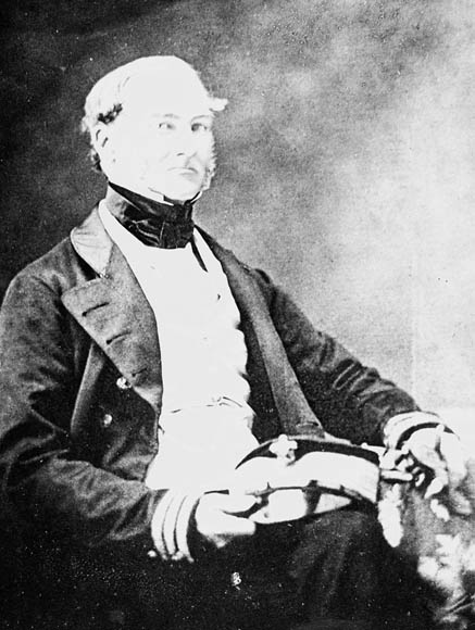
Bayfield, Wisconsin, was named in honor of Admiral Henry Wolsey Bayfield, who surveyed Lake Superior between 1823-1825. His map of Chequamegon Bay is available online here. Photograph from Dictionary of Canadian Biography.
In making the traverse from Train River Bay, to Presque Isle Bay, a singular object was visible to the right, long before the shore opposite to it came in sight. Under the effect of refraction, it rose and fell, dilated and contracted, changing continually from a tall spire to a flat belt of land. By the glass, it was seen to be almost destitute of trees, and Mr. Bushnell began to regard it as one of the peaks of Point Kewena. There is no map of this lake, upon which a navigator can rely, except a British one, from the survey of Capt. Bayfield, (Royal Navy,) made about 20 years ago. We had what purported to be a copy, but soon found that it was not a true one. We could neither recognise from it, the harbour, the points, nor the rivers, where we were. At Chocolate river the coast, from a westerly course, makes almost a right angle to the northward; but at that time, whether we were at Chocolate, or Dead Men’s river, we could not tell.
The isolated object seen in the north proved to be the “Granite Rock,” situated about 10 miles from the shore, 50 to 80 feet in height, and a few acres in extent. Along this shore, huge masses of this recent granite rise through the water, and may be seen in its clear depths. From the section stake just mentioned the Granite Rock bears north, 10 or 12 miles distant. It must not be confounded with “Standard’s Rock,” which is in the track of vessels from Point Kewena to St. Mary’s, 30 miles from land. That these granite rocks are more recent than the sedimentary sandstone which rests upon them, is evident from observation. The metamorphic rocks have protruded through the sandstone, distorting and breaking up the strata. If the red, or variegated sandstone, had been deposited after the upheaval, this disturbance would not have been visible, nor would there have been seen the discolouration and semi-vitrification at the junction, or contact of the two formations.
The mountainous country, which here comes quite to the lake, extends in east and west ranges, beyond the sources of the Huron river and Kewena Bay, and appears to have been formed by the same volcanic effort. The spacious and beautiful harbour where we lay, is formed by four granitic islands, three of them now connected with the shore by sand-bars, forming as many “Presque Isles.”
Our next day’s sail ended at a small creek, represented on the map as the St. John’s river, but by the voyageurs called Cypress river, from the adjacent forest of cypress timber, as it is called. This tree is an evergreen, with rough bark, resembling a tamarack, but the leaves are more like the hemlock. At 15 miles from Presque Isle Harbour, the shore made again to the westward, the sandstone bluff being more elevated and perpendicular; its strata somewhat rolling, but the general dip appeared to be westward. The knobs of Point Kewena were now distinctly in sight, from 40 to 50 miles distant, in the north. Mr. Door, being quite sick with a bilious fever, we determined to make a long traverse on the next day, across the bay, to Inverse Island, and thence, with all dispatch, to Copper Harbour. But after putting out, in the face of a stiff breeze, early in the day, we found it impossible to weather the next point, and returned to camp. The river called the St. John’s by us, is known to the French as the “Chien-Jaun,” or Yellow Dog river, corrupted, in the first instance, to “Shannejone,” and Thence to St. John. It is, on the map, laid down as about 30 miles long. In this country the creek is never used, but the French term “riviere,” is applied to all its streams, which is Anglicised river. Being now wind-bound for the day, I took our trusty and intelligent whaler, Martin, who had already shown himself a good woodsman, as well as a first-rate sialor, and followed the creek into the interiour. At the end of two miles of still, deep water, our canoe was obstructed by flood-wood, and at three-fourths of a mile further, by a fall of 8 or 10 feet, over sand rock. Above the fall was a beautiful lake, overlooked by granitic mountains on the west, with an opening at the south. This led us to a second lake, and this to a third – strictly speaking, only branches of the same water – in all, about four miles long. On the wast and south were gentle ridges, sustaining the first valuable pines we had seen; on the west, lofty hills. In the low grounds, at the water level, were thousands of large white cedars, forming a perfect abattis, or barrier, against our progress. There were pheasants and ducks in abundance – red squirrels, and whortleberries. On the whole, there was present so much of the New England scenery and productions, that I have written on my sketch of these ponds the name of “New England Lakes.” This is the termination of our 30 mile river.
On the succeeding day, the wind being still adverse to a direct passage to Copper Harbour, we thought only of proceeding along the coast, to the westward, and reached the mouth of Huron river, in a few hours. The health of our invalid having improved, we hauled the boat over the sand-bar, at the mouth of this river, and finding deep and wide water, ascended about two miles, and encamped. The reports of other exploring parties, were highly favourable to the Huron region, as a mineral location; but after expending two days of rainy weather, in the mountains between the Little and the Big Huron, and finding the signs of valuable copper not promising, we set forward for the “Anse.”

Map of the Mineral Lands Upon Lake Superior Ceded to the United States by the Treaty of 1842 With the Chippeway Indians.
~ Wisconsin Historical Society
During our stay, we had made an excursion, by water, into a bay about 15 miles deep, called after the adjacent islands and river, Huron Bay. The shores are low, and the extremity, or head, swampy, and filled with a labyrinth of wet islands, covered with white cedar. On the south, the Huron range overlooks the bay, at a height of 500 to 600 feet. This inlet is in the form of a pocket, gathered at the middle; and if necessary, though shallow, would accommodate a great number of vessels. When we were fairly at the bottom of the pocket, the wind came square in, and preventing our departure that night, we were under the necessity of encamping, without blankets, in a lodge lately occupied by the surveyors. A lodge is a temporary habitation, erected by those who have no tents, to be occupied for the night, or, for some days if the weather is bad. It is made of evergreen boughs, pine, hemlock, or balsam, cut short. The frame-work consists of two crotches, and a pole between them. On the side towards the wind poles are laid, like rafters, one end on the ground, the other on the cross-pole, in the crotches. On these the small brush is laid, like shingles, beginning at the ground, and each course overlapping the last. The ends are stopped in the same way, and the fire built in front. They serve to keep off the dew, snow, and wind, but are of little avail in heavy rains.
The promontory between Huron Bay and Kewena Bay is called “Point Obang,” a corruption of “Point Abaye.” It is a low, flat tract of land, which bears some sugar maple, and has a good soil, capable of cultivation. The range line between ranges 29 and 30 west, comes to the lake a short distance west of the mouth of Huron river. The northwest corner of Section 18, T. 52 No., R. 29 W., is about a mile from the shore – showing a progress to the westward of St. Marie’s of 29 towns, and to the northward five towns.
About six miles from the shore is a collection of granitic islands, called the Huron Islands, inhabited by rabbits in great numbers. Soon after casting loose from the Islands, our fitful breeze again settled into the west, where she tumbled and pitched all night and all the next day, our faithful whaler sleeping on board. In the evening, a calm enabled us to work with oars, and to reach the mission at the “Anse” about daybreak.
This term, is the French for a small bay, and is used to designate the place, as well as the head or extremity of Kewena Bay. Here the Abbe Mésnard preached to the Sioux, in 1660, and impelled by the missionary spirit, proceeded towards “Chegoimegon,” the modern La Pointe. He is said to have perished in the wilds beyond the Ontonagon, for he was seen no more.
There is yet a Catholic mission on the north side of the bay, which, with its collection of log cabins, and chapel, presents at a distance, a very pretty view. On the south side is the Fur Company’s agency, now comparatively desolate, and the Methodist mission for the Chippeways. Dr. Johnson, the carpenter, and Mr. Brockway, the blacksmith and farmer, of this mission, showed our party great kindness, which is more to be considered, when it is known that the spirit of copper speculation had attracted many people to the country, all of whom received the good offices of the establishment.
The mission farm produces good grass, very heavy crops of potatoes and turnips, good oats, barley, and rye. They are now trying the wheat crop, with little doubt of success.
Those who have spent the winter here, do not complain of its severity, although snow lies from one to four feet deep, from December till May. The bay furnishes inexhaustible supplies of white fish, that are taken almost the entire year. Every night, except Sunday, the water is dotted with the canoes of the squaws and Indians, planting their gill nets; and again, at daylight in the morning, these female fishermen are seen overhauling the net for their morning meal. The two missions appear to divide the band about equally. At this moment, the principal portion of both flocks are absent at La Pointe, receiving their annuities, each under the watchful care of their respective pastors.
From the Anse to the mouth of the Ontanagon, direct by land, is a very practicable route for a road, the distance about 45 miles. It is from this place, also, that the winter trail to Green Bay leads off to the southward, and which must always be the approach from the States by land. To reach the Ontanagon by water, the distance is about 160 miles, following the shore around Point Kewena. But about 12 miles from the Catholic mission there is a river, called the Portage river, that communicates with the Portage Lakes, which extend across the base of Point Kewena, to within one mile and a half of the northern shore. For bark canoes and light craft this portage is practicable, and usually made. About 60 miles of navigation is thus avoided.
Having feasted a couple of days upon the good things of the Anse, to wit: potatoes, turnips, sweet milk, and fresh bread, we departed for Copper Harbour, and arrived there in ten days. The sand rock of the south shore of Kewena Bay continued around on the northern side to “Bay de Gris.” A little beyond this, a different rock made its appearance, but probably the geological equivalent of the red and variegated sand rock. it is a very coarse, but stratified conglomerate, with pebbles of gate, quartz trap, amygdaloid trap, red granite, &c., many of them larger than a man could lift. It is raised in uplifts, corresponding with the subordinate trap, and contains fissures like the trap, which are filled with spar. The general course of the uplifts is southwest by west, and the course of the fissures or veins, both of the trap and conglomerate, is nearly at right angles to the face of the uplifts. It is in these veins that the native copper and its ores are found.
The line of greatest elevation runs near the middle of the point, forming an anticlinal axis, from which the rocks pitch each way, at various angles, from 20 to 60 deg. But it must not be supposed that the descent is regular from the summit towards the lake. In the volcanic convulsions that generated and raised the trap rocks, they were greatly broken and fractured; and consequently, the overlying rocks, the conglomerate and sandstones, were dislocated in the same way. They now lie in the form of vast steps; the broken faces of the conglomerate and trap nearly perpendicular, and the slopes at the angles above stated. The veins of the stratified and the unstratified rocks appear to be of the same age, to have been formed by the same cause, after the enclosing rocks had taken the form and position they now have. Upon the manner of the formation of these veins there are various conjectures, which I have not space to notice. When they pass from the conglomerate to the harder and more compact trap rock, they are said to diminish in width, sand the material of the vein changes. They carry, in general, beautiful calcareous spar, and also other substances besides copper, such as quartz and barytes.

Painting of Douglass Houghton by Robert Thom. Houghton first explored the south shore of Lake Superior in 1840. Houghton died on Lake Superior during a storm on October 13, 1845. Chequamegon Bay’s City of Houghton was named in his honor, and is now known as Houghton Falls State Natural Area.
From the Manitou Islands, at the extremity of Point Kewena, to the Portage Lakes, the most elevated mountain range, or rather succession of knobs, is nearer to the north than the south shore, and from 100 to 800 feet in height. It is a very rough region to explore, with precipitous rocks, thick cedar swamps, and tangled evergreens, in every part. But, Dr. Hougton, with five companies of explorers and surveyors, has subdivided all the land east of the Portage Lakes into sections, during the past summer, except one fractional township. The labour and exposure attending this work cannot be understood by any except those who have been upon the ground, and seen its mountains and swamps. This survey was undertaken to demonstrate the practicability and value of a favourite system of Dr. Houghton’s. He had, as geologist of the State of Michigan, spent several years in this desert region, and knew its mineral worth. He felt, as every exploring geologist feels, the necessity of exact topographical and lineal surveys, in order to give his reports that character of perfect accuracy of which the science is capable. in truth, a large portion of the results of mineral explorations is geographical, topographical, and mathematical matter. The thickness, extent, and dip of rocks, when found, constitute a perfect measurement of the country. Dr. Houghton contracted with the Government to make the lineal survey of this region, and at the same time a geological one; and labouring upon it as the great undertaking of his life, had, as I have remarked, nearly completed the most difficult portion – that of Point Kewena. His melancholy fate is well known.

Detail of Copper Harbor and Fort Wilkins from “Survey of Location No. 4 for the Pittsburgh & Boston Copper Harbor Mining Co.” Image digitized by the Detroit Public Library Burton Historical Collection for The Cliff Mine Archeology Project Blog.
By these surveys, Fort Wilkins and Copper Harbour are situated near the southwest corner of town 59 north, range 28 west, or 12 towns north, and 28 towns west of St. Mary’s.
The returns of the Government surveys of this region will not show any of the coasts and water-courses, in connexion with towns and section lines, but will give the elevation and depression – what public surveys hitherto have not – of the country, taken at every change, by the barometer. They will, further, exhibit the exact limit and character of the mineral region. Such a system, introduced into all the public surveys, with modifications suitable to the agricultural districts, such as the analysis of soils, collection of plants and marls, would be of immense advantage to the settler, and honourable to the nation.
The maps and papers of the mineral agency at Porter’s Island, in Copper Harbour, showed about 500 locations, of one mile square, each. The War Department has, by usage, the control of the mineral lands of the United States. It is doubtful whether there is any law that covers the case of the copper mines of Lake Superiour. The President has, however, reposed the power of leasing these and other mineral lands in the War Department, which confides their management to the Bureau of Ordnance, which acts by local agents. The Secretary of War, or the local agents, grant permits of search and location, and the location being made, a lease is granted to the locator. in this lease, there are covenants to render the Government six per cent. of the mineral raised, for three years, and after that time, the Government have power to require ten per cent. for the next six years.
At first, the permits including three miles square, or nine square miles; but were, early last spring, reduced to one square mile, and given upon every application, without fees. About 70 permits were now laid in the neighbourhood of Dead Men’s river, and 8 or 10 about the mouth of Huron river. The Point Kewena, proper, that is to say, that portion east of the Portage Lakes, was mostly covered, and various other large tracts on the waters of Elm river, the Ontonagon, Iron river, and even on the Brulé, beyond La Pointe.
In order, therefore, to locate our permits, it became necessary to go westward, and explore some of the vacant regions beyond the Portage Lakes. We therefore left Copper Harbour, touching at Agate Harbour, Eagle Harbour, and Eagle river, and proceeded to the mouth of Salmon Trout river, in township 55 north, range 35 west.
Mr. Bushnell, and myself, and two men, here took to the woods, and striking the range line between 34 and 35, followed it south, to the southeast corner of township 53 north, range 35 west, being about 17 miles interiour. To our surprise, instead of finding a rugged mineral region, we had passed through a handsome rolling country, tolerably well watered, with a good loamy soil, producing an abundance of sugar maple. Along the margin of the lake, owing probably to the harsh and moist winds from the water, nothing bu birch, balsam, pine, hemlock, spruce, and white cedar, is seen; but to the distance of two to five miles, interiour, the forest growth changes entirely. There is an occasional white pine, with a lofty, straight, and majestic trunk, some scattering elms, linns, and black oaks, but the reigning tree is the sugar maple.
On the left, lay the valley of the Portage Lakes and of Sturgeon river, which we had just crossed. Turning westward, we soon encountered one of those eye-sores to the explorer and surveyor, a cedar swamp, in which a progress of a mile an hour is considered rapid travelling. The white cedar lives to a great age before it beings to decline. It finally rots at the root, and is blown down by the northern tempest. But this is by no means its end; its prostrate trunk sends up live branches, that draw sustenance through the roots of the parent, of new prongs went by itself below, among the buried trunks of preceding centuries. In after ages, when it has at length matured, and, weakened by time, has yielded to the winds, another sprout from its side keeps the family stock in perpetual being. Beneath the accumulated bodies of these trees, some dead and some living, the water, in which they delight, stands the year through, flowing gradually towards some stream of the vicinity. What is remarkable, the water of these swamps, so little and slow is the decay of the cedar tree, is clear, pure and cool.
I hope I have been able to convey to the reader, a just idea of a white cedar swamp, because without a correct conception of this, he will never be able to realize the great difficulty of travelling in this new country. After he has penetrated one of them forty rods, the view is equally extensive in every direction, whether it is only forty rods to the other side, or whether it is two miles. In addition to the network of logs, and the thicket of leaves that never fall, it is necessary to thin of numberless dry, sharp, and stiff prongs, the imperishable arms and limbs of dead and fallen trees. It is then to be remembered that every man carries more or less of a load upon his back; his blanket, his tin cup, probably some implement, a hatchet, or a hammer, with specimens, and a few pounds of provisions.
The second night found us advanced about one mile into a noble cedar swamp. Climbing a tree extended somewhat the range of the eye, but it met only the sombre and half naked trunks of the white cedar, in every direction. A camp-bed was formed beneath a tall and beautiful larch, or tamarack, and a fire made at its root. The bed was made made as usual of branches, kept out of the water in this instance by brush and poles. This white cedar has the merit of burning readily, as well as of durability, and made to-night a bright fire, flaming gaily upwards against the straight and stately larch. When had such an illumination shone there before? The owl gave utterance to his surprise in hideous screams, and hooted for his mate. The larch, as it swayed to and fro in the night breeze, seemed to creek and groan because of the fire, which was scorching its sinews and boiling its life-blood in its veins. No doubt, before many seasons pass by, he will sicken and die, and from a tall prince, overlooking the humble cedars, will come heavily down, perhaps in the stillness of night, and lay his body along side of theirs.
In the morning, after passing a cold and comfortless night, a few minutes’ travel cleared the swamp, and rising some very high land, we found the stratified sandstone again, and inclined towards the lake.
At the southeast corner of township 53 north, range 36 west, the trap ranges again made their appearance, from whose summits the mountains of the Huron river were visible, in the south, beyond the Anse.

John Harris Kinzie
~ Wikipedia.org
We were now on the head waters of Elm river, on ground located for many miles around. Most of them are what are called office locations, made without visiting the spot, and in consequence of some locations made by Mr. Kenzie, of Chicago, from actual observation, of which favourable reports were in circulation.
That night we should have met two of our men at a rendezvous with supplies; but neither party had sought the right spot, so indefinite were the descriptions given us of localities. As it was some miles from the coast to the mineral ranges, the boat passed slowly along the shore, sending out provisions, from time to time, to the exploring party. It was not then known how far west the township lines were surveyed, consequently the points of meeting were fixed at the forks of some stream, or some old camp, and in finding these many errours might be committed. In this case a day was consumed in uniting the two parties, which would not have been of so much consequence, had not the stock of eatables began to fail. But most of the disagreeable effects of a short allowance were avoided by the capture of a porcupine, of which we made, by long boiling in the camp-kettle, very palatable soup.
On the 20th of September, at a distance of 20 miles from the coast, there were a few flakes of snow, succeeding a cold rain. On the 21st and 22d, rain. The ground passed over during this week, is drained by the Salmon Trout river, (a creek,) Elm river, Misery river, Sturgeon, and Flint Steel rivers. Every member of the party was delighted with its soil, its beautiful and heavy timber, and the unsurpassed purity, plenty, and coldness of its waters. We passed several small clear lakes, the sources of many streams. These streams are in general but few miles in length, enlarging very fast as you follow them downward from the head, alive with the famous speckled trout, rapid in their descent, and so uniform in the flow of water, that water power is every where abundant. Many a time did Patrick and Charley select their future farms, on the border of some quiet pool, from which a tumbling brook issued, bearing its faithful tribute into the reservoir of the Father of Lakes.
The cedar swamps, so hateful to the explorer, will be necessary to the farmer for his supply of rails; the tall, round pines, scattered here and there among the sugar trees, now so green and majestic, will supply him with lumber; the straight and beautiful balsam, with timber.
Hitherto, the mineral trap rocks that rise occasionally through the sandstone stratum, do not greatly interfere with the use of the land for tillage. This rock, when fully disintegrated, gives a light soil that produces well. In this vicinity, the trap rises suddenly out of the plain land, sometimes with one perpendicular face and one gentle slope; sometimes like an island with a bluff all around, and flat, rich land on the top; and sometimes in irregular peaks, standing among the timber like cones and pyramids. At the sources of Flint Steel river we saw, interspersed with protruding summits of trap, peaks of conglomerate shooting up from flat land, to the height of 50, 70, and 100 feet.
Pursuing a southwesterly course, about noon, on the 26th, we entered the ravines that lead into the Ontanagon. From Elm river to the Ontanagon, the sand rock is covered from 10 to 400 feet in depth, with a stratified deposite of red clay and sand, very fine. It is commonly called clay, but contains more silex than alumine, though tit is so minutely divided as to have the appearance of clay. I saw nowhere true clay beds, but it is possible some of this deposite will harden in the fire, so as to make bricks.
This great sand-bed is easily washed out by running water. From the Falls, the Ontanagon has hollowed out for itself a channel 300 to 400 feet deep, and from a half a mile to two miles wide. The lateral gullies are very numerous, deep, and steep. Every permanent rill, operating for ages, has excavated a narrow trough, the bottom of which descends towards the river, in the inverse proportion to its length, and the sides remain as nearly a perpendicular as the earth will lie. The low grounds, not so wet as to cause cypress and cedar swamps, are everywhere inclined to produce hemlock and balsam. It is the same in the prairies; cold, moisture, and a confined atmosphere, causing the growth of evergreens, and also of cedars.
It will be easy to judge of the facilities of travelling in the region of the gullies. To cross them, rising one slippery face and sliding down the next, is very exhausting to men loaded with packs. To follow down one of the ravines, so narrow, deep, and shaded, as almost to exclude the sun at noon, is much like the change “from the frying pan into the fire.” The timber of the sides has fallen inward, into and across the contracted pathway of the rivulet, so thick, and so much entangled, that the mind is in a constant state of exercise, determining whether it is easier to crawl under, or climb over the next log.
In such regions, as you approach the common discharge of all these ravines, as a creek, a lake, or, as in this case, a river, the number of lateral gullies diminish, and it is sometimes preferable to take the crest of the gulf, and follow it towards the mouth. We did so; and coming along a narrow backbone, scarcely wide enough for two to walk abreast, suddenly came to its termination, with the river far below us. It was noon of a lovely day, such as are called the Indian summer. In the distance, to the north 12 or 15 miles, a thick haze covered the lake; the sides and bottom of the valley of the Ontonagon, were brilliant in the mellow sunlight, mottled with yellow and green; the golden tops of the sugar tree mingled with the dark summits of the pine and the balsam. The rough gorges that enter the valley on both sides, were now concealed by the dense foliage of the trees, partly gorgeous, and partly sombre, made yet richer by the contrast, so that the surface of the wood, as seen from our elevation, in fact from the waving top of a trim balsam which I had ascended, lay like a beautifully worked and colored carpet, ready for our feet.
On this promontory, jutting into the valley, we kindled a fire in the dry and hollow trunk of a hemlock, as a beacon to our companions, who were to be at the foot of the rapids with the boat.
On the left or inland side, the valley at some miles distant is seen to divide, corresponding with the two branches of the river. In this direction are elevated peaks, several hundred feet higher than our position, but partly hid in the mist of the atmosphere. We had now spent as much time in scene gazing as was profitable, and taking up our packs, tumbled down the bluff to the river. There stood the tents, and there lay the boat, with our comrades lounging about in the sun. The meeting brought forth three hearty shouts all around, and such congratulations of genuine good will, as none but woodsmen and sailors know.
We were now at the foot of the rapids, one mile north of the correction base, which is also the line between towns 50 and 51 north, and one mile east of the range line between ranges 39 and 40 west.
On the next day, after washing, drying, and mending, some of the most needed garments, Patrick, our faithful Irishman, and myself, crossed the river, and went west along the correction line. This course carried us constantly nearer the lake, because the direction of the shore is south of west. The timber was, as might have been expected, on approaching the lake, more hemlock, birch, and balsam; but the soil appeared as good as that we had passed over from Salmon Trout river, in range 35 west. In range 41 west, we turned to the left, and soon found that no surveys had been made south of the correction line. The same day a rain set in, that lasted, with little intermission, four days and five nights. In the trap region, the magnetic needle is subject to great fluctuations. When the sky is overcast, as it was in this case, from morning to night, the sun, the principal guide, is of course lost. If the traveller loses his confidence in the compass, that instrument is the same as lost, and he is compelled to rely upon judgement, or rather the woodsman’s instinct. This judgement is, sometimes, a very uncertain reliance. The streams and ridges of land are so irregular that little information can be drawn from them. There is a great difference in persons, in the accuracy of their calculations, guided by the “make of the country,” as its general topography is called. In this region, none but the oldest hunters and trappers feel safe, when the compass begins to play false, and the sun withdraws himself. If the consumption of provisions could cease for the time, it would always be safer and wiser to stop and encamp until clear weather comes; but the appetite does not seem to know that circumstances alter cases. With the mind in a state of perplexity, the fatigue of travelling is greater than usual, and excessive fatigue, in turn weakens, not only the power of exertion, but of resolution, also. The wanderer is finally overtaken with an indescribable sensation—one that must be experienced to be understood —that of lostness. At the moment when all his faculties, instincts, and perceptions, are in full demand, he finds them all confused, irregular, and weak. When every physical power is required to carry him forward, his limbs seem to be yielding to the disorder of his mind; he is filled with an impressive sense of his inefficiency, with an indefinite idea of alarm, apprehension, and dismay; he reasons, but trusts to no conclusion: he decides upon the preponderance of reason and fact, as he supposes, and is sure to decide wrong. If he stumbles into a trail he has passed before, or even passed within a few hours, he does not recognise it; or if he should at last, and conclude to follow it, a fatal lunacy impels him to take the wrong end. His own tracks are the prints of the feet of some other man, and if the sun should at last penetrate the fogs and clouds that envelop his path, the world seems for a time to be turned end for end; the sun is out of place — perhaps it is, to his addled brain, far in the north, coursing around to the south, or in the west, moving towards the east. At length, like a dream, the delusion wears away; objects put on their natural dress; the sun takes up its usual track; streams run towards their mouths; the compass points to the northward; dejection and weakness give place to confidence and elasticity of mind.
I have twice experienced what I have here attempted to describe. It is a species of delirium. It oppresses and injures every faculty, like any other intense and overwhelming action. The greatest possible care should be taken to prevent the occasion for its return. Two men, last summer, were exploring on Elm river, and without compass or food, started for a vein a few rods from camp. They got entangled among swamps and hills, and wandered forty-eight hours in the woods, bewildered and lost. By accident, they struck the lake shore, and their senses returned. It is not prudent to be a moment without the means of striking a fire, without food for a day or two, and a plenty of clothing, or without a compass. Our man Martin, and myself, went out in the morning, from Salmon Trout river, intending to go three miles and return. He had neither coat, nor vest, nor stockings, because the weather was mild. A rain soon come on, and a thick mist; steering for the camp, we struck the creek two miles above the mouth and the camp. The ground in the vicinity of the lake has a low, evergreen bush, with a leaf like the hemlock, which lies flat on the surface, entangling the feet at every step. It was dark when we struck the creek, and began to follow it down stream. The sloughs, logs,ground hemlocks, and cedar brush, were so bad, that it would have been difficult to make much progress in daylight, and it was now pitch dark. We took to the water-course to avoid the brush and bluffs of either bank, and waded along the channel. But the waters of these streams are always cold, and Martin, though a stout fellow, and full of resolution, began to be numb with cold and wet. We took nothing to eat; our matches were wet; the gun could not be fired off. There was but one course to pursue. The stream would take us to camp, but how far distant that desirable spot lay, we could not conjecture. But the chilly water must be avoided, and the brush and logs, wet, slippery, and numberless as they were, must be surmounted. “We have crossed that log before,” says Martin. “What, are we lost? Impossible; we have not left the stream a moment—it cannot be.” Crooked and winding as it was, it is not possible that we should travel twice over the same ground. But there was the log, to all appearance the same we had crossed half an hour before. Both of us would swear to the identity of the log—the same timber, the same size, the same splinters at the root; the bark off in the same way; and still it was more probable that two such logs should be found, than that we had passed twice over the same spot.
We crawled around, filled with the mystery—and it is not to this hour any thing else than a mystery. In about two hours my companion gave an exclamation of hope and joy. He had been up the creek the day before, shooting ducks and fishing for trout. He recognised the spot where the canoe was obstructed by flood-wood, half a mile from the tents. We now knew where there was a trail, and in a few minutes beheld the sparks of the camp-fire ascending gaily among the trees.
With fire works better secured, with more attention to clothing on the part of Martin, and to blankets by both of us, especially with ordinary prudence in regard to provisions, the discomfort and exertion, the bruises, chills, and exhaustion of this day, so injurious to the constitution, whether felt immediately or not, might have been entirely avoided. It may be thought that such vexations might be prevented by a rational foresight, and this is no doubt true ; but in practice they occur frequently to woodsmen, and they are in general as keen in the examination of chances as any class of men. Even Indians and Indian guides become bewildered, miscalculate their position, make false reckonings of distances, lose courage, and abandon themselves to despair and to tears.
The maps for the copper region, instead of assisting the explorer, were for the interiour so erroneous—a fault worse than deficiency—that mistakes equal to a day’s travel frequently resulted from a reliance upon them.
On the office map there was noted a lake not far above the forks of the Ontanagon—on the west fork. Leaving the “correction base” at the southwest corner of town 51 N., range 40 W., we should have struck that lake in the distance of ten miles; but, instead of a lake, found ourselves involved in the marshes at the sources of the Cranberry and Iron rivers, the lake itself being about fifteen miles distant. The forks of the Ontanagon appeared from the map, and the best information within reach, to be about four miles by river above the foot of the rapids. This was made a point in our return, to which a packer was sent with pork and beans. Instead of making the rendezvous in one day’s travel, as was expected, he reports the distance at fifteen miles by river, and seven or eight in a direct line. The delay occasioned by bad weather and mistakes, amounted on our part to two days; the packer, who had at last reached the forks, after spending two nights in a cold rain, without fire, had left, and carried back his provisions. Patrick had, by mistake, taken salt pork for three men, instead of two. When we arrived at the Forks, only one meal of bread and beans remained, with a little tea and sugar; but the pork was sufficient for two days more. It was necessary to alter our route, and employ those two days in reaching the agency at the mouth of the river. This is an instance of hazard and disappointment, and it is difficult to see how it could have been avoided. With the greatest sagacity and forethought, small parties, who do not survey and mark their courses and distances, cannot avoid occasional perils.

Photograph by Ian Shackleford, 2011, of the Ontonagon Copper Boulder off display at the Smithsonian Institution National Museum of Natural History.
~ Wikipedia.org
The circumstances in which we were placed, did not allow of as much observation upon that interesting region, the Falls of the Ontanagon, as I desired. The greatest fall is on the west branch, and occupies a distance of at least two miles, with a descent of about eighty feet. It was at the head of this succession of cataracts, that the “Copper Rock” was found, which is now at Washington city. It lay when first discovered, on the brink of the river, in the red deposite, of which I have spoken, although mountains of trap, sandstone, and conglomerate, rise on all sides. The rock was removed from its place upon a temporary railway, constructed through the woods, about four miles, to a point on the river where it could be floated. This road crossed deep ravines, and a steep mountain 300 feet high. The rock was hauled along on a car, and up the mountain, by a capstan and ropes. Its weight is a little over 3,000 pounds.
It is now eighty years since this copper rock obtained notoriety among white men. Mr. Alexander Henry,- an adventurous Englishman, and an agreeable writer, who entered the Indian country immediately after the peace of 1763, gives a description of the rock, which is worthy of being repeated.
“On the 19th of August, (1765,) we reached the mouth of the river Ontanagon, one of the largest on the south side of the lake. At the mouth was an Indian village, and at three leagues above, a fall, at the foot of which sturgeon were at this season so abundant, that a month’s subsistence for a regiment, could have been taken in a few hours. But I found this river chiefly remarkable for the abundance of virgin copper which is on its banks and in its neighbourhood, and of which the reputation is at present (1809) more generally spread, than it was at the time of this, my first visit. The copper presented itself to the eye in masses of various weight. The Indians showed me one of twenty pounds. They were used to manufacture this metal into spoons and bracelets for themselves. In the perfect state in which they found it, it required nothing but to be beat into shape. The ‘Pi-wa-tic,’ or Iron river, enters the lake to the westward of the Ontanagon, and here it is pretended silver was found, while the country was in the possession of the French.”—Part 1, pp. 194-5.
“On my way (1776) I encamped a second time at the mouth of the Ontanagon, and now took the opportunity of going ten miles up the river, with Indian guides. The object which 1 went most expressly to see, and to which I had the satisfaction of being led, was a mass of copper, of the weight, according to my estimate, of no less than five tons. Such was its pure and malleable state, that, with an axe, I was able to cut off a portion weighing a hundred pounds. On viewing the surrounding surface, I conjectured that the mass, at some period or other, had rolled from the side of a lofty hill which rises at its back.”—p. 203.
I quote extensively from Mr. Henry’s interesting book, because it is now out of print, and very rare. Capt. Jonathan Carver, also, travelled in the Lake Superiour and Mississippi country, in 1766, of whom,-after the manner of succeeding travellers, speaking of their predecessors, Mr. Henry says, “and he falls into other errours.” The Chippeways told Carver, that being once driven by a storm to the Isle de Maurepas, (now Michipicoten,) they had found large quantities of shining earth, “which must have been gold dust.” They put some of it into their canoes, but had not moved far from the land, when a spirit sixty feet in height strode into the water, and ordered them to bring every particle of it back to the island. This of course they did, and never ventured again to the haunted island.
![Detail of Lake Superior from Carver [Jonathan], Captain. Journal of his travels with maps and drawings, 1766. ~ Boston Public Library](https://chequamegonhistory.com/wp-content/uploads/2016/05/jonathan-carver-lake-superior-detail.jpg)
Detail of Lake Superior from [Jonathan] Carver, Captain. Journal of his travels with maps and drawings, 1766.
~ Boston Public Library
In the spring of 1769, Mr. Henry, excited by this and other reports of the Indians, visited the islands, expecting to find “shining rocks and stones of rare description,” but found only a mass of rock, rising into barren mountains, with veins of spar. The Indians then insisted upon going to another island to the south, (Caribeau) as it was the true island of the “golden sands;” but the weather prevented this visit at that time. In 1770, Mr. Baxter, Mr. Bostwick, and Mr. Henry, were constituted members of a company for working mines on Lake Superiour.
“We passed the winter together at Sault de Sainte Marie, and built a barge fit for the navigation of the lake; at the same time laying the keel of a sloop of forty tons. Early in May, 1771, we departed from Point aux Pins, our shipyard, and sailed for the island of Yellow Sands, promising ourselves to make our fortunes, in defiance of the serpents. I was the first to land, carrying with me my loaded gun, resolved to meet with courage the guardians of the gold.
“A stay of three days did not enable us to find gold, or even yellow sands ; and no serpents appeared to terrify us, not even the smallest and most harmless snake.
“On the fourth day, after drying our Caribeau meat, we sailed for Nanibason, (on the north shore,) which we reached in eighteen hours, with a fair breeze. On the next day, the miners examined the coast of Nanibasou, and found several veins of copper and lead ; and after this returned to Point aux Pins, where we erected an air furnace. The assayer made a report on the ores which we had collected, stating that the lead ore contained silver in the proportion of forty ounces to the ton; but the copper ore only in very small proportion indeed.”
~ A Brief Account of the Lake Superior Copper Company, 1845, page 13.
The party now start for the Ontanagon, having in company a Mr. Norberg, an officer in the 60th regiment, then stationed at Mackinaw, old fort. At Point Iroquois, he found among the loose stones, one “of eight pounds, of a blue colour, and semi-transparent,” which he deposited in the British Museum at London, and which, it is said, contained sixty per cent, of silver.
“Hence we coasted westward, but found nothing till we reached the Ontanagon, where, besides the detached masses of copper formerly mentioned, we saw much of the same metal imbedded in stone. Proposing to ourselves to make a trial on the hill, till we were better able to go to work on the solid rock, we built a house, and sent to the Sault de Sainte Marie for provisions. At the spot pitched upon for the commencement of our preparations, a green coloured water, which tinged iron of a copper colour, issued from the hill, and this the miners called a leader. In digging, they found frequent masses of copper, some of which were of three pounds weight. Having arranged every thing for the accommodation of the miners during the winter, we returned to the Sault. Early in the spring of 1772, we sent a boat load of provisions, but it came back on the 20th day of June, bringing with it, to our surprise, the whole establishment of miners. They reported that in the course of the winter they had penetrated forty feet into the hill, but that on the arrival of the thaw, the clay on which, on account of its stiffness, they had relied, and neglected to secure by supports, had fallen in ; that from the detached masses of metal which to the last had daily presented themselves, they supposed there might be ultimately reached some body of the same, but could form no conjecture of its distance. Here our operations in this quarter ended It was never for the exportation-of copper that our company was formed but always with a view to the silver which it was hoped the ores, whether of copper or lead, might in sufficient quantity contain.”—pp. 227,233.
“In the following August we launched our sloop, and carried the miners to the vein of copper ore on the north side of the lake, (probably at Nanibasou, about one day’s sail from Michipicoten.) Little was done during the winter; but by dint of labour, performed between the commencement of the spring of 1773, and the ensuing month of September, they penetrated thirty feet into the solid rock. The rock was blasted with great difficulty, and the vein which at the beginning was of the breadth of four feet, had in the progress contracted into four inches. Under these circumstances we desisted, and carried the miners back to the Sault. What copper ore we had collected, we took to England; but the next season we were informed that the partners there declined entering into further expenses. In the interim, we had carried the miners along the north shore, as far as the river Pic, making, however, no discovery of importance. This year, therefore, (1774,) Mr. Baxter disposed of the sloop and other effects of the company, and paid its debts. The partners in England were his Royal Highness the Duke of Gloucester, Mr. Secretary Townshend, Sir Samuel Tucket, Baronet, Mr. Baxter, Consul of the Empress of Russia, and Mr. Cruikshank. In America, Sir William Johnson, Baronet, Mr. Bostwick, Mr. Baxter, and myself. A charter had been petitioned for and obtained, but owing to our ill success, it was never taken from the seal office.”—pp. 234-5.

Detail of Ontonagon River, “Paul’s Cabin,” the Ontonagon Boulder, and the Porcupine Mountains from Map of the Mineral Lands Upon Lake Superior Ceded to the United States by the Treaty of 1842 With the Chippeway Indians.
~ Wisconsin Historical Society
There is living an old chief who, when a boy, saw this company of English miners at the falls of the Ontanagon. He represents the manager as a stout, burly man, with a red face. There are near the spot where the great copper rock was found, remains of a chimney, supposed to belong to the house spoken of by Henry. The timber around the spot was of a second growth; now cut away by Mr. James Paul, who has lived there, and located a three-mile permit. He told me that an aspen, eighteen inches in diameter, had blown down near his cabin, and a copper kettle was found, flattened and corroded, beneath its roots. There are also the remains of ancients pits, still visible; and in the sand and clay deposite, by digging, lumps of native copper are now found. There can, therefore, be no doubt but this is the spot visited by the English company, before the American Revolution, and now become again an object of hope and notoriety.
This region is singularly wild and disordered. The Falls, which are distinct from the “Rapids,” are caused by the irregular upheaval of trap, sandstone, and conglomerate, thrown about in grand confusion. To the miner and geologist such points possess not only the greatest interest, but the greatest practical value.
Here appears to be one of those great centres of convulsion, which raised and tossed about the metalliferous rocks. Another may be seen to the eastward of the Portage Lakes. From the central point in such direction along the line of action, that is to say, in a northeasterly and southwesterly course, the height of the upheaval and the extent of the distortion gradually becomes less on each side. The effect of the subterranean forces being very much the same upon the overlying sand rock, as that of a projecting point of rock upon the ice of an estuary of the sea when the tide falls away. The trap uplifts represent the rock, itself rising instead of the sandstone stratum settling. The resemblance is not perfect, but only illustrative. The field of ice subsiding upon a sharp point of rock, in a bay of quiet waters, will break and crack equally in all directions. But the uprising trap, though it has a centre, does not act equally on all sides; for there is a line of upheaval, along which the force operates, giving rise to an elevated ridge, which is highest at the centre, or focus. It has a breadth of 5 to 15 miles, and a length of 50 or 60. The trap rock intruding from below has within itself a certain regularity, which I have noticed before ; throwing up long parallel faces, looking inward towards the line of greatest elevation.
Of this fact I have from observation a knowledge of only a portion of the northern half of the trap range ; from the Manitou Islands to Sun river, a distance of about 120 miles. I did not cross the range far enough to ascertain the position of the south half, and give this statement of its organization upon the representation of other explorers, whom I have no reason to doubt.
These ranges are not- in every case parallel to the great anticlinal line, but generally they are so. There are cases of spurs, or lateral ranges, of limited extent, branching off from the main pile. Both the trap and the overlying conglomerate rocks, are very hard to work. The trap is the most compact, but is more uniform in its texture. The conglomerate encloses pebbles of all sizes, and of many different rocks, most of them very hard. This want of homogenity prevents the blast from producing that effect, which it would on a close, uniform, tight rock. I think there can be little doubt but Mr. Henry’s conjecture respecting the source of the copper rock of the Ontanagon, and the many copper boulders found in the red clay deposite, is correct. That they were loosened from their position in a neighboring vein, by the disentegration of the enclosing rock, and by the force of gravity and that agent, whatever it may have been, which brought on the red sand and clay deposite, they have been scattered around. The red deposite is evidently younger than the sandstone and the trap, for it is horizontal. The sandstone it is equally evident is older than the trap, for the latter has shot up through it, tilting it outward from the line of uplift. The copper boulders are found imbedded in the red loam, as it may be called, and must have been loosened from the vein at and before the period when it (the loam) was brought on.
The native copper, which is the principal ore of the country, (if metal can be called an ore,) exists in the veins, in all sizes and shapes; from the weight of the point of a pin to 20, 40, 100, 1,000 and 1,500 pounds. A boulder was found this season near the mouth of Elm river, weighing over 1,500 pounds, which is now at New Haven. I saw an irregular mass in a vein near Agate Harbour, about one mile east, which might with great care have been taken out, weighing 800 to 1000 pounds. It was removed in one body, to the amount of about 400 pounds; but to procure such specimens there is great trouble and expense, in securing all the prongs against damage by the blast. These boulders are found in the water-worn pebbles of the shore, and of various sizes, from 1 to 40 and 100 pounds. They are also found far to the southward, in Wisconsin—giving rise to great hopes and speculations—transported by that universal power, (whatever it was,) which covered the northern hemisphere with drift from the north.
It may then be suggested whether the great copper rock and its satellites, of the Falls of the Ontanagon, were not carried thither in the same manner. There is certainly room for such a doubt. But no matter how far these masses of copper have been transported, or how short the distance they have been moved, they must have originally been derived from veins. Here we find not the particular veins from which the boulder was extracted, but find in the country veins containing exactly such masses. They may have been dragged from regions farther north, where similar veins probably exist, but as there is no necessity for going to sogreat a distance in search of their origin, so there is not a.s great a probability of finding their original seat far from their present position. The difficulty of transporting such heavy material is a strong reason against distance, though not a conclusive one.
But in the case of the great rock, the number of attending fragments is so numerous—so much more so than is known anywhere else at a distance from the veins, that little doubt remains that they are from a nest not very far off. In the gold region, and in the lead mines, where loose metal is found, the miner begins to search in all directions to ascertain from whence it came. If he finds it more abundant on one side than another, he famines more closely the soil of that side; and if found to increase as he proceeds, he is convinced that he is on the trail. As he follows this, the evidences multiply, and at last he arrives at the parent vein, from which the scattered fragments were driven. It is probable that time, money, and enterprise, will finish what the English company began; and at last disclose a prominent vein within hearing of the cataracts of the west branch.
The mouth of the Ontanagon is one of those commanding points that strike the observer at first glance. As Henry says, it is the principal river of the south shore, and the only one except the Chocolate river and Grand Marais, where a vessel can enter. There is now, in a low stage of the lake, six feet water on the bar, and deep water several miles up the stream, which is about 300 feet wide. It is the natural outlet of a large fanning region, which the surveyors say extends 50 or GO miles interiour, and 40 or 50 each way along the shore. The mineral belt occupies several miles in width, at this point 10 or 12 miles from the shore, and parallel with it; but at the mouth of Sun, Black, and Montreal rivers, it comes down to the waters of the lake. On each side of this range, and even among the Porcupine Mountains, the agricultural resources of the country are only limited by the shortness of the seasons. The soil is good— the climate without an equal for health and strength, and the lake and streams abound in fish. The swamps and the flat lands produce wild grass in abundance, showing the tendency of the soil to that production. Potatoes, turnips, and all roots grow here in the greatest perfection; and oats and barley do well. I have little doubt but it will also be found an excellent wheat region.
We found the rich bottom-lands of the Ontanagon already dotted with the cabins of pre-emption claimants, for several miles up the river. The Indians have a tradition about the name of Ontanagon, as about almost every thing else, and say it is truly “Nindinagan.” That an old woman, long ago, was cooking on the shore at the mouth, and her dish slipped into the current and was carried out into the lake. She exclaimed, “Oh! there goes my dish,” the Indian of which is said to be Nindinagan.
The site at its mouth is rather low and swampy. On the west the Porcupine Mountains rise boldly out of the water, at the distance of 20 miles, presenting that peculiar outline of the trap uplifts by which they may be recognised afar off, almost as well as by inspection. A cross-section, which would also correspond with the end view, from the Ontanagon may be compared to the notches or teeth of a mill-saw, laid upon its back, one edge straight and vertical, the other sloping. If the expectations of mineral locators are realized, the prosecution of the mining business will of itself create a place of some importance here. To the fanner of New England there will be great inducements, as soon as the mining operations are placed upon a sure footing; for the products most congenial to the region are such as are bulky, and cost much in their transportation, to wit: potatoes and roots, hay and oats. It is well known that miners never till the soil to much purpose. A garden and a little pasture suffice for them. This must be done by the practical farmer. The mineral and the agricultural districts are here so admirably situated as mutually to render to each interest the greatest assistance. When the navigation shall be completed around the rapids of the St. Mary’s, the emigrant and miner, placing himself at any harbour of any of the lakes, may take his passage to any part of Lake Superiour, with his family and effects. The hardy son of Vermont and New Hampshire will find here his own climate and mountains; his own trout streams, and a good substitute for the shad and salmon of the ocean ; and a soil equal to most parts of the West, without the fever and ague of the more southern portions. The facility of making roads to the interiour is great, and along the shore they are practicable. Of course, on the immediate east, ravines are too frequent to cross without expensive bridges. But a few miles inland the country rises, the valleys of the streams diminish, and a very favourable country is found as far east as the Portage Lakes and the Anse. Here the swamps and lakes form the only serious obstacles, and they are avoided by good selections of routes. The difficulty of making roads in the Ontanagon region is far less than it was in the first settlement of Ohio.
Until the night of the 5th of October I had not observed any frost, although the leaves were already coloured with the hues of autumn, and falling from their stems hid begun to cover the ground. The winds and ruins that occurred between the 5th and the 10th left the branches of the trees almost as naked as in winter, and the snow began to fall. We were received at the Agency house with that liberality of hospitality which can be found nowhere more full and hearty than among the backwoodsmen of the West. Major Campbell, the agent, was absent in search of a copper rock, in the neighbourhood of “Lake Vieux Desert,” about 150 miles distant. In the evening Mr. Paul, who has been three years in the country, and who had joined in the wild-goose chase after the copper rock, on the faith of an Indian, came in, and amused the company till a late hour by reciting the stratagems and effrontery of their Indian guide.
Since the whites have shown such an intense curiosity about copper rocks, they have sprung up on all sides. Every Indian knows where one may be found. It can be had of any size or shape, and generally for the price of a few dollars and provisions for the trip. It is generally seven, ten, or twelve days’ journey to it. The Great Spirit and the tribe will destroy or otherwise injure him who shows it to the white man, but they will lead him to the vicinity, and he can do the rest. In this case a monster was to be found, and the price was to correspond; but $50 or $60 was somehow procured in advance. The Indian lived in the neighbourhood of the rock and had shown it to but one other mortal; a half breed now dead. After great labour and vexation the party approached the sacred place. There are four trees marked with Porcupines, done in charcoal; according to the description. They were far from any trap ranges, in a low, swampy country. The Indian fixes his eyes in a given direction, and all are elated with the certainty of success. They scour the woods in that direction, but no rock is found. The Indian and his boy wish to be left to pursue the search by themselves, and still the rock hides itself. He is watched, and they find that he only moves around in a limited circle, and returns to the camp. Hesitating between the apprehension that he is duped, and the realization of his hopes, the agent becomes impatient. The Indian at length points his finger to the spot, but the Great Spirit had sunk the rock deep into the earth. The Indian is calm and immovable. “Hou, hou—marchez wigwam” he says, in the usual tone. “What does he say?” inquires the agent. “He says we had better go to his wigwam,” replies the interpreter. The scene changes from the highest expectations to the highest rage. “Give him a hundred lashes—break every bone in his body—kill him!” and expressions of this sort, are now heard, with gestures to match. The Indian could not understand English, but knew enough to be sensible that some cursing was going on, and that he was the object. He now began to kindle with wrath. The first motion was to throw down his pack, and in this he was followed by the boy, and two or three other Indians of the party. What was the agent, the surveyor, and the interpreter to do, here in this wilderness, deserted by their packers and guides. Paul, who had long known the Indian’s cunning, saw at once the position of affairs, laughed at the agent, and offered the Indians a half dollar to take up their packs. They had, in the mean time, proceeded from anger to mockery. They had paraded themselves in advance of the party, strutting along with some small willow sticks on their shoulders, in derision of the many loads under which the whites were groaning. The latter were obliged not only to pocket the insult, but to employ the old man, his boy, wife, and canoe, to cross some lakes that lay in their route home.
Coming in they met another party of whites, with the usual complement of Indians, also in search of a copper rock, said to exist in the region of Lake Vieux Desert. If such rock were actually visible, no Indian would show it, so long as he can get one-half of his yearly support from it as a guide. Those who know them best, say that it matters little to the explorer whether such boulders exist or not, the Indians will never be guilty of showing one to a white man. There is a superstition upon the subject, and it is also a rule that the proceeds of a found rock should be divided, and a large portion go to the chief. In case an Indian actually knew of one, he would not disclose its position, unless he was sure the fact would never be made known to his tribe.
On the morning of the second day the square-sail of our boat, which had been to La Pointe, appeared at the foot of the Porcupine Mountains, bright in the light of the rising sun. At eleven it entered the river, before a bountiful breeze, and the company was once more together.
“Algonquin Company of Detroit.”
~ Reports of Wm. A. Burt and Bela Hubbard, by J. Houghton Jr and T. W. Bristol, 1846, page 97.
The mining company for which we were acting is called the “Algonquin,” and is composed principally of citizens of Detroit. Our locations were made, four in number, upon the waters of Flint Steel river, and we were now on the way thither, to make preparations for the men who were to stay through the winter. Towards evening, we entered the mouth of Flint Steel river, which is six miles east of the Ontanagon. Dragging the boat over the bar, and rowing it two miles up the stream, we landed. From thence to the locations, is about twelve miles, over a beautiful rolling country of sugar maple. The copper found here is chiefly native, and is enclosed in the trap rock. We brought away a piece weighing seven pounds, that lay in a vein near the surface.
On the 13th, we were again at the boat, working out of the river. For several days there had been snow, and indications of the close of the season. The snow was still falling as we proceeded down the lake, after dark, with a view of reaching Elm river. But the water was calm, and the oarsmen were making good speed. A little after 9 o’clock, we passed the mouth of Misery river, a bleak and desert place, without firewood, and some of the party fancying they saw a light at the old camp, or Elm, the boat was kept on her course. It was difficult to the see shore at the distance of twenty rods, on account of the falling snow.
About half past 9, a light puff of wind came on from the northwest, which aroused the attention of Martin at once. “If the next one (says he) is stiffer than that, we must put about for Misery river.” A sharp flaw followed his words, and the boat was put about. But it was scarcely before the breeze, when it came in short, irregular blasts, and the water became agitated. Martin was our oracle on the water. He said we must make the shore instantly, and the craft bounding and splashing, was headed for a light streak that appeared to be a sand beach, but above which frowned a dark line like a bluff! Before she struck, the sharp, irregular waves combed freely over the sides and the stern of the boat.
“Charley, Patrick, Mike, and all hands, throw your oars and jump ashore!” Every man was in the water in a moment, holding her by the head. “Keep her stern off; heave, ho! heave, ho! Now she sticks. Throw out the luggage before she fills. Keep her stern off; heave, ho! Now she rests; take a line to that root.” It would seem that not more than five minutes had passed, since we were quietly moving over that water, from which we were now thankful to seek relief on land. The storm had already become a tempest, roaring through the woods and over the waves, like a tornado. There stood the giant frame of Charley at the stern of the boat, the waves dashing over him, lifting and pushing her towards the shore; the others grasping her by the sides, assisted to work her further on, but she was too much loaded with water, to be moved by main strength; Martin soon rigged the halyards into a purchase with two blocks, by which advantage she was drawn beyond the reach of the sea, that seemed to grow more angry as we rescued the boat from that element.
There is generally within hailing distance a birch tree to be found, and the ragged outside bark, that rolls up like paper, in tatters, will burn at the touch of fire. No matter whether the tree is green or dry, or the day has been wet or dry, there is some side of a birch tree from which there can be pulled a handful of these paper-like shreds, to kindle a fire. These, with a few small dead cedar limbs, will always, with due care, give the foundation of a camp-fire. But to be more certain, voyageurs usually carry a roll of peeled birch bark, the remains of some bark canoe, and this, broken and split into strips, burns at once. Groping about among the balsams and pines, that stood thick on the beach, no birch could be found. The roll in the boat had been washed out, and though found at last, was coarse and wet. The wind and snow which penetrated every nook and corner, added to the difficulty of starting a blaze, and some of the party began to yield to the influence of cold and exhaustion, when we found a piece of dry pine board, and cutting it into shavings, had the satisfaction to see it flame up brightly at the root of a tree. A dish of hot tea rivived every one, and at 1 o’clock, the whole party were as sound asleep as ever, in a little hollow, back from the shore. But the storm raged on until the morning after the succeeding day, when we ventured to put ourselves before it, and reached Copper Harbour, sixty miles distant, in eleven hours, without landing. As we passed Eagle river, a number of people were seen along the coast, where the spray still dashed over the rocks, in search, as we afterwards learned, of the body of Dr. Houghton, who with two of his men, were lost there as the gale arose. It is remarkable that no more persons were shipwrecked on that dreadful night. A birch canoe, with an Indian and his boy, and a white man, put out from Agate Harbour, and sailed in the height of the storm to Eagle Harbour, several miles. Other boats were exposed at various points, but by seeking the shore in season, escaped the danger. Dr. H. had the misfortune to be opposite a forbidding coast, with rocks extending into the water, and shallow for some distance out. It was not his misfortune alone, but that of science, and the nation. The boat did not, as it appears from the survivors, capsize, so capable is a well-built sail boat of resisting severe weather; but was sent end over end, probably by hitting the bottom, while in a trough of the sea.
~ James Hall Jr., 1811–1898, A Biographical Memoir by Robert H. Dott Jr., 2005
In September, a boat of about the same size, made the passage from Isle Royal to Copper Harbour, direct across the open lake, with a bark canoe in tow, before a severe gale. A party of seven men, among whom was Mr. Hall, of the New York survey, were on the island, and short of provisions. The vessel which was expected to take them off had missed the rendezvous, and they were driven to attempt the passage in their open boats. When fairly out on the lake, the wind, which was fair, increased to a gale, in which they gave themselves up for lost. About midway from the two shores the canoe and two men went adrift, and it became necessary to put about and take them again in tow. When it is considered how much the lug of a canoe impedes and endangers a small sail boat in bad weather, it will be regarded as a miracle of preservation that these men completed their voyage in safety.
I intended to give a brief notice of the mines now in operation, but have already made a much longer article, as I fear, than will suit a magazine reader.
“Lake Superior Company”
~ Reports of Wm. A. Burt and Bela Hubbard, by J. Houghton Jr and T. W. Bristol, 1846, page 92.
The most extensive works are those belonging to the “Lake Superiour Company,” at Eagle river, under the superintendence of Col. C. H. Gratiot. There were here about 120 workmen, and, in September, near 800 tons of ore, ready for the stamping or crushing machine. This machine is a very nice piece of mechanism, that works by water, and crushes ten tons of the rock in a day. The principal shaft, then 70 feet deep, was in a vein or dyke, about 11 feet wide, one-half of which bears native silver in such quantities as to be an object without regarding the copper. Whether it is a true vein, or an irregular mass, I find geologist do not agree; but for practical purposes, it is regular and extensive.
“Pittsburgh and Boston Copper Harbor Company”
~ Reports of Wm. A. Burt and Bela Hubbard, by J. Houghton Jr and T. W. Bristol, 1846, page 92.
“New York and Lake Superior Company”
~ Reports of Wm. A. Burt and Bela Hubbard, by J. Houghton Jr and T. W. Bristol, 1846, pages 93-94.

“Boston Mining Company”
~ Copper Country Reflections
About four miles southwest from this, the “Pittsburg Company” are working a vein about four feet wide, which bears silver also, but its value is not as well tested as the Lake Superiour Company’s bed. Eagle river is only a brook, coming down from the mountains, which a Ynan may cross by ten steps at low water. The shaft and pounding mill is about one and a half miles from the shore, and their landing is five or six miles east. At Eagle Harbour, they have a saw mill and many buildings. The celebrity of the mines, and the scarcity of places of shelter, have caused a great many persons to visit the spot during the past season. The superintendent and his assistants have, however, always shown visiters that attention and hospitality, which could nowhere be esteemed more highly. About three miles east of Eagle river, is the Henshaw location, not as yet much worked. On the west side of Eagle Harbour, at Sprague’s location, I procured a handsome specimen of silver, which appeared to be abundant. On the east side is the Bailey location, not worked, but which is well spoken of. On Agate Harbour, the “New York and Lake Superiour Company” had sunk three shafts without hitting the metallic vein. The “Boston Company” have an establishment at the east end of the harbour. Within two miles, on the east, there are two veins, from one of which a piece of native copper, weighing about 400 pounds, was taken by Mr. Hempstead, and in the other a valuable sulphuret of copper has since been discovered. A vein of sulphuret is also known on the waters of Mineral creek, a few miles west of the Ontanagon.
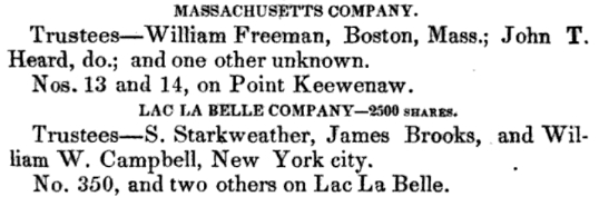
“Massachusetts Company”
~ Reports of Wm. A. Burt and Bela Hubbard, by J. Houghton Jr and T. W. Bristol, 1846, pages 101.
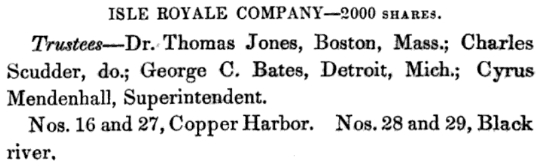
“Isle Royale Company”
~ Reports of Wm. A. Burt and Bela Hubbard, by J. Houghton Jr and T. W. Bristol, 1846, pages 94.
The “Massachusetts Company” have commenced works about a mile west of the extremity of Copper Harbour, where several veins, apparently rich, and said to carry silver, have been opened on the coast. At the Harbour, the “Pittsburgh Company” have two shafts, from which they have taken several tons of the rich black oxyde. A mile east, is a location of the ” Isle Royal Company,” under the charge of Mr. Cyrus Mendenhall, employing ten or fifteen hands.
There are probably now in the country 600 persons engaged in mining, as labourers, agents, clerks, superintendents, and mining engineers.
Communication is kept up with them during the winter, by a semimonthly mail from Green Bay, taken on the back of a man, by way of the Menominee river and the Anse, to the post-office at Fort Wilkins. This does not allow the carriage of newspapers, or heavy packages, but only letters. Although the winter is severe, it is so uniform that those who have tried it do not complain, and even pursue their journeys with more facility by land than they can in summer. If a road were open to Green Bay, the journey would be made in four or five days, over a road which, once trod, would be perfect for several months. From the best information derived from mail carriers, and gentlemen who have made the trip on snow-shoes, it is not an expensive route for a road.
Judge William Austin Burt
~ Wikipedia.org
I have spoken frequently of the fluctuations of the needle, and of its variations. The surveys in this region can be made only with the solar compass, or some instrument of that nature. The one used by Judge Burt, who has run all the township lines west of the Sault, is of his own invention. It is now made in England for exportation to this country. This compass is placed in the meridian by an apparatus always directed on the sun, and as it carries a needle, shows the variation every time it is set.
At the Sault the regular variation was given 2 deg. east, which, at every section corner on the town lines, is written with red chalk on the stake. At southwest corner section 19, range 35 west, T. 55 north, variation 7 deg. 15 min. east; 6 miles directly south, 5 deg. 15 min. east. One mile north of southeast corner of T_ 52 north, range 36 west, variation 5 deg. 5 min.; one mile west, 6 deg. 5 min. At south corner of T. 52, range 37, variation 5 deg. 15 min. east; one mile north, 1 deg. 10 min.; two miles west, 1 deg. 35 min.; three miles further west, 8 deg. 15 min. At middle of south line of T. 51 north, range 40 west, variation 5 deg. 35 min. east.
For game we saw pheasants, or as some call them partridges, in great numbers, and also red squirrels. No turkeys, deer, or black squirrels. There are bears, moose, and reindeer; yet they are not numerous. There is also an animal of the wild-cat species, called a lynx, whose tracks we saw. For reptiles, we saw none but a few feeble garter snakes. There are owls, mice, and rabbits in abundance. We saw no insects of consequence, except spiders, and these were sufficiently numerous to be troublesome. During the latter part of June, and the whole of July, in the woods and low places, there are countless myriads of moschetoes and sand-flies. They are said not to be troublesome on the coast.
Much of the comfort of a trip in this region depends on the outfit. Arrangements should be made for a supply of at least two pounds of solid food per day for each man, and a surplus for friends who are less provident.
The cheapest, least weighty and bulky, as well as the best for health and relish, are hard bread, beans, and salt pork, of the very best quality. Tea, coffee, and sugar, are in such cases not necessaries, but are, for the expense and trouble, the greatest and cheapest luxuries that can be had under any circumstances. To every two men there must be a small camp-kettle, and if in a boat, a large kettle and frying-pan. In the woods, a hatchet to every two men, and a strong tin cup for each, with a surplus of one-half these articles to make up for losses. Knives, forks, and spoons disappear so fast that two setts to each man will be none to many. Salt and pepper are indispensable for the game you may kill; and if there are a plenty of horse-pistols, a great many pheasants may be shot without much loss of time. But these are not to be taken into account for supplies.
A pocket compass is necessary to each party. For a pack there is nothing better than a knapsack and straps, without the boards. Ordinary clothing is of no use, for it will disappear in a short time. The surveyors wear trousers made of heavy cotton ticking, and a sort of pea-jacket made of the same. This or medium cotton duck will stand wear, and although moisture comes through, the rains do not. It thickens when wet, and turns long storms better than any thing except oil-cloth. A supply of thick flannel shirts should be procured without fail, and flannel or Canton flannel under-clothes. A vest is unnecessary, and instead of suspenders the pantaloons are kept up by a broad belt, on which the tin-cup may be strung. A low, round-crowned, white beaver hat is much worn, but perhaps a light cap, of oiled silk, made soft and impervious to rain, is better. For the feet, moccasins or light brogans, made of good leather, and plenty of woollen stockings. In the wet season, cowhide boots, made of good but not heavy leather, and very large, but in the shape of the foot. A flint and steel for emergencies, and matches for ordinary use to strike a fire. Without something water-proof around them, the matches will acquire moisture in long spells of wet weather. If you carry a map case, they may be put in a second case, around which the map is rolled. A belt with a leather pouch and a buckle, to carry the hatchet in, is a very great convenience; for nothing is so likely to be lost as a hatchet. We were three days without one in very bad weather, having dropped it on the route.
Tents are not indispensible, but comfortable, especially along the shore and in very warm weather, when moschetoes are plenty.
A good, large, heavy Mackinaw blanket is beyond comparison the most necessary article to the voyageur and woodsman. With all these preparations, the lover of exercise and adventure may count upon as much enjoyment, on a trip through the Lake Superior country, as he will find at home. If he is badly provided, he will be inefficient and uneasy – will suffer many privations, and perhaps injure his health.
By Amorin Mello
A curious series of correspondences from “Morgan”
… continued from Copper Harbor Redux.

The Daily Union (Washington D.C.)
“Liberty, The Union, And The Constitution.”
August 29, 1845.
EDITOR’S CORRESPONDENCE.
—
[From our regular correspondent.]
ST. LOUIS, Mo. Aug. 19, 1845.
One of the most interesting sections of the North American continent is the basin of the Upper Mississippi, being, as it is, greatly diversified by soil, climate, natural productions, &c. It embraces mineral lands of great extent and value, with immense tracts of good timber, and large and fertile bodies of farming land. This basin is separated by elevated land o the northeast, which divides the headwaters of rivers emptying into the Mississippi from those that flow into the lakes Superior and Michigan, Green Bay, &c. To the north and northwest, it is separated near the head of the Mississippi, by high ground, from the watercourses which flow towards Hudson’s bay. To the west, this extensive basin is divided from the waters of the Missouri by immense tracts of elevated plateau, or prairie land, called by the early French voyageurs “Coteau des Prairies,” signifying “prairie coast,” from the resemblance the high prairies, seen at a great distance, bear to the coast of some vast sea or lake. To the south, the basin of the Upper Mississippi terminates at the junction of the Mississippi with the Des Moines river.
The portion of the valley of the Mississippi thus described, if reduced to a square form, would measure about 1,000 miles each way, with St. Anthony’s falls near the centre.
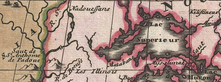
1698 detail of Saint Anthony’s Falls and Lake Superior from Amerique Septentrionalis Carte d’un tres grand Pays entre le Nouveau Mexique et la Mer Glaciace Dediee a Guilliaume IIIe. Roy de La Grand Bretagne Par le R. P. Louis de Hennepin Mission: Recol: et Not: Apost: Chez c. Specht a Utreght 1698.
~ Commons.Wikimedia.org
For a long time, this portion of the country remained unexplored, except by scattered parties of Canadian fur-traders, &c. Its physical and topographical geography, with some notions of its geology, have, as it were, but recently attracted attention.

Douglas Volk painting of Father Hennepin at Saint Anthony Falls.
~ Commons.Wikimedia.org

Father Antoine “Louis” Hennepin
~ Wikipedia.org
Father Hennepin was no doubt the first white man who visited St. Anthony’s falls. In reaching them, however, he passed the mouth of St. Peter’s river, a short distance below, without noticing it, or being aware of its existence. This was caused by the situation of an island found in the Mississippi, directly in front of the mouth of St. Peter’s, which, in a measure, conceals it from view.
After passing the falls, Father Hennepin continued to ascend the Mississippi to the St. Francis river, but went no higher.

Portrait of Jonathan Carver from his book, Travels through the interior parts of North America in the years 1766, 1767 and 1768.
~ Wisconsin Historical Society
In the year 1766, three years after the fall of Canada, Captain Johnathan Carver, who had taken an active part as an officer in the English service, and was at the surrender of Fort William Henry, where (he says) 1,500 English troops were massacred by the Indians, (he himself narrowly escaping with his life,) prepared for a tour among the Indian tribes inhabiting the shores of the upper lakes and the upper valley of the Mississippi. He left Boston in June of the year stated, and, proceeding by way of Albany and Niagara, reached Mackinac, where he fitted out for the prosecution of his journey to the banks of the Mississippi.
From Mackinac, he went to Green Bay; ascended the Fox river to the country of the Winnebago Indians; from thence, crossing some portages, and passing through Lake Winnebago, he descended the Wisconsin river to the Mississippi river; crossing which, he came to a halt at Prairie du Chien, in the country of the Sioux Indians. At the early day, this was an important trading-post between French traders and the Indians. Carver says: “It contains about three hundred families; the houses are well built, after the Indian manner, and well situated, on a very rich soil, from which they raise every necessary of life in great abundance. This town is the great mart whence all the adjacent tribes – even those who inhabit the most remote branches of the Mississippi – annually assemble about the latter end of May, bringing with them their furs to dispose of to the traders.” Carver also noticed that the people living there had some good horses.
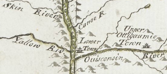
Detail of Prairie du Chien from Carver [Jonathan], Captain. Journal of his travels with maps and drawings, 1766.
~ Boston Public Library
The fur-trade, which at one time centred here, and gave it much consequence, has been removed to St. Peter’s river. Indeed, this trade, which formerly gave employment to so many agents, traders, trappers, &c., conferring wealth upon those prosecuting it, is rapidly declining on this continent; in producing which, several causes conspire. The first is, the animals caught for their furs have greatly diminished; and the second is, that competition in the trade has become more extensive and formidable, increasing as the white settlements continue to be pushed out to the West.
John Jacob Astor established the American Fur Company.
~ Wikipedia.com
At Prairie du Chien is still seen the large stone warehouse erected by John Jacob Astor, at a time when he ruled the trade, and realized immense profits by the business. The United States have a snug garrison at this place, which imparts more or less animation to the scene. It stands on an extensive and rather low plain, with high hills in the rear, running parallel with the Mississippi.
The house in which Carver lodged, when he visited this place, is still pointed out. There are some men living at this post, whose grandfather acted as interpreter to Carver. The Sioux Indians, whom Carver calls in his journal “the Nadowessies,” which is the Chippewa appellation for this tribe of Indians, keep up the tradition of Carver’s visit among them. The inhabitants, descendants of the first settlers at Prairie du Chien, now living at this place, firmly believe in the truth of the gift of land made to Carver by the Sioux Indians.
From this point Carver visited St. Anthony’s falls, which he describes with great accuracy and fidelity, accompanying his description with a sketch of them.
![Detail of Saint Anthony's Falls from Carver [Jonathan], Captain. Journal of his travels with maps and drawings, 1766. ~ Boston Public Library](https://chequamegonhistory.com/wp-content/uploads/2016/05/carver-detail-of-st-anthony-falls.jpg)
Detail of Saint Anthony’s Falls from Carver [Jonathan], Captain. Journal of his travels with maps and drawings, 1766.
~ Boston Public Library
From the Mississippi river Carver crossed over to the Chippewa river; up which he ascended to its source, and then crossed a portage to the head of the Bois Brulé, which he called “Goddard’s river.” Descending this latter stream to Lake Superior, he travelled around the entire northern shore of that lake from west to east, and accurately described the general appearance of the country, including notices of the existence of the copper rock on the Ontonagon, with copper-mineral ores at points along the northeastern shore of the lake, &c.
![Detail of "Goddard's River," La Pointe, and Ontonagon from Carver [Jonathan], Captain. Journal of his travels with maps and drawings, 1766. ~ Boston Public Library](https://chequamegonhistory.com/wp-content/uploads/2016/05/carver-detail-of-goddard-river-and-la-pointe.jpg)
Detail of “Goddard River,” La Pointe, and Ontonagon from Carver [Jonathan], Captain. Journal of his travels with maps and drawings, 1766.
~ Boston Public Library
He finally reached the Sault St. Marie, where he found a French Indian trader, (Monsieur Cadot,) who had built a stockade fort to protect him in his trade with the Indians.
Detail of Sault Ste Marie from Carver [Jonathan], Captain. Journal of his travels with maps and drawings, 1766.
~ Boston Public Library
Descendants of this Monsieur Cadot are still living at the Sault and at La Pointe. We met one of them returning to the latter place, in the St. Croix river, as we were descending it. They, no doubt, inherit strong claims to land at the falls of the St. Mary’s river, which must ere long prove valuable to them, if properly prosecuted.
From the Sault St. Marie, Carver went to Mackinac, then garrisoned by the English, where he spent the winter. The following year he reached Boston, having been absent about two years.
From Boston he sailed for England, with a view of publishing his travels, and securing his titles to the present of land the Sioux Indians have made him, and which it is alleged the English government pledged itself to confirm, through the command of the King, in whose presence the conveyance made to Carver by the Sioux Indians was read. He not only signified his approval of the grant, but promised to fit out an expedition with vessels to sail to New Orleans, with the necessary men, &c., which Captain Carver was to head, and proceed from thence to the site of this grant, to take possession of it, by settling his people on it. The breaking out of the American revolution suspended this contemplated expedition.
Captain Carver died poor, in London, in the year 1780, leaving two sons and five daughters. I consider his description of the Indians among whom he travelled, detailing their customs, manners, and religion, the best that has ever been published.
In this opinion I am sustained by others, and especially by old Mr. Duncan Graham, whom I met on the Upper Mississippi. He has lived among the Indians ever since the year 1783. He is now between 70 and 80 years old. He told me Carver’s book contained the best account of the customs and manners of the Indians he had ever read.
His valuable work is nearly out of print, it being rather difficult to obtain a copy. It went through three editions in London. Carver dedicated it to Sir Joseph Banks, president of the Royal Society. Almost every winter on the Indians and Indian character, since Carver’s time, has made extensive plagiarisms from his book, without the least sort of acknowledgement. I could name a number of authors who have availed themselves of Carver’s writings, without acknowledgement; but as they are still living, I do not wish to wound the feelings of themselves or friends.
One of the writers alluded to, gravely puts forth, as a speculation of his own, the suggestion that the Winnebagoes, and some other tribes of Indians now residing at the north, had, in former times, resided far to the south, and fled north from the wars and persecutions of the bloodthirsty Spaniards; that the opinion was strengthened from the fact, that the Winnebagoes retained traditions of their northern flight, and of the subsequent excursions of their war parties across the plains towards New Mexico, where, meeting with Spaniards, they had in one instance surprised and defeated a large force of them, who were travelling on horseback.
Now this whole idea originated with Carver; yet Mr. ——— has, without hesitation, adopted it as a thought or discovery as his own!

Alexander Henry, The Elder.
~ Wikipedia.com
The next Englishman who visited the northwest, and explored the shores of Lake Superior, was Mr. Henry, who departed from Montreal, and reached Mackinac through Lake Huron, in a batteau laden with some goods. His travels commenced, I believe, about 1773-‘4, and ended about 1776-‘7. Mr. Henry’s explorations were conducted almost entirely with the view of opening a profitable trade with the Indians. He happened in the country while the Indians retained a strong predilection in favor of the French, and strong prejudices against the English. It being about the period of the Pontiac war, he had some hazardous adventures among the Indians, and came near losing his life. He continued, however, to prosecute his trade with the Indians, to the north and west of Lake Superior. Making voyages along the shores of this lake, he became favorably impressed with the mineral appearances of the country. Finding frequently, through is voyageurs, or by personal inspections, rich specimens of copper ore, or of the metal in its native state, he ultimately succeeded in obtaining a charter from the English government, in conjunction with some men of wealth and respectability in London, for working the mines on Lake Superior. The company, after making an ineffectual attempt to reach a copper vein, through clay, near the Ontonagon, the work was abandoned, and was not afterwards revived.
General Cass, with Colonel Allen, &c., were the next persons to pass up the southern coast of Lake Superior, and, in going to the west and northwest of the lake, they travelled through Indian tribes in search of the head of the Mississippi river. Their travels and discoveries are well known to the public, and proved highly interesting.
Mr. Schoolcraft’s travels, pretty much over the same ground, have also been given to the public; as also the expedition of General Pike on the Upper Mississippi.

Major Stephen Harriman Long published his expedition as Voyage in a Six-oared Skiff to the Falls of St. Anthony in 1817.
~ Wikipedia.org
More lately, the basin of the Upper Mississippi has received a further and more minute examination under the explorations directed by Major Long, in his two expeditions authorized by government.

Joseph Nicholas Nicollet
~ Wikipedia.org
Lastly, Mr. J. N. Nicollet, a French savan, travelling for some years through the United States with scientific objects in view, made an extensive examination of the basin of the Upper Mississippi.
He ascended the Missouri river to the Council Bluffs; where, arranging his necessary outfit of men, horses, provisions, &c., (being supplied with good instruments for making necessary observations,) he stretched across a vast tract of country to the extreme head-waters of the St. Peter’s, determining, as he went, the heights of places above the ocean, the latitude and longitude of certain points, with magnetic variations. He reached the highland dividing the waters of the St. Peter’s from those of the Red river of the North. He descended the St. Peter’s to its mouth; examined the position and geology of St. Anthony’s falls, and then ascended the same river as high as the Crow-wing river. The secondary rock observed below the falls, changes for greenstone, sienite, &c., with erratic boulders. On the east side of the river, a little below Pikwabik, is a large mass of sienitic rock with flesh-colored feldspar, extending a mile in length, half a mile in width, and 80 feet high. This is called the Little Rock. Higher up, on the same side, at the foot on the Knife rapids, there are sources that transport a very fine, brilliant, and bluish sand, accompanied by a soft and unctuous matter. This appears to be the result of the decomposition of a steachist, probably interposed between the sienitic rocks mentioned. The same thing is observed at the mouths of the Wabezi and Omoshkos rivers.
Detail of Saint Anthony’s Falls and Saint Peter’s River from Hydrographical Basin of the Upper Mississippi River from Astronomical and Barometrical Observations Surveys and Information by Joseph Nicolas Nicollet, 1843.
~ David Rumsey Map Collection
Ascending the Crow-wing river a short distance, Mr. Nicollet turned up Gull river, and proceeded as far as Pine river, taking White Fish lake in his way; and again ascended the east fork of Pine river, and reached Little Bay river, which he descended over rapids, &c., to Leech lake, where he spent some days in making astronomical observations, &c. From Leech lake, he proceeded, through small streams and lakes, to that in which the Mississippi heads, called Itasca. Having made all necessary observations at this point, he set out on his return down the Mississippi; and finally, reaching Fort Snelling at St. Peter’s, he spent the winter there.

Detail of Leech Lake and Lake Itasca from Hydrographical Basin of the Upper Mississippi River from Astronomical and Barometrical Observations Surveys and Information by Joseph Nicolas Nicollet, 1843.
~ David Rumsey Map Collection
Lake Itasca, in which the Mississippi heads, Mr. Nicollet found to be about 1,500 feet above the level of the ocean, and lying in lat. about 47° 10′ north, and in lon. 95° west of Greenwich.
This vast basin of the Upper Mississippi forms a most interesting and valuable portion of the North American continent. From the number of its running streams and fresh-water lakes, and its high latitude, it cannot fail to prove a healthy residence for its future population.
It also contains the most extensive body of pine timber to be found in the entire valley of the Mississippi, and from which the country extending from near St. Anthony’s falls to St. Louis, for a considerable distance on each side of the river, and up many of its tributaries, must draw supplies of lumber for building purposes.
In addition to these advantages, the upper basin is rich in mines of lead and copper; and it is not improbable that silver may also be found. Its agricultural resources are also very great. Much of the land is most beautifully situated, and fertile in a high degree. The climate is milder than that found on the same parallel of latitude east of the Alleghany mountains. Mr. Nicollet fixes the mean temperature at Itasca lake at 43° to 44°; and at St. Peter’s near St. Anthony’s falls, at 45° to 46°

“Maiden Rock. Mississippi River.“ by Currier & Ives. Maiden’s Rock Bluff. This location is now designated as Maiden Rock Bluff State Natural Area.
~ SpringfieldMuseums.org
Every part of this great basin that is arable will produce good wheat, potatoes, rye, oats, Indian corn to some extent, fine grasses, fruits, garden vegetables, &c. There is no part of the Mississippi river flanked by such bold and picturesque ranges of hills, with flattened, broad summits, as are seen extending from St. Anthony’s falls down to Prairie du Chien, including those highlands bordering Lake Pepin, &c. Among the cliffs of sandstone jutting out into perpendicular bluffs near the river, (being frequently over 100 feet high,) is seen one called Maiden’s rock. it is said an Indian chief wished to force his daughter to marry another chief, while her affections were placed on another Indian; and that, rather than yield to her father’s wishes, she cast herself over this tall precipice, and met an instant death. On hearing of which, her real lover, it is said, also committed suicide. Self-destruction is very rare among the Indians; and we imagine, when it does occur, it must be produced by the strongest kind of influence over their passions. Mental alienation, if not entirely unknown among them, must be exceedingly rare. I have no recollection of ever having heard of a solitary case.
From St. Anthony’s falls to St. Louis is 900 miles. The only impediment to the regular navigation of the river by steamboats, is experienced during low water at the upper and lower rapids.
“St. Louis Map circa 1845”
~ CampbellHouseMuseum.org
The first are about 14 miles long, with a descent of only about 25 feet. The lower rapids are 11 miles long, with a descent of 24 feet. In each case, the water falls over beds of mountain or carboniferrous limestone, which it has worn into irregular and crooked channels. By a moderate expenditure of money on the part of the general government, which ought to be made as early as practicable, these rapids could be permanently opened to the passage of boats. As it is at present, boats, in passing the rapids at low water, and especially the lower rapids, have to employ barges and keel-boats to lighten them over, at very great expense.
From the rapid settlement of the country above, with the increasing trade in lumber and lead, the business on the Upper Mississippi is augmenting at a prodigious rate. When the river is sufficiently high to afford no obstruction on the lower rapids, not less than some 28 or 30 boats run regularly between Galena and St. Louis – the distance being 500 miles. Besides these, two or three steam packets run regularly to St. Anthony’s falls, or to St. Peter’s, near the foot of them. Every year will add greatly to the number of these boats. Other fine large and well-found packets run from St. Louis to Keokuk, at the foot of the lower rapids, four miles below which the Des Moines river enters the Mississippi river. It is the opinion of Mr. Nicollet, that this river can be opened, by some slight improvements, for 100 miles above its mouth. It is said the extensive body of land lying between the Des Moines and the Mississippi, and running for a long distance parallel with the left bank of the latter, contains the most lovely,rich and beautiful land to be found on the continent, if not in the world. It is already pretty thickly settled. Splendid crops of wheat and corn have been raised on farms opened upon it, the present year. Much of the former we found had already arrived at depots on the river, in quantities far too great to find a sufficient number of boats, at the present low water, to carry it to market.
I do not see but the democratic party are regularly gaining strength throughout the great West, as the results of the recent elections, which have already reached you, sufficiently indicate.
Those who wish to obtain more general, as well as minute information, respecting the basin of the Upper Mississippi, I would recommend to consult the able report, accompanied with a fine map of the country, by Mr. J. N. Nicollet, and reprinted by order of the Congress at their last session.
I am, very respectfully,
Your obedient servant,
MORGAN.
This curious series of correspondences from “Morgan” is continued in the September 1 and September 5 issues of The Daily Union, where he arrived in New York City again after 4,200 miles and two and a half months on this delegation. As those articles are not pertinent to the greater realm of Chequamegon History, this concludes our reproduction of these curious correspondences.
