Biographical Sketch of Vincent Roy, Jr.
March 3, 2016
By Amorin Mello
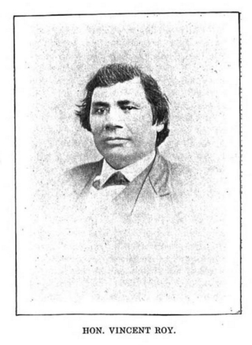
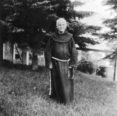
Portrait of Vincent Roy, Jr., from “Short biographical sketch of Vincent Roy,” in Life and Labors of Rt. Rev. Frederic Baraga, by Chrysostom Verwyst, 1900, pages 472-476.
Miscellaneous materials related to Vincent Roy,
1861-1862, 1892, 1921
Wisconsin Historical Society
“Miscellaneous items related to Roy, a fur trader in Wisconsin of French and Chippewa Indian descent including a sketch of his early years by Reverend T. Valentine, 1896; a letter to Roy concerning the first boats to go over the Sault Ste. Marie, 1892; a letter to Valentine regarding an article on Roy; an abstract and sketch on Roy’s life; a typewritten copy of a biographical sketch from the Franciscan Herald, March 1921; and a diary by Roy describing a fur trading journey, 1860-1861, with an untitled document in the Ojibwe language (p. 19 of diary).”
Reuben Gold Thwaites was the author of “The Story of Chequamegon Bay”.
St. Agnes’ Church
205 E. Front St.
Ashland, Wis., June 27 1903

Reuben G. Thwaites
Sec. Wisc. Hist Soc. Madison Wis.
Dear Sir,
I herewith send you personal memories of Hon. Vincent Roy, lately deceased, as put together by Rev. Father Valentine O.F.M. Should your society find them of sufficient historical interest to warrant their publication, you will please correct them properly before getting them printed.
Yours very respectfully,
Fr. Chrysostom Verwyst O.F.M.

~ Proceedings of the State Historical Society of Wisconsin, Issue 51, 1904, page 71.
~ Biographical Sketch – Vincent Roy. ~
~ J. Apr. 2. 1896 – Superior, Wis. ~
I.
Vincent Roy was born August 29, 1825, the third child of a family of eleven children. His father Vincent Roy Sen. was a halfblood Chippewa, so or nearly so was his mother, Elisabeth Pacombe.1
Three Generations:
I. Vincent Roy
(1764-1845)
II. Vincent Roy, Sr.
(1795-1872)
III. Vincent Roy, Jr.
(1825-1896)
His grandfather was a french-canadian who located as a trader for the American Fur Company first at Cass Lake Minn, and removed in 1810 to the bank of Rainy River at its junction with Little Fork, which is now in Itasca Co. Minn.2 At this place Vincent saw at first the light of the world and there his youth passed by. He had reached his twentieth year, when his grandfather died, who had been to him and all the children an unmistakable good fortune.
‘I remember him well,’ such are Vincent’s own words when himself in his last sickness.3 ‘I remember him well, my grandfather, he was a well-meaning, God-fearing frenchman. He taught me and all of us to say our prayers and to do right. He prayed a great deal. Who knows what might have become of us, had he not been.’
The general situation of the family at the time is given by Peter Roy thus:4
“My grandfather must have had about fifty acres of land under cultivation. About the time I left the place (1839) he used to raise quite a lot of wheat, barley, potatoes and tobacco – and had quite a lot of stock, such as horses, cattle, hogs and chickens. One winter about twenty horses were lost; they strayed away and started to go back to Cass Lake, where my grandfather first commenced a farm. The horses came across a band of Indians and were all killed for food. – When I got to be old enough to see what was going on my father was trading with the Bois Forte bands of Chippewa Indians. he used to go to Mackinaw annually to make his returns and buy goods for a year’s supply.”
This trading of the Roys with the Indians was done in commission from the American Fur Company; that is they were conducting one of the many trading posts of this Company. What is peculiar is that they were evidently set up to defeat the hostile Hudson Bay Company, which had a post at Fort St. Francis, which was across the river, otherwise within sight. Yet, the Roys appear to have managed things peaceably, going at pleasure to the Fort at which they sold the farm-products that were of no use to themselves.
II.
LaPointe – School – Marriage
Grandfather Roy died and was buried on the farm in 1845. Soon after, the family broke away from the old homestead and removed to LaPointe, where a boy had been placed at school already 6 or 7 years before.5
“About the year 1838 or 1839,” says Peter Roy,6 “my father took me down to LaPointe, it then being the headquarters of the American Fur Company. He left me with my uncle Charles LaRose. (Mr. LaRose was married to his mother’s sister.) At that time my uncle was United States interpreter for Daniel P. Bushnell, U.S. Indian Agent. I went to the missionary school (presbyterian), which was under the charge of Rev. Sherman Hall. Grenville T. Sprout was the teacher.”
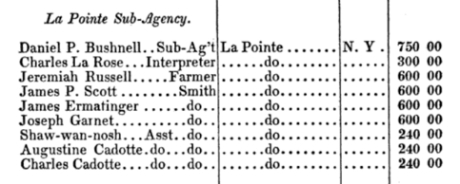
Officers | Where employed | Where born | Compensation
~ “War Department – Indian Agencies,” Official Register of the United States, 1839
The family was acting on wise principles. Where they lived church and school were things unknown and would remain such for yet an indefinite future. The children were fast growing from under the care of their parents; yet, they were to be preserved to the faith and to civilization. It was intended to come more in touch with either. LaPointe was then a frontier-town situated on Madaline Island; opposite to what is now Bayfield Wis. Here Father Baraga had from upwards ten years attended the spiritual wants of the place.
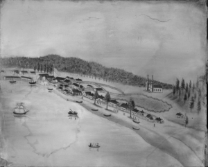
“View of La Pointe,” circa 1842.
~ Wisconsin Historical Society
Our Vincent came, of course, along etc. etc. with the rest. Here for the first time in his life, he came within reach of a school which he might have attended. He was however pretty well past school age. The fact is he did not get to see the inside of a school a ten months and may be, much less, as there is an opinion he became an employ for salary in 1845, which was the year of his arrival.7 But with his energy of will made up for lack of opportunity. More than likely his grandfather taught him the first rudiments, upon which he kept on building up his store of knowledge by self-instruction.
‘At any spare moment,’ it is said,8 ‘he was sure to be at some place where he was least disturbed working at some problem or master some language lesson. He acquired a good control of the English language; his native languages – French and Ojibway – were not neglected, & he nibbled even a little at Latin, applying the knowledge he acquired of that language in translating a few church hymns into his native Ojibway. Studying turned into a habit of life with him. When later on he had a store of his own, he drew the trade of the Scandinavians of that locality just because he had picked up quite a few words of their language. Having heard a word he kept repeating it half loud to himself until he had it well fixed on his memory and the stock laid up in this manner he made use of in a jovial spirit as soon as often as an opportunity was open for it.’

“Boardwalk leading to St. Joseph’s Catholic Church in La Pointe.” Photograph by Whitney and Zimmerman, circa 1870.
~ Wisconsin Historical Society
About three years after his coming to LaPointe, Vincent chose for his life’s companion Elisabeth Cournoyer. The holy bond of matrimony between them was blessed by Reverend Otto Skolla in the LaPoint catholic church, August 13th, 1848. They did not obtain the happiness to see children born to them. Yet, they lived with each other nearly 48 years and looking back over those years there appears nothing which could not permit their marriage to be called a happy one. Their home had a good ordinary measure of home sunshine in which, in a way, children came yet to do their share and have their part.
III.
His occupation.
Vincent was employed in the interest of the fur trade with little intermission up to the forty third year of his life and thereafter until he retired from business he was engaged in keeping a general store.
“Lapointe was a quiet town in the early days and many Indians lived there. The government pay station was there and the Indians received certain monies from the government.”
“The Austrians, a fine Jewish family, established a store and maintained a good Indian trade.”
“Knowing the Indians lack of providing for the future, the Austrians always laid in extra supplies for the winter and these were doled out when necessary.”
~ Tales of Bayfield Pioneers by Eleanor Knight, 2008.
“Mr. and Mrs. Julius Austrian were among the first settlers. Splendid people they were and especially kind to the Indians. It was their custom to lay in extra supplies of flour and corn meal for they knew the Indians would be begging for them before the winter was over. On this particular occassion the winter had been extra cold and long. Food supplies were running low. The Indians were begging for food every day and it was hard to refuse them. The flour was used up and the corn meal nearly so. Still Mrs. Austrian would deal it out in small quantities. Finally they were down to the last sack, and then to the last panful. She gave the children half of this for their supper, but went to bed without tasting any herself. About midnight she was awakened by the cry of ‘Steamboat! Steamboat!’ And looking out the window she saw the lights of the North Star approaching the dock. She said that now she felt justified in going downstairs and eating the other half of the corn bread that was left.”
~ The Lake Superior Country in History and in Story by Guy M. Burnham, 1930, pg. 288.
It was but natural that Vincent turned to the occupation of his father and grandfather. There was no other it may have appeared to him to choose. He picked up what was lying in his way and did well with it. From an early age he was his father’s right hand and business manager.9 No doubt, intelligent and clever, as he was, his father could find no more efficient help, who, at the same time, was always willing and ready to do his part. Thus he grew up. By the time the family migrated south, he was conversant with the drift of the indian trade knowing all its hooks and crooks; he spoke the language of the indians and had their confidence; he was swift a foot and enduring against the tear and wear in frontier life; and there was no question but that he would continue to be useful in frontier business.
Leopold and Austrian (Jews) doing a general merchandize and fur-trading business at LaPointe were not slow in recognizing ‘their man.’ Having given employment to Peter Roy, who by this time quit going to school, they also, within the first year of his arrival at this place, employed Vincent to serve as handy-man for all kind of things, but especially, to be near when indians from the woods were coming to trade, which was no infrequent occurrence. After serving in that capacity about two years, and having married, he managed (from 1848 to 1852) a trading post for the same Leopold and Austrian;10 at first a season at Fond du Lac, Minn., then at Vermillion Lake, and finally again at Fond du Lac.11 Set up for the sole purpose to facilitate the exchange trade carried on with the indians, those trading-posts, nothing but log houses of rather limited pretensions, were nailed up for the spring and summer to be reopened in the fall. Vincent regularly returned with his wife to LaPointe. A part of the meantime was then devoted to fishing.12
A Dictionary of the Otchipwe Language, Explained in English was published by Bishop Frederic Baraga in 1853.
It was also in these years that Vincent spent a great deal of the time, which was at his disposal, with Father Frederic Baraga assisting him in getting up the books of the Ojibway language, which that zealous man has left.13
In the years which then followed Vincent passed through a variety of experience.
IV.
His first Visit to Washington, D.C. – The Treaty of LaPointe.
Read Chief Buffalo Really Did Meet The President on Chequamegon History for more context about this trip.
At the insistence of Chief Buffalo and in his company Vincent made his first trip to Washington D.C. It was in the spring of the year 1852. – Buffalo (Kechewaishke), head chief of the Lake Superior Ojibways had seen the day, when his people, according to indian estimation, was wealthy and powerful, but now he was old and his people sickly and starving poor. Vincent referring once to the incidents of that time spoke about in this way:14
“He (Buffalo) and the other old men of the tribe, his advisors, saw quite well that things could not go on much longer in the way they had done. The whites were crowding in upon them from all sides and the U.S. government said and did nothing. It appeared to these indians their land might be taken from them without they ever getting anything for it. They were scant of food and clothing and the annuities resulting from a sale of their land might keep them alive yet for a while. The sire became loud that it might be tried to push the matter at Washington admitting that they had to give up the land but insisting they be paid for it. Buffalo was willing to go but there was no one to go with him. He asked me to go with him. As I had no other business just then on hand I went along.”
Ashland, Wisconsin, is named in honor of Henry Clay’s Estate.
They went by way of the lakes. Arriving at Washington, they found the City and the capitol in a barb of morning and business suspended.15 Henry Clay, the great statesman and orator, had died (June 29) and his body was lying in state. Vincent said:
“we shook hands and spoke with the President (Fillmore) and with some of the headmen of the government. They told us that they could not do anything at the moment, but that our petition should be attended to as soon as possible. Unable to obtain any more, we looked around a few days and returned home”.
The trip had entailed a considerable drain on their private purses and the result towards the point at issue for them, the selling of the land of the indians, was not very apparent.

Henry C. Gilbert
~ Branch County Photographs
After repeated urging and an interval of over two years, during which Franklin Pierce had become President of the United States, the affairs of these Indians were at last taken up and dealt with at LaPointe by Henry C. Gilbert and David B. Herriman, commissioners on the part of the United States. A treaty was concluded, September 30th, 1854. The Lake Superior Ojibways thereby relinquished their last claims to the soil of northwest Michigan, north east Wisconsin and an adjoining part of Minnesota, and, whilst it was understood that the reserves, at L’Anse Michigan, Odanah, and Courte Oreille Wisconsin and Fond du Lac Minnesota, were set apart for them, they received in consideration of the rest the aggregate sum of about four hundred and seventy five thousand dollars, which, specified as to money and material, ran into twenty years rations.
Chief Buffalo, in consideration of services rendered, was allowed his choice of a section of land anywhere in the ceded terrain.
‘The choice he made,’ it is said,16 ‘were the heights of the city of Duluth; but never complying with the incident law formalities, it matters little that the land became the site of a city, his heirs never got the benefit of it. Of Vincent who had been also of service to the indians from the first to the last of the deal, it can only be said that he remained not just without all benefit from it.’
Julius Austrian‘s capitalization of the Mixed Blood clause from the 1854 Chippewa Treaty will be published on Chequamegon History.
A clause was inserted in the treaty (art. 2. n. 7.) 17 by which heads of families and single persons over twenty one years of age of mixed blood were each entitled to take and hold free of further charge eighty acres of the ceded lands.; – this overruled in a simple and direct way the difficulties Vincent had met with of late in trying to make good his claim to such a property. The advantage here gained was however common to others with him. For the sacrifices he made of time and money in going with Chief Buffalo to Washington he was not reimbursed, so it is believed, and it is very likely time, judging from what was the case when later on he made the same trip a second time.
V.
The small-pox.
During the two years the Lake Superior indians waited for the United States to settle their claims, important events transpired in which Vincent took part. In the fall of 1853 those indians were visited by the smallpox which took an epidemic run among them during the following winter. The first case of that disease appeared in the Roy family and it is made a circumstance somewhat interesting in the way it is given.18 Vincent and his oldest brother John B. were on some business to Madison, Wisconsin. Returning they went around by way of St. Paul Minnesota to see their brother Peter Roy who was at the time acting representative of a northern district, at the Minnesota territorial legislation which had then, as it seems, convened in extra session. On the evening previous to their departure from St. Paul, John B. paid a short visit to a family he knew from Madaline Island. In the house in which that family lived a girl had died about a year before of small-pox, but no one was sick there now at the time of the visit. If John B.’s subsequent sickness should have to be attributed to infection, it was certainly a peculiar case. The two brothers started home going by way of Taylor’s Falls, up the St. Croix river on the Wisconsin side, till Yellow Lake river, then through the woods to what is now Bayfield where they crossed over to Madaline Island. John B. began feeling sick the second day of the journey. Vincent remembered ever after the anxiety which he experienced on that homeward journey.19 It costed him every effort to keep the energies of his brother aroused. Had the same been allowed to rest as he desired he had inevitably perished in the woods. All strengths was however spent and the sick man lay helpless when the boat which carried them from the mainland touched Madaline Island. Willing hands lifted him from the boat and carried him to his house. His sickness developed into a severe case of small-pox of which he finally recovered. The indians of whom the settlement was chiefly made up did not as yet understand the character of that disease which was all the more dangerous with them for their exposed way of living. Before they were aware of it they were infected. General sickness soon prevailed. Deaths followed. Some fled in dismay from the settlement, but it may be said only to carry the angel of death to other habitations and to die after all.
Several members of the Roy family were laid up with the sickness, none of them died though.20 Vincent had been in close contact with his brother while yet on the road and had been more than any attending his brother and other members of the family in their sickness, yet he passed through the ordeal unscathed. The visitation cased with the return of spring.
VI.
Superior.
Vincent had barely emerged from the trouble just described when it was necessary for him to exert himself in another direction. A year or so previously he had taken up a claim of land at the headwaters of Lake Superior and there was improvement now on foot for that part of the country, and danger for his interests.21

Vincent Roy Jr. storage building, circa 1933.
The following is a statement by John A. Bardon of Superior accompanying the photography, “Small storehouse building erected by the late Vincent Roy [Jr] at Old Superior. The timbers are 4′ x 8′. After the one mile dike across Superior Bay had served its purpose, it was allowed to gradually go to pieces. The timbers floating in the Bay for a while were a menace to navigation. You would find them drifting when least expected. The U.S. War Department caused the building of this dike from the end of Rice’s Point, straight across to Minnesota Point to prevent the waters of the St. Louis River being diverted from the natural entry at Superior, to the newly dug canal, across Minnesota Point in Duluth. The contention was that, if the waters of the St. Louis were diverted, the natural entrance at Superior would become shoaled from lack of the rivers scouring current. However, when the piers were extended into 18 feet of water at both the old entrance and the Duluth Canal, it was found that the currents of the river had no serious effect. The dike was never popular and was always in the way of the traffic between Superior and Duluth. Several openings were made in it to allow the passage of smaller boats. It was finally condemned by the Government Engineers as a menace to navigation. This all happened in the early 70’s. This building is now the only authentic evidence of the dike. It is owned by the Superior and Douglas County Historical Society. The writer is the man in the picture.”
~ Wisconsin Historical Society

Read more about Vincent Roy, Jr.’s town-site at Superior City here on Chequamegon History.
The ship canal at Sault St Marie was in course of construction and it was evidently but a question of days that boats afloat on Lakes Huron and Michigan would be able to run up and unload their cargo for regions further inland somewhere on the shore at the further end of Lake Superior, at which a place, no doubt, a city would be built. The place now occupied by the city of Superior was suitable for the purposes in view but to set it in order and to own the greatest possible part of it, had become all at the same time the cherished idea of too many different elements as that developments could go on smoothly. Three independent crews were struggling to establish themselves at the lower or east end of the bay when a fourth crew approached at the upper or west end, with which Vincent, his brother Frank, and others of LaPointe had joined in.22 As this crew went directly to and began operations at the place where Vincent had his property it seems to have been guided by him, though it was in reality under the leadership of Wm. Nettleton who was backed by Hon. Henry M. Rice of St. Paul.23 Without delay the party set to work surveying the land and “improving” each claim, as soon as it was marked off, by building some kind of a log-house upon it. The hewing of timber may have attracted the attention of the other crews at the lower end about two or three miles off, as they came up about noon to see what was going on. The parties met about halfway down the bay at a place where a small creek winds its way through a rugged ravine and falls into the bay. Prospects were anything but pleasant at first at the meeting; for a time it seemed that a battle was to be fought, which however did not take place but the parceling out of ‘claims’ was for the time being suspended. This was in March or April 1854. Hereafter some transacting went on back the curtain, and before long it came out that the interests of the town-site of Superior, as far as necessary for efficient action, were united into a land company of which public and prominent view of New York, Washington, D.C. and other places east of the Mississippi river were the stockholders. Such interests as were not represented in the company were satisfied which meant for some of them that they were set aside for deficiency of right or title to a consideration. The townsite of the Superior of those days was laid out on both sides of the Nemadji river about two or three miles into the country with a base along the water edge about half way up Superior bay, so that Vincent with his property at the upper end of the bay, was pretty well out of the way of the land company, but there were an way such as thought his land a desirable thing and they contested his title in spite of his holding it already for a considerable time. An argument on hand in those days was, that persons of mixed blood were incapable of making a legal claim of land. The assertion looks more like a bugaboo invented for the purpose to get rid of persons in the way than something founded upon law and reason, yet at that time some effect was obtained with it. Vincent managed, however, to ward off all intrusion upon his property, holding it under every possible title, ‘preemption’ etc., until the treaty of LaPointe in the following September, when it was settled upon his name by title of United States scrip so called, that is by reason of the clause,as said above, entered into the second article of that treaty.
The subsequent fate of the piece of land here in question was that Vincent held it through the varying fortune of the ‘head of the lake’ for a period of about thirty six years until it had greatly risen in value, and when the west end was getting pretty much the more important complex of Superior, an English syndicate paid the sum of twenty five thousand dollars, of which was then embodied in a tract afterwards known as “Roy’s Addition”.
VII.
– On his farm – in a bivonac – on the ice.
Superior was now the place of Vincent’s home and continued to be it for the remaining time of his life. The original ‘claim’ shanty made room for a better kind of cover to which of course the circumstances of time, place, and means had still prescribed the outlines.24 Yet Vincent is credited with the talent of making a snug home with little. His own and his wife’s parents came to live with him. One day the three families being all seated around a well filled holy-day table, the sense of comfort called forth a remark of Vincent’s mother to her husband:25
“Do you remember, man,” she said, “how you made our Vincent frequently eat his meals on the ground apart from the family-table; now see the way he repays you; there is none of the rest of the children that could offer us as much and would do it in the way he does.”
It was during this time of his farming that Vincent spent his first outdoor night all alone and he never forgot it.26 It was about June. Spring had just clothed the trees with their full new foliage. Vincent was taking a run down to Hudson, Wisconsin, walking along the military wagon road which lead from Superior to St. Paul. Night was lowering when he came to Kettle river. Just above the slope he perceived a big bushy cedar tree with its dense branches like an inscrutable pyramid set off before the evening light and he was quickly resolved to have his night’s quarters underneath it. Branches and dry leaves being gathered for a bed, his frugal meal taken he rolled up in the blanket carried along for such purposes, and invited sleep to come and refresh his fatigued mortality. Little birds in the underbrush along the bank had twittered lower and lower until they slept, the frogs were bringing their concert to a close, the pines and cedars and sparse hardwood of the forest around were quiet, the night air was barely moving a twig; Vincent was just beginning to forget the world about him, when his awakening was brought on upon a sudden. An unearthly din was filling the air about him. As quick as he could extricate himself from his blanket, he jumped to his feet. If ever his hair stood up on end, it did it now; he trembled from head to foot. His first thoughts as he afterwards said, were, that a band of blood-thirsty savages had discovered his whereabouts and were on the point to dispatch him. In a few moments, everything around was again dead silence. He waited, but he heard nothing save the beating of his own heart. He had no other weapon than a muzzle-loaded pistol which he held ready for his defense. Nothing coming in upon him, he walked cautiously from under his shelter, watching everything which might reveal a danger. He observed nothing extraordinary. Facing about he viewed the tree under which he had tried to sleep. There! – from near the top of that same tree now, as if it had waited to take in the effect of its freak and to ridicule all his excitement, a screeching owl lazily took wing and disappeared in the night. The screeching of this bird with its echo in the dead of night multiplied a hundred times by an imagination yet confused from sleep had been the sole cause of disturbance. Vincent used to say that never in his life he had been so upset as on this night and though all had cleared up as a false alarm, he had had but little sleep when at daybreak he resumed his journey.
Another adventure Vincent had in one of these years on the ice of Lake Superior.27 All the family young and old had been on Bass Island near Bayfield for the purpose of making maple-sugar. That meant, they had been some three weeks in March-April at work gathering day and night the sap tapped from maple-trees and boiling down to a mass which they stored in birch bark boxed of fifty to hundred and fifty pounds each. At the end of the season Vincent got his horse and sleigh and put aboard the product of his work, himself, his wife and two young persons, relatives of his wife, followed; they were going home to Superior on the ice of the lake along the shore. When they came however towards Siskowit bay, instead of following the circuit of the shore, they made directly for Bark Point, which they saw standing out before them. This brought them out on a pretty big field of ice and the ice was not to be trusted so late in spring as it was now. Being almost coming in upon the point they all at once noticed the ice to be moving from shore – a split was just crossing through ahead of them. No time was to be lost. With a providential presence of mind, Vincent whipped his horse, which seemed to understand the peril of the situation; with all the speed it could gather up in a few paces it jumped across the gap. The sleigh shooting over the open water struck the further ice edge with a thump yet without harm – they were safe.
By pressure of other ice wedging in at a distance or from the hold which wind and wave get upon it, a considerable area of ice may, sometimes in spring, break loose with a report as that of a cannon and glide apart some ten feet right out upon the start. That it happened different this time and that our travelers did not drift out into the lake with a cake of ice however large yet, any thawing away or breaking up under them, was their very good fortune.
VIII.
– Superior’s short-lived prosperity – V. at his old profession – a memorable tour.

Built circa 1857, photographed circa 1930.
“The trading post was owned by Vincent Roy [Jr]. The Roy family was prominent in the early history of the Superior area.”
~ Wisconsin Historical Society
Vincent was too near Superior as not to feel the pulsation of her life and to enter into the joys and sorrows of already her infant days.28 The place had fast donned the appearance of a city; streets were graded, lines of buildings were standing, trades were at work. Indeed, a printing office was putting out at convenient intervals printed matter for the benefit of the commonwealth at home and abroad; then was a transfer of real-estate going on averaging some thousand dollars a week, town lots selling at two to three hundred dollars each; and several stores of general merchandise were doing business.
The scarcity of provision the first winter was but an incident, the last boat which was to complete the supply being lost in a gale. It did not come to severe suffering and great was the joy, when a boat turned up in spring especially early.
In short, the general outlook had great hopes on the wing for the place, but its misgivings came. Its life blood ceased to flow in the financial crisis of September 1857, as the capital which had pushed it was no more forthcoming. It was a regular nor’easter that blew down the young plant, not killing it outright but stunting its growth for many, many years to come. The place settled down to a mere village of some hundred inhabitants, doing duty of course as county seat but that was not saying much as the whites stood in that part of the country all the way to pretty well up in the eighties.

~ The Superior Chronicle, July 7th, 1860.
About 1856 Vincent embarked again in the profession of his youth, the fur trade. Alexander Paul who did business in “The Superior Outfit” on Second Street, engaged his services. After a few years the business passed into the hands of Peter E. Bradshaw; which however did not interfere with Vincent. He was required to give all his attention to fur and peltry; first to getting them in, then to sorting them and tending to them until they were set off in the east. His employers had trading posts along the north shore at Grand Marais and Grant Portage, about the border line at the Lakes Basswood, Vermillion and Rainy, then at Lower Red Lake, at Mud Lake east of Leech Lake and at Cross Lake about thirty miles north of Crow Wing Minnesota. A tour of inspection of these posts was necessary on the average in the fall to see what was needed to be sent out, and in the spring to get home the peltries which had been obtained.29 One tour in which Vincent, Mr. P Bradshaw, Francis Blair, and one or two others, made up the party, was regarded especially memorable. It was undertaken early in spring, perhaps in February since the calculation was to find brook and lake yet passable on the ice. The party set out with the usual train of three dogs harnessed to a toboggan which carried as long as the dogs did not give out, the most necessary luggage; to wit, a blanket for each the men to roll up in at night and the supply of food consisting in a packet of cornmeal with a proportionate amount of tallow for the dogs and bacon for the men to add, the Canadian snowshoes being carried in hand any way as long and wherever they would be but an incumbrance to the feet. Their way led them along the wagon road to Kettle river, then across the country passing Mille lac Lake to Crow Wing, then northward to touch their posts of Cross and Mud Lake, moving nearly always on the ice in that region of lakes in which the Mississippi has its beginning. After leaving the Mud Lake post a swamp of more than a day in crossing was to be traversed to reach the Red Lake post. They were taking the usual trail but this time they were meeting more than usual inconvenience. They had been having a few days soft weather and here where the water would not run off they found themselves walking knee-deep in the slush, to increase their annoyance it set in drizzling. Still they trudged along till about mid-afternoon when they halted. The heavens scowling down in a gray threatening way, all around snow, from which looked forth, an occasional tuft of swamp grass, otherwise shrubby browse with only at places dwarfed pine and tamarack, were sticks of an arm’s thickness and but thinly scattered, they were in dread of the night and what it might bring them in such dismal surrounding. They were to have a fire and to make sure of it, they now began to gather sticks at a place when they were to be had, until they had a heap which they thought would enable them to keep up a fire till morning. The next thing and not an easy one was to build a fire. They could not proceed on their usual plan of scraping away the snow and set it up around as a fortification against the cold air, it would have been opening here a pit of clear water. So they began throwing down layers of sticks across each other until the pile stood in pierform above water and snow and furnished a fire-place. Around the fire they built a platform of browse-wood and grass for themselves to lie upon. But the fire would not burn well and the men lay too much exposed. Luckily the heavens remained clouded, which kept up the temperature. A severe cold night easily have had serious results in those circumstances. The party passed a very miserable night, but it took an end, and no one carried any immediate harm from it.
Next morning, the party pushed forward on its way and without further adventure reached the Red Lake post. Thence they worked their way upwards to the Lake of the Woods, then down the Rainy Lake River and along Rainy Lake, up Crane Lake, to Pelican Lake, and finally across Vermillion Lake to the Vermillion post, about the spot where Tower, Minn. now stands. Thence back to Superior, following the water courses, chiefly the St. Louis river. The distance traveled, if it is taken in a somewhat straight line, is from five to six hundred miles, but for the party it must have been more judging from the meandering way it went from lake to lake and along the course of streams. That tour Messrs. Bradshaw required for their business, twice a year; once in the winter, to gather in the crops of furs of the year and again in the fall to furnish the posts with provision and stock in trade and the managing there lay chiefly upon Mr. Roy. As to the hardships on these tours, dint of habit went far to help them endure them. Thus Mr. Bradshaw remarked yet in 1897 – he did not remember that he or any of his employees out on a trip, in the winter, in the open air, day and night, ever they had to be careful or they get a cold then.
“As any who have tried snowshoes will know, there is a trick to using them. The novice will spread his legs to keep the snowshoes from scraping each other, but this awkward position, like attempting too great a distance before conditioning oneself to the strain, will cause lameness. Such invalids, the old voyageur type would say, suffer from ‘Mal de raquette.’“
~ Forest & Outdoors, Volume 42, by the Canadian Forestry Assocation, 1946, page 380.
Not infrequently a man’s ingenuity came into action and helped to overcome a difficulty. An instance in case happened on the above or a similar tour. Somewhere back of Fond du Lac, Minn, notwithstanding the fact that they were approaching home, one of the men declared himself incapable of traveling any longer, being afflicted most severely with what the “courreurs du bois” called “mal de la raquette.” This was a trouble consequent to long walks on snow shoes. The weight and continual friction of the snow-shoe on the forefoot would wear this so much that blood oozed from it and cramps in foot and leg set in. In this unpleasant predicament, the man was undismayed, he advised his companions to proceed and leave him to his fate, as he would still find means to take care of himself. So he was left. After about a week some anxiety was felt about the man and a search-party set out to hunt him up. Arriving at his whereabouts, they found their man in somewhat comfortable circumstances, he had built for himself a hut of the boughs of trees and dry grass and have lived on rabbits which he managed to get without a gun. So far from being in need of assistance, he was now in a condition to bestow such for it being about noon and a rabbit on the fire being about ready to be served he invited his would-be-rescuers to dinner and after he had regaled them in the best manner circumstances permitted, he returned home with them all in good spirits.
The following incidents shows how Mr. Roy met an exigency. Once at night-fall he and the men had pitched for a night’s stay and made preparations for supper. No game or fish was at hand. A brook flowed near by but there was nothing in the possession of the crew to catch a fish with. But Roy was bent upon making the anyway scant fare more savory with a supply of fish, if it could be. Whilst the rest made a fire, he absented himself and in a very short time he returned with a couple of fish fresh from the water and sufficiently large to furnish a dish for all. He had managed to get them out from the brook with no other contrivance than the forked twig of a tree.
The following trip of Mr. Roy is remembered for the humorous incidents to which it gave occasion. One summer day probably in August and in the sixties, a tourist party turned up at Superior. It consisted of two gentlemen with wives and daughters, some six or seven persons. They were from the east, probably New York and it was fairly understood that it was the ambition of the ladies to pose as heroines, that had made a tour through the wild west and had seen the wild indian in his own country. The Bradshaws being under some obligation to these strangers detailed Roy and a few oarsmen to take them by boat along the north shore to Fort William, where they could take passage on a steamer for the continuation of their journey.
Now the story goes that Roy sent word ahead to some family at Grand Marais, Minn. or thereabouts that his crew would make a stop at their house. The unusual news, however, spread and long before Roy’s boat came in sight, not only the family, which was to furnish hospitality, was getting ready, but also their friends; men, women and children, in quite a number, had come gathering in from the woods, each ready for something, if no more, at least to show their wild indian faces.

Maple sugar in a birch bark container.
~ Minnesota Historical Society
When Roy and the gentlemen and ladies in his custody had arrived and were seated at table, the women and girls busied themselves in some way or another in order to make sure not to miss seeing, what was going on, above all how the strange ladies would behave at table. The Indian woman, who had set the table, had put salt on it – simply enough it is said for the boiled eggs served; – but what was peculiar, was that the salt was not put in salt-dishes, but in a coffee cup or bowl. If sugar was on the table, it was maple-sugar, which any Indian of the country could distinguish from salt, but the ladies at the table were not so versed in the customs of the country through which they were travelling, they mistaking the salt for sugar, reached for it and put a tea-spoonful of it into their tea or coffee. A ripple of surprise ran over the numerous spectators, the features of the older ones relaxing somewhat from their habitual rigor and a half-suppressed titter of the younger being heard – possibly in their judgement, the strange ladies of the city in the east were the less civilized there. In fact, the occurrence was never forgotten by those who witnessed it.
Proceeding on their journey, one night Roy and those in his custody had not been able to take their night’s rest at a human habitation and had chanced to pitch their tents on a high embankment of the lake. During the night the wind arose and blew a gale from the lake, so strong that the pegs of the tents, in which the ladies were lodged, pulled up and the canvass blew away. When the ladies were thus on a sudden aroused from sleep and without a tent out in the storm they screamed for their life for Roy to come to their aid. The men helped along with Roy to set up the tent again. Roy often afterwards amusingly referred to this that the ladies had not screamed for their husbands or fathers, but for Roy. The ladies gave later on their reasons for acting thus. Not knowing the real cause of what was transpiring, they in their freight thought the wild Indians were now indeed upon them that they were on the point of being carried off into the woods. In such a peril they of course thought of Roy as the only one who could rescue them. After the excitement things were soon explained and set aright and the ladies with their husbands and fathers arrived safely at Fort William and took passage in due season on an east-bound steamer.
A Friend of Roy.
Sources of Inform:tion
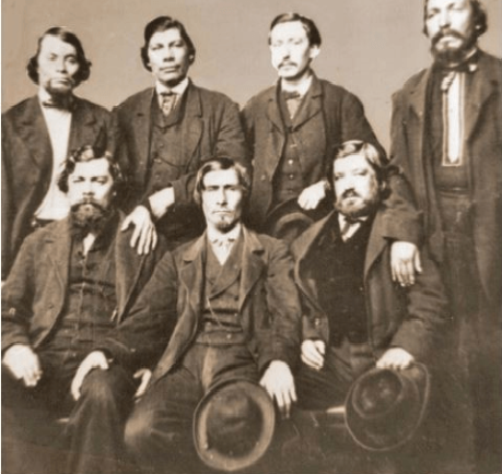
“Top: Frank Roy, Vincent Roy, E. Roussin, Old Frank D.o., Bottom: Peter Roy, Jos. Gourneau (Gurnoe), D. Geo. Morrison.” The photo is labelled Chippewa Treaty in Washington 1845 by the St. Louis Hist. Lib and Douglas County Museum, but if it is in fact in Washington, it was probably the Bois Forte Treaty of 1866, where these men acted as conductors and interpreters (Digitized by Mary E. Carlson for The Sawmill Community at Roy’s Point).
1 His journal and folks.
2 Pet. Roy’s sketch.
3 Mr. Roy to V.
4 P. R.’s sketch
5 Mr. Geo. Morrison says, the place was in those days always called Madelaine Island.

~ The Superior Chronicle, July 7, 1860.
6 P. Roy’s sketch.
7 His wife.
8 His folks.
9 Cournoyer.
10 Mrs. Roy.
11 See foot-note.
12 Mrs. Roy.
13 Fr. Eustachius said smthng to this effect.
14 Mr. Roy to V.
15 Cournoyer or Mr. Roy to V.
16 Cournoyer.
18 by Geo. Morrison & others.
19 Mr. Roy to V.
20 The family.
21 Mr. Roy to V.
22 Mr. Roy to V.
23 History of Superior as to the substce.
Vincent Cournoyer was Vincent Roy Jr’s brother-in-law. The Roy brothers, Cournoyer, Morrison, and La Fave were all Mixed-Blood members of the Lake Superior Chippewa, and elected officials in Douglas County, Wisconsin.
24 The family.
25 Cournoyer.
26 Mr Roy to V. – His family also.
27 Mr. Roy to V. – His family also.
28 History aS subst.e
29 Mr. J. Bradshaw and J. La Fave.
Father Valentine wishes his name to be suppressed in this communication and hence signs himself as above: “A Friend of Roy.”
Fr. Chrysostom Verwyst O.F.M.
Reverend Chrysostome Verwyst, circa 1918. ~ Wisconsin Historical Society
By Amorin Mello
In our Penoka Survey Incidents series earlier this year, we followed some of the adventures and schemes of Albert Conrad Stuntz circa 1857. The legacy of Albert’s influential survey still defines the geopolitical landscape of the Penokee Mountains to this day. However, Albert’s work during the late 1850s was relatively minor in comparison to that of his brother, George Riley Stuntz, during the early 1850s. The surveying work of George and his employees started in 1852 and enabled the infamous land speculators and townsite promotors of Superior City to manifest their schemes by early 1854 (months before the Treaty of La Point occurred later that year).
Among the men that worked with George was Augustus Hamilton Barber. Sometime around 1850, Augustus had followed his Grandparents, Aunts, Uncles, and Cousins from the Barber family of Lamoille County, Vermont, to Lancaster in Grant County, Wisconsin. After a short career as a school teacher in Grant County, Augustus came to Lake Superior in 1852 employed by George as a Chainman under his contract with the United States General Land Office to survey lands at the Head of Lake Superior.
Before taking a closer look at the Barber Papers, let’s examine the lives and affairs of other surveyors and speculators along the southwest shore of Lake Superior, starting with George Riley Stuntz and his production of these Exterior Field Notes (June of 1852):


Duluth and St. Louis County, Minnesota;
Their Story and People
By Walter Van Brunt, 1921, pages 64-65.

Portrait of George Nettleton’s cabin on Minnesota Point in 1852 on page 75.
First Settler.– The honor, for both Superior and Duluth, must presumably go to George R. Stuntz. He came in 1852, and settled in 1853. Several were earlier of course, but can hardly be considered to have been legitimate independent settlers. Carlton had been on the ground, at Fond du Lac, for some years, but he was Indian agent; Borup and Oaks had spent their time between La Pointe and Fond du Lac, but were then at St. Paul, and mainly interested in the development of that city, and in fur trading. Wm. R. Marshall stated that he “was on the lake as early as 1848,” but not to settle and he did not come again until 1857. Wm. R. Marshall and George R. Stuntz were fellow-surveyors, in federal pay, “back in the ’40s,” but Marshall did not seek to take the place of Stuntz as premier pioneer at the head of Lake Superior. As a matter of fact, although “on the lake as early as “1848,” Marshall did not then get nearer to Duluth than La Pointe, where he met “Borup and Oaks, the principal traders, Truman Warren, George Nettleton, Cruttenden, Wattrous, Rev. Sherman Hall, E. F. Ely and others.” It is quite possible that Stuntz was with Marshall in 1848, for that was the year in which Stuntz first entered Minnesota territory “having charge of a surveying party that was working near Lake Pepin and in what is now Washington County.”
The “Heart of the Continent.”– George R. Stuntz prepared the way for the first attempt at white settlement at the head of Lake Superior. He surveyed the land on the Wisconsin side, within a year of beginning which survey, in 1852, the first settlers began to appear. George R. Stuntz came by direction of George B. Sargent, who at the time was surveyor-general of the Iowa, Wisconsin and Minnesota district for the federal government, his headquarters being at Davenport, Iowa. In that year, states Carey, “he surveyed and definitely located a portion of the northeastern boundary line between Minnesota and Wisconsin, starting from the head of navigation on the St. Louis River, at Fond du Lac, and running south to the St. Croix River.” Stuntz himself stated: “I came in 1852. I saw the advantages of this point (Minnesota Point) as clearly then as I do now (1892). On finishing the survey for the government, I went away to make a report, and returned the next spring and came for good. I saw as surely then as I do now that this was the heart of the continent commercially, and so I drove my stakes.”
![Group of people, including a number of Ojibwe at Minnesota Point, Duluth, Minnesota [featuring William Howenstein] ~ University of Minnesota Duluth, Kathryn A. Martin Library](https://chequamegonhistory.com/wp-content/uploads/2015/06/howenstein-minnesota-point.jpg)
Group of people, including a number of Ojibwe at Minnesota Point, Duluth, Minnesota [featuring William Howenstein in 1872?] ~ University of Minnesota Duluth
The Vanguard.– He did not come alone, needing of course assistants in the work of surveying, but he was in charge of the work, Gand necessarily takes first place in the accounting. William C. Sargent, son of George B. Sargent, stated in 1916, that his father “came here (Duluth) first in 1852 with George R. Stuntz and Bill Howenstein,” and goes on to state “a word of those two grand men, George R. Stuntz and Bill Howenstein.” He believed that “to George R. Stuntz, more than to any other man belongs the honor (of) opening up that region,” and of Howenstein, he said: “And old Bill Howenstein, one of the best ever, and always my very good friend, a kindly body, with a quaint dry humor unsurpassed and seldom met with in these later days. I had many an interesting chat with him, in his home on Minnesota Point, that he built in 1852, and lived in until his death, some years ago.” Bill Howenstein, undoubtedly was of Stuntz’ party in 1852, but it is doubtful whether he built a log house on Minnesota Point in that year. As to General Sargent’s visit in 1852. If he did come then, it was probably only a flying visit. His interest in the head of Lake Superior in 1852 reached only to the extent of directing Stuntz to survey it. He, himself, had the surveying business of three states to attend to.
The New York Times
[December 11, 1852]
The Region about the Southwest End of Lake Superior.
Mr. Stuntz, of Grant County, Wis., has been deputed by the general Land Surveyor of this Northwest District to lay off such a tract of land about the southwest point of the lake into townships and sections, as emigrants will earliest require. He returned via La Pointe and Stillwater last week. We have obtained from him some new views of that region. From Fond du Lac, a trading post situated 11 miles inland on the St. Louis River, eastward, for perhaps 50 miles, the margin of the lake is a flat strip of land reaching back to a rocky ridge about 11 miles off. The soil of this flat land is a rich red clay. The wood is white cedar and pine of the most magnificent growth. The American line is beyond the mouth of the St. Louis and Pigeon rivers. It evidently abounds in copper, iron and silver. The terrestrial compass cannot be used there, so strong is the attraction to the earth. The needle rears and plunges “like mad.” Points of survey have to be fixed by the solar compass.
The Indian and half breed packmen have astonishing strength. One Indian, who is described by the others as being as large as two men, carried for a company of 11 men provisions for ten days, viz: one barrel of flour, half barrel of pork and something else, beside the utensils. Mirage is a common phenomenon is Spring and Summer. For the bays not opening as soon as the main lake, or not cooling so early, an object out on the lake, is viewed from the shore, through a dense medium of air and a thin medium. Hence is a refraction of rays which gives so many wonderful sights that the Chippewas call that the spirit or enchanted land. Sail vessels which are really 40 miles off, are seen flapping and bellying about almost within touch. Turreted Islands, look heavy and toppling towards the zenith. Forests seem to leap from their stems and go a soaring like thistles for the very sport of it.
The ice did not leave some of the bays till the 10th of June. The fish are delicious, especially the salmon trout. But little land game. Mr. Stunts calculates on wonderful enterprises in that country after the opening of the Saut Canal.
Mr. S. describes La Pointe a town of the Lake, as being situated at the head of a bay some 25 miles from the high lake, and secluded from the lake by several islands. He saw there a warehouse 300 feet long, built of tamarac poles, and roofed with bark. This building is very much warped by the pressure of age ; it is entered by a wooden railway. The town is dingy and dreary. He saw a most luxurious garden by the former residence of Dr. Borup. It contained a variety of fruit trees and shrubs, such as plums, cherries, apples, pears, currants, &c.

Cover of Stuntz’s Exterior Field Notes (August-October 1852) ~ Wisconsin Public Land Survey Records: Original Field Notes and Plat Maps

George Riley Stuntz was also assisted by his brother Albert Conrad Stuntz as well as the African-Chippewa mixed-blood Stephen Bonga employed as an Axeman. To learn more about the interesting Bonga (Bonza) family and Stephen as “the first white child born at the head of Lake Superior,” read pages 39-41 of The Black West by William Loren Katz (1971), and pages 131-34 of Black Indians also by Katz (2012).
The Eye of the North-west: First Annual Report of the Statistician of Superior, Wisconsin
By Frank Abial Flower, 1890

Portrait of Stephen Bonga, page 7.
GEORGE R. STUNTZ, DEPUTY U. S. SURVEYOR [pages 50-52]

Portrait of George Riley Stuntz, page 26.
In 1852 George R. Stuntz took a contract to run the township lines in this part of the country, including the state boundary, and filed with the land-office at Dubuque a rude map of the head of the lake, on the Wisconsin side, in December of that year. He took a new contract and returned in the spring of 1853 to survey the copper range around Black River, a few miles south of Superior. He brought seeds with him and planting them on the Namdji, raised a quantity of vegetables; they grew to great size. he also built a trading-post on Minnesota point near the present light-house, and a mill on Iron River in Bayfield county. In respect of these operations W. W. Ward writes from Morley, Mo.:
The first lumber of any description produced locally, other than by “Whip sawing”, was at Iron River, Wisconsin about forty miles from Superior on the South Shore of Lake Superior.
George R. Stuntz with William C. Howenstein, Andrew Reefer and George Falkner built and operated a water power “up and down” sawmill at the falls on Iron River about a half a mile from the Lake, capable of cutting three thousand feet of lumber a day. The writer has several 1 1/4 inch absolutely “clear” White Pine boards 24 and 26 inches wide and 18 feet long that were originally stored in a loft to be used in building a skiff. This mill was built in 1854 and the lumber was floated up the Lake to Superior, Oneota and Fond du Lac…
~ Superior, Wisconsin, papers, 1831-1942 ([unpublished])
From “A Pioneer of Old Superior” by Lillian Kimball Stewart
“In the summer of ’54 the Sam Ward plying between the Sault and any port on Lake Superior, brought on every trip a goodly number of emigrants, speculators, and tourists, bent on seeing the new “city” of Superior. Stuntz’s dock was located near an Indian village, so that every traveler as well as every piece of freight or baggage was subject to inspection by braves, squaws, and papooses before receiving a passport to the shore across the bay…”
~ Superior, Wisconsin, papers, 1831-1942 ([unpublished])
“It was in the spring of 1853 that Mr. Stuntz, Deputy U. S. Surveyor, received his second contract to survey and run the township lines taking in the range around Black River Falls, a portion of Left-hand River country and that part where Superior now is. In the latter part of April that year he organized a party – viz., Nat. W. Kendall, James McKinzie, Pain Bradt, James McBride, Harvey Fargo, Wm. H. Reed, John Chisholm, Joseph Latham, Augustus Barber, and your humble servant. Procured three birch-bark canoes and supplies at Stillwater, Minn.: left there the first day of May, passed up the St. Croix River to its head, made a portage of about two and a half miles into the headwaters of the Brule River, down said river into Lake Superior, thence up the lake to what was called the entry of St. Louis Bay [now Superior Bay], and landed on Minnesota Point in the early part of June. At that time there were no white settlers in this end of the lake – all Chippewa Indians and ‘breeds’ – scarcely a stick missing on that side of the bay where Superior City now stands. We finished the surveying contract and went in early fall down to Iron River, built a double log-shanty, and made other preparations for the construction of a saw mill. Here the first lumber was made at the head of the lake and the first road opened through to the settlement on the St. Croix. The following February, Mr. Stuntz having a trading-post on Minnesota Point [then Stuntz’s Point], I went there and assisted in building a block-house and steamboat pier, and found improvements and a few log-shanties built where old Superior now is located.”
[…]
HUSTLING FOR TOWNSITES [pages 58-60]

Vincent Roy Jr. ~ Life and Labors of Rt. Rev. Frederic Baraga by Chrysostom Verwyst,
VI. – Superior.
Vincent [Roy Jr.] had barely emerged from the trouble just described when it was necessary for him to exert himself in another direction. A year or so previously he had taken up a claim of land at the headwaters of Lake Superior and there was improvement now on foot for that part of the country, and danger for his interests.
The ship canal at Sault St Marie was in course of construction and it was evidently but a question of days that boats afloat on Lakes Huron and Michigan would be able to run up and unload their cargo for regions further inland somewhere on the shore at the further end of Lake Superior, at which a place, no doubt, a city would be built. The place now occupied by the city of Superior was suitable for the purposes in view but to set it in order and to own the greatest possible part of it, had become all at the same time the cherished idea of too many different elements as that developments could go on smoothly. Three independent crews were struggling to establish themselves at the lower or east end of the bay when a fourth crew approached at the upper or west end, with which Vincent, his brother Frank, and others of LaPointe had joined in. As this crew went directly to and began operations at the place where Vincent had his property it seems to have been guided by him, though it was in reality under the leadership of Wm. Nettleton who was backed by Hon. Henry M. Rice of St. Paul. Without delay the party set to work surveying the land and “improving” each claim, as soon as it was marked off, by building some kind of a log-house upon it. The hewing of timber may have attracted the attention of the other crews at the lower end about two or three miles off, as they came up about noon to see what was going on. The parties met about halfway down the bay at a place where a small creek winds its way through a rugged ravine and falls into the bay. Prospects were anything but pleasant at first at the meeting; for a time it seemed that a battle was to be fought, which however did not take place but the parceling out of ‘claims’ was for the time being suspended. This was in March or April 1854. Hereafter some transacting went on back the curtain, and before long it came out that the interests of the town-site of Superior, as far as necessary for efficient action, were united into a land company of which public and prominent view of New York, Washington, D.C. and other places east of the Mississippi river were the stockholders. Such interests as were not represented in the company were satisfied which meant for some of them that they were set aside for deficiency of right or title to a consideration. The townsite of the Superior of those days was laid out on both sides of the Nemadji river about two or three miles into the country with a base along the water edge about half way up Superior bay, so that Vincent with his property at the upper end of the bay, was pretty well out of the way of the land company, but there were an way such as thought his land a desirable thing and they contested his title in spite of his holding it already for a considerable time. An argument on hand in those days was, that persons of mixed blood were incapable of making a legal claim of land. The assertion looks more like a bugaboo invented for the purpose to get rid of persons in the way than something founded upon law and reason, yet at that time some effect was obtained with it. Vincent managed, however, to ward off all intrusion upon his property, holding it under every possible title, ‘preemption’ etc., until the treaty of LaPointe in the following September, when it was settled upon his name by title of United States scrip so called, that is by reason of the clause, as said above, entered into the second article of that treaty.
The subsequent fate of the piece of land here in question was that Vincent held it through the varying fortune of the ‘head of the lake’ for a period of about thirty six years until it had greatly risen in value, and when the west end was getting pretty much the more important complex of Superior, an English syndicate paid the sum of twenty five thousand dollars, of which was then embodied in a tract afterwards known as “Roy’s Addition”.
~ Biographical Sketch – Vincent Roy Jr; Vincent Roy Jr. Papers.
Up to the time of the survey in the spring of 1854 all was chaos as to lands west of the claims of Robertson, Nelson, Baker and their party. There could be no titles or bona fide purchases, as only the mouth of the Nemadji had been surveyed. There were really three “townsite” companies— Robertson, Nelson and Baker, with their associates J. A. Bullen, J. T. Morgan, E. Y. Shelly, August Zachau, C. G. Pettys, Abraham Emmett, and perhaps others, forming one which had the surveyed lands next to the Nemadji. West of them were Francis Roy, Benjamin Cadotte, Robert Bothwick, Basil Dennis, Charles Knowlton and nearly a dozen half-breeds, mostly brought from Crow Wing by Nettleton in the interest of what was known as the “Hollinshead crowd”—Edmund and Henry M. Rice, George L. Becker, Wm. and George W. Nettleton, Benjamin Thompson, James Stinson and W. H. Newton. Still farther west were Benjamin W. Brunson, A. A. Parker, R. F. Slaughter, C. D. Kimball, Rev. E. F. Ely, George R. Stuntz, Bradley Salter, Joseph Kimball, Calvin Hood, and others who proposed to call their town Endion—”Ahn-dy-yon,” the Chippewa for “home.”
B. W. Brunson, still a resident of St. Paul, has described the contest in writing. He says:
“Believing Superior would become of importance I went there in February, 1854, with R. F. Slaughter. We found some Ontonagon parties had claimed on the bay and we bought an interest in their claims and began to lay out a city and make improvements. While surveying the town, and when we had the same so far completed as to make a plat of it, the township having been subdivided by a good surveyor, then it was that Vincent Roy, Basil Dennis, Charles Brissette and Antoine Warren, accompanied by twenty-one other half-breeds and some four or five white men, headed, led and directed by one Stinson and one Thompson, who were acting for themselves and as agents of the company, came upon the lands to make their claims and avail themselves of pre-emption rights as citizens of the United States. These men were in the employ of the company for the purpose of making claims, and there was a claimant for each and every quarter-section as fast as the surveyor set the quarter-post. They had commenced the day before, with or at the same time the surveyor commenced his work. The timber being dense and there being a strong force, they were able to build an 8×10 cabin and cover it with boughs, upon each quarter, and then overtake the surveyor before he could establish the next quarter, thus taking the land as they went, and in that manner were progressing when they came upon the land marked out and occupied by us.“
The meeting of the two hostile parties occurred on the banks of the deep slough in what is now called Central Park. Nothing but the timidity of the half-breeds prevented bloodshed. Brunson was armed and intended to, and did stand his ground. Thompson, one of the pluckiest of men, was also armed, having two revolvers, and was prepared and intended to proceed. The Indians, not being armed, did not wish to engage in a battle where the leaders only were prepared to fight; and so there was no physical conflict, though a state of chaos and bad feeling continued for some time. Several cabins were demolished, Brunson’s party entirely cutting in pieces a house built by Basil Dennis on the ground now occupied by Dr. Conan’s fine residence.
A long legal contest followed. Finally in 1862-63 patents issued from the government to three men—S. W. Smith, Lars Lenroot and Oliver Lemerise—chosen as trustees of the townsite for the benefit of actual occupants. Thus those who claimed to be proprietors of, but not settlers on the townsite, lost their lands as well as their labor. In the winter of 1853-54 Henry M. Rice asked the Commissioner of the General Land Office whether, when lands which had not been surveyed were claimed for a townsite they would be liable to pre-emption as soon as the survey should be made. The answer was in favor of pre-emption; and that is how those who with Brunson put money into Superior City townsite lost it. The actual settlers got the townsite, the patent being made to the three trustees named who divided the plat, containing 240 acres with riparian rights in Superior Bay, and deeded lots to occupants and purchasers. It may be proper to mention here that a little plat of thirty-four acres, with riparian rights in the bay, and known as Middletown, went through a similar siege of litigation and was finally patented to three trustees —Urguelle Gouge, Louis Morrisette and Nicholas Poulliott—for the benefit of actual occupants. These decisions did not come until the “city” had collapsed and the land become nearly worthless.
The New York Times
[June 19th, 1858]
WESTERN LAND FRAUDS.
More Blood in the Body than Shows in the Face – Land Frauds in the Northwest – The Superior City Controversy – Pre-emptions by Swedes and Indians
Washington, Thursday, June 17, 1858.
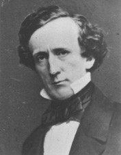
Senator Henry Mower Rice
~ United States Senate Historical Office
There are some interesting matters here besides what takes place in Congress, and I propose from time to time to touch upon them. An expenditure of $60,000,000 per annum does not cover all the pickings and stealings that “prevail” in our hereabouts. Senator RICE did not tell all he knew about land-office operations, when he testified to the value of the Fort Snelling property. Nobody is better aware than he that the tract would be much better to cut up into town lots than Bayfield was when he bought it for a few cents an acre, and sold it for hundreds of dollars. If we could find out all that Senator BRIGHT knows of these matters, one could learn how to become a millionaire at very small expense of brains or labor. Indian treaties and land-office jobbing have made more men rich than care to tell of it – ask General CASS if this is not so.
Seeing a bushel-basket of papers in the Interior Department the other day, I was curious to know what the kernel might be to all that rind, and made inquiry in the premises. I was told that they enveloped the case of Superior City. I cast my eye over some of them, and noticed that an argument was filed on behalf of one of the parties by Mr. Senator BRIGHT – or rather with Senator BRIGHT’S indorsement. This whetted my desire of knowledge, and I ran my eye over the paper in question, which was from the pen of a Minnesota Judge and was without exception the richest document I ever saw intended for a judicial or administrative tribunal. The substance of it was that the opinion of the Attorney-General CUSHING in the case was absurd, the adoption of his views by the Interior Department preposterous, and the action of the local Land office at Superior, in defining the status of certain half-breed Indians on the most abundant testimony, corrupt. It was clear enough that such a document required at least a senatorial indorsement to justify its reception. Nobody can suppose for a moment that Senator BRIGHT has any interest in the result of the case, or that he expected to influence the judgement of his friend, HENDRICKS, (Commissioner of the General Land Office,) by appearing in it. That would be too strong an inference to draw from so meek a fact ; and yet the malicious might suggest it as an apprehension.

Original Proprietors of Superior featuring James Stinson, Benjamin Thomson, Dr. W.W. Coran, U.S. Senator Robert J Walker, George W. Cass, and Horace Bridge. Featured in The Eye of the North-west, pg. 8.
From the printed argument of Senator BRIGHT’S friend, and from a private abstract of the testimony in the case, and a few items I have picked up in the Land Office, I think it will be in my power to indite an epistle that may excite some attention. At the Southwestern extremity of Lake Superior, there is a tract of land, which is expected some day to become the cite of a large city. Being aware of its great advantages for this purpose, a St. Paul speculator by the name of THOMPSON, and a Canadian operator by the name of STINSON, undertook to possess themselves of it as long as as in the early part of General PIERCE‘S administration, by vicarious preemptions. In this plan they were assisted by some official gentlement, who shared in the spoils, and patents were ground out in double-quick time, or certificates issued to Swedes and Indians for the benefit of this STINSON and THOMPSON, and their associate speculators.
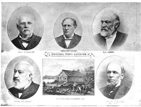
More Proprietors of Supeior from The Eye of the North-west, pg. 9.
In the Summer of 1854, this Mr. STINSON, headed a gang of Swedes and led them from Swede Lake, in the Territory of Minnesota, to Lake Superior, guiding them in person to the tracts he wished them to preempt. These men were ignorant of our language and of our laws, and were used by STINSON to “settle” their tracts, “prove up” their claims, and “convey” to him, the said STINSON, without knowing either the frauds they were practicing, or the rights which they might have secured to themselves if they had been acting in good faith. In the Land Office at Hudson, where these frauds were perpetrated, there was a notary public, who drew the deeds to STINSON, got the signatures of the Swedes to them and took the acknowledgements, immediately after the preemption oath had been administered – the Swedes thinking the whole operation a part of the preemption process. The terms were said to be $30 a month, and a bonus of $15 on the consummation of the bargain. The names of these Swedes were Aaron Peterson, Martin Larson, Peter Nelson, John Johnson, Sven Magnassan, Lorenz Johnson, Peter Norell, Sven Larson, Andreas Senson, Johannes Helon, Johannes Peterson, and Peter Erickson. These “preemptors,” for their own benefit, all “proved up” at Hudson, and the very same day they made conveyances to STINSON. The same thing is true of another Swedish invasion that was made in the Summer of 1855. In that year three Swedes – Old Westerland, Andrew Walmart, and Israel Janssen – commenced their settlements June 11, proved up June 22, and conveyed to STINSON June 22 – eleven days being sufficient for the whole operation. The records of the Land Office at Superior, and of the Register of Deeds of Douglas County, show these facts. They are well known in the General Land Office.
But Mr. STINSON did not operate through Swedes alone. He and his friend THOMPSON worked with half-breed Indians also. In March, 1854, he and THOMPSON followed up the Government Surveys with a gang of Chippewa half-breed Indians. The whole gang made preemptions in Douglas County, under the guidance of THOMPSON and STINSON, who hired them at La Pointe, and convered a large portion of a township with their fraudulent pre-emptions, which were proved up simultaneously, and simultaneously conveyed to the attorney of THOMPSON and STINSON. The names of all of this gang appear on the tract books in the General Land Office. These were Joseph Lamoureaux, Joseph Defaut, Joseph Dennis, Joseph Gauthier, Francis Decoteau, John B. Goslin, George D. Morrison and Levi B. Coffee, all preemptors for these land-sharks. There were three or four more half-breeds in the gang, who ran foul of some eight or ten American citizens who were seeking to save a slice of this Territory from Swedish and Indian preemption, and lay out a town site there under the law. This was the origin of the Superior City controversy, which has been pending some three or four years in the various land offices, and which has accumulated the basket of papers which first drew my attention to a case of such interesting dimensions. The contest is nominally between three or four Chippewa half-breeds claiming some three hundred acres as a town site. But the Indians are not merely bogus citizens, they are bogus pre-emptors in the bargain, for they were the hired men of THOMPSON & STINSON.
Mr. CUSHING decided in this controversy, before it was so settled by the Dred Scott case, that a half-breed Indian, receiving annuities as such, recognized as a dependent of a tribe, and the beneficiary of treaty stipulations, could become a citizen of the United States only by some positive act of Federal legislation ; that he could not, of his own volition, or by the laws of a State, change his condition from that of an Indian to that of a Federal citizen. Strange as it may seem, it appears that this part of the Dred Scott is repudiated by Mr. Commissioner HENDRICKS, who thinks a state cannot make a Federal citizen of a man with a drop of negro blood in his veins, but that the Commissioner of the General Land Office may naturalize Indians, ad libitum, without statute or judgement to sustain him.
I am curious to see how this controversy will be decided. The General Land Office upheld STINTSON’S Swedish preemption, on the ground that the frauds were discovered too late for the Commissioner to interefere. Whether or not STINSON hasmade any negro preemptions does not appear. It was too cold at the end of the lake for negroes to flourish much. But now it is to be settled in a case where the attempted frauds have been seasonably discovered, whether or not a Canadian adventurer can preempt whole townships of the Public Lands by the agency of a gang of half-breed Indians, and procure patents for them when the facts are known to the Federal authorities.
The pre-emptive right. Homesteads.
~ Superior, Wisconsin, papers, 1831-1942 ([unpublished])
Detail of Superior City townsite at the head of Lake Superior from Stuntz’s 1854 Plat Map of Township 49 North Range 14 West.
Early history of Superior should make mention of this right of acquisition, since there under, titles to government land were derived. Any qualified person might acquire title to one hundred and sixty acres of land by settling thereon, erecting a dwelling and making other improvements. Such person was to be twenty-one years of age, either male or female, or the head of a family whether man or woman.
Proof of each settlement was required to be made on a certain day at the United State Land Office and upon the payment of two hundred dollars with the taking of a required oath, the preemptioner got his one hundred and sixty acres of land.
But the whole proceeding, was far from straight, as a general thing, and in fact often amounted to a fraud.
“In the first place, Superior was backed by a powerful company of Democratic politicians and Government bankers in Washington, while the northern and northeastern portions of the state were still held by the Indians. This Superior company sought a connection with the Mississippi river, to obtain which they urged in congress the passage of a land grant bill, offering ten sections to the mile to aid in the construction of a railroad from Milwaukee to some point on Lake St. Croix, on the western boundary of the state of Wisconsin.”
~ History of Duluth and St. Louis County, Past and Present,
Volume 1, page 230.
Hence the whole country, in and about Superior, was dotted with preemption cabins, which were little more than logs piles up in walls, without floors, or windows, often with brush for a roof, a hole therein for a chimney and perhaps for a door. A slashing of half an acre or so of trees was the “improvement” so called. A very barbarous travesty, it was, upon a white man’s home and farm. Here is an instance, where as was said, a certain doctor of divinity laid claim to a quarter section of land, now in the midst of this city.
One day he sought “to prove up” his preemption, and one Alfred Allen was his witness, and they asked Allen, “Was the pre-emptions shanty good to live in?“, the law requiring a good habitable house on the claim. And Alf said “Yes, good for mosquitoes.” The Reverend said “Pshaw! Pshaw!” Meanding to upbraid or caution the witness who thereupon only protested and adjured the harder. The difficulty was somehow smoothed over, through some mending of the proofs, and perhaps connivance on the part of persons charged with administration of the United States land laws.
Nevertheless, it is interesting to member that upon rude and rough proceedings, such as are herein alluded to, rest at bottom the titles and claims to everything we own in the nature of lots, blocks, and land.
From: Statements of Hiram Hayes. Mr. Hayes came to Superior in 1854.
History of Duluth and St. Louis County, Past and Present, Volume 1
By Dwight Edwards Woodbridge, et al, 1910
GEORGE R. STUNTZ. [pages 229-231]
One of the earliest settlers at the head of the lakes was Mr. George E. Stuntz, who a short time ago joined the great majority. Before his death Mr. Stuntz wrote of his pioneer experiences as follows:
“In July, 1852, I came to the head of Lake Superior to run the land lines and subdivide certain townships. When I arrived at the head of the lakes there was nothing in Duluth or Superior. There was no settlement. The old American Fur Company had a post at La Pointe, at the west side of Madeline Island.
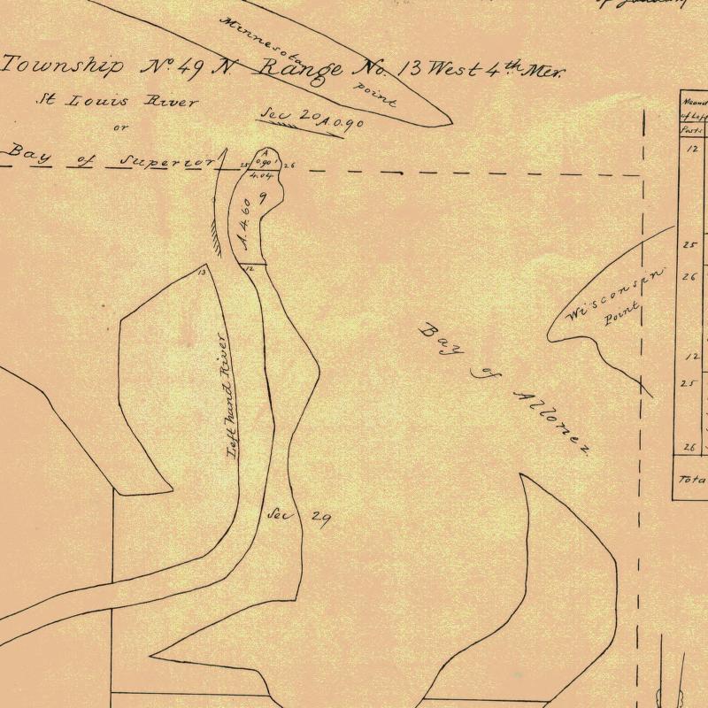
Detail of Minnesota Point from Stuntz’s Exterior Field Notes (August-October of 1852).
“In 1853 I got the range subdivided, and also in Superior, townsite 49, range 13. During the same year, later, in my absence, there came parties from the copper district of upper Michigan and located claims upon the range. They were principally miners. During the same year I built a residence on Minnesota Point under treaty license before the territory was sold to the Government. At that time there were only missionaries or license traders in the tract, as it belonged to the original Indian territory. In 1852, at Fond du Lac, there was a trading post and warehouse, in which I stored my goods on my arrival. In the fall of 1853 I bought three yoke of cattle and two cows at St. Croix Falls and brought them to the mouth of the Iron river, and had to cut a road thirty miles through the dense forest so as to get the oxen, cows and cart through. Later in the fall of 1853 I came through with an extra yoke of oxen, buying provisions, etc., and on coming up to Superior I found quite a settlement of log cabins. These settlers were anxious to get to the United States land office, then at Hudson, Wis. A dense forest intervened. We organized a volunteer company in January, 1854, to cut a road from old Superior to the nearest lumber camp on the St. Croix river, I furnishing two barrels of flour, provisions, pony and dog train, necessary to carry the provisions for a gang of seventeen men. The road was completed in twenty days, the snow being at that time two feet deep. This cut through a direct road to Taylor’s Falls and Stillwater. In 1854 I completed a mill on the Iron river and employed a man to superintend it, and I remained at Minnesota Point, my trading post, where I had first taken out the license. In the same year I took a contract to subdivide two townships located in Superior, townships 48-49, range 15, and afterward I attended the treaty at the time the Indians sold this country to the Government.
Before the 1854 Treaty of La Pointe could be ratified in Washington, D.C., the oral description agreed upon during the negotiations for exterior boundaries of the Chippewa treaties had to be surveyed with the tribe, documented, and delivered to Washington, D.C. before 1855. It is not clear who was involved with the exterior boundaries of these reservations; whether it was Stuntz, Barber, and/or others from their party.
“There were 5,000 Indians present with their chiefs. It was the biggest assemblage of Indians ever held at Lake Superior at this period of the country’s history. It took a month to pacify the troubles that grew among the different tribes in regard to their proportionate rights. This treaty was sent to congress September [30], 1854, and was ratified and became law in January, 1855.
To be continued in 1854…
Photos, Photos, Photos
February 10, 2014
The queue of Chequamegon History posts that need to be written grows much faster than my ability to write them. Lately, I’ve been backed up with mysteries surrounding a number of photographs. Many of these photos are from after 1860, so they are technically outside the scope of this website (though they involve people who were important in the pre-1860 era too.
Photograph posts are some of the hardest to write, so I decided to just run through all of them together with minimal commentary other than that needed to resolve the unanswered questions. I will link all the photos back to their sources where their full descriptions can be found. Here it goes, stream-of-consciousness style:

Ojibwa Delegation by C.M. Bell. Washington D.C. 1880 (NMAI Collections)
This whole topic started with a photo of a delegation of Lake Superior Ojibwe chiefs that sits on the windowsill of the Bayfield Public Library. Even though it is clearly after 1860, some of the names in the caption: Oshogay, George Warren, and Vincent Roy Jr. caught my attention. These men, looking past their prime, were all involved in the politics of the 1850s that I had been studying, so I wanted to find out more about the picture.
As I mentioned in the Oshogay post, this photo is also part of the digital collections of the Smithsonian, but the people are identified by different names. According to the Smithsonian, the picture was taken in Washington in 1880 by the photographer C.M. Bell.
I found a second version of this photo as well. If it wasn’t for one of the chiefs in front, you’d think it was the same picture:
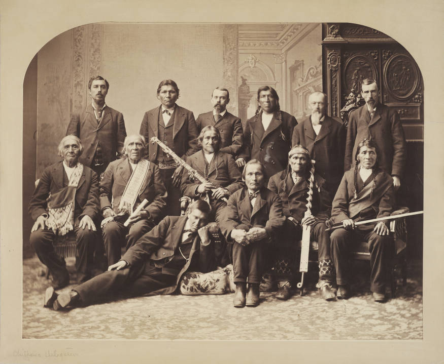
Chippewa Delegation (Denver Public Library Digital Collections)
While my heart wanted to believe the person, probably in the early 20th century, who labelled the Bayfield photograph, my head told me the photographer probably wouldn’t have known anything about the people of Lake Superior, and therefore could only have gotten the chiefs’ names directly from them. Plus, Bell took individual photos:
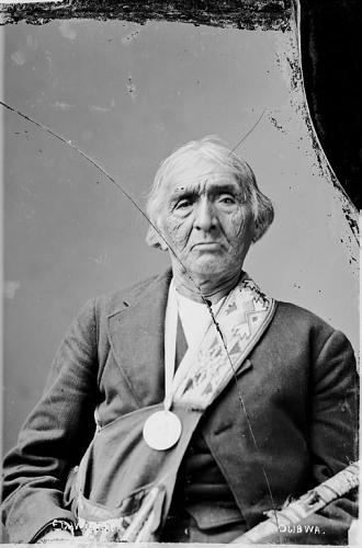
Edawigijig (Edawi-giizhig “Both Sides of the Sky”), Bad River chief and signer of the Treaty of 1854 (C.M. Bell, Smithsonian Digital Collections)
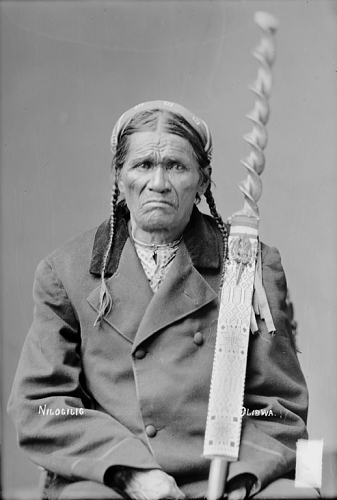
Niizhogiizhig: “Second Day,” (C.M. Bell, Smithsonian Digital Collections)
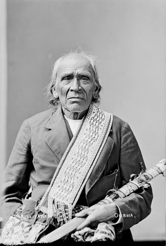
Kiskitawag (Giishkitawag: “Cut Ear”) signed multiple treaties as a warrior of the Ontonagon Band but afterwards was associated with the Bad River Band (C.M. Bell, Smithsonian Digital Collections).
By cross-referencing the individual photos with the names listed with the group photo, you can identify nine of the thirteen men. They are chiefs from Bad River, Lac Courte Oreilles, and Lac du Flambeau.
 According to this, the man identified by the library caption as Vincent Roy Jr., was in fact Ogimaagiizhig (Sky Chief). He does have a resemblance to Roy, so I’ll forgive whoever it was, even if it means having to go back and correct my Vincent Roy post:
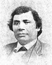
Vincent Roy Jr. From C. Verwyst’s Life and Labors of Rt. Rev. Frederic Baraga, First Bishop of Marquette, Mich: To which are Added Short Sketches of the Lives and Labors of Other Indian Missionaries of the Northwest (Digitized by Google Books)

Top: Frank Roy, Vincent Roy, E. Roussin, Old Frank D.o., Bottom: Peter Roy, Jos. Gourneau (Gurnoe), D. Geo. Morrison. The photo is labelled Chippewa Treaty in Washington 1845 by the St. Louis Hist. Lib and Douglas County Museum, but if it is in fact in Washington, it was probably the Bois Forte Treaty of 1866, where these men acted as conductors and interpreters (Digitized by Mary E. Carlson for The Sawmill Community at Roy’s Point).
So now that we know who went on the 1880 trip, it begs the question of why they went. The records I’ve found haven’t been overly clear, but it appears that it involved a bill in the senate for “severalty” of the Ojibwe reservations in Wisconsin. A precursor to the 1888 Allotment Act of Senator Henry Dawes, this legislation was proposed by Senator Thaddeus C. Pound of Wisconsin. It would divide the reservations into parcels for individual families and sell the remaining lands to the government, thereby greatly reducing the size of the reservations and opening the lands up for logging.
Pound spent a lot of time on Indian issues and while he isn’t as well known as Dawes or as Richard Henry Pratt the founder of the Carlisle Indian School, he probably should be. Pound was a friend of Pratt’s and an early advocate of boarding schools as a way to destroy Native cultures as a way to uplift Native peoples.
I’m sure that Pound’s legislation was all written solely with the welfare of the Ojibwe in mind, and it had nothing to do with the fact that he was a wealthy lumber baron from Chippewa Falls who was advocating damming the Chippewa River (and flooding Lac Courte Oreilles decades before it actually happened). All sarcasm aside, if any American Indian Studies students need a thesis topic, or if any L.C.O. band members need a new dartboard cover, I highly recommend targeting Senator Pound.
Like many self-proclaimed “Friends of the Indian” in the 1880s, Senator Thaddeus C. Pound of Wisconsin thought the government should be friendly to Indians by taking away more of their land and culture. That he stood to make a boatload of money out of it was just a bonus (Brady & Handy: Wikimedia Commons).
While we know Pound’s motivations, it doesn’t explain why the chiefs came to Washington. According to the Indian Agent at Bayfield they were brought in to support the legislation. We also know they toured Carlisle and visited the Ojibwe students there. There are a number of potential explanations, but without having the chiefs’ side of the story, I hesitate to speculate. However, it does explain the photograph.
Now, let’s look at what a couple of these men looked like two decades earlier:
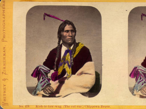
This stereocard of Giishkitawag was produced in the early 1870s, but the original photo was probably taken in the early 1860s (Denver Public Library).

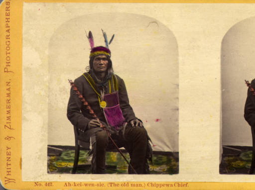
By the mid 1850s, Akiwenzii (Old Man) was the most prominent chief of the Lac Courte Oreilles Band. This stereocard was made by Whitney and Zimmerman c.1870 from an original possibly by James E. Martin in the late 1850s or early 1860s (Denver Public Library).
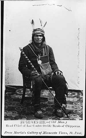
Giishkitawag and Akiwenzii are seem to have aged quite a bit between the early 1860s, when these photos were taken, and 1880 but they are still easily recognized. The earlier photos were taken in St. Paul by the photographers Joel E. Whitney and James E. Martin. Their galleries, especially after Whitney partnered with Charles Zimmerman, produced hundreds of these images on cards and stereoviews for an American public anxious to see real images of Indian leaders.
Giishkitawag and Akiwenzii were not the only Lake Superior chiefs to end up on these souvenirs. Aamoons (Little Bee), of Lac du Flambeau appears to have been a popular subject:

Aamoons (Little Bee) was a prominent chief from Lac du Flambeau (Denver Public Library).
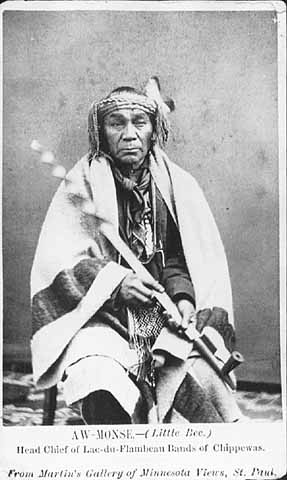
As the images were reproduced throughout the 1870s, it appears the studios stopped caring who the photos were actually depicting:

One wonders what the greater insult to Aamoons was: reducing him to being simply “Chippewa Brave” as Whitney and Zimmerman did here, or completely misidentifying him as Na-gun-ub (Naaganab) as a later stereo reproduction as W. M. McLeish does here:
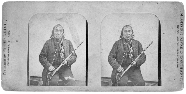
Chief identified as Na-gun-ub (Minnesota Historical Society)
Aamoons and Naaganab don’t even look alike…

Naaganab (Minnesota Historical Society)
…but the Lac du Flambeau and Fond du Lac chiefs were probably photographed in St. Paul around the time they were both part of a delegation to President Lincoln in 1862.

Chippewa Delegation 1862 by Matthew Brady? (Minnesota Historical Society)
Naaganab (seated middle) and Aamoons (back row, second from left) are pretty easy to spot, and if you look closely, you’ll see Giishkitawag, Akiwenzii, and a younger Edawi-giizhig (4th, 5th, and 6th from left, back row) were there too. I can’t find individual photos of the other chiefs, but there is a place we can find their names.
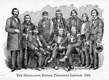
(From Early Life Among the Indians by Benjamin Armstrong)
Benjamin Armstrong, who interpreted for the delegation, included a version of the image in his memoir Early Life Among the Indians. He identifies the men who went with him as:
Ah-moose (Little Bee) from Lac Flambeau Reservation, Kish-ke-taw-ug (Cut Ear) from Bad River Reservation, Ba-quas (He Sews) from Lac Courte O’Rielles Reservation, Ah-do-ga-zik (Last Day) from Bad River Reservation, O-be-quot (Firm) from Fond du Lac Reservation, Sing-quak-onse (Little Pine) from La Pointe Reservation, Ja-ge-gwa-yo (Can’t Tell) from La Pointe Reservation, Na-gon-ab (He Sits Ahead) from Fond du Lac Reservation, and O-ma-shin-a-way (Messenger) from Bad River Reservation.
It appears that Armstrong listed the men according to their order in the photograph. He identifies Akiwenzii as “Ba-quas (He Sews),” which until I find otherwise, I’m going to assume the chief had two names (a common occurrence) since the village is the same. Aamoons, Giishkitawag, Edawi-giizhig and Naaganab are all in the photograph in the places corresponding to the order in Armstrong’s list. That means we can identify the other men in the photo.
I don’t know anything about O-be-quot from Fond du Lac (who appears to have been moved in the engraving) or S[h]ing-guak-onse from Red Cliff (who is cut out of the photo entirely) other than the fact that the latter shares a name with a famous 19th-century Sault Ste. Marie chief. Travis Armstrong’s outstanding website, chiefbuffalo.com, has more information on these chiefs and the mission of the delegation.
Seated to the right of Naaganab, in front of Edawi-giizhig is Omizhinawe, the brother of and speaker for Blackbird of Bad River. Finally, the broad-shouldered chief on the bottom left is “Ja-ge-gwa-yo (Can’t Tell)” from Red Cliff. This is Jajigwyong, the son of Chief Buffalo, who signed the treaties as a chief in his own right. Jayjigwyong, sometimes called Little Chief Buffalo, was known for being an early convert to Catholicism and for encouraging his followers to dress in European style. Indeed, we see him and the rest of the chiefs dressed in buttoned coats and bow-ties and wearing their Lincoln medals.
Wait a minute… button coats?… bow-ties?… medals?…. a chief identified as Buffalo…That reminds me of…
This image is generally identified as Chief Buffalo (Wikimedia Commons)

Anyway, with that mystery solved, we can move on to the next one. It concerns a photograph that is well-known to any student of Chequamegon-area history in the mid 19th century (or any Chequamegon History reader who looks at the banners on the side of this page).Noooooo!!!!!!! I’ve been trying to identify the person in The above “Chief Buffalo” photo for years, and the answer was in Armstrong all along! Now I need to revise this post among others. I had already begun to suspect it was Jayjigwyong rather than his father, but my evidence was circumstantial. This leaves me without a doubt. This picture of the younger Chief Buffalo, not his more-famous father.
The photo showing an annuity payment, must have been widely distributed in its day, because it has made it’s way into various formats in archives and historical societies around the world. It has also been reproduced in several secondary works including Ronald Satz’ Chippewa Treaty Rights, Patty Loew’s Indian Nations of Wisconsin, Hamilton Ross’ La Pointe: Village Outpost on Madeline Island, and in numerous other pamphlets, videos, and displays in the Chequamegon Region. However, few seem to agree on the basic facts:
When was it taken?
Where was it taken?
Who was the photographer?
Who are the people in the photograph?
We’ll start with a cropped version that seems to be the most popular in reproductions:
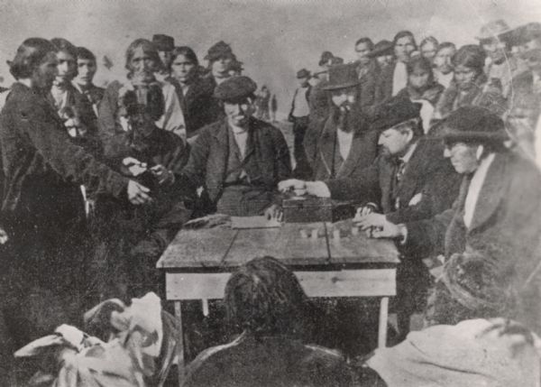
According to Hamilton Ross and the Wisconsin Historical Society: “Annuity Payment at La Pointe: Indians receiving payment. Seated on the right is John W. Bell. Others are, left to right, Asaph Whittlesey, Agent Henry C. Gilbert, and William S. Warren (son of Truman Warren).” 1870. Photographer Charles Zimmerman (more info).
In the next one, we see a wider version of the image turned into a souvenir card much like the ones of the chiefs further up the post:
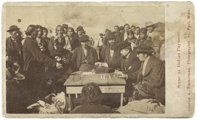
According to the Minnesota Historical Society “Scene at Indian payment, Wisconsin; man in black hat, lower right, is identified as Richard Bardon, Superior, Wisconsin, then acting Indian school teacher and farmer” c.1871 by Charles Zimmerman (more info).
In this version, we can see more foreground and the backs of the two men sitting in front.

According to the Library of Congress: “Cherokee payments(?). Several men seated around table counting coins; large group of Native Americans stand in background.” Published 1870-1900 (more info).
The image also exists in engraved forms, both slightly modified…

According to Benjamin Armstrong: “Annuity papment [sic] at La Pointe 1852” (From Armstrong’s Early Life Among the Indians)
…and greatly-modified.
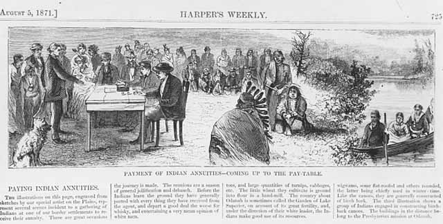
Harper’s Weekly August 5, 1871: “Payment of Indian Annuities–Coming up to the Pay Table.” (more info)
It should also be mentioned that another image exists that was clearly taken on the same day. We see many of the same faces in the crowd:
Scene at Indian payment, probably at Odanah, Wisconsin. c.1865 by Charles Zimmerman (more info)
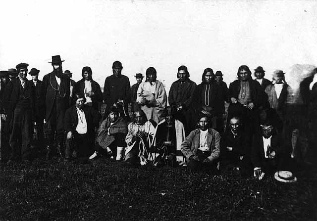
We have a lot of conflicting information here. If we exclude the Library of Congress Cherokee reference, we can be pretty sure that this is an annuity payment at La Pointe or Odanah, which means it was to the Lake Superior Ojibwe. However, we have dates ranging from as early as 1852 up to 1900. These payments took place, interrupted from 1850-1852 by the Sandy Lake Removal, from 1837 to 1874.
Although he would have attended a number of these payments, Benjamin Armstrong’s date of 1852, is too early. A number of secondary sources have connected this photo to dates in the early 1850s, but outside of Armstrong, there is no evidence to support it.
Charles Zimmerman, who is credited as the photographer when someone is credited, became active in St. Paul in the late 1860s, which would point to the 1870-71 dates as more likely. However, if you scroll up the page and look at Giishkitaawag, Akiwenzii, and Aamoons again, you’ll see that these photos, (taken in the early 1860s) are credited to “Whitney & Zimmerman,” even though they predate Zimmerman’s career.
What happened was that Zimmerman partnered with Joel Whitney around 1870, eventually taking over the business, and inherited all Whitney’s negatives (and apparently those of James Martin as well). There must have been an increase in demand for images of Indian peoples in the 1870s, because Zimmerman re-released many of the earlier Whitney images.
So, we’re left with a question. Did Zimmerman take the photograph of the annuity payment around 1870, or did he simply reproduce a Whitney negative from a decade earlier?
I had a hard time finding any primary information that would point to an answer. However, the Summer 1990 edition of the Minnesota History magazine includes an article by Bonnie G. Wilson called Working the Light: Nineteenth Century Professional Photographers in Minnesota. In this article, we find the following:
“…Zimmerman was not a stay-at-home artist. He took some of his era’s finest landscape photos of Minnesota, specializing in stereographs of the Twin Cities area, but also traveling to Odanah, Wisconsin for an Indian annuity payment…”
In the footnotes, Wilson writes:
“The MHS has ten views in the Odanah series, which were used as a basis for engravings in Harper’s Weekly, Aug. 5, 1871. See also Winona Republican, Oct. 12, 1869 p.3;”
Not having access to the Winona Republican, I tried to see how many of the “Odanah series” I could track down. Zimmerman must have sold a lot of stereocards, because this task was surprisingly easy. Not all are labelled as being in Odanah, but the backgrounds are similar enough to suggest they were all taken in the same place. Click on them to view enlarged versions at various digital archives.
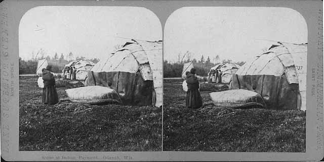
Scene at Indian Payment, Odanah Wisconsin (Minnesota Historical Society)


Chippewa Wedding (British Museum)

Domestic Life–Chippewa Indians (British Museum)
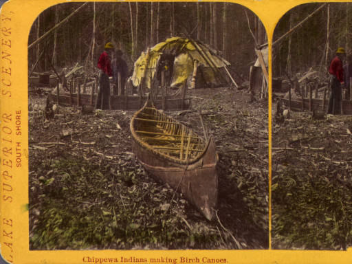
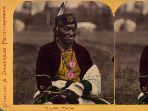

Chippewa Wedding (British Museum)

Finally…

Scene at Indian Payment–Odanah, Wis. (Wikimedia Images)
So, if Zimmerman took the “Odanah series” in 1869, and the pay table image is part of it, then this is a picture of the 1869 payment. To be absolutely certain, we should try to identify the men in the image.
This task is easier than ever because the New York Public Library has uploaded a high-resolution scan of the Whitney & Zimmerman stereocard version to Wikimedia Commons. For the first time, we can really get a close look at the men and women in this photo.
They say a picture tells a thousand words. I’m thinking I could write ten-thousand and still not say as much as the faces in this picture.


To try to date the photo, I decided to concentrate the six most conspicuous men in the photo:
1) The chief in the fur cap whose face in the shadows.
2) The gray-haired man standing behind him.
3) The man sitting behind the table who is handing over a payment.
4) The man with the long beard, cigar, and top hat.
5) The man with the goatee looking down at the money sitting to the left of the top-hat guy (to the right in our view)
6) The man with glasses sitting at the table nearest the photographer
According to Hamilton Ross, #3 is Asaph Whittlesey, #4 is Agent Henry Gilbert, #5 is William S. Warren (son of Truman), and #6 is John W. Bell. While all four of those men could have been found at annuity payments as various points between 1850 and 1870, this appears to be a total guess by Ross. Three of the four men appear to be of at least partial Native descent and only one (Warren) of those identified by Ross was Ojibwe. Chronologically, it doesn’t add up either. Those four wouldn’t have been at the same table at the same time. Additionally, we can cross-reference two of them with other photos.

Asaph Whittlesey was an interesting looking dude, but he’s not in the Zimmerman photo (Wisconsin Historical Society).

Henry C. Gilbert was the Indian Agent during the Treaty of 1854 and oversaw the 1855 annuity payment, but he was dead by the time the “Zimmerman” photo was taken (Branch County Photographs)
Whittlesey and Gilbert are not in the photograph.
The man who I label as #5 is identified by Ross as William S. Warren. This seems like a reasonable guess, though considering the others, I don’t know that it’s based on any evidence. Warren, who shares a first name with his famous uncle William Whipple Warren, worked as a missionary in this area.
The man I label #6 is called John W. Bell by Ross and Richard Bardon by the Minnesota Historical Society. I highly doubt either of these. I haven’t found photos of either to confirm, but the Ireland-born Bardon and the Montreal-born Bell were both white men. Mr. 6 appears to be Native. I did briefly consider Bell as a suspect for #4, though.
Neither Ross nor the Minnesota Historical Society speculated on #1 or #2.
At this point, I cannot positively identify Mssrs. 1, 2, 3, 5, or 6. I have suspicions about each, but I am not skilled at matching faces, so these are wild guesses at this point:
#1 is too covered in shadows for a clear identification. However, the fact that he is wearing the traditional fur headwrap of an Ojibwe civil chief, along with a warrior’s feather, indicates that he is one of the traditional chiefs, probably from Bad River but possibly from Lac Courte Oreilles or Lac du Flambeau. I can’t see his face well enough to say whether or not he’s in one of the delegation photos from the top of the post.
#2 could be Edawi-giizhig (see above), but I can’t be certain.
#3 is also tricky. When I started to examine this photo, one of the faces I was looking for was that of Joseph Gurnoe of Red Cliff. You can see him in a picture toward the top of the post with the Roy brothers. Gurnoe was very active with the Indian Agency in Bayfield as a clerk, interpreter, and in other positions. Comparing the two photos I can’t say whether or not that’s him. Leave a comment if you think you know.
#5 could be a number of different people.
#6 I don’t have a solid guess on either. His apparent age, and the fact that the Minnesota Historical Society’s guess was a government farmer and schoolteacher, makes me wonder about Henry Blatchford. Blatchford took over the Odanah Mission and farm from Leonard Wheeler in the 1860s. This was after spending decades as Rev. Sherman Hall’s interpreter, and as a teacher and missionary in La Pointe and Odanah area. When this photo was taken, Blatchford had nearly four decades of experience as an interpreter for the Government. I don’t have any proof that it’s him, but he is someone who is easy to imagine having a place at the pay table.
Finally, I’ll backtrack to #4, whose clearly identifiable gray-streaked beard allows us to firmly date the photo. The man is Col. John H. Knight, who came to Bayfield as Indian Agent in 1869.
Col. John H. Knight (Wisconsin Historical Society)
Knight oversaw a couple of annuity payments, but considering the other evidence, I’m confident that the popular image that decorates the sides of the Chequamegon History site was indeed taken at Odanah by Charles Zimmerman at the 1869 annuity payment.
Do you agree? Do you disagree? Have you spotted anything in any of these photos that begs for more investigation? Leave a comment.
As for myself, it’s a relief to finally get all these photo mysteries out of my post backlog. The 1870 date on the Zimmerman photo reminds me that I’m spending too much time in the later 19th century. After all, the subtitle of this website says it’s history before 1860. I think it might be time to go back for a while to the days of the old North West Company or maybe even to Pontiac. Stay tuned, and thanks for reading,
